4162 entries match your criteria. The first 100 are listed. ⊳
Historical Markers and War Memorials in Missouri
By Michael E Sanchez, Jr., March 24, 2017
Adair County, Missouri Courthouses Marker back
| 1 ► Missouri, Adair County, Kirksville — Adair County, Missouri Courthouses / Early Days of Adair County, Missouri — |
| On North Elson Street just south of West Harrison Street, on the left when traveling south. | |||
| 2 ► Missouri, Adair County, Kirksville — Battle of Kirksville — August 6, 1862 — |
| On North Franklin Street at West Washington Street, on the left when traveling north on North Franklin Street. | |||
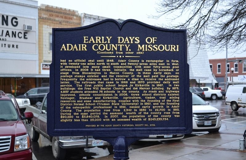
| 3 ► Missouri, Adair County, Kirksville — Early Days of Adair County, Missouri — |
| On North Franklin Street just north of West Washington Street, on the left when traveling north. | |||
| 4 ► Missouri, Adair County, Kirksville — The Cyclone — April 27, 1899 — |
| On North Elson Street just north of West Washington Street, on the left when traveling south. | |||
| 5 ► Missouri, Andrew County, Savannah — Andrew County — |
| 6 ► Missouri, Andrew County, Savannah — Christian Church in Savannah, Missouri — |
| On West Market Street at South 6th Street, on the right when traveling west on West Market Street. | |||
| 7 ► Missouri, Andrew County, Savannah — Conglomerate Rock — |
| On Court St. just north of S. 5th Street, on the right when traveling north. | |||
| 8 ► Missouri, Andrew County, Savannah, Nodaway Township — First Christian Church — Savannah, MO. — |
| On South 5th Street at West Market Street, on the right when traveling south on South 5th Street. | |||
| 9 ► Missouri, Atchison County, Fairfax — Veterans Memorial — |
| On Main Street (U.S. 59) near Denny Street, on the right when traveling west. | |||
| 10 ► Missouri, Atchison County, Phelps City, Templeton Township — Brownville Bridge — 1939 — |
| On U.S. 136, 1.8 miles west of State Highway D, on the right when traveling west. | |||
| 11 ► Missouri, Atchison County, Rock Port — Atchison County Walk of Honor — |
| On Main Street (Missouri Route 111) near Clay Street, on the left when traveling south. | |||
| 12 ► Missouri, Atchison County, Rock Port — Atchison County War Memorial — |
| On Main Street (Missouri Route 111) at Clay Street, on the left when traveling south on Main Street. | |||
| 13 ► Missouri, Atchison County, Rock Port — Rock Port — |
| On U.S. 136 at Market Street, on the left when traveling west on U.S. 136. | |||
| 14 ► Missouri, Audrain County, Mexico — Audrain County Veterans Memorial — |
| On Washington Avenue at Monroe Street, on the left when traveling south on Washington Avenue. | |||
| 15 ► Missouri, Audrain County, Mexico — Bean Creek German Evangelical Church and Littleby Methodist Church Bell — "Honor the God on high" — "Ehre sei den Gott in der Höhe" — |
| Near Missouri Route 15. | |||
| 16 ► Missouri, Audrain County, Mexico — Bonnot Combined Brick Machine — 1904 • 1926 — |
| Near Missouri Route 15. | |||
| 17 ► Missouri, Audrain County, Mexico — Diaspore Boulder — Weight 10,400 Lbs. — |
| Near Missouri Route 15. | |||
| 18 ► Missouri, Audrain County, Mexico — Graceland — Built 1857 — |
| On Muldrow Street (Missouri Route 15) south of Quisenberry Street, on the right when traveling south. | |||
| 19 ► Missouri, Audrain County, Mexico — Hardin College Bell — June 1873 - May 1932 — |
| Near Missouri Route 15. | |||
| 20 ► Missouri, Audrain County, Mexico — John Bingle Morris — |
| On Jefferson Street at Monroe Street, on the left when traveling north on Jefferson Street. | |||
| 21 ► Missouri, Audrain County, Mexico — Mexico — |
| On Mudrow Street (Missouri Route 15) at Hisey Street, on the right when traveling south on Mudrow Street. | |||
| 22 ► Missouri, Audrain County, Mexico — Missouri Military Academy — |
| 23 ► Missouri, Audrain County, Mexico — Old Courthouse Clock Bell — 1868 - 1952 — |
| Near Missouri Route 15. | |||
| 24 ► Missouri, Audrain County, Mexico — Old Stones — |
| Near Missouri Route 15. | |||
| 25 ► Missouri, Audrain County, Mexico — Rex McDonald 833 — The World's Champion Saddle Stallion — Born May 20, 1890 • Died Nov. 10, 1913 — |
| On Muldrow Street (Missouri Route 15) south of Quisenberry Street, on the right when traveling south. | |||
| 26 ► Missouri, Audrain County, Mexico — The Churchill Gate — |
| On Clark Street (U.S. 54) at Hendy Street, on the right when traveling north on Clark Street. | |||
| 27 ► Missouri, Audrain County, Mexico — The Green Estate — |
| On Clark Street (U.S. 54) at Hendy Street, on the right when traveling north on Clark Street. | |||
| 28 ► Missouri, Audrain County, Mexico — The Missouri Exercise Tiger Army & Navy Anchor Memorial — |
| On Monroe Street at Washington Street, on the left when traveling west on Monroe Street. | |||
| 29 ► Missouri, Barry County, Cassville — Butterfield Overland Mail in Missouri - 1858-1861 — |
| On Main Street (State Road Y) at 7th Street, on the left when traveling north on Main Street. | |||
| 30 ► Missouri, Barry County, Cassville — Secession Convention in Cassville — A State Divided — The Civil War in Missouri — |
| On Main Street. | |||
| 31 ► Missouri, Barry County, Cassville — Veterans Memorial — |
| On Missouri Route 112. | |||
| 32 ► Missouri, Barry County, Hilltop — Roaring River School — |
| On "No Name", 0.2 miles south of State Highway 112, on the left when traveling south. | |||
| 33 ► Missouri, Barry County, Monett — Christopher G. Stark Memorial — |
| On Monett South Park Walking Trail. | |||
| 34 ► Missouri, Barry County, Monett — Veterans Memorial — |
| On S. Lincoln Avenue. | |||
| 35 ► Missouri, Barry County, Monett — War Memorial — |
| 36 ► Missouri, Barry County, Purdy — Purdy Veteran's Memorial — |
| On 3rd Street. | |||
| 37 ► Missouri, Barry County, Purdy, Purdy Township — Douglas A-4 Skyhawk — U.S. Navy Commander Edward Estes — |
| Near East State Highway C at Gabby Gibbons Drive, on the right when traveling east. | |||
| 38 ► Missouri, Barry County, Purdy, Purdy Township — Veterans Memorial — |
| Near East State Highway C at Gabby Gibbons Drive, on the right when traveling east. | |||
| 39 ► Missouri, Barton County, Lamar — Harry S Truman — In Memoriam — |
| On 11th Street near Truman Street, on the left when traveling east. | |||
| 40 ► Missouri, Barton County, Lamar — Harry S. Truman — May 8 1884 - Dec. 26, 1972 — |
| On Gulf Street, on the right when traveling north. | |||
| 41 ► Missouri, Barton County, Lamar — Harry S. Truman Birthplace Memorial — |
| On 11th Street at Truman Street, on the left when traveling east on 11th Street. | |||
| 42 ► Missouri, Barton County, Lamar — Lamar — |
| On Gulf Street at 11th Street West, on the right when traveling north on Gulf Street. | |||
| 43 ► Missouri, Barton County, Lamar — McCook Post No. 34 G.A.R. Civil War Memorial — Barton County War Memorial — |
| On Broadway at 10th Street, on the right when traveling south on Broadway. | |||
| 44 ► Missouri, Barton County, Lamar — Replica of the Statue of Liberty — |
| On Broadway at 11th Street, on the left when traveling north on Broadway. | |||
| 45 ► Missouri, Barton County, Liberal — Veterans Memorial — 1776 • 1976 — |
| On NW 40th Road (Missouri Route K) at Denton, on the left when traveling east on NW 40th Road. | |||
| 46 ► Missouri, Bates County, Adrian — Lt Charles Garrison Veterans Memorial — All Gave Some - Some Gave All — |
| On Missouri Route 18, 0.2 miles east of Exit 141 (Interstate 49), on the right when traveling east. | |||
| 47 ► Missouri, Bates County, Butler — “First Kansas Colored Volunteer Infantry” — They Fought Like Tigers — |
| On Ohio Street at Delaware Street, on the left when traveling west on Ohio Street. | |||
| 48 ► Missouri, Bates County, Butler — Arnold Post No. 46 Veterans Memorial — |
| 49 ► Missouri, Bates County, Butler — Arnold Post No. 46 World War Memorial — |
| 50 ► Missouri, Bates County, Butler — Bates County World War I Memorial — |
| On Ohio Street at Delaware Street, on the left when traveling west on Ohio Street. | |||
| 51 ► Missouri, Bates County, Butler — Bates County, Missouri in 1862 — |
| Near Marth Road (Road 1002) near Cooper Road (County Road 5001). | |||
| 52 ► Missouri, Bates County, Butler — Battle of Island Mound Memorial — |
| On Marth Road (County Road 1002) east of Cooper Road (County Road 5001), on the left when traveling west. | |||
| 53 ► Missouri, Bates County, Butler — Butler History Murals — |
| On Dakota Street at Delaware Street, on the left when traveling east on Dakota Street. | |||
| 54 ► Missouri, Bates County, Butler — Butler Memorial Airport — 1963 — |
| 55 ► Missouri, Bates County, Butler — David Clayton Wolfe — 1864 - 1917 — |
| 56 ► Missouri, Bates County, Butler — Eugene S. Hurt Chapter 67 D.A.V. Veterans Memorial — |
| On Main Street at Ohio Street, on the left when traveling north on Main Street. | |||
| 57 ► Missouri, Bates County, Butler — First Kansas Colored Volunteer Infantry Regimental History — |
| On Marth Road (County Route 1002) near Cooper Road (County Route 5001), on the left when traveling west. | |||
| 58 ► Missouri, Bates County, Butler — North Field — Webster School 1900 — |
| On Mill Street (State Road H) at Havannah Street, on the right when traveling east on Mill Street. | |||
| 59 ► Missouri, Bates County, Butler — Order No. 11 — August 25, 1863 — Forced Evacuation and Burning of Bates County — |
| On West Ohio Street east of North Delaware Street, on the left when traveling west. | |||
| 60 ► Missouri, Bates County, Butler — Palace Office Building — |
| On Ohio Street at Main Street, on the right when traveling west on Ohio Street. | |||
| 61 ► Missouri, Bates County, Butler — Prairie Fire and the Battle of Island Mound — |
| Near Marth Road (County Road 1002) near Cooper Road (County Road 5001). | |||
| 62 ► Missouri, Bates County, Butler — Replica of the Statue of Liberty — |
| On High Street at Ohio Street, on the left when traveling north on High Street. | |||
| 63 ► Missouri, Bates County, Butler — The Battle of Island Mound — |
| On Marth Road (County Route 1002) near Cooper Road (County Route 5001), on the left when traveling west. | |||
| 64 ► Missouri, Bates County, Butler — The Battle of Island Mound: A Demonstration to the Nation — |
| On Marth Road (County Road 1002) near Cooper Road (County Road 5001), on the left when traveling west. | |||
| 65 ► Missouri, Bates County, Butler — The Toothman Farm — Home to a Notorious Rebel Family — |
| On Marth Road (County Road 1002) near Cooper Road (Road 5001), on the left when traveling west. | |||
| 66 ► Missouri, Bates County, Hume — Veterans Memorial — |
| On Hume Street (Missouri Route A) at 2nd Street, on the left when traveling east on Hume Street. | |||
| 67 ► Missouri, Bates County, Rich Hill — 33 — Harmony Mission — American Presbyterian and Reformed Historical Site No. 33 — |
| On Walnut Street (State Highway A) at 13th Street, on the right when traveling east on Walnut Street. | |||
| 68 ► Missouri, Bates County, Rich Hill — The Town That Coal Built — Rich Hill, Missouri — "Big Mouth" — |
| On 7th Street at Park Street, on the left when traveling south on 7th Street. | |||
| 69 ► Missouri, Benton County, Warsaw — Butterfield Overland Mail in Missouri — 1858-1861 — |
| On Van Buren Street at Main Street, on the right when traveling north on Van Buren Street. | |||
| 70 ► Missouri, Bollinger County, Marble Hill — Marble Hill — |
| On High Street at Gilmore Street, on the right when traveling north on High Street. | |||
| 71 ► Missouri, Bollinger County, Marble Hill, Lorance Township — Mineral Well — |
| On High Street just south of Water Street, on the left when traveling south. | |||
| 72 ► Missouri, Bollinger County, Puxico, Wayne Township — Battle of Mingo Swamp — |
| On Missouri Route 51 at County Route 624, on the left when traveling south on State Route 51. | |||
| 73 ► Missouri, Boone County, Centralia — The Civil War in Centralia — Missouri's Civil War — |
| On West Singleton Street at South Allen Street, on the right when traveling east on West Singleton Street. | |||
| 74 ► Missouri, Boone County, Columbia — "Make A Brighter Future" — |
| On East Stewart Road just west of South Providence Road (State Highway 163), in the median. | |||
| 75 ► Missouri, Boone County, Columbia — 3rd Street Market, Blue & White Café, and the Harvey House — |
| On North Providence Road (State Highway 163) just north of Switzler Street, on the left when traveling north. | |||
| 76 ► Missouri, Boone County, Columbia — African American Heritage Trail — |
| On Park Avenue just east of North Providence Street (State Highway 163), on the right when traveling east. | |||
| 77 ► Missouri, Boone County, Columbia — African-American Heritage — Flat Branch Park — |
| On South 4th Street at Cherry Street, on the right when traveling south on South 4th Street. | |||
| 78 ► Missouri, Boone County, Columbia — African-American Heritage Trail — |
| On East Broadway just east of North 4th Street, on the left when traveling east. | |||
| 79 ► Missouri, Boone County, Columbia — African-American Heritage Trail — |
| On North 5th Street at East Walnut Street, on the right when traveling north on North 5th Street. | |||
| 80 ► Missouri, Boone County, Columbia — African-American Heritage Trail — |
| On South 5th Street at Davis Street, on the right when traveling north on South 5th Street. | |||
| 81 ► Missouri, Boone County, Columbia — African-American Heritage Trail — |
| On North 5th Street just north of East Ash Street, on the left when traveling north. | |||
| 82 ► Missouri, Boone County, Columbia — African-American Heritage Trail — |
| On East Broadway, 0.1 miles west of North 1st Street, on the left when traveling west. | |||
| 83 ► Missouri, Boone County, Columbia — African-American Heritage Trail — |
| On North Garth Avenue at East Ash Street, on the right when traveling north on North Garth Avenue. | |||
| 84 ► Missouri, Boone County, Columbia — African-American Heritage Trail — |
| On North Providence Road (State Highway 163) at East Ash Street, on the left when traveling north on North Providence Road. | |||
| 85 ► Missouri, Boone County, Columbia — African-American Heritage Trail — |
| On Switzler Street just west of Lasalle Place, on the right when traveling west. | |||
| 86 ► Missouri, Boone County, Columbia — African-American Heritage Trailhead — |
| On South 4th Street at Cherry Street, on the right when traveling south on South 4th Street. | |||
| 87 ► Missouri, Boone County, Columbia — Annie Fisher's House — African-American Heritage Trail — |
| On Park Avenue at North 7th Street, on the right when traveling east on Park Avenue. | |||
| 88 ► Missouri, Boone County, Columbia — Beetle Bailey — |
| Near Conley Avenue. | |||
| 89 ► Missouri, Boone County, Columbia — Columbia — |
| On Old U.S. 63 just south of Shepard Boulevard, on the right when traveling south. | |||
| 90 ► Missouri, Boone County, Columbia — Columbia Cemetery — |
| On Broadway, on the right when traveling east. | |||
| 91 ► Missouri, Boone County, Columbia — Commerce — Flat Branch Park — |
| On South 4th Street at Cherry Street, on the right when traveling south on South 4th Street. | |||
| 92 ► Missouri, Boone County, Columbia — Don Faurot / Faurot Field — |
| On Stadium Boulevard (Missouri Route 740) at Providence Road (Missouri Route 163), on the right when traveling east on Stadium Boulevard. | |||
| 93 ► Missouri, Boone County, Columbia — Douglass Park and Pool, Russell Chapel — African-American Heritage Trail — |
| On North Providence Road (State Highway 163) just north of Switzler Street, on the right when traveling north. | |||
| 94 ► Missouri, Boone County, Columbia — Early Settlement — Flat Branch Park — |
| On South 4th Street at Cherry Street, on the right when traveling south on South 4th Street. | |||
| 95 ► Missouri, Boone County, Columbia — George Clinton Swallow — A.M., M.D., L.L.D. — 1817 - 1899 — |
| 96 ► Missouri, Boone County, Columbia — In Loving Memory of Mrs. Beulah Ralph — |
| On North Providence Road (State Highway 163) at Boone Drive, on the right when traveling north on North Providence Road. | |||
| 97 ► Missouri, Boone County, Columbia — In Memory of the United States Colored Troops of the Civil War — Known to Be Buried in Columbia Cemetery — |
| Near East Broadway just west of North 1st Street, on the left when traveling west. | |||
| 98 ► Missouri, Boone County, Columbia — James Shannon L.L.D. — |
| 99 ► Missouri, Boone County, Columbia — Jewell Cemetery — |
| Near Providence Road (Missouri Route 163) south of Green Meadows Road, on the right when traveling south. | |||
| 100 ► Missouri, Boone County, Columbia — Lest We Forget: Lynching at the Stewart Road Bridge — |
| Near South Providence Road (State Highway 163) 0.1 miles south of East Stewart Road, on the left when traveling north. | |||
4162 entries matched your criteria. The first 100 are listed above. Next 100 ⊳