By Barry Swackhamer, June 28, 2017
Indians and Emigrants Marker
RANKED BY RELEVANCE, THEN GEOGRAPHICALLY
Near Vietnsm Veterans Memorial Highway (Interstate 84), on the right when traveling west.
On Scott Mountain Road (Route 3 at milepost 83.3), on the right when traveling north.
On Interstate 84 at milepost 71, on the right when traveling west.
Near SW Jefferson Way at SW 30th St.
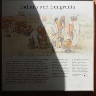
Near SW Boones Ferry Road at SW Tauchmann Street.
Near South Promenade at Avenue A.
On Iredale Street, 0.1 miles north of 5th Street, on the left when traveling east.
Near Cape Arago Highway, 5 miles west of Seven Devils Road.
On Oregon Coast Highway (U.S. 101) 0.1 miles south of Lower Smith River Road, on the right when traveling south.
On Lower Smith River Road (County Road 48 at milepost 1), at Stables Road (County Road 498), on the left when traveling north on Lower Smith River Road.
On Dead Indian Memorial Rd at Green Springs Highway (U.S. 66) on Dead Indian Memorial Rd. Reported permanently removed.
Near Interstate 5 at milepost 62 near Merlin Road, on the right when traveling north.
On Oregon Route 58 south of Edenvale Road, on the left when traveling north.
On Succor Creek Highway (Oregon Route 201) near Adams Road, on the left when traveling north.
Near Hatchery Road, 0.3 miles south of Tanner Creek Road.
Paid Advertisement
On Columbia River Highway (Interstate 84 at milepost 23), 8.6 miles west of Rooster Rock Park West-bound on ramp, on the right when traveling west.
On Historic Columbia River Highway at Crown Point Highway on Historic Columbia River Highway.
On Biggs-Rufus Highway (Oregon Route 206) 0.2 miles east of Moody Road (County Road 143), on the right when traveling west.
Near Celilo Park Road, 0.1 miles south of Celilo-Wasco Highway (Oregon Road 206), on the right when traveling west.
On Allen Street (Old U.S. 4) west of 5th Avenue North, on the right when traveling west.
Near Harbor Drive west of Lower Harbor Road, on the right when traveling west.
On Old Highway 12, 0.2 miles Frenchtown Road.
On Central Avenue just east of Oregon Coast Highway (southbound) (U.S. 101), on the left when traveling east.
On James Street, 0 miles east of Newton St, on the left when traveling east.
On McLoughlin Boulevard (Oregon Route 99) near S. 2nd Street, on the right when traveling south.
On Northbound Rest Area (Interstate 205), on the right when traveling north.
On Ocean View Drive south of West 2nd Street, on the left when traveling south.
On Oregon Gulch Road at Oregon City Trail, on the left when traveling south on Oregon Gulch Road.
On Elk Valley Road at Parkway Drive, on the right when traveling north on Elk Valley Road.
Near Lincoln Boulevard at Sheridan Avenue.
Paid Advertisement
On Spring Gulch Road at California Highway 273, on the right when traveling east on Spring Gulch Road.
On Scott Mountain Road (California Route 3).
On West 1st Street (Route 138/385) near Cedar Street, on the right when traveling east.
Near Jefferson Drive Southwest west of 4th Street Southwest, on the right when traveling east. Reported permanently removed.
Near East Lake Forest Drive near Orchid Way, on the right when traveling west.
Near North Eagle Road (State Highway 55) at U.S. 26, on the left when traveling north.
On Interstate 84, 1 mile north of Black's Creek Road, on the right when traveling south.
On West Jefferson Street at North 6th Street, on the right when traveling west on West Jefferson Street.
On Warm Springs Avenue (at milepost 7), 0.1 miles south of Highland Valley Road, on the left when traveling north.
Near U.S. 20 at State Highway 75, on the left when traveling west.
On East Grove Road at Parma Road, on the left when traveling east on East Grove Road.
On Chesterfield Road near 24 Mile Road.
On South Commerical Street at W. Madison Avenue, on the left when traveling south on South Commerical Street.
On Old Oregon Trail Road near Bennett Road, on the right when traveling west.
On Three Island State Park near West Madison Avenue, on the right when traveling south.
Paid Advertisement
On U.S. 20 near Northeast Teapot Road, on the right when traveling south.
On East Idaho Avenue (State Highway 19) near South 2nd Street East, on the left when traveling west.
On Interstate 86 at milepost 18 near Cold Water Road, on the right when traveling east.
Near Park Lane near Register Road, on the left when traveling west.
On Harrison Street near Bannock Avenue, on the left when traveling east.
On Falls Avenue at Valdez Street on Falls Avenue.
On Interstate 86 at milepost 30 near Register Road, on the right when traveling west.
Near U.S. 86 at milepost 30 near Rock Creek Road, on the right when traveling west.
On Crescent Road at West Campus Road, on the right when traveling east on Crescent Road.
On 151st Street, on the right when traveling east.
On Shawnee Mission Parkway near Melrose Lane, on the right when traveling east.
On Riverside Drive east of Scott Avenue, on the left when traveling east.
On Riverside Drive, on the left when traveling east.
On Valley Road (State Highway 9) 0.1 miles east of U.S. 77, on the right when traveling east.
Paid Advertisement
On East Bertrand Street (U.S. 24) west of Grand Avenue, on the right when traveling west.
On The Road to Oz Highway (State Highway 99), on the right when traveling south.
On The Road to Oz Highway (State Highway 99), on the left when traveling south.
On The Road to Oz Highway (State Highway 99), on the right when traveling south.
On Louisville Road (U.S. 127) at Oregon Road, on the right when traveling north on Louisville Road.
On Liberty Street near Lexington Avenue, on the right when traveling north.
Near East 110th Street south of Red Bridge Road.
On West Santa Fe Trail west of Madison Avenue, on the right when traveling west.
On Main Street just south of Broadway Street, on the left when traveling north.
On Yellowstone Avenue at Electric Street, on the right when traveling west on Yellowstone Avenue.
On Yellowstone Avenue at Canyon Street, on the left when traveling west on Yellowstone Avenue.
On Central Avenue at Railroad Street, on the right when traveling north on Central Avenue.
Paid Advertisement
On Court Street (U.S. 136) at 2nd Street, on the right when traveling west on Court Street.
Near U.S. 26, on the right when traveling south.
On U.S. 26, on the right when traveling north.
Near U.S. 26, on the right when traveling south.
On State Highway 27 at Road 54, on the right when traveling south on State Highway 27.
On State Highway 27 at Road 54, on the right when traveling south on State Highway 27.
On D Street north of 4th Street, on the right when traveling north.
On Lincoln Highway (U.S. 30) at County Road M, on the right when traveling west on Lincoln Highway.
On Lawrence Road at West Road 80, on the left when traveling north on Lawrence Road.
Near North Buffalo Bill Avenue, 0.8 miles north of Lincoln Highway (U.S. 30), on the right when traveling north.
On State Highway 92, on the left when traveling east.
On State Highway 88 near Road 92, on the right when traveling south.
Near US Highway 26 (State Highway 92) 2.4 miles west of Main Street (Gold Rush Highway) (U.S. 385), on the left when traveling west.
On 33rd Avenue (U.S. 30/81) near 7th Street, on the right when traveling south.
On Old Oregon Trail, on the right when traveling west. Reported permanently removed.
On Robidoux Road (also known as Robadeau Pass Road), on the right when traveling west.
Paid Advertisement
On Holloway Road (Nebraska Route 79C) near County Road D, on the left when traveling north.
Near Old Oregon Trail, on the right when traveling west.
On Road Q just east of U.S. 81, on the left when traveling east.
On Lincoln Avenue south of 1st Street, on the right when traveling south.
On Oscawana Lake Road (New York State Route 20) 0.1 miles south of Peekskill Hollow Road, on the right when traveling north.
1852 entries matched your criteria. The first 100 are listed above.
Next 100 ⊳
* Inflectional forms of words are their plurals, singulars, and possessives as well as gramatical tenses and similar variations.