via Virginia Department of Historic Resources, unknown
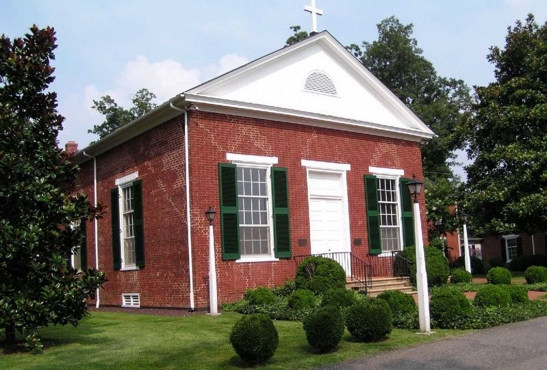
St. Stephen's Episcopal Church
GEOGRAPHIC SORT Title Sort Marker Number Sort Marker Number Sort N Marker Number Sort T Publication Order Sort Publication Order Sort A Erected Year Sort Most Viewed Sort Most Recent-Interest Sort Most Recently Changed Sort SEE FAQ #33 FOR DESCRIPTIONS
On Forest Road (U.S. 221) east of Venture Drive, on the right when traveling west.
On Interpretive Trail, 1.7 miles south of State Park Road, on the right.
On West Lynchburg Salem Turnpike (U.S. 460) 0.3 miles west of Circle K Road (Virginia Route 751), in the median.
On West Lynchburg Salem Turnpike (U.S. 460) 0.2 miles west of Thaxton School Road (Virginia Route 831), on the right when traveling west.
On East Lynchburg-Salem Turnpike (U.S. 460) west of Ryland Drive, on the right when traveling west.
On South Scenic Highway (U.S. 52) at Seddon Street (County Route 1005), on the right when traveling west on South Scenic Highway.
On South Scenic Highway (Route 52) 0.5 miles west of Waddletown Road (Virginia Route 617), on the right when traveling west. Reported permanently removed.
On Stony Fork Road (U.S. 52) near West Blue Grass Trail (Virginia Route 42), on the right when traveling south.
On West Blue Grass Trail (Virginia Route 42) at Poor Valley Road (County Route 625) on West Blue Grass Trail.
On North Scenic Highway (U.S. 52) at Interstate 77, on the right when traveling south on North Scenic Highway.
On Stoney Fork Road (U.S. 52) at Old Mountain Road (County Route 621), on the right when traveling south on Stoney Fork Road.
On Lynchburg Salem Turnpike (U.S. 460), on the right when traveling east.
On Main Street (U.S. 11), on the right when traveling south. Reported missing.
On Main Street (U.S. 11), on the right when traveling south.
On Lee Hwy (U.S. 11), on the right when traveling north. Reported missing.
Paid Advertisement
On Lee Highway (U.S. 11) north of Updike Lane, on the right when traveling north.
On Lee Hwy (U.S. 11) south of 2nd Avenue, on the right when traveling north.
On Roanoke Road (U.S. 220), on the right when traveling south.
On Roanoke Road (U.S. 220) south of International Parkway, in the median.
On Main Street (Local Road T-630) at Roanoke Street (Local Road T-1204), on the left when traveling east on Main Street.
On Breckinridge Mill Road (County Route 600) 1 mile south of Grove Hill Road (Route 606), on the left when traveling south.
On Fincastle Road (U.S. 220) at West Main Street (Local Route T-630), on the right when traveling north on Fincastle Road.
On Roanoke Road (U.S. 220) at Trinity Road, on the right when traveling north on Roanoke Road.
On Botetourt Road (U.S. 220) at Houseman Street (County Route 1211), on the left when traveling north on Botetourt Road.
On Botetourt Road (Route 220) at Poor Farm Road (Route 681), in the median on Botetourt Road.
On Arcadia Road (Virginia Route 614) near Lee Highway (Virginia Route 055), on the right when traveling west. Reported permanently removed.
On Lee Highway (Route F055 Frontage Road) south of Plank Road (County Route 610), on the left when traveling north.
On Lee Highway (U.S. 11), on the right when traveling south.
On Martin Luther King Jr. Boulevard (Virginia Route 113) north of State Street, on the right when traveling north.
On Lee Highway (U.S. 11/19) west of Sugar Hollow Road, on the right when traveling west.
On Lee Street north of Cumberland Street (Virginia Route 113), on the left when traveling north.
Paid Advertisement
On State Street at Edgemont Avenue on State Street.
On Lee Street north of Cumberland Street (Virginia Route 113), on the left when traveling north.
On Lee Highway (U.S. 11/19) 0.1 miles west of Forsythe Road, on the right when traveling west.
On Boydton Plank Road (U.S. 1) at Christanna Highway (Virginia Route 46), on the right when traveling north on Boydton Plank Road.
On Boydton Plank Road (U.S. 1) at Christanna Highway (Virginia Route 46), on the right when traveling north on Boydton Plank Road. Reported permanently removed.
On Boydton Plank Road (U.S. 1) 0.2 miles north of Poor House Road (County Route 642), on the right when traveling south.
On Christanna Highway (Virginia Route 46) south of Jonesboro Church Road (County Road 645), on the right when traveling south.
On Boydton Plank Road (U.S. 1) 0.6 miles south of Tanner Town Road, on the right when traveling north.
On Piney Pond Road (U.S. 58) 0.1 miles west of Main Street (County Route 659), on the left when traveling west.
On Boydton Plank Road (U.S. 1) at Old Indian Road on Boydton Plank Road.
On Christanna Highway (Virginia Route 46) at Boydton Plank Road (U.S. 1), on the right when traveling south on Christanna Highway.
On Old Stage Road, 0.4 miles south of Smoky Ordinary Road.
On Pleasant Shade Drive / Governor Harrison Parkway (U.S. 58) at 5 Forks Access Road, on the right when traveling west on Pleasant Shade Drive / Governor Harrison Parkway.
On Pleasant Shade Drive / Governor Harrison Parkway (U.S. 58) at 5 Forks Access Road, on the right when traveling west on Pleasant Shade Drive / Governor Harrison Parkway.
On Christanna Highway (Virginia Route 46) 0.7 miles south of Iron Bridge Road (County Road 715), on the right when traveling south.
On North Main Street (Business U.S. 58) at Athletic Field Road, on the right when traveling west on North Main Street.
Paid Advertisement
On Brunswick Drive (County Route 644) at Exit 24 (Interstate 85) on Brunswick Drive.
On Christanna Highway (Virginia Route 46) 0.5 miles north of Gasburg Road (County Road 626), on the right when traveling north.
On Christanna Highway (Virginia Route 46) near Dromgoole Road (County Road 669), on the right when traveling north.
On Christanna Highway (Virginia Route 46) 0.1 miles south of Gasburg Road (County Road 626), on the left when traveling north.
On Boydton Plank Road (U.S. 1) at Old Stage Road (County Route 712), on the right when traveling north on Boydton Plank Road.
On Boydton Plank Road (U.S. 1) at Old Stage Road, on the right when traveling south on Boydton Plank Road.
On Boydton Plank Road (U.S. 1) at Old Stage Road (County Route 712), on the right when traveling north on Boydton Plank Road.
On Boydton Plank Road (U.S. 1) 0.1 miles south of Flat Rock Road (County Route 643), on the right when traveling north.
On U.S. 460 just east of the Kentucky State Line, on the left when traveling west.
On Main Street at Walnut Street (Local Route T-1003), on the left when traveling south on Main Street.
On Red Bud Highway (Virginia Route 80) just west of Chimney Rock Road, on the right when traveling west.
On U.S. 460 south of Shortt Gap Road, on the right when traveling north.
On James Madison Highway (U.S. 15) at Circle Drive Road (County Route 715), on the right when traveling south on James Madison Highway.
On Anderson Highway (U.S. 60) at Lee Wayside Road, on the right when traveling east on Anderson Highway.
On Anderson Highway (U.S. 60) at Mount Rush Highway (Virginia Route 24), on the right when traveling east on Anderson Highway.
On Anderson Highway (U.S. 60) 0.4 miles west of Ayers Road, on the left when traveling west.
Paid Advertisement
On East James Anderson Highway (U.S. 60) 0.2 miles east of Scotts Bottom Road (Virginia Route 632), on the right when traveling east.
On James Madison Highway (U.S. 15) at Old Curdsville Road (County Route 633), on the right when traveling north on James Madison Highway. Reported permanently removed.
On South Madison Road (U.S. 15) at School Road (Virginia Route 633), on the right when traveling north on South Madison Road.
On North Madison Road (U.S. 15) at South Constitution Route (State Highway 20), on the right when traveling south on North Madison Road.
On James Madison Highway (U.S. 15) at Gravel Hill Road (Virginia Route 617), on the right when traveling north on James Madison Highway. Reported permanently removed.
On North James Madison Highway (U.S. 15) at Gravel Hill Road (Virginia Route 617), on the right when traveling north on North James Madison Highway.
On North Madison Road (U.S. 15) at Gold Mine Street (Alternate County Route 1010), on the right when traveling south on North Madison Road.
On James Madison Highway (U.S. 15) at County Route 687, on the right when traveling south on James Madison Highway.
On James Madison Highway (U.S. 15) at Toney Lane, on the right when traveling north on James Madison Highway.
On James Madison Highway (U.S. 15) at C. G. Woodson Drive (County Route 670), on the right when traveling north on James Madison Highway.
On James Madison Highway (U.S. 15) 0.3 miles north of Trents Mill Road (Virginia Route 622), on the right when traveling north.
On James Madison Highway (U.S. 15) 0.2 miles north of Glen Road (County Route 686), on the right when traveling north.
On James Madison Highway (U.S. 15) at Evans Mill Road (County Route 621), on the right when traveling north on James Madison Highway.
On James Madison Hwy (U.S. 15) at Francisco Road (Virginia Route 636), on the right when traveling south on James Madison Hwy.
On James Madison Highway (U.S. 15) at Francisco Road (County Route 626), on the right when traveling south on James Madison Highway.
On West 29th Street (U.S. 60) west of Culvert Street (County Route 631), on the left when traveling west.
Paid Advertisement
On Main Street (Business U.S. 29) at Wards Droad (U.S. 29), on the left when traveling south on Main Street.
On Wickliffe Road (Virginia Route 40) at Pick Street, on the right when traveling east on Wickliffe Road.
On Swinging Bridge Road (County Route 605) at Wickliffe Road (Virginia Route 40), on the right when traveling west on Swinging Bridge Road.
On Wickliffe Road (Virginia Route 40) at Mt. Calvary Road (County Route 600), on the right when traveling east on Wickliffe Road.
On Main Street south of East Rush Street (County Route 1103), on the right when traveling south.
On Lusardi Drive (U.S. 501) at Rush Street when traveling north on Lusardi Drive.
On Brookneal Highway (U.S. 501) near Pigeon Run Road (County Route 652), on the right when traveling south. Reported missing.
On Richmond Highway (U.S. 460) 0.3 miles west of Mount Athos Road (County Route 726), on the right when traveling east.
On Richmond Highway (U.S. 460) 0.1 miles east of Oxford Furnace Road (County Route 662), on the right when traveling west.
On Alum Springs Road (County Route 858) at Town Fork Road (County Route 623), on the right when traveling east on Alum Springs Road.
On Village Highway (Virginia Route 24) just west of Red House Road (County Road 615), on the right when traveling west.
On Village Highway (Virginia Route 24), on the right when traveling west.
On Village Highway (Route 501) near Rails End Lane (County Route 838), on the right when traveling south.
On Main Street (State Highway 2) near Courthouse Lane.
On North Main Street (Business U.S. 301) at West Broaddus Avenue (Route 207), on the left when traveling north on North Main Street.
On Washington Highway (U.S. 1) at Oxford Road, on the right when traveling north on Washington Highway.
Paid Advertisement
On Ladysmith Road (County Route 639) at Countyline Church Road (County Route 603), on the right when traveling east on Ladysmith Road.
On Washington Highway (U.S. 1), on the right when traveling north.
On Dawn Boulevard (Virginia Route 30), on the right when traveling east.
On Washington Highway (U.S. 1), on the right when traveling north.
On Dawn Blvd. (Virginia Route 30) 1.8 miles east of Interstate 95, on the left when traveling east.
2617 entries matched your criteria. Entries 201 through 300 are listed above.
⊲ Previous 100 —
Next 100 ⊳