THE HISTORICAL
MARKER DATABASE
“Bite-Size Bits of Local, National, and Global History”


275 entries match your criteria. The first 100 are listed.                                               Next 100 ⊳


Historical Markers and War Memorials
in the Little Rock Metropolitan Area Region

 
By Mark Hilton, August 3, 2016
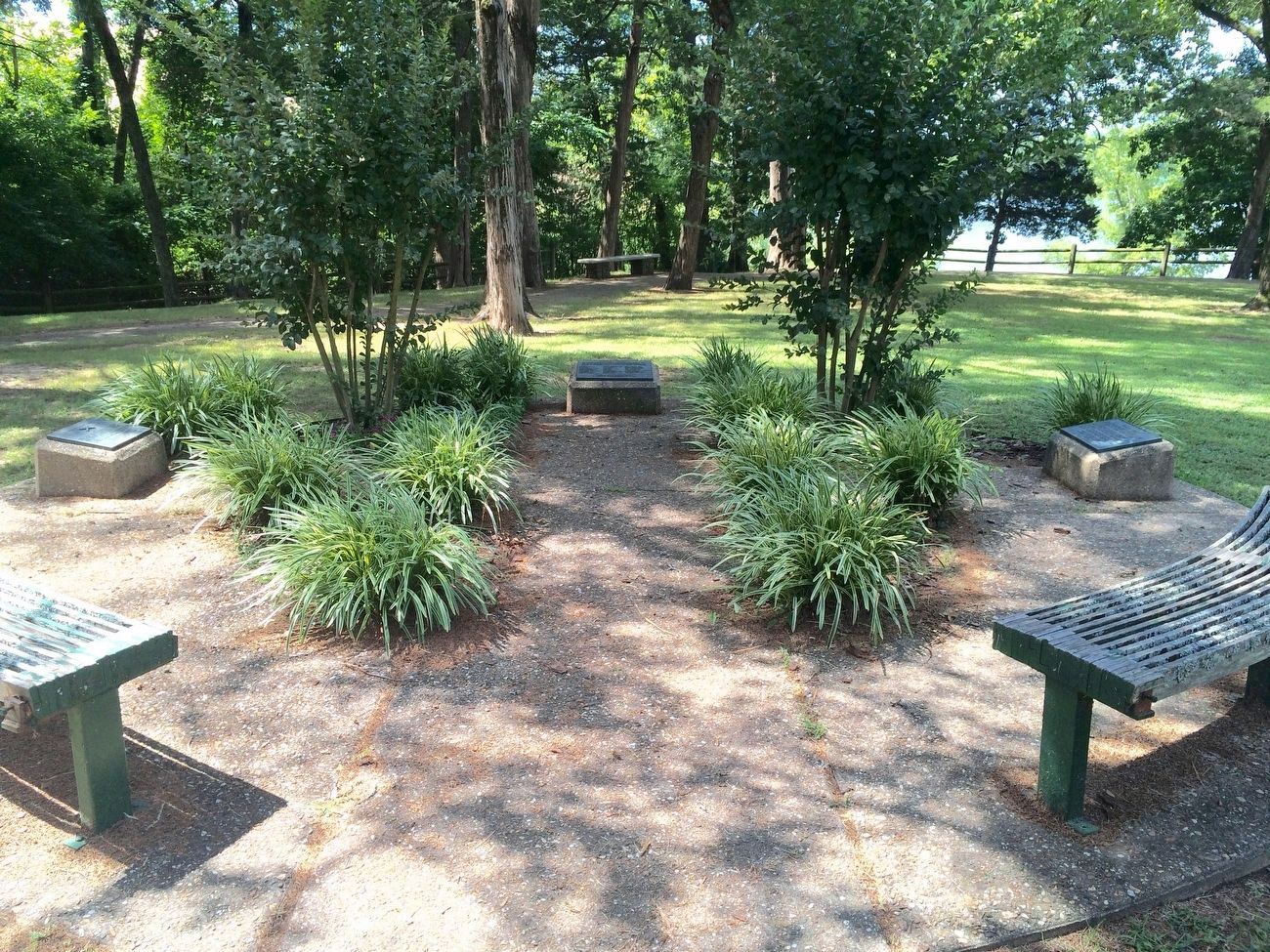
"Trail of Tears" Marker in Cadron Settlement Park on right of photo.
1 ► Arkansas, Faulkner County, Conway — "Trail of Tears" —
Near State Highway 319 0.1 miles west of Cadron Settlement Lane.
2 ► Arkansas, Faulkner County, Conway — 450th Commemoration De Soto Expedition — 1541 – 1991 —
Near State Highway 319 1.6 miles west of Old Morrilton Highway (U.S. 64).
3 ► Arkansas, Faulkner County, Conway — Cadron Blockhouse —
Near State Highway 319 1.7 miles west of 6200 Highway 319 West (U.S. 64).
4 ► Arkansas, Faulkner County, Conway — 82 — Cadron in the Civil War —
Near State Highway 319 at Cadron Settlement Lane, on the right.
5 ► Arkansas, Faulkner County, Conway — Cherokee Memorial —
Near State Highway 319 1.7 miles west of Old Morrilton Highway (U.S. 64).
6 ► Arkansas, Faulkner County, Conway — Conway Confederate Monument —
On Robinson Avenue west of Locust Avenue, on the right when traveling west.
7 ► Arkansas, Faulkner County, Conway — Conway Fire Department September 11, 2001 Memorial —
On Caldwell Street just west of Locust Avenue, on the left when traveling west.
8 ► Arkansas, Faulkner County, Conway — E-4 — Faulkner County — The First Court House —
Near Locust Avenue at Main Street, on the right when traveling south.
9 ► Arkansas, Faulkner County, Conway — 78 — Faulkner County in the Civil War —
Near Bruce Street.
10 ► Arkansas, Faulkner County, Conway — Faulkner County Veterans Memorial —
On Locust Avenue at Main Street, on the left when traveling north on Locust Avenue.
11 ► Arkansas, Faulkner County, Conway — 38 — Lines Cemetery —
Near Sturgis Road at Round Mountain Road and Scenic Hill Road, on the right when traveling south.
12 ► Arkansas, Faulkner County, Conway — Lt. Joseph W. Harris, U.S.A. —
Near State Highway 319 0.1 miles west of Cadron Settlement Lane.
13 ► Arkansas, Faulkner County, Conway — Robins House —
On Locust Avenue at Scott Street, on the right when traveling south on Locust Avenue.
14 ► Arkansas, Faulkner County, Conway — Simon Park —
On Front Street just north of Main Street, on the left when traveling north.
15 ► Arkansas, Faulkner County, Conway — The Hendrix Bell at Altus —
Near Harkrider Street (Business U.S. 65) at Markham Street, on the right when traveling south.
Paid Advertisement
16 ► Arkansas, Grant County, Leola — Battle of Jenkins' Ferry —
Near State Highway 46 1.9 miles south of State Highway 291, on the right when traveling south.
17 ► Arkansas, Grant County, Leola — 112 — Confederate Headquarters / Confederate Flank Attack
Near Arkansas Route 229 0.4 miles north of Lee Street, on the right when traveling north. Reported missing.
18 ► Arkansas, Grant County, Leola — 110 — General Samuel Rice / Confederate Cannons Captured —
Near Arkansas Route 46 2 miles south of Route 291, on the right when traveling south.
19 ► Arkansas, Grant County, Leola — 113 — Jenkins Ferry / Pontoon Bridge —
On Highway 46 2 miles south of Highway 291, on the right when traveling south.
20 ► Arkansas, Grant County, Leola — 115 — Officers Killed / Union Wounded —
On Arkansas Route 46 at County Road 6, on the right when traveling south on Arkansas Route 46.
21 ► Arkansas, Grant County, Leola — Red River Campaign — Battle of Jenkins' Ferry —
Near State Highway 46 1.9 miles south of State Highway 291, on the right when traveling south.
22 ► Arkansas, Grant County, Leola — 114 — Refugee Children / Supplies Destroyed —
On Arkansas Route 46 at Route 291, on the right when traveling south on Arkansas Route 46.
23 ► Arkansas, Grant County, Prattsville — 116 — Clash at Whitten's Mill —
Near U.S. 270 west of Salburnit Road (State Route 291), on the right when traveling west.
24 ► Arkansas, Grant County, Sheridan — 1976 American Bicentennial —
On South Oak Street just south of West Center Street (U.S. 270), on the left when traveling south.
25 ► Arkansas, Grant County, Sheridan — American Legion B-17 Veterans Memorial —
On Grant 51 (County Rd. 51) 2 miles east of Ark. Hwy. 35, on the right when traveling east.
26 ► Arkansas, Grant County, Sheridan — American Legion B-17 Veterans Memorial Park —
On Grant 51 ( County Rd. 51) 2 miles east of State Road 35, on the right when traveling east.
27 ► Arkansas, Grant County, Sheridan — Grant County War Memorial — We Have Not Died in Vain if Tyranny Died With Us —
On West Center Street at S. Oak Street, on the right when traveling east on West Center Street.
28 ► Arkansas, Grant County, Sheridan — Site of First County Courthouse 1871 — Burned 1877 —
On West Center Street (State Highway 270) just west of South Main Street, on the left when traveling west.
29 ► Arkansas, Grant County, Sheridan — Unknown Soldiers — USA — April 29 -30, 1864 —
On Grant 51 (County Road 51) 2 miles State Road 35, on the right when traveling east.
30 ► Arkansas, Grant County, Sheridan — Unknown Soldiers CSA — April 29 - 30, 1864 —
On Grant 51 (County Rd. 51) 2 miles east of Ark. 35, on the right when traveling east.
31 ► Arkansas, Lonoke County, Austin — Austin —
On Arkansas Route 38 at Ray Sowell Road, on the right when traveling east on Arkansas Route 38.
Paid Advertisement
32 ► Arkansas, Lonoke County, Austin — 138 — Austin in the Civil War —
On Arkansas Route 38 at Ray Sowell Road, on the right when traveling east on Arkansas Route 38.
33 ► Arkansas, Lonoke County, Austin — Oakland Grove (Old Austin) — Short Cut to Indian Territory 1832-1838 — Trail of Tears Through Arkansas —
On Ray Sowell Road at State Route 38, on the right when traveling west on Ray Sowell Road.
34 ► Arkansas, Lonoke County, Cabot — Camp Nelson —
On Rye Drive 0.1 miles east of Lonoke County 267, on the left when traveling east.
35 ► Arkansas, Lonoke County, Cabot — Camp Nelson Confederate Cemetery —
On Rye Drive 0.1 miles east of Lonoke County 267 when traveling east.
36 ► Arkansas, Lonoke County, Cabot — World War II Memorial — In Honor —
On North Lincoln at S. Polk St., on the left when traveling north on North Lincoln.
37 ► Arkansas, Lonoke County, Carlisle — 90 — Action at Ashley's Station —
On South Court Street at West Durkee Street, on the right when traveling south on South Court Street.
38 ► Arkansas, Lonoke County, Carlisle — William H. Fuller — Father of the Arkansas Rice Industry —
On E. 5th Street east of N. Court Street, on the right when traveling east.
39 ► Arkansas, Lonoke County, Lonoke — A Gun for All Reasons — 3-inch Gun was light, accurate and lethal —
On North Center Street (State Highway 31) north of 2nd Street, on the right when traveling north.
40 ► Arkansas, Lonoke County, Lonoke — Battle of Brownsville —
On Arkansas Route 31 at Flynt Lane, on the right when traveling north on Arkansas Route 31.
41 ► Arkansas, Lonoke County, Lonoke — Eberts Air Field — World War I Training Site —
On East Front Street east of Hicks Street, on the right when traveling east.
42 ► Arkansas, Lonoke County, Lonoke — 16 — Hicks' Station in the Civil War —
On SE Front Street (U.S. 70) 1 mile east of Honeysuckle Lane, on the left when traveling east.
43 ► Arkansas, Lonoke County, Lonoke — Joe P. Eagle/D.R. Boone Building —
On Front Street Southwest (U.S. 70) west of South Center Street, on the right when traveling east.
44 ► Arkansas, Lonoke County, Lonoke — Lonoke County Confederate Monument —
On North Center Street (State Highway 31) north of 2nd Street, on the right when traveling north.
45 ► Arkansas, Lonoke County, Lonoke — Lonoke County Honor Roll —
On North Center Street (Arkansas Route 31) at East 4th Street, on the right when traveling north on North Center Street.
46 ► Arkansas, Lonoke County, Lonoke — Lonoke Landmarks —
On North Center Street (State Highway 31) north of 2nd Street, on the right when traveling north.
47 ► Arkansas, Lonoke County, Lonoke — F 25 — Senator Joe T. Robinson — Lonoke County —
On North Center Street (State Highway 31) north of 2nd Street, on the right when traveling north.
Paid Advertisement
48 ► Arkansas, Lonoke County, Lonoke — 1 — The Little Rock Campaign - Brownsville — Confederates Fight to Stop Union Advance —
On Arkansas Route 31 at Flynt Lane, on the right when traveling north on Arkansas Route 31.
49 ► Arkansas, Lonoke County, Lonoke — The Lonoke Depot —
On Front Street Northwest at Park Street when traveling east on Front Street Northwest.
50 ► Arkansas, Lonoke County, Lonoke — The Shull House — Circa 1917 —
On Park Street at West Locust Street, on the right when traveling south on Park Street.
51 ► Arkansas, Lonoke County, Lonoke — Thomas Sloan Boyd House —
On Park Street at West Pine Street, on the right when traveling south on Park Street.
52 ► Arkansas, Lonoke County, Scott — Home to Some; Capitol City to All — Toltec Mounds Archeological State Park —
On Toltec Mounds Rd 1 mile south of Ar. Rd 165 (State Road 165), on the right.
53 ► Arkansas, Lonoke County, Scott — Plants Tell a Human Story —
On Toltec Mounds Road 1 mile Ar. Rd 165 (State Road 165), on the right when traveling south.
54 ► Arkansas, Lonoke County, Scott — The Path to Domesticated Plants — The Relationship between people and plants is profoundly import —
On Toltec Mounds Road at Hwy 165, on the right on Toltec Mounds Road.
55 ► Arkansas, Lonoke County, Scott — The Plum Bayou Garden —
On Toltec Mounds Road 1 mile south of Local Highway 165, on the right when traveling south.
56 ► Arkansas, Pulaski County, Baucum — 4 — The Little Rock Campaign - River Crossing — Union Troops Cross Arkansas River to Capture Little Rock —
On Willow Beach Road west of Colonel Maynard Road (County Road 85), on the left when traveling west.
57 ► Arkansas, Pulaski County, Jacksonville — A Gallant Charge — The First Iowa Cavalry Charges Burning Reed's Bridge —
On South First Street (Arkansas Route 161) 0.3 miles south of Carver Lane, on the right when traveling south.
58 ► Arkansas, Pulaski County, Jacksonville — Brother Against Brother — Union and Confederate Missourians Fight at Bayou Meto —
On South First Street (Arkansas Route 161) south of Carver Lane, on the right when traveling south.
59 ► Arkansas, Pulaski County, Jacksonville — Like Sorrow's Veil... — The Confederates Burn Reed's Bridge Over Bayou Meto —
Near South First Street (Arkansas Route 161) north of Lakeshore Drive, on the right when traveling north.
60 ► Arkansas, Pulaski County, Jacksonville — Our Batteries Opened a Tremendous Fire — The Union Artillery at the Battle of Reed's Bridge —
On South First Street (Arkansas Route 161) south of Nixon Drive, on the right when traveling south.
61 ► Arkansas, Pulaski County, Jacksonville — The Brigade Moved Forward — The Opening Movements of the Battle of Reed's Bridge —
Near East Trickey Lane at Military Road.
62 ► Arkansas, Pulaski County, Jacksonville — The Defense of the Ford — Bennett Holds the Key to the Confederate Line —
Near South First Street (Arkansas Route 161) north of Lakeshore Drive, on the right when traveling north.
63 ► Arkansas, Pulaski County, Jacksonville — 2 — The Little Rock Campaign — Reed's Bridge — Confederates Stop Union Advance —
Near South First Street (Arkansas Route 161) north of Lakeshore Drive, on the right when traveling north.
Paid Advertisement
64 ► Arkansas, Pulaski County, Jacksonville — Thunder on Bayou Meto — Confederate Artillery in the Battle for Reed's Bridge —
On South First Street (Arkansas Route 161) at Lakeshore Drive, on the right when traveling south on South First Street.
65 ► Arkansas, Pulaski County, Jacksonville — Arkansas Ordnance Plant (AOP) — Guard Shack —
On North Hospital Circle at West Main Street, on the left when traveling north on North Hospital Circle.
66 ► Arkansas, Pulaski County, Jacksonville — Battle of Reed's Bridge —
Near East Trickey Lane at Military Road.
67 ► Arkansas, Pulaski County, Jacksonville — Bayou Meto Historic Site —
On North First Street (State Highway 161) at Gregory Place, on the right when traveling north on North First Street.
68 ► Arkansas, Pulaski County, Jacksonville — 85 — Bayou Metre Hornets —
On North First Street (State Highway 161) at Gregory Place, on the right when traveling north on North First Street.
69 ► Arkansas, Pulaski County, Jacksonville — Civil War Soldiers Buried at Bayou Meto Cemetery —
Near North 1st Street (State Road 161) at Gregory Place, on the right when traveling north.
70 ► Arkansas, Pulaski County, Jacksonville — 135 — Confederates at Bayou Meto
On Division Street at South Second Street, on the right when traveling east on Division Street. Reported missing.
71 ► Arkansas, Pulaski County, Jacksonville — First Jacksonville School —
On East Main Street at South Oak Street, on the right when traveling east on East Main Street.
72 ► Arkansas, Pulaski County, Jacksonville — Governor Homer M. Adkins — 1890-1964 —
On West Main Street at Jeff Davis Street, in the median on West Main Street.
73 ► Arkansas, Pulaski County, Jacksonville — In Honor and Remembrance —
On North Hospital Circle just south of West Main Street, on the right when traveling south.
74 ► Arkansas, Pulaski County, Jacksonville — Jacksonville, Arkansas —
On West Main Street at Jones Street, on the left when traveling east on West Main Street.
75 ► Arkansas, Pulaski County, Jacksonville — 118 — Marmaduke-Walker Duel —
On South First Street (Arkansas Route 161) at Lakeshore Drive, on the right when traveling south on South First Street.
76 ► Arkansas, Pulaski County, Jacksonville — Memorial Honoring 53 —
On Veterans Circle 0.1 miles West Main Street, on the right.
77 ► Arkansas, Pulaski County, Jacksonville — Memphis Military Road —
On East Trickey Lane at Military Road, on the right when traveling east on East Trickey Lane.
78 ► Arkansas, Pulaski County, Jacksonville — Shared Gray     Jacob Gray — 1758-1836     1762-1837 —
Near East Trickey Lane at Military Road.
79 ► Arkansas, Pulaski County, Jacksonville — The Little Rock Campaign — The Struggle for Arkansas's Capital —
Near South First Street (State Road 161) north of Lakeshore Drive, on the right when traveling north.
Paid Advertisement
80 ► Arkansas, Pulaski County, Jacksonville — The Memphis to Little Rock Railroad — Samson Gray Helps Link the State Capital with the Mississippi —
Near East Trickey Lane at Military Road.
81 ► Arkansas, Pulaski County, Jacksonville — The Trail of Tears through Jacksonville — Trail of Tears National Historic Trail — National Trails System —
Near East Trickey Lane at Military Road.
82 ► Arkansas, Pulaski County, Jacksonville — They Passed This Way — Trail of Tears National Historic Trail — National Trails System —
Near East Trickey Lane at Military Road.
83 ► Arkansas, Pulaski County, Jacksonville — Tom Cory — 1933-2000 —
On South James Street just north of Louise, on the left when traveling south.
84 ► Arkansas, Pulaski County, Jacksonville — Veterans Memorial — Bell Tower —
On North Hospital Circle just north of West Main Street, in the median.
85 ► Arkansas, Pulaski County, Little Rock — A Wild Look Back — Cat House —
On Zoo Drive 0.1 miles west of S. Monroe Street when traveling west.
86 ► Arkansas, Pulaski County, Little Rock — Alexander George House —
Near East 3rd Street at Dean Kumpuris Street, on the left when traveling east.
87 ► Arkansas, Pulaski County, Little Rock — Arkansas in the Civil War —
Near President Clinton Avenue.
88 ► Arkansas, Pulaski County, Little Rock — Choctaw Route Station — (1899) —
Near Dean Kumpuris Street at East 3rd Street, on the right when traveling north.
89 ► Arkansas, Pulaski County, Little Rock — Clinton Presidential Park Bridge History —
On President Clinton Avenue, on the left when traveling east.
90 ► Arkansas, Pulaski County, Little Rock — 10 — Frank Moore — Member of the Elaine Twelve —
On Barber Street 0.1 miles north of East 26th Street, on the right when traveling north.
91 ► Arkansas, Pulaski County, Little Rock — Harris House —
On Fourche Dam Pike at Richland Drive, on the left when traveling west on Fourche Dam Pike.
92 ► Arkansas, Pulaski County, Little Rock — In Memory of all who served on the Island of Oahu —
Near Barber Road 0.1 miles north of East 26th Street, on the right when traveling north.
93 ► Arkansas, Pulaski County, Little Rock — It is River City — La Petite Roche Historical Walk —
Near President Clinton Avenue.
94 ► Arkansas, Pulaski County, Little Rock — Memorial Stadium — 1948 —
Near Stadium Drive.
95 ► Arkansas, Pulaski County, Little Rock — Oakland-Fraternal Cemetery —
On Barber Street at East 21st Street, on the right when traveling south on Barber Street.
Paid Advertisement
96 ► Arkansas, Pulaski County, Little Rock — One Old Rock — La Petite Roche Historical Walk —
Near President Clinton Avenue.
97 ► Arkansas, Pulaski County, Little Rock — Over the Jumps —
On Zoo Drive 0.2 miles west of Fair Park Drive when traveling west.
98 ► Arkansas, Pulaski County, Little Rock — 33 — Primrose Cemetery — Resting Place for Early Germanic Settlers —
On Dixon Road (State Highway 338), on the right when traveling west.
99 ► Arkansas, Pulaski County, Little Rock — River Traffic —
Near President Clinton Avenue.
100 ► Arkansas, Pulaski County, Little Rock — Smaller Rock, Big Bridge — La Petite Roche Historical Walk —
Near President Clinton Avenue.

275 entries matched your criteria. The first 100 are listed above. Next 100 ⊳

 
 
CeraNet Cloud Computing sponsors the Historical Marker Database.
This website earns income from purchases you make after using our links to Amazon.com. We appreciate your support.
Paid Advertisement
Nov. 10, 2026