► Are you looking for a list of all entries in a place called Oregon? Or in a state or province called Oregon?
By Barry Swackhamer, June 28, 2017
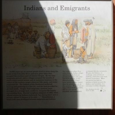
Indians and Emigrants Marker
RANKED BY RELEVANCE
| Near Vietnsm Veterans Memorial Highway (Interstate 84), on the right when traveling west. |
| On Interstate 84 at milepost 71, on the right when traveling west. |
| On McLoughlin Boulevard (Oregon Route 99) near S. 2nd Street, on the right when traveling south. |
| On Oregon Buttes Road at Emigrant Trail, on the left when traveling south on Oregon Buttes Road. |
| Near Southwest Naito Parkway south of SW Pine Street. |
| On Southeast Spruce Street at SE Washington Ave (U.S. 138) on Southeast Spruce Street. |
| Near Waverly Street Northeast, on the left when traveling west. |
| On McLoughlin Boulevard (Oregon Route 99) near S. 2nd Street, on the right when traveling south. |
| On Interstate 84 at milepost 185 near Umatilla-Stanfield Highway (U.S. 395), on the right when traveling west. |
| On North Bank Chetco River Road at Oregon Coast Hwy (U.S. 101), on the right when traveling south on North Bank Chetco River Road. |
| On SW Jefferson Way at SW 15th Street, on the right when traveling west on SW Jefferson Way. |
| Near John Day Highway (Oregon Route 19) 2 miles north of U.S. 26, on the left when traveling north. |
| On Oregon Coast Highway (U.S. 101) south of Central Avenue, on the right when traveling south. |
| Near Otter Crest Loop 0.1 miles north of Miroco Street, on the right when traveling south. |
| On Interstate 84 at milepost 224 near County Route 1021, on the right when traveling west. |
| On Interstate 84 at milepost 293 near Medical Springs Highway (Chandler Lane) ( Route 203), on the right when traveling west. |
| On Shawnee Mission Parkway near Melrose Lane, on the right when traveling east. |
| Near Columbia River Highway (U.S. 30) near Clifton/Shingle Mill Road, on the right when traveling west. |
| On Allen Street (Old U.S. 4) west of 5th Avenue North, on the right when traveling west. |
| On Scott Mountain Road (Route 3 at milepost 83.3), on the right when traveling north. |
| On 151st Street, on the right when traveling east. |
| On Main Street just south of Broadway Street, on the left when traveling north. |
| On SW 2nd Street at SW Adams Avenue on SW 2nd Street. |
| Near U.S. 97, on the right when traveling south. |
| Near Huntington Highway (Business U.S. 30) near Interstate 84, on the right when traveling north. |
| On Beech Street at Locust Street, on the right when traveling west on Beech Street. |
| On Immigrant Road at Canyon Creek Road, on the right when traveling west on Immigrant Road. |
| Near Old Oregon Trail near Interstate 84, on the left when traveling north. |
| Near Washington Street near Abernethy Road, on the right when traveling north. |
| Near Biggs-Rufus Highway (Oregon Route 209) near Old Moody Road (County Route 143). |
| On Hot Springs Road at Teapot Road/Ross Road, on the right when traveling west on Hot Springs Road. |
| On East Monument Road (State Highway 74) at South Pawnee Avenue, on the right when traveling west on East Monument Road. |
| On Thundered Boulevard (U.S. 26) near Lee Road, on the left when traveling east. |
| On Southwest Frazer Avenue near Southwest 1st Street, on the left when traveling west. |
| Near Hilgard Highway (Oregon Route 244) near Interstate 84. |
| On State Highway 21 at East Lake Forest Drive, on the right when traveling east on State Highway 21. |
| On Lincoln Highway (U.S. 30) at County Road M, on the right when traveling west on Lincoln Highway. |
| On Road Q just east of U.S. 81, on the left when traveling east. |
| On Ocean View Drive south of West 2nd Street, on the left when traveling south. |
| Near Forest Road 84 at milepost 228 near Evergreen Lane. |
| On Deschutes Way at Boston St SW, on the left when traveling south on Deschutes Way. |
| On Court Street (U.S. 136) at 2nd Street, on the right when traveling west on Court Street. |
| On American Legion Memorial Highway (U.S. 281) at West Saddlehorn Road, on the right when traveling south on American Legion Memorial Highway. |
| On Old Oregon Trail, on the right when traveling west. Reported permanently removed. |
| On U.S. 20 at South Harney Road, on the right when traveling east on U.S. 20. |
| On La Grande - Baker Highway (Adams Avenue) (U.S. 30) near Otten Drive, on the right when traveling north. |
| On The Road to Oz Highway (State Highway 99), on the left when traveling south. |
| On Grand Army of the Republic Highway (U.S. 34) 0.3 miles west of South Roseland Avenue, on the right when traveling west. |
| Near Interstate 84 near Gate Road/Sisley Creek Road, on the right when traveling north. |
| On Road S 0.4 miles south of Interstate 80, on the right when traveling south. |
| Near North Eagle Road (State Highway 55) at U.S. 26, on the left when traveling north. |
| On 571st Avenue at 712th Road, on the left when traveling west on 571st Avenue. |
| On Lawrence Road at West Road 80, on the left when traveling north on Lawrence Road. |
| On Old U.S. 30 at Oxman Ranch Road, on the left when traveling west on Old U.S. 30. |
| On Memorial Drive east of Center Drive. |
| On Northwest Everett Street west of Northwest Broadway, on the left when traveling east. |
| On National Park Highway/Oregon Trail (U.S. 89), on the right when traveling south. |
| On Northbound Rest Area (Interstate 205), on the right when traveling north. |
| On Old Highway 12 0.2 miles Frenchtown Road. |
| On South 5th Avenue (Old U.S. 91) at West Blackrock Road, on the right when traveling west on South 5th Avenue. |
| On Old Oregon Trail Road near Bennett Road, on the right when traveling west. |
| On Court Square, on the left when traveling south. |
| On West Jefferson Street at North 6th Street, on the right when traveling west on West Jefferson Street. |
| Near Oregon Trail Boulevard (Business U.S. 30) near Frontage Road, on the right when traveling north. |
| Near Lucinda Rollins Road near South Guernsey Road, on the left when traveling west. |
| Near Lincoln Boulevard at Sheridan Avenue. |
| On Riverside Drive east of Scott Avenue, on the left when traveling east. |
| On Valley Road (State Highway 9) 0.1 miles east of U.S. 77, on the right when traveling east. |
| On Brown Street at Hess Street, on the left when traveling south on Brown Street. |
| Near US Highway 26 (State Highway 92) 2.4 miles west of Main Street (Gold Rush Highway) (U.S. 385), on the left when traveling west. |
| On Washington Street north of Abernathy Road, on the right when traveling north. |
| On Wendover Road at Cottonwood Road, on the right when traveling west on Wendover Road. |
| Near Washington Street near Abernethy Road, on the right when traveling north. |
| On Roswell Road (Oregon Route 452) at Succor Creek Highway ( Route 201), on the left when traveling west on Roswell Road. |
| On North Main Street at West Center Street, on the left when traveling south on North Main Street. |
| On Goerig Street at Pacific Avenue on Goerig Street. |
| On Old Highway 99 SE south of 88th Ave SE, on the right when traveling north. |
| On U.S. 20 near Industrial Way. |
| On Riverside Drive, on the left when traveling east. |
| On Sussex Avenue East at Sheridan Street N on Sussex Avenue East. |
| Near Lucinda Rollins Road near South Guernsey Road, on the left when traveling west. |
| On South Center Street at East 1st Steet, on the right when traveling north on South Center Street. |
| Near U.S. 20 at State Highway 75, on the left when traveling west. |
| On Falls Avenue at Valdez Street on Falls Avenue. |
| On Crescent Road at West Campus Road, on the right when traveling east on Crescent Road. |
| On Oregon Coast Highway (U.S. 101) south of SW Alder Street, on the right when traveling north. |
| On Washington Street East (U.S. 26) at Short Street North, on the right when traveling west on Washington Street East. |
| Near Cottage Street Northeast. |
| Near Natural Bridge Road (County Road 13) 2.5 miles south of Spring Canyon Road (County Road 11). |
| On The Road to Oz Highway (State Highway 99), on the right when traveling south. |
| On County Route Y at County Route 3900, on the right when traveling east on County Route Y. |
| On County Route V east of County Route 4200, on the left when traveling west. |
| On Nebraska Route 14 near County Route AA, on the left when traveling north. |
2554 entries matched your criteria. The first 100 are listed above.
Next 100 ⊳
Thin black lines indicate changes in relevance. Between each pair of lines entries are ordered geographically but all have the same relevance.* Inflectional forms of words are their plurals, singulars, and possessives as well as gramatical tenses and similar variations.
Nov. 10, 2026
