267 entries match your criteria. The first 100 are listed. ⊳
Santa Fe Trail Historical Markers
This is an important trade route from New Franklin, Missouri (and parts west as the railroad moved west) to Santa Fe, New Mexico. The trail was in use from 1822 until the late 1880s.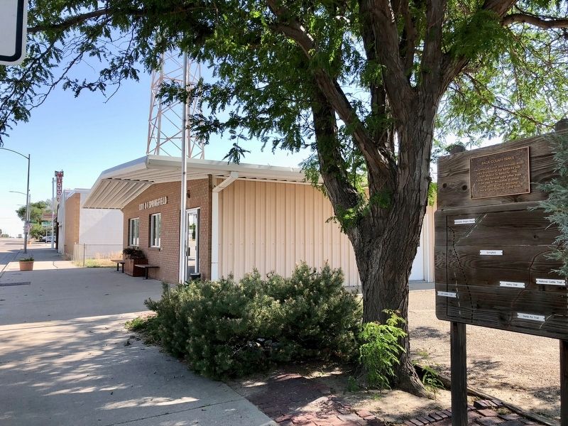
By Mark Hilton, June 27, 2018
Baca County Trails Marker near the Springfield Town Hall.
| 1 ► Colorado, Baca County, Springfield — Baca County Trails — |
| On Main Street (U.S. 287) north of East 8th Avenue, on the right when traveling north. | |||
| 2 ► Colorado, Bent County, Hasty — Santa Fe Trail — Travelers through Time — |
| Near County Highway HH near County Highway 24. | |||
| 3 ► Colorado, Bent County, Hasty — Santa Fe Trail — |
| On County Highway HH near County Highway 24. | |||
| 4 ► Colorado, Bent County, Las Animas — Santa Fe Trail — 1822 — 1872 — |
| On U.S. 50 at County Road 13, on the right when traveling west on U.S. 50. | |||
| 5 ► Colorado, Las Animas County, Model — The Santa Fe Trail — |
| On U.S. 350 at milepost 15, on the right when traveling north. | |||
| 6 ► Colorado, Las Animas County, Trinidad — 212 — Road to Santa Fe - Over the Pass / Santa Fe Trail Country - "Uncle Dick" Wootton — |
| Near Interstate 25 Frontage Road when traveling north. | |||
| 7 ► Colorado, Las Animas County, Trinidad — Santa Fe Trail — |
| Near Kansas Avenue at San Pedro Street. | |||
| 8 ► Colorado, Las Animas County, Trinidad — The Santa Fe Trail — |
| On West Main Street at North Commercial Street, on the right when traveling west on West Main Street. | |||
| 9 ► Colorado, Las Animas County, Trinidad — Transportation on the Santa Fe Trail — |
| On El Moro Road at County Highway 71.1 on El Moro Road. | |||
| 10 ► Colorado, Otero County, La Junta — Bent's Fort on Santa Fe Trail — |
| On Colorado 194, 0.1 miles east of County Road 35, on the right when traveling east. | |||
| 11 ► Colorado, Otero County, La Junta — Santa Fe Trail — 1822-1872 — |
| On State Highway 194 east of County Highway 35, on the left when traveling west. | |||
| 12 ► Colorado, Otero County, Timpas — Milestone — |
| On State Highway 71 north of U.S. 350, on the left when traveling north. | |||
| 13 ► Colorado, Prowers County, Lamar — Big Timbers — |
| Near Scenic U.S. 50/287 at State Highway 196, on the left when traveling north. | |||
| 14 ► Colorado, Prowers County, Lamar — Experience the Past on the Santa Fe Trail — |
| Near Main Street (U.S. 50) at E. Beech Street, on the right when traveling north. | |||
| 15 ► Colorado, Prowers County, Lamar — Explore Big Timbers Region — |
| On Scenic U.S. 50/287 at State Highway 196, on the right when traveling west on U.S. 50/287Scenic . | |||
| 16 ► Colorado, Prowers County, Lamar — Madonna of the Trail — |
| Near Scenic U.S. 50/287 at State Highway 196, on the right when traveling west. | |||
| 17 ► Colorado, Prowers County, Lamar — Santa Fe Trail — 1822 - 1872 |
| On Main Street (U.S. 50) 0.3 miles south of Colorado Highway 196, on the right when traveling north. Reported permanently removed. | |||
| 18 ► Colorado, Prowers County, Lamar — Santa Fe Trail — 1822-1872 — |
| On Scenic U.S. 50/287 at State Highway 196, on the right when traveling west on U.S. 50/287Scenic . | |||
| 19 ► Colorado, Prowers County, Lamar — Santa Fe Trail Scenic and Historic Byway — Colorado — |
| On Scenic U.S. 50/287 at State Highway 196, on the right when traveling west on U.S. 50/287Scenic . | |||
| 20 ► Colorado, Prowers County, Lamar — Santa Fe Trail, 1821-1880 — |
| On Scenic U.S. 50/287 at State Highway 196, on the right when traveling west on U.S. 50/287Scenic . | |||
| 21 ► Colorado, Pueblo County, Colorado City — Santa Fe and Taos Trails — |
| Near Highway 165 at CanAm Highway (Interstate 25). | |||
| 22 ► Kansas, Barton County, Great Bend — Site of Fort Zarah — 1822 - 1872 — |
| On U.S. 56, on the left when traveling east. | |||
| 23 ► Kansas, Barton County, Pawnee Rock — "A Point of Red Rocks" — |
| 24 ► Kansas, Barton County, Pawnee Rock — "A Rallying Point for the Indians" — |
| 25 ► Kansas, Barton County, Pawnee Rock — "A Remarkable Rocky Point" — |
| 26 ► Kansas, Barton County, Pawnee Rock — "Along Came the Line of Wagons" — |
| 27 ► Kansas, Barton County, Pawnee Rock — “One of the Grandest Sights Ever Beheld” — |
| 28 ► Kansas, Barton County, Pawnee Rock — “One of the Grandest Sights Ever Beheld” — |
| 29 ► Kansas, Barton County, Pawnee Rock — Marking the Rock — |
| 30 ► Kansas, Barton County, Pawnee Rock — Pawnee Rock — |
| On U.S. 56 at milepost 190.8, on the left when traveling west. | |||
| 31 ► Kansas, Barton County, Pawnee Rock — 71 — Pawnee Rock — |
| On U.S. 56 at SW 70th Road / County Line Road, on the left when traveling west on U.S. 56. | |||
| 32 ► Kansas, Barton County, Pawnee Rock — Santa Fe Trail — 1822 - 1872 — |
| On U.S. 56, on the right when traveling east. | |||
| 33 ► Kansas, Barton County, Pawnee Rock — Santa Fe Trail — 1822 - 1872 — |
| 34 ► Kansas, Barton County, Pawnee Rock — 50 — Santa Fe Trail — |
| On SW 112th Avenue/Center Street, 0.4 miles north of Bismark Avenue, on the left when traveling north. | |||
| 35 ► Kansas, Barton County, Pawnee Rock — Santa Fe Trail Monument — |
| 36 ► Kansas, Barton County, Pawnee Rock — William Becknell — |
| 37 ► Kansas, Douglas County, Baldwin City — 8 — Baldwin — |
| On U.S. 56, 0.1 miles east of North 250th Road, on the right. | |||
| 38 ► Kansas, Douglas County, Baldwin City — Black Jack Park — |
| On U.S. 56, 0.1 miles East 2000 Road, on the left when traveling west. | |||
| 39 ► Kansas, Douglas County, Baldwin City — Ivan L. Boyd Memorial Prairie Preserve — |
| On N 200th Road (U.S. 56) east of E 2000th Road, on the right when traveling east. | |||
| 40 ► Kansas, Douglas County, Baldwin City — Palmyra — |
| On Eisenhower Street. | |||
| 41 ► Kansas, Douglas County, Baldwin City — Palmyra Well — |
| On Washington Street just east of Palmyra Lane. | |||
| 42 ► Kansas, Douglas County, Baldwin City — Santa Fe Trail — |
| On Eisenhower Street at Palmyra Lane, on the left when traveling north on Eisenhower Street. | |||
| 43 ► Kansas, Douglas County, Baldwin City — Santa Fe Trail — |
| On U.S. 56, 0.1 miles East 2000 Road, on the left when traveling west. | |||
| 44 ► Kansas, Douglas County, Baldwin City — Trail Park — |
| On North 6th Street at North 400 Road, on the left when traveling north on North 6th Street. | |||
| 45 ► Kansas, Douglas County, Centropolis — Globe — |
| On Lake Road at N 400 Road, on the right when traveling south on Lake Road. | |||
| 46 ► Kansas, Douglas County, Globe — Santa Fe Trail Crossed Here — |
| On U.S. 56, on the left when traveling west. | |||
| 47 ► Kansas, Douglas County, Overbrook — Santa Fe Trail — |
| On E550 Road at N400 Road, on the right when traveling south on E550 Road. | |||
| 48 ► Kansas, Edwards County, Ardell — 58 — Santa Fe Trail — 1822-1872 — |
| On U.S. 50/56, 0.5 miles west of 50th Avenue (County Road 9), on the left when traveling west. | |||
| 49 ► Kansas, Edwards County, Kinsley — 60 — Santa Fe Trail — 1822-1872 — |
| On U.S. 50, 0.1 miles east of 90th Avenue (Winchester Avenue), on the left when traveling east. | |||
| 50 ► Kansas, Edwards County, Offerle — 61 — Santa Fe Trail — 1822-1872 — |
| On U.S. 50/56 just west of South Walnut Street, on the right when traveling west. | |||
| 51 ► Kansas, Edwards County, Offerle — The Dry Route of the Santa Fe Trail — |
| On U.S. 50/56 just west of South Walnut Street, on the right when traveling west. | |||
| 52 ► Kansas, Ellis County, Hays — Santa Fe Mail Company Depot — Hays City, Kansas — |
| On West 9th Street east of Fort Street, on the right when traveling south. | |||
| 53 ► Kansas, Finney County, Garden City — Santa Fe Trail — 1822-1872 — |
| Near East Fulton Street (Business U.S. 50) just east of Campus Drive, on the right when traveling east. | |||
| 54 ► Kansas, Finney County, Garden City — 73 — Santa Fe Trail — 1822 - 1872 — |
| On Maple Street at 6th Street, on the right when traveling east on Maple Street. | |||
| 55 ► Kansas, Finney County, Holcomb — Crossing of Santa Fe Trail — |
| On Park Drive just west of North Jones Avenue (Old U.S. 50), on the left when traveling south. | |||
| 56 ► Kansas, Ford County, Dodge City — 65 — Santa Fe Trail — 1822-1872 — |
| On Kerri Drive just west of North 2nd Avenue, on the right when traveling west. | |||
| 57 ► Kansas, Ford County, Dodge City — 66 — Santa Fe Trail — 1822-1872 — |
| On Wyatt Earp Boulevard (Business U.S. 50) 0.1 miles east of Matt Down Road, on the right when traveling east. | |||
| 58 ► Kansas, Ford County, Fort Dodge — 75 — Fort Dodge — |
| On U.S. 400, 0.2 miles west of Sheridan Street, on the left when traveling west. | |||
| 59 ► Kansas, Ford County, Howell — A Fine Country… — |
| 60 ► Kansas, Ford County, Howell — Campsite of the U.S. Survey Team Sept. 10-21, 1825 — |
| On US-50 (U.S. 50/400), on the right when traveling west. | |||
| 61 ► Kansas, Ford County, Howell — 67 — Santa Fe Trail — 1822 - 1872 — |
| On U.S. 50/400, 0.5 miles west of Howell Road, on the right when traveling west. | |||
| 62 ► Kansas, Ford County, Howell — Santa Fe Trail Remains — |
| 63 ► Kansas, Ford County, Howell — Santa Fe Trail Sites to the East — |
| 64 ► Kansas, Ford County, Howell — Santa Fe Trail Sites to the West & South — |
| 65 ► Kansas, Ford County, Howell — Santa Fe Trail, 1821 - 1880 — |
| 66 ► Kansas, Ford County, Howell — The Worst Piece of Road — |
| 67 ► Kansas, Ford County, Howell — Trails on the Prairie — |
| 68 ► Kansas, Ford County, Wright — 74 — The Road to Santa Fe — |
| Near U.S. 56 at U.S. 283. | |||
| 69 ► Kansas, Grant County, Hugoton — 83 — Wagon Bed Springs — |
| On State Highway 25, 14.4 miles north of U.S. 56, on the left when traveling north. | |||
| 70 ► Kansas, Gray County, Cimarron — Santa Fe Trail — |
| On Avenue A (U.S. 50/400) 0.7 miles west of Main Street (State Highway 23), on the right when traveling west. | |||
| 71 ► Kansas, Gray County, Cimarron — The Santa Fe Trail — |
| Near South Main Street (State Highway 23) 0.1 miles south of West Avenue E, on the right when traveling south. | |||
| 72 ► Kansas, Hamilton County, Coolidge — 83 — Santa Fe Trail — 1822-1872 — |
| On Coolidge Avenue (U.S. 50/400) just east of Main Street, on the right when traveling east. | |||
| 73 ► Kansas, Hamilton County, Syracuse — Santa Fe Trail — 1822-1872 — |
| On Avenue A (U.S. 50/400) just west of North Gates Street, on the right when traveling west. | |||
| 74 ► Kansas, Johnson County, Gardner — A Look Back in Time — The Santa Fe, Oregon, and California trails once passed this way — |
| Near U.S. 56 at West 183rd Street, on the right when traveling west. | |||
| 75 ► Kansas, Johnson County, Gardner — A Look Back in Time — The Santa Fe Trail stirs the imagination as few other historic trails — |
| Near U.S. 56 at West 183rd Street, on the right when traveling west. | |||
| 76 ► Kansas, Johnson County, Gardner — Apprehension and Conflict — |
| Near U.S. 56 at West 183rd Street, on the right when traveling west. | |||
| 77 ► Kansas, Johnson County, Gardner — Eye of the Needle — |
| Near U.S. 56 at West 183rd Street, on the right when traveling west. | |||
| 78 ► Kansas, Johnson County, Gardner — Following Their Dreams — |
| Near U.S. 56 at West 183rd Street, on the right when traveling west. | |||
| 79 ► Kansas, Johnson County, Gardner — From Prairie Schooners to Locomotives — |
| Near U.S. 56 at West 183rd Street, on the right when traveling west. | |||
| 80 ► Kansas, Johnson County, Gardner — 6 — Overland Trails — |
| On Main Street, 0.1 miles North Oak Street, on the right when traveling west. | |||
| 81 ► Kansas, Johnson County, Gardner — Santa Fe Trail — |
| On Shawnee Street at Elm Street, on the right when traveling north on Shawnee Street. | |||
| 82 ► Kansas, Johnson County, Olathe — A Most Desirable Spot For Camping — |
| 83 ► Kansas, Johnson County, Olathe — Elm Grove Campground — |
| On Old US-Highway 56, 0.1 miles east of West 151st Street, on the right when traveling west. | |||
| 84 ► Kansas, Johnson County, Olathe — Lone Elm Campground — |
| On Lone Elm Park Drive, on the right when traveling south. | |||
| 85 ► Kansas, Johnson County, Olathe — Lone Elm Park — |
| On Lone Elm Park Drive, on the right when traveling east. | |||
| 86 ► Kansas, Johnson County, Olathe — Rest for the Weary — |
| 87 ► Kansas, Johnson County, Olathe — Roads To The West — |
| 88 ► Kansas, Johnson County, Olathe — Santa Fe Trail — |
| On North Santa Fe Street. | |||
| 89 ► Kansas, Johnson County, Olathe — 3 — Santa Fe Trail — 1822 - 1872 — |
| On Lone Elm Road at West 167th Street, on the left when traveling south on Lone Elm Road. | |||
| 90 ► Kansas, Johnson County, Olathe — The Travelers — |
| 91 ► Kansas, Johnson County, Olathe — Trail Campground..To Farm..To Park — |
| 92 ► Kansas, Johnson County, Olathe — Trails West — by Eldon Tefft — |
| On Lone Elm Park Drive, on the left when traveling south. | |||
| 93 ► Kansas, Johnson County, Overland Park — "A Day on the Trail" — |
| On 80th Street at Santa Fe Drive, on the right when traveling west on 80th Street. | |||
| 94 ► Kansas, Johnson County, Overland Park — Opening the Floodgates — |
| 95 ► Kansas, Johnson County, Overland Park — Santa Fe and Oregon Trails — |
| On 151st Street, on the right when traveling east. | |||
| 96 ► Kansas, Johnson County, Overland Park — 1 — Santa Fe Trail — 1822 - 1872 — |
| On 80th Street at Santa Fe Drive, on the right when traveling west on 80th Street. | |||
| 97 ► Kansas, Johnson County, Overland Park — Two Routes from Westport — |
| 98 ► Kansas, Johnson County, Overland Park — Two Ways West from Westport — |
| On 80th Street at Santa Fe Drive, on the right when traveling west on 80th Street. | |||
| 99 ► Kansas, Johnson County, Overland Park — Voices from the Trail — |
| 100 ► Kansas, Johnson County, Shawnee — Gum Springs — |
| On Shawnee Mission Parkway near Melrose Lane, on the right when traveling east. | |||
267 entries matched your criteria. The first 100 are listed above. Next 100 ⊳