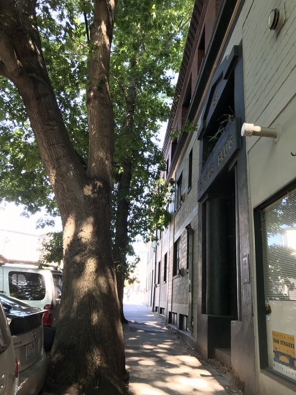
On 20th Avenue NW at Leary Avenue NW, on the right when traveling north on 20th Avenue NW.
In 1891 William Curtiss built a modest structure on this site to house his tinware and stove manufacturing and sales business. By 1909 he had expanded his inventory to include a wide variety of hardware products and in 1911 he constructed the . . . — — Map (db m181464) HM
On Leary Avenue Northwest, on the right when traveling south.
The artists who created the Mural at Bergen Place have said in a picture what a thousand words cannot adequately express: that our community has links to other cities and other nations that span cultural, political and economic differences, and that . . . — — Map (db m310887) HM
On Northwest Market Street west of 20th Ave NW, on the left when traveling east.
A grant from philanthropist Andrew Carnegie helped to underwrite construction cost, also with money raised by local citizens & businesses at the time.
This building has not been a library since 1963
This building is on The National Register . . . — — Map (db m298501) HM
On Ballard Avenue Northwest north of NW Ione Place, on the right when traveling north.
In 1901 Nicholas Theisen started his liquor store in the adjacent Chopard Block. Known as the California Wine Company, it featured "a high grade of California wine." Through the success of his business Mr. Theisen was able to construct the Theisen . . . — — Map (db m181442) HM
On Ballard Avenue Northwest south of NW Vernon Place, on the left when traveling north.
Prior to the construction of this classic building, this site housed a much more modest structure that contained the White Front Saloon. Proprietors John Peterson and Hector Chestnut ran their bar here from 1900 to 1905. When the current structure . . . — — Map (db m181483) HM
On Rainier Avenue South north of South Holden Street, on the right when traveling north.
A Trolley Stop along the Seattle and Rainier Valley Railway
Wildwood Station dates back to Washington State's early yeans when the first privately owned electric trolley rail service carried passenger streetcars and freight trains along . . . — — Map (db m181541) HM
Carkeek Park is an urban oasis. The salt water beach, the salmon bearing stream, wetlands, forest, picnic tables, play areas and miles of trails welcome visitors with new discoveries year round.
The land once occupied by early Salish peoples . . . — — Map (db m102488) HM
On this site stood Seattle's first High School. Opened in 1902 as Seattle High School, in 1904 it was named Broadway High School until its closing in 1946. Broadway set high standards for education and racial harmony. This plaque is presented by . . . — — Map (db m102981) HM
On Harvard Avenue at East Pine Street on Harvard Avenue.
The Broadway Performance Hall of Seattle Central Community College was constructed in 1911-12 as an addition to Broadway High School, to accommodate gymnasiums and auditorium/study hall. Restored and remodeled, it opened in 1979 as a theater, with . . . — — Map (db m266485) HM
On East Pine Street at Broadway, on the right when traveling west on East Pine Street.
The Washborn-Haines Company built this structure to showcase their preeminent Chrysler auto dealership, so special that Walter Chrysler himself came out for the opening on November 29, 1925. This building continued to house automobile sales and . . . — — Map (db m103015) HM
On East Denny Way near Belmont Avenue East, on the right when traveling west.
Two markers are side-by-side on this house:
(Marker 1)
Ward House
Seattle's Oldest Building
1882
Seattle Landmark
(Marker 2)
George Ward House
520 E Denny Way
has been placed on the
National Register
of . . . — — Map (db m102516) HM
Near 15th Avenue East south of East Garfield Street.
—First Presbyterian missionary to serve western Washington, 1854. Started 15 churches including the first Presbyterian church of Seattle.
—President of University of Washington, 1865-66 & 1874-76.
—Founded Sumner Academy, 1863, which . . . — — Map (db m121329) HM
On East Yesler Way at 23rd Avenue, on the left when traveling east on East Yesler Way.
Built by the people of Seattle, this structure was originally dedicated as the Henry L. Yesler Memorial Public Library. Over the course of the 20th century it served a diverse and changing community. In 1975, to reflect these changes and honor . . . — — Map (db m181534) HM
On 5th Avenue at Spring Street, on the left when traveling south on 5th Avenue.
On this site the Sisters of Charity of the House of Providence, on April 25, 1878, established Providence Hospital, Seattle's first hospital and continued its operation until September 24, 1911, when the new instiution was dedicated, at 500 17th . . . — — Map (db m307288) HM
“This market is yours. I dedicate it to you, and may it prove a benefit to you and your children. It is for you to defend, to protect and to uphold; and it is for you to see that those who occupy it treat you fairly, that no extortion be . . . — — Map (db m69997) HM
Near Akaskan Way, on the right when traveling north. Reported permanently removed.
The famous “Ton of Gold” that started the Alaska Gold Rush was unloaded here in 1897. The SS Portland landed the valuable cargo at this pier then known as Scwabacher Dock. — — Map (db m294129) HM
Near Alaskan Way, on the right when traveling south. Reported permanently removed.
At this site on August 31, 1896, the Nippon Yusen Kaisha Steamer ‘Miike Maru’ arrived with her cargo of tea. This was the first regularly scheduled steamer service between the Orient and Seattle and marked the birth of Seattle as an international . . . — — Map (db m294130) HM
On Alaskan Way, on the right when traveling south.
The U.S. Navy’s “Great White Fleet” arrived Seattle May 23 and departed May 27, 1908 to continue their famous 46,000 mile round the world cruise. Part of the fleet anchored in Elliot Bay near this site and the crews disembarked here at . . . — — Map (db m48001) HM
First Pastor
Dr. George F. Whitworth.
Charter Members
Mary E. Whitworth • Clara Whitworth York
Lida Whitworth • Ruth J. McCarty
Rebecca Jones • Samuel Kenny
Jessie Kenny
Erected on the Fiftieth
Anniversary of the
founding . . . — — Map (db m81459) HM
On 4th Avenue South at South Main Street, on the right when traveling north on 4th Avenue South.
The Japanese community on the West Coast blossomed in the early 20th century, despite hostility directed at Asian immigrants in the United States. The Chinese population remained mostly male and single due to discriminatory immigration policies, . . . — — Map (db m296015) HM
On 4th Avenue South north of South Main Street, on the right when traveling north.
Seattle’s Japanese American community established a thriving Nihonmachi (Japantown) north of Jackson Street in the early 20th century. Japanese-owned shops, bathhouses, tailors, and other businesses served the community. Japanese-language . . . — — Map (db m296022) HM
On First Avenue at Madison Street on First Avenue.
Designed by Max Umbrecht for J.W. Clise, this building originally housed stores, offices and lodgings, and together with others in the area, marked the northward move of the downtown up First Avenue. Later it was converted into a parking garage and . . . — — Map (db m99629) HM
On 9th Avenue south of Cherry Street, on the right when traveling south.
Under the provisions of the National
Historic Preservation Act of
October 15, 1966, this property
possesses exceptional value in
commemorating, or illustrating
American history
Placed on the National Register on
March 16, 1972 by . . . — — Map (db m181530) HM
On 1st Avenue north of Bell Street, on the right when traveling north.
Dedicated: 1893
Elmer Fisher, architect
National Historic Register
Renovation & addition dedicated 1999
Snell Partnership, Architect
Cassimar US, Inc. & Austin A. Bell Associates, LLC
a member of the Murray Franklyn family . . . — — Map (db m181425) HM
On Alaskan Way South at South Washington Street, on the right when traveling south on Alaskan Way South.
In this area once part of the bay, vessels from ports all over the world dumped their ballast. Untold thousands of tons were unloaded into the water by ship’s crews including 40,000 tons from San Francisco’s Telegraph Hill.
The island, long a . . . — — Map (db m48122) HM
Designed in 1901 by Max Umbrecht
For Clifford Beebe, This Building Although
Presenting an Elegant Neo-Regency Facade,
Housed a Modest Hostelry for Most of its
Earlier Life. It was Restored to In-City
Housing by the Cornerstone . . . — — Map (db m120352) HM
The original Bell Street Bridge was a wooden trestle built in 1915 to provide access to Pier 66 from Elliott Avenue and the hillside above.
In the early 1900s, trestle bridges connected many of Seattle's piers on the central waterfront with the . . . — — Map (db m86453) HM
On Akaskan Way, on the right when traveling south.
The site of the Indian camping place called Muck-Muck-Wum. In 1911 the headquarters of Washington’s first public port was established here by commissioners H.M. Chittenden, C.E. Remsberg and Robert Bridges. This tablet dedicated May 19, during . . . — — Map (db m48002) HM
On 1st Avenue north of Bell Street, on the left when traveling north.
On this site, from 1978 to 1982, the Belltown Café served the neighborhood as a cultural hearth and home to a Groundhog Day root pie tradition. The café proprietors often traded food for art with their customers. One exchange resulted in the . . . — — Map (db m180272) HM
[Right side of the monument]
Kitsap sights Vancouver’s vessel 1792 – First vessel on Puget Sound
[Left side of the monument]
Seattle
Chief of the Suquamish
A firm friend of the whites
For him the city of . . . — — Map (db m47938) HM
On Maynard Avenue, South north of South King Street.
Dedicated to American Soldiers of Chinese Ancestry in Seattle and vicinity who died in the service of their country during World War II,
1941 - 1945
[Translation in Chinese calligraphy]
Yeu Louie
Lee Hong Chew
Bak Hong Chin
John . . . — — Map (db m26934) WM
Only the base of this building, designed by the well-known firm of Bebb and Gould, in 1915 was designated. In 1982 the Bumgardner Partnership saved the facade and merged it into the new tower for the Cornerstone Development Corporation. — — Map (db m99636) HM
On Alaskan Way (Washington Route 519), on the right when traveling south. Reported permanently removed.
Colman Dock was built on this site by J. M. Colman in 1909. This dock was center of ferry boat activity on Puget Sound. Seattle Ferry Terminal dedicated May 18, 1966, National Maritime Day - 1966 — — Map (db m294215) HM
On Lenora Street at 2nd Avenue, on the left when traveling west on Lenora Street.
The Cristalla site is the original home of the Crystal Pool Natatorium. Known as Crystal Pool, the building was commissioned in 1913 by Seattle dignitary C. D. Stimson and designed by architect Marcus Priteca, a prominent West Coast designer . . . — — Map (db m99651) HM
The Dearborn House currently serves as Historic Seattle’s headquarters. The Classical Revival style building was constructed for Henry H. Dearborn (1844 - 1909), an East Coast investment banker who relocated to Seattle in the 1880s. He was . . . — — Map (db m266496) HM
On Pike Place west of 1st Ave, on the right when traveling north.
Frank Goodwin and his nephew Arthur saw an opportunity: Use Frank’s Gold Rush money to acquire, expand, and develop new buildings around the bustling farmers market. As their buildings grew downhill and to the north, other developers built the more . . . — — Map (db m294019) HM
On Alaskan Way at Seneca Street, on the right when traveling south on Alaskan Way.
One of the world’s best harbors. Noted by Captain George Vancouver in 1792 and first surveyed by midshipmen, Sam Elliott of the Wilkes Expedition in May 1841. With its depths to 100 fathoms the bay can accommodate the biggest ships. Through the . . . — — Map (db m294378) HM
On Alaskan Way South, on the right when traveling south.
Elliott Bay and the land surrounding it was shaped over millennia by glaciers, volcanic eruptions, and earthquakes. More recently, humans have played a big part. The natural forces that have made this place so beautiful also pose risks, reminding us . . . — — Map (db m310903) HM
On 2nd Avenue at Seneca Street, on the right when traveling south on 2nd Avenue.
For much of the 20th Century, this site was occupied by the Medical Arts Building, a six-story brick and concrete building, built in 1903. This original building was named the Lumber Exchange. In a 1950 renovation by its long-time owners, the Albert . . . — — Map (db m99566) HM
Opened in May 1930, the Exchange Building was designed to house more stock and mercantile exchanges than any building in the United States. It was constructed as one of the tallest and largest reinforced concrete structures in the world. . . . — — Map (db m99501) HM
Father Sullivan served as president of Seattle University from 1976-1996, leading it into a prosperous time of record enrollment, financial stability and new academic programs. An insightful leader in the Seattle community, he served as chairman of . . . — — Map (db m99644) HM
On 4th Avenue just south of Battery Street, on the right when traveling north.
Historic fire bell from Station No. 4 located at 4th and Battery Street in the 1800's prior to the first Denny regrade - This bell sounded out the fire alarms to all the stations in the North End area and Queen Anne Hill by means of area code and . . . — — Map (db m98926) HM
On First Avenue south of Pike Street, on the right when traveling south.
A main north-south artery of Seattle, stretching north from the original Pioneer Square business district, First Avenue was lined with offices, leading hotels, banks and even a few residences. Until the mid-20th century, the street was also home to . . . — — Map (db m47941) HM
On 1st Avenue north of Marion Street, on the right when traveling north.
Arthur A Denny
in his log cabin home on
this spot opened the first
post office of Seattle
August 27, 1853.
———————————
This Tablet was Erected by the Washington . . . — — Map (db m99533) HM
This is the corner stone of the old church, corner of Fourth Avenue and Spring Street. It was removed to this location A.D. October 1906 by order of the Session... — — Map (db m81457) HM
In memory of the men of our church who gave their lives for their country and the liberty of the world
Major Golland C. Clark Jr. •
P.F.C. Hugh E. Craven •
Private H. E. Dupar •
Lieut. David C. Hall Jr. •
P.O. J. Francis Henning • . . . — — Map (db m81461) WM
In memory of the men of our church who gave their lives for their country and the liberty of the world
Capt. John S. Pringle •
Capt. Elijah W. Worsham •
Lieut. Walter C. Lee •
Lieut. Wm. J. A. MacDonald •
Lieut. Harold C. White • . . . — — Map (db m81460) WM
Longtime Music Director of the Seattle Symphony, Maestro Schwarz has initiated concert series, led award-winning recordings and introduced many new American works. He is active as a spokesman for music education, and was honored in 1994 as . . . — — Map (db m99649) HM
On South Main Street east of 4th Avenue South, on the right when traveling west.
Injustice Challenged
Over and above any man-made creed or law is the natural law of life — the right of human individuals to live and to creatively express themselves. No man was born with the right to limit that law. . . . — — Map (db m296050) HM
This Excellent Example of Richardsonian
Romanesque Architecture was Built as the
City Expanded Northward to Meet the Needs
of the Alaskan Gold Rush. It, also was
Long in Use as a Workingmen’s Hotel, and
Has Been Converted to Apartment . . . — — Map (db m120462) HM
On Maynard Avenue South at South King Street, on the left when traveling north on Maynard Avenue South.
Dedicated jointly by the Municipal Governments of Taipei, The Republic of China, and Seattle, Washington, USA, symbolizing the good will and close friendship of their people.
Designed and constructed in Taipei and donated to and erected in . . . — — Map (db m294041) HM
In a city built around water [illegible] getting around can be difficult. Interstate Freeway 5 bisects Seattle, creating a major north-south corridor when it was built in the 1960s. However, it did not permanently divide the city's downtown to the . . . — — Map (db m235223) HM
On 1st Avenue at Lenora Street, on the right when traveling south on 1st Avenue.
Registered national
historic place
Washington State Advisory Council
on Historic Preservation
Guiry/Schillestad Buildings
under the provisions of the
National Historic Preservation
Act of 1966, this property possesses . . . — — Map (db m181422) HM
On Alaskan Way south of Yesler Wy, on the right when traveling south.
Original Shoreline
Historically, the eastern shoreline of Elliott Bay looked much like the other unaltered shorelines across Puget Sound—bluff-backed beach with intertidal marshes and mudflats. These mudflats and gently sloping beaches were . . . — — Map (db m310911) HM
On Western Avenue at Vine Street, on the left when traveling west on Western Avenue.
President J.A. Tudor & Associates 1956-1985. Graduated with Honors University of Washington School of Electrical Engineering - Masters of Engineering - University of Pennsylvania - Founder Witts Air Cargo and Delta Metals. Loving Husband of . . . — — Map (db m299648) HM
On Alaskan Way South near Yesler Way, on the right when traveling south. Reported permanently removed.
The settlement would have been destroyed but for the presence of the U.S. Sloop of War “Decatur”. Anchored off this point, she fired a volley at the attackers, frightening them into hasty retreat.
Erected National Maritime Day 1959 — — Map (db m310918) HM WM
Left Marker:
This is Sacred Land. Before World War II a community of Japanese and Japanese Americans lived on what is now south campus. In 1942, approximately 120,000 were incarcerated and held behind barbed wire for three or more years . . . — — Map (db m103016) HM WM
On 4th Avenue South north of South Main Street, on the right when traveling north.
Japanese immigrants faced discrimination from the moment they set foot in the U.S. In the early 20th century, U.S. law prohibited most Asians from entering the country, and barred them from citizenship if they did come. In most states, Alien Land . . . — — Map (db m296018) HM
On Maynard Avenue S, on the right when traveling north.
Nihonmachi
Pre-World War II
In the early 1900s, Seattle’s Japantown, or Nihonmachi, was home to the second largest Japanese American population in the US. The population peaked in the 1930s, concentrating around 6th Avenue and Main . . . — — Map (db m294035) HM
On Stewart Street near Westlake Avenue, on the left when traveling south.
[Front]
This commemorates the services of an energetic and wise leader in many enterprises undertaken for the general welfare especially the project for connecting Lake Washington with tide water by a ship canal
[Right side] . . . — — Map (db m47940) HM
On Alaskan Way South at South King Street, on the right when traveling south on Alaskan Way South.
A coal wharf was located at the waterfront during the late 19th century. Coal was transported here by railroad from Newcastle and Renton. Abandoned in the early 1900’s, the wharf soon became the Skinner & Eddy Shipyard.
During World War I, the . . . — — Map (db m48123) HM
On South Main Street east of 6th Avenue South, on the right when traveling east.
Hai! Japantown 2021
Zocalo Studios has collaborated with Jan Johnson, of the Panama Hotel, to create a memory wall on the exterior plywood surrounding the building. These images speak of the Internment period during World War II, when all . . . — — Map (db m294001) HM WM
In 1975, guided by a belief that the personal computer would be a valuable tool on every office desktop and in every home, Bill Gates and Paul Allen cofounded a company called Microsoft, which would grow to become the #1 computer software company in . . . — — Map (db m99657) HM
On South Main Street at 4th Avenue South, on the right when traveling west on South Main Street.
A new generation of Japanese Americans came of age in the 1960s and ‘70s -- in a nation transformed by Civil Rights campaigns, anti-war protests, and other social movements. Inspired by African American activists and their own community elders, . . . — — Map (db m296039) HM
On South King Street at 5th Avenue S on South King Street.
Seattle has had three Chinatowns since the 1860s. The present, third Chinatown was established in the early 1900s. This gate, or Pai-Lau, marks the western entrance to Seattle's Chinatown.
For many years, the Seattle Chinese community . . . — — Map (db m142220) HM
On Harvard Avenue at Seneca Street on Harvard Avenue.
This distinctive English gothic style church was completed in 1912, the third edifice of the Pioneer Baptist congregation founded in 1869. Its spire, which once dominated the city skyline, continues to say here is a church dedicated to the worship . . . — — Map (db m266490) HM
On University Street at 5th Ave, on the right when traveling east on University Street.
This plaque marks the site of the former Seattle Ice Arena, built in 1915 and home to the Seattle Metropolitans of the Pacific Coast Hockey Association. In March of 1917, the Metropolitans became the first US team to win the Stanley Cup after a 3-1 . . . — — Map (db m299650) HM
Former headquarters and printing plant of the Seattle Union Record (1918-1928) Harry E.B. Ault, editor and manager
The only daily labor newspaper in the U.S. with a peak circulation of 112,000 copies. Owned by the Seattle Central Labor . . . — — Map (db m273198) HM
On 1st Avenue west of Stewart Street, on the right when traveling south.
The only daily labor newspaper in the U.S. with a peak circulation of 112,000 copies. Owned by the Seattle Central Labor Council, affiliated unions and trade councils. — — Map (db m294937) HM
On Alaskan Way South near Yesler Way, on the right when traveling south. Reported permanently removed.
Seattle’s first pier lies buried beneath your feet. The famous Yesler sawmill and wharf, constructed in 1853m marked the birth of Seattle’s great lumber and shipping industries. For many years it was the center of Seattle’s business district. . . . — — Map (db m310919) HM
English (right side of marker):
This stone, marked with the geophysical data of the City of Galway, is part of a Seattle Sister Cities benchmark project designed in 1984 by Seattle artist Don Scott (1937-1985). Similar to another stone . . . — — Map (db m235005) HM
On University Street west of 5th Avenue, on the right when traveling west.
On this site
the University of Washington
was established in 1861
through the leadership of
Daniel Bagley and Arthur Denny
and the generosity of
Charles and Mary Terry and Edward Lander
who joined Arthur and Mary Denny
in donating . . . — — Map (db m118089) HM
On 2nd Avenue at Bell Street, on the left when traveling south on 2nd Avenue.
Just like that - it was gone. An electrical fire gutted the
building at Second Avenue and Bell Street on May 18, 2001,
putting an end to a storied Belltown place. Constructed in
1925 as the Seattle Taxicab Company headquarters and
garage, the . . . — — Map (db m99653) HM
On 4th Avenue South near South Main Street, on the right when traveling north.
As WWII ended, Japanese Americans began to return to Seattle from the camps where they had been incarcerated. Anti-Japanese sentiment remained high, and many returnees found that their homes and possessions had been vandalized or stolen. The Hunt . . . — — Map (db m296037) HM
On Alaskan Way (Washington Route 99) at South Washington Street, on the right when traveling south on Alaskan Way. Reported permanently removed.
Beneath your feet lies the wreckage of the pioneer sidewheel steamer "Idaho", which served from 1900 until 1909 as Dr. Alexander de Soto's famous wayside mission hospital. Here Dr. de Soto ministered to the needs of seafarers and the destitute, . . . — — Map (db m294377) HM
Under the provisions of the National Historic Preservation Act of 1966, this property possesses exceptional value in illustrating American history and culture
Entered in the National Register of Historic Places May 6, 1976 by the U.S. . . . — — Map (db m266495) HM
On Spring Street east of Terry Avenue, on the right when traveling east.
Built 1931
Designated October 7, 2009
as a
City of Seattle
Historic Landmark
Designed by:
James H. Shack
Shack, Young & Myers Architects — — Map (db m181516) HM
On 2nd Avenue at University Street, on the left when traveling south on 2nd Avenue.
Although the architect and builder are unknown, the Brooklyn Building is one of the few remaining late nineteenth century commercial buildings of consequence outside the Pioneer Square Historic District.
Largely a residential street before the . . . — — Map (db m99626) HM
Organized December 12, A.D. 1869
by Rev. George F. Whitworth, D.D.
Membership 8
This edifice
erected A.D. 1906
Rev. M. A. Matthews, D.D.
Pastor
Dedicated to the Worship
of the Triune God — — Map (db m81458) HM
In 1889, while this building was under construction, fire consumed most (sixteen blocks) of Seattle's downtown business district. The deep pit that had been dug for this building's foundation acted as a fire stop, preventing the destruction from . . . — — Map (db m99477) HM
On Pine Street at 9th Avenue, on the right when traveling east on Pine Street.
Listed in the National Register of
Historic Places by the
National Park Service,
U.S. Department of the Interior
October 9, 1974 — — Map (db m181515) HM
On Alaskan Way, on the right when traveling south. Reported permanently removed.
In commemoration of the visit of President Theodore Roosevelt’s “Great White Fleet” to Seattle in May of 1908. From here the fleet continued on their famous round the world cruise. — — Map (db m294127) HM
On 8th Avenue at James Street, on the right when traveling south on 8th Avenue.
Fire destroyed the interior of the church in 1902. It was rebuilt in its present form with enlarged transepts, sanctuary, and addition of a tower. The eclectic design is derived from English Country Gothic. The church has long been an important . . . — — Map (db m181532) HM
On South Jackson Street near 4th Avenue South, on the right when traveling west.
Restored and rededicated by Sound Transit on October 16, 1999 to link the past and future of public transportation and serve the Central Puget Sound community. Union Station served as the Seattle passenger terminal for the Oregon - Washington . . . — — Map (db m48168) HM
On University Street west of 5th Avenue, on the right when traveling west.
Victory Square was created during World War II as a place for citizens to rally behind the war effort and to raise community morale. This plaque marks the site, which included a speaker's stand and a replica of the Washington Monument inscribed with . . . — — Map (db m118086) WM
On South Main Street east of 4th Avenue South, on the right when traveling west.
The 1980s saw a growing movement to secure justice for Japanese Americans who had been incarcerated during WWII. Along with the campaign for redress came efforts to overturn the wartime cases of Gordon Hirabayashi, Fred Korematsu, and Minoru . . . — — Map (db m296040) HM
On Maynard Avenue South south of South King Street, on the left when traveling south.
"In very early days, when I first was traveling around the country, around the state, I was first accepted for what I was — a black man. When I came to the International District, I was accepted as a human being. There was no race. . . . — — Map (db m181538) HM
On 4th Avenue South, on the right when traveling north.
After the bombing of Pearl Harbor by the Japanese in December 1941, Japanese Americans became the targets of increased hostility and suspicion. The FBI rounded up community leaders; those left behind were subjected to curfews and travel . . . — — Map (db m296028) HM
On Alaskan Way, on the right when traveling south. Reported permanently removed.
The Seattle waterfront played and exciting role in the early days of pioneer Seattle. Where you are now standing once was tidal flats, edged by forests. Salish natives traveled up and down the coast in intricately carved cedar dugout canoes and . . . — — Map (db m294132) HM
On Western Avenue at Virginia Street / Pike Street, in the median on Western Avenue.
Welcome to downtown Seattle's neighborhood market. Pike Place Market is the city's center for fresh, local produce, specialty food and small independent businesses. Established in 1907 to connect citizens and farmers, the Market continues its . . . — — Map (db m75521) HM
758 entries matched your criteria. Entries 101 through 200 are listed above. ⊲ Previous 100 — Next 100 ⊳