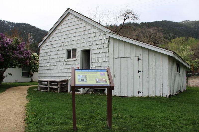
By 1900 the town of Gardnerville had replaced Genoa as Carson Valley's commerce center. Hotels, stores, and liveries in Genoa closed, and buildings stood vacant. One Genoa couple saw a shuttered hotel as the key to a better life for their . . . — — Map (db m227670) HM
[Front of Marker:]
Genoa
Original Home Station
April 3, 1860 – Aug. 30, 1860
Relay Station
Sep. 1, 1860 – Nov. 20, 1861
By
Town of Genoa
Genoa Volunteer Fire Department
Carson Valley Historical Society . . . — — Map (db m20663) HM
Built by volunteers to replace the church destroyed in the Terrible Fire of 1910, this pioneer refuge served the town for town meetings as well as church services for many years. The bell tower and porch were added in 1978 by volunteers. — — Map (db m21245) HM
On this tree, early morning Nov. 26, 1897 occurred the blackest episode in the history of Nevada. Adam Uber of Calaveras Co. Cal. was forcefully taken from jail abused and hanged by an angry mob, for the pistol killing of Hans Anderson a local . . . — — Map (db m20655) HM
After a long odyssey from Germany Hans Meyer-Kassel and his wife Maria fell in love with Genoa and settled here in 1945. They became an integral part of this community residing here until their deaths. From the haven of his studio just up the . . . — — Map (db m234228) HM
Born: April 30, 1827, Tinn, Telemark, Norway
Emigrated to America from Norway: May 30, 1837
Carried the mail: January 1856 – May 1876 (Twice a month -
during the winter for 20 years.)
Distance: 90 miles between Placerville, Ca and . . . — — Map (db m20679) HM
Born April 30, 1827 at Upper Tinns, Telemark District of Norway, John A. “Snowshoe” Thompson’s parents Tosten Olsen and Gro Johnsdotter baptized him as John Tostensen. At an early age he learned to “snow skate” (snow ski). In . . . — — Map (db m20712) HM
As a Tribute
To a great compatriot from Telemark
This plaque was presented
by the Norwegian Olympic Ski Team
competing at Sqaw Valley
in February 1960
Dedicated to
John A. “Snow-Shoe” . . . — — Map (db m20748) HM
Served as first elected judge of Douglas County from 1864 – 66. Later on he served as District Attorney and Superintendent of Schools.
While in the practice of law he was considered one of the foremost jurists of his time and was engaged in . . . — — Map (db m20785) HM
Genoa's first two-story brick mansion
built for his bride in 1855-56 by Mormon
Station locator Stephen Kinsey, editor of
the first newspaper (handwritten). It was
the third land claim in Nevada. It was the
site of elegant socials and the Genoa . . . — — Map (db m135908) HM
Look up at the mountains in front of you – note the various canyons. How do you think they factored into Mormon Station’s location?
The most prominent ridge to your left is Genoa Canyon. The creek that flowed out of this canyon served as the . . . — — Map (db m229119) HM
Marker One:
Originator of the Genoa Candy Dance
Lillian Virgin Finnegan, known affectionately as “Lillie”, was born and raised in Genoa. An early graduate of Nevada State university, she was a teacher, suffragist, business woman, and . . . — — Map (db m223522) HM
In 1851 Col. John Reese, with a little band of eighteen men crossed the great deserts and built the first trading post in Nevada, “Mormon Station”. Later came more members of the Mormon Faith who settled and established the town of Genoa. Among . . . — — Map (db m20686) HM
In early June, 1850, a party of Mormons led by Abner and Thomas Blackburn, Hampton S. Beatie and Joseph Dumont, established a trading post about a mile to the north of this site. In September, as they returned to Salt Lake City, a party of . . . — — Map (db m20698) HM
Panel One:
Utah Territory
The area now making up the state of Nevada was acquired by the United States after the Mexican-American War. This newly acquired land was generally labeled as unorganized territory until 1850. The State of . . . — — Map (db m227650) HM
Carson Valley is the birthplace of Nevada. By 1851, people settled at a place they called Mormon Station, renamed Genoa in 1856. With the early establishment of a post office and local government, the community can lay claim to the title of . . . — — Map (db m99652) HM
In 1863, Al Livingston built this building and called it Livingston’s Exchange. In 1884, Frank Fettic bought it and renamed it Fettic’s Exchange. He operated it as a “Gentlman's Saloon” allowing no rough stuff or excessive drinking. It subsequently . . . — — Map (db m20661) HM
The principle emigrant trail to California’s gold fields in the 1850’s passed about 50 yards east of here. In June, 1850, Hampton S. Beatie and Abner Blackburn, two Mormons from Salt Lake City, established Nevada’s first trading post a few yards . . . — — Map (db m21218) HM
Built: Spring of 1886 Foundation: Rock
Building Size: 80 x 33 Feet – 16 Foot Ceiling
Flooring: Best Quality Wood Available
Constructed: By the Sons of Joseph Raycraft
Joseph, acting as a wagon master for 300 souls, headed west with . . . — — Map (db m98073) HM
Fresh produce was difficult to come by along the California Trail. Emigrants would often pay sky-high prices for fruits and vegetables when they were available. The traders at Mormon Station were eager to take advantage of this demand. . . . — — Map (db m229118) HM
Panel One: The Campbell Property
A glimpse into life in Genoa in the early and mid-1900s...
Almost 100 years after John Reese built his log cabin trading post, a man named Bernabe (Ben) Arribalsaga built the house in front . . . — — Map (db m227662) HM
Here stood the first grist mill in Carson Valley built in Mill Canyon Genoa in 1854 by wheelwright Thomas Knott for Colonel John Reese. It was moved to this site by William M. Cary in 1865.
Behind the mill stood a dwelling house, which . . . — — Map (db m99863) HM
“Brown was a heavy man, about 200lbs, noted as a lawless desperado whose name was terror to all who know, or had heard of him. He made his brags on the day of his death, which was his 30th birthday, that he had killed 11 men, and was going to have . . . — — Map (db m115737) HM
In 1877, John H Davis had this building constructed as a new location for his existing store nearby. The general store was an integral part of 1800s era towns like Genoa and supplied dried goods, food and other necessities to the growing Nevada . . . — — Map (db m169673) HM
In 1851, George Chorpenning and fellow Pennsylvania entrepreneur Absalom Woodward received a contract for $14,000 from the U.S. Post Office to establish the first U.S. Mail service between Sacramento, CA and Salt Lake City, UT. The monthly trip was . . . — — Map (db m223623) HM
These plaques are near the site
of the original Pony Express Station.
The Pony Express passed through
Genoa, the oldest city in Nevada, until
the completion of the telegraph.
Erected by the Nevada Pony
Express Centennial Committee. . . . — — Map (db m20711) HM
The Territorial Enterprise, a newspaper founded in Genoa in 1858 was at this location and one other in the town. The press was later moved to Carson City and then Virginia City. The first telegraph office in Nevada was also located on this block. . . . — — Map (db m169650) HM
Like many Nevada hot springs, these dot a fault break along which the mountains rise. In 1862, along this Carson branch of the Emigrant Trail, David and Harriet Walley developed a $100,000 spa with 11 baths, a ballroom and gardens. The thermal . . . — — Map (db m89511) HM
You’re now standing at the western edge of the Great Basin. If you were an emigrant headed to California, you would have entered the Great Basin 450 miles back along the trail in southern Idaho, or 500 miles back in Salt Lake City if you had . . . — — Map (db m98142) HM
We Salute John “Snowshoe” Thompson
On his homemade snowshoes John carried the mail and supplies over the snowy Sierras for 20 winters. As he traveled, he saved the lives of seven people who were snowbound in mountain cabins. In . . . — — Map (db m20729) HM
What is this place?
Mormon Station State Historic Park is the site of a California Trail trading post. The John Reese party established the post in 1851 as a business venture. Travelers passing through often referred to Reese’s post as . . . — — Map (db m229108) HM
The trading post at Mormon Station was an important supply stop for gold seekers on their way to California. Heading through Nevada, travelers followed the Humboldt River until it reached its end at the Humboldt Sink. What came next was a brutal 40 . . . — — Map (db m229306) HM
This type of wagon is known as a “prairie schooner.” Designed to be as light and agile as possible, prairie schooners were the wagon of choice for emigrants traveling across the California Trail. The name stems from the white canvas covers giving . . . — — Map (db m229304) HM
At trading stations and other remote settlements throughout the West, nearly all goods had to be brought in from elsewhere. This need for supplies led to the development of the freight wagon. Freight wagons were built for the sole purpose of hauling . . . — — Map (db m229303) HM
(back) The Pony Express Started on April 3, 1860. The original route from Johnson Pass (Echo Summit) to Genoa went through Hope Valley to Woodfords Station.
On May 14, 1860 the new toll road over Daggett Pass opened to foot and horse . . . — — Map (db m432) HM
This area bears the name of Michele E. Spooner, a French Canadian entrepreneur, who, along with others, was instrumental in establishing the wood and lumber industry which supplied the needs of the Comstock mines and mills.
In 1868 Spooner . . . — — Map (db m69715) HM
Built in 1909 by A.F. Neidt, a cement contractor who also poured most of the early sidewalks in Minden. The home was later occupied by Annie Hickey Raycraft, who offered room and board for "unmarried lady" school teachers. — — Map (db m23833) HM
William H. Boyd was granted a Utah Territory Franchise December 19, 1861, to provide a road to join Genoa to the Cradlebaugh Toll Road, the trunkline to the mining district of Esmeralda. Boyd's Toll Road is still visible to the northwest and . . . — — Map (db m150168) HM
Ground was broken for the garage in 1911, with structure additions in 1917 and 1927. The initials stand for the owner Clarence Oliver Dangberg. Later, under the ownership of the Fred "Brick" Hellwinkel family, the C.O.D. garage was the oldest . . . — — Map (db m23514) HM
"We soon entered the lower end of Carson Valley. The steep mountains on our right, are thickly covered with pines... on the east side of the valley, the mountains present no green thing; all is naked and dreary." - Franklin Langworthy, Oct. 9, 1850 — — Map (db m99867) HM
To recreate turn-of-the-century Minden, local merchants Don and Roxanne Stangle, in 1990, suggested building this park. A beautiful period clock would be its central feature. After seven years of planning and designing the park and raising nearly . . . — — Map (db m23424) HM
Construction of Coventry Cross Episcopal Church began in 1936 at the building's original site in Smith Valley. The church was named for the large stone cross that stands on the church's Rood beam (a beam in a medieval church across the entrance to . . . — — Map (db m23948) HM
The remains of Cradlebaugh Bridge, built in 1861 by William Cradlebaugh, stand ¼ mile westward. This bridge shortened the distance from Carson City to Aurora in the then booming Esmeralda Mining District.
There were two routes from Carson . . . — — Map (db m40100) HM
The Nevada Legislature voted to move the county seat to Minden in 1916. The Courthouse, designed by F.J. Delongchamps, was built for $23,178 on a lot deeded from the Dangberg Land and Livestock Company. Originally the building housed all the county . . . — — Map (db m23971) HM
In Commemoration
of Douglas County men who gave
their lives in World War II
Franklin Mack Andrews ● Semore Arnold ● Donald Cornbread ● Giles Cornbread ● Wilber Frank ● Harlan Fricke ● Walter Leehman . . . — — Map (db m20881) HM
Construction began in 1968 when the old Farmer's Bank, purchased in 1954 by the First National Bank of Nevada, had again outgrown itself. The remodeled building now houses an engineering firm owned and operated by R.O. Anderson. — — Map (db m23787) HM
Grace Dangberg was the granddaughter of Heinrick Frederick Dangberg, a pioneer Carson Valley settler from a village near Minden, Germany, whose family founded Minden, Nevada.
Miss Dangberg, a distinguished Nevadan, devoted her considerable . . . — — Map (db m3191) HM
This, the second house built in Minden (1907), housed Henry Beck, the first manager of the Minden Milling Company, and was located across the street from from the mill at Fifth Street and Railroad Avenue, now Highway 395. — — Map (db m23898) HM
This house was designed for John Dangberg by Frederic DeLongchamps, a noted architect throughout the West. Construction was completed in 1912. John was one of the Dangberg Brothers who founded Minden in 1906. Dangberg Land and Livestock Company . . . — — Map (db m23933) HM
Built in 1917 for local rancher M.E. Fay, the home was later owned by John and Norma Ellis. John, Norma and their son Darwin owned and operated the Minden Mercantile. — — Map (db m23936) HM
Minden, the seat of Douglas County since 1916, was named for a town in Westphalia, Germany, where the founder of the D.F. Dangberg Land and Live Stock Company, was born in 1829. The company established Minden in 1905 to provide terminal facilities . . . — — Map (db m20877) HM
First opened in 1910 by Chris Christoffersen. This was the first store in Minden of its type, selling dry goods, clothing, shoes, and cameras. Later, the store was operated by Lin Blondin and Ken Watson. In time, it became known as Town and Country . . . — — Map (db m23578) HM
Completed in 1908, the new mill was financed by many of the early residents of Minden. Initially, it could process 100 barrels of flour daily from the local grain. Its four silos held 65,000 bushels of grain. In 1921 the mill was described as "one . . . — — Map (db m23981) HM
Built in 1906. the park became the “town square” for the first residential section of Minden. The first bandstand, a rectangular structure, was built in 1914. The present bandstand was built by the Minden Rotary Club in 1984 and . . . — — Map (db m20893) HM
This site marks the end of the Virginia and Truckee rail extension from Carson City which was completed in 1906. A depot was built here as well as first home site for the station manager, Herb Coffin. Mr. Coffin’s home was a converted boxcar but a . . . — — Map (db m23430) HM
The original building was constructed in 1951 for the partnership of Warren Reed and Willard Meneley Insurance Company. In 1953 the offices also served as the temporary home for the Douglas County Public Library. Reed's son Alan and family currently . . . — — Map (db m23742) HM
The Second Farmer's Bank was constructed in 1918 and operated until 1968. The bank had sound financial resources for its size and in 1933, following a bank moratorium called by President Roosevelt, Farmer's Bank was among the first in the nation to . . . — — Map (db m23700) HM
Built in 1910, few buildings in Minden have experienced a more diverse life. Its many uses include a saloon/bar, card parlor, soda fountain, grocery store, and several restaurants. — — Map (db m23361) HM
The members of the Minden Town Board selected this site, on the Minden-Gardnerville boundary and adjacent to the telephone company offices, as a particularly appropriate location for what they have named "Sunset Park".
In the early 1900's, . . . — — Map (db m55510) HM
"The trail, on leaving camp, entered a strip of upland, covered with wild sage and brush and through which run several mountain streams of much beauty." - Silas Newcomb, Aug 28, 1850 — — Map (db m99819) HM
Toll Roads
Johnson's Cutoff, also called the Carson Ridge Emigrant Road, passed over Spooner Summit and down Clear Creek from 1852 through 1854, but was rugged and little used. With discovery of the Comstock Lode in 1859, Spooner Summit . . . — — Map (db m69714) HM
During the late 1940s, this land was used by Sky Harbor Airport and Casino, which flew its wealthy patrons in from San Francisco to spend money in the local casinos. The airport consisted of a dirt landing strip, but with the snow-crested Crystal . . . — — Map (db m91859) HM
In commemoration of The Pony Express, a fleeting but exciting epoch in the winning of the West.
Erected April 4, 1963 by Harrah’s, William F. Harrah, President.
The first Pony Express rider passed here April 4, 1860 on his way to Friday’s . . . — — Map (db m46433) HM
Carson Valley below, now a broad expanse of cultivated and pasture lands, was originally a strip of meadow along the banks of the river where 49’ers, following the California branch of the emigrant trail, rested their stock and bought vegetables . . . — — Map (db m34518) HM
Lumbering operations in the Glenbrook area of Lake Tahoe began in 1861. Consolidation of V-Flume systems in and near Clear Creek Canyon by 1872 made it possible to float lumber, cordwood, and sawed material from Spooner’s Summit to Carson City and . . . — — Map (db m21014) HM
Camels were imported into the United States for military purposes in the mid-1850's. Lt. Edward Beale of the U.S. Army tested the animals for caravan operations in the deserts of the Southwest. The experiment was not successful and the camels . . . — — Map (db m41082) HM
By 1880 the ores of the Comstock had dwindled and the men who founded the Virginia & Truckee Railroad and owned most of the mills on the Comstock needed to restore their high level profits. Mining bonanzas in the southern deserts set a plan afoot to . . . — — Map (db m103171) HM
"Crossed the river... to avoid some very high bluffs which here come to the river. One is very high, leaving a foot path under it. The country is very mountainous-the hills bare and rocky... the valley very narrow."-Byron N. McKinstry, Sep 4, . . . — — Map (db m264924) HM
The legendary Paiute Leader; friend and guide to pioneers; breveted a "Captain" by John C. Fremont; gave his name to a valley, river and town; died near here in 1860.
Dedicated July 20, 1974
By E Clampus Vitus
Julia C. Bulette . . . — — Map (db m30865) HM
The first Chinese were brought to this site in 1856 to build the "Reese" ditch from the Carson River to the entrance of Gold Canyon. The ditch was used for placer mining. The Chinese soon began reworking the placers, earning a living from those . . . — — Map (db m69688) HM
Dayton was the first seat of Lyon County and had one of the first courthouses built in Nevada. Finished in 1864, local residents celebrated the new two-story brick building and its Italianate styling as an important architectural benchmark for a . . . — — Map (db m143630) HM
Dayton, one of the earliest settlements in Nevada was first known as a stopping place on the river for California-bound pioneers. Coming in from the desert they rested here before continuing westward.
In 1849, gold was found at the mouth of Gold . . . — — Map (db m69687) HM
Founded in 1851, this is one of the oldest constantly maintained cemeteries in the State of Nevada. The trail to the Mother Lode passed directly in front and the wagon tracks can still be seen with careful observation.
James Finney (Ole . . . — — Map (db m89439) HM
In 1865 Lyon County built this imposing stone school building for the residents of Dayton, then the county seat. It is the second oldest schoolhouse in Nevada and is the oldest such structure to remain in its original location. The building served . . . — — Map (db m143635) HM
Born in Virginia in 1817, an often-inebriated prospector named James Finney was known as "Old Virginia" or "Old Virginny" to his friends. He lived in a tent dug into the side of the hill, which would become known as Johntown, located two miles from . . . — — Map (db m89525) HM
Spafford Hall built this station and trading post in the early 1850's to accommodate emigrants bound for California. Hall, who was the first permanent settler, was severely injured in a hunting accident in 1854 and sold the station to one of his . . . — — Map (db m89514) HM
James Finney, State of Virginia native, died Chinatown Dayton June 20, 1861. About 44 years old, one of the first placer gold miners in Gold Canon, arriving in 1850 or 1851. Old Virginny was so revered by other Comstock miners, they named Vrginia . . . — — Map (db m89532) HM
The Carson River While camping in 1849, waiting for snow to melt in the Sierra Nevada, frontiersman and wagon train guide Abner Blackburn used a butcher knife to dig Nevada's first-found gold from a creek bed at the mouth of Gold Cañon. The . . . — — Map (db m160800) HM
Mound House was located one-half mile north of this point. Originally constructed in 1871 as a station and siding on the Virginia and Truckee Railroad, it served for some time simply as a wood and water stop. In 1877, a post office was established. . . . — — Map (db m173904) HM
Dedicated September 15, 2001
Nevada
Added Station
Jul. 1, 1861 - Nov. 20, 1861
By
Bennetts Family
James Stretesky
Dayton Historic Society
Don, Nancy, Jody & Jeff Dallas
Robert & Rae Marie Foster Family
Pony . . . — — Map (db m29750) HM
In July 1849, Abner Blackburn, a former member of the Mormon Battalion, made the first gold discovery in what is now Nevada near this site (see the canyon to the right). William Prouse, a member of a passing emigrant party, made a second discovery . . . — — Map (db m143642) HM
The first community building was built by the Odd Fellows in 1863 costing $30,000. Lodge offices and Hall were on the second floor. The Odeon Saloon and Billiard Parlour occupied the west side of the street floor, hosting such notables as Mark . . . — — Map (db m89448) HM
Sutro was a town, a tunnel, and a man. The well-planned community was headquarters for the Sutro Drainage Tunnel.
German-born Adolph Sutro came to the Comstock in 1860. He advocated a drainage tunnel, visualizing development of Comstock ore . . . — — Map (db m175810) HM
Sutro Tunnel
The concept of a water-drainage tunnel driven into a mountainside was not new, but Adolph Sutro’s vision and tenacity elevated it to an unprecedented scale. After a fire destroyed his Dayton, Nevada, stamp mill in 1863, the . . . — — Map (db m300327) HM
The completion of the Sutro Tunnel was the culmination of years of planning and labor - an engineering marvel of the nineteenth century-but it was not the end of Mr. Sutro's vision. The tunnel and the ore processing mills he planned to establish . . . — — Map (db m309601) HM
Had its beginning in May, 1869, when Fred Birdsall built a half-mile horse drawn railroad from the Lyon Mill of Dayton to the Gold Canyon Mine Tailings. On July 11, 1881, Engine No. 1, the “Ernie Birdsall,” first ran on a 3 foot gauge . . . — — Map (db m160797) HM
In February of 1872, with the construction of the tunnel
well underway and thinking he would no longer have to
travel as much, Adolph Sutro contacted Mr. Bethel, in
charge of buildings etc at the tunnel and instructed him to
construct a . . . — — Map (db m287004) HM
The only quartz stamp mill in which Adolph Sutro was
directly involved was built in 1861 on the Carson River near
Dayton, Nevada. After examining Comstock ores, Sutro
believed he could recover their values more efficiently than
existing . . . — — Map (db m300298) HM
The Misfits is a contemporary western drama filmed in 1960 and is best known for the final film roles of movie legends Clark Gable and Marilyn Monroe. It was directed by John Huston and written by playwright Arthur Miller. In 1956, Miller . . . — — Map (db m201467) HM
The mule barn, a significant historical structure, was built
around 1874 to house and feed the mules that were used
at the Sutro Tunnel. It is in the same configuration today
as when it was initially built, a testament to its enduring legacy. . . . — — Map (db m287007) HM
Dayton was an important point on the Pony Express route. The site of the old station is approximately 200 yards northwest near the old firehouse. — — Map (db m69689) HM
The Carson and Colorado Railroad (C&C) The Carson and Colorado Railroad (C&C), completed in 1881, operated on a 3-foot narrow-gauge track. Nicknamed the "Slim Princess," it provided transportation from Mound House, Nevada to Keeler, California . . . — — Map (db m160798) HM
The Machine Shop
The Machine and Blacksmith Shop was constructed in March 1872 as a frame building measuring 36 by 96 feet. It included offices for a draughtsman and bookkeeper. The machinery for the shop had been ordered earlier than . . . — — Map (db m309513) HM
The original Union Hotel was located across the street. It was rebuilt here in 1870 after a fire destroyed the old hotel. The former post office site originally housed the dining room and barber shop. The freestanding rock wall is the original . . . — — Map (db m89513) HM
Dayton (known as Chinatown 1857-1861) Dayton is the site of Nevada's first gold discovery (1849) and the state's first permanent Euro-American settlement, founded after miners created a tent town at the mouth of Gold Cañon in 1851. Initially . . . — — Map (db m160799) HM
The Lincoln Highway was conceived and promoted by industrialists who were determined to act on the concept of creating one transcontinental highway from amongst the various and fragmented paths, trails and city streets. The LH (1913 -1927) brought . . . — — Map (db m46380) HM
462 entries matched your criteria. Entries 101 through 200 are listed above. ⊲ Previous 100 — Next 100 ⊳