348 entries match your criteria. Entries 101 through 200 are listed.⊲ Previous 100 — Next 100 ⊳
Lost at Sea Historical Markers
Markers honoring merchant mariners, fishermen/women, crew and passengers who have been lost at sea during warfare and peacetime. Excluded: military personnel (in war or peace); aircraft; vessels lost with no people lost.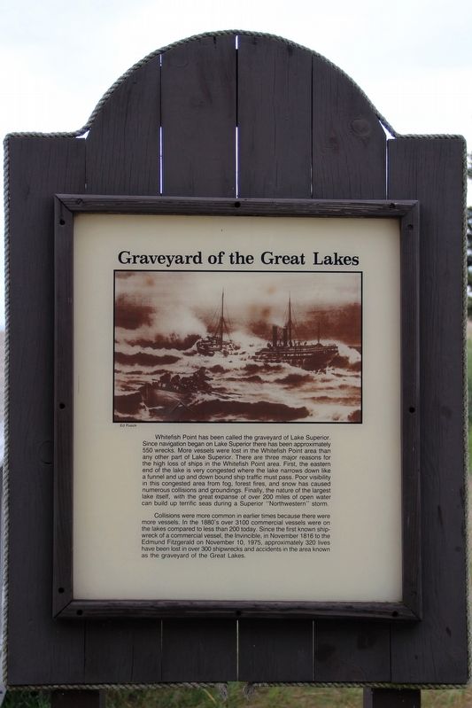
By cmh2315fl via Flickr (CC BY-NC 2.0), August 3, 2011
Graveyard of the Great Lakes Marker
101 ► Michigan, Chippewa County, Paradise — Graveyard of the Great Lakes —  |
| Near North Whitefish Point Road 0.5 miles north of West Sandy Lane, on the left when traveling north. | |||
| 102 ► Michigan, Chippewa County, Sault Ste. Marie — Heavy traffic on Portage Avenue — |
| Near West Portage Avenue near Ferris Street, on the right when traveling west. | |||
| 103 ► Michigan, Emmet County, Mackinaw City — Carl D. Bradley — Sank November 18, 1958 — Thirty-three lives lost — Shipwrecks Nearby — |
| Near Headlands Road north of McGulpin Point Road, on the right when traveling north. | |||
| 104 ► Michigan, Emmet County, Mackinaw City — Cedarville — Sank May 7, 1965 — Ten lives lost — Shipwrecks Nearby — |
| Near Headlands Road north of McGulpin Point Road, on the right when traveling north. | |||
| 105 ► Michigan, Emmet County, Mackinaw City — Eber Ward — Sank April 20, 1909 — Five lives lost — Shipwrecks Nearby — |
| Near Headlands Road north of McGulpin Point Road, on the right when traveling north. | |||
| 106 ► Michigan, Emmet County, Mackinaw City — James W. Bennett — Sank November 14, 1876 — Five lives lost — Shipwrecks Nearby — |
| Near Headlands Road north of McGulpin Point Road, on the right when traveling north. | |||
| 107 ► Michigan, Huron County, Harbor Beach — Daniel J. Morrell — The Cambria Steamship Co. — |
| On Ritchie Drive 0.3 miles east of North Lakeshore Road. | |||
| 108 ► Michigan, Huron County, Harbor Beach — Shipwrecks of the Harbor Beach Area — |
| On Trescott Street near Resort Road, on the left when traveling east. | |||
| 109 ► Michigan, Huron County, Harbor Beach — The Great Storm of 1913 — |
| On Trescott Street near Resort Road. | |||
| 110 ► Michigan, Huron County, Port Hope, Rubicon Township — Daniel J. Morrell — |
| Near Park Drive near Gulick Drive. | |||
| 111 ► Michigan, Huron County, Port Hope, Rubicon Township — Life Saving Service, Station 2 — |
| Near Park Drive near Gulick Drive. | |||
| 112 ► Michigan, Huron County, Port Hope, Rubicon Township — Storm of 1913 — |
| On Park Drive near Gulick Drive. | |||
| 113 ► Michigan, Huron County, Port Hope, Rubicon Township — The Great Lakes — |
| Near Park Drive near Gulick Drive. | |||
| 114 ► Michigan, Leelanau County, Empire — Of Wrecks and Water Trails — Sleeping Bear Dunes National Lakeshore — |
| Near Pierce Stocking Scenic Drive 2.1 miles west of South Dune Highway, on the right when traveling south. | |||
| 115 ► Michigan, Marquette County, Marquette — Picnic Rocks Memorial — |
| Near North Lakeshore Boulevard at Picnic Rocks Drive, on the right when traveling north. | |||
| 116 ► Michigan, Mason County, Ludington — L0484 — S.S. Pere Marquette 18 — |
| On Lakeshore Drive (State Highway 116) at Court Street, on the left when traveling north on Lakeshore Drive. | |||
| 117 ► Michigan, Mason County, Ludington — S0318 — Armistice Day Storm — |
| On Lakeshore Drive (State Highway 116) north of Pere Marquette Street, on the left when traveling north. | |||
| 118 ► Michigan, Oakland County, Rochester — 1937-1947 — |
| Near Sixth Street. | |||
| 119 ► Michigan, Oceana County, Pentwater — S571 — Graveyard of Ships / Veterans' Day Storm — |
| On South Hancock Street (Business U.S. 31) north of Fifth Street, on the right when traveling south. | |||
| 120 ► Michigan, Ottawa County, Grand Haven — Coast Guard Cutters on the Great Lakes — |
| Near South Harbor Drive just west of Y Drive, on the right when traveling west. | |||
| 121 ► Michigan, Ottawa County, Grand Haven — 1831 — Shipwrecks and the Coast Guard / The Escanaba — |
| On South Harbor Drive west of Y Drive, on the right when traveling west. | |||
| 122 ► Michigan, Presque Isle County, Rogers City — 2186 — Forty Mile Point Lighthouse / Lake Huron Graveyard of Ships — |
| Near County Park Road 0.2 miles north of U.S. 23 when traveling north. | |||
| 123 ► Michigan, Presque Isle County, Rogers City — The Bunkhouse — |
| Near County Park Road 0.2 miles north of U.S. 23 when traveling north. | |||
| 124 ► Michigan, Presque Isle County, Rogers City, Rogers Township — Rogers City Sailors Memorial — |
| On North Lake Street at East Michigan Avenue, on the right when traveling north on North Lake Street. | |||
| 125 ► Michigan, Sanilac County, Port Sanilac — S0110 — The Great Storm of 1913 — |
| Near South Lakeshore Road (State Highway 25) 1 mile E. Washington Road. | |||
| 126 ► Michigan, Schoolcraft County, Manistique — Carl D. Bradley — |
| On Lakeshore Drive (U.S. 2), on the left when traveling west. | |||
| 127 ► Michigan, Schoolcraft County, Thompson — The Christmas Tree Ship — |
| On unnamed road 0.1 miles east of U.S. 2, on the right when traveling east. | |||
| 128 ► Michigan, Schoolcraft County, Thompson, Thompson Township — S696 — Christmas Tree Ship / Thompson — |
| On unnamed road 0.1 miles east of U.S. 2, on the right when traveling east. | |||
| 129 ► Michigan, St. Clair County, Fort Gratiot — L2219 — Lake Huron Water Supply Project / Tunnel Explosion — Registered Michigan Historic Site — |
| On Park Road east of Michigan Highway 25, in the median. | |||
| 130 ► Michigan, St. Clair County, Marine City — The Marine City 1866 - 1880 — |
| On South Water Street (Michigan Route 29) at East St. Clair Street, on the right when traveling north on South Water Street. | |||
| 131 ► Michigan, St. Clair County, Marine City — The R.G. Coburn — 1870 - 1871 — |
| On South Water Street near Broadway Street, on the right when traveling north. | |||
| 132 ► Michigan, St. Clair County, Marine City — Titanic Memorial — |
| On South Water Street (Michigan Route 29) at Bridge Street, on the right when traveling north on South Water Street. | |||
| 133 ► Michigan, St. Clair County, Port Huron — Commerce & Catastrophe — |
| On Quay Street at Fort Street, on the right when traveling east on Quay Street. | |||
| 134 ► Michigan, St. Clair County, Port Huron — Great Storm of 1913 and Sailors Memorial — |
| On Thomas Edison Parkway at Elmwood Street, on the right when traveling north on Thomas Edison Parkway. | |||
| 135 ► Michigan, St. Clair County, Port Huron — The Storm — |
| Near Omar Street. | |||
| 136 ► Michigan, Wayne County, Detroit, Belle Isle — S.S. Edmund Fitzgerald — |
| On The Strand west of Inselruhe Avenue, on the right when traveling east. | |||
| 137 ► Michigan, Wayne County, Detroit, Belle Isle — S.S. Edmund Fitzgerald — 1958 - 1975 — |
| On The Strand west of Inselruhe Avenue, on the right when traveling east. | |||
| 138 ► Michigan, Wayne County, Detroit, Belle Isle — S.S. Edmund Fitzgerald — Anchor — |
| On The Strand near Picnic Way, on the right when traveling east. | |||
| 139 ► Minnesota, Goodhue County, Red Wing — The Sea Wing Disaster / Victims of the Sea Wing Disaster — |
| Near Broad Street at Levee Road. | |||
| 140 ► Minnesota, Saint Louis County, Duluth, Canal Park — The Wreck of the Mataafa — |
| Near Canal Park Drive at Morse Street, on the right when traveling north. | |||
| 141 ► Minnesota, Wabasha County, Lake City — The Sea Wing Disaster — |
| On North Lakeshore Drive (U.S. 61 / 63) north of West Clay Street, on the right when traveling north. | |||
| 142 ► Missouri, Buchanan County, St. Joseph, Washington Township — William Mitchelhill — August 27th 1870 - May 7th 1915 — In Memoriam — |
| Near Mount Mora Road. | |||
| 143 ► Nebraska, Knox County, Niobrara — 101 — The Sage Brothers — |
| Near Walnut Street (Outlaw Trail Scenic Byway) (State Highway 12) at Spruce Avenue, on the right when traveling east. | |||
| 144 ► New Hampshire, Rockingham County, Portsmouth — CMoMM (SS) Arthur L. Stanton Chief of the Boat (COB) — Albacore — Portsmouth Submarine Memorial Association — |
| Near Submarine Way north of Bypass U.S. 1, on the left when traveling west. | |||
| 145 ► New Hampshire, Rockingham County, Portsmouth — New Hampshire's Lost Boat — USS Capelin SS 289 — |
| Near Submarine Way north of Bypass U.S. 1, on the left when traveling west. | |||
| 146 ► New Jersey, Atlantic County, Atlantic City — Dedicated to the Men and Women Who Lost Their Lives at Sea — |
| Near North Rhode Island Avenue north of Parkside Avenue, on the left when traveling north. | |||
| 147 ► New Jersey, Atlantic County, Atlantic City — Lighthouse History / Absecon Lighthouse Facts — Absecon Lighthouse — |
| On Pacific Avenue, on the left when traveling east. | |||
| 148 ► New Jersey, Atlantic County, Atlantic City — The Whaling Bark Stafford — Absecon Lighthouse — |
| On Pacific Avenue at S Rhode Island Avenue, on the left when traveling east on Pacific Avenue. | |||
| 149 ► New Jersey, Atlantic County, Atlantic City — USCS Steamer Robert J. Walker / Assistant Keepers' Dwelling — |
| On South Vermont Avenue at Pacific Avenue, on the right when traveling south on South Vermont Avenue. | |||
| 150 ► New Jersey, Camden County, Camden, Central Waterfront — U.S. Merchant Marine and U.S. Navy Armed Guard — |
| Near South Delaware Avenue south of Dr. Martin Luther King Boulevard, on the right when traveling south. | |||
| 151 ► New Jersey, Cape May County, Cape May — Cape May County Fishermans Memorial — |
| On Missouri Avenue at Baltimore Avenue on Missouri Avenue. | |||
| 152 ► New Jersey, Mercer County, Trenton, South Trenton — 1912 — |
| On Lamberton Street near New Jersey Route 29, on the left when traveling north. | |||
| 153 ► New Jersey, Monmouth County, Asbury Park — S.S. Morro Castle Disaster — |
| Near Ocean Avenue at 5th Avenue, on the right when traveling north. | |||
| 154 ► New Jersey, Ocean County, Barnegat Light — U.S. Merchant Marine WW II Memorial — |
| Near Broadway, on the right when traveling north. | |||
| 155 ► New Jersey, Ocean County, Surf City — USS Murphy — |
| On Long Beach Boulevard (County Road 607) just north of North 11th Street, on the right when traveling north. | |||
| 156 ► New York, Bronx County, Bronx, Hunts Point — General Slocum Disaster — City of New York Parks & Recreation — |
| Near Viele Avenue at Tiffany Street, on the left when traveling west. | |||
| 157 ► New York, Cayuga County, Union Springs — 282 — The Frontenac — |
| On New York State Route 90 at Dills Beach Road, on the right when traveling south on New York State Route 90. | |||
| 158 ► New York, Chautauqua County, Brocton — Ships and Shipwrecks at Lake Erie State Park — |
| Near East Trail north of Traffic Circle, on the right when traveling west. | |||
| 159 ► New York, Chautauqua County, Dunkirk — Eastern Basin Shipwrecks — A Watery Record of Mishaps — Maritime Heritage — |
| On Central Avenue 0.1 miles north of Lake Shore Drive West ( Route 5), on the left when traveling north. | |||
| 160 ► New York, Delaware County, Margaretville — The Buy-Out Program — |
| On Main Street (New York State Route 30) just east of Fair Street, on the right when traveling east. | |||
| 161 ► New York, Erie County, Buffalo, First Ward — Penobscot-Morania Collision — |
| Near Fuhrmann Boulevard near The Skyway ( Route 5). | |||
| 162 ► New York, Erie County, Buffalo, Waterfront — The Legend of John Maynard — Immortalized in a poem by Theodor Fontane — |
| On Erie Street 0.2 miles west of Marine Drive, on the left when traveling north. | |||
| 163 ► New York, Nassau County, East Rockaway — Historic Waterfront — Tragic Ocean Shipwrecks off East Rockaway — |
| Near Main Street at Althouse Avenue. | |||
| 164 ► New York, Nassau County, Freeport — Two Shipwrecks and the Life Saving Service — |
| On Woodcleft Avenue south of Hamilton Street, on the left when traveling south. | |||
| 165 ► New York, Nassau County, Long Beach — Wreck of the Mexico (1837) — |
| Near Boardwalk at Lincoln Boulevard, on the right when traveling east. | |||
| 166 ► New York, Nassau County, Lynbrook — The Wreck of the Mexico - January 2, 1837 — |
| Near Merrick Road. | |||
| 167 ► New York, Nassau County, Lynbrook, Hempstead — The Wreck of the Bristol - November 21, 1836 — Bristol and Mexico Monument, MARINERS BURYING GROUND — |
| On Merrick Road near Ocean Avenue. | |||
| 168 ► New York, New York County, Manhattan, Alphabet City — Slocum Memorial Fountain — Tompkins Square Park — |
| Near East 9th Street. | |||
| 169 ► New York, New York County, Manhattan, Battery Park — American Merchant Mariners' Memorial — |
| Near Battery Place at West Street. | |||
| 170 ► New York, New York County, Manhattan, Battery Park — American Merchant Mariners' Memorial — |
| Near Admiral George H. Dewey Prominade. | |||
| 171 ► New York, New York County, Manhattan, Bloomingdale — Isidor and Ida Straus — |
| On Broadway north of West 106th Street, on the right when traveling south. | |||
| 172 ► New York, New York County, Manhattan, Bloomingdale — Straus Park — 1912 — City of New York Parks & Recreation — |
| Near Broadway just south of West 107th Street, on the right when traveling south. | |||
| 173 ► New York, New York County, Manhattan, East Village — General Slocum Disaster Centennial — 1904 - 2004 — |
| On East 6th Street, on the left when traveling east. | |||
| 174 ► New York, New York County, Manhattan, Financial District — Titanic Memorial Lighthouse — |
| On Pearl and Fulton Street. | |||
| 175 ► New York, New York County, Manhattan, Financial District — Wireless Operators Memorial — |
| On State Street at Pearl Street on State Street. | |||
| 176 ► New York, New York County, Manhattan, Hamilton Heights — Stephen H. Tyng Jr — |
| Near West 155th Street north of Riverside Drive. | |||
| 177 ► New York, New York County, Manhattan, Meatpacking District — Disaster at Sea — |
| Near Hudson River Greenway. | |||
| 178 ► New York, New York County, Manhattan, Meatpacking District — The Unsinkable Ship — Titanic — |
| Near Eleventh Avenue near West 13th Street. | |||
| 179 ► New York, Niagara County, Lewiston — The Cibola Anchor — |
| On Plain Street at Niagara Street on Plain Street. | |||
| 180 ► New York, Orleans County, Albion — Erie Canal Spurs Albion's Growth and Prosperity — |
| On North Platt Street 0.1 miles north of East Bank Street, on the right when traveling north. | |||
| 181 ► New York, Queens County, Queens, Astoria — 301 — General Slocum Disaster — Astoria Park — |
| On Shore Boulevard 0.4 miles south of Ditmars Boulevard, on the right when traveling south. | |||
| 182 ► New York, Queens County, Queens, Middle Village — General Slocum Disaster Memorial — |
| Near Metropolitan Ave. | |||
| 183 ► New York, Richmond County, Staten Island, Fort Wadsworth — The Four Chaplains — |
| Near South Weed Road. | |||
| 184 ► New York, Richmond County, Staten Island, St. George — In Memory of the Staten Island Ferry passengers — |
| On Ferry Terminal Viaduct east of Bay Street, on the right when traveling north. | |||
| 185 ► New York, St. Lawrence County, Chippewa Bay, Dark Island — Shipwrecks in Surrounding Waters — |
| Near County Route 6. | |||
| 186 ► New York, Suffolk County, Montauk Point — Lost At Sea — |
| Near Old Montauk Highway. | |||
| 187 ► New York, Suffolk County, Patchogue — The Wreck of the Louis V. Place — |
| On Montauk Highway (Route 27A) at River Drive on Montauk Highway. | |||
| 188 ► New York, Suffolk County, Patchogue — The Wreck of the Nahum Chapin — |
| Near Montauk Highway at Riverview Avenue. | |||
| 189 ► New York, Warren County, Hague — The Wreck of the Steamboat John Jay — Lakes to Locks Passage — Lake George Region — |
| On Lake Shore Drive (New York State Route 9N) south of Graphite Mountain Road ( Route 8), on the right when traveling north. | |||
| 190 ► New York, Warren County, Lake George — Ethan Allen tour boat tragedy — |
| On Lower Amherst Street, on the right when traveling east. | |||
| 191 ► New York, Wayne County, Pultneyville — Wreck of the St. Peter — National Register of Historic Places — |
| Near Foreman Park 0.1 miles north of Lake Road. | |||
| 192 ► New York, Westchester County, Ossining — 24 — The Collyer Family — A Shipbuilding Dynasty on the Hudson — Dale Cemetery Heritage Trail — |
| Near Havell Street at Jenkins Court. | |||
| 193 ► North Carolina, Chatham County, Pittsboro — H-10 — Captain Johnston Blakeley — |
| On NC-87 (State Highway 87) at East Perry Road/Chicken Bridge Road, on the right when traveling north on NC-87. | |||
| 194 ► North Carolina, Currituck County, Corolla — A-33 — Wreck Of The Metropolis — |
| On Ocena Trail (State Highway 12) at Albacore Street, on the right when traveling north on Ocena Trail. | |||
| 195 ► North Carolina, Hyde County, Ocracoke — Welcome to Ocracoke… — Outer Banks National Scenic Byway — |
| On Water Plant Road at NPS Road, on the left when traveling east on Water Plant Road. | |||
| 196 ► Ohio, Adams County, Peebles — The Shawnee And The King Of The Serpents |
| Near Horner Chapel Road (Ohio Route 73) 0.9 miles west of Horner Chapel Road (Route T-116), on the right when traveling west. Reported permanently removed. | |||
| 197 ► Ohio, Ashtabula County, Ashtabula — American Merchant Marine Veterans Memorial — |
| On Walnut Boulevard east of Hulbert Avenue, in the median. | |||
| 198 ► Ohio, Lucas County, Toledo, East Toledo — America's Submarines Of The Great Lakes — |
| On South Marina Drive, on the left when traveling north. | |||
| 199 ► Ohio, Lucas County, Toledo, Southside — Inuksuk — (in-uk-shuk) Inuit translation: "something resembling a man." — |
| Near Hippo Way, on the right when traveling south. | |||
| 200 ► Ohio, Lucas County, Whitehouse — Whitehouse Veterans Memorial Park — |
| On Providence Street (Ohio Route 64) just south of Maumee Street, on the right when traveling south. | |||
348 entries matched your criteria. Entries 101 through 200 are listed above. ⊲ Previous 100 — Next 100 ⊳