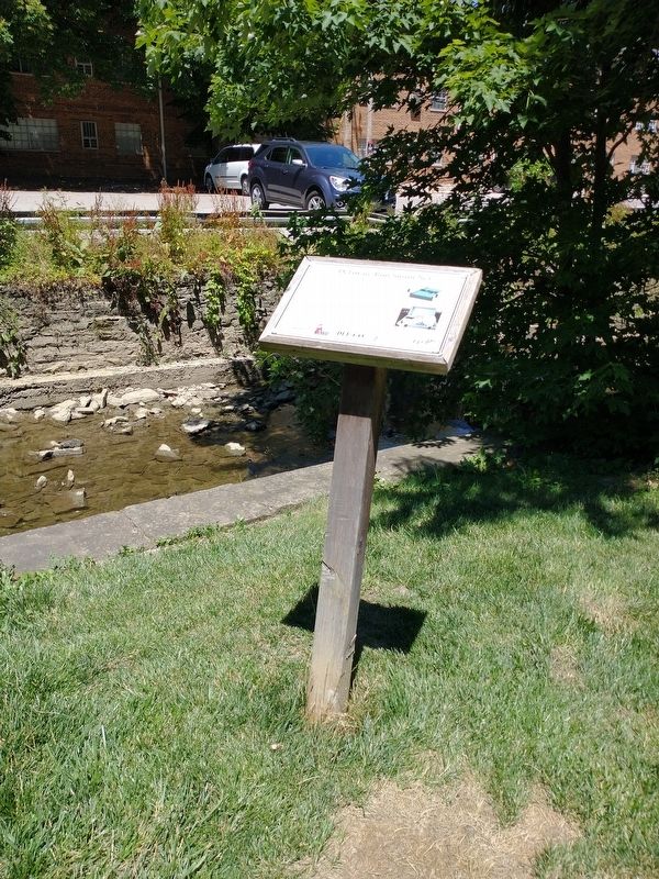
This storm net structure was developed as a student research project in cooperation with Ohio Wesleyan University, the City of Delaware Public Utilities Department, and StormX Water Systems. The purpose of this project is to determine if the . . . — — Map (db m203320) HM
Ohio Wesleyan University was established in 1842, in one building (Elliot Hall) which at the time was located a short distance from the proposed location for the bioretention cell. Elliot was built near a sulphur spring, which flowed into the . . . — — Map (db m203316) HM
Here is Lock No. 21 in a series of 23 lift locks, numbered from Bristol to Easton. The aqueduct over Cooks Creek is one of nine which carried water and shipping across branches of the Delaware River. — — Map (db m19233) HM
Formed September 26, 1789 out of Chester County. Named for the Delaware River and site of William Penn's first entry into Pennsylvania, 1682. Old Chester Courthouse (1724) is one of America's early public buildings. County seat, Media, incorporated . . . — — Map (db m83368) HM
Delaware County was constituted September 26, 1789. This courthouse was built in 1850 and rebuilt in 1913. It is the sixth of this judicial district in line of direct succession from the first court house in Pennsylvania. — — Map (db m83371) HM
Terminus of the waterway uniting the Hudson and Delaware rivers. Built in 1825-28. A gravity railroad feeder reached to Carbondale. For 70 years the anthracite trade outlet for the region. — — Map (db m89443) HM
Millionaire's Row
Charles F. Sternberg, who owned a grain elevator on Ohio Street, commissioned the Mansion as a private residence in 1869 at an estimated cost of $200,000. Architect George M. Allison, about whom little is known, designed . . . — — Map (db m76056) HM
The UD Alumni Association (UDAA) has strengthened the commitment of graduates to the University of Delaware since 1846 and is governed by a volunteer Board of Directors. The names that follow are those who served as president along with the . . . — — Map (db m238444) HM
Base inscription-erected by the United Daughters of the Confederacy Caleb Ross
Chapter #2635 and the Sons of Confederate Veterans, Delaware Grays Camp #2068. Front text-not legible, back text-not legible, side text-Smith Gilley, Confederate Army, . . . — — Map (db m105569) WM
Dug by hand, mostly by Irish immigrants, the 66 mile D & R Canal was completed in 1834. 18 feet wide and 8 feet deep, the canal originally had 14 locks to raise and lower boat traffic
The D & R Canal operated as an inland waterway between the . . . — — Map (db m191190) HM
The arrival of the Delaware and Hudson Railroad at Lake George in 1882 had a significant impact on life in the region. Early vacationers often arrived in rail cars direct from New York City and Albany. While the rich and famous relaxed at lakeside . . . — — Map (db m16118) HM
Points of Interest
118.8: Bristol Marsh Preserve contains an important freshwater tidal marsh, one of the few remaining along Pennsylvania's coastal region. Visitors may use the viewing platforms, a walking trail, and interpretive . . . — — Map (db m160092) HM
Points of Interest
107 Palmyra Cove Nature Park encompasses 250 acres of ecological treasures including woodlands, wetlands, a tidal cove and river shoreline. More than 250 bird species have been observed there.
107 . . . — — Map (db m194948) HM
Delaware and Hudson Canal
has been designated a
Registered National
Historic Landmark
Under the provisions of the Historic Sites Act of August 21, 1935 this site possesses exceptional value in commemorating or illustrating the history of . . . — — Map (db m49088) HM
This Tanbark stone came from J.E. Rhoads & Sons of Delaware. Founded in 1702 in Chester County, Pa. as a leather tannery, it is the oldest firm in the United States.
As shown above, the stone was rolled on its serrated edge to grind tanbark . . . — — Map (db m240909) HM
The Chesapeake & Delaware Canal was a water route for freedom seekers on the escape network known as the Underground Railroad. It provided a shortcut of 300 nautical miles compared to the bay and ocean route. However, the shortcut came with deadly . . . — — Map (db m297958) HM
In memory of those who lost their lives during construction of the Delaware & Raritan Canal.
From 1830 to 1834, an army of ditch diggers, carpenters and masons - many of whom were Irish immigrants - built the canal. Large numbers perished during . . . — — Map (db m17080) HM
In Honor of those from Delaware Township who served in the Armed Forces of the United States of America.
Erected by Sergeantsville Memorial Post 8390
Veterans of Foreign Wars
1992 — — Map (db m17087) HM
Concord Township, one of the first townships created by William Penn, dates from February 6, 1683. The name was chosen by the early Quaker settlers to reflect their harmonious feelings toward their new home. Originally established in the shape of a . . . — — Map (db m146791) HM
In commemoration of the Dutch settlements on the Delaware 1626-1664
The territory was occupied by the Dutch West India Company and known as New Netherland
Extended from the Capes of the Delaware to the Connecticut River and Embraced within its . . . — — Map (db m107327) HM
In commemoration of the Swedish settlements on the Delaware 1638-1655
New Netherland embraced within its boundaries the Commonwealth of Pennsylvania And included lands on the West Side of the Delaware from Cape Hendopen to Trenton Falls. On the . . . — — Map (db m107328) HM
The African American community known today as Polktown is one of the earliest remaining free black settlements in Delaware and has been continuously occupied for nearly two centuries. It extended on both sides of the historic branch canal and . . . — — Map (db m244709) HM
This humble home was the first residence of Blues Hall Of Fame guitarist "Lonesome" George Thorogood purchased on July 1, 1981 after his national rise to prominence. It was the residence and home of George and was frequented by band . . . — — Map (db m274949) HM
Each spring, upon arrival from their Central and South American wintering grounds, Delaware beachnesters establish colonies and take part in courtship rituals. The birds lay their eggs in shallow nests scraped into the sand mostly between the . . . — — Map (db m94322)
"Besides, I want to tell
you there were pretty
good times and many
a heart broken and
rough life on the canal."
Flora Henry, Locktender
Shouts of "Gid-Up” echo along the canal. Pairs of mules
strain at their harnesses to get . . . — — Map (db m163686) HM
Delaware Governor Walter W. Bacon speaks at ceremonies after a parade in Wilmington in 1945 honoring Medal of Honor recipient, Army Sergeant James P. Connor. Connor landed in North Africa in November, 1942, with the 9th Division and went on to . . . — — Map (db m194618) HM WM
Points of Interest
105 Griffith Morgan House, a ca. 1693 native sandstone farmhouse, may be the oldest surviving house in Camden County. On the National Register of Historic Places, it is maintained as a public historic site by a . . . — — Map (db m194890) HM
According to Megan Wren, director of the Bayshore Discovery Center, “Bivalve is a gritty, working waterfront (town) that a casual visitor might call ‘lost in time’. Someone who knows the place a little better would probably use words like . . . — — Map (db m64381) HM
Historical Significance
Dug by hand, mostly by Irish immigrants, the 66 mile D & R Canal was completed in 1834. 75 feet wide and 8 feet deep, the canal originally had 14 locks to raise and lower boat traffic.
The D & R Canal operated as . . . — — Map (db m21270) HM
To commemorate the crossing of the Delaware River at this point by General George Washington and the Continental Troops, Christmas Night, 1776, and the splendid victory at Trenton.
Committee
John D. James, President
Russell W. Knight, . . . — — Map (db m5401) HM
Points of Interest
98.8 Washington Avenue Green/Pier 53 is the first waterfront park in South Philadelphia. Among other features, the park celebrates and interprets the Pier's history as Philadelphia's immigration station. The Park . . . — — Map (db m192856) HM
Delaware & Hudson Canal Park
Dedicated September 29, 1988
To the leisure enjoyment of all the residents of orange county through the generous land acquisition support given by the National Park Service, N.Y. State Office of Parks, Recreation & . . . — — Map (db m193763) HM
Newly installed rain gardens and bioswales will help fix
erosion problems, reduce runoff, and improve water quality
and habitat. Delaware Creek is a 1.8-mile stream that drains
five square miles. It enters the Maumee River at river mile 9.2.
1 . . . — — Map (db m217119) HM
In grateful remembrance
of the
Soldiers and Sailors
of Delaware County
who fought for the unity
of this Republic
1861-1865.
This monument is dedicated
that future generations
may cherish the principles
of
civil and . . . — — Map (db m83373) WM
Locks raise and lower canal boats where the elevation of the land changes. The 972 feet elevation difference between Honesdale, PA on the left side of the blue diagram below, and Kingston, NY on the right side, is drawn using 108 steps. Each . . . — — Map (db m122270) HM
In memory of those Delawareans who died during the terrorist attacks on America in September 2001 and in grateful appreciation for the service of many brave persons who responded to terrorists crisis in our nation's time of need. — — Map (db m190740) WM
In loving memory of the men and women of the first state who served our nation in World War I. Their sacrifices will never be forgotten. — — Map (db m194641) WM
The original landing was started during the 17th century of stone filled wood cribs, being enlarged several times. The city acquired ownership from the New Castle Frenchtown Railroad Co. in 1914, and rebuilt the wharf with a concrete face on new . . . — — Map (db m57133) HM
This monument is dedicated to the immigrants who came to New Castle from Italy starting in the late 1890s. They came primarily from the Abruzzo Region which is located on the Adriatic east from Rome. Residing for the most part on the west side of . . . — — Map (db m246127) HM
Settled in 1684
by
Christopher Nutter
Through a land grant from Charles Calvert,
The third Lord Baron of Baltimore
Originally referred to as
"Attawattacoquin"
Later known as
"Bridge Branch"
until January 3, 1871, . . . — — Map (db m50178) HM
Alexander Hand, 1862 •
Charles B. Tanner, 1862 •
James Parke Postles, 1863 •
John B. Maberry, 1863 •
Bernard McCarren, 1863 •
John Shilling III, 1864 •
Henry A du Pont, 1864 •
David E. Buckingham, 1865 •
Samuel Rodmond Smith, 1865 . . . — — Map (db m206354) WM
Union Station
Architecture by
Daniel Burnham, 1908
Designed in the Beaux-Arts style, this was the world's largest train station when it opened - the station and terminal zone originally covered approximately 200 acres and included 75 . . . — — Map (db m8442) HM
First run 1751, agreed upon 1760 and finally ratified 1769 by King George III, thus ending almost a century of controversy between the proprietors of the two provinces. — — Map (db m168147) HM
Long the Sergeantsville Hotel. Gordon's Tavern in 1780. It has been the site of every town meeting since 1838. The township bought it in 1948. — — Map (db m72208) HM
The State Street Locks were located here. The canal was 42.9 miles long and there were 14 locks between Bordentown and New Brunswick via Bound Brook. The feeder extended 21.6 miles from Raven Rock. The main stream was 75 feet wide and 8 feet deep. . . . — — Map (db m10075) HM
This statue which was carved in Italy, and was first exhibited at the Centennial Exposition was purchased and presented to the city by the Mayor, the Common Council and other officials of the City of Trenton, in the year 1889
This pedestal . . . — — Map (db m4176) HM
Sussex Branch Mile Post 56
(Originally located at Andover Junction, NJ) Circa 1905. This mile post is from the DL&W Sussex Branch, which ceased operatons in 1966. “56” indicates the number of miles from Hoboken, NJ. Gift of Bill Jentz — — Map (db m91157) HM
has been designated a
Registered National
Historic Landmark
under the provisions of the
Historic Sites Act of August 21, 1935
This site possesses exceptional value
in commemorating or illustrating
the history of the United . . . — — Map (db m215028) HM
In 1824 two Philadelphia merchants, Maurice and Wilbur Wurts, proposed a canal to transport coal from mines in northwest Pennsylvania to New York City via the Hudson River. The canal opened in 1828 at a cost of over one million dollars and was 108 . . . — — Map (db m147831) HM
The Rondout Creek at this site provided the tidewater terminal for the D and H Canal, a constructed water-way of 108 miles, completed in 1828. Starting at Honesdale, Pennsylvania, hundreds of flat canal boats carried millions of tons of coal, . . . — — Map (db m59272) HM
Here are locks No. 8-11 of the 23 lift locks on this canal. New Hope also had one of the nine aqueducts and the only toll station between Bristol and Easton. Coal was the largest item of shipping. — — Map (db m20104) HM
Opened from Bristol to this place in 1831; and completed to Easton in 1852. Outlet lock to the river built here in 1834. The near-by River House, built 1794, was a popular barge stop on the canal. — — Map (db m86035) HM
Used earth's resources
In natural order!
Built liquid highway
With flowing water!
Follow the river
Stay close to the source!
Locks raised - locks lowered
Control nature's force!
Construction complete
Eighteen thirty-two!
Transport . . . — — Map (db m163673) HM
Has been designated a
National
Historic Landmark
This site possesses national significance
in commemorating the history of the
United States of America
— — Map (db m163674) HM
Uhlertown, known as Mexico at an earlier date, was named for Michael Uhler, boatbuilder and operator of a line of canal boats. Lock No. 18 and well kept buildings are interesting reminders of canal days. — — Map (db m18084) HM
This historic mansion and estate was built as a summer home circa 1850 in the Italianate style by Charles Macalester, Jr., a prosperous businessman and banker. He held close personal relations with Presidents Jackson, Van Buren, Polk, Pierce, . . . — — Map (db m194951) HM
The wooden stakes with white rope in front of you, show the size of a D & H Canal Co. boat after 1850, when they were eighty-nine feet long and fourteen and a half feet wide.
At the stern (back end) was a small cabin which was about twelve by . . . — — Map (db m122225) HM
Built by Ferdinand Wood
Designed that the portals be
“Hi and wide as a load of hay”
Cost shared by Delaware and Chester Counties
Named for Mordecai Bartram
— — Map (db m92214) HM
Born in Alexandria, Virginia, relocated to 203 E. 10th Street, Wilmington, Delaware. Redding graduated from Howard High School in 1919, and with honors from Brown University in 1923. After college, Redding taught in Florida, and at Morehouse . . . — — Map (db m217947) HM
Boatbuilding American canal boats met standards as unique as their canals. Here, the preferred boat met Lehigh Coal and Navigation Company’s specifications of 87 ½ feet long, 10.5 feet wide and 7 ½ feet tall. The wooden . . . — — Map (db m86687) HM
First chartered by the Grand Lodge of Pennsylvania as Lodge No. 33 on April 3, 1781. Early meetings were held alternately at Christiana Bridge and New Castle. This was one of four Lodges whose representatives gathered in Wilmington on June 6 and 7, . . . — — Map (db m156139) HM
Welcome to the Preserve’s self-guided nature trail. Why is this land special? Situated on the southern edge of New Jersey’s pine barrens, Eldora Nature Preserve is the site of The Nature Conservancy’s first preserve established expressly for . . . — — Map (db m64312) HM
The Mid-Atlantic Highlands region of Pennsylvania, New Jersey, New York, and Connecticut forms 3-5 million acre forested greenbelt around the densely populated areas of Philadelphia, New York City, and Hartford.The region stretches from northwestern . . . — — Map (db m86118) HM
Governor C. Douglass Buck appointed a committee in 1929 to review Delaware's notable historic sites and develop a way to identify them. In 1931, the General Assembly of Delaware passed and Governor Buck signed House Bill No. 62, an act . . . — — Map (db m271732) HM
“Our residents take pride and partner in their heritage—they understand the meaning of what we have and act to preserve it”
Delaware & Lehigh National Heritage Corridor and State Heritage Park, Management Action Plan.
Welcome to . . . — — Map (db m289326) HM
Much had been written about the Delaware & Hudson Canal but unfortunately, that is not the case for this building, especially its early years.
According to Phineas Goodrich in his 1880 book, History of Wayne County, Pennsylvania, . . . — — Map (db m122239) HM
In 1816 two Philadelphia dry-goods merchants, William and Maurice Wurts, purchased some anthracite coal fields in the Lackawanna Valley of Pennsylvania and began a small-scale mining operation. Their timing was impeccable — the War of 1812 had . . . — — Map (db m142839) HM
Consisting of Treasure Island and Marshall Island. Home to one of the nation's oldest Boy Scout camps, established by the Philadelphia Council, B.S.A. in 1913. Birthplace of the Order of the Arrow, a national campers' honor society founded upon . . . — — Map (db m35078) HM
New Castle has a long history as a national transportation link. In the 1820s a turnpike connected ships on the Delaware River with ships on the Chesapeake Bay. However, the turnpike was in poor condition. Progressive town leaders saw . . . — — Map (db m102543) HM
A natural waterway follows the contours of the land over which it flows, the depth of water varies, depending on the quantity and velocity of flow. To maintain the constant depth of water required for transportation, a canal is engineered as a . . . — — Map (db m15663) HM
Our generation has the moral obligation to make sure that future generations have open spaces to enjoy where they can refresh their spirit. — Lorraine Fleming
As a student, Lorraine Fleming and her classmates took . . . — — Map (db m180668) HM
In this house lived Ryves Holt
Chief Justice
of “Three Lower Counties On Delaware,”
1745 to 1763
Member of Assembly
of “Three Lower Counties On Delaware,”
1734-1737, 1742-1744, 1746-1755,
And Speaker of Assembly . . . — — Map (db m221639) HM
Philadelphia's industrial might and its location along the Delaware River earned it the title "Workshop of the World." For the earliest inhabitants, the river provided food. Industry used it later for transportation and as a convenient sewer. . . . — — Map (db m194938) HM
Philadelphia's industrial might and its location along the Delaware River earned it the title "Workshop of the World." For the earliest inhabitants, the river provided food. Industry used it later for transportation and as a convenient sewer. . . . — — Map (db m274241) HM
The Delaware River has shaped the culture and economy of Philadelphia for centuries. The area's first residents, the Lenni Lenapi, came here to fish and hunt. European immigrants arrived in the mid-1500s. They built factory towns connected to the . . . — — Map (db m194933) HM
The Delaware River has shaped the culture and economy of Philadelphia for centuries. The area's first residents, the Lenni Lenapi, came here to fish and hunt. European immigrants arrived in the mid-1500s. They built factory towns connected to the . . . — — Map (db m240200) HM
This is Lock No. 50, operated by P.O. Callahan, one of ninety-five wood-lined units on the 108-mile-long canal; the remaining thirteen locks were lined with local stone hand-cut to fit the chambers.
The P.O. Callahan lock marked the end of the . . . — — Map (db m142842) HM
Philadelphia's industrial might and its location along the Delaware River earned it the title "Workshop of the World." For the earliest inhabitants, the river provided food. Industry used it later for transportation and as a convenient sewer. . . . — — Map (db m194937) HM
Surf fishing is a Delaware tradition older than the beach parks themselves.
Decades of cooperation between surf anglers, DNREC Division of Parks and Recreation, elected officials, and other concerned citizens have created perfect conditions . . . — — Map (db m206352) HM
Built in the 1850's as a residence for the family of F. W. Boothroyd, owner of a prosperous boatyard located on this property, this house is typical of canal-side buildings of the time. Its simple construction, minimal architectural detailing, and . . . — — Map (db m142849) HM
After its heyday in the late 1850's to 1870's, the canal gradually lost business to the faster, more efficient railroads, which could ship coal in the dead of winter and the dark of night. This loss of business resulted in layoffs of boats, fewer . . . — — Map (db m142843) HM
Built in the 1790s, this 2½ story gray fieldstone house is the former home of Judge Hugh M. Morris. Morris was a Delaware native, respected attorney and distinguished federal judge. He purchased the house and a large parcel of land here in 1933. . . . — — Map (db m161924) HM
In 2020, in partnership with the Center for the Inland Bays (CIB) and DNREC, over 300' of DBG's Pepper Creek southeast edge was restored using a natural living shoreline approach to preserve and protect the eroding tidal saltmarsh. In 2023, a . . . — — Map (db m302735) HM
When Bill Hopkins came to Delaware in 1964 as the first superintendent for Cape Henlopen State Park, he brought with him a vision that would shape preservation in the state for years to come. For more than forty years he has been a driving force . . . — — Map (db m150116) HM
Charles A. "Chazz" Salkin's 35-year career with Delaware State Parks began as Director of the Young Adult Conservation Corps at Bellevue State Park in 1978 and culminated in an unprecedented 21-year tenure as Director of the Delaware Division of . . . — — Map (db m240845) HM
The civil war officially began on April 12, 1861 when Confederate forces bombarded the Union controlled Fort Sumter.
Delaware was a Border . . . — — Map (db m238413) HM
3658 entries matched your criteria. Entries 201 through 300 are listed above. ⊲ Previous 100 — Next 100 ⊳
Thin black lines indicate changes in relevance. Between each pair of lines entries are ordered geographically but all have the same relevance.
* Inflectional forms of words are their plurals, singulars, and possessives as well as gramatical tenses and similar variations.