494 entries match your criteria. Entries 401 through 494 are listed.⊲ Previous 100
NYC Parks Historical Markers
The purpose of this NYC Parks & Recreation program is to place historical identification markers which describe the history of the site, park improvements, and the biography of the person for whom the park is named.
These historical signs also offer virtual and physical context to parks, playgrounds, monuments, and landmarks across New York City.
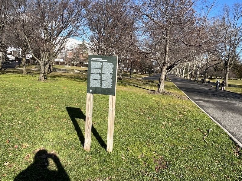
The Unisphere, located at the center of the radial pathways in the northern half of Flushing Meadows Corona Park, was commissioned for the New York World's Fair of 1964-65. Designed by landscape architect Gilmore D. Clarke (1892-1982) in aluminum . . . — — Map (db m239575) HM
What is this?
You've found yourself in the beautiful, evergreen-shaded retirement home of some of New York City's hardest-working employees—our beloved playground animals. They've spent their careers teaching important life lessons . . . — — Map (db m294878) HM
What is this?
You've found yourself in the beautiful, evergreen-shaded retirement home of some of New York City's hardest-working employees—our beloved playground animals. They've spent their careers teaching important life lessons . . . — — Map (db m294879) HM
This site is a public garden which is maintained by neighborhood volunteers through GreenThumb. Founded in 1978, GreenThumb helps local residents transform vacant properties into attractive green spaces. If you want to join this garden, call (212) . . . — — Map (db m239598) HM
This park honors Carlos R. Lillo (1963-2001), a paramedic
for the New York City Fire Department's Emergency Medical
Services Division who died while on duty on September
11, 2001. Raised in Astoria, Queens, Lillo began his career
in emergency . . . — — Map (db m278499) HM
Detective Brian "Smiles" Simonsen, a member of the 102nd Precinct, lost his life in the line of duty responding to a robbery on February 12, 2019, at 42 years old. He exemplified love for this community both on and off-duty.
A family-man and . . . — — Map (db m294791) HM
Flushing Meadows-Corona Park, today New York City's second largest park, has risen like a phoenix from the ashes. The 1,255-acre open space was indeed an ash disposal heap in the early 20th Century, noted by F. Scott Fitzgerald in The Great . . . — — Map (db m307586) HM
About the Homestead
The Homestead was built between 1774 and 1785. Captain Joseph King first purchased this farmhouse from his father-in-law in 1801 and named it "Kingsland." His family and their descendants lived here until the 1930s. . . . — — Map (db m193349) HM
About the House
Lewis Howard Latimer [1848-1928] was an African American inventor, son of fugitive slaves, self-taught poet, and painter. His historic Victorian home in Flushing, Queens, is now a New York City Landmark and museum, operated . . . — — Map (db m193420) HM
Willow Lake Playground draws its name from nearby Willow Lake in Flushing Meadows Corona Park. Willow Lake, like adjacent Meadow Lake, was created by Parks Commissioner Robert Moses (1888-1981) for the 1939-40 World’s Fair. Willow Lake’s surface . . . — — Map (db m283570) HM
This pond honors Private First Class Laurence George E. Strack (1948-1967) the first Woodhaven resident to die serving in the Vietnam War. Strack participated in many local youth league baseball teams and earned the most valuable player title. In . . . — — Map (db m294784) HM
Original use: Officers' Quarters
Current use: Center for the Women of New York
Replacing a frame structure from the first development phase of the Fort at Willets Point, Building 207 was constructed for . . . — — Map (db m275867) HM
Original use: Post hospital
Current use: Not in use
Constructed for $37,830, this hospital is Fort Totten's third, replacing two previous frame structures built in the 1800s. It is an imposing example of . . . — — Map (db m275930) HM
Original use: Post Bakery
Current use: FDNY EMS Classrooms
Built according to the Quartermaster General's standard plan for bakeries developed in 1894, the Post Bakery is utilitarian in style, designed to be . . . — — Map (db m275883) HM
This Colonial Revival building, constructed in a variant style called Neo-Georgian, was one of many facilities constructed by the YMCA on army posts throughout . . . — — Map (db m275882) HM
Original use: Post Fire Engine House
Current use: Fire Prevention Education
Despite being the first Post Fire Engine House, Building 331 displays many characteristics of modern design, with space for . . . — — Map (db m275885) HM
Original use: War Department Theater
Current use: Not in use
Funded by the Work Relief Appropriations Act of 1937 under the War Department's Construction Program, this is one of many contemporary theaters . . . — — Map (db m275886) HM
Original use: Fort Totten Chapel
Current use: Community Functions
This building is the site's second chapel, constructed after its wooden-frame predecessor was destroyed in a fire in 1937. Funding for its . . . — — Map (db m275868) HM
Original use: Battery King
Current use: Baseball Fields
Directly below your feet, under what are now baseball fields and a memorial mound, was once Battery King. This mortar battery was completed in 1900 as . . . — — Map (db m275945) HM
Fort Totten Park takes its name from the Civil War-era fortress built on this peninsula in the Long Island Sound. Construction of the fort began in 1862 and in 1898 it was named by the U.S. Army for General Joseph Totten (1788-1864), who was at . . . — — Map (db m275864) HM
Fort Totten Park takes its name from the Civil War-era fortress built on this peninsula in the Long Island Sound. Construction of the fort began in 1862 and in 1898 it was named by the U.S. Army for General Joseph Totten (1788-1864), who was at . . . — — Map (db m275872) HM
History This park takes its name from the Civil War era fortress on the property. Originally referred to by its location on Willets Point, the Army officially named it for General Joseph Totten (1788-1864), following his demise in the . . . — — Map (db m65125) HM
History
This park takes its name from the Civil War era fortress on the property. Originally referred to by its location on Willets Point, the Army officially named it for General Joseph Totten (1788-1864), following his demise in the Battle of . . . — — Map (db m65126) HM
Within the northeast corner of the Fort Totten Water Battery lies the “Main Magazine”. The Main Magazine consists of three vaulted rooms. The two larger rooms, numbers two and three, were used to store gun powder, while room number one was used to . . . — — Map (db m65129) HM
Welcome to Fort Totten Park! Before becoming a public green space in 2005, Fort Totten Park was a military fort for about a century. Over 100 structures from this time can still be found in the park today and have been designated as historic . . . — — Map (db m275863) HM
Emerald Playground's name was inspired by its location on Jewel Avenue. The roadway was given its name because streets north of what is now Queens Boulevard were at one time given names in alphabetical order. Jewel Avenue, formerly known as Jewel . . . — — Map (db m294883) HM
What was here before?
In 1861 landowners John and Maria Remsen sold Mill Pond, Mill Brook, and the land surrounding the bodies of water, including this property, for $4,250 to the Town of Jamaica for its water supply system. In the deed the . . . — — Map (db m294774) HM
About the Manor
This 18th-19th century manor was home to Rufus King, signer of the U.S. Constitution and early voice in the anti-slavery movement. His son, John A. King, Governor of New York State from 1857-1859, resided here later. More than . . . — — Map (db m239545) HM
Freedom Square is located in the heart of the Kew Gardens Hills neighborhood. As late as the 20th century this central Queens community was predominantly farmland, but the transportation improvements of the 1930s—Grand Central Park way and the . . . — — Map (db m271266) HM
Queens Valley is a former name of Kew Gardens Hills, a neighborhood originally known as Head of the Vleigh. The latter name is derived from Vleigh Road, now Vleigh Place, which connected the town of Flushing to Brooklyn during colonial times. The . . . — — Map (db m271264) HM
Before the 1870s, Hunter's Point was a tidal wetland with meadows, sandy hills, rock outcroppings, marshes, and streams. Much of southern Hunter's Point, including this park, was under water.
Before the arrival of Europeans in the 17th . . . — — Map (db m241583) HM
Salt marshes play a vital role in our coastal waters. These ecosystems protect the shoreline from erosion, filter pollutants from the water, and provide a rich wildlife habitat.
In the last 200 years, more than 80 percent of New York City's . . . — — Map (db m241581) HM
This park is named for John F. Murray (1889-1944), a lifetime Queens resident and a dedicated recreation supervisor for Queens parks for many years. Although his Parks job kept him busy, he also devoted much of his time to a variety of other . . . — — Map (db m203810) HM
This section of the park is the former site of the New York Sugar Refining Company of Long Island City.
Claus Doscher, a Brooklyn sugar refiner, founded the New York Sugar Refining Company of Long Island City in 1897. Located on Second . . . — — Map (db m241582) HM
These two 19th-century millstones were removed from the sidewalk during the 2011 reconstruction of Queens Plaza and set within this landscape as a reminder of Queens' agrarian past. Millstones like these were used to grind corn and grain into . . . — — Map (db m241367) HM
This playground is named in honor of dedicated politician and public servant Maurice A. FitzGerald (1897-1951). FitzGerald was born in Brooklyn and attended Boys’ High School and the New Lots Evening High School. He began his career as a civil . . . — — Map (db m133888) HM
Throughout Forest Park you will find several Eastern White Pines (Pinus strobus L.) tree groves, which provide shelter and food for the park's animal residents. The largest and oldest pine grove is located here. In 1914, 2,500 pine trees . . . — — Map (db m294779) HM
Forest Park features several Eastern White Pine tree groves. The largest and oldest is located off the Myrtle Avenue and Park Lane South entrance to the park. To commemorate the park's centennial, local schools and volunteers planted 100 new . . . — — Map (db m294782) HM
How did this site become a triangle?
Forest Park, including this triangle, was acquired by the City of Brooklyn between 1895 and 1898 and became property of the City of New York after consolidation of the five boroughs in 1898. This . . . — — Map (db m294783) HM
What was here before?
This park is located in Richmond Hill. The neighborhood gets its name from a hill that was formed by a glacial moraine from the Wisconsin Glacier. In 1776 the Battle of Long Island was fought along the ridge in Forest . . . — — Map (db m294778) HM
What was here before?
This playground is located in the Sunnyside section of Queens whose name originates from the Bragaw family estate, Sunnyside Hill, built in 1713. This area was a rural hamlet mostly consisting of small farms and . . . — — Map (db m210054) HM
What was here before?
This playground is located in the Sunnyside section of Queens whose name originates from the Bragaw family estate, Sunnyside Hill, built in 1713. This area was a rural hamlet mostly consisting of small farms and . . . — — Map (db m210055) HM
Kettle Ponds
Twenty thousand years ago, a massive ice sheet called the Wisconsin Glacier reached its southern limit in Long Island. When the ice sheet receded, large glacial fragments remained. These fragments melted and left depressions . . . — — Map (db m294786) HM
This playground, bounded by MacFarland Avenue, Major Avenue and Sand Lane, takes its name from the surrounding neighborhood of Arrochar in eastern Staten Island. Starting in the 1830s, New Yorkers retreating from overcrowding and disease that . . . — — Map (db m271293) HM
Years ago, this forest was destroyed by mining, farming, and other human causes. The landscape you see today is an example of secondary ecological succession — a process where a natural area regrows over time after a disturbance. Below, you'll . . . — — Map (db m275975) HM
What was here before?
Formerly known as Androvetteville in the 1700s after the Androvette family who settled the area in 1699, this neighborhood was known as Kreischerville from the mid-1800s to the early 1900s. Drawn by the clay deposits . . . — — Map (db m275979) HM
For more than half a century, until World War I, Staten Island's Charleston was called Kreischerville. The area was named for Balthazar Kreischer, a Bavarian builder who became a successful manufacturer of clay products.
Business is . . . — — Map (db m275973) HM
What was here before?
This was once the property of Sir Roderick Cameron (1825-1900), a businessman who co-founded the R.W. Cameron and Company shipping line. The nearby Cameron Lake is named after his family.
How did this site become . . . — — Map (db m255705) HM
This pond is named after Jerome X. O’Donovan (1944 – 2014), more commonly known as “Jay” O’Donovan, a lifelong Staten Island resident and decorated Marine Corps Veteran who earned two bronze stars and a promotion to Captain during the Vietnam . . . — — Map (db m160769) HM
This park is named for Lt. John H. "Johnny Nice Guy" Martinson, a 14-year veteran of the Fire Department who lost his life after sustaining fatal injuries fighting a two-alarm fire at Ebbets Field Houses in Brooklyn on January 3, 2008.
Lt. . . . — — Map (db m255707) HM
This park on the northeastern shore of Staten Island occupies the site of the former estate of Arthur Von Briesen (1843-1920).
A native of Germany, Von Briesen immigrated to the United States in 1858 at the age of 15. After enduring some . . . — — Map (db m154037) HM
What was here before?
John E. White Park is in the Staten Island neighborhood of Fort Wadsworth, which takes its name from the nearby military installation overlooking the Narrows. As early as 1663, the British controlled a fortification . . . — — Map (db m255726) HM
What was here before?
Staten Island was originally inhabited by the Lenape. The first recorded Europeans in this area were French merchants Jacques Guyon and Jacques Baudoeun, who each received a grant of 200 acres from the local governor, . . . — — Map (db m293086) HM
What was here before?
The region's earliest inhabitants were the Lenape. After Frenchman Jacques Guyon (1637-1688) settled here in 1664, this area was populated by Europeans by the end of that century.
Originally called "Gifford" after . . . — — Map (db m239519) HM
The LaTourette family farmed in this area until 1910, then sold the property to New York City in 1928. Today it is home to the popular LaTourette Golf Course, and provides easy access to Historic Richmond Town and the central Greenbelt.
Tour . . . — — Map (db m271307) HM
What was here before?
Erastus Wiman (1834-1904), a prominent Staten Island businessman, first developed this area of Mariners Harbor in the late 1880s as an entertainment center that concentrated on a new rail station, which he called . . . — — Map (db m271322) HM
What was here before?
This site located on Richmond Terrace between Van Pelt and Van Name Avenues is in Staten Island's Mariner's Harbor on the North Shore. The town was known for its oyster harvesting in the 1800s. The subsequent maritime . . . — — Map (db m271320) HM
The Big Park, known as Grandview Playground after adjacent Grandview Avenue until 2017, was originally named Mariners Harbor Houses Playground for the adjacent housing development. Both the playground and the housing complex took their names from . . . — — Map (db m271323) HM
What was here before?
First purchased in 1848 by John Vanderbilt, the land was sold to the National Prohibition Party in 1887 to create a summer retreat. By July 1888, the National Prohibition Campground Association had built a large . . . — — Map (db m271312) HM
What was here before?
The land encompassing this park and the General Charles W. Berry Houses was once occupied by the Richmond County Fair Grounds. In 1905 the Richmond County Fair moved to the fairgrounds, after it was previously held in . . . — — Map (db m271295) HM
What was here before?
By the mid-1800s, this parcel was located along the edge of the estate owned by William Henry Vanderbilt, railroad tycoon and philanthropist. Most of his property would later become Miller Field, a couple of blocks away. . . . — — Map (db m295603) HM
This park commemorates Staten Island resident Corporal Allan Francis Kivlehan (1932-1950), who was raised in the local New Dorp Beach neighborhood and died at the age of eighteen, while serving this country in the Korean War.
Kivlehan grew . . . — — Map (db m181556) HM WM
Faber Park and Pool is located on what was once the north shore home of the Faber family. Their lead pencil manufacturing company was begun by Caspar Faber in Stein, Germany in 1761. A century later, his descendant Eberhard Faber (d.1879) came to . . . — — Map (db m42655) HM
What was here before?
Faber Park and Pool is located on what was once the Faber family's North Shore property. Jenny Faber, a family member living in Port Richmond, was granted a deed in 1869 to the surrounding land under and above the Kill . . . — — Map (db m181576) HM
This park is named in honor of Abraham Levy (1890-1917), the first serviceman from Richmond County to die in World War I. Levy lived at 1166 Castleton Avenue in West New Brighton, Staten Island. As a 2nd Class Seaman in the Naval Reserve, Levy . . . — — Map (db m271315) HM
What was here before?
The Dutch and French settled this area in the late 1600s, and it remained very sparsely populated through the century on all of Staten Island in 1698. The county seat was established in 1729 in Richmond, in the center . . . — — Map (db m271316) HM
[Much of the marker was illegible at the time the photo was taken.]
Conclusion
The Ardennes Campaign was crucial to ending the war in Europe. American and Allied Forces had met and defeated an exceptionally large number of the . . . — — Map (db m239515) HM
A stately Greek Revival structure, the Seguine House faces Prince’s Bay on the southern shore of Staten Island. Built in 1838 by Joseph H. Seguine (1801-1856), the house is a physical reminder of the classical architecture and thriving commerce of . . . — — Map (db m155032) HM
Built in 1838, this Greek Revival-style house is one of the grandest 19th century homes on Staten Island. It is listed on the National Register of Historic Places and is a proud New York City and State Landmark. — — Map (db m181545) HM
At dawn on Dec. 16, 1944, three powerful German armies plunged headlong into the rugged hills and dense forests of the Ardennes region of Belgium and Luxembourg. Sheltered from Allied air attacks by dense fog and bad weather, they attacked the . . . — — Map (db m154945) HM
What was here before?
The neighborhood's history dates to the 1668 plantation of Governor Francis Lovelace (1621-1675). Additional farms were operated in the vicinity by the Cruser, Crocheron, and deGroot families. In 1836 the respected eye . . . — — Map (db m293087) HM
What was here before?
The neighborhood's history dates to the 1668 plantation of Governor Francis Lovelace (1621-1675). Additional farms were operated in the vicinity by the Cruser, Crocheron, and deGroot families. In 1836 the respected eye . . . — — Map (db m293088) HM
About the House
The original Dutch farmhouse, built in 1690, was purchased in 1844 by Alice Austen's (1866-1952) grandfather, John Haggerty Austen. Austen's architectural transformation of his home into a Victorian Gothic cottage was . . . — — Map (db m207457) HM
De Matti Park is one of nine playgrounds that NYC Parks built through a war memorial fund. They opened simultaneously on July 15, 1934. Nicholas De Matti was a Private, First Class, in Company K, 310th Infantry, 78th Division, and a Staten Island . . . — — Map (db m255722) HM
Nicholas De Matti Playground is one of nine playgrounds that Parks built through a war memorial fund. They opened simultaneously on July 15, 1934. Nicholas De Matti was a Private, First Class, in Company K, 310th Infantry, 78th Division, and a . . . — — Map (db m158616) HM
Bounded by Victory Boulevard, Louis Street, and Howard Avenue, Hero Park honors the 144 Staten Island soldiers who died in World War I. Large evergreen trees, dedicated to each veteran decorate the park. Plaques with each soldier's name once . . . — — Map (db m239458) HM
What was here before?
This area was once home to the Lenape. The landscape remained rural until the mid-19th century. As more people moved from more crowded parts of New York City, towns were incorporated to accommodate the increase in . . . — — Map (db m239455) HM
What was here before?
Stapleton was founded in 1836, and by the 1860s was home to a large German immigrant community who recognized the area's beer brewing potential and its many fresh springs and hillsides for underground cool storage . . . — — Map (db m239474) HM
The neighborhood of Stapleton, founded in 1836, was named for William J. Staples (1807-1883), who along with his partner Minthorn Thompkins (1807-1881), purchased the land in the northeast corner of Staten Island from the Vanderbilt family. They . . . — — Map (db m207534) HM
Opened in 2016, Stapleton Waterfront Park connects Stapleton and surrounding neighborhoods with new access to the waterfront. The neighborhood of Stapleton was founded in 1836 and named for William J. Staples (1807-1883). Along with Minthorn . . . — — Map (db m207489) HM
Aesop (c. 620 - 564 BC) is famous for his fables, metaphorical fairy tales with moral conclusions. According to Greek tradition, Aesop was born into slavery in approximately 620 BC in the ancient Greek town of Mesembria in the region of Thrace. . . . — — Map (db m208938) HM
Christopher Billop’s c. 1680 grand stone manor is named in memory of the 1776 conference convened at the House in an attempt to end the Revolutionary War. It is a National Historic Landmark listed on the National Register of Historic Places and is . . . — — Map (db m42669) HM
New York City is one of the great seaports of the world, and its heritage has been shaped by its relationship to the water. Located on the southernmost point of the city, Tottenville's coastal environment was at the center of its rich maritime . . . — — Map (db m181540) HM
This park honors Austin J. McDonald (1892-1918) a New York City resident killed in the line of duty during World War I. Located in Staten Island on Forest Avenue in West Brighton, it is one of nine playgrounds built by the Parks Department . . . — — Map (db m271314) HM
What was here before?
This area of Staten Island was named Little Farms in the 1900s by the real estate company of Wood, Harmon & Co. With new streets laid out from the Staten Island Railway to Woodrow Road along Rossville Avenue, the . . . — — Map (db m275967) HM
494 entries matched your criteria. Entries 401 through 494 are listed above. ⊲ Previous 100