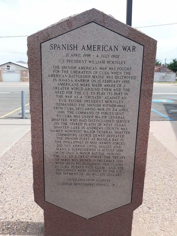
American Civil War
12 April 1861 - 9 April 1865
U.S. President Abraham Lincoln
The War Between the States began when 11 Southern states demanding stronger state rights seceded and formed the Confederate States of America led by . . . — — Map (db m164164) HM WM
C.E. Ogden No. 1, producing 200 barrels a day from San Andres lime formation was brought in, Dec. 1929, by Deep Rock Oil Co.--The Andrews County discovery well and first of 730 wells in Fuhrman-Masco oil field.
Bought, Feb. 1932, by . . . — — Map (db m61380) HM
Andrews County Veterans Memorial was dedicated on the 11th hour of the 11th day of the 11th month of 2006.
All veterans that are living or deceased that served in the military will be eligible. The veteran must be honorably discharged and born, . . . — — Map (db m110153) WM
On May 25, 1965, from one of 7,400 producing oil wells in the county's 196 fields, came the Billionth Barrel of Andrews County crude oil.
In the 35 years and 5 months since oil flowed from the county's discovery well, C.E. Ogden No. 1, in Dec. . . . — — Map (db m61377) HM
In recognition of loyal and unselfish service to the community of Andrews over a period of 47 years.
This building will henceforth be known as the C.E. Carruth Bi-Centennial Building
As a key member of the American Revolution Bi-centennial . . . — — Map (db m164031) HM WM
Descendant of a Virginian who fought in the American Revolution. Came to Texas at 17 for health. Served (1898-1899) in Spanish-American War, Co. K, 1st Texas Inf. Vol. Regt. Later took up ranching in Andrews County. Married Jessie Whitten; had 4 . . . — — Map (db m61373) HM
One of last frontiers of Texas. Anglo settlement here lagged 60 years behind rest of state due to Indians and scarcity of water.
In 1886 O.B. Holt became first man to file for county land. First settlers included the Cowden brothers and . . . — — Map (db m290341) HM
"We will not waiver, we will not tire we will
not falter and we will not fail. Peace and freedom
will prevail. George W. Bush
Persian Gulf War
2 August 1990 - 11 April 1991
U.S. President George H. Bush
The occupation of Kuwait . . . — — Map (db m164078) HM WM
Named for old town of Florey, established as a post office 7 miles to the northeast in 1909, prior to the organization of Andrews County, June 1910.
In heart of the Means Oil Field, opened 1930, this park is at site of a 1934-1958 camp of . . . — — Map (db m61421) HM
In 1941 the Fullerton Oil Company of California struck oil near this site, and by 1945 more than 100 drilling rigs were in operation. The discovery brought great numbers of workers into the area, resulting in the establishment of the town of . . . — — Map (db m61418) HM
Only building remaining in old Shafter Lake, first settlement in Andrews County and at one time its largest town. Built 1908. Concrete blocks, hand pressed from sand of Shafter Lake, are the original frame.
Recorded Texas Historic . . . — — Map (db m290382) HM
"Events have brought our
American democracy to
new influence and new
responsibilities. They will
test our courage, our devotion to duty, and our
concept of liberty to that end. We will devote our
strength, our resources, and our firmness . . . — — Map (db m164053) HM WM
Organized in 1907 by circuit preacher F.T . Pollard and seven charter members. The group held services in local school until 1912, when a one-room church was built, financed by donations of members, including a generous gift from rancher J.S. Means. . . . — — Map (db m61379) HM
Chartered Jan. 16, 1916, by Midland Farms Co., which was owned by David Fasken of Toronto, Canada. The 65 miles of road were completed from Midland to Seminole in 1918. Operated with an engine borrowed from Texas and Pacific Railway until 1920, when . . . — — Map (db m110192) HM
Founded when Andrews County was organized, in 1910, on land owned by Robert Madison Means (b. 1878). With his father, J.S. Means, "Bob" Means began homesteading here in 1899 and organized an abstract company in 1909. When Andrews battled Shafter . . . — — Map (db m290340) HM
First town in yet-unorganized Andrews County. Platted 1908.
Named for lake charted in 1875 survey of Col. Wm. R. Shafter, whose maps and victories over powerful Indians opened the Permian Basin to settlement.
Water trough built by John . . . — — Map (db m61420) HM
In 1875, Col. Wm. R. Shafter and a company of soldiers traveled from Fort Concho (where San Angelo is today) to Monument Springs, N. Mex., charting the arid plains, mapping all the vital watering places.
This marker is in the only town of . . . — — Map (db m61376) HM
Built in 1900, this is one of the
oldest houses in Andrews County.
S. H. Purcell, his wife, and two
relatives each filed on a section
of public land, building this home
where section-corners met, so
that each individual could fulfill
the . . . — — Map (db m164030) HM
Andrews County produced it’s 2nd billionth barrel of crude oil August 21, 1981. Sixteen years and 96 days after its first billionth barrel came from beneath the county’s 1500 square miles.
In producing two billion barrels in 52 years, Andrews . . . — — Map (db m61378) HM
"Let every nation know,
whether it wishes us well
or ill, that we shall pay
any price bear any burden,
meet any hardship support
any friend to assure the
survival and success
of freedom."
John F. Kennedy
Vietnam War
5 August . . . — — Map (db m164076) HM WM
A nation which does not
remember what it was
yesterday does not know
what it is today nor what
it is trying to do. We are
trying to do a futile thing.
If we do not know where we
came from or what we have
been about.
T. Woodrow Wilson
. . . — — Map (db m164034) HM WM
"We must be the great
arsenal of democracy, it is the strength of men and women who value their
freedom more highly than they value their live. We have the men - the
skill the wealth - and
above all the will...
Franklin D. Roosevelt
World . . . — — Map (db m164074) HM WM
One of the first schools in Andrews County, opened in 1907 near the north edge of Whalen Lake, on land donated by Mrs. M. B. Dillard. The one-room school, built by Joe and Jake Mathis, with materials purchased by Will Gates, served the children of . . . — — Map (db m290387) HM
Cowboys and settlers fought here in early days for the right to claim lands placed in the public domain in 1902 by Texas courts. To keep land they were using, ranchers sent their men wearing blue ribbon armbands to file claims at the office of the . . . — — Map (db m294556) HM
Built of hand-hewn native stone from Gail Mountain, this jail was planned for maximum security. Diebold Safe and Lock Company was awarded the $4,500 contract in 1896. Behind the two-foot-thick outside walls, the cell walls and floor are of 1/3 inch . . . — — Map (db m307902) HM
Built of hand-hewn native stone from Gail Mountain, this jail planned for maximum security. Is one of the oldest jails in use in West Texas. Diebold Safe and Lock Co. was awarded the $4,500 contract in 1896.
Behind two-foot thick outside . . . — — Map (db m307914) HM
David Dorward arrived in Borden County in 1892. He was born December 15, 1872, in Burleson County, TX, to David and Anna Atkinson Dorward. In 1893 David began working as a wagon cook for the Square and Compass Ranch; a year later he began work for . . . — — Map (db m294555) HM
In 1876 the Texas State Legislature named
one of the newly formed counties in the
northwest part of the state in honor of
Gail Borden. Born in Norwich, New York,
Borden lived in Kentucky, Indiana and
Mississippi. While living in Texas, Borden . . . — — Map (db m291625) HM
Borden County, created in 1876, was organized in 1891, the same year the town of Gail was established as county seat. The next year, J.I. and L.E. Wilborn gave land for the courthouse sqaure and three churches, and dedicated Block 18 of the townsite . . . — — Map (db m290389) HM
Shown on maps as Mucha Que, Mucha Kowa, Muchakooga, de Cordova, or Signal Hill, this peak rises to an elevation of 2862 feet. Its name is of Native American origin. About 1872, it was the site of a village where Apaches and Comanches traded with . . . — — Map (db m127256) HM
About 3,000 ft. elevation. Since 17th century, a landmark in travel from Texas points to Mexico and California. According to tradition, named by Spaniards for resemblance to ancient castles. Has associations with stories of lost trains of gold and . . . — — Map (db m203144) HM
Since 1839 Texas has set aside her public lands to finance education. The University of Texas at Austin acquired the land at this site in 1883, after the first owner, a railroad company, returned it to the state as worthless. For years McElroy Ranch . . . — — Map (db m85571) HM
Formed from Tom Green County Created February 26, 1887 Organized September 3, 1927. Named in honor of William Carey Crane 1816-1885. A Baptist minister President of Baylor University 1863-1885 Crane, The County Seat. — — Map (db m85569) HM
On Sep. 30, 1947, the Crane Board of Trustees proposed $1,050,000 to build a new high school campus for the growing community. The board and Supt. L.L. Martin hired architect Sylvan Blum Haynes, noted for designing several other schools and . . . — — Map (db m194542) HM
A natural salt deposit, known and used for the past 300 years. On land grant from Mexico to Juan Cordova; name, misread on maps, is now unique to lake.
Apaches were encountered here by explorers in 1683. From days of early settlers, Mexicans . . . — — Map (db m118270) HM
Noted church leader, educator. A Virginian. Received B. A. and M. A., George Washington University. Taught in Georgia, 1837-39; was ordained Baptist minister, 1838. Was pastor of various leading churches; president of 2 church colleges in . . . — — Map (db m118268) HM
One of the most important sites in the old west. Named for skulls pointing toward crossing. Only ford for many miles where animals could enter, drink and leave Pecos River safely. Elsewhere deep banks would trap them. Ford mapped 1849 by Capt. R. B. . . . — — Map (db m68928) HM
As it winds its way across Texas, the Pecos River can often be swift and dangerous. Historically, frequent flooding made even the best crossings unusable. In May 1684, Spanish explorer Juan Domínguez de Mendoza and his expedition team camped at a . . . — — Map (db m150323) HM
O. W. Parker (1876-1962) moved to Crockett County in 1902 and worked for local ranchers until he eventually established his own ranch. Parker had this house built for his family after the 1926 Yates oil field discovery brought prosperity to the . . . — — Map (db m150324) HM
Built 1902. Second courthouse for county. American Gothic architecture, planned by Oscar Ruffini, San Angelo. Material is fine stone quarried nearby on Meyer and Couch properties. Cost $30,000.
Early day community social center. Used for cowboy . . . — — Map (db m116313) HM
Built 1892, about a year after county's organization; contractor was Z.D. Gafford of San Angelo. Building stone was quarried to north of structure, on Meyers property. Tower may have been designed for hangings, but no gallows were ever installed. . . . — — Map (db m116730) HM
In 1923 World Oil Co., owned by Chester R. Bunker, Ft. Worth publisher and printer, began drilling on the L. P. Powell Ranch. Work progressed slowly, depending on the availability of money, under the direction of superintendent Mickey Green and the . . . — — Map (db m117985) HM
(Inscription on front of monument)
.. Be sure you are right - then go ahead ..
(Inscription on rear of monument)
David Crockett was born in Tennessee on August 17, 1786
Participated in the Creek Indian Campaign 1813-1814 . . . — — Map (db m116599) HM
The first platted town in Crockett County, Emerald was founded in 1889 by Fort Worth & Rio Grande Railway Immigration Agent T. W. Wilkinson. It was to be an agricultural shipping point on a planned extension of the F.W. & R.G. Publicized from Maine . . . — — Map (db m117502) HM
A native of Illinois, E. M. Powell was a surveyor and railroad engineer in Kentucky before moving to Texas in 1874. He worked as a surveyor during the railroad construction boom in Texas in the 1870s, taking parcels of land in payment for his . . . — — Map (db m143982) HM
Site 33 miles west on U.S. 290. Upon U.S. surrender Texas forts start of Civil War. Made part Confederate far western frontier line. Occupied by 2nd Texas Cavalry on supply line to and from Arizona-New Mexico. Campaign 1861-62, intended to make . . . — — Map (db m7284) HM
A Confederate veteran. Captain, Co. B. 2nd Regiment, Arkansas Cavalry, Civil War. Born in Mississippi. Came to Texas, 1877. Served as county clerk after moving here, 1888.
Married Elizabeth A. Royal. One of his 5 children was U.S. Congressman . . . — — Map (db m126676) HM
First station after leaving Ozona on the San Angelo-Ozona mail line. Here, at the 20-mile point of an 86-mile run, fresh horses awaited. The stand, built in 1902, served one of Texas' last commercial stage lines.
Ten horses were kept here, as at . . . — — Map (db m116312) HM
A Confederate veteran.
Born in Lamar County. In Civil War, was in Co. G, Col. R.T.P. Allen's Texas Infantry, and was discharged in 1865.
On September 5, 1871, married Miss Matilda Peacock, in Lampasas County. They had 2 sons. Moved to . . . — — Map (db m126679) HM
Although Indians, Spaniards, wagon trains, and military expeditions crossed through this area earlier, the first permanent settlers in present-day Crockett County were native Texans Laura (McNutt) (1862-1941) and William Peery Hoover (1854-1922), . . . — — Map (db m126680) HM
Built about 1893. From its early days, boarded teachers, visiting athletic teams and business callers in city.
Noted guests of 1919-1921 were geologists and lease men seeking to develop the now-significant oil fields of Crockett . . . — — Map (db m116349) HM
The first permanent school building in Ozona; constructed of native limestone in 1910-1912, when Ozona was only 21 years old. The heating and ventilating system, never before used in the state when installed here, is still in operation daily. . . . — — Map (db m116729) HM
Constructed 1905 for county's first financial institution.
Organized by cattle and sheep ranchers and the town's doctor.
During construction of native stone building, banking was done next door in store of L. B. Cox, vice-president. J. W. . . . — — Map (db m116315) HM
By the 1920s many ranchers in Crockett County had fenced their land, preventing their neighbors from driving sheep and cattle to the railroad shipping point in Barnhart (23 miles north of here). A solution to the problem was offered by the . . . — — Map (db m116311) HM
Focus for civic life in early Ozona. City founder E. M. Powell provided the water well equipped with 18-foot windmill, a water trough, and a small cypress tank.
At first meeting of Crockett County Commissioners Court, July 22, 1891, under a . . . — — Map (db m116594) HM
This site was selected for the Crockett County seat in 1891 because of a producing water well (200' northwest). Joe Moss, who drilled for water throughout the area, dug the well for E. M. Powell (1847-1925), railroad surveyor, financier, and land . . . — — Map (db m116593) HM
U.S. Army veteran of Civil War, discharged after loss of arm, siege of Vicksburg.
Born in Pennsylvania. Came to Texas after war. Was a farmer-teacher-postmaster.
Wives: (1) Melinde Beal; (2) Zilla Parker. Had 4 children. Lived in Ozona . . . — — Map (db m117983) HM
A Confederate veteran, of 18th La. Cav. Bn., Civil War.
Born in Louisiana. Came to Texas in 1872; to Ozona, 1891. Built city's first school, first courthouse, Baptist church, other structures.
Married Alice Crimm, March 1, 1876. Had three . . . — — Map (db m126678) HM
Flagstone ruins nearby mark site of early 1900s stage stand, first stop on passenger and mail line connecting Ozona with Southern Pacific railhead at Comstock — 80 miles distant.
When stage pulled in about 8:30 A.M. (having left Ozona at . . . — — Map (db m79331) HM
Although the early history of this structure is unrecorded, it is known that the house originally was built in the townsite of Emerald (9 miles east). Established in 1889 as Crockett County's first settlement, Emerald was the colonization project of . . . — — Map (db m117507) HM
In 1892 Claude B. Hudspeth (1877-1941) began publication of a weekly newspaper called the "Ozona Kicker." Following his three-year ownership, Hudspeth entered politics, serving first in the Texas Legislature and later as representative from the . . . — — Map (db m300816) HM
In 1893, T.L. Hammonds moved a 3-room frame house from the nearby town of Emerald to this site. In 1894, Phillip Perner (1860-1905), a local merchant, purchased and enlarged the structure. Following Perner's death, his wife, Mary Ross . . . — — Map (db m127877) HM
Born in Maryland. Fought in Civil War as a Virginian in the Confederate Army, although he had brothers in the U.S. Army. He came to Texas soon after the war. Married Henrietta Norrid in Fredericksburg, August 23, 1870. Lived in Ozona in old age. . . . — — Map (db m117977) HM
A versatile sculptor of people, animals, birds and religious symbols, McVey attended the University of Texas and taught art there and at Rice University. He played football at Rice under the legendary coach John Heisman in 1924. McVey studied and . . . — — Map (db m7286) HM
The bakery was a stone and adobe building with a large oven that measured approximately 12 feet wide and 11-feet deep. The fort's baker, also a soldier, was responsible for providing the daily ration of bread for an average of 130 men. In 1860, . . . — — Map (db m202174) HM
On December 26, 1867, the 40 soldiers and officers of Company K, 9th Cavalry, were attacked at Fort Lancaster by an estimated 400 Kickapoo and their allies. The battle began when the teamster leading the horses to water, William Sharpe, was lassoed, . . . — — Map (db m201737) HM
The largest residence at the fort housed the Commanding Officer and his family. They provided hospitality for important travelers to the fort.
"Captain Carpenter invited us to take a bite with him. We availed ourselves of the invitation with . . . — — Map (db m201707) HM
The commissary, along with the quartermaster storehouse, was one of the first stone buildings constructed at Fort Lancaster. It supplied soldiers with government-issued provisions, uniforms, and bedding. Provisions were bought from private . . . — — Map (db m201725) HM
These barracks closely resembled those of Company K, except that they were vacated two years earlier. In 1859, the Army transferred Company H to a newly established post along the Lower San Antonio-El Paso Road that would eventually become Fort . . . — — Map (db m202171) HM
Soldiers originally lived in quickly built structures made of locally available materials or prefabricated Turnley Cottages. Neither type of building was comfortable or effective at shielding the occupants from the weather. The permanent stone and . . . — — Map (db m201729) HM
This small cemetery is one of two known at Fort Lancaster. The fort likely had an official post military cemetery but its location is not known and the burials there would have been relocated to another fort when Fort Lancaster was decommissioned. . . . — — Map (db m201721) HM
The post hospital was an adobe structure with a dispensary, storeroom, and a small three-bed ward. There was also an attached kitchen building. The hospital staff included a civilian surgeon, a hospital steward, a nurse, a matron, and a dedicated . . . — — Map (db m201719) HM
First known to civilized men in the 18th century, when, according to legend, Franciscan Padre Alvarez prayed for water to ease his thirst, put down his staff, and saw a spring gush forth from the ground. This landmark of western travel was named for . . . — — Map (db m85005) HM
Each company had its own dedicated kitchen and mess hall where cooks, often soldiers themselves, prepared and served meals for the enlisted soldiers. Meals revolved around limited food supplies-mostly beef, bread, and canned goods but a garden . . . — — Map (db m202172) HM
In 1860, there were four laundresses employed for Company K at Fort Lancaster. Each had her own living quarters made of adobe, complete with an open hearth and stone chimney. Typically, laundresses charged each soldier $2.00 per month for washing, . . . — — Map (db m202176) HM
Soldiers burned limestone in the kiln to create quicklime, an ingredient in the mortar, stucco, and whitewash used in the construction of the post buildings. A large amount of wood, which was a scarce resource, was needed to fuel the kiln. They . . . — — Map (db m201723) HM
Each officer's quarters originally consisted of two rooms separated by a double fireplace with a detached kitchen behind. By 1860, the kitchens had been attached and half of the structures had wooden shingle roofs. Both unmarried officers and those . . . — — Map (db m201716) HM
Route of march and troop supply on Texas frontier. Followed in part pre-Columbian Indian trails and "Old Chihuahua Trail" that ran from San Antonio to El Paso and Mexico. In 1840s this was extended to Gulf Coast Port of Indianola where imported . . . — — Map (db m126683) HM
The Quartermaster provided general supplies and rations for soldiers. He also oversaw the bakery, blacksmith's shop, and carpenter's shop. He also supervised the corral, granary and hay yard for the fort's horses and mules.
Caption . . . — — Map (db m202178) HM
Established in 1855 by the United States Government as a protection to travelers and mail on the overland route from San Antonio to San Diego. Abandoned in 1861. Reoccupied in 1868 for a short time. — — Map (db m126687) HM
Owned and operated by a civilian merchant, the sutler's store was the only two-story building at Fort Lancaster. The sutler sold liquor, tobacco, and supplies to travelers as well as soldiers. This building also served as a stage relay station for . . . — — Map (db m201722) HM
The Chihuahua Trail was opened by segments, but was not called by this name until the 19th century. A small part of the route, along the nearby Pecos River, was followed by the Spaniard Gaspar Castano de Sosa in 1590, during an expedition to New . . . — — Map (db m126681) HM
Spanning 82 acres in the Pecos River valley, Fort Lancaster State Historic Site commemorates the vestiges of a post established in 1855 to protect the military route between San Antonio and El Paso. Visitors wander through ruins imagining the . . . — — Map (db m308405) HM
Created February 1, 1858
Recreated August 21, 1876
from Bexar Territory
Organized February 13, 1905
Named in honor of
Nicholas Mosby Dawson
1808-1842
Who fought at the Battle of
San Jacinto and fell at
Dawson's . . . — — Map (db m110193) HM
By the 1920s, Dawson County’s rapidly expanding cotton economy was outgrowing its labor supply. Like other areas of the country, Lamesa began to rely on migrant laborers from Mexico to increase the available pool of seasonal workers. One effort to . . . — — Map (db m110195) HM
First burial ground in Dawson County. Given by Frank Conner. First grave, Nov. 10, 1904, for Mrs. G. W. Pate, who had suggested cemetery. Plot closed 1907, except for 1949 burial of W. R. Kelly beside his wife. The 22 others here: Montie Andrews, . . . — — Map (db m110196) HM
W.C. Bishop of Chicago, Ill., and wealthy lumberman George N. Fletcher established the Oto (later Bar To) ranch about 1887 on Fletcher's extensive landholdings in Dawson County. A post office was opened at the ranch headquarters on May 15,1889, and . . . — — Map (db m110198) HM
Made in era of Mexican rule in Texas for John Beales, who through partnerships, acquired 70,000,000 acres of land and gained the title of “Texas' largest land king”.
Alexander LeGrande's survey covered about 2,000 miles in west . . . — — Map (db m86336) HM
Since there were no public schools in rural Ector County, R.W. Smith and Teague Baker in 1906 erected an 8'x10' school building in Baker's pasture. They hired a teacher at $15 a month, plus room and board, which each furnished on alternate months. . . . — — Map (db m86335) HM
Opened as oil field June 14, 1935, with flow of 1140 bbls. of crude oil daily from discovery well. Within a month, shacks and tents housed 350 people. Harry L. Tucker in May 1937 platted town of Ector City. Name later changed to honor C. A. . . . — — Map (db m202016) HM
Post Office established 1944 in drug store of C. J. Brown, Jr., who named it in response to U.S. Post Office Dept. request for title suitable to locality. Residents have since made history by planting shade trees. Now production hub of Permian . . . — — Map (db m72750) HM
This house was built circa 1947 at 916 E. 17th St., Northeast of downtown Odessa. It was the home of 3 noted people before America knew their names. Two were elected Chief Executive of the U.S. and the third became First Lady, wife of the 41st and . . . — — Map (db m296735) HM
A barbed, bristling flying wedge—the Comanches—rode into 18th century Texas, driving the Wichitas and Caddoes east, the Apaches west, becoming lords of the south plains. Harassed the Spanish and Anglo-Americans along frontier from Corpus . . . — — Map (db m73339) HM
It may have literally taken two thousand years to complete construction of the original Stonehenge; however, this replica was erected in about six weeks. These stones weigh 15 to 20 tons each and were moved from the quarry two at a time on tractor . . . — — Map (db m269583) HM
Worked as roughneck, oilfield salesman before founding Rodman Supply of Odessa, 1935. Opened stores throughout Permian Basin. Legendary wildcatter completed hundreds of producing wells during 40-year career. With partners founded refineries, gas . . . — — Map (db m86321) HM
Earl George Rodman, Sr. (1896–1976) and William Douglas Noel (1914–1987) brought the petrochemical industry to Odessa. Rodman and Noel came together in 1946 to form the Odessa Natural Gasoline Company and enjoyed major success as their . . . — — Map (db m155289) HM
Created February 26, 1887
from Tom Green County
Organized January 15, 1891
Named in honor of
Matthew Duncan Ector
1822-1879
Member of the Texas Legislature
A Confederate Officer and
outstanding jurist
Odessa, The County . . . — — Map (db m86704) HM
463 entries matched your criteria. The first 100 are listed above. Next 100 ⊳