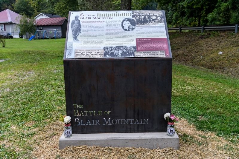
In August 1921, an estimated 15,000 coal miners and their allies participated in the largest armed labor uprising in US history.
But this was just the finale of a drama begun a decade earlier. In 1912, on Paint Creek and Cabin Creek, . . . — — Map (db m206809) HM
Designed by architect H. Russ Warne in Neo-Classical Revival style. Opened in 1921; replaced first brick courthouse. Features Indiana limestone, Beaux-Arts Classicism in small open-domed belvedere, tetra-style 2-story porticos with Corinthian . . . — — Map (db m138450) HM
Little Coal River
The Litle Coal River is formed by Pond Fork and Spruce Laurel at Madison, WV. The river fows north by Danville, WV, Julian, WV and loops around to McCorkle, WY. The Little Coal River joins the Big Coal River at Alum Creek, . . . — — Map (db m272230) HM
County seat, incorporated in 1906 and
named for William Madison Peyton, a leader
in movement for the formation of Boone
County, 1847. Peyton, pioneer in the development of the Coal River Valley, locked and
dammed Coal River in the 1840’s and . . . — — Map (db m138449) HM
Born in 1810 in present-day Boone County, Methodist minister Robert Hager was a delegate to the state’s first constitutional convention in Wheeling. 1861-1863. He supported including a provision for gradual emancipation in WV and also a free school . . . — — Map (db m138447) HM
Founded in 1917 by T. E. B. Siler and
M. Slush; named for newspaper editor
Frank Nellis. Purchased by ARMCO
in 1920. Noted as model coal mining
town. Homes were built by Minter of
Huntington. ARMCO Assoc. Building, in
center of town, housed . . . — — Map (db m137428) HM
William C. Barker • Julias Domokos • Lester Gunnoe • William H. Gunnoe • O’Dell Linville • Onal O. Miller • John Setliff • Steve Turkovitch • Lawrence J. Vincent • John Williams • William O. Workman
— • —
On Saturday, November 6, . . . — — Map (db m137442) HM
John Peter Salley (Salling) and companions discovered
coal near here in 1742 on their exploring trip from the Greenbrier River. They followed the Coal River to its junction with The Great Kanawha River at St. Albans. — — Map (db m137510) HM
Under rock overhang across highway was an Indian camp site. Here were found several burials. One occupation, Fort Ancient, dates from A.D. 1400; another, Buck Garden, from A.D. 1000. Pottery and other artifacts were found. — — Map (db m252534) HM
To the north, birthplace and home
of John Edward Kenna, U. S. Senator
and prominent figure in the early
life of this State. His statue
stands among the notables of other
States in the Hall of Columns in
the national capitol in Washington. — — Map (db m137454) HM
Named for William Madison Peyton,
father of navigation on Coal River,
who promoted and actively engaged in
coal mining. As chief engineer for the
Coal River Navigation Company, he
locked and dammed Coal River in the
1840’s and made it . . . — — Map (db m137511) HM
(At base of flagpole on the right)
In memory of
West Virginia Armed Services
who have given the ultimate
sacrifice during the
War on Terror
In remembrance of
the victims
September 11, . . . — — Map (db m272217) WM
War comes to the Big Coal River - Emboldened by a resounding victory against Confederates at Boone Court House (Madison), Union General Cox ordered Federal troops back into the Coal River Valley. This time the target was the Big Coal River. . . . — — Map (db m285300) HM
The Coal River is a tributary of the Kanawha River in southern West Virginia. It is formed near the community of Alum Creek by the confluence of the Big and Little Coal Rivers. The Coal River flows generally northward through western Kanawha County, . . . — — Map (db m137542) HM
Completed as Sherman District Jr.
High in 1931. Whitesville School
replaced a building that burned
down in 1929. Wysong and Bengston
designed the rare example of high-style Art Deco architecture in the
southern West Virginia coalfields.
Since . . . — — Map (db m137755) HM
Following the footprint.
Every mine explosion leaves behind a footprint that offers clues to investigators
as to where the blast originated and how the force traveled from the ignition
point. The footprint left behind in the Upper Big Branch . . . — — Map (db m137546) HM
Monday, April 5
3:01 p.m. Explosion erupts
through the mine, blasting
debris out of the portals and
lasting for several minutes.
The carbon monoxide
monitoring system alarms
and mine fan records show
a major disruption to . . . — — Map (db m137549) HM
This memorial is dedicated to twenty-nine miners who lost their lives in an explosion at the Upper Big Branch Coal Mine on April 5th, 2010 and to all miners who have suffered injury, illness or death as a result of working in the coal industry. This . . . — — Map (db m137751) HM
1907 Fairmont Coal Company
Monongah No. 6 and No. 8 Mines
Monongah, West Virginia
At 10:20 a.m., December 6, 1907, explosions occurred at the No. 6 and No. 8 mines at Monongah, West Virginia. The explosions ripped through the mines, . . . — — Map (db m285301) HM
Settled in 1777 by “Elder” John Alderson, the frontier missionary. He organized the first Baptist church in the Greenbrier Valley. In 1763, the Muddy Creek settlements were destroyed by Shawnee Indians under Cornstalk. — — Map (db m76515) HM
Alderson Academy opened September 18, 1901, a coeducational secondary school founded mainly through the efforts of Miss Emma C. Alderson. Closely associated with Greenbrier Baptist Church, after 1910 control was assumed by W. Va. Baptist . . . — — Map (db m76519) HM
"French" raised here 1890-1894 adopted from traveling circus. Roamed free until frightening salesman who jumped in river. Lions must now be leashed. — — Map (db m210993) HM
Originally called the "Joint County Bridge” when built in 1914, this bridge replaced an iron bridge built in 1882 at the same location. The original stone piers of the iron bridge are encased within the present concrete piers. In 1977, the West . . . — — Map (db m160052) HM
Buried on hill above eighty-nine unknown Confederate soldiers
from Georgia who perished in camp here during winter
1862 1863 — — Map (db m160845) HM WM
Greenbrier County. Formed, 1778, from Botetourt and Montgomery. Named for the river which drains it. This county had many pioneer forts and saw many bloody Indian battles. Here are the world-famed White Sulphur and other mineral springs. . . . — — Map (db m76636) HM
The nearby highway is part of route traversing W.Va. from Lewisburg to Point Pleasant memorialized by the state to commemorate the march of the American Colonial army of 1,200 men led by Andrew & Charles Lewis. After a month's march this army . . . — — Map (db m238227) HM
Fort Donnally. Built by Andrew Donnally a few miles north about 1771. Attack on this fort by 200 Indians in 1778 was second most important frontier engagement in the State. The fort was relieved by force under Col. John Stuart.
Border . . . — — Map (db m238233) HM
Fort Donnally. Built by Andrew Donnally a few miles north about 1771. Attack on this fort by 200 Indians in 1778 was second most important frontier engagement in the State. The fort was relieved by force under Colonel John Stuart.
Border . . . — — Map (db m252082) HM
The resistant Droop Sandstone
in this quarry is the “Maxon Sand”
of the driller, and shows southerly
dipping cross laminations. This
Sand yields oil and natural gas
at depths of over 1000 feet in
southern and central West Virginia. — — Map (db m140575) HM
Unknown Soldiers. Six miles west, a Confederate regt. from Georgia camped at Blue Sulphur Springs in improvised shelters, during the winter of 1863. Many died of exposure and disease, and are buried on the hill 400 yards north of the spring. . . . — — Map (db m100004) HM WM
The massive pebbly sandstone exposed in the cliff is the Berea of the driller and geologist. This sand produces large quantities of oil and natural gas in West Virginia. — — Map (db m255186)
Caldwell on Scribner's Magazine Cover
Caldwell, located two and a half miles east of Lewisburg, gets its name from James R. Caldwell, whose family owned and occupied the stately brick house, "Elmhurst," on the bank of the Greenbrier River. . . . — — Map (db m238237) HM
Although saltpeter (potassium nitrate or nitre), an essential element in the manufacture of gunpowder, had been mined at Organ Cave since the eighteenth century, the need for the mineral increased dramatically during the Civil War. Several . . . — — Map (db m59342) HM
Wherever you are, you are in a watershed. It is the land area and water that drains into a common stream, lake and river. This includes water flowing on the surface and water underground.
As above.. The people of the Greenbrier River . . . — — Map (db m298449) HM
Leslee McCarty (1948-2022) lived life as a protector of water and a lover of animals large and small. Her tireless dedication helped spawn the Greenbrier River Watershed Association and this Trail, two of her many environmental causes. We invite . . . — — Map (db m298452) HM
The Rev. Isaac Kauffman, a Mennonite minister, and Esther Kauffman came to Greenbrier County in 1788. The Coffman Cemetery, established in 1805 upon Esther's death, is near Isaac and Esther's home place at the end of Coffman Cemetery Road. At the . . . — — Map (db m243858) HM
In November 1863, David S. Creigh, a well-known southern sympathizer, found a Union soldier ransacking his home and harassing his wife. In the ensuing fight, Creigh killed the man, then hid the body. Later arrested, Creigh was tried and, on June 10, . . . — — Map (db m110028) HM
Col. John Stuart, who came here in 1769 with McClanahan, the Renicks, and companions, bought out earlier claims of William Hamilton. "The Cliffs" to the east offer one of the celebrated beauty spots of Greenbrier Valley. — — Map (db m50389) HM
Brief History:
Blue Sulphur Springs Pavilion was constructed ca. 1838 as a centerpiece of a health resort which rivaled the famous Greenbrier in terms of its comforts and refinement. Crisp, clear water bubbled up from the natural spring in . . . — — Map (db m159704) HM
Site of Blue Sulphur Springs Resort 1835-1858. Water from spring said to have healing powers. Known as early settler campground & Buffalo Lick. — — Map (db m159703) HM
Early in May 1862, Union Col. George Crook, 36th Ohio Infantry, led his command from Charleston to raid the Virginia Central Railroad near Covington. After tearing up track and burning a bridge, he and his men arrived in Lewisburg on May 17, with . . . — — Map (db m59344) HM
The 3rd Provisional Ohio Brigade's camp was on this hill. The Confederate artillery opened the battle at 5 a.m. with a bombardment of the Federal camp. — — Map (db m21739) HM
The 36th Ohio assembled near the courthouse & advanced up Randolph & Chestnut Streets to attack the right of the Confederate line where they routed the 22nd Virginia. — — Map (db m243856) HM
Confederate dead were laid out in the Old Stone Church & then buried in the churchyard without ceremony. After the war their remains were moved to the present Confederate Cemetery. — — Map (db m75375) HM
After the battle the Greenbrier County Library and other public buildings were used as temporary hospitals. Civil war graffiti can still be seen on one library wall. — — Map (db m252080) HM WM
On the evening of May 1, 1863, Lt. Col. George Edgar moved to block Union troops marching to Lewisburg. Establishing lines at Tuckwiller's hill, Edgar caught the enemy by surprise under cover of darkness early on the 2nd, and reportedly feigned . . . — — Map (db m116378) HM
The Greenbrier Limestone in the quarry represent the "Big Lime" of the driller. Fish-egg like oölitic zones in the "Big Lime" produce oil and natural gas in West Virginia. — — Map (db m97799) HM
Carnegie Hall, built in 1902, by Lewisburg Female Institute and citizens of the Greenbrier Valley area. It is one of only three Halls in the U.S. named for Andrew Carnegie who gave $26,750. Local citizens gave $10,000 to complete the Hall. . . . — — Map (db m61464) HM
This Center Green lies at the crossroads of two major Native American Trails, Seneca Trail and Midland Trail, and served as one of the earliest building sites in the City.
The limestone risers forming the staircase served as the foundation for . . . — — Map (db m271803) HM
Col. John Stuart. Col. John Stuart built Stuart Manor, 1789, near Fort Stuart. He was a military and civil leader and led a company in the Battle of Point Pleasant. As clerk of Greenbrier County, he left many historic records. His first . . . — — Map (db m50394) HM
Here at Fort Union, built in 1770, a frontier army of 1100 men assembled in 1774 under command of Gen. Andrew Lewis. On Sept. 12, the army began a march through 160 miles of trackless wilderness to the mouth of the Kanawha River and defeated . . . — — Map (db m75198) HM
Remains of 95 unknown Confederate soldiers who fought in the Battle of Lewisburg on 23 May 1862 lie in this cross shaped common grave. It has an upright 80 feet long and cross arms of 40 feet. After the Civil War the unclaimed dead were removed from . . . — — Map (db m21740) HM
In a cross-shaped mass grave at the end of this path lie the remains of 95 unknown Confederate soldiers who fought in the Battle of Lewisburg on 23 May 1862.
This path is the original trace of the James River-Kanawha Turnpike which carried . . . — — Map (db m140681) HM
Confederate Cemetery. On the hill, 400 yards west, in a common grave shaped like a cross, lie unclaimed bodies of ninety-five Confederate soldiers, casualties of the area, including those of the Battle of Droop Mountain and the Battle of . . . — — Map (db m21748) HM
The wartime division of WV lasted into the years just after the Civil War. To protect the new state and political party power, leaders used test oaths to keep ex-Confederates from voting and to limit their role in government. Joseph "Old Scratch" . . . — — Map (db m176398) HM
Enslaved African, noted for bravery in defense of Fort Donnally during Shawnee attack May 29, 1778. He was granted his freedom by James Rodgers in 1801. Land granted to other defenders; his 1795 pension petition, supported locally, denied. . . . — — Map (db m21737) HM
Before the mid-1800s, a dooryard garden was desirable if not essential to every household. Our garden is an interpretation of the plants that would have been grown circa 1840 here in the Greenbrier Valley.
Doctoring was unsophisticated and . . . — — Map (db m298521) HM
Greenbrier College. Site of the campus of Greenbrier College. In 1812, the Rev. John McElhenney established a co-ed school, the Lewisburg Academy. In 1875, the academy transferred all properties to the Lewisburg Female Institute. Briefly . . . — — Map (db m140673) HM
The Lewisburg Academy, a co-ed school, was chartered in 1812. In 1875, the board of trustees decided to form the Lewisburg Female Institute to educate young women. the young men's branch would eventually become the Greenbrier Military School. The . . . — — Map (db m298522) HM
Constructed 1837 by John W. Dunn, well known local brickmason. All brick was made locally. Building has been in constant use since its completion and is unchanged except for wings added in 1937 and 1963. — — Map (db m50471) HM
Dedicated to the
Greenbrier Countians
who were killed in the
service of our country,
to the former
Prisoners of War,
and to those who are still
Missing in Action
World War I • World War II
Korean War • Vietnam War
[Honor . . . — — Map (db m75365) WM
First established at Lewisburg 1808-09 by Dr. John McElhenney and chartered as an academy in 1812. Used as barracks and hospital during War between the States. Present buildings on north side of town built 1921. — — Map (db m19378) HM
First school was established 1808-09 by Dr. John McElhenney and chartered as an academy in 1812. Used as barracks and hospital during War between the States. The present buildings were erected in 1921. — — Map (db m19382) HM
Stepping stones were large, flat river stones. They were placed far enough apart to allow wheeled traffic to easily pass over. The stones were located at various intersections around Lewisburg before the roads were paved.
Historically, . . . — — Map (db m298455) HM
History of Lewisburg
The land Lewisburg sits on was occupied by various Native American groups including the Shawnee, the Seneca, the Delaware and the Cherokee. European settlers began to colonize the area in the 1750s. Lewisburg was named . . . — — Map (db m298520) HM
For 20 years (1997-2017) Josh Polan and the Riverbend Nursery Team worked "hand in glove" with the Lewisburg Foundation to envision design, develop and maintain the gardens and green spaces of downtown Lewisburg.
75 trees, 14 gardens, . . . — — Map (db m298524) HM
The Lewis Theatre was designed in functional, post deco style by R.L. Whitten, Architect, Charleston, WV and constructed in 1939 for presenting film and "small" vaudeville. This two-story, longitudinally symmetric theatre is built primarily of . . . — — Map (db m298453) HM
The remains of 95 unknown Confederate soldiers from the Battle of Lewisburg, fought May 23, 1862, lie in this cross-shaped common grave. It has a vertical length 80 feet long and a cross arm of 40 feet long, with an overall width of 10 feet. . . . — — Map (db m21742) HM
Side A Site of Fort Savannah, built in 1755. Here at Camp Union Gen. Andrew Lewis mustered troops which participated in the Battle of Point Pleasant 1774. Lewisburg was incorporated in October, 1782, by the Virginia Assembly. Side B . . . — — Map (db m21747) HM
The Battle of Lewisburg was fought on May 23, 1862, between the Southern forces of General Henry A. Heth and the Northern forces of Colonel George Crook, later famous as the captor of Geronimo. The inhabitants of Lewisburg, Virginia, a peaceful town . . . — — Map (db m140701) HM
The Battle of Lewisburg was fought on May 23, 1862, between the Southern forces of General Henry A. Heth and the Northern forces of Colonel George Crook, later famous as the captor of Geronimo. The inhabitants of Lewisburg, Virginia, a peaceful town . . . — — Map (db m203645) HM
Confederate troops under Gen. Henry Heth here, May 23, 1862, were repulsed in attach upon division of Col. Geo. Crook's brigade. The Old Stone Church was used as a hospital. In his retreat, Heth burned bridge over Greenbrier at Caldwell. — — Map (db m19380) HM
Pontiac's War. Massacre of white families of Muddy Creek and of the Clendenins near here by a band of Shawnee Indians led by Chief Cornstalk, in 1763, completed the destruction of the early settlements in the Greenbrier Valley.
Welsh . . . — — Map (db m50395) HM
For sixty two years, the Beloved Pastor of Lewisburg Church. A faithful servant of God and a Pioneer of Presbyterianism in a vast part of Virginia. — — Map (db m75364) HM
In recognition of the foresight of the Honorable Senator Robert C. Byrd whose leadership efforts on behalf of improved health care for West Virginians and enhanced training opportunities for WVSOM students made this facility possible — — Map (db m243853) HM
Born July 28, 1805, Samuel Price served in the Virginia legislature, 1850-1841 Constitutional Convention, and 1861 Richmond Convention. From 1863 to 1865, he was Lt. Governor of Confederate Virginia. As president of West Virginia’s Constitutional . . . — — Map (db m140698) HM
Named in honor of Jehu Lewis Shuck, first American Baptist Missionary to China in 1835 and a member of Big Levels Baptist Church, established in 1796.
Reorganized in 1927.
This building erected in 1938. — — Map (db m140683) HM
January of 1980, eleven residents of Lewisburg founded The Lewisburg Foundation. Since that time this non-profit community membership organization has worked steadily to complete projects which protect and enhance the historic values and natural . . . — — Map (db m140675) HM
"Leave me but a banner to plant upon the mountains of Augusta and I will rally around me the men who will lift our bleeding country from the dust, and set her free."
....Washington . . . — — Map (db m75200) HM
In 1831, the Virginia Assembly recognized the need to increase the government's presence in the area then known as "western Virginia." On April 8th, the assembly passed a law stating that the Supreme Court would have a month-long summer session . . . — — Map (db m298476) HM
Pocahontas County. Formed from Bath, Pendleton and Randolph in 1821. Named for Pocahontas, Indian princess, friend of the Jamestown settlers. Site of Droop Mountain battle, November 6. 1863. The famous Cranberry Glades are in this county. . . . — — Map (db m251879) HM
Memorialization of coal miners from Quinwood and surrounding areas
who took the coal from these mountains and hauled it throughout
this great land. — — Map (db m164949) HM
Nicholas County. Formed in 1818 from Greenbrier, Kanawha and Randolph. Named for Wilson C. Nicholas, governor, Virginia, 1814-1817. In this countý in 1861 sharp engagements were fought at Kessler's Cross Lanes and at Carnifex Ferry. . . . — — Map (db m238104) HM
Meadow River Lumber Company. Established as Raine-Andrew Lumber Co. concern with purchase of 32,000 ac. (1906-08) by John & Tom Raine, namesake of Rainelle, founded 1908. Used logging railroad from woods to mill & Sewell Valley RR (NF&G) to . . . — — Map (db m50391) HM
The Greenbrier Limestone, which crops out here and along U.S. Route 219 between Renick and Salt Sulphur Springs, is the "Big Lime" of the driller. Fish-egg like oolitic zones in the "Big Lime" yield oil and natural gas in West Virginia. — — Map (db m243852) HM
Howard M. "Toddy" Loudin (1898-1990) coached basketball, football and baseball for 41 years, 31 of them at Greenbrier High School in Ronceverte. Loudin coached in Ronceverte from 1935 to 1966, leading the 1962 Greenbrier High School basketball . . . — — Map (db m298525) HM
In this cave, whose beautiful natural formations have long been known, salt petre was manufactured before 1835. When war broke out between the states in 1861, it was a source of powder supply for General Lee's army. — — Map (db m76509) HM
From the French word meaning “Greenbrier”. Thomas Edgar settled in Greenbrier County before 1780. His son built first grist mill on Greenbrier River. Three successive mills were destroyed but the fourth plant operates today. — — Map (db m76513) HM
A post office was established here in 1889 and the village was incorporated in 1945. Named for Dr. Cyrus A. Rupert (1812-1891), a prominent local physician. The first settler here was William McClung (1738-1833) who came in 1766. A soldier in the . . . — — Map (db m50390) HM
Built in 1901, church building was dedicated in memory of the Rev. Sam Black (1813 - 1899). He preached here in the 1880s - 90s. Born in Rupert & licensed in 1840, Black was a Methodist circuit rider almost fifty years. Sam Black Church, a spiritual . . . — — Map (db m55766) HM
Interred in nearby cemetery is Zona Heaster Shue. Her death in 1897 was presumed natural until her spirit appeared to her mother to describe how she was killed by her husband Edward. Autopsy on the exhumed body verified the apparition's account. . . . — — Map (db m50356) HM
On November 26, 1862, 20 members of Company G, 2nd WV Cavalry, led by Maj. William H. Powell and Lt. Jeremiah Davidson, surprised and routed 500 Confederate soldiers of the 14th VA Cavalry at the base of Cold Knob. Union forces captured more than . . . — — Map (db m144217) HM WM
Site of the first organized golf club in United States. It was formed, 1884, on the "Oakhurst estate of owner, Russell W. Montague, a New Englander and Scotchmen" George Grant, Alexander m. and Roderick McLeod and Lionel Torrin. — — Map (db m21752) HM
A two-day encounter, Aug. 26-27, 1863, between Gen. Sam Jones' Confederates and Gen. W. W. Averell's Federals. Action is also known as Howard's Creek, White Sulphur Springs and Rocky Gap. Losses: 350. — — Map (db m76721) HM
449 entries matched your criteria. The first 100 are listed above. Next 100 ⊳