On Westside Street south of West Northside Street, on the left when traveling south.
In 1957, local government officials in Tuskegee, Alabama sought to gerrymander the city's limits in an attempt to diminish the number of black votes in upcoming elections. Alabama state senator Sam Engelhardt sponsored Act 140, which transformed . . . — — Map (db m139876) HM
On West Montgomery Road east of Peyton Road, on the right when traveling west. Reported missing.
Churches within the African American community played an important role during the civil rights movement. They were places beyond control of white power structure, as well as locations where people could express themselves without reprisal. They . . . — — Map (db m139884) HM
On Cedar Street south of Railroad Avenue, on the right when traveling north.
Mount Olive Missionary Baptist Church developed out of the Tuskegee Baptist Church, originally organized in 1842. Although both whites and blacks (slaves) initially worshipped at the same location, the white congregants built a new facility in 1858, . . . — — Map (db m139880) HM
On West Martin Luther King Highway (U.S. 80) west of South Jericho Street, on the right when traveling east.
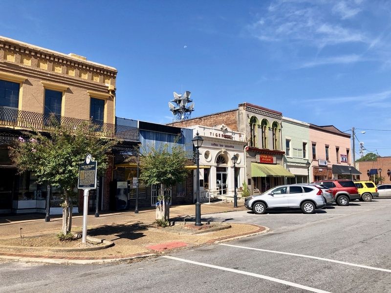
Rosa Louise McCauley Parks (1913 – 2005) was an iconic activist during the mid twentieth century civil rights movement. Born in Tuskegee, Parks later moved with her mother to Pine Level located near Montgomery, Alabama. She was encouraged by . . . — — Map (db m134670) HM
On East Martin Luther King Highway (U.S. 80) east of North Maple Street, on the left when traveling east.
Samuel "Sammy" Leamon Younge, Jr. (1944-1966), a civil rights and voting rights activist, was the first African American university student killed during the civil rights movement. A Tuskegee native, Younge was attending Tuskegee University when . . . — — Map (db m139875) HM
On South Main Street (U.S. 29) at East Price Street, on the right when traveling north on South Main Street.
In August of 1963, the United States District Court M. D. Alabama sided with the plaintiff in Lee v. Macon County Board of Education. This pivotal civil rights case involved the integration of, the all-white Tuskegee High School (located on . . . — — Map (db m139878) HM
On North Elm Street north of West Northside Street, on the left when traveling north. Reported missing.
Following World War II, Tuskegee's black population began to grow, and many sought to register to vote. Perceiving a threat to their political power, white politicians tried to control the black vote through a variety of techniques. These actions . . . — — Map (db m139877) HM
On Franklin Road near Boy Scout Circle, on the left when traveling north.
Amelia Boynton Robinson (1911 2015) was a voting rights activist and civil rights icon. Born on August 18, 1911, in Savannah, Georgia, she received her bachelor's degree in home economics from Tuskegee University in 1927. In 1934, Mrs. Boynton . . . — — Map (db m139890) HM
On Bibb Street, 0.2 miles north of Hudson Street, on the left when traveling north.
Charles Goode Gomillion (1900-1995) was born on April 1, 1900, in Johnston, South Carolina. He joined the faculty at Tuskegee University in 1928, where he served as dean of students and chair of the social sciences department. He was president of . . . — — Map (db m140006) HM
On NW Chambliss Street south of West Montgomery Road, on the left when traveling south.
Jessie Parkhurst Guzman (1898-1996) was born in Savannah, Georgia, educated at Howard University (BA, 1919) and Columbia University (MA, 1924), and worked at Tuskegee University for over forty years. During Guzman's time at Tuskegee University, she . . . — — Map (db m139885) HM
On Moton Drive at Booker T. Washington Boulevard on Moton Drive.
Julius Rosenwald (1862-1932) was a Jewish multimillionaire merchant and one of the founders (1906) of Sears, Roebuck, and Company, then the largest department store in the United States. Rosenwald was a member of the Tuskegee University Board of . . . — — Map (db m134671) HM
On University Avenue east of Booker T Washington Boulevard, on the right when traveling east.
The Tuskegee Institute Advancement League (TIAL) was a student-based organization started in 1963 and reorganized in 1965 during the school integration crises. It originally sought to gain a measure of academic freedom through input with the . . . — — Map (db m139886) HM
On West Montgomery Road at Chambliss Street, on the left when traveling west on West Montgomery Road.
The Tuskegee Civic Association, whose offices were located here, started out of The Men’s Meeting of the 1920s and the Tuskegee Men’s Club of the 1930s. On April 13, 1941, in order to increase its effectiveness and to embrace all segments of the . . . — — Map (db m139923) HM
On Government Street, on the right when traveling south.
Jews have been part of Alabama’s economic, social and political life since 1764. It was not until 1841 that Mobile’s small Jewish community grew large enough to organize “Congregation” Shaarai Shomayim (Gates of Heaven). The community . . . — — Map (db m27083) HM
Max Aronson was born at 713 Center Street, (a house formerly located across the street), on March 21, 1880, to Esther and Harry Aronson, a Jewish dry goods salesman. The Aronson family relocated to Pine Bluff, Arkansas in the 1890's. Aronson’s first . . . — — Map (db m99370) HM
On President Clinton Avenue, on the right when traveling east.
From 1882 to 1887, an ornate two-story space on the second floor of this building served as the social hall for the Concordia Association – an organization established in 1864 to help Jewish immigrant families adapt to their new lives in . . . — — Map (db m78014) HM
Near Point Lobos Avenue west of El Camino del Mar, on the right when traveling east.
Although the arched gateway is long gone, the
two lions still remain. This was the estate of Adolph Sutro—a Jewish-American immigrant, mining engineer and Mayor of San Francisco. After transforming the windswept sand dunes into a Victorian estate . . . — — Map (db m202194) HM
"Set up for yourself roadmarks...the way by which you went. Return, O virgin of Israel" Jeremiah 31:21
Nearly 70 Jewish immigrants were settled in and near Cotopaxi. Facing insurmountable challenges, the ill equipped . . . — — Map (db m134127) HM
The Hebrew Cemetery
The Hebrew Benevolent Association established the Hebrew Cemetery in January,1880, in the Southwest corner of Leadville’s Evergreen Cemetery with the transfer of 101,000 square feet from the Union Veteran’s Association. . . . — — Map (db m239342) HM
On West 4th Street at Pine Street, on the right when traveling east on West 4th Street.
The Jewish Settlement
The group of Jews in Leadville traced their roots to Germany. They tended to be assimilationists and practiced Reform Judaism, including worship services largely in English, women as members of the congregation, and the . . . — — Map (db m135817) HM
On South Maple Street at East 3rd Street, on the left when traveling north on South Maple Street.
Jews have been part of Trinidad's social, economic and political life since first arriving as traders along the Sante Fe Trail. Maurice and Isaac Wise opened a store on Main Street in 1867. The Jaffa Brothers' Trading Company was established in . . . — — Map (db m135690) HM
On North Grand Avenue, on the left when traveling north.
Jewish-Americans have contributed to the rich cultural, economic and political life throughout Colorado’s
history. Mr. Abraham Goldsmith and his brother Henry Goldsmith are the first known Jewish immigrants to
what was then the Territory of . . . — — Map (db m232622) HM
On NE Cholokka Boulevard at Northeast Magnolia Avenue, in the median on NE Cholokka Boulevard.
Moses Elias Levy (1782-1854), a Moroccan born Jewish merchant, came to Florida after its cession from Spain to the United States in 1821. Before his arrival, Levy acquired over 50,000 acres in East Florida. In 1822, Levy began development on . . . — — Map (db m93854) HM
On East Chase Street, 0.1 miles east of North Jefferson Street, on the right when traveling east.
Jewish families in Pensacola began organized worship following the Civil War. On this site in 1876 a Reform Jewish Synagogue was constructed. The State of Florida granted a charter in 1878 for Congregation Beth El. Temple Beth El joined the Union of . . . — — Map (db m134326) HM
On 27908 Virgil Hawkins Circle, 0.1 miles south of North Quarters Raod, on the right when traveling south.
Julius Rosenwald was the chairman of Sears Roebuck and Co. in 1908. As a Jewish American, he believed the most serious problem of the United Stats was the plight of Black Americans. Rosenwald was a close friend of Booker T. Washington. . . . — — Map (db m185785) HM
On Seacrest Boulevard at 10th Avenue, on the right when traveling south on Seacrest Boulevard.
A school for black children was established before 1900 by members of the St. Paul AME Church. In 1907, the congregation petitioned the Dade County School Board for a teacher and built a small building on donated land. The school received its most . . . — — Map (db m223346) HM
Near Merivale Drive north of Red Bug Lake Road, on the left when traveling north.
In the vicinity of this marker, famed actress and inventor Hedy Lemarr, died on January 19, 2000 at her home on Wesson Drive in the Orange Grove Park neighborhood. Born Hedwig Eva Marie Kiesler on November 9, 1914, in Austria to Emil and Gertrude . . . — — Map (db m218116) HM
On Cherry Street at Spring Street (Georgia Route 19), on the right when traveling east on Cherry Street.
Jewish-Americans have played a significant role in the economic,social and political life of Macon since the 1840s. To meet their growing religious needs, they established Orthodox Congregation Kahal Kadosh Beth Israel in 1859 in downtown Macon. The . . . — — Map (db m155592) HM
On Roswell Road at Larry McDonald Memorial highway (Interstate 75), on the right when traveling west on Roswell Road.
In respectful memory of the thousands
across America, denied justice by lynching;
victims of hatred, prejudice, and ignorance.
Between 1880-1946,
~570 Georgians were lynched. — — Map (db m136757) HM
On Roswell Road (Georgia Route 120) at Larry McDonald Memorial Highway (Interstate 75), on the right when traveling west on Roswell Road.
Near this location on August 17, 1915, Leo M. Frank, the Jewish superintendent of the National Pencil Company in Atlanta, was lynched for the murder of thirteen-year-old Mary Phagan, a factory employee. A highly controversial trial fueled by . . . — — Map (db m16574) HM
On Slaton Drive, NW near West Paces Drive, on the right when traveling south.
John Marshall Slaton was born in Meriwether County and graduated from the University of Georgia before practicing law in Atlanta. Slaton served in both houses of the Georgia legislature and two terms as governor (1911-12 and 1913-15). While in . . . — — Map (db m99371) HM
As manager of the Piotrkow Trybunalski Glass Factory, he saved over 700 Jews during the Holocaust while risking his own life. (Poland 1944)
Memoir of Alina Braun Rindler, A Survivor
Donated by the Jewish American Society for Historic . . . — — Map (db m134549) HM
On Elm Street south of West 1st Street, on the right when traveling north.
John Jacob Hays was born in New York circa 1770. His family emigrated to North America from the Netherlands in 1720. The Hays family belongs to Congregation Shearith Israel, the oldest Jewish Congregation in the United States.
John Jacob . . . — — Map (db m202482) HM
John Jacob Hays was born in New York circa 1770. His family emigrated to North America from the Netherlands in 1720. The Hays family belongs to Congregation Shearith Israel, the oldest Jewish Congregation in the United States.
John Jacob Hays . . . — — Map (db m140422) HM
On South Broadway Street south of West State Street (Indiana Route 28), on the left when traveling south.
Diplomat James G. McDonald grew up in Albany and taught history at Indiana University by 1910. Representing the Foreign Policy Association, he met with Nazi officials in 1933, including Adolph Hitler who was quickly rising to power. McDonald . . . — — Map (db m203649) HM
Jews have been part of the social, economic and cultural life of Iowa since the early 19th century. It was not until 1855 that the Jewish population in Keokuk grew large enough to establish a religious community, Congregation B’nai Israel ( . . . — — Map (db m27084) HM
On this site the first Jewish place of worship in the state of Kansas was built. After a large Jewish community established residence in Leavenworth City, Kansas Territory. Temple B'Nai Jeshurun was constructed in 1866. Initially, the first group of . . . — — Map (db m103870) HM
August Bondi was born July 21, 1831, in Vienna, Austria. The Bondis, Jewish European refugees, fled the Austrian Empire after the failed revolutions of 1848 and settled in St. Louis, Missouri. August Bondi moved to Pottawatomie Creek in Franklin . . . — — Map (db m134060) HM
On Convention Center Boulevard near John Churchill Chase Street, in the median.
On this site in 1852, Jewish American philanthropist, Judah Touro, a distinguished veteran of the Battle of New Orleans, established Touro Infirmary to care for seamen, immigrants, slaves, and the indigents of all races and religions. Touro . . . — — Map (db m40487) HM
Site of the first permanent Jewish house of worship in the State of Louisiana, Gates of Mercy Synagogue, 1845; located at 410-420 N. Rampart St. Gates of Mercy, chartered by the State in 1827, confirmed the abolition of the Code Noir, which had . . . — — Map (db m13167) HM
On West Union Street just east of South Centre Street, on the right when traveling east.
Jewish citizenry in Cumberland can be documented back to 1816. By 1853 twelve Jewish families had taken residence in this growing city of 6150 people. It was this small group which applied to the Maryland General Assembly for an Act incorporating . . . — — Map (db m134329) HM
On Grove Street, on the left when traveling north.
On this site stood the Shick house and farm. Jacob and Mary Shick were two of the first Jewish settlers in Watertown, becoming an integral part of the ethnic and religious diversity that marks its history. The Shicks made their home here for nearly . . . — — Map (db m201382) HM
1856: The First Jewish Congregation in Minnesota
Mount Zion Hebrew Association was founded in 1856 by eight German Jewish families who came up the Mississippi from St. Louis. Joseph Ullman and Isidor Rose were in the fur business. Other . . . — — Map (db m134145) HM
On South Commerce Street at Washington Street, on the left when traveling south on South Commerce Street.
Jewish Americans have been part of Mississippi’s economic, social and political life since the 1780’s. In 1843, the Jewish community of Natchez grew large enough to organize and sustain the state’s first permanent religious congregation, Temple . . . — — Map (db m79345) HM
On South State Street at South Street, on the right when traveling north on South State Street.
Jackson's Jewish congregation was organized in 1861. While not the first congregation in Mississippi, Beth Israel was the first to build a temple. In 1867-1868 a wood frame structure was built on this site. Used as both a school and a house of . . . — — Map (db m134332) HM
On East Van Dorn Avenue (Mississippi Route 4/178) at South Market Street, on the right when traveling west on East Van Dorn Avenue.
Union General Ulysses S. Grant, frustrated by illegal smuggling of cotton for war materials conducted by Northern and Southern speculators, issued General Order #11 from Holly Springs. The order explicitly focused on Jews, anywhere within Tennessee, . . . — — Map (db m169021) HM
On East College Street at South Market Street, on the right when traveling west on East College Street.
Born the eldest child to Elizabeth and James Wells, she grew up in Holly Springs, and attended Shaw University, now Rust College. She was a reformer who insisted on economic and political resistance to oppression. She became head of a household at . . . — — Map (db m136680) HM
On Harney Street east of South 24th Street, on the right when traveling west.
Jews have been part of Nebraska’s social, economic and political life since the mid 1800’s.
It was not until 1871 that the small Jewish community in Omaha grew large enough to organize and formally found Congregation of Israel.
On Sept. . . . — — Map (db m40743) HM
On 537 South "C" Street, on the right when traveling north.
From the first recorded ore discoveries in 1859, the Comstock area was part of a global community. Arriving from places as diverse as the Germanies, Poland, Russia, and North America, Jewish immigrants with engineering backgrounds, . . . — — Map (db m40485) HM
This resting place of Comstock Pioneers was vandalized in the 1960s. Research, historic photographs, and ground radar made some rehabilitation possible.
"How wonderful it is that nobody need wait a single moment before starting to improve the . . . — — Map (db m207281) HM
The Jewish cemetery is located a few miles north of where you stand. It was the norm for organizations to have separate cemeteries. However the commonalities of the Comstock population are of more significance than separatism. Like their neighbors, . . . — — Map (db m134333) HM
On State Street at Penhallow Street on State Street.
First Permanent Jewish House of Worship in New Hampshire Star of David New Hampshire's Jewish community dates back to the pre colonial ear. Temple Israel, established as a formally organized community in 1910, affirmed the American principles . . . — — Map (db m76462) HM
On North Rochdale Avenue (County Route 571), on the right when traveling south.
Front Organized as an agro-industrial Jewish cooperative community by the Provisional Commission for Jewish Farm Settlements in the United States, led by Benjamin Brown (1885-1939), Jersey Homesteads was one of approximately 100 communities . . . — — Map (db m95997) HM
On Old Falls Road near Route 42, on the right when traveling north.
Borscht Belt - Fallsburg
The story of the tourism industry in Sullivan County, particularly in the Town of Fallsburg, is vast and vibrant. Fallsburg was a major hub of the Borscht Belt. This segment of Route 42, known as "Hotel Row," led to . . . — — Map (db m231203) HM
On Old Route 17, on the left when traveling north.
In the early 20th century, Livingston Manor was a community of farms, bowling pins, tanning, and acid factories. Max Schwartz was the first Jewish Settler followed by a wave of Jewish families that
became merchants and shop owners. They . . . — — Map (db m230329) HM
On Broadway (New York State Route 42) near Prince Street, on the right when traveling east.
During the heyday of the Borscht Belt, Monticello had about 65 hotels and 133 bungalow colonies. Kutscher's Country Club was known for its sports and entertainment scene. It hosted Muhammad Ali, while additional boxers trained at other hotels. . . . — — Map (db m223722) HM
On Post Hill Road, on the left when traveling north.
Borscht Belt - Mountain Dale
The arrival of the New York and Oswego Midland Railroad in 1871 opened Mountain Dale to tourism and influx of Jewish immigrants. This transformed the rural farming hamlet, originally known as Sandburg, into a . . . — — Map (db m230794) HM
Borscht Belt - South Fallsburg
Once referred to as the "King of the Catskills," South Fallsburg was home to a vast selection of hotels and bungalow colonies for those seeking community, leisure, and entertainment. Originally boosted by . . . — — Map (db m246962) HM
On Briscoe Road, on the right when traveling west.
Borscht Belt - Swan Lake
Swan Lake boasted some of the most iconic vacation destinations during the Borscht Belt's "Golden Age" of the 1920s-1970s, many built by Jewish proprietors Henry Siegel and Jacob Kretchmer. Originally . . . — — Map (db m231202) HM
Born in Cleveland, Ohio to German Jewish immigrants, Hiram Halle bought his first house in Pound Ridge on Trinity Pass Road, February 1929. From 1916-1944 he was head of the petrochemical giant, Universal Oil Products. From 1933 through the onset . . . — — Map (db m134062) HM
On U.S. 117 at Murphy Road, on the left when traveling north on U.S. 117.
Jewish refugees from Nazi Germany lived, 1939-46, at agricultural colony founded in 1909 and revived by Alvin Johnson. Two mi. SW. — — Map (db m134334) HM
On Valley City Memorial Park, on the right when traveling north.
Born in Germany in 1887, Herman Stern immigrated to America in 1903, where he took work at the Straus Clothing store in Carrington. Stern later managed the Straus’ North Dakota businesses from his store in Valley City, where he lived for the . . . — — Map (db m99291) HM
Jews have been part of North Dakota's social, economic, agricultural and political life since territorial days. Between the 1880's and the 1920's, aided by the Jewish Agricultural and Industrial Society, primarily Russian and Romanian Jews came to . . . — — Map (db m134335) HM
On November 17, 2015, the United States Department of the Interior officially named this site to the National Register of Historic Places. From the 1880s through the 1930s, 1200 Jewish farmers lived on over 250 homesteads in North Dakota - the . . . — — Map (db m103862) HM
Unlike most of their Jewish brethren who remained on or near the East Coast in big cities, these first-time farmers boarded trains to "The Great Northwest," staking their claims 20 years after McInstosh County was opened for homesteading. They . . . — — Map (db m103863) HM
On North Chestnut Street south of East 10th Avenue, on the right when traveling north.
Julius Rosenwald Fund. In 1912, Tuskegee Institute President Dr. Booker T. Washington invited Jewish-American philanthropist Julius Rosenwald to serve on the Tuskegee board of directors to help African American education, where rural, . . . — — Map (db m232470) HM
In 1911, Booker T. Washington, head of Tuskegee Institute in Alabama, asked Julius Rosenwald, a Jewish Philanthropist, to serve on the board of directors at Tuskegee. Washington shared his vision with Rosenwald; lifting the veil of ignorance would . . . — — Map (db m234456) HM
Jews have lived in Oklahoma since the mid 19th century. In 1903, Jews in Oklahoma City organized Temple B'Nai Israel. During its first few years, the congregation met at several local churches. The synagogue, located at 50 Broadway Circle, was . . . — — Map (db m134144) HM
After construction of a railroad line South from Roseburg in 1881-1883, Solomon Abraham, the local right of way agent, platted the community and named it Julia after his wife. After a dispute with Abraham, A.F. Morris, the Chief Engineer for the . . . — — Map (db m134058) HM
On W. Orange St. at N. Queen Street, on the right when traveling west on W. Orange St..
Jewish pioneer and merchant, Simon played a significant role in the development of central and western PA. He participated in expeditions as far as the Mississippi and helped establish Lancaster as a center for exploration, trade & settlement. . . . — — Map (db m147204) HM
Deadwood is recognized as the site of the first organized Jewish community in South Dakota. On August 28, 1892, the Hebrew Cemetery Association became the first organization to purchase a section of land in Mount Moriah Cemetery. The section is . . . — — Map (db m218057) HM
On Main Street at Wall Street, on the right when traveling south on Main Street.
Jewish American pioneers significantly contributed to the commercial development and establishment of responsible government in Deadwood. For example, gritty Jewish westerner, Sol Star, arrived in Deadwood in 1876 with his business partner Seth . . . — — Map (db m183220) HM
Harris Franklin, his wife Anna, and son Nathan arrived in Deadwood, Dakota Territory in 1877. A Jewish immigrant from humble beginnings, Harris Franklin earned his fortune through the wholesale liquor business and gradually diversified into cattle, . . . — — Map (db m183628) HM
Since the territorial days of 1870's, Jewish people have played an important role in the social, economic and cultural life of South Dakota. In the 1880's, Sioux Falls experienced an influx of Reformed Jews from Germany, who became some of the . . . — — Map (db m134205) HM
Doane Robinson (1856-1946) was the South Dakota state historian from 1901 to 1926. Speaking to the Black and Yellow Trail Association in January 1924, Robinson proposed his idea to carve legendary figures of the American West into the Black Hills . . . — — Map (db m184424) HM
On Market Street north of West Church Avenue, on the right when traveling north.
Master Sergeant Roddie Edmonds (1919-1985) of Knoxville served in the US Army during World War II. He was taken prisoner by the Germans at the Battle of the Bulge. Edmonds was held prisoner at Stalag IXA POW camp near Ziegenhain, Germany. In . . . — — Map (db m160252) HM
On Main Street at Exchange Street, on the right when traveling south on Main Street.
Jews have been part of Tennessee’s economic, social and political life since the late 18th century. Congregation Children of Israel, chartered by the State of Tennessee, March 2, 1854, rented and eventually purchased a building near this site at . . . — — Map (db m84648) HM
On County Road 317 west of County Road 314, on the right when traveling east.
Julius Rosenwald was a Jewish American philanthropist. He believed the most serious problem of the United States was the plight of Black Americans. Dr. Booker T. Washington, though having been a slave, rose to become the nationally respected . . . — — Map (db m229538) HM
On West Martin Luther King Junior Boulevard at Ramey Avenue, on the left when traveling west on West Martin Luther King Junior Boulevard.
Through the joint efforts of Dr. Booker T. Washington, President of Tuskegee University, and Julius Rosenwald, a Jewish American philanthropist, more than 200 schools and related buildings were constructed in rural, Black communities in East Texas. . . . — — Map (db m243515) HM
At this location in January of 1854, the Great Pathfinder of the American West, John C. Fremont, and 21 other men found themselves in the middle of winter. The explorers were part of Fremont's last expedition of the American west.
Having left . . . — — Map (db m134347) HM
On West Broadway just west of West Temple, on the right when traveling west.
Jews have been part of Utah’s religious, economic, social, and political life since the mid-19th century. Congregation B’Nai Israel was organized in 1874. The first service was held in March, 1883. B’Nai Israel merged with Congregation Montefiore in . . . — — Map (db m35792) HM
From the beginning of the Common Era and into the nineteenth century, European Jews were prohibited from owning land. By necessity, Jews abandoned an agrarian existence and turned to a more urban way of life, becoming instead shopkeepers, peddlers, . . . — — Map (db m134344) HM
In 1911, the Jewish Agricultural and Colonial Association of Philadelphia purchased 6,085 acres of land and water rights from the Utah State Land board for the agricultural experiment that they would name Clarion. Members of the association tasked . . . — — Map (db m134341) HM
For the Jewish settlers who came to Utah, Clarion was not just a theoretical experiment; it was a real opportunity to escape the poverty and stress of life in the ghettos of the eastern cities, for themselves as well as their families. As the . . . — — Map (db m134343) HM
On Rectortown Road (County Route 710) 0.3 miles north of Frogtown Road (Virginia Route 702), on the left when traveling north.
In 1912, Booker T. Washington, head of Tuskegee Institute in Alabama, asked Julius Rosenwald, a Jewish Philanthropist and President of Sears, Roebuck & Company, to serve on the Board of Directors at Tuskegee. Their unique partnership led . . . — — Map (db m160918) HM
On Alexandria Pike (Business U.S. 15/211) at North Street, on the right when traveling north on Alexandria Pike.
In 1912, Booker T. Washington, head of Tuskegee Institute in Alabama, asked Julius Rosenwald, a Jewish Philanthropist and President of Sears, Roebuck & Company, to serve on the board of directors at Tuskegee. Their unique partnership led to the . . . — — Map (db m137506) HM
On Darbytown Road at Longbridge Road, on the right when traveling east on Darbytown Road.
Benjamin B. Levy, a young Jewish volunteer, received the Medal of Honor on 1 Mar. 1865, one of the first Jews so recognized. He entered service in the 1st New York Infantry in New York City on 22 Apr. 1861. During the Battle of Glendale (Frayser's . . . — — Map (db m231611) HM
On North 14th Street at East Franklin Street, on the right when traveling north on North 14th Street.
Jews have participated in Virginia’s social and economic life from the colony’s beginnings. Kahal Kadosh Beth Shalome (Holy Congregation House of Peace) was founded in Richmond in 1789, when the Jewish community grew large enough to establish the . . . — — Map (db m231612) HM
From the 1940’s – 1960’s, U.S. Indian Policy was Termination. The policy strove for Native American Tribes to sell their lands to the government. The Tribes would disband and “assimilate” into American society, ending their unique . . . — — Map (db m134142) HM
On North Madison Street at 3rd Avenue, on the left when traveling north on North Madison Street.
Jews have participated in the social, economic and political life of the
Pacific Northwest from the earliest period of exploration and
settlement. Temple Emanu-El, erected at 3th and Madison was the first permanent
Jewish House of Worship . . . — — Map (db m134350) HM
On Pioneer near 20th Street, on the left when traveling east.
The first Permanent Jewish Synagogue in Wyoming was erected in 1915 by Cheyenne’s Mt. Sinai Congregation. German Jewish merchants came to Cheyenne starting in 1867, organized but were unable to build a Synagogue. After 1900, with the arrival of . . . — — Map (db m27087) HM
On Fort Oranjestraat, on the right when traveling south.
November 16, 1776, the guns of Ft. Oranje returned a salute from an American brigantine, the Andrew Doria, “recognizing” the New American government and flag. The brigantine carried a copy of the Declaration of Independence signed in . . . — — Map (db m210148) HM
On this site was the infamous “Little Camp”. Separated by only a barbed-wire fence from the Main camp, its inmates were subjected to the greatest suffering of all those at Buchenwald. Begun in late 1942, its first inmates were Polish, Russian, . . . — — Map (db m134689) HM WM
On Callejón San Sebastián just north of Calle de Chajón, on the left when traveling north.
De los 6 millones de Judíos asesinados durante el Holocausto, entre 1939 a 1945, 1.5 millones eran niños. Ana Frank fue una entre todos ellos. “A pesar de todo, sigo creyendo que las personas son realmente buenas de corazón”. Ana Frank . . . — — Map (db m190723) HM WM
141 entries matched your criteria. The first 100 are listed above. The final 41 ⊳