127 entries match your criteria. The first 100 are listed. The final 27 ⊳
Natchez Trace Historical Markers
The Natchez Trace was a historical path that extended nearly 500 miles from Natchez, Mississippi to Nashville, Tennessee and was used as a main route of travel from pre-colonial times to the early 1800s. This series includes markers about the Natchez Trace and markers located along the Natchez Trace Parkway.
Near Natchez Trace Parkway (at milepost 327.3), 1.4 miles east of N Pike (County Route 21), on the left when traveling east.
During the early 1800s, a slave-owning planter class including George Colbert’s family, emerged among the Chickasaw.
George’s success stemmed from a variety of endeavors. He fought with the Americans against the Shawnee and Creeks, traveled to . . . — — Map (db m107261) HM
Near Natchez Trace Access Road (at milepost 327.3), 0.4 miles west of Natchez Trace Parkway, on the right when traveling west.
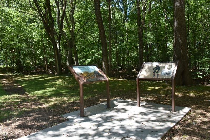
Here, near the bubbling waters of Buzzard Roost Spring, Levi Colbert (Itawamba Minko, “Bench Chief”) built one of the many inns—called stands—along the Natchez Trace.
But it was Colbert’s negotiating and language skills . . . — — Map (db m107265) HM
Near Natchez Trace Parkway (at milepost 327.3), 1.4 miles east of N Pike (County Route 21), on the left when traveling east.
George Colbert's stand sat atop the ridge before you. As one of many inns that dotted the Trace between Nashville and Natchez, it provided travelers with food and lodging.
With a Scottish father and Chickasaw mother, George Colbert used his . . . — — Map (db m107260) HM
Near Natchez Trace Parkway (at milepost 327.3), 1 mile north of N. Pike (County Road 21).
This scene would have occurred far below the surface of the lake you see now. From 1802 to 1819, George Colbert operated a ferry across the quarter-mile breadth of the powerful Tennessee River. The ferry carried mail, militia, settlers, Indians and . . . — — Map (db m84705) HM
On Park Road, 0.4 miles north of Natchez Trace Parkway, on the left when traveling east.
George Colbert operated a ferry across the Tennessee River from 1800 to 1819. His stand or inn offered travelers a warm meal and shelter during their journey on the Old Trace. Colbert looked after his own well-being and once charged Andrew Jackson . . . — — Map (db m69630) HM
Near Natchez Trace Parkway (at milepost 327.3), 1 mile north of N. Pike (County Road 21).
This monument is to memorialize Chickasaw Chief George Colbert who operated a river ferry, traveler’s stand, and had a home on this Natchez Trace site. Colbert Co. AL was named in his honor. — — Map (db m84706) HM
Near Natchez Trace Access Road (at milepost 320.3), 0.4 miles north of Natchez Trace Parkway (U.S. 72), on the left when traveling north.
Levi Colbert, a Chickasaw Chief, operated a stand near here that served Old Trace travelers in the early 1800's. Adjacent to this area was a spring which provided an abundant water supply. — — Map (db m84708) HM
Near Natchez Trace Parkway (at milepost 327.3), 1.6 miles east of N Pike (County Route 21), on the left when traveling east.
In the early 1800s, ferries like the one George Colbert ran near here on the Tennessee River linked segments of the Natchez Trace. Ferries carried people across the river—for a fee. Post riders, Kaintucks, military troops, casual travelers, . . . — — Map (db m107258) HM
On Natchez Trace Access Road (at milepost 320.3), 0.4 miles north of Natchez Trace Parkway.
Inns, or stands, provided occasional shelter for travelers along the Natchez Trace. These stands offered flood to eat and food for thought: local news, information, and ideas. The ever-changing mix of diverse populations—whites, American . . . — — Map (db m107263) HM
Near Natchez Trace Parkway (at milepost 327.3), 1.3 miles east of N Pike (County Route 21), on the left when traveling east.
Frontier America once walked along the Natchez Trace.
The Chickasaw and Choctaw used the Trace for transportation and trade. After 1801, with tribal permission, post riders who rode the Trace connected isolated settlements in Mississippi and . . . — — Map (db m107257) HM
Near Natchez Trace Parkway (at milepost 327.3), 2.7 miles east of N Pike (County Route 21), on the left when traveling east.
The Natchez Trace Parkway is designed to encourage leisurely exploration of the history and beauty of Old Southwest. Here are a few pointers to make your trip more enjoyable.
Regulations and Safety
Obey posted speed limits. Be alert for . . . — — Map (db m107254)
Near Natchez Trace Parkway (at milepost 327.3), 1.6 miles N Pike (County Route 21), on the left when traveling east.
Alabama’s Winter Waterfowl
The Tennessee River Valley is the winter home for thousands of waterfowl. These birds migrate from across the northern US and Canada down through the center of the continent to the Tennessee River.
Careful . . . — — Map (db m107253) HM
Near Natchez Trace Parkway (at milepost 328.7) west of County Route 2, on the left when traveling west.
The Trail of Tears led groups of Cherokee up the Tennessee River here. The Cherokee are one of southeastern tribes who were relocated to Oklahoma due to the US Indian removal policy in the 1830s.
During removal, most Cherokee went by land, but . . . — — Map (db m107267) HM
Near Natchez Trace Parkway (at milepost 330.2), 1.4 miles north of County Road 2, on the right when traveling north.
Rock Spring Nature Trail offers you an opportunity to explore a small natural spring as it bubbles forth from the ground. Small fish dart about a deep pool created as the stream wandered through rich bottomland soil and limestone rock. Vegetation . . . — — Map (db m84703) HM
On Lissie Street/Old Cotton Street, 0.2 miles north of Liberty Road, on the right when traveling north.
Mrs. Egbert Jones and Mrs. Ferriday Byrnes, members of the Mississippi State Society Daughters of the American Revolution (DAR), played important roles in the development of the Natchez Trace Parkway. Mrs. Jones, of Holly Springs, State Regent 1906 . . . — — Map (db m42629) HM
On Lissie Street, 0.2 miles north of Liberty Road, on the right when traveling north.
After the American Revolution, frontiersmen from the Ohio Valley carried their products down stream to Spanish controlled New Orleans and Natchez.
Returning home, boatmen followed a series of Indian trails from Natchez to Nashville—trails . . . — — Map (db m87224) HM
On N. Broadway Street, on the left when traveling north.
Marked by the Daughters of the American Revolution in Mississippi 1909.
This historic thoroughfare from Natchez to Nashville, Tenn. was used as a mail route in 1796.
Although it was a well known Indian trail in far earlier days. — — Map (db m4555) HM
Near Natchez Trace Parkway (at milepost 8.7), 0.5 miles U.S. 61, on the right when traveling north. Reported missing.
(Marker #1)
A National Road
Natchez in the extreme south-western corner of the United States was threatened by Spain in 1800 and later by France and Great Britain.
President Jefferson in 1801 decided that a road from Nashville . . . — — Map (db m87267) HM
Near Emerald Mound Road, 1 mile west of Natchez Trace Parkway, on the right when traveling west.
Before you is the second largest temple mound in the United States. Only Monks Mound in Cahokia, Illinois, is larger. This eight acre mound, constructed from a natural hill, was built and used from about 1300 to 1600 by the Mississippians, . . . — — Map (db m61974) HM
Near Emerald Mound Road, 1 mile Natchez Trace Parkway, on the right when traveling west.
Before you is a 30 foot secondary mound on which once stood a temple containing sacred Indian images.
Archeological evidence indicates that at least two small mounds stood along the North and South sides of the primary platform. These mounds . . . — — Map (db m87272) HM
On Natchez Trace Parkway (at milepost 12.4), 2.1 miles east of Mississippi Highway 553, on the right when traveling north.
This bluff shows a deep deposit of windblown topsoil known as loess (pronounced LOW–ess). It was formed during the Ice Age when glaciers covered the northern half of the United States.
At this time nearly continuous duststorms swept in . . . — — Map (db m62182) HM
On Natchez Trace Parkway (at milepost 8.7), 0.5 miles north of U.S. 61, on the right when traveling north.
Across the Parkway behind you is a portion of the Old Natchez Trace - - a wilderness road that originated from a series of trails used by the southeastern Indian tribes. The Natchez Trace was politically, economically, socially, and militarily . . . — — Map (db m87265) HM
Near Natchez Trace Parkway (at milepost 5.1), 3.3 miles south of U.S. 61. Reported missing.
First school for women chartered by Mississippi Legislature located here. Elizabeth Roach led in organization. School was important from 1818-1843. — — Map (db m87231) HM
Near Natchez Trace Parkway (at milepost 5.1), 3.3 miles south of U.S. 61.
The Natchez Trace was still active and Mississippi had just become a state when the Elizabeth Female Academy opened its doors in November of 1818. Much can be learned about the culture of early Mississippi here in the community of Washington. As the . . . — — Map (db m87232) HM
Near Natchez Trace Parkway (at milepost 5.1), 3.3 miles south of U.S. 61.
First women’s college in America chartered on Feb. 17, 1819 to confer degrees on women. Named in honor of Elizabeth Roach, through whose generosity the College was made possible. Audubon was on the faculty. — — Map (db m87235) HM
On Natchez Trace Parkway (at milepost 176.3), 0.1 miles south of County Road 3122, on the right when traveling north.
About half a mile northwesterly, Bethel, meaning “House of God” was opened in 1822 as one of thirteen Choctaw mission stations. Indians, slaves, and other men “labored hard during four weeks ... frequently till 10 o’clock at night, . . . — — Map (db m87479) HM
On Natchez Trace Parkway (at milepost 175.6), 0.8 miles south of County Road 3122, on the right when traveling north.
Forests are fascinating places – whole new worlds unfold to anyone who takes time to explore them.
Across Cole Creek you will find a typical mixed hardwood forest. Here you can discover for yourself the many marvels in a bottomland . . . — — Map (db m87477)
On Natchez Trace Parkway (at milepost 164.3), 1.3 miles south of Mississippi Highway 12, on the left when traveling north.
Plants need water as much as men need money. Some are satisfied with little; some cannot flourish unless they have a lot; the majority can live contentedly with medium amounts.
From here, a trail descends to the vegetation that thrives in the . . . — — Map (db m87476)
Near Natchez Trace Parkway (at milepost 232.4), 2.6 miles north of Mississippi Highway 8, on the right when traveling north.
(Marker #1)
Prehistoric Trade
Raw materials and articles from distant areas reached the Indians of the Bynum site by trade along trails that were the forerunners of the Natchez Trace.
Spool-shaped objects made of . . . — — Map (db m84830) HM
On N. Jackson Street at E. Madison Street, on the right when traveling north on N. Jackson Street.
This monument marks the Natchez Trace through Chickasaw County. By the Treaty of Pontotoc in 1832, the Chickasaw Indians ceded to the United States their lands east of the Mississippi. In 1801-1802 the old Indian trail was converted into a wagon . . . — — Map (db m97567) HM
On Natchez Trace Parkway (at milepost 221.4), 1.9 miles north of Mississippi Highway 46, on the left when traveling north.
Preserved here is a portion of a nearly 200-year old road – the Old Natchez Trace. Maintaining this 500-mile long wilderness road in the early 1800's was a difficult if not hopeless task.
As you look down the sunken trench note the . . . — — Map (db m84832) HM
Near Natchez Trace Parkway (at milepost 193.1), 2.4 miles south of Mississippi Highway 9.
On February 15, 1934, while serving as U.S. Congressman from Mississippi, Thomas Jefferson Busby (1884-1964) introduced a bill authorizing a survey of the Old Natchez Trace. Four years later the historic road was designated a unit of the National . . . — — Map (db m87481) HM
Near Natchez Trace Parkway (at milepost 193.1), 2.4 miles south of Mississippi Highway 9.
(Marker #1)
The Great Eastern Hardwood Forest
Before Columbus, the world of the eastern Indian was one of a vast continuous forest stretching from Canada to the Gulf coast. A mature forest, it changed little over the centuries, and . . . — — Map (db m87480) HM
On Natchez Trace Parkway (at milepost 180.7), 0.1 miles south of Mississippi Highway 413, on the right when traveling north.
Louis Leflore first traded with the Choctaw Indians at a bluff now part of Jackson Mississippi. About 1812 he established his stand 900 feet to the northeast on the Natchez Trace.
Because of the storekeepers nationality, the area was often . . . — — Map (db m87485) HM
On Natchez Trace Parkway (at milepost 180.7), 0.1 miles south of Mississippi Highway 413, on the right when traveling north.
This memorial marks a stage on the “Natchez Trace.” The first highway opened through the lower South, by the Treaty of Dancing Rabbit Creek in 1830, between the American government and the Choctaw Indians. The surrounding country became . . . — — Map (db m87495) HM
On Natchez Trace Parkway (at milepost 203.5), 0.6 miles south of U.S. 82, on the right when traveling north.
Pigeon Roost Creek, to your left, is a reminder of the millions of migrating passenger pigeons that once roosted in trees in this area. The species has been completely destroyed.
One mile east where the Natchez Trace crossed the creek, . . . — — Map (db m87484) HM
On Natchez Trace Parkway (at milepost 198.6), 3.1 miles north of Mississippi Highway 9, on the right when traveling north.
In the early 1800's many thoughtful Americans believed that isolation and the difficulties of communication would force the Mississippi Valley settlements to form a separate nation. Hoping to hold the frontier, Congress in 1800 established a post . . . — — Map (db m87483) HM
This is the Natchez Trace. For many years it served man well, but as with many things when its usefulness passed, it was abandoned.
Over the years, this time-worn path has been a silent witness to honor and dishonor. It bears the prints of . . . — — Map (db m87357) HM
At the end of this trail is evidence of a once thriving rural community. First settled in the late 1790's, the town grew from a watering place along the Natchez Trace, and took its name from the source of that water -- the Rocky Spring. In 1860, a . . . — — Map (db m80147) HM
This ford marked the beginning of the wilderness of the Choctaw nation and the end of the old Natchez District. Nearby Fort Deposit was a supply depot for troops clearing the Trace in 1801-02, and troops were assembled here during the Burr . . . — — Map (db m61981) HM
Near Natchez Trace Parkway (at milepost 45.7), 4.2 miles north of Mississippi Highway 18. Reported missing.
Excavation of this site tells us much about the people of the late prehistoric periods. The Plaquemine culture included the ancestors of the modern tribes of Mississippi and Louisiana. It was a society with elaborate agriculturally oriented . . . — — Map (db m87325) HM
On Natchez Trace Parkway (at milepost 52.4), on the right when traveling north.
The sounds of a busy woodland stream and the quiet murmur of a lazy waterfall have long been stilled here. Only after a heavy rainfall does water fill the stream and set the waterfall singing.
Over the years the water table has dropped . . . — — Map (db m87327)
On Natchez Trace Parkway (at milepost 41.5), 0.4 miles north of Mississippi Route 18, on the left when traveling north.
Preserved here is a portion of the deeply eroded or “sunken” Old Trace. Hardships of journeying on the Old Trace included heat, mosquitoes, poor food, hard beds (if any), disease, swollen rivers, and sucking swamps.
Take 5 minutes to walk this . . . — — Map (db m87313) HM
On Natchez Trace Parkway (at milepost 88.1), 1 mile north of Interstate 20, on the right when traveling north.
Like many of his generation, Mead came from the east seeking opportunity in the Mississippi Territory. He owned a tavern on the Old Trace near Natchez and held several political offices, including acting governor in 1806. During this time, he . . . — — Map (db m69679) HM
On Northside Drive at Old Vicksburg Road, on the right when traveling east on Northside Drive.
Operated at junction of Natchez Trace & Old Vicksburg Rd. by Robert H. Bell (1783-1835) & his "yellow man Vincent," freed by Bell's will in 1835. Bell-Vincent Scholarship, Millsaps College, endowed with funds from the sale of this land, memorializes . . . — — Map (db m50873) HM
On East College Street east of McLemore Drive, on the right when traveling east.
This stone marks the crossing of the Natchez Trace, pioneer highway of Mississippi Territory, blazed through the forest during the administration of Gov. W.C.C. Clairborne.
Over it marched the Tennessee troops to join Andrew Jackson in 1812. . . . — — Map (db m115391) HM
Near Natchez Trace Parkway (at milepost 93.1), 0.5 miles north of Medgar Evers Boulevard (U.S. 49), on the left when traveling north.
To improve communication to the Old Southwest, the Natchez Trace was declared a post road in 1800. Afterwards, with Choctaw permission, improvements to this section of the Old Trace began. In 1805, the Choctaw allowed inns, known as stands, to be . . . — — Map (db m87361) HM
On Natchez Trace Parkway (at milepost 78.3), 0.6 miles south of Mississippi Highway 467, on the right when traveling north.
By the time of the Civil War, the Natchez Trace had lost its significance as a national road. One of the sections ran from Port Gibson toward Jackson but the route veered from the original Trace to reach Raymond. In the spring of 1863, General U.S. . . . — — Map (db m87360) HM
Near Natchez Trace Parkway (at milepost 73.5), 5.4 miles south of Mississippi Highway 467, on the right when traveling north.
The Treaty of Doaks Stand, 1820, opened this land to white settlement. Land was quickly claimed, and pioneer families established themselves in this wilderness. William Dean and his wife Margaret settled near here on the Old Natchez Trace in . . . — — Map (db m87359) HM
On Natchez Trace Parkway (at milepost 61), 1.7 miles north of Fisher Ferry Road, on the left when traveling north.
(Left Panel)
Lower Choctaw Boundary
The line of trees to your left has been a boundary for 200 years. It was established in 1765 and marked the eastern limits of the Old Natchez District. This boundary ran from a point 12 . . . — — Map (db m87312) HM
On Natchez Trace Parkway (at milepost 283.3), 1 mile north of Mississippi Highway 371, on the left when traveling north.
This woodland trail takes you through a lowland where rich soil and abundant moisture support a variety of large, water-tolerant trees including tulip poplar, sycamore, and water oak.
Baldcypress thrive in the swampy backwaters of a . . . — — Map (db m84763)
On Natchez Trace Parkway (at milepost 283.3), 1 mile east of State Highway 371, on the left when traveling east.
Named after an early setter, Donivan Slough is fed by water runoff from the field in front of you. Although water levels fluctuate seasonally at this site, it remains wet year round. This moist environment allows unique growing opportunities for . . . — — Map (db m107283) HM
On Natchez Trace Parkway (at milepost 18.4), 1.6 miles south of Mississippi Highway 553, on the right when traveling north. Reported missing.
Before your very eyes an endless struggle is taking place. Trees are striving here for the essentials of life – water, sunlight and space. Trying to get ahead, the hardwoods push upward, their crowns filling all the overhead space, shutting . . . — — Map (db m87285)
Near Natchez Trace Parkway (at milepost 15.5), 0.2 miles south of Cannonsburg Road.
(Marker #1)
Mount Locust as an Inn
Growing traffic on the Trace gave Ferguson opportunity to develop Mount Locust.
After 1795, the Mississippi was legally opened for American traffic. Settlers floated their products downriver . . . — — Map (db m87276) HM
Near Natchez Trace Parkway (at milepost 15.5), 0.2 miles south of Cannonsburg Road.
Constructed ca. 1780, this home is one of the oldest structures in Mississippi. It functioned as both a working plantation and as an inn, where travelers on the Natchez Trace could rest for the night. Mount Locust is the only surviving inn of the . . . — — Map (db m87277) HM
Near Natchez Trace Parkway (at milepost 145.1), 1.2 miles south of Mississippi Highway 429, on the left when traveling north.
(Marker #1)
Meet the Beaver
A member of the rodent family that has adapted itself to work and live both on land and in the water.
Beavers are large, weighing up to 60 pounds in Mississippi. Squat and with a low center of . . . — — Map (db m87489)
On Natchez Trace Parkway (at milepost 140) at Red Dog Road, on the left when traveling north on Natchez Trace Parkway.
The road to your left, running to Canton, Mississippi, was opened in 1834 and named for Choctaw Indian Chief Ofahoma or Red Dog. Like other Choctaw, he had accepted the way of his European neighbors and had become a farmer.
Chief Ofahoma . . . — — Map (db m87488) HM
On Natchez Trace Parkway (at milepost 135.5), 0.1 miles north of Old Robinson Road, on the right when traveling north.
The road crossing the Parkway follows the Robinson Road which was built in 1821; nearly all of it passing through the country of the Choctaw Indians. It joined Jackson, Mississippi, and Columbus, center of the “settlements on the . . . — — Map (db m87487) HM
Near Natchez Trace Parkway (at milepost 278.4), 2.4 miles east of Friendship Road (County Road 1303), on the left when traveling east.
Twentymile Bottom, now cultivated, was typical of the many low areas along streams through which the Natchez Trace passed.
In 1812 Reverend John Johnson stopped at Old Factors Stand, near this bottom, and wrote this account of bottomland . . . — — Map (db m84764) HM
Much of the Old Trace had been abandoned by the start of the civil war. However, the war did leave its mark on the Trace as it did upon the rest of the South, as soldiers marched, camped and fought along portions of this historic old road.
A 5 . . . — — Map (db m61803) HM
On Natchez Trace Parkway (at milepost 251.9), 0.3 miles north of Pontocola Road (County Road 506), on the left when traveling north.
Ages ago this area was under an arm of the ocean. Shells and other marine organisms were deposited to form the limestone seen here.
Exposure of the limestone to all types of weathering gradually changed it into a heavy fertile soil of various . . . — — Map (db m84816) HM
Near Natchez Trace Parkway (at milepost 261.8), 0.5 miles south of McCullough Boulevard (Mississippi Highway 178), on the left when traveling north.
(Marker #1)
A Chickasaw Village
Here once stood an Indian village of several houses and a fort.
Summer House
During the summer they lived in rectangular well-ventilated houses.
Winter House
In the winter . . . — — Map (db m84809) HM
Near Natchez Trace Parkway (at milepost 263.9) north of U.S. 78.
This monument marks a stage in the course of the Natchez Trace through Mississippi. Over this first high-road came a tide of the best population of the older Southern states seeking homes in the Southwest. After the Treaty of Pontotoc, Oct. 20, . . . — — Map (db m84800) HM
Near Natchez Trace Parkway (at milepost 263.9) north of U.S. 78.
In the early 1800's ordinary Americans could not be bothered with learning the names of Chickasaw villages on the Natchez Trace. One they called Old Town, and passed the name on to the stream running through this valley. It is one of the sources of . . . — — Map (db m84799) HM
On Natchez Trace Parkway (at milepost 128.4), 6.6 miles south of Mississippi Highway 16, on the left when traveling north.
(Left Panel)
Doaks Stand
About 1812 William Doak established his stand or tavern on the Natchez Trace which is five miles north of the Parkway at this point. The Treaty of Doaks Stand was signed there in 1820.
Because . . . — — Map (db m87493) HM
On State Highway 43, 0.1 miles west of Natchez Trace Parkway, on the left when traveling west.
This monument marks the Natchez Trace over which our pioneer ancestors came to Mississippi. It is located on the site of Madisonville, an early county seat of Madison County.
Erected by the Mississippi Daughters of the American Revolution, . . . — — Map (db m87496) HM
On Natchez Trace Parkway (at milepost 128.4), 6.6 miles south of Mississippi Highway 16, on the left when traveling north.
Pine forests of the south played a major role in the growth of the Nation and have become a southern economic mainstay along with soybeans, cotton, and other agricultural products. Today, through reforestation and management as a crop, pines produce . . . — — Map (db m87492)
On Natchez Trace Parkway (at milepost 122), 7.1 miles north of Mississippi Highway 43, on the right when traveling north.
Water tupelo and baldcypress trees can live in deep water for long periods. After taking root in summer when the swamp is nearly dry, the seedlings can stay alive in water deep enough to kill other plants.
This trail leads through an . . . — — Map (db m87490)
Near Natchez Trace Parkway (at milepost 106.9), 3.4 miles north of Old Canton Road, on the right when traveling north.
Archeologists tell us there was a house here sometime around 500 A.D. and that the pottery found in the mounds was made before 700 A.D. Likely, the population was continuous over centuries with customs being handed from generation to generation, . . . — — Map (db m87364) HM
Near Natchez Trace Parkway (at milepost 107.9), 4.4 miles north of Old Canton Road, on the right when traveling north.
At the end of the French and Indian War in 1763, Great Britain gained control of the territory between the Appalachians and the Mississippi River except for the New Orleans area. The northern boundary of West Florida was first established at 31° . . . — — Map (db m87366) HM
Near Natchez Trace Parkway (at milepost 100.7), 0.5 miles west of Interstate 55, on the left when traveling east.
U.S. agents like Silas Dinsmoor lived among the Choctaw and represented their interests while implementing U.S. policy. His duties included surveying and preventing illegal settlement on Choctaw land. He also encouraged the Choctaw to be more . . . — — Map (db m87362) HM
On Old Agency Road east of North Livingston Road, on the left when traveling east.
Named for the Choctaw Indian Agency
once located in this area, Old Agency
Road is a portion of the original road
system that formed the old Natchez
Trace. Its sunken roadbed and high
earthen banks are evocative of the
narrow road that . . . — — Map (db m115374) HM
On Old Agency Road west of Highland Colony Parkway, on the right when traveling west.
Named for the Choctaw Indian Agency once located in this area, Old Agency Road is a portion of the original road system that formed the old Natchez Trace. Its sunken roadbed and high earthen banks are evocative of the narrow road that linked Natchez . . . — — Map (db m115375) HM
Near Natchez Trace Parkway (at milepost 104.5), 1 mile east of Old Canton Road.
Two portions of a nearly 200 year old wilderness road, the Old Natchez Trace, are preserved here. Nearly 500 miles long, it grew from Indian trails to a national road and communications link between the Old Southwest and the United States to the . . . — — Map (db m87363) HM
Near Natchez Trace Parkway (at milepost 122), 1.1 miles south of Ratliff Ferry Road, on the left when traveling south.
In 1698 the French explorer, Pierre Le Moyne, Sieur d'Iberville, sailed into the mouth of this river and found pearls. He named it "River of Pearls."
The Natchez Trace, a hundred years later, avoided the marshy lowlands by following the ridge . . . — — Map (db m86031) HM
On Natchez Trace Parkway (at milepost 241.4), 1.6 miles south of County Road 413, on the left when traveling north.
The United States agents to the Chickasaws lived from 1802 to 1825 west of here on the Old Natchez Trace.
That Americans could peacefully travel the road through Indian lands was due in large measure to the agents. Their efforts to preserve . . . — — Map (db m84821) HM
On Natchez Trace Parkway (at milepost 243.3), 0.2 miles north of County Road 413, on the left when traveling north.
Somewhere in this vicinity, the Spanish explorer Hernando de Soto crossed the animal paths that later became the Natchez Trace. In 1539, he set out on a long arduous journey that took him across the Southeastern United States. He crossed the . . . — — Map (db m84820) HM
On Natchez Trace Parkway (at milepost 245.6), 1.4 miles south of Mississippi Highway 41, on the right when traveling north.
At Monroe Mission Station northwest of here, the Chickasaws first received Christianity and education in 1822. Five years later, 100 acres were under cultivation and 81 pupils were attending the school. Boys learned farming and carpentry, and girls . . . — — Map (db m84819) HM
On Natchez Trace Parkway (at milepost 251.1), 0.5 miles south of Pontocola Road (County Road 506), on the right when traveling north.
Westerly on the Natchez Trace stood an Indian village “Pontatock” with its council house which, in the 1820's, became the “Capitol” of the Chickasaw Nation.
The chiefs and headmen met there to sign treaties or to . . . — — Map (db m84817) HM
On Natchez Trace Parkway (at milepost 249.6), 2 miles south of Pontocola Road (County Road 506), on the left when traveling north.
Named for a Chickasaw word meaning “tree root,” Tockshish was a community of Indians and white men on the Natchez Trace to the northwest. John McIntosh, British agent to the Choctaws, first settled there before 1770.
In 1801, . . . — — Map (db m84818) HM
On Nachez Trace Parkway (at milepost 286.7), on the right when traveling east.
Pharr Mounds is the largest and most important archeological site in northern Mississippi. Eight large, dome-shaped burial mounds are scattered over an area of 90 acres (100 football fields).
These mounds were built and used about 1-200 A.D. by a . . . — — Map (db m35764) HM
Near Natchez Trace Parkway (at milepost 293.2), 0.3 miles west of John Rankin Highway (County Road 1).
The parkway bridge is named in honor of United States Representative Jamie L. Whitten who for years fought for funds in Congress to complete the Natchez Trace Parkway and the Tennessee-Tombigbee Waterway.
His vision helped make possible this . . . — — Map (db m84731) HM
Near Natchez Trace Parkway (at milepost 293.2), 0.3 miles west of John Rankin Highway (County Road 1).
The Tennessee-Tombigbee Waterway has three main parts. The largest section from Demopolis, Alabama, north to Amory, Mississippi, utilizes the Tombigbee River but changes and shortens the existing channel with dams, locks, and short cuts. From Amory . . . — — Map (db m84732) HM
Near Natchez Trace Parkway (at milepost 293.2), 0.3 miles west of John Rankin Highway (County Road 1).
In the mid 1700's Sieur de Bienville, founder of Mobile, recommended to Louis XIV, a waterway connecting the Tennessee River with the Tombigbee River. Later, American settlers also recognized the advantages of such a shortcut. Residents of Knox . . . — — Map (db m84730) HM
Near Natchez Trace Parkway (at milepost 308.8), 1.2 miles north of Mississippi Highway 30, on the left when traveling north.
The village site was occupied as early as 8000 B.C. by hunters who stayed only long enough to prepare their kill. From the time of Christ to 1000 A.D., migratory people of this area practiced limited agriculture.
The nearby fields and streams . . . — — Map (db m36061) HM
Near Natchez Trace Parkway (at milepost 308.4), 0.8 miles north of Mississippi Highway 30, on the right when traveling north.
The description of the ground surface and the type of rock indicate that this cave was a result of solution activity. A long room or corridor was dissolved out of the rock by under-ground water. The roof of the room eventually weakened and . . . — — Map (db m84728) HM
On Natchez Trace Parkway (at milepost 213.3), 1 mile south of Mississippi Highway 15, on the left when traveling north.
Unlike modern nations, Indian tribes seldom recognized clear, exact boundaries to their lands. However, the Chickasaw and Choctaw Indians came to accept as a dividing line the stream that flowed in this valley. It remained the boundary until both . . . — — Map (db m84833) HM
On U.S. 82 at Natchez Trace Road, on the right when traveling west on U.S. 82.
This monument marks the Natchez Trace at Mathiston in the county of Webster, named for the great statesman Daniel Webster.
“Along this road brave spirits came over shallow brook and roaring stream, to toil and die and leave to men . . . — — Map (db m97625) HM
On Natchez Trace Exit Road, 0.2 miles east of Natchez Trace Parkway, on the left when traveling east.
(Marker #1)
The Natchez Trace Parkway
This parkway, a unit of the National Park System, commemorates one of the great thoroughfares of early-day America: the Natchez Trace.
(Photo Captions)
Jackson Falls
A . . . — — Map (db m87494) HM
Near Harding Pike (U.S. 70S) 0.2 miles north of Leake Avenue, on the right when traveling north.
In 1742 a European settler recorded his travel and the conditions of the path which was known as the Natchez Trace. This is the earliest known recording of the trace, a portion of which was located on the site of Belle Meade Plantation. The trace, . . . — — Map (db m81472) HM
On West End Avenue (U.S. 70S), on the right when traveling south.
The house of John Cockrill, an early settler, stood about 60 yards north, near a large spring, whose waters ran northeast into Lick Branch, which emptied Great Salt Lick, around which Nashville was founded. A blacksmith shop stood under the great . . . — — Map (db m12765) HM
The old Natchez Trace was a 450-plus-mile footpath that ran through Natchez, Choctaw, and Chickasaw lands.
The Natchez Trace National Scenic Trail consists of five separate sections for over 60 miles of trail, including some segments of the . . . — — Map (db m107106) HM
Near Natchez Trace Parkway (at milepost 404.7), 3.1 miles south of Williamsport Pike (Tennessee Route 50), on the right when traveling north.
This trail descends to Jackson Falls, a beautifully sculptured cascade that seems ageless. But it isn’t. For thousands of years before the falls existed, Jackson Branch flowed into this high valley, isolated from the Duck River below.
Then, in . . . — — Map (db m84576)
The Natchez Trace Parkway leads you 444 miles through three states and 10,000 years of North American history. Also designated as a National Scenic Byway and All-American Road, the Parkway encourages travelers to experience historic and scenic . . . — — Map (db m108199) HM
Near Natchez Trace Parkway (at milepost 403.7), 4.1 miles south of Williamsport Pike (Tennessee Route 50), on the left when traveling north.
Preserved here is a 2,000-foot long section of the original Old Natchez Trace which follows a ridge 300 feet above the Duck River.
A 10-15 minute stroll will take you to the end of the trail and back and provide a change of pace from driving. . . . — — Map (db m84582) HM
Near Natchez Trace Parkway (at milepost 405.1), 2.7 miles south of Williamsport Pike (Tennessee Route 50), on the right when traveling north.
The Morrow family farm, visible from this outlook, is an excellent example of agriculture working in harmony with the environment. The Morrow’s, like other conservation farmers, have a strong conservation ethic and a desire to leave improved soil . . . — — Map (db m84575) HM
is designed to encourage leisurely exploration of the history and beauty of Old Southwest. Here are a few pointers to make your trip more enjoyable.
Here are a few pointers to make your trip more enjoyable.
Regulations and Safety
Obey . . . — — Map (db m107105) HM
Near Natchez Trace Parkway (at milepost 375.8) at Laurel Hill Road (Old Trace Drive), on the right when traveling north.
(Marker #1)
A Ride on the Old Natchez Trace
From this point you may drive over a mile and a half of the Old Trace and see for yourself this frontier road much as it appeared in the early 1800's.
En route, stop at the three . . . — — Map (db m84649) HM
127 entries matched your criteria. The first 100 are listed above. The final 27 ⊳