265 entries match your criteria. The first 100 are listed. Next 100 ⊳
Idaho State Historical Society Historical Markers
Markers of the Idaho Highway Historical Marker Program administered by the Idaho State Historical Society in cooperation with the Idaho Transportation Department.
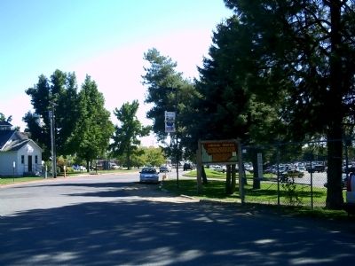
On Campus Lane, 0.1 miles west of Broadway Avenue (U.S. 20/26), on the left when traveling west. Reported permanently removed.
U.S. commercial airline service began with a Varney Airlines flight from Pasco to Boise which landed here on April 6, 1926. Army planes had delivered airmail before that time.
After Varney Airlines was merged with newer companies to become United . . . — — Map (db m22734) HM
On State Highway 21 at milepost 17,, 0.2 miles south of Arrowrock Road, on the right when traveling north.
Higher than any other dam from 1915 until 1934, Arrowrock Dam still is an essential part of Boise Valley's irrigation system.
Located six miles upstream from here, Arrowrock is 350 feet high and 1,150 feet wide. Built at a cost of $4,725,000 . . . — — Map (db m22597) HM
On Interstate 84 at milepost 62,, 1 mile west of Black's Creek Road, on the right when traveling west.
Idaho has a large Basque community that preserves it's ancient European traditions in a new land of opportunity. Coming here originally to herd sheep on mountain and desert ranges, they shifted into other occupations as quickly as possible, making . . . — — Map (db m31680) HM
On Warm Springs Avenue (at milepost 7), 0.1 miles Highland Valley Road, on the left when traveling north.
In 1863 and 1864, overland packers hauling supplies from Salt Lake City to Idaho City crossed here and took a direct route northward to More's Creek.
They cut a steep grade from the Oregon Trail down to Beaver Dick's Ferry, which served a . . . — — Map (db m22641) HM
On Campus Lane, 0.1 miles west of Broadway Avenue (U.S. 20/26), on the left when traveling west. Reported permanently removed.
Expanding from a two-year community college (1932-1965) to a campus with a graduate program, Boise State was designated as a university in 1974.
Originating as an Episcopalian academy founded in 1892, this institution was located a mile north of . . . — — Map (db m22735) HM
On State Highway 21 at milepost 8,, 0.3 miles east of Warm Springs Avenue, on the right when traveling south.
Diversion Dam was completed in 1909 to lift water into an already constructed New York canal system, greatly expanding its irrigated farmlands.
After a quarter century of failure to dig a large canal above Diversion Dam, United States Reclamation . . . — — Map (db m22586) HM
On State Highway 21 at milepost 17,, 0.2 miles south of Arrowrock Road, on the right when traveling north.
More's Creek is named for J. Marion More, leader of the party of miners who founded Idaho City, October 7, 1862.
Like most of Idaho's early miners, he came originally from the South. Unlike most of them, he struck it rich. During the Idaho gold . . . — — Map (db m22595) HM
On Interstate 84, 1 mile north of Black's Creek Road, on the right when traveling south.
Indians, trappers, and emigrants who came this way before 1900 used a more direct route to get between Boise and Glenns Ferry. Their road still can be seen at Bonneville Point 5 miles from here. Following close to a line of hills bordering a . . . — — Map (db m22181) HM
On Warm Springs Avenue (at milepost 7), 0.1 miles south of Highland Valley Road, on the left when traveling north.
The Oregon Trail is still clearly visible coming off the rimrock across the river. Here the west bound emigrants after 1840 came gratefully down into this green valley.
The first cart passed here with Spalding and Whitman, pioneer missionaries, . . . — — Map (db m22639) HM
On Main Street at Franklin Road, on the right when traveling north on Main Street.
All Idaho land surveys refer to a
beginning point --"Initial Point"--
16 miles directly south of here.
When he began surveying Idaho in 1867, Lafayette Cartee, first surveyor general of Idaho Territory, established the initial point on a . . . — — Map (db m53439) HM
On U.S. 95 at milepost 136 at Illinois Avenue, on the right when traveling north on U.S. 95.
An ambitious railroad project to a high Seven Devils copper mine (elevation 6800 ft.) created a lot of excitement here in 1898-1899.
This would have been Idaho's highest mountain railroad if funding had been available to complete it. Construction . . . — — Map (db m23226) HM
On State Highway 55 at milepost 153,, 0.5 miles west of Woodland Road, on the right when traveling east.
John Welch -- always known as Packer John -- hauled supplies from Lewiston to Idaho City during a major Boise Basin gold rush of 1863-1864.
He built a cabin (1/4 mile north of here) that immediately became an historic Idaho landmark. Territorial . . . — — Map (db m37957) HM
On U.S. 95 at milepost 128,, 0 miles north of Mesa Road, on the right.
For more than half a century, after 1910, an apple orchard of nearly 1400 acres, thought to be the largest in the United States under one management, covered this area.
Investors, mostly from the eastern U.S., bought 10-acre shares to finance the . . . — — Map (db m23222) HM
On U.S. 91 at milepost 30.2 near South Old Oxford Highway, on the right when traveling north.
You are standing in the outlet of ancient Lake Bonneville, a vast prehistoric inland sea, of which Salt Lake is modern remnant
Covering over 20,000 square miles when it overflowed here about 14,500 years ago, its winding shoreline would have . . . — — Map (db m105831) HM
On Old Highway 91 (Grant Road) near Old Highway 30 West (Business Interstate 15), on the left when traveling north.
Through this canyon once puffed the wood-burning locomotives of the narrow-gauge Utah and Northern Railway.
Construction, undertaken by a Mormon Co-op, came northward from a junction with the transcontinental line, but stopped in 1874 at . . . — — Map (db m108284) HM
Near Main Street near U.S. 30, on the right when traveling west.
Long before white men discovered these springs, Sept. 9, 1812, Indians gathered here to use the free hot water.
Except wheen they found hot springs, pre-historic Indians had a hard time getting hot water. The wove watertight baskets into . . . — — Map (db m124585) HM
On South 5th Avenue (Business Interstate 15) at South 4th Avenue (U.S. 30), on the left when traveling north on South 5th Avenue.
In an era of emigrants, Mormon settlers and the military, Pocatello emerged as a strong leader of the the Hukenduka Shoshone.
Born after 1810, Pocatello claimed this area and surrounding territories as his homeland. He soon watched his . . . — — Map (db m108286) HM
On South 5th Avenue near East Dillon Street, on the right when traveling north.
This great institution began here on Sept. 22, 1902, with 4 teachers and 40 students.
Originally the Academy of Idaho, it became Idaho Technical Institute in 1915, the Southern Branch of the University of Idaho in 1927, and Idaho State . . . — — Map (db m108306) HM
On National Park Highway/Oregon Trail (U.S. 89), on the right when traveling south.
Most early Bear Lake settlers came from Britain. One was the first woman convert to the LDS church in Europe.
Born in Preston, England, Aug. 24, 1806. Ann Elizabeth Walmsley Palmer was baptized July 30, 1837. An invalid, she was carried into the . . . — — Map (db m99318) HM
On U.S. 89 at milepost 2.2 near Loveland Lane, on the left when traveling south.
Discovered in 1812 by trappers returning home from Astoria, Oregon, this valley and its large lake soon became an important fur trade center.
Donald Mackenzie, Jim Bridger and a host of famous beaver hunters operated here. Two major summer . . . — — Map (db m105867) HM
On Main Street (U.S. 30) near Stringtown Road, on the right when traveling north.
In 1870, Brigham Young appointed Ezra T. Clark, David Hess, and Nicholas Barkdull to colonize this area.
Originally known a Twin Creeks, Joseph C. Rich surveyed the site in 1871. In 1872, the new settlement was named Georgetown in honor . . . — — Map (db m140244) HM
On Aug. 13, 1896, Butch Cassidy and his infamous Wild Bunch of gunmen invaded Montpelier's bank and scooped up more than $16,500 in gold, silver and currency.
Leaving a surprised cashier and his terrified customers, they calmly rode away. A . . . — — Map (db m90806) HM
On U.S. 30 at milepost 441.7 near Hunters Lane, on the right when traveling west.
On their way west to Oregon and California, emigrant wagons often crossed high ridges in order to avoid gullies and canyons.
When he came here in 1843, Theodore Talbot noted that he "had to cross a very high hill, which is said to be the . . . — — Map (db m90807) HM
On U.S. 30 at milepost 441.7 near Hunters Lane, on the right when traveling west.
Coming west with Ezra Meeker in 1852, Thomas McAuley decided to build a road to let emigrants bypass Big Hill.
Worst of all Oregon Trail descents, Big Hill needed replacement. Eliza McAuley reported that her brother Tom "fished awhile, . . . — — Map (db m90808) HM
On U.S. 30 at milepost 440.1 near Bench Road, on the left when traveling west.
In 1848, Pegleg Smith established a trading post on the Oregon Trail at Big Timber somewhere near here on the river.
Some travelers called it "Fort Smith", though it had only four log cabins and some Indian lodges. Packing a plow and tools . . . — — Map (db m90805) HM
On U.S. 30 at milepost 454.5 near Walter Lane, on the right when traveling west.
A bad ford gave trouble to wagon trains crossing this stream on the trail to California and Oregon in 1849.
In that year, gold-seeking 49'ers developed a shortcut that crossed here. Then emigrants built two bridges here in 1850. But an . . . — — Map (db m90804) HM
On South Main Street (U.S. 89) near East 1st South Street, on the right when traveling south.
This pioneer Idaho town was founded Sept. 26, 1863 when a wagon train brought more than 30 families of Mormon colonizers.
More pioneers soon followed, some living in huts of quaking aspen and others building log cabins for the mild first . . . — — Map (db m105836) HM
On South Main Street (U.S. 89 at milepost 15.8) near East 1st South Street, on the right when traveling south.
Designed by one of Brigham Young's sons, this imposing Romanesque tabernacle was built between 1884 an 1889 by skilled local craftsmen.
Swiss stone masons cut and carved red sandstone that horse and ox teams hauled from a canyon 18 miles . . . — — Map (db m105848) HM
On U.S. 95 at milepost 381 at Old Sanders Road, on the left when traveling north on U.S. 95.
When their annual Montana plains buffalo hunt proved futile in 1876, North Idaho's Coeur d' Alene Indians needed to move from Cataldo to a better farming area.
So in 1877 their Jesuit mission was relocated here. After their community grew . . . — — Map (db m122035) HM
On U.S. 95 at milepost 381 at Old Sanders Road, on the left when traveling north on U.S. 95.
Dedicated in memory of pioneer women, Mary Minerva McCroskey State Park has a forested skyline drive that offers spectacular views of forest, farms, and distant mountains.
Virgil T. McCroskey devoted his life to preserving trees and . . . — — Map (db m122036) HM
On State Highway 5, 0.1 miles west of North 23rd Street, on the right when traveling west.
John Mullan was the Army officer who in 1859-1862 surveyed and built the Mullan Road
from Walla Walla, Washington to Fort Benton, Montana.
The road was to connect the Missouri and the Columbia, and Congress approved in 1855.
Indian . . . — — Map (db m110031) HM
On State Highway 3 at milepost 92 near Round Lake Road, on the right when traveling south.
Established November 4, 1842, by Father Nicolas Point, S.J.
Eagerly sought by the Coeur d'Alene Indians, the Black Robed missionaries supervised the building of a log cabin, and in the spring, began to teach "the mysteries of plowing and . . . — — Map (db m122109) HM
On State Highway 3 at milepost 96 at State Highway 97, on the right when traveling south on State Highway 3.
Designed to connect the Missouri and the Columbia, this military wagon road was constructed past here in 1859.
Swamps in the St. Joe valley has to be corduroyed with logs, and 70 men spent a week digging out sidehills south of here and . . . — — Map (db m122114) HM
On U.S. 20 at Twin Buttes Road, on the right when traveling east on U.S. 20.
Big Butte
Towering 2500 feet high, two over lapping rock domes form a 300,000 year-old butte that dominates this lava plain.
After a hot flow of molten rhyolite (acidic rock) boiled up through older lava, a second rhyolite dome pushed up a . . . — — Map (db m103820) HM
On Interstate 15 at milepost 101.3, on the right when traveling north.
Molten rock, forced upward for 30 to 50 miles through fissures in the earth, has cooled into the hard lava found here.
Continued pressure from below has made great cracks in the contorted surface. This lava solidified only a few thousand . . . — — Map (db m108346) HM
On U.S. 20 at Twin Buttes Road, on the right when traveling east on U.S. 20.
Three Buttes
Rising above this level plain of lava flows and windblown soils these high landmarks are recent additions to Idaho’s landscape.
East Butte (farthest east) flowed up and cooled quickly about 600,000 years ago, while Big Southern . . . — — Map (db m103818) HM
On U.S. 20 at milepost 170 near Rock Creek Road, on the left when traveling west.
Water from deep snow that falls on high mountain ridges north of here is stored each Spring in this reservoir to irrigate farm land near Shoshone and Richfield.
Big Wood River flows past some hills that separate this valley from a broad plain . . . — — Map (db m110116) HM
On North Main Street (State Highway 75 at milepost 113) near Kirtley Road, on the right when traveling north.
Rich strikes in 1879 led to a rush in the lead and silver mines of this valley. The famous Minnie Moore Mine alone produced a total of $8.4 million worth of ore.
Mining quickly brought a railroad and prosperity. The Ketchum smelter pioneered . . . — — Map (db m110115) HM
An old emigrant road headed west across Camas Prairie and then descended to the valley below on its way to rejoin the Oregon Trail 28 miles west of here.
This route, discovered by Donald Mackenzie's fur trade party in 1820, came into use for . . . — — Map (db m125602) HM
On State Highway 75 at milepost 156 near Forest Road 406, on the left when traveling south. Reported permanently removed.
Searching the mountain wilderness for beaver, Alexander Ross came up Wood River and discovered this summit, Sept. 18, 1824.
Leading a large brigade of Hudson's Bay Company trappers, he wondered whether he ever could get through unknown . . . — — Map (db m110051) HM
On State Highway 75 at milepost 152 near Forest Road 409, on the right when traveling south.
After Warren P. Callahan located a rich lead-silver mine here, April 26, 1876, thousands of eager treasure-hunters joined in a rush to Wood River in 1880
Successful prosectors discovered valuable lodes from here to Bellevue. Galena has a . . . — — Map (db m110052) HM
On State Highway 75 at milepost 161 near Salmon River Road (Forest Road 215), on the right when traveling south.
Rising as a small stream in the valley to the south, the Salmon winds 420 miles across Idaho before flowing into Snake River.
Discovered in 1895 by Lewis and Clark, and explored with great difficulty by fur traders and prospectors, the . . . — — Map (db m110050) HM
On State Highway 75 at milepost 167 at Beaver Creek Road (Forest Road 204), on the right when traveling south on State Highway 75.
Gold discoveries on Beaver Creek in 1879 led to mining activity near here that summer, but major production was delayed until 1886.
By 1885, Sawtooth City had three saloons, two restaurants, a meat market, a store, a Chinese laundry, and . . . — — Map (db m110045) HM
On State Highway 75 at milepost 131 near West Sage Road, on the right when traveling south.
When Sun Valley Lodge was built in 1936, Union Pacific engineers developed chair lifts to transport skiers uphill.
Starting with two modest ski slopes on Dollar Mountain and Proctor Mountain, chair lifts were used for all Sun Valley ski . . . — — Map (db m110054) HM
On State Highway 75 at milepost 164 near Forest Road 0777A, on the left when traveling south.
Levi Smiley found gold on Smiley Creek in 1878, and E.M. Wilson discovered a still richer lode 8 miles above here near Vienna, on June 4, 1879.
Before shutting down in 1886, Vienna was a thriving mining camp with a $200,000 twenty-stamp . . . — — Map (db m110048) HM
On State Highway 21 at milepost 95,, 1.4 miles north of Grandjean Road, on the right when traveling north.
An immigrant from Denmark where he had studied forestry, he came to this part of Idaho in 1883 to mine, hunt and trap.
Before Idaho became a state in 1890, he built a winter cabin below Grandjean Peak on a site later occupied by Grandjean Ranger . . . — — Map (db m22638) HM
On State Highway 55 at milepost 64, just south of West Boise Street, on the left when traveling south.
Gold was struck in Boise Basin (over the ridge to the east) in 1862, and the rush to these new mines came through here.
Traffic came by steamer up the Columbia to Umatilla, and thence overland. At first there were only pack and saddle trains, but . . . — — Map (db m23235) HM
On State Highway 21 at milepost 28 at Grimes Creek Road, on the left when traveling north on State Highway 21.
Named for George Grimes who, with Moses Splawn, led the party which on August 2, 1862 made the strike that started the Boise basin gold rush.
The party was searching for a rich basin described to Splawn a year earlier by an Indian. Farther up . . . — — Map (db m22600) HM
On State Highway 21 at milepost 38,, 0.1 miles west of Lodgepole Lane, on the left when traveling north.
This roaring metropolis was founding early in October, 1862, about ten weeks after gold was discovered in Boise basin.
By the next summer, this was the largest city in the Northwest, with 6,275 people -- 5,691 of them men! Families followed, and . . . — — Map (db m22601) HM
On State Highway 21 at milepost 20,, 0.2 miles south of Stewart Way, on the left when traveling north.
The Old Toll Road to Idaho City crossed the ridge from Boise through the lowest point you can see in the skyline across the valley.
Climbing the More's creek canyon wall, it crossed this highway about here and swung north. The road was built and . . . — — Map (db m22599) HM
On State Highway 21 at milepost 77,, 0.6 miles east of Kirkham Road, on the right when traveling east.
A talented artist, Emma Edwards went to work in 1890 to to design Idaho's state seal when she was only 18 years old.
Although her father had moved to California after serving as governor of Missouri (1844 to 1848), Emma preferred to spend much of . . . — — Map (db m22637) HM
On State Highway 21 at milepost 72,, 0.2 miles east of Banks Lowman Road, on the right when traveling north.
In 1907, Nathaniel W. Lowman settled here, and four years later, when he started a post office in his large log house, this community was named for him.
Only a few scattered settlers lived here then. Lowman got all its supplies once a year from a . . . — — Map (db m22616) HM
On Hope Peninsula Road at 200, on the right when traveling south on Hope Peninsula Road.
Idaho’s fur trade began in the fall of 1809 when David Thompson built a trading post 2½ miles southwest of here. Kullyspell House (Thompson spelled “Kalispell” that way) was the earliest fur trade post in the American Pacific . . . — — Map (db m112927) HM
On State Highway 200, on the right when traveling south.
When the last of the continental ice sheets blocked this valley, a great lake extended over 200 miles into Montana. Ice about as high as the mountain ridges held back water as deep as 800 to 1000 feet at Missoula, ten to twenty thousand years . . . — — Map (db m73490) HM
On June 20, 1863, Bill Hickman started a ferry 9 miles up Snake River for thousands of gold hunters headed for mines that now are in Montana.
Named for an eagle that had a nest on a rock there, his ferry flourished until James Madison . . . — — Map (db m70584) HM
On West Arco Highway (U.S. 20 at milepost 291) near North 135 West, on the left when traveling west.
Early day big game hunters who occupied lava caves around here more than 12,000 years ago, had a diet that included elephants, camels and giant bison.
When a gradual change to a warmer, drier climate made local grasslands into more . . . — — Map (db m174239) HM
Idaho’s earliest toll bridge spanned Snake River at this rocky site in 1865, replacing Eagle Rock Ferry, 9 miles upstream.
James Madison Taylor (a relative of Presidents Madison and Taylor and a founder of Denver, Colorado) settled here in . . . — — Map (db m70583) HM
On Chinook Street at U.S. 95, on the right when traveling east on Chinook Street.
Gold miners rushing to Wild Horse in British Columbia in 1863 were paddled across this river by Indians; in 1864 E.L. Bonner established a proper ferry here.
This ferry and its trading store served the Wild Horse packtrains for many years. . . . — — Map (db m122203) HM
On U.S. 95 at milepost 504 near Deep Creek Loop (State Highway 2), on the left when traveling north.
Coming from Canada, the famous map maker and trader for the North West Company explored this area and river in 1808.
On May 8 somewhere near here, Thompson's famished party, all sick from eating a "much tainted" antelope, met ten lodges of . . . — — Map (db m122201) HM
On U.S. 95 at milepost 504 near Deep Creek Loop (State Highway 2), on the left when traveling north.
Moving from the north down this valley, the edge of the continental ice sheet blocked rivers and formed glacial lakes.
Then as the ice gradually melted, a lake rose here behind the receding ice dam, and extended up Kootenai valley into . . . — — Map (db m122174) HM
On Chinook Street at U.S. 95, on the right when traveling east on Chinook Street.
The Kootenai Tribe of Idaho has lived in their aboriginal homeland of Idaho, Montana and British Columbia for thousands of years.
A unique culture, the Kootenais are known for their distinctive sturgeon-nose canoe and their linguistically . . . — — Map (db m122202) HM
On U.S. 95 at milepost 504 near Deep Creek Loop (State Highway 2), on the left when traveling north.
Thousands of eager miners came by here in an 1864-65 gold rush to Wild Horse, BC. Parts of their pack trail still can be seen.
An extension of North Idaho's earlier gold excitements, Wild Horse was served by a pack trains that hauled . . . — — Map (db m122176) HM
On W. Grand Ave south of S. Bingham Street, on the right when traveling north.
An important page in atomic history was written here on July 17, 1955, when the lights of Arco were successfully powered from atomic energy. Chosen by the Atomic Energy Commission as an experiment in the peaceful use of atomic power, Arco, Idaho . . . — — Map (db m68916) HM
Near U.S. 20 at milepost 265,, 1.2 miles west of Van Buren Boulevard, on the right when traveling east.
When its water is not diverted for upstream irrigation, Lost River flows past here into a sink 14 miles to the northeast.
Lava flows in the Snake River plains buried old channels of Lost River, Little Lost River, and Birch Creek. No longer able . . . — — Map (db m70448) HM
Near U.S. 20 at milepost 265,, 1.2 miles west of Van Buren Boulevard, on the right when traveling east.
Since 1949, more nuclear reactors – over 50 of them – have been built on this plain than anywhere else in the world.
This 900-square-mile Idaho National Laboratory is the birthplace of the Nuclear Navy. Commercial power reactor . . . — — Map (db m70447) HM
On State Highway 33 at N 1480W (County Highway 1480), on the right when traveling west on State Highway 33.
John Day’s River
Fur traders named this stream for John Day, a pioneer trapper who died in the valley north of here, Feb. 16, 1820
John Day had started west with John Jacob Astor’s Pacific Fur Company that discovered Snake River . . . — — Map (db m103827) HM
On U.S. 20 at milepost 148 near Washington/Wheat Ranch Road, on the left when traveling west.
Angered by white encroachment on Camas Prairie lands which had been guaranteed to the Bannock Indians by treaty, Buffalo Horn's band went to war May 30, 1878
Trouble had been brewing on the reservation for years, and the government had . . . — — Map (db m110141) HM
On U.S. 30, 0 miles east of West Plymouth Road, on the right when traveling east.
After reaching Boise River, emigrant wagons had to travel 30 miles to find a good crossing about 1/4 mile north of here.
They had to avoid a wide zone of shifting channels, so they descended Canyon Hill where the route is still visible. In . . . — — Map (db m22326) HM
On Cleveland Boulevard at South 20th Avenue, on the right when traveling east on Cleveland Boulevard. Reported missing.
Planned by the Presbyterians of southern Idaho in 1884 and opened with 19 students in 1891, this is Idaho's oldest college.
William Judson Boone, the founder, remained president 45 years. From a modest beginning with a faculty of 8 (including two . . . — — Map (db m26193) HM
Near Marsing Murphy Road (State Highway 78) 0.2 miles east of Poplar Drive, on the right when traveling east.
Natural hot water available here
has been a popular attraction
for thousands of years.
A winter village site for about 5000 years, these hot springs had large pit houses typical of plateau communities northwest of here from 4,300 to about . . . — — Map (db m47336) HM
On Lincoln Road, 0.2 miles east of Middleton Road, on the left when traveling east.
Only 2 young boys survived the Indian attack on Alexander Ward's 20 member party, Oregon bound on August 20, 1854. Military retaliation for the slaughter so enraged the Indians that Hudson's Bay Co. posts Fort Boise and Fort Hall had to be . . . — — Map (db m22328) HM
On 16th Avenue at Garrity Boulevard, on the right when traveling south on 16th Avenue.
In 1913, Eugene Emerson started a Christian school that his church developed into an accredited college on a campus he donated. The college, located on a campus 2 mile southwest of here, moved to university status in 1999.
Northwest Nazarene . . . — — Map (db m73204) HM
On U.S. 20/26 just east of Notus Road, on the left when traveling west.
Confederate refugees from Missouri started farming in this area in 1863 and 1864, when gold and silver mining camps created a great demand for flour and cattle. Driven out from their Missouri River homes below Kansas City by extremely bitter Civil . . . — — Map (db m21988) HM
On Parma Road, 0 miles Parma Road, on the left when traveling west.
An Iowa Indian who came through here with Wilson Price Hunt's fur trappers in 1811, Marie Dorion spent an incredible winter in this region in 1814. She and her two infant children were sole survivors of a mid-January Bannock Indian clash at John . . . — — Map (db m21995) HM
On Parma Road, 0 miles west of Parma Rd., on the left when traveling north.
An important Hudson's Bay Company fur trade post was established in 1834 four miles west of here on the bank of the Snake River. Fur trading declined, but this British post became famous for its hospitality to American travellers on the Oregon . . . — — Map (db m21992) HM
On U.S. 30 at milepost 378.8 near Lund Road, on the right when traveling west.
In 1879, Mormon farmers from Utah settled Chesterfield, 16 miles north of here.
Based on Joseph Smith's Zion Plat, Chesterfield was laid out on an orderly grid of large blocks separated by wide streets with the Meeting House on the highest . . . — — Map (db m106773) HM
On U.S. 30 at milepost 376.2 near Lundgren Canyon Road, on the left when traveling west.
In the summer of 1849, the California Gold Rush was diverted this way in search of a more direct route to the mines.
Stampeding 49'ers would try anything to save miles and time in their rush for California's gold: the regular Oregon and . . . — — Map (db m106774) HM
On Soda Point Power Plant Road near Reservoir Road, on the right when traveling south.
Until about 28,000 years ago, Bear River used to flow northwest from here through Portneuf Canyon into Snake River.
Then these lava eruption blocked that route, diverting Bear River south into what now is Salt Lake. At that time a large . . . — — Map (db m106728) HM
On U.S. 30 near South 3rd Street West, on the left when traveling west.
Col. P.E. Connor set up the old town of Soda Springs, now mostly flooded, and an adjacent army post near here May 20, 1863.
The gold rush to Idaho had greatly increased traffic on the Oregon Trail, and the post was needed to protect travelers . . . — — Map (db m105972) HM
On East 2nd Street South near South Main Street, on the right when traveling west.
Free clear sparkling soda water still is available in a beautiful Soda Springs city park located 2 miles from here.
A prime attraction for more than 160 years, soda water from these springs was marketed nationally after rail service . . . — — Map (db m106256) HM
On Soda Point Power Plant Road near Reservoir Road, on the right when traveling south.
In 1840, John Bidwell began to assemble emigrants from Missouri to open a road to California; and a year later, he set out with a party of 69 Pacific Coast pioneers.
When they reached here, August 12, 1841, half of this group decided to go . . . — — Map (db m106729) HM
On U.S. 30 near South 3rd Street West, on the left when traveling west.
In this area are a group of springs famous to Oregon Trail travelers, most of whom stopped to try the "acid taste and effervessing gasses" of the waters.
Earlier, fur traders often -- less elegantly -- called the place "Beer Springs" after . . . — — Map (db m105967) HM
On Wayan Loop Road (State Highway 34) near Wayan Loop Road, on the right when traveling east.
Rising to an elevation of more than 9,800 feet, Cariboo Mountain -- visible north of here -- has two of Idaho's highest gold camps.
Jesse "Cariboo Jack" Fairchild discovered gold high on Cariboo Mountain in August, 1870, and a mining rush . . . — — Map (db m105965) HM
On Wayan Loop Road (State Highway 34) near Wayan Loop Road, on the right when traveling west.
Discovered this valley in 1818 or 1819 while hunting beaver for Donald MacKenzie's Northwest Company trappers.
An Iroquois leader -- he also explored Grey's River nearby in Wyoming. Aside from his trapping skills, he was noted for his unusual . . . — — Map (db m105964) HM
On State Highway 77 at East Miller Hall Court, on the left when traveling north on State Highway 77.
Established in March, 1893, by the Second Idaho State Legislature.
Residents of Albion erected and furnished a two-story stone building on five acres of donated land, and the very successful teacher-training school opened on September 11, . . . — — Map (db m138484) HM
On State Highway 77 at milepost 18,, 0.2 miles south of North St., on the right when traveling north.
J.L. Davis... Diamondfield Jack... spent most of 6 years in the Cassia County jail while the courts and pardon board were trying to figure out what to do with him. By far the best known of the gunmen who fought in Idaho's sheep and cattle wars, he . . . — — Map (db m31639) HM
On U.S. 30 at milepost 250,, 0.2 miles east of S 800 W, on the left when traveling east.
When completed in 1904, Milner Dam raised Snake River 38 feet to divert water into major north and south side canals.
A gravity system unmatched in size in national reclamation development, this project irrigates 360,000 acres of land. Twin . . . — — Map (db m31636) HM
On U.S. 30 at milepost 253,, 0.3 miles east of S 700 W, on the right when traveling east.
In 1880, George Starrh, a Snake River placer miner, started a ferry across Snake River one mile north of here. From 1880-2, freighters hauling supplies for a mining rush to Wood River used Starrh's ferry (powered by river current when stiff winds . . . — — Map (db m31635) HM
On State Highway 81 at milepost 8 near Idahome Road, on the right when traveling south.
After wheat crops flourished in the dry farm area, Idahome sprang up here in 1916 as a railroad terminal. Irrigation projects boosted its Economy.
When wheat farms disappeared and highway traffic replaced rail service here, Idahome became . . . — — Map (db m123849) HM
On State Highway 77 at milepost 3,, 0.6 miles east of 1700 S. Road, on the right when traveling east.
This shortcut to the California goldfields, followed by most of the 49'ers, came out of the hills to the east and joined the old California trail just about here. Opened by "Messrs. Hudspeth & Myers, of the Jackson County, Missouri, Company," who . . . — — Map (db m31638) HM
On State Highway 27 at milepost 1,, 0.2 miles north of 1800 South Road, on the right when traveling south.
A vast display of towering granite rocks (16 miles southeast of here) attracted emigrants who were on their way to California. A gold rush visitor, July 14, 1849, reported that "you can imagine among these massive piles, church domes, spires, . . . — — Map (db m31637) HM
On A-2 Clark County Road (Main Street) near Interstate 15, on the left when traveling east.
When General O.O. Howard tried to get more than 600 Nez Perce Indians to settle on a North Idaho reservation in 1877, he ran into a lot of trouble here.
On their way to Yellowstone Park, Chief Joseph's Nez Perce people reached Hole in the . . . — — Map (db m124339) HM
Near West Camas Creek Road (Forest Road 006) near Interstate 15, on the left when traveling east.
After Montana's Gold Rushes began in 1862, thousands of miners came past here and a Beaver Canyon stage station was built here.
Freighters and travelers on stage lines from Salt Lake to Montana stopped at this station until Utah and . . . — — Map (db m124337) HM
Near U.S. 12 at milepost 27 near Rapidview Lane, on the left when traveling east.
Indians have lived here next to this good fishing hold for 10,000 years.
As long as 3,000 years ago, they had large oval houses, 28 feet long by 24 feet wide. To build these houses, they put a bark and mat covering over a frame of 50 or so . . . — — Map (db m121416) HM
On U.S. 12 at Summit Grade, on the left when traveling west on U.S. 12.
In 1898, after rail service from Lewiston reached Lenore, a tramway was begun to ship grain from Camas Prairie (1600 feet above) to a new freight stop directly across the river.
Previously, grain wagons descended a long steep hill from the . . . — — Map (db m109760) HM
On U.S. 12, 0.6 miles west of Lenore Grade, on the right.
Founded by Seth S. Slater, May 6, 1861, Slaterville (permanent population, 50) had 5 edifices – built mainly of colored blankets – 2 stores, 2 houses, and a saloon.
When the Colonel Wright “snapped her tow-line on the Grand Rapids . . . — — Map (db m110703) HM
On U.S. 12, 3 miles south of Michigan Avenue, on the right when traveling west.
After more than a month’s search, they finally had reached a westward river where they could use canoes.
From here they continued another 16 miles with their pack horses before they found a campsite with trees suitable for making canoes.
But at . . . — — Map (db m109757) HM
On Main Street (State Highway 11 at milepost 29) at Canal Street, on the right when traveling west on Main Street.
The fabulous Gold Rush days of Idaho began on September 30, 1860, when W.F. Bassett struck gold just about here.
E.D. Pierce, who knew the country, had led twelve prospectors, including Bassett, out from Walla Walla in August. After news of . . . — — Map (db m121518) HM
On State Highway 11 at milepost 27 near Fromelt Road, on the left when traveling east.
Charged with hacking a prominent local merchant to pieces, five Chinese were hanged here by vigilantes Sept. 18, 1885.
They were just setting out on a long, hard 240 mile trip from Pierce to face trial at the county seat in Murray when the . . . — — Map (db m121442) HM
On State Highway 11 at milepost 28 near Fromelt Road, on the left when traveling east.
Commercial center of Idaho's earliest mining district in the great days of 1861. It flourished here for more than a year.
Pierce City was only 2 miles away but another town sprang up near some rich gold strikes. In its first few weeks, Oro . . . — — Map (db m121517) HM
265 entries matched your criteria. The first 100 are listed above. Next 100 ⊳