By Rebecca Maxwell, September 24, 2009
Airmail Service Marker at BSU
GEOGRAPHIC SORT Title Sort Marker Number Sort Marker Number Sort N Marker Number Sort T Publication Order Sort Publication Order Sort A Erected Year Sort Most Viewed Sort Most Recent-Interest Sort Most Recently Changed Sort SEE FAQ #33 FOR DESCRIPTIONS
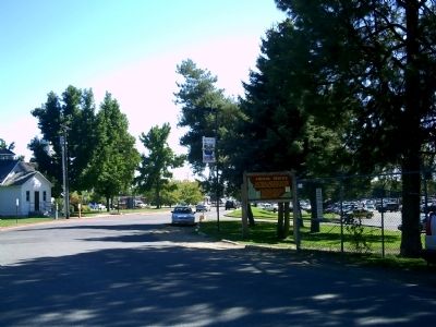
On Campus Lane, 0.1 miles west of Broadway Avenue (U.S. 20/26), on the left when traveling west. Reported permanently removed.
On State Highway 21 at milepost 17,, 0.2 miles south of Arrowrock Road, on the right when traveling north.
On Interstate 84 at milepost 62,, 1 mile west of Black's Creek Road, on the right when traveling west.
On Warm Springs Avenue (at milepost 7), 0.1 miles Highland Valley Road, on the left when traveling north.
On Campus Lane, 0.1 miles west of Broadway Avenue (U.S. 20/26), on the left when traveling west. Reported permanently removed.
On State Highway 21 at milepost 8,, 0.3 miles east of Warm Springs Avenue, on the right when traveling south.
On State Highway 21 at milepost 17,, 0.2 miles south of Arrowrock Road, on the right when traveling north.
On Interstate 84, 1 mile north of Black's Creek Road, on the right when traveling south.
On Warm Springs Avenue (at milepost 7), 0.1 miles south of Highland Valley Road, on the left when traveling north.
On Main Street at Franklin Road, on the right when traveling north on Main Street.
On U.S. 95 at milepost 136 at Illinois Avenue, on the right when traveling north on U.S. 95.
On State Highway 55 at milepost 153,, 0.5 miles west of Woodland Road, on the right when traveling east.
On U.S. 95 at milepost 128,, 0 miles north of Mesa Road, on the right.
On U.S. 91 at milepost 30.2 near South Old Oxford Highway, on the right when traveling north.
On Old Highway 91 (Grant Road) near Old Highway 30 West (Business Interstate 15), on the left when traveling north.
Paid Advertisement
Near Main Street near U.S. 30, on the right when traveling west.
On South 5th Avenue (Business Interstate 15) at South 4th Avenue (U.S. 30), on the left when traveling north on South 5th Avenue.
On South 5th Avenue near East Dillon Street, on the right when traveling north.
On National Park Highway/Oregon Trail (U.S. 89), on the right when traveling south.
On U.S. 89 at milepost 2.2 near Loveland Lane, on the left when traveling south.
On Main Street (U.S. 30) near Stringtown Road, on the right when traveling north.
On Washington Street near North 9th Street.
On U.S. 30 at milepost 441.7 near Hunters Lane, on the right when traveling west.
On U.S. 30 at milepost 441.7 near Hunters Lane, on the right when traveling west.
On U.S. 30 at milepost 440.1 near Bench Road, on the left when traveling west.
On U.S. 30 at milepost 454.5 near Walter Lane, on the right when traveling west.
On South Main Street (U.S. 89) near East 1st South Street, on the right when traveling south.
On South Main Street (U.S. 89 at milepost 15.8) near East 1st South Street, on the right when traveling south.
On U.S. 95 at milepost 381 at Old Sanders Road, on the left when traveling north on U.S. 95.
On U.S. 95 at milepost 381 at Old Sanders Road, on the left when traveling north on U.S. 95.
On State Highway 5, 0.1 miles west of North 23rd Street, on the right when traveling west.
Paid Advertisement
On State Highway 3 at milepost 92 near Round Lake Road, on the right when traveling south.
On State Highway 3 at milepost 96 at State Highway 97, on the right when traveling south on State Highway 3.
On U.S. 20 at Twin Buttes Road, on the right when traveling east on U.S. 20.
On Interstate 15 at milepost 101.3, on the right when traveling north.
On U.S. 20 at Twin Buttes Road, on the right when traveling east on U.S. 20.
On U.S. 20 at milepost 170 near Rock Creek Road, on the left when traveling west.
On North Main Street (State Highway 75 at milepost 113) near Kirtley Road, on the right when traveling north.
On U.S. 20/26, on the right when traveling west.
On State Highway 75 at milepost 156 near Forest Road 406, on the left when traveling south. Reported permanently removed.
On State Highway 75 at milepost 152 near Forest Road 409, on the right when traveling south.
On State Highway 75 at milepost 161 near Salmon River Road (Forest Road 215), on the right when traveling south.
On State Highway 75 at milepost 167 at Beaver Creek Road (Forest Road 204), on the right when traveling south on State Highway 75.
On State Highway 75 at milepost 131 near West Sage Road, on the right when traveling south.
On State Highway 75 at milepost 164 near Forest Road 0777A, on the left when traveling south.
On State Highway 21 at milepost 95,, 1.4 miles north of Grandjean Road, on the right when traveling north.
On State Highway 55 at milepost 64, just south of West Boise Street, on the left when traveling south.
Paid Advertisement
On State Highway 21 at milepost 28 at Grimes Creek Road, on the left when traveling north on State Highway 21.
On State Highway 21 at milepost 38,, 0.1 miles west of Lodgepole Lane, on the left when traveling north.
On State Highway 21 at milepost 20,, 0.2 miles south of Stewart Way, on the left when traveling north.
On State Highway 21 at milepost 77,, 0.6 miles east of Kirkham Road, on the right when traveling east.
On State Highway 21 at milepost 72,, 0.2 miles east of Banks Lowman Road, on the right when traveling north.
On Hope Peninsula Road at 200, on the right when traveling south on Hope Peninsula Road.
On State Highway 200, on the right when traveling south.
On West Arco Highway (U.S. 20 at milepost 291) near North 135 West, on the left when traveling west.
On Chinook Street at U.S. 95, on the right when traveling east on Chinook Street.
On U.S. 95 at milepost 504 near Deep Creek Loop (State Highway 2), on the left when traveling north.
On U.S. 95 at milepost 504 near Deep Creek Loop (State Highway 2), on the left when traveling north.
On Chinook Street at U.S. 95, on the right when traveling east on Chinook Street.
On U.S. 95 at milepost 504 near Deep Creek Loop (State Highway 2), on the left when traveling north.
On W. Grand Ave south of S. Bingham Street, on the right when traveling north.
Paid Advertisement
Near U.S. 20 at milepost 265,, 1.2 miles west of Van Buren Boulevard, on the right when traveling east.
Near U.S. 20 at milepost 265,, 1.2 miles west of Van Buren Boulevard, on the right when traveling east.
On State Highway 33 at N 1480W (County Highway 1480), on the right when traveling west on State Highway 33.
On U.S. 20 at milepost 148 near Washington/Wheat Ranch Road, on the left when traveling west.
On U.S. 30, 0 miles east of West Plymouth Road, on the right when traveling east.
On Cleveland Boulevard at South 20th Avenue, on the right when traveling east on Cleveland Boulevard. Reported missing.
Near Marsing Murphy Road (State Highway 78) 0.2 miles east of Poplar Drive, on the right when traveling east.
On Lincoln Road, 0.2 miles east of Middleton Road, on the left when traveling east.
On 16th Avenue at Garrity Boulevard, on the right when traveling south on 16th Avenue.
On U.S. 20/26 just east of Notus Road, on the left when traveling west.
On Parma Road, 0 miles Parma Road, on the left when traveling west.
On Parma Road, 0 miles west of Parma Rd., on the left when traveling north.
On U.S. 30 at milepost 378.8 near Lund Road, on the right when traveling west.
On U.S. 30 at milepost 376.2 near Lundgren Canyon Road, on the left when traveling west.
On Soda Point Power Plant Road near Reservoir Road, on the right when traveling south.
On U.S. 30 near South 3rd Street West, on the left when traveling west.
Paid Advertisement
On East 2nd Street South near South Main Street, on the right when traveling west.
On Soda Point Power Plant Road near Reservoir Road, on the right when traveling south.
On U.S. 30 near South 3rd Street West, on the left when traveling west.
On Wayan Loop Road (State Highway 34) near Wayan Loop Road, on the right when traveling east.
On Wayan Loop Road (State Highway 34) near Wayan Loop Road, on the right when traveling west.
On State Highway 77 at East Miller Hall Court, on the left when traveling north on State Highway 77.
On State Highway 77 at milepost 18,, 0.2 miles south of North St., on the right when traveling north.
On U.S. 30 at milepost 250,, 0.2 miles east of S 800 W, on the left when traveling east.
On U.S. 30 at milepost 253,, 0.2 miles east of West 7 South, on the left when traveling east.
On State Highway 81 at milepost 8 near Idahome Road, on the right when traveling south.
On State Highway 77 at milepost 3,, 0.6 miles east of 1700 S. Road, on the right when traveling east.
On State Highway 27 at milepost 1,, 0.2 miles north of 1800 South Road, on the right when traveling south.
On A-2 Clark County Road (Main Street) near Interstate 15, on the left when traveling east.
Near West Camas Creek Road (Forest Road 006) near Interstate 15, on the left when traveling east.
Near U.S. 12 at milepost 27 near Rapidview Lane, on the left when traveling east.
On U.S. 12 at Summit Grade, on the left when traveling west on U.S. 12.
Paid Advertisement
On U.S. 12, 0.6 miles west of Lenore Grade, on the right.
On U.S. 12, 3 miles south of Michigan Avenue, on the right when traveling west.
On Main Street (State Highway 11 at milepost 29) at Canal Street, on the right when traveling west on Main Street.
On State Highway 11 at milepost 27 near Fromelt Road, on the left when traveling east.
On State Highway 11 at milepost 28 near Fromelt Road, on the left when traveling east.
265 entries matched your criteria. The first 100 are listed above.
Next 100 ⊳