611 entries match your criteria. Entries 101 through 200 are listed.⊲ Previous 100 — Next 100 ⊳
Quakerism Historical Markers
This series is on the history of Quakers (The Religious Society of Friends), including notable Meeting Houses, burial grounds, individuals, settlements and schools.
This series is not about things named after Quakers but are not related to Quakerism, such as Quaker State Oil or Quaker Oats.
On Market Street east of South Street, on the right when traveling east.
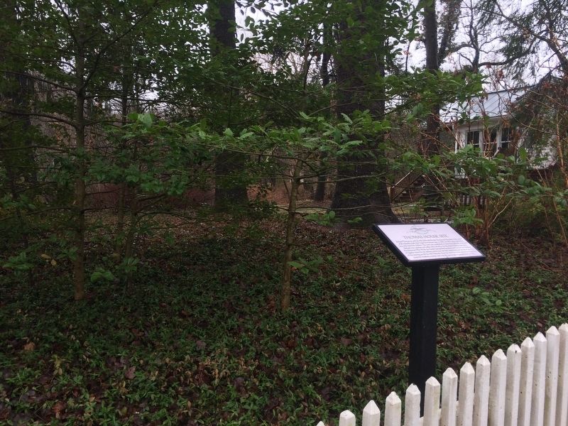
Richard Thomas, Jr. and his wife, Deborah Brooke Thomas, the founders of the town of Brookeville, built their large frame house here ca. 1801. In 1814, they were living here with their five children. The town was established on land that Deborah . . . — — Map (db m114394) HM
On Olney-Sandy Spring Road (Maryland Route 108) at Georgia Avenue (Maryland Route 97), on the right when traveling east on Olney-Sandy Spring Road.
1720: Original land grant of 2550 acres from George III
1760: Area known as Fair Hill after first house built
1800: Olney House built and named after Olney England
1826: Mechanicsville P.O. established at Fair Hill, . . . — — Map (db m179230) HM
On Brooke Road, 0.1 miles west of Chandlee Mill Road, on the right when traveling west.
Countee Cullen: Poet, Anthropologist, Novelist, Translator, Children's Author, and Playwright
Countee Cullen died in 1946; he was only 42 years. In the centuries of the 20s and 30s he along with his friends Arna Bontemps, . . . — — Map (db m188351) HM
Near Brooke Road, 0.1 miles north of Hickory Knoll Road, on the right when traveling north.
The Mutual Memorial Cemetery, established in 1873, is the final resting place of more than 300 African American citizens who lived in and around Sandy Spring, MD. The inhabitants of this hallowed ground, collectively, experienced a history that . . . — — Map (db m206729) HM
On Brooke Road, 0.1 miles west of Chandlee Mill Road, on the right when traveling west.
Harridays and Carrolls
Joseph Harriday was born on November 29, 1953 to the late Archie "Jerry" Bell and the late Sadie Harriday, died on Friday, August 30, 2019 in his home in Germantown, MD. Joe loved watching the "Andy . . . — — Map (db m188347) HM
On Brooke Road, 0.1 miles west of Chandlee Mill Road, on the right when traveling west.
Historic Sites Allegedly Connected to the Underground Railroad
Caleb Bentley and his son Richard Bentley owned and occupied Historic Bloomfield from the early 1800s until 1914. The Bentleys were Quaker farmers, entrepreneurs, and active . . . — — Map (db m188243) HM
On Meeting House Road, on the left when traveling south.
1753: Sandy Spring Friends Meeting established on this site by three or four families who had moved here from first Friends Meeting on Western Shore of Chesapeake Bay.
1770: James Brooke conveyed one acre of land to his sons to . . . — — Map (db m67674) HM
On Brooke Road, 0.1 miles west of Chandlee Mill Road, on the right when traveling west.
Martha Howard and John H. Murphy Alliance Founded the Baltimore Afro-American Newspaper
Martha E. Howard (1846-1915) was the third child of Enoch George and Harriet Howard. She was born a slave and was released to her mother . . . — — Map (db m188350) HM
On Brooke Road, 0.1 miles west of Chandlee Mill Road, on the right when traveling west.
Olive Branch Community Church
On the evening of Sept 13, 2006, a small group met at Reverend Kelly's home. They decided to build a new church. Pastor Kelly and the seven Founding Elders continued to meet at various homes and . . . — — Map (db m188150) HM
The Civil War profoundly affected county residents because of their proximity to Washington, D.C. —the Union Capital— and Virginia, the northern reach of the Confederate States of America. No community in Montgomery County was immune to the . . . — — Map (db m104229) HM
On Brooke Road, 0.1 miles west of Chandlee Mill Road, on the right when traveling west.
Through their efforts, conviction and dedication to the belief that all persons should be free, slavery in the United States was abolished and people of African heritage could finally join the family of Americans.
Sandy Spring slaves were . . . — — Map (db m188138) HM
On Meeting House Road, on the left when traveling south.
1753
First Sandy Spring Meeting
of Record of The
Religious Society of Friends
held in this grove
1817
Present Building Erected
1953
Bicentennial Commemoration
by
Sandy Spring Meeting United . . . — — Map (db m67663) HM
On Brooke Road, 0.1 miles west of Chandlee Mill Road, on the right when traveling west.
Sandy Spring Museum
Sandy Spring Museum located at 17901 Bentley Rd., was founded as a local history museum, preserving the history of the surrounding area of Sandy Spring, MD. The museum is also a community gathering place, . . . — — Map (db m188153) HM
On Brooke Road, 0.1 miles west of Chandlee Mill Road, on the right when traveling west.
The Powell-Matthews-Cook and Brooks Families in Sandy Spring: Focus on Lucy Matthews Cook
Margaret Ann Powell, born circa 1890s is the mother of Lucy Powell Matthews and great grandmother of Lucy Matthews Cook.
Gilbert Matthews [son of . . . — — Map (db m188277) HM
Near Norwood Road (Maryland Route 182) 0.1 miles north of Ednor Road, on the right when traveling north.
In 2004, this trail corridor was named in honor of the mother of the modern environmental movement, Rachel Carson. When complete, the Rachel Carson Greenway Trail will be 25 miles long, connecting the Anacostia Trail System in Prince George's . . . — — Map (db m162744) HM
The Sandy Spring community took its name from this spring, which provides fresh water filtered through the sandy soil. In 1745, the spring was located on what was once known as “Snowden's Manor” and later known as “Harewood”. In 1910, John and . . . — — Map (db m104248) HM
On Brooke Road, 0.1 miles west of Chandlee Mill Road, on the right when traveling west.
Tribute to Robert H. "Bob" Hill: Entrepreneur, Master Builder, and Community Leader
Robert H. Hill was born on a farm in Sandy Spring in 1904. His parent, Samuel T. and Mary Hill, were prosperous and raised not only 16 children, but hogs, . . . — — Map (db m188361) HM
Near Norwood Road (Maryland Route 182) 0.1 miles north of Ednor Road, on the right when traveling north.
More than 150 years ago, Woodlawn plantation was the envy of Montgomery County farmers and the pride of its owners, the Palmer family. The estate boasted one of the County's grandest manor homes, productive fields, and several outbuildings. . . . — — Map (db m162743) HM
On Park Police Drive near Ednor Road, on the left when traveling east.
Sandy Spring has had large Quaker and African American populations since its founding in the 1720s. Encouraged by their regional and national Religious Society, most Sandy Spring Quakers had freed their slaves by about 1820, creating a . . . — — Map (db m67633) HM
On Park Police / Woodlawn Drive, on the right when traveling north.
Built by the Thomas Family in the early 1800s,this property, formerly known as Woodlawn, has national significance. In 1816, Samuel and Anna Thomas established a Friends Boarding School here. Francis Scott Key frequently visited his daughters who . . . — — Map (db m67596) HM
On Layhill Road (Maryland Route 182) at Norwood Road (Maryland Route 182), on the right when traveling west on Layhill Road.
Mothers and fathers alike sought to ensure that their sons and daughters had continual access to education between 1861 and 1865. At the height of the Civil War, public primary schools in Montgomery County were closed due to deficient state . . . — — Map (db m162739) HM
On Randolph Road east of Kemp Mill Road, on the right when traveling east.
A 1794 map of Maryland indicates a mill at this site owned by Quaker minister and political activist Evan Thomas. Thomas' Mill, leased to Thomas Brown in 1803, was sold to Aaron Dyer in 1816. Francis Valdenar purchased the frame saw and grist mill . . . — — Map (db m332) HM
Near Colesville Road (U.S. 29) south of Hillwood Drive, on the left when traveling north.
In 2004, this trail corridor was named in honor of the mother of the modern environmental movement, Rachel Carson. When complete, the Rachel Carson Greenway Trail will be 25 miles long, connecting the Anacostia Trail System in Prince George's . . . — — Map (db m114368) HM
Near Old Muirkirk Road. Reported permanently removed.
Iron Production: Maryland’s Industrial Past
Maryland’s early economy and identity were based on slave-based agriculture. However, slaves were also employed in manufacturing iron, one of the first non-agricultural industries. Seeing how other . . . — — Map (db m104641) HM
On Old Muirkirk Road, 0.2 miles north of Muirkirk Road, on the right when traveling north.
Iron Production: Maryland's Industrial Past
Maryland's early economy and identity were based on slave-based agriculture. However, slaves were also employed in manufacturing iron, one of the first non-agricultural industries.
One of the . . . — — Map (db m188081) HM
On Rennell Avenue West, 0.2 miles east of Willows Road, on the left when traveling east.
The Civil War left St. Mary's County with traditional economic and social structures in ruins. For over 150 year Southern Maryland plantation owners had depended on slave labor, and their sympathies were with the Confederacy. Some had crossed . . . — — Map (db m181741) HM
Near Point Lookout Road (Maryland Route 5) 0.4 miles west of Rosecroft Road, on the left when traveling west.
Throughout the 16th and 17th centuries, England and all of Europe were fraught with religious prejudices. These pitted Protestants against Catholics and let to wars, executions, and torture. England would fight a civil war, in part, over religious . . . — — Map (db m138727) HM
On St. Michaels Road (Maryland Route 33) at Unionville Road (Maryland Route 370), on the right when traveling west on St. Michaels Road.
Near this spot, about 1665, Quaker settlers built the Betty’s Cove Meetinghouse, at this intersection, known as “The Pincushion,” they established a school, adding one of the first public libraries in America in 1676, George Fox, founder . . . — — Map (db m3167) HM
On Easton Parkway (Maryland Route 322) 0.1 miles south of Bay Street (Maryland Route 33), on the right when traveling north.
In December 1682 attended a General Meeting of "Friends" on the Choptank River after a visit to Lord Baltimore at Col. Thomas Tailler's in Ann Arundel Co. "Philemon Lloyd with some horsemen waited on Penn" by order of Lord Baltimore. — — Map (db m138297) HM
Near South Morris Street at Market Street, on the right when traveling north.
1668
A parcel of land, including the area that will become Oxford, is traded from Edward Lloyd to William Stephens, Jr., a Quaker from Dorchester County.
1670
The name "Oxford" first appears on a map of Maryland and Virginia . . . — — Map (db m204977) HM
Near Quaker Road, 0.1 miles north of Spring Hill Rd.
Sandwich Monthly Meeting of Friends, established in 1657, is the
oldest continuous Quaker meeting in North America. It consists
of congregations here, in West Falmouth and in Yarmouth.
This meetinghouse, the third on this site, was built . . . — — Map (db m140503) HM
In Memory
of those members and associates of the East Hoosuck Society of Friends who, laying aside their religious scruples, took up arms, in the War for Independence in defense of their homes and liberties.
In the Friends Burial . . . — — Map (db m118632) WM
Built in 1782 by Quakers who had settled Adams (then East Hoosuc) from Smithfield, R. I. and Dartmouth, Mass. in 1769. Coming together from the farms in this valley, the Friends worshipped here for sixty years before the meeting was laid down upon . . . — — Map (db m118616) HM
On Maple Street west of Forest Park Avenue, on the right when traveling west.
Established c. 1767
Adams' first public burial ground
Begun by the Adams Friends
Designed in 1869 by Charles F. Sayles,
an East Chester native
Resting place of Adams laborers
civic leaders and industrialists
Listed on the National . . . — — Map (db m118615) HM
Thomas Macy, first town clerk of Amesbury, erected this house prior to 1654. Persecuted for harboring Quakers he sold the house and fled to Nantucket, becoming the first white settler as related in Whittier's poem "The Exiles." — — Map (db m48772) HM
On Essex Street just east of North Pine Street, on the right when traveling west.
The Friends Burying Ground is Salem's third oldest and smallest cemetery. Its earliest existing gravestone is dated 1702 for Cestofor Foster. Members of the locally well-known Southwick family are also buried here. On this site in 1718 the Religious . . . — — Map (db m197170) HM
Witness for religious freedom. Hanged on Boston Common - 1660. "My life not availeth me in comparison to the liberty of the truth."
Erected by the Art Commission of the Commonwealth of Massachusetts from the legacy of Zenas Ellis of Fair . . . — — Map (db m20925) HM
On Tremont Street, on the right when traveling north.
Along the second row parallel to the front path are the stones of the three “Rebeccas”: Rebecca (Baker) Gerrish (d. 1743), Rebecca Smith Sanders (d. 1745/6), and Rebecca (Smith) Alexander Deal Sprague (ca. 1704-1746), who were . . . — — Map (db m18984) HM
Near Hull Street, on the left when traveling east.
Most of the gravestones in Copp’s Hill Burying Ground are upright stone markers placed before 1825. The quality and complexity of the carving depended on the skill of the carver and the budget of the person buying the memorial. The majority of the . . . — — Map (db m191735) HM
Near Hull Street, on the left when traveling east.
The Kennebec Raid Captain Thomas Lake (1615-1676) (C-143) was born in Tetney, County Lincoln, England in 1615 and settled in Boston in the 1650s. He and his partner, Thomas Clarke, set up trading posts in Maine, including one at Arrowsic Island . . . — — Map (db m191736) HM
On Chain Lake Street, 0.6 miles east of Carver Road, on the right when traveling east.
In the 1830s southern runaway slaves bound for freedom in Canada came into Michigan near Cassopolis. In 1840, Cass County's Quaker community, which provided a haven for the fugitives, became an integral part of the Underground Railroad. Many free . . . — — Map (db m64712) HM
On State St. (Road M-60) at Broadway Ave. (Road M-62), on the right when traveling west on State St..
Beginning in 1829, Penn, Calvin, and Porter townships in Cass County were settled by Quakers who migrated there. Free Blacks also settled there, and both groups lived in harmony. Blacks in Cass County enjoyed many rights, such as the right to own . . . — — Map (db m79005) HM
On James Street, 0.1 miles north of Brownsville Road, on the right when traveling north.
Quakers from the mid-Atlantic region settled here during the 1830's. This is the site of the meeting house, built in 1856, which replaced a log cabin dating from 1837. The congregation contained many active Abolitionists, and this area soon became . . . — — Map (db m68407) HM
On State Street (State Highway 60) at Water Street, on the right when traveling east on State Street.
Vandalia, prior to the Civil War, was the junction of two important "lines" of the "Underground Railroad." Slaves fleeing through Indiana and Illinois came to Cass County, where Quakers and others gave them shelter. Fugitives seeking a refuge in . . . — — Map (db m201617) HM
On North Adrian Highway (State Highway 52) at West Valley Road, on the left when traveling north on North Adrian Highway.
Adrian Monthly Meetinghouse
Quakers from New York, New Jersey and Pennsylvania settled in southeastern Michigan in the early nineteenth century. In June 1831 Adrian Quakers held their first meeting in the home of Darius Comstock. In 1834 . . . — — Map (db m102686) HM
On East Church Street (State Highway 52) at South Main Street (State Highway 52), on the right when traveling east on East Church Street.
Laura Haviland, affectionately known as Aunt Laura, is probably the best-known and most-admired person who ever lived in Lenawee County. The reason for this admiration and acclaim lies in Mrs. Haviland's life-long devotion to helping others and in . . . — — Map (db m169285) HM
On Grand River Avenue at Oakland Street, on the left when traveling west on Grand River Avenue.
Buildings and sites of historic interest
1. First Post Office, 1825 (23925 Farmington Road)
2. Approximate site of first school, 1826
3. Site of first saw mill, 1826
4. Oldest frame house in Farmington, 1824
5. Site of first . . . — — Map (db m85016) HM
On Grand River Avenue at Liberty Street, on the right when traveling east on Grand River Avenue.
In the 1820's, members of the Society of Friends played a key role in the settlement of several Michigan communities. Farmington was founded in 1824 by Arthur Power, a Quaker from Farmington, New York. In 1831, what was apparently Michigan's first . . . — — Map (db m85104) HM
On Gill Road at Cortland Street, on the left when traveling south on Gill Road.
In 1832 Arthur Power, founder of Farmington, donated this parcel of land for a cemetery and Friends Meeting House. The Friends referred to their burial ground as "God's Acre." The first persons buried here were Selinda and Phebe Minerva Power, . . . — — Map (db m169083) HM
On Shiawassee Road at Farmington Road, on the right when traveling west on Shiawassee Road.
Two Indian Trails crossed at this point: the Orchard Lake Trail running north and south, and the Shiawassee Trail running east and west. In 1824, a Quaker settlement began to develop around this point. In the 1850's, the settlement expanded . . . — — Map (db m85158) HM
On Farmington Road at Glenn Valley Drive, on the right when traveling north on Farmington Road.
Lemuel and Lucy Botsford were Quakers. From Salisbury, Connecticut, they moved to Lyons, New York, and in 1836 to Farmington's Quaker settlement. In 1837 the Botsfords built this Greek Revival house on what became known as Botsford Hill. The house . . . — — Map (db m105576) HM
On Lafayette Road (U.S. 1) at Rocks Road, on the right when traveling north on Lafayette Road.
Based on the 1640 southern boundary of Bachiler's farm, it was surveyed by Capt. Nicholas Shapley in 1657, dividing the Province of New Hampshire from the Massachusetts Bay Colony 1689-1741.
In 1662 three Quaker women, being banished from the . . . — — Map (db m115419) HM
Across this driveway stood the old Quaker (Friends) meeting house and school. At the monthly meeting of the Friends dated Jan. 1, 1731, it was concluded that “ye meeting for worship shall be removed from John Sculls (house) and shall . . . — — Map (db m92416) HM
Near West Park Street west of Prince Street, on the right when traveling west.
English Quakers first settled Bordentown in 1682 and during the 18th century, the community became a center of commerce with stagecoach and ferry connections to New York and Philadelphia. The Camden and Amboy (C&A) Railroad began construction in . . . — — Map (db m212538) HM
On West Broad Street, 0.1 miles west of High Street, on the right when traveling west.
Founded at London in 1675 by William Penn and Quaker trustees, the proprietors of West Jersey sold shares in land that resulted in rapid development of Burlington starting in 1677.
The council was formed in 1688 to manage the growing demand . . . — — Map (db m33896) HM
On West Broad Street east of Locust Avenue, in the median.
The City of Burlington is numbered among the oldest and, at one time, the most influential towns in New Jersey. At Holland's behest, Walloon settlers from southern Belgium arrived at present-day Burlington Island in 1624 and their community . . . — — Map (db m220859) HM
Quakers settled Crosswicks in 1677 and purchased this land toward the end of that century. Friends have worshiped on this site continuously since that time. The smaller building was erected in the mid 1780's for use as a Quaker school and is now . . . — — Map (db m36084) HM
On South Cropwell Road at Old Marlton Pike N on South Cropwell Road.
Cropwell Friends has been placed on the National Register of Historic Places by the United States Department of the Interior. Built 1809. — — Map (db m79434) HM
The Religious Society of Friends (Quakers) established this graveyard in 1759 along with the beginning of Upper Evesham Meeting that now is called Medford Monthly Meeting. The first recorded burial was that of Mark Stratton in the same year. Plain, . . . — — Map (db m79451) HM
On Union Street east of Cherry Street, on the right when traveling east.
Established in 1759, the first Meeting House was built in 1762 The present Meeting House dates from 1814, with the newest addition completed in 1984. 1847-1997 — — Map (db m44780) HM
On N Main Street (County Route 541) south of Marlton Pike (New Jersey Route 70), on the right when traveling north.
Maurice and Jeanette Haines lived here from 1911 to 1974. He served years on Township Committee and as Mayor. She was a Quaker minister, admired for her service to the community. — — Map (db m44678) HM
On S Main Street (County Route 541) at South Street, on the right when traveling south on S Main Street.
Owen Stratton, born in 1769 on his family’s farm south of the village, purchased this home in c. 1835 to be nearer the Union Street Friends Meeting House. — — Map (db m44687) HM
On East Main Street at Chester Avenue on East Main Street.
The granite stone behind this plaque marks the location of the first Friends Meeting House. Built of logs in 1700. It was the earliest building for worship in Moorestown.
In 1720, it burned and was replaced with a large stone building which was . . . — — Map (db m24650) HM
On East Main Street at Chester Avenue on East Main Street.
He was well known as a maker of grandfather clocks. Circa 1775-1832.
For a number of years he was a member of the township committee.
A Quaker, he died in 1832 and is buried in the Friends Graveyard across Main Street.
The building, later . . . — — Map (db m24651) HM
On this site stood John Woolman’s Tailor Shop Here he probably “tended shop and kept books” in 1740 when a lad of 20. He bought the property in 1747, and deeded it to his mother, Elizabeth Woolman in 1753. *************** The second . . . — — Map (db m79684) HM
On Moorestown - Mount Laurel Road at Hainesport Road, on the left when traveling east on Moorestown - Mount Laurel Road.
Oldest Friends Meeting House in Burlington County – Used as barracks for General Clinton’s troops in June 1778 Built 1760 Addition 1798 — — Map (db m35883) HM
On Bank Avenue just east of Main Street, on the right when traveling east.
Dating to 1851 and designed by Philadelphia architect Samuel Sloan as an Italianate Villa, the iconic Caleb Clothier House remains as one of the several founders' "cottages" along the Delaware River bank in Riverton.
Clothier and nine other . . . — — Map (db m194862) HM
On 5th Street just east of Howard Street, on the right when traveling west.
When public education began here, there was no Riverton — or Palmyra — and the idea of public schools was so radical that there were few anywhere in America. Though the Quaker schools of Westfield and Moorestown Friends were formed by . . . — — Map (db m220860) HM
On Bank Avenue west of Penn Street, on the left when traveling west.
Of the ten Riverton founders, Robert Biddle outlived all the others by decades and resided in Riverton far longer. He was an abolitionist, a successful hardware merchant, and the long-time treasurer of Swarthmore College. This was his summer . . . — — Map (db m194881) HM
On Bank Avenue just west of Main Street, on the left when traveling west.
At the crossroads of illustrious Philadelphia families
Ancestors and family connections to this house included a friend of William Penn, the first governor of Pennsylvania, two Mayors of Philadelphia, a member of the Continental . . . — — Map (db m194868) HM
On Highland Road at Springfield Meeting House Road, on the left when traveling north on Highland Road.
This Site was placed in the National
and New Jersey State Historical Registers
in 1979.
The Meeting House, situated at the
intersection of two Indian Trails, is one
of the oldest in Burlington County.
Early Quakers worshipped here . . . — — Map (db m35918) HM
On Cooper Street at North 3rd Street, on the right when traveling west on Cooper Street.
Cooper Street has been one of Camden's most important streets for over two centuries. Known in 1765 as the Middle Ferry Road, it became Cooper Street in 1773 when Jacob Cooper laid out the town in Camden. The street takes its name from the Cooper . . . — — Map (db m208376) HM
Beginning in the 1620s European settlers of Dutch, Swedish and English origin arrived along the Delaware River in the vicinity of present-day Camden, and by the 1670s English Quakers had established permanent homesteads throughout the region. One . . . — — Map (db m88384) HM
On Cooper Street at Haddon Avenue (County Road 561), on the right when traveling east on Cooper Street.
Newton Friends Meetinghouse (c 1828) is the oldest religious building in the city of Camden and is listed on the National Register of Historic Places.
Quakers played an important role in the early development of the colony of New Jersey and . . . — — Map (db m220908) HM
Welcome to Saddler’s Woods Historic Conservation Area. These woods are in the Newton Creek watershed and contain old growth ecosystems, restored woodlands, and wetlands.
Saddler’s Woods is named in honor of Joshua Saddler. Saddler was a slave on a . . . — — Map (db m79621) HM
On Shore Road (Route 9) 0.1 miles south of Argoe Drive, on the right when traveling south.
Built in 1716, a monthly meeting first formed in 1702. This is the oldest Quaker place of worship in New Jersey that is still used for services. — — Map (db m209298) HM
James Whitall, a wealthy Quaker farmer and merchant, and his wife Ann Cooper built the main brick section in 1748. On April 16, 1777, the Pennsylvania militia commandeered the farm and built Fort Mercer in the northern apple orchard. Son Job . . . — — Map (db m13439) HM
On Croton Road (County Road 579) south of Nixon Farm Road, on the right when traveling north.
Established 1764 by Quakers as burial site for non-members of their Society. In mid-1700s, a cemetery for enslaved Africans was sited across the road. By mid-1800s the slaves stones were torn out and the graves plowed over. — — Map (db m208535) HM
On County Route 579, on the right when traveling west.
An early 1700S log meeting here was replaced by a stone structure in 1754. This was torn down and rebuilt in 1862, reusing the original stones. This Friends' meeting is still in use today with its extant records dating back to 1744. — — Map (db m16678) HM
Near Quaker Road (County Route 533) at Mercer Road, on the right when traveling north.
The area around the meeting house and along the Stony Brook river was originally the “Stony Brook Village,” officially part of the town of West Windsor in Middlesex County. A majority of the original colonists that came to settle in . . . — — Map (db m62289) HM
On Hamilton Avenue at New Jersey Route 129, on the right when traveling east on Hamilton Avenue.
Today's casual visitor to Trenton may not fully understand the significance of the "Trenton Makes, the World Takes" sign on the Market Street bridge, however, those words define the important role that Trenton played in the growth of this country . . . — — Map (db m212537) HM
On North Warren Street (U.S. 206) at West Hanover Street, on the right when traveling south on North Warren Street.
The British occupied this site in December, 1776. Buried in its small graveyard are Revolutionary War figures, including George Clymer and General Philemon Dickinson. Clymer, a Pennsylvanian who helped finance the Continental Army, signed the . . . — — Map (db m208093) HM
On S Broad Street at E Front Street, on the right when traveling north on S Broad Street.
Mill Hill Park contains the site of Mahlon Stacy’s gristmill (later known as the Trenton Mills), the city’s very first industrial facility. The American Revolution’s Second Battle of Trenton was partly fought on the park grounds. The . . . — — Map (db m127197) HM
Making steel in the 18th century was a challenge, especially in America. Steel was essential for making edge tools, such as axes and scythes, and other items like bayonets, knives and the mechanisms for guns and clocks; yet the science of making . . . — — Map (db m79352) HM
Near East Hanover Street just west of North Montgomery Street, on the right when traveling west.
George Clymer
Signer of the Constitution of the
United States of America
Deputy from Pennsylvania to
Federal Constitutional Convention
May 25, 1787 – September 17, 1787 — — Map (db m4007) HM
On Lamberton Street north of New Jersey Route 29, on the left when traveling north.
Seeking refuge from religious persecution in England, Quakers John Fenwick and Edward Byllynge buy West New Jersey from John, Lord Berkeley. — — Map (db m211651) HM
On Lamberton Street north of New Jersey Route 29, on the left when traveling north.
A Quaker monthly meeting convenes for the first time at the Falls of the Delaware in the house of William Biles near present day Morrisville. — — Map (db m211659) HM
In the 1670s and 1680s, most of the proprietors of the Province of West Jersey were Quakers. Quakers were attracted to the new colony by the promise of economic prosperity and religious freedom as well as the opportunity to raise families in a . . . — — Map (db m166122) HM
Riverview Cemetery, today a wedge of green between two major highways, is an oasis in the concrete and asphalt of the city where Trenton’s history is written silently in gravestones. Here in 1685, John Lambert conveyed two acres to the . . . — — Map (db m166125) HM
From the onset of European settlement in North America slavery was a recognized institution and integral to the colonial economy. Although Quakers discouraged the practice, settlers of other religious faiths living in the Delaware Valley . . . — — Map (db m166128) HM
Just as the river has for centuries flowed across the falls of the Delaware, so have waves of people streamed into the Trenton area to settle, raise families and make a living. Still more people have passed through this hub in the landscape – . . . — — Map (db m166133) HM
611 entries matched your criteria. Entries 101 through 200 are listed above. ⊲ Previous 100 — Next 100 ⊳