429 entries match your criteria. The first 100 are listed. ⊳
Former U.S. Presidents: #18 Ulysses S. Grant Historical Markers
By Brandon Fletcher, July 9, 2011
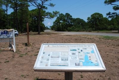
"Damn The Torpedoes!" The Campaigns for Mobile, 1864 - 1865 Marker
| 1 ► Alabama, Baldwin County, Gulf Shores — "Damn The Torpedoes!" The Campaigns for Mobile, 1864 - 1865 — |
| On Fort Morgan Road (Alabama Route 180) 1.2 miles west of Dune Road, on the right when traveling west. | |||
| 2 ► Alabama, Baldwin County, Spanish Fort — “Damn The Torpedoes!” — The Campaigns for Mobile, 1864-1965 — |
| On Larry Dee Cawyer Drive. | |||
| 3 ► Alabama, Mobile County, Mobile — "Damn The Torpedoes!" The Campaigns for Mobile, 1864 - 1865 — The Museum of Mobile — |
| On South Royal Street south of Government Street, on the left when traveling south. | |||
| 4 ► Alabama, Wilcox County, Furman — Furman National Historic District — |
| On Freedom Farm Road (County Route 59) 0.3 miles south of Alabama Route 21, on the right when traveling south. | |||
| 5 ► Arizona, Cochise County, Bowie — The Bascom Affair — |
| Near Apache Pass Road. | |||
| 6 ► Arkansas, Benton County, Bella Vista — United States Commanders in Chief — |
| 7 ► Arkansas, Pulaski County, Little Rock, Downtown — Capital Hotel — Historical Marker — |
| On Louisiana Street at West Markham Street, on the right when traveling north on Louisiana Street. | |||
| 8 ► California, Calaveras County, Murphys — 267 — Old Sperry Hotel — The Mitchler Hotel — |
| On Main Street west of South Algiers Street, on the right when traveling east. | |||
| 9 ► California, Madera County, Madera — Madera — Spanish for "Lumber", The First Industry — |
| On Highway 145 at Road 400, on the right when traveling west on Highway 145. | |||
| 10 ► California, Mariposa County, Mariposa — Schlageter Hotel — |
| On Charles (Main) Street (State Highway 140) at 5th Street, on the left when traveling south on Charles (Main) Street. | |||
| 11 ► California, Napa County, Yountville — Flags over California in 1870 — |
| Near Washington Street near Yount Street, on the left when traveling north. | |||
| 12 ► California, Nevada County, Grass Valley — Holbrooke Hotel — Founded 1851 — |
| On Main Street, on the right when traveling west. | |||
| 13 ► California, Sacramento County, Sacramento, Southwestern Sacramento — Pioneer Cemetery Grove — Sacramento Pioneer Association – Founded 1854 |
| Reported permanently removed. | |||
| 14 ► California, Santa Clara County, Hollister — 1843 - Rancho de San Luis Gonzaga - 1931 — |
| Near Whiskey Flat Road/Trail. | |||
| 15 ► California, Siskiyou County, Fort Jones — Sgt. James Bryan — |
| Near Cemetery Road. | |||
| 16 ► California, Siskiyou County, Tulelake — Last Meeting of the Peace Commission — Lava Beds National Monument — National Park Service, U.S. Department of the Interior — |
| On Hill Road. | |||
| 17 ► California, Stanislaus County, Knights Ferry — Knight's Ferry — 1849 - 1930 — |
| On Sonora Road at Dent Street, on the left when traveling west on Sonora Road. | |||
| 18 ► California, Stanislaus County, Knights Ferry — 347 — Knight's Ferry — ← 1 Mile — |
| On State Highway 120 at milepost 16.4 at Kennedy Road, on the left when traveling west on State Highway 120. | |||
| 19 ► California, Tulare County, Kings Canyon National Park — General Grant Tree Trail — |
| On Swale Road. | |||
| 20 ► California, Tulare County, Porterville — Welcome to the Tule River Indian-Reservation — |
| On N Reservation Drive, on the right when traveling north. | |||
| 21 ► Colorado, Denver County, Denver, Central — Constitution Hall — |
| On Blake Street, on the right when traveling south. | |||
| 22 ► Colorado, Gilpin County, Central City — Central City — |
| On Main Street (State Highway 279) at Spring Street on Main Street. | |||
| 23 ► Connecticut, Litchfield County, Plymouth, Terryville — Dorence Atwater, Plymouth's Civil War Hero — |
| On Main Street at Main Street, on the right when traveling north on Main Street. | |||
| 24 ► Delaware, Sussex County, Georgetown — SC-96 — General Alfred T.A. Torbert — |
| On West Pine Street, on the right when traveling north. | |||
| 25 ► Delaware, Sussex County, Milton — SC-207 — Governor Joseph Maull Carey — |
| On Federal Street (Delaware Route 5) near Coulter Street, on the right when traveling south. | |||
| 26 ► District of Columbia, Washington, Northeast Washington, Capitol Hill — Frederick Douglass — (1817 - 1895) — |
| Near A Street Northeast east of Frederick Douglas Court Northeast, on the left when traveling east. | |||
| 27 ► District of Columbia, Washington, Northwest Washington, Capitol Hill — Ulysses S. Grant Memorial — |
| On 1st Street Northwest north of East Capitol Circle Northwest, on the left when traveling north. | |||
| 28 ► District of Columbia, Washington, Northwest Washington, Downtown — White House Kitchen Garden — National Park Service, U.S. Department of the Interior — |
| On E Street Northwest west of 15th Street Northwest, on the right when traveling west. | |||
| 29 ► District of Columbia, Washington, Northwest Washington, Foggy Bottom — Winder Building — Erected 1848 — Purchased by United States Government 1852 |
| On 17th Street Northwest at F Street Northwest, on the right when traveling south on 17th Street Northwest. Reported permanently removed. | |||
| 30 ► District of Columbia, Washington, Northwest Washington, Former Walter Reed Army Medical Center — 6 — Cameron's Creek and the Rose Garden — Former Walter Reed Army Medical Center — Walking Tour — |
| On Main Drive Northwest, 0.1 miles west of 12th Street Northwest, on the right when traveling east. | |||
| 31 ► District of Columbia, Washington, Northwest Washington, Logan Circle — John Logan House — A Memorial to General and Senator John A. Logan — Champion in the Struggle to Preserve the Union and Establish Racial Justice in America — |
| On P Street Northwest at Logan Circle Northwest, on the left when traveling east on P Street Northwest. | |||
| 32 ► District of Columbia, Washington, Northwest Washington, Logan Circle — John Logan House — A Memorial to General and Senator John A. Logan — Champion in the Struggle to Preserve the Union and Establish Racial Justice in America — |
| On Logan Circle Northwest just north of P Street Northwest, on the right when traveling south. | |||
| 33 ► District of Columbia, Washington, Northwest Washington, Logan Circle — No Braver Man Than John Logan — |
| On P Street Northwest at Logan Circle Northwest, on the left when traveling east on P Street Northwest. | |||
| 34 ► District of Columbia, Washington, Northwest Washington, Logan Circle — When Logan Rode The Battle Line — |
| On P Street Northwest west of Logan Circle Northwest, on the left when traveling east. | |||
| 35 ► District of Columbia, Washington, Northwest Washington, Penn Quarter — The New Willard — Erected 1901 — |
| On Pennsylvania Avenue Northwest at 14th Street Northwest (Highway 1), on the right when traveling west on Pennsylvania Avenue Northwest. | |||
| 36 ► District of Columbia, Washington, Northwest Washington, Penn Quarter — W.6 — The Willard InterContinental Hotel — Civil War to Civil Rights — Downtown Heritage Trail — |
| On 14th Street Northwest at Pennsylvania Avenue Northwest, on the right when traveling south on 14th Street Northwest. | |||
| 37 ► District of Columbia, Washington, Northwest Washington, Penn Quarter — W.6 — The Willard Inter-Continental Hotel — Civil War to Civil Rights — Downtown Heritage Trail |
| On 14th Street Northwest (U.S. 1) at Pennsylvania Avenue Northwest, on the right when traveling south on 14th Street Northwest. Reported permanently removed. | |||
| 38 ► District of Columbia, Washington, Southwest Washington, Capitol Hill — Capitol Square, SW — Historical Information — |
| On 1st Street Southwest at Garfield Circle Southwest on 1st Street Southwest. | |||
| 39 ► District of Columbia, Washington, Southwest Washington, Capitol Hill — Ulysses S. Grant Memorial — National Mall and Memorial Parks — National Park Service, U.S. Department of the Interior |
| On 3rd Street Southwest north of Maryland Avenue Southwest, on the right when traveling north. Reported missing. | |||
| 40 ► District of Columbia, Washington, Southwest Washington, Southwest Waterfront — 16 — Recreation and River Park — River Farms to Urban Towers — Southwest Heritage Trail — |
| On N Street Southwest east of 4th Street Southwest. | |||
| 41 ► District of Columbia, Washington, Southwest Washington, Southwest Waterfront — The River Queen — |
| On Wharf Street Southwest west of District Square Southwest, on the left when traveling north. | |||
| 42 ► Florida, Alachua County, Archer — F-320 — David Levy Yulee and Cotton Wood Plantation — |
| On SW 134th Avenue at SW 170th St, on the right when traveling west on SW 134th Avenue. | |||
| 43 ► Florida, Seminole County, Sanford — Mount Vernon Grove — Featured Tree — Mount Vernon Red Maple — |
| Near West 7th Street just west of Myrtle Avenue, on the right when traveling west. | |||
| 44 ► Florida, St. Johns County, St. Augustine — Officers' Quarters |
| On Marine Street, 0.1 miles south of St. Francis Street/Avenida Menendez, on the right when traveling south. Reported permanently removed. | |||
| 45 ► Florida, St. Johns County, St. Augustine — William Wing Loring — |
| On Florida 13 at Cordova Street, on the left when traveling east on Florida 13. | |||
| 46 ► Florida, Volusia County, DeBary — F-155 — DeBary Hall / Florida Federation of Art, Inc. — |
| On Sunrise Boulevard at Mansion Boulevard on Sunrise Boulevard. | |||
| 47 ► Georgia, Bartow County, Kingston — Sherman’s March to the Sea — |
| On East Main Street at Elliott Street, on the left when traveling east on East Main Street. | |||
| 48 ► Georgia, Coweta County, Newnan — William Thomas Overby — |
| On West Court Square at North Court Square, on the left when traveling west on West Court Square. | |||
| 49 ► Georgia, Glynn County, Jekyll Island — Preserving the Legacy — |
| On Old Plantation Road north of Schoolhouse Lane, on the right when traveling north. | |||
| 50 ► Georgia, Walker County, Chickamauga — North and South Reunited — Historic Camp Thomas — |
| Near Cove Road (Georgia Route 341) south of Gordon Street. | |||
| 51 ► Georgia, Walker County, Chickamauga — Rosencrans Avenue — Major General William S. Rosencrans, USA 1819-1898 — |
| On Gordon Street at Rosencrans Avenue (unopened), on the right when traveling west on Gordon Street. | |||
| 52 ► Georgia, Walker County, Chickamauga — Start of the Atlanta Campaign — Historic Chickamauga Georgia — |
| Near Red Belt Road south of Lee-Gordon Mill Circle. | |||
| 53 ► Illinois, Alexander County, Cairo — The Meeting of the Rivers — |
| On Fort Defiance Road, on the right when traveling south. | |||
| 54 ► Illinois, Coles County, Mattoon — Lieutenant General Ulysses S. Grant — |
| On Shelby Avenue east of North Second Division Street, on the right when traveling east. | |||
| 55 ► Illinois, Coles County, Mattoon — Mattoon's Union Agricultural Fairgrounds and Civil War Camp Grant — |
| On Shelby Avenue east of North Second Division Street, on the right when traveling east. | |||
| 56 ► Illinois, Cook County, River Grove — U.S. Grant G.A.R. Post No. 28 Memorial — |
| 57 ► Illinois, Monroe County, Waterloo — Col. William R. Morrison — |
| Near Park Street (Illinois Route 156) at South Library Street, on the left when traveling east. | |||
| 58 ► Illinois, Pike County, Perry — General Grant and the 21st IL Regiment — |
| On County Highway 5 at 354th Avenue, on the right when traveling south on County Highway 5. | |||
| 59 ► Illinois, Sangamon County, New Berlin — Colonel Ulysses S. Grant — |
| On Old Jacksonville Road (County Route 8) at New Salem Church Road, on the left when traveling west on Old Jacksonville Road. | |||
| 60 ► Illinois, Sangamon County, Springfield, Historic West-Side — Site of Camp Yates — 1861 — |
| On South Lincoln Avenue south of West Washington Avenue, on the left when traveling south. | |||
| 61 ► Indiana, Huntington County, Huntington — Huntington Civil War Memorial — |
| On W. Park Drive. | |||
| 62 ► Iowa, Cerro Gordo County, Mason City — Civil War Memorial — |
| On Federal Avenue south of 1st Street NW, on the right when traveling south. | |||
| 63 ► Kansas, Johnson County, Merriam — 05 — Merriam Park & George Kessler — Merriam Historic Plaza Walking Path — |
| 64 ► Kansas, Leavenworth County, Fort Leavenworth — Grant — |
| On Grant Avenue at Riverside Drive, on the left when traveling north on Grant Avenue. | |||
| 65 ► Kansas, Leavenworth County, Leavenworth — 9 — General William Tecumseh Sherman — "Local Lawyer & Total Warrior" — Historic Wayside Tour #9 — |
| On Esplanade Street at Delaware Street, on the left when traveling north on Esplanade Street. | |||
| 66 ► Kentucky, Ballard County, Wickliffe — 27 — Fort Jefferson — |
| On Westvaco Road (U.S. 51/62), on the right when traveling south. | |||
| 67 ► Kentucky, Ballard County, Wickliffe — 757 — Union Supply Base — |
| On Westvaco Road (U.S. 51/62), on the right when traveling south. | |||
| 68 ► Kentucky, Carlisle County, Bardwell — 563 — Demonstration - 1862 — |
| On Elm Street (U.S. 51/62), on the right when traveling south. | |||
| 69 ► Kentucky, Kenton County, Covington — 1594 — Grant House — |
| On Greenup Street north of 6th Street, on the right when traveling north. | |||
| 70 ► Kentucky, Laurel County, East Bernstadt — Battle of Camp Wildcat — |
| Near Old Wilderness Road, 0.1 miles south of Camp Wildcat Road (Sheltowee Trace). | |||
| 71 ► Kentucky, Madison County, Bighill — 1905 — Merritt Jones / Wayside Tavern / Jones Tavern / CSA Cemetery — |
| On McKee Road (U.S. 421) 1.3 miles south of Big Hill Road (State Road 21), on the right when traveling north. | |||
| 72 ► Kentucky, Madison County, Richmond — Battle of Richmond, Ky. — August 29-30, 1862 — |
| On Berea Road (U.S. 25/421) at Pace Ramsey Road, on the left when traveling south on Berea Road. | |||
| 73 ► Kentucky, Marion County, Lebanon — Major General George H. Thomas at Lebanon, Kentucky — |
| On North Spalding Avenue (Kentucky Route 55) at West Walnut Street (Kentucky Route 55), on the left when traveling north on North Spalding Avenue. | |||
| 74 ► Kentucky, McCracken County, Paducah — 924 — Grant's Proclamation — |
| On North 5th Street north of Park Avenue, on the right when traveling east. | |||
| 75 ► Kentucky, McCracken County, Paducah — 916 — Paducah, Kentucky / McCracken County — |
| On North 8th Street (Business U.S. 45) at North H C Mathis Drive (U.S. 45), on the right when traveling east on North 8th Street. | |||
| 76 ► Kentucky, McCracken County, Paducah — Union Gen. U.S. Grant — |
| On North Water Street. | |||
| 77 ► Kentucky, McCracken County, Paducah — 829 — Welcome to Paducah, Ky. / Barkley Field, Paducah, Ky. — |
| On Richard Roof Drive, 0.1 miles west of Fisher Road (Kentucky Highway 724), on the right when traveling south. | |||
| 78 ► Louisiana, East Carroll Parish, Lake Providence — Grant's Canal — |
| On U.S. 65 at Ingram Street, on the right when traveling north on U.S. 65. | |||
| 79 ► Louisiana, East Carroll Parish, Lake Providence — Soldiers' Rest — |
| On Lake Street (U.S. 65) 0.2 miles north of Huggins Street, on the right when traveling north. | |||
| 80 ► Louisiana, Grant Parish, Colfax — Grant Parish and Town of Colfax — |
| On Eighth Street (State Highway 158) at Main Street (Alexandria-Colfax Highway) (State Highway 8), on the right when traveling north on Eighth Street. | |||
| 81 ► Louisiana, Lafourche Parish, Thibodaux — Mary King Fulford — |
| On Jackson Street south of Seventh Street, on the right when traveling south. | |||
| 82 ► Louisiana, Madison Parish, Delta — Grant's Canal — |
| Near Old Highway 80 East at Stafford Drive, on the left when traveling south. | |||
| 83 ► Louisiana, Madison Parish, Delta — Grant's Canal — |
| Near Old Highway 80 East at Stafford Drive, on the left when traveling south. | |||
| 84 ► Louisiana, Madison Parish, Delta — Mississippi Sidestep — |
| Near Old Highway 80 East at Stafford Drive, on the left when traveling south. | |||
| 85 ► Louisiana, Madison Parish, Tallulah — Crescent Plantation — |
| On State Highway 602 at Crescent Plantation Drive, on the right when traveling east on State Highway 602. | |||
| 86 ► Louisiana, Rapides Parish, Pineville — Deserting soldiers and the end of the war — |
| On Riverfront Street north of Main Street. | |||
| 87 ► Louisiana, Tensas Parish, Newellton — Franklin Plantation — |
| On State Highway 605, 0.5 miles south of State Highway 888, on the right when traveling south. | |||
| 88 ► Maine, Kennebec County, Augusta — 12 — Maine's Voice Against Slavery / Le Maine Proteste Contre l'Esclavage — |
| On Winthrop Street at Wyman Street, on the right on Winthrop Street. | |||
| 89 ► Maryland, Anne Arundel County, Annapolis — Lincoln in Annapolis — |
| On West Street at Calvert Street, on the right when traveling west on West Street. | |||
| 90 ► Maryland, Anne Arundel County, Fort Meade — Major General George G. Meade — Fort George G. Meade - United States Army — |
| On English Avenue, 0.2 miles south of Mapes Road, on the right when traveling north. | |||
| 91 ► Maryland, Cecil County, Elkton — Creswell Hall — |
| On Delaware Avenue (Maryland Route 7) 0.1 miles east of Creswell Ave., on the right when traveling east. | |||
| 92 ► Maryland, Cecil County, Port Deposit — John A. J. Creswell — |
| On Main Street (Maryland Route 222) at Center Street (Maryland Route 276), on the right when traveling north on Main Street. | |||
| 93 ► Maryland, Frederick County, Frederick — Battle of Monocacy — The Battle that saved Washington — |
| On Urbana Pike (State Highway 355), on the right when traveling south. | |||
| 94 ► Maryland, Frederick County, Frederick — The Battle That Saved Washington — |
| Near Interstate 270, on the right when traveling west. | |||
| 95 ► Maryland, Garrett County, Oakland — Garrett Memorial Church — (St. Matthew’s Episcopal Church) — |
| On West Liberty Street near South 2nd Street, on the left when traveling west. | |||
| 96 ► Maryland, Montgomery County, Silver Spring, Downtown Silver Spring — The Blair Family and the Civil War — |
| Near Jesup Blair Drive east of Georgia Avenue (U.S. 29), on the right when traveling east. | |||
| 97 ► Maryland, Prince George's County, Hyattsville — “Hitching Post Hill” or “Ash Hill” — |
| On Rosemary Lane, 0.2 miles west of Claymore Avenue, on the left when traveling west. | |||
| 98 ► Massachusetts, Dukes County, Oak Bluffs, Martha's Vineyard — The Bishop Gilbert Haven Cottage — |
| On Clinton Avenue south of Jordan Crossing, on the left when traveling south. | |||
| 99 ► Massachusetts, Middlesex County, Lexington — Lexington Ship Memorial — |
| Near Bedford Street (Massachusetts Route 225) at Massachusetts Ave (Massachusetts Route 4), on the right when traveling north. | |||
| 100 ► Massachusetts, Middlesex County, Lexington — The Battle Green — |
| On Harrington Road, on the right when traveling east. | |||
429 entries matched your criteria. The first 100 are listed above. Next 100 ⊳