By Mark Hilton, August 26, 2013
Autaugaville Marker
GEOGRAPHIC SORT WITH USA FIRST Geographic Sort Title Sort Marker Number Sort Marker Number Sort N Marker Number Sort T Publication Order Sort Publication Order Sort A Erected Year Sort Most Viewed Sort Most Recent-Interest Sort Most Recently Changed Sort SEE FAQ #33 FOR DESCRIPTIONS
On South Autauga Street at Academy Street, on the right when traveling south on South Autauga Street.
On Main Street (U.S. 84) at College Street, on the right when traveling north on Main Street.
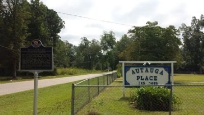
Near County Road 484, 0.2 miles east of County Road 473, on the right when traveling east.
On Railroad Street Southwest at Hickory Street Southeast, on the right when traveling north on Railroad Street Southwest.
On South 4th Street at Toughnut Street, on the right when traveling north on South 4th Street.
On Spring Street, on the left when traveling north.
On Klamath Boulevard, 0.2 miles south of Ehlers Avenue, on the right when traveling north.
On Racetrack Valley Road, 26 miles south of Ubehebe Crater, on the left when traveling south.
On Hollywood Boulevard at Highland Avenue, on the left when traveling west on Hollywood Boulevard.
On North Hermosa Avenue north of West Carter Avenue, on the left when traveling north.
Near Mattly Avenue near 1st Street.
On U.S. 395 north of Deadmans Creek Exit, on the right when traveling south.
Paid Advertisement
On 7th Street at K Street, on the right when traveling south on 7th Street. Reported missing.
On Puesta Del Sol just west of Mission Canyon Road, on the left when traveling west.
On Figueroa Street just north of Harbor Boulevard, on the right when traveling north.
On 21st Street Northwest at H Street Northwest, on the right when traveling south on 21st Street Northwest.
On Ehren Cemetery Road, 1.2 miles south of Ehren Cutoff Road (County Road 583), on the right when traveling south.
Near San Marco Avenue (Business U.S. 1) at West Castillo Drive, on the right when traveling north.
On South Main Street (Business U.S. 319) just south of East Central Avenue (Georgia Route 37), on the left when traveling south.
On East 16th Avenue (Georgia Route 30) 0.1 miles west of I-75 and 16th Avenue (Interstate 75), on the right when traveling west.
On Court Square (Georgia Route 62) at Main Street, on the left when traveling east on Court Square.
On North Perry Street (Georgia Route 20) south of Lawrenceville Highway (Georgia Route 8), on the left when traveling south.
On East Crogan Street at North Clayton Street, on the left when traveling east on East Crogan Street.
On East Crogan Street at South Clayton Street (Georgia Route 20), on the right when traveling east on East Crogan Street.
On North Perry Street (Georgia Route 20) at West Crogan Street (Georgia Route 8), on the right when traveling south on North Perry Street.
On East Crogan Street east of South Clayton Street, on the right when traveling east.
On North Clark Street at West Wisconsin Street, on the right when traveling north on North Clark Street.
Paid Advertisement
Near South Front Street south of 2nd Street, on the left when traveling south.
On Washington Street at North 6th Street, on the right when traveling west on Washington Street.
On North Des Moines Street (Fox Avenue) (County Highway M43) just north of Market Street (330th Street) (State Highway 175), on the left when traveling north.
On Old Mammoth Cave Road (at milepost 15), 1.2 miles north of Mammoth Cave Road (Kentucky Route 70), on the right when traveling west.
On Muses Mill Road (Route 1103) at Morehead Road (Kentucky Route 32), on the right when traveling east on Muses Mill Road.
On Old Shelbyville Road at Middletown Square, on the left when traveling west on Old Shelbyville Road.
On Second Street (State Highway 8) near Main Street/Alexandria-Colfax Highway (State Highway 8), on the right when traveling north.
On Baltimore Street at Queen City Drive, on the left when traveling east on Baltimore Street.
Near West Fayette Street at North Greene Street.
On Reno Monument Road at the Appalachian Trail, on the left when traveling west on Reno Monument Road.
On Massachusetts Avenue at Memorial Drive, on the right when traveling south on Massachusetts Avenue.
On U.S. 31, 0.8 miles west of Airport Drive (Marion Center Road) (County Highway 65), on the right when traveling west.
On South Sharpe Avenue at Shelby Street, on the right when traveling south on South Sharpe Avenue.
Near Frederic Street north of Live Oak Avenue, on the left when traveling north.
On North Water Street at Themis Street, on the right when traveling south on North Water Street.
On Water Street at Market Street, on the right when traveling south on Water Street.
Paid Advertisement
Near Daniel Webster Highway (U.S. 3) 0.2 miles north of Connector Road.
On Cranbury Road (County Route 615).
On East Main Street, 0.5 miles east of Teague Drive, on the right when traveling east.
Near Laurel Park Highway, 0.1 miles north of Beechwood Circle.
Near 12th Street Northeast, 0.2 miles east of 6th Avenue Northeast (Chautauqua Boulevard), on the left when traveling east.
On Broadway North just north of 2nd Avenue North, on the left when traveling north.
On Waterloo-Mt Vernon Road (County Route 14) west of Ohio Route 141, on the right when traveling west.
Near Ohio Route 93 at Rock Run Road (County Route 41), on the left when traveling south.
On Edward Warren Drive (Cemetery Road), 0.2 miles north of Ohio River Scenic Byway (U.S. 52), on the right when traveling north.
On State Highway 38 at Screw Pin Rd (County Road 18), on the right when traveling south on State Highway 38.
On Main Street (U.S. 41/64) at Mabee Avenue, on the right when traveling east on Main Street.
On N Washington Street near W Broadway Street, on the right when traveling north.
Paid Advertisement
Near South 12th Street, on the right when traveling south.
Near Gendy Street north of Burnett Tandy Drive.
On Main Street (Vermont Route 131) at High Street, on the right when traveling west on Main Street.
On Stilwell Drive just west of Pullman Road, on the left when traveling west.
Near Flag Rock Road, 0.9 miles north of 12th Street Northwest (Route 619), on the right when traveling north.
Near Fort Chiswell Road (U.S. 52) at Pauley Flatwoods (County Road 608).
On Midland Trail W Road (U.S. 60) 0.1 miles south of Exit 156 - Sam Black Church exit (Interstate 64), on the right when traveling east.
On East Washington Avenue (U.S. 151) near North Stoughton Road (U.S. 51), on the right when traveling west.
Near South Main Street (State Road 80) south of West Webster Street, on the right when traveling south.
On 5 Avenue just north of Main Street, on the right when traveling north.
On Main Street (Manitoba Route 52) just south of William Avenue, on the right when traveling south.
On Route Marie-Victorin (Québec Route 132) 3.5 kilometers east of 12ieme Avenue (Québec Route 265), on the left when traveling east.
On Rue du Petit Champlain south of Rue Sous le Fort, on the right when traveling south.
On Calle Rodolfo Robles at 21 Avenida, on the right when traveling west on Calle Rodolfo Robles.
Near Lorong 14 just east of Lorong 4, on the left when traveling east.