254 entries match your criteria. The first 100 are listed. Next 100 ⊳
Santa Fe Trail Historical Markers
This is an important trade route from New Franklin, Missouri (and parts west as the railroad moved west) to Santa Fe, New Mexico. The trail was in use from 1822 until the late 1880s.
By Mark Hilton, June 27, 2018
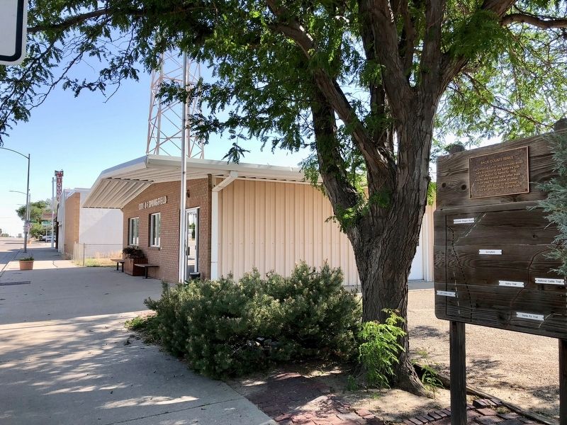
Baca County Trails Marker near the Springfield Town Hall.
The Cimarron Cutoff and Granada Road were branches of the Santa Fe Trail from Missouri to Santa Fe. The Aubrey and Penrose were other trails. From 1866-97 thousands of Texas cattle were driven to Montana on the XIT and National Cattle trails. — — Map (db m120040) HM
Dinosaur Freeway Geology of John Martin Reservoir
is part of the Dakota sandstone
formations which extend from Denver,
Colorado to Tucumcari, New Mexico.
In the Cretaceous period the region
was bordered with lakes, swamps . . . — — Map (db m181091) HM
Trail of Commerce
The heavily laden freight wagons traveled in parallel columns to minimize dust and for convenience when circling the wagons at night or when danger threatened. A circle of wagons provided a fine defensive position. But the . . . — — Map (db m77883) HM
Panel 1
Road to Santa Fe
"...for it begins upon the outside line of the outside State (Missouri) and runs directly toward the setting sun..." - Sen. Thomas Hart Benton, following the Santa Fe Trail survey, 1825
For . . . — — Map (db m97715) HM
This monument
marks the route of the
Santa Fe Trail
1822 - 1879
placed by the
Daughters of the
American Revolution
and the
State of Colorado
It also commemorates
the faithful work of
Harriett Parker Campbell . . . — — Map (db m77856) HM
This memorial is the
Property of the State of Colorado
The Santa Fe Trail
1840 - 1878
Two roads or forks of the Mountain Branch
of the Santa Fe Trail-Bent's Old Fort to
Taos and Santa Fe-joined . . . — — Map (db m104912) HM
The Santa Fe Trail was a major trade route to and from Santa Fe, New Mexico between 1821 and 1880. Wagon ruts, visible from the highway, evidence the thousands of caravans that traversed the route during its 59-year period of use. The Santa Fe Trail . . . — — Map (db m191749) HM
Erected at the request of the Daughters of the American Revolution 1910 by A.E. Reynolds
Bent's Fort Santa Fe Trail as shown by ruins of walls in 1909
1822 The Santa Fe Trail 1875
This stone marks the point of the trail where the . . . — — Map (db m192004) HM
Travelers from Missouri would have crossed more than 600
miles of plains by the time they stood here. They picked this
more difficult Mountain Route of the Santa Fe Trail for its
reliable water. With less than a quarter of the trip . . . — — Map (db m180840) HM
An area along the Arkansas River bottoms, 45 miles westward from a point 20 miles east of Lamar was known as “The Big Timbers” during the “Building of the West.” Big Timbers received its name from giant cottonwoods which flanked both banks of the . . . — — Map (db m213689) HM
Location, Location, Location
Thousands of caravans used the Santa Fe Trail between 1821 and 1880. The trail clung close to the Arkansas River for hundreds of miles across the open plains. The Arkansas Valley offered gentle terrain . . . — — Map (db m106937) HM
John Martin Reservoir The Southeast Colorado region, including the Big Timbers area, was once a great inland sea. The first transportation routes across the Santa Fe Trail were established by prehistoric migrating groups that . . . — — Map (db m213693) HM
The Story Begins… in 1922 when Mrs. John Trigg Moss representing the National Society of the Daughters of the American Revolution and Harry Truman joined forces to petition Congress to designate a "National Old Trails Road," . . . — — Map (db m213698) HM
The Santa Fe Trail was the main trade route between Franklin MO and Santa Fe NM. The main part of the trail was 780 miles long. Thousands of freight wagons rumbled along the trail each year, except for the winter months. The trail passes several . . . — — Map (db m106939) HM
The Heart of the Old West Santa Fe Trail Scenic and Historic Byway is an 188 mile portion of the Santa Fe National Historic Trail designated as one of America's Byways and a Colorado Scenic Byway. The entire Santa Fe Trail begins in . . . — — Map (db m213699) HM
The Santa Fe Trail passed through present Lamar a quarter-mile south of this sign. In 1821 it became America's first international commercial highway, and for sixty years it was one of the nation's great routes of commerce and westward expansion. . . . — — Map (db m213700) HM
In the early 19th century, the Santa Fe and Taos trails became the most renowned trading rouses in the West. For 60 years, American and Mexican traders drove great caravans of prairie schooner across a sweeping sea of grass - an 800-mile route that . . . — — Map (db m188275) HM
We set out at the ushal time and at 8 miles West We passed point of Red Rocks about 600 yds from the river and at Eleven miles crossed the paney River….Some Cottenwood on the Banks and Some Bushis. the Red Rock is evidently a volcanic production . . . — — Map (db m64249) HM
No one actually knows how Pawnee Rock was named. Josiah Gregg, who had been over the Santa Fe Trail eight times beginning in 1831, wrote: the attention of the traveller is directed to the ‘Pawnee Rock' so called, it is said, on account of a . . . — — Map (db m64243) HM
From 1821 until late in the 1800s Pawnee Rock was a noted landmark along the Santa Fe Trail. Thousands of wagons lumbered and creaked by here carrying goods to or from the great American Southwest. Many travelers recorded their impressions of . . . — — Map (db m64245) HM
Slowly along came the line of wagons, and the prairie breeze brought us, in sound, faint and far between, the driver’s invocations to their mules.
Matthew C. Field, journalist
1839
From 1821 until the late 1860s the Santa Fe Trail ran . . . — — Map (db m64241) HM
Standing here 175 years ago Santa Fe Trail travelers looked out over a sea of grass. About three miles to the south a line of timber marked the Arkansas River which meandered across the prairie. A few plum thickets dotted the landscape, and an . . . — — Map (db m64203) HM
Standing here 175 years ago Santa Fe Trail travelers looked out over a sea of grass. About three miles to the south a line of timber marked the Arkansas River which meandered across the prairie. A few plum thickets dotted the landscape, and an . . . — — Map (db m64205) HM
Pawnee Rock changed very little for ten thousand years. The hill was grass-covered with a fifty-foot-high face on the southeast side in front of you. Wind, water, and vegetation slowly eroded the stone.
But Pawnee Rock has changed. The top of . . . — — Map (db m64242) HM
A mile northeast is Pawnee Rock, a famous landmark on the Santa Fe Trail. Considered the mid-point of the long road between Missouri and New Mexico. Pawnee Rock was a symbol of challenges overcome. Many early travelers mentioned it in their . . . — — Map (db m55303) HM
"We first rode nearly north about a mile to a remarkable Rocky Point . . .We rode upon the top which is probably 50 feet above the plain below, and from whence there is a charming view of the country in every direction."
—George Sibley, . . . — — Map (db m64191) HM
In honor of the brave men and women
who passing over the old Santa Fe Trail,
endured the hardships of frontier life,
and blazed the path of civilization for posterity
Pawnee Rock, given to the State of Kansas
by Benj. P. Unruh,
in . . . — — Map (db m64248) HM
Here, and for the next 300 miles west, Highway 56 roughly follows the old Santa Fe Trail, and frequently crosses it. White settlement began in this area in 1854, the year Kansas became a territory, and in 1855 the town of Palmyra was founded. When . . . — — Map (db m20073) HM
South of this park are 18 acres of virgin prairie. Purchased 1967 by Douglas County from Russell Hays for a permanent prairie preserve and historic site. Evidence of Santa Fe Trail plainly visible. Original site of DAR marker was near pioneer . . . — — Map (db m20062) HM
Across the small foot bridge and up the trail is the entrance to a 16-acre remnant of a tallgrass prairie. It is dedicated to Dr. Boyd, who was a biology professor at Baker University, 1941-1982. Dr. Boyd was instrumental in getting the county to . . . — — Map (db m63702) HM
First important repair stop on the Santa Fe Trail
Blacksmith - General Store - Hotel
Well - Saw Mill - Post Office
Lawyer
Settled 1856 Surveyed 1857
The Palmyra Association donated the land for Baker University and City of . . . — — Map (db m91202) HM
This well was hand dug when the town of Palmyra was established in 1857, it served travelers on the Santa Fe Trail, as well as townspeople.
The well is 25 ft in diameter and 56 ft deep and about 17 ft to water. — — Map (db m91201) HM
This Angling Road is the Original Santa Fe Trail.
Park Area Donated by I. and J. Stickle to Baker University in 1907.
D.A.R. Monument Commemorates the Dispersal of Free-State and Pro-Slavery Forces after the Battle of Black Jack.
Original . . . — — Map (db m20075) HM
Santa Fe Trail followed high land to the SW of this marker.
Two miles south of here the Marion Town Company laid out the Town of Marion in honor of Gen. Francis Marion, "The Swamp Fox" of Revolutionary War fame. Town well, Blacksmith Shop, two . . . — — Map (db m19729) HM
North of this point one mile, the Santa Fe Trail’s Dry Route ran southwest to merge with the Wet Route at the Caches, two miles west of present Dodge City. At a later date, the Dry Route ran one mile south of this point to merge with the Wet Route . . . — — Map (db m213913) HM
When the Union Pacific Railway, Eastern Division reached Hays City in October, 1867, this site became the temporary starting point of the Santa Fe Trail until mid-1868. The Five-Mule Concord Coaches of the Santa Fe Mail Company left here daily on . . . — — Map (db m96493) HM
Fort Dodge, named for Maj. Gen. Grenville M. Dodge, was established here in 1865. It was a supply depot and base of operations against warring Plains Tribes. Custer, Sheridan, Miles, Hancock, "Wild Bill" Hickok and "Buffalo Bill" Cody are figures . . . — — Map (db m65406) HM
"Long ago the Arapahoes had a fine country of their own. The white man came to see them, and the Indians gave him buffalo meat and a horse to ride on…the country was big enough for the white man and the Arapahoes, too…The government sent . . . — — Map (db m65508) HM
Camping near this location Sept. 10, 1825, the survey team remained through September 21 waiting for a courier with information from the U.S. Government as to how to proceed further. West of the 100th meridian which surveyor Joseph Brown mistakingly . . . — — Map (db m65720) HM
has been designated a
Registered National
Historic Landmark
under the provisions of the
Historic Sites Act of August 21, 1935
This site possesses exceptional value
in commemorating or illustrating
the history of the United . . . — — Map (db m65494) HM
Unlike the emigrant trails that took travelers west to Utah, Oregon, and California, the Santa Fe Trail mainly handled commercial traffic moving east and west.
When Santa Fe became part of the United States in 1848 after the Mexican-American . . . — — Map (db m65519) HM
Pioneered by William Becknell in 1821, the Santa Fe Trail was a 900-mile overland road that connected Franklin, Missouri, with Santa Fe, New Mexico, and was an important commercial trade route. Near here, trail travelers had to decide which route . . . — — Map (db m65496) HM
Eighteen Miles a Day
Hundreds of freight wagons laden with trade items once lumbered by here, passing just uphill from where you are standing. Large caravans took six to ten weeks to travel the 900 miles between Mexico (present-day New . . . — — Map (db m65512) HM
For 60 years, this prairie soil was torn by the hooves of mules, oxen, and horses, and compacted by the weight of the large freight wagons they pulled. The wagons of a caravan traveled four abreast to avoid dust and to quickly form defensive . . . — — Map (db m65440) HM
You are standing on a bluff above the Arkansas River, an international boundary between the United States and Mexico during the early years of the Santa Fe Trail. This area was prone to flooding and the ruts offer an excellent illustration of how . . . — — Map (db m65495) HM
The Santa Fe trail, extending 750 miles from the Kansas City area to the old Spanish settlement of Santa Fe, was the great overland trade route of the 1820's to 1870s. Its commercial use began in 1821, when William Becknell headed west with a pack . . . — — Map (db m55277) HM
About two miles west were the Lower Springs of the Cimarron River, known today as Wagon Bed Springs. For early-day travelers on the famous Santa Fe Trail, the springs were an “oasis” in dry weather. Several shortcuts of the trail converged here, . . . — — Map (db m213735) HM
Cimarron, settled in 1878, got its name as the starting point at one time of the shorter Cimarron or dry route to Santa Fe. Here the Santa Fe Trail divided, one branch heading directly southwest, the other (present US 50) following the Arkansas . . . — — Map (db m204576) HM
Heavy freight wagons lumbering to and from New Mexico, and emigrant families and gold seekers heading west to Oregon and California all shared this route from Independence and Kansas City. The trails split here at Gardner Junction.
Preserving . . . — — Map (db m131353) HM
Spanning 900 miles of the Great Plains between the United States (Missouri) and Mexico (Santa Fe), this great trail of commerce between two countries was also a route for the frontier military and emigration to the West. For 60 years, the trail was . . . — — Map (db m131377) HM
The Indian Removal Act of 1830 required that many American Indian Tribes in the eastern part of the United States be moved to the Great Plains Region west of the Missouri River — lands identified as the “Permanent Indian Frontier.” . . . — — Map (db m131313) HM
"This morning we passed the road to Oregon that leaves, about eight miles from Round Grove, the Santa Fe Road, and turns to the right towards the Kansas. A way post had been put there, marked "Road to Oregon." —Dr. Frederick A. . . . — — Map (db m131352) HM
"We took the Oregon road, instead of that to Santa Fe and went twelve miles before we discovered our error. In returning two of our wagons broke down, by which we were detained two days until July 4th. We at last got fairly on the Santa Fe . . . — — Map (db m131312) HM
Travel along the Oregon and California trails increased in the 1840s with the cry of “Westward Ho.” When the 1848 discovery of gold was made at Sutter’s Mill in California, the desire to reach the gold fields ahead of others intensified . . . — — Map (db m131310) HM
Here US-56 lies directly on the route of the Oregon-California and Santa Fe trails. Nearby, the trails branched. On a rough sign pointing northwest were the words, "Road to Oregon." Another marker directed travelers southwest along the road to Santa . . . — — Map (db m21669) HM
The Lone Elm Campground
The land here at Lone Elm met the three requirements for a stopover for travelers on the trail...wood, water, and grass. Wood for campfires and wagon repairs, water for the support of people and animals, and grass for . . . — — Map (db m34342) HM
For over three decades starting in 1827, Elm Grove Campground, one mile east of near the bridge on Cedar Creek, was an important frontier camp site. Thousands of Santa Fe traders, Oregon and California emigrants, missionaries, mountain men, soldiers . . . — — Map (db m20093) HM
Lone Elm is one of the most historic and important frontier trail camp sites in America and was used as a campground and rendezvous point for all three of our nation's great western roads to the frontier.....the Santa Fe, Oregon, and California . . . — — Map (db m34334) HM
"Travelers came to look upon it as an old friend - they felt an attachment for the tree that had so often sheltered and shaded them from storm and sun..."
W.W.H. Davis (1853)
Lone Elm Park was purchased by the City of Olathe in 2000 to . . . — — Map (db m34339) HM
"These is a romance about the stage coach that will never die. Its jolly driver with his six-in-hand, the merry passenger with his jokes ans stories, and the stations along the road where we used to stretch our tired limbs will long linger like a . . . — — Map (db m20096) HM
The Santa Fe Trail
The Santa Fe Trail began in 1821 when William Becknell led a small group of men on a trading expedition from frontier Missouri to colonial Santa Fe. Mexico had recently declared its independence from Spain and abolished . . . — — Map (db m34340) HM
The Travelers
For more than four decades, tens of thousands of travelers camped here. The Lone Elm campground was one or two nights out from the frontier "jumping off" points on the Missouri River. The great lone elm tree that gave this . . . — — Map (db m34355) HM
In 1857, Newton Ainsworth claimed this land and allowed the trail travelers to continue camping here. A decade later, the railroads began to make their way west and the great overland trails became a part of history. The need for camping at Lone . . . — — Map (db m34357) HM
The oxen and Conestoga wagon sculpture was originally commissioned in 1994 for use at the Kansas Visitors Center at 119th & Strang Line Road. When the Center closed in 2002 the sculpture was awarded to the City of Olathe. The sculpture has been . . . — — Map (db m34337) HM
Images Art Gallery has proudly designed and painted this mural depicting "A Day on the Trail." The Santa Fe Trail was a two-way trail of commerce and cultural exchange between the United States and Mexico from 1821 to the 1870's. Oxen or mules . . . — — Map (db m99304) HM
[Inset]
"from 'Sappling Grove' where there is an excellent fountain spring & a very good place to camp.. The road runs a little round on the high ridge."
The Santa Fe Trail began in 1821 when William Becknell and a small . . . — — Map (db m100228) HM
Both the Santa Fe and Oregon Trails crossed here, northeast to southwest, beginning 1821. The trails took separate courses farther west. A route through Kansas Territory was opened north of here in the 1830's after the founding of Westport, Mo. Long . . . — — Map (db m20213) HM
The Santa Fe Trail forked into two routes as it headed south from Westport. Along the routes were campgrounds for trail travelers — to the northeast of the junction was Sapling Grove and the southwest was a campground called Flat Rock or . . . — — Map (db m100264) HM
Imagine seeing Santa Fe Trail wagon trains coursing through Overland Park! Around you swirls the sights and sounds of wagons creaking, oxen braying, and wagon masters shouting commands. You are standing between two historic branches of the Santa . . . — — Map (db m99307) HM
The Santa Fe, Oregon, and California trails proved to be both challenging and exhilarating for the travelers in the caravans passing through this junction along one of the Westport routes. Letters and diaries are filled with adventures and . . . — — Map (db m100260) HM
Located today at 59th Terrace and Bluejacket in the city of Shawnee, Gum Springs was the site of the Shawnee Indian church and meeting house, as well as the location of several excellent springs, all near the intersection of the Fort Leavenworth . . . — — Map (db m50693) HM
254 entries matched your criteria. The first 100 are listed above. Next 100 ⊳