By K. Linzmeier, June 20, 2013
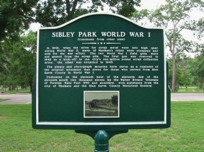
Sibley Park World War I Marker
| Near Mound Avenue west of Spence Street. |
| On South Broad Street south of East Hickory Street, on the left when traveling south. |
| Near Amos Owen Lane north of South Riverfront Drive (U.S. 169). |
| On South 2nd Street at Warren Street on South 2nd Street. |
| Near Mill Road near State Highway 68. |
| On North 4th Street north of East Plum Street, on the right when traveling north. |
| On Minneopa State Park south entrance road south of Gadwall Road (County Route 69), on the right when traveling east. |
| Near Gadwall Road (County Route 69), on the left when traveling west. |
| On Center Street (County Road 32) at Second Street on Center Street. |
| On State Highway 68, 0.8 miles west of 480th Lane (County Highway 45), on the right when traveling west. |
| On 1st Street at Main Street (County Road 11) on 1st Street. |
| On County Road 11 at County Road 29, on the left when traveling north on County Road 11. |
| On County Road 11 near County Road 29, on the left when traveling north. |
| On County Road 11 at County Road 29, on the left when traveling north on County Road 11. |
| On 280th Street (County Highway 29) 0.1 miles east of 215th Avenue, on the right when traveling west. |
| On Knudsen Street (County Road 31) south of Hanson Street (County Road 7), on the left when traveling south. |
| On County Road 257, 0.4 miles east of 155th Avenue, on the left when traveling east. |
| On Broadway (State Highway 257) at 2nd Street East on Broadway. |
| On County Road 257, 0.4 miles east of 155th Avenue, on the left when traveling east. |
| Near County Road 11, 1.1 miles north of County Road 6, on the left when traveling north. |
| Near County Road 11, 1.1 miles north of County Road 6, on the left when traveling north. |
| On Broadway (State Highway 257) north of Blessum Street (State Highway 257), on the right when traveling south. |
| Near County Road 11, 1.1 miles north of County Road 6, on the left when traveling north. |
| On Broadway (State Highway 257) south of 1st Street West, on the right when traveling south. |
| On County Road 24, 0.5 miles east of County Road 8, on the left when traveling east. |
| On County Road 24, 0.1 miles east of County Road 8, on the right when traveling east. |
| On County Road 24, 0.9 miles west of County Road 8, on the right when traveling west. |
| On South Minnesota Street at 6th South Street on South Minnesota Street. |
| On Cottonwood Street, 0.2 miles west of South Broadway Street (Minnesota Highway 15 / 68), on the right when traveling west. |
| On 1st North Street at North Broadway (Minnesota Highway 15 / 68) on 1st North Street. |
| Near North Minnesota Street south of 3rd North Street, on the left when traveling south. |
| On North Minnesota Street south of 1st North Street, on the left when traveling south. |
| On South State Street south of Center Street, on the right when traveling south. |
| On North Minnesota Street at Center Street, on the left when traveling south on North Minnesota Street. |
| On South State Street north of 1st South Street, on the left when traveling north. |
| On North Minnesota Street south of 3rd North Street, on the right when traveling south. |
| Near Highway 26 west of Summit Avenue when traveling west. |
| On Center Street at South Minnesota Street on Center Street. |
| On 170th Avenue, 0.3 miles south of County Highway 25, on the right when traveling south. |
| On Pfaender Drive, 0.2 miles north of 5th North Street (County Highway 27), on the right when traveling north. |
| On North Minnesota Street south of 2nd North Street, on the left when traveling south. |
| On North Minnesota Street south of 2nd North Street, on the right when traveling south. |
| On Center Street west of South State Street, in the median. |
| Near Cemetery Avenue, 0.2 miles north of 20th North Street (U.S. 14), on the right when traveling north. |
| On North Minnesota Street south of 2nd North Street, on the left when traveling south. |
| On County Highway 25 west of 140th Avenue, on the right when traveling west. |
| On South Minnesota Street south of 1st South Street, on the left when traveling south. |
| On North Broadway (State Highway 15 / 68) south of 2nd North Street, on the right when traveling south. |
| On North Broadway Stret (State Highway 68) just east of 2nd Street North, on the right when traveling east. |
| On North Broadway Stret just east of 2nd Street North, on the right when traveling east. |
| On South Front Street at 2nd South Street, on the right when traveling north on South Front Street. |
| On North German Street at North 2nd Street, on the right when traveling north on North German Street. |
| On North Minnesota Street south of 3rd North Street, on the left when traveling south. |
| On Broadway (State Highway 15 / 68) at Center Street on Broadway. |
| On County Road 21, 0.3 miles west of 661st Avenue, on the left when traveling west. |
| On Center Street near North Minnesota Street, on the right when traveling west. |
| Near Monument Street north of Center Street, on the right when traveling north. |
| On North German Street at 5th North Street, on the right when traveling north on North German Street. |
| On North German Street at 5th North Street, on the right when traveling north on North German Street. |
| On 2nd North Street at North Broadway on 2nd North Street. |
| On North State Street at Center Street on North State Street. |
| On North Garden Street at 1st North Street on North Garden Street. |
| On Schell's Road, 0.1 miles south of 18th Street South, on the left when traveling south. |
| On North Minnesota Street south of 3rd North Street, on the left when traveling south. |
| On 5th North Street west of North Garden Street, on the right when traveling west. |
| On South State Street south of Center Street, on the right when traveling south. |
| On North Broadway (State Highway 15/68) north of 1st North Street, on the right when traveling north. |
| On 4th North Street west of North Minnesota Street. |
| On 3rd North Street at North German Street on 3rd North Street. |
| Near Cemetery Avenue, 0.4 miles north of 20th North Street (U.S. 14), on the right when traveling north. |
| On County Highway 29, 0.1 miles east of 205th Avenue, on the left when traveling east. |
| On South State Street south of Center Street, on the left when traveling south. |
| On North Broadway (State Highway 15 / 68) south of 1st North Street, on the right when traveling south. |
| On Center Street east of South Broadway Street, on the right when traveling east. |
| On South State Street south of Center Street, on the right when traveling south. |
| On 17th Street South east of South Franklin Street, on the left when traveling west. |
| On South State Street south of 1st South Street, on the right when traveling south. |
| On KC Road, 0.8 miles west of North Broadway Street, on the right when traveling west. |
| On North Broadway (State Highway 15 / 68) at 1st North Street, on the right when traveling south on North Broadway. |
| Near 3rd North Street at North German Street. |
| On Center Street at Broadway Street (Minnesota Highway 15 / 68) on Center Street. |
| On South Front Street north of 1st South Street, on the right when traveling north. |
| Near Monument Street north of Center Street (County Road 13), on the right when traveling north. |
| Near 190th Street, 0.2 miles west of Minnesota Highway 15, on the right when traveling west. |
| On Main Street at Broadway Street (County Road 24), on the right when traveling west on Main Street. |
| On 1st Avenue North at Oak Street Northwest on 1st Avenue North. |
| On 280th Avenue, 1 mile south of U.S. 14, on the right when traveling south. |
| On State Highway 4, 0.3 miles north of 295th Street, on the left when traveling north. |
| On State Highway 4, 0.3 miles north of 295th Street, on the left when traveling north. |
| On 260th Avenue at 190th Street on 260th Avenue. |
| On Main Street West (U.S. 14) west of 1st Avenue, on the right when traveling west. |
| On County Road 24 at 370th Avenue, on the left when traveling east on County Road 24. |
| On East End Avenue (County Highway 5) at East Rock Street (U.S. 14) on East End Avenue. |
| On East Central Street west of Cass Avenue, on the right when traveling east. |
| Near County Road 24, 0.5 miles east of East End Avenue (County Highway 5), on the right when traveling east. |
| Near State Highway 210, 3.9 miles east of State Highway 45, on the right when traveling east. |
| Near State Highway 210, 3.9 miles east of State Highway 45, on the right when traveling east. |
| Near State Highway 210, 3.9 miles east of State Highway 45, on the right when traveling east. |
| On State Highway 73 at Automba Road (County Road 6 & 131), on the right when traveling north on State Highway 73. |
| On Main Street (State Highway 73) north of 1st Avenue South, on the right when traveling north. |
2034 entries matched your criteria. Entries 101 through 200 are listed above.
⊲ Previous 100 —
Next 100 ⊳