4872 entries match your criteria. The first 100 are listed. ⊳
Historical Markers and War Memorials in North Carolina
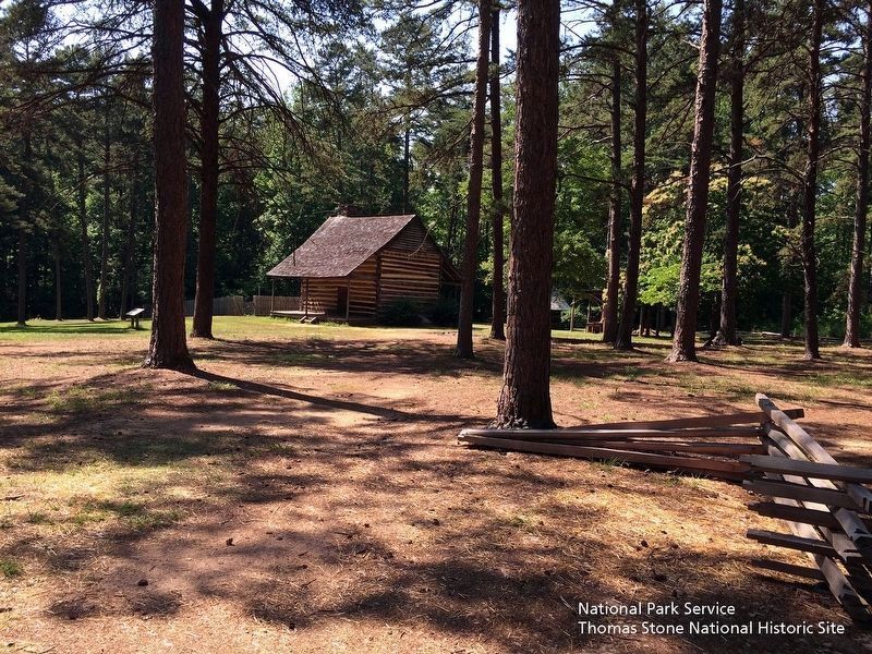
National Park Service, Thomas Stone National Historic Site, May 28, 2019
John Allen House
| 1 ► North Carolina, Alamance County, Burlington — A Revolutionary War Connection — |
| Near State Highway 62, 0.2 miles south of Oakbury Road, on the right when traveling south. | |||
| 2 ► North Carolina, Alamance County, Burlington — Alamance Mill Village — 1837 — Historic District — |
| On Alamance Road (North Carolina Route 62), on the right when traveling south. | |||
| 3 ► North Carolina, Alamance County, Burlington — G-2 — Battle of Alamance — |
| On Alamance Road (State Highway 62) 0.1 miles south of Bonnie Lane, on the right when traveling south. | |||
| 4 ► North Carolina, Alamance County, Burlington — G-24 — Battle of Alamance — |
| On North Carolina 62 (North Carolina Route 62) north of Clapp Mill Road, on the left when traveling south. | |||
| 5 ► North Carolina, Alamance County, Burlington — GG-1 — Battle of Alamance — |
| On NC Highway 62 at Clapp Mill Road, on the left when traveling south on NC Highway 62. | |||
| 6 ► North Carolina, Alamance County, Burlington — Battle of Alamance Monument — |
| On State Highway 62, 0.1 miles east of Clapp Mill Road, on the right when traveling east. | |||
| 7 ► North Carolina, Alamance County, Burlington — Battle of Clapp's Mill — |
| Near Huffman Mill Road. | |||
| 8 ► North Carolina, Alamance County, Burlington — G-111 — Battle of Clapp's Mill — |
| On North Carolina 62 (North Carolina Route 62) at Porter Sharpe Road, on the right when traveling south on North Carolina 62. | |||
| 9 ► North Carolina, Alamance County, Burlington — Cammack Building — |
| On East Davis Street south of South Main Street, on the right when traveling east. | |||
| 10 ► North Carolina, Alamance County, Burlington — Camp Alamance — |
| On North Main Street at Webb Avenue (North Carolina Highway 87) on North Main Street. | |||
| 11 ► North Carolina, Alamance County, Burlington — Charles Richard Drew — 1904 - 1950 — |
| On NC Highway 49, on the left when traveling north. | |||
| 12 ► North Carolina, Alamance County, Burlington — Colonial Column — |
| On North Carolina Route 62 at Clapp Mill Road, on the right when traveling east on State Route 62. | |||
| 13 ► North Carolina, Alamance County, Burlington — Dentzel Carousel — |
| On South Main Street at South Main Street on South Main Street. | |||
| 14 ► North Carolina, Alamance County, Burlington — First Battle of the Revolution — |
| On North Carolina 62 (State Highway 62) east of Clapp Mill Road, on the left when traveling west. | |||
| 15 ► North Carolina, Alamance County, Burlington — Friendship Academy and High School — 1879 - 1927 — |
| On Friendship-Patterson Mill Rd. at Friendship Rock Creek Road, on the right when traveling west on Friendship-Patterson Mill Rd.. | |||
| 16 ► North Carolina, Alamance County, Burlington — Governor Tryon and the Militia — |
| On State Highway 62 at Clapp Mill Road, on the right when traveling east on State Highway 62. | |||
| 17 ► North Carolina, Alamance County, Burlington — G-58 — Henry Jerome Stockard — |
| On North Church Street at Graham-Hopedale Road on North Church Street. | |||
| 18 ► North Carolina, Alamance County, Burlington — G-126 — J. Spencer Love — 1896 - 1962 — |
| On North Church Street/US Highway 70 at Beaumont Ave., on the left when traveling east on North Church Street/US Highway 70. | |||
| 19 ► North Carolina, Alamance County, Burlington — Johnston Moves West — Logisticians at Work — Carolinas Campaign — |
| Near South Main Street. | |||
| 20 ► North Carolina, Alamance County, Burlington — McCray Primitive Baptist Church — |
| On Harvey Chandler Road west of North Carolina Route 62, on the right when traveling west. | |||
| 21 ► North Carolina, Alamance County, Burlington — McCray School — |
| On North Carolina 62, 0.2 miles south of Louis Graham Road (SR 1757) when traveling north. | |||
| 22 ► North Carolina, Alamance County, Burlington — Norfolk & Western Caboose #518654 — |
| On West Webb Avenue (NC Highway 87), on the left when traveling west. | |||
| 23 ► North Carolina, Alamance County, Burlington — G-89 — North Carolina Railroad — |
| On West Front Street at South Main Street, on the right when traveling west on West Front Street. | |||
| 24 ► North Carolina, Alamance County, Burlington — Oak Grove Plantation — |
| Near North Carolina Route 62 near Kimesville Road (County Route 1113), on the right when traveling west. | |||
| 25 ► North Carolina, Alamance County, Burlington — Oak Grove Plantation — 1790-1910 — |
| Near North Carolina Route 62 at Kimesville Road (County Route 1113), on the right when traveling west. | |||
| 26 ► North Carolina, Alamance County, Burlington — Occaneechi in the Service — Piedmont Indians in the Civil War — |
| 27 ► North Carolina, Alamance County, Burlington — Pine Hill Cemetery - Veterans Memorial — |
| On East Summit Avenue. | |||
| 28 ► North Carolina, Alamance County, Burlington — Pioneer Plant — Burlington Industries — |
| On Graham Street at North Avenue on Graham Street. | |||
| 29 ► North Carolina, Alamance County, Burlington — Pleasant Grove High School — 1922 - 1971 — |
| On North NC Highway 49, on the left when traveling north. | |||
| 30 ► North Carolina, Alamance County, Burlington — Pugh's Rock — |
| Near State Highway 62, 0.2 miles south of Oakbury Road, on the right when traveling south. | |||
| 31 ► North Carolina, Alamance County, Burlington — Pyle's Defeat — February 1781 — |
| On Anthony Road at Old Trail, on the right when traveling east on Anthony Road. | |||
| 32 ► North Carolina, Alamance County, Burlington — G-22 — Pyle's Defeat |
| On Maple Avenue near Anthony Road, on the right when traveling south. Reported permanently removed. | |||
| 33 ► North Carolina, Alamance County, Burlington — G-22 — Pyle's Defeat — |
| On Maple Avenue (North Carolina Route 49) at Anthony Road (County Road 1148), on the right when traveling south on Maple Avenue. | |||
| 34 ► North Carolina, Alamance County, Burlington — St. Paul's Lutheran Church — |
| On Bellemont-Alamance Road, on the left when traveling east. | |||
| 35 ► North Carolina, Alamance County, Burlington — GG-2 — The Battle of Alamance — |
| Near North Carolina Route 62 south of Oakbury Road, on the right when traveling south. | |||
| 36 ► North Carolina, Alamance County, Burlington — The Battle of the Alamance — |
| On North Carolina 62 (State Highway 62) west of Clapp Mill Road, on the left when traveling west. | |||
| 37 ► North Carolina, Alamance County, Burlington — The John Allen House — |
| Near North Carolina Route 62, 0.2 miles south of Oakbury Road, on the right when traveling south. | |||
| 38 ► North Carolina, Alamance County, Burlington — The McCray School — |
| On North Carolina Route 62 south of Louis Graham Road, on the left when traveling north. | |||
| 39 ► North Carolina, Alamance County, Burlington — The McCray School — |
| On North Carolina Route 62 south of Louis Graham Road, on the left when traveling north. | |||
| 40 ► North Carolina, Alamance County, Burlington — The Regulators' Field — A Lesson for the Defeated — Carolinas Campaign — |
| On Highway 62, on the left when traveling south. | |||
| 41 ► North Carolina, Alamance County, Burlington — Union Ridge Church — 1815 — |
| On Union Ridge Road (County Route 1001) at Altamahaw Union Ridge Road, on the left when traveling north on Union Ridge Road. | |||
| 42 ► North Carolina, Alamance County, Burlington, Alamance — G-82 — Alamance Cotton Mill — |
| On North Carolina 62, on the right when traveling south. | |||
| 43 ► North Carolina, Alamance County, Burlington, Alamance — Johnston Moves West — Holt's Mill — Carolinas Campaign — |
| On North Carolina 62 (State Highway 62), on the left when traveling south. | |||
| 44 ► North Carolina, Alamance County, Burlington, Alamance — G-33 — Trading Path — |
| On North Carolina 62, 0.1 miles south of Pond Road, on the right when traveling south. | |||
| 45 ► North Carolina, Alamance County, Burlington, Alamance — G-60 — Tryon’s Camp — |
| On North Carolina Route 62 north of Pond Road (Route 0.2), on the right when traveling north. | |||
| 46 ► North Carolina, Alamance County, Burlington, Bellemont — G-60 — Tryon's Camp — |
| On State Highway 49 at 1300 Bellemont Lane on State Highway 49. | |||
| 47 ► North Carolina, Alamance County, Burlington, Cedarock Park — Carriage Shed — |
| Near R Dean Coleman Road, 1 mile north of Friendship Patterson Mill Road. | |||
| 48 ► North Carolina, Alamance County, Burlington, Cedarock Park — Cedarock Historical Farm — |
| Near R Dean Coleman Road, 1 mile north of Friendship Patterson Mill Road. | |||
| 49 ► North Carolina, Alamance County, Burlington, Cedarock Park — John and Polly Garrett House — |
| Near R Dean Coleman Road, 1 mile north of Friendship Patterson Mill Road. | |||
| 50 ► North Carolina, Alamance County, Burlington, Cedarock Park — Original Garrett House — |
| Near R Dean Coleman Road, 1 mile north of Friendship Patterson Mill Road. | |||
| 51 ► North Carolina, Alamance County, Burlington, Cedarock Park — Post Office — |
| Near R Dean Coleman Road, 1 mile north of Friendship Patterson Mill Road. | |||
| 52 ► North Carolina, Alamance County, Burlington, Cedarock Park — The Animals of a Turn of the Century Farm — |
| Near R Dean Coleman Road, 1 mile north of Friendship Patterson Mill Road. | |||
| 53 ► North Carolina, Alamance County, Burlington, Cedarock Park — The Corn Crib — |
| Near R Dean Coleman Road, 1 mile north of Friendship Patterson Mill Road. | |||
| 54 ► North Carolina, Alamance County, Burlington, Glencoe — Picker House and Dye House — Glencoe — |
| On Glencoe Street, on the left when traveling west. | |||
| 55 ► North Carolina, Alamance County, Burlington, Glencoe Village — A Legacy of Community — |
| On Glencoe Street, on the left when traveling west. | |||
| 56 ► North Carolina, Alamance County, Burlington, Glencoe Village — African Americans in the Mill Village — |
| On Glencoe Street, on the left when traveling west. | |||
| 57 ► North Carolina, Alamance County, Burlington, Glencoe Village — After the Whistle Blows — |
| On Glencoe Street, on the left when traveling west. | |||
| 58 ► North Carolina, Alamance County, Burlington, Glencoe Village — Calling the Mill Village 'Home' — |
| On Glencoe Street, on the left when traveling west. | |||
| 59 ► North Carolina, Alamance County, Burlington, Glencoe Village — Children in the Mill Village — |
| On Glencoe Street, on the left when traveling west. | |||
| 60 ► North Carolina, Alamance County, Burlington, Glencoe Village — Churches — Glencoe — |
| On Glencoe Street, on the left when traveling north. | |||
| 61 ► North Carolina, Alamance County, Burlington, Glencoe Village — Cotton Dust and Poverty — |
| On Glencoe Street, on the left when traveling west. | |||
| 62 ► North Carolina, Alamance County, Burlington, Glencoe Village — Glencoe - Company Office and Store — |
| On Glencoe Street. | |||
| 63 ► North Carolina, Alamance County, Burlington, Glencoe Village — Glencoe - Grist Mill and Dam Site — |
| On Mill Race Road. | |||
| 64 ► North Carolina, Alamance County, Burlington, Glencoe Village — Glencoe - Life in the Mill Village — From Farm to Factory — |
| On Glencoe Street, on the right when traveling west. | |||
| 65 ► North Carolina, Alamance County, Burlington, Glencoe Village — Glencoe - The Marshall Family House Site — |
| On Sarah Rhyne Road, on the right when traveling west. | |||
| 66 ► North Carolina, Alamance County, Burlington, Glencoe Village — Glencoe - The School — |
| On Sarah Rhyne Road, on the right when traveling west. | |||
| 67 ► North Carolina, Alamance County, Burlington, Glencoe Village — Glencoe - Two-Story Workers' Houses — |
| On Glencoe Street. | |||
| 68 ► North Carolina, Alamance County, Burlington, Glencoe Village — Glencoe Management Houses — |
| On Glencoe Street. | |||
| 69 ► North Carolina, Alamance County, Burlington, Glencoe Village — Glencoe Mill — 1880 - 82 — |
| On Glencoe Street, on the right when traveling west. | |||
| 70 ► North Carolina, Alamance County, Burlington, Glencoe Village — Glencoe Mill Village — Built 1880 - 82 — |
| On Glencoe Street. | |||
| 71 ► North Carolina, Alamance County, Burlington, Glencoe Village — Living in a Mill-Centered World — |
| On Glencoe Street, on the left when traveling west. | |||
| 72 ► North Carolina, Alamance County, Burlington, Glencoe Village — Lodge Hall and Barber Shop — Glencoe — |
| On Glencoe Street, on the right when traveling north. | |||
| 73 ► North Carolina, Alamance County, Burlington, Glencoe Village — Men in the Mill Village — |
| On Glencoe Street, on the left when traveling west. | |||
| 74 ► North Carolina, Alamance County, Burlington, Glencoe Village — Neighbors Divided — |
| On Glencoe Street, on the left when traveling west. | |||
| 75 ► North Carolina, Alamance County, Burlington, Glencoe Village — Power, Wheel House and Turbine — Glencoe — |
| On Glencoe Street, on the left when traveling west. | |||
| 76 ► North Carolina, Alamance County, Burlington, Glencoe Village — The Mill Buildings — Mill Design — Glencoe — |
| On Glencoe Street, on the left when traveling west. | |||
| 77 ► North Carolina, Alamance County, Burlington, Glencoe Village — The Rise of the Textile Mill Communities — |
| On Glencoe Street, on the left when traveling west. | |||
| 78 ► North Carolina, Alamance County, Burlington, Glencoe Village — Women in the Mill Village — |
| On Glencoe Street, on the left when traveling west. | |||
| 79 ► North Carolina, Alamance County, Burlington, Glencoe Village — Working the Shift — |
| On Glencoe Street, on the left when traveling west. | |||
| 80 ► North Carolina, Alamance County, Elon — Elon Homes for Children — The Snyder Campus — |
| On East Trollinger Avenue east of South O'Kelly Avenue, on the right when traveling east. | |||
| 81 ► North Carolina, Alamance County, Elon — G-52 — Elon University — |
| On North Williamson Avenue near West Haggard Avenue. | |||
| 82 ► North Carolina, Alamance County, Graham — "Elmhurst" — 1869 — |
| On South Main Street at Pine Street on South Main Street. | |||
| 83 ► North Carolina, Alamance County, Graham — 1763 Providence — Center of History — |
| Near North Main Street. | |||
| 84 ► North Carolina, Alamance County, Graham — Alamance County Confederate Memorial — |
| On Court Square. | |||
| 85 ► North Carolina, Alamance County, Graham — Alamance County Courthouse — |
| On Main Street at Elm Street on Main Street. | |||
| 86 ► North Carolina, Alamance County, Graham — Alamance County War Memorial — |
| On West Elm Street. | |||
| 87 ► North Carolina, Alamance County, Graham — G-55 — Alexander Wilson — |
| On State Highway 54 at State Highway 119, on the left when traveling east on State Highway 54. | |||
| 88 ► North Carolina, Alamance County, Graham — Built to House the Alamance Gleaner — |
| On Harden Street. | |||
| 89 ► North Carolina, Alamance County, Graham — Captain James W. White House — 1871 — |
| On South Main Street, on the right when traveling south. | |||
| 90 ► North Carolina, Alamance County, Graham — G-96 — Graham College — |
| On Main Street/NC Highway 87 at McAden Street, on the left when traveling north on Main Street/NC Highway 87. | |||
| 91 ► North Carolina, Alamance County, Graham — Graham's First Bank — |
| On SW Court Square, on the right when traveling south. | |||
| 92 ► North Carolina, Alamance County, Graham — Johnston Moves West — Ruffin Mills — Carolinas Campaign — |
| Near Boywood Road. | |||
| 93 ► North Carolina, Alamance County, Graham — G-120 — Kirk-Holden War — |
| On Main Street, on the right when traveling north. | |||
| 94 ► North Carolina, Alamance County, Graham — G-21 — Lindley's Mill — |
| On North Carolina 87 near East Greensboro-Chapel Hill Road, on the left when traveling south. | |||
| 95 ► North Carolina, Alamance County, Graham — Michael Holt II — 1723 - 1799 — |
| On Hanford Hills Road at Monticello Court, on the left when traveling south on Hanford Hills Road. | |||
| 96 ► North Carolina, Alamance County, Graham — Montwhite Building — 1907 — |
| On North Main Street at Harden Street on North Main Street. | |||
| 97 ► North Carolina, Alamance County, Graham — Mt. Hermon Meeting House — |
| Near Bass Mt. Road. | |||
| 98 ► North Carolina, Alamance County, Graham — National Bank of Alamance — |
| On Court Square, on the right when traveling south. | |||
| 99 ► North Carolina, Alamance County, Graham — Originally a Wing of the Union Hotel — |
| On East Elm Street at North Marshall Street on East Elm Street. | |||
| 100 ► North Carolina, Alamance County, Graham — Providence Church & Cemetery — First building erected c. 1763 — |
| On North Main Street, on the right when traveling north. | |||
4872 entries matched your criteria. The first 100 are listed above. Next 100 ⊳