This replica Hot Shot Furnace stands on the foundation of Fort Macon's original Hot Shot Furnace, built in 1836. Hot Shot Furnaces were used in forts to heat non-explosive cannonballs red hot for use against the unarmored wooden enemy warships of . . . — — Map (db m31502) HM
Smallest caliber cannon used in the War Between the States. Several of these were used as secondary armament in Fort Macon during 1834-1861 to defend vulnerable areas against assaults.
Weight of Bronze Barrel ........887 Pounds
Weight of Gun . . . — — Map (db m31501) HM
This cannon is a replica of a smoothbore Model 1841 Navy 32-pounder which stood here during the War Between the States. Cannons of this caliber comprised almost half of Ft. Macon's armament. The 32-pounder is so named because it fired round iron . . . — — Map (db m31535) HM
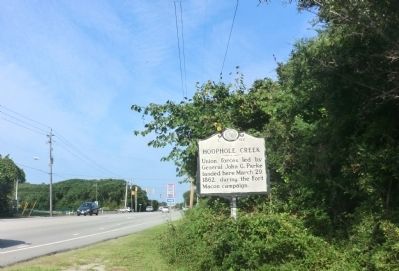
These are the only known surviving cannons of Fort Macon's original armament. Used in the fort 1862 to 1902. Similar to mortars used by the Union Army against the fort in the 1862 bombardment. Weight of Barrel .......................... 1968 Pounds . . . — — Map (db m31490) HM
Following the end of the War Between the States Fort Macon returned to its peacetime status as one of the US Army’s military posts. During the last half of the 1860s a lack of suitable quarters for officers and their families became a serious . . . — — Map (db m77070) HM
This cannon is a replica of a rifled Model 1841 Navy 32-pounder which stood here in the War Between the States. The cannon was originally a smoothbore 32-pounder and fired a round 32-pound cannonball. In October, 1861, Confederate soldiers converted . . . — — Map (db m31536) HM
If you could go back in time to the years of the last half of the Nineteenth Century you would find this area looked quite a bit different than it does today. The area around Fort Macon was cleared of any vegetation. The fort itself was only one . . . — — Map (db m77065) HM
Fort Macon was constructed between 1826 and 1834. This fort was used in the War Between the States (1861-1865), the Spanish American War (1898) and World War II (1941-1945). Fort Macon also served as a military prison from 1862-1877. Fort Macon was . . . — — Map (db m31479) HM
Before the outbreak of the Civil War in 1861, local citizens formed the Beaufort Harbor Guards. These Confederate sympathizers, led by Capt. Josiah Pender, occupied Fort Mason when the sole guard, U.S. Army Ordnance Sgt. William Alexander, quietly . . . — — Map (db m77029) HM
(front)
Resident of Beaufort and marine superintendent at Duke University Marine Laboratory, he led the successful search for the ironclad U.S.S. Monitor.
Progenitor of modern warships, the Monitor fought C.S.S. Virginia in the first . . . — — Map (db m213133) HM
Deeded to town, 1731, by Nathanael Taylor. Capt. Otway Burns of the War of 1812, Revolutionary and Civil War soldiers are buried here. — — Map (db m77031) HM
To the memory of the
Confederate Dead
of Carteret County,
1861-1865
Erected by
The Daughters of
Confederacy
Fort Macon Chapter
Beaufort, N.C. 1926
"Not even time can destroy heroism." — — Map (db m225892) WM
Launched on Jan. 30, 1862, at the Continental Iron Works in Greenpoint, N.Y., the USS Monitor made history as the Union Navy’s first ironclad warship. It fought the Confederate ironclad CSS Virginia in the first-ever clash between two . . . — — Map (db m213139) HM
Carolina City was a small settlement established in 1855. It contained a post office, a turpentine distillery, and the large Carolina Hotel, a favorite resort stop for visitors from New Bern arriving by rail or steamship. During the Civil War, the . . . — — Map (db m31270) HM
Large Confederate camp which extended over an area of 1 sq. mi. stood here; taken by Union Army, March 23, 1862, in Fort Macon campaign. — — Map (db m31250) HM
Union occupied the town March 22, 1862, & used this area in staging the Fort Macon campaign. Union camps remained in vicinity until 1865. — — Map (db m225764) HM
Prelude: On February 8, 1862, Union General Ambrose E. Burnside captured Roanoke Island, key to the important Sound Region of Norteastern North Carolina. On February 10, Elizabeth City fell followed by strategic New Bern on March 14. . . . — — Map (db m31254) HM
Company K, 9th New Jersey Volunteers, built the Bogue Sound Blockhouse here in the summer of 1862 to guard the junction of the Bogue Sound Road and Newport Road. Protected by a surrounding ditch and earthworks, the log blockhouse was armed with one . . . — — Map (db m77094) HM
The 7th North Carolina Infantry built Newport Barracks here as a set of log winter quarters in 1861-1862. Union soldiers later took possession and added a hospital, headquarters, stables, storehouses, earthworks to protect the complex, and an . . . — — Map (db m31225) HM
Believe it or not, Portsmouth, the small, now-deserted village on this remote island, was once a bustling seaport. North Carolina's colonial legislature chartered Portsmouth in 1733 to serve coastal trade, and for more than two years it was one of . . . — — Map (db m177229) HM
Cedars Cemetery monuments dating prior to 1826 are observed while strolling through these hallowed grounds. Civil War soldiers of the "Milton Blues" are buried in a common grave. Maintained by the Woman's Club of Milton, who gave it the name "Cedars . . . — — Map (db m171801) HM
Woodside House, built in 1838 by Caleb Richmond, where General Ramseur recovered from wounds received in battles of Malvern Hill and Chancellorsville. Scene of his 28 October, 1863 marriage to his cousin Ellen Richmond. As Brigadier showed . . . — — Map (db m220879) HM
This elegant Victorian home was originally known as the Dr. Wilson House. Dr. Wilson served as a surgeon in the Confederate army and a physician in Milton. The 1880s expansion of the home features shingled gables, dental molding, decorative side . . . — — Map (db m220872) HM
To the sons of Caswell County who served in the War of 1861-65 in answer to the call of their country
In whatever event that may face our national existence may God give us the will to do what is right, that, like our forefathers we may . . . — — Map (db m216383) WM
In 1862, the Secretary of War called on Haupt to assist in the reconstruction of railroads destroyed by retreating Confederates. Haupt was able to both rebuild the rail system and organize an efficient rail operation to resupply the Union. In nine . . . — — Map (db m70564) HM
(front)
C.S.A.
To the Confederate Soldiers of Catawba County 1861-65
Confederate Heroes
(side)
Full Companies Sent Out
Co. A. 12 Reg.
Co. F. 23 Reg.
Co. C. 28 Reg.
Co. E. 32 Reg.
Co. E. 57 Reg.
Co. F. 32 Reg. . . . — — Map (db m156720) WM
On a Civil War raid through Western North Carolina by Gen. George Stoneman's U.S. Cavalry troops commanded by Col. William J. Palmer passed through Newton on April 17, 1865, burned the Confederate Commissary depot and the county jail, and shot and . . . — — Map (db m152421) HM
Our Confederate Heroes C.S.A
—
1861-1865
We care not whence they came.
Dear in their lifeless clay,
Whether unknown or known to fame,
Their cause and country still the same,
They died and wore the gray.
This Monument is . . . — — Map (db m117052) WM
After Union Gen. Ambrose E. Burnside captured Roanoke Island in February 1862, U.S. Navy vessels patrolled the Chowan River from its mouth in North Carolina to Franklin, Virginia, located on the Blackwater River, a tributary. The Chowan River here . . . — — Map (db m231989) HM
Bought in France for N.C. by Robt. Smith & Thos. Benbury agents for Governor Caswell. Brought to Edenton by Capt. Boritz on "The Holy Heart of Jesus" in 1778. Mounted on this spot 1861. Spiked and trunnions broken off by Federal Fleet 1862. . . . — — Map (db m34965) HM
On May 5, 1864, the Confederate ironclad ram CSS Albemarle under Commander James W. Cooke, with gunboats Cotton Plant and Bombshell, steamed out of the Roanoke River into Bachelor's Bay and Albemarle Sound before you, bound for . . . — — Map (db m34832) HM
Organized in March 1862 under the leadership of Capt. William Badham Jr., Lt. John M. Jones, and Lt. Nelson McClees, the Edenton Bell Battery was composed of men primarily from Chowan, Tyrrell, and Washington Counties. Lacking adequate artillery, . . . — — Map (db m34835) HM
Now one of Edenton's most tranquil locations, during the antebellum period Edenton harbor was the town's industrial center with wharves, shipyards, and maritime activity.
North Carolina's small, ill-protected harbors prevented development of . . . — — Map (db m34770) HM
Gashed with honorable scars
low in glory's lap they lie,
though they fell, they fell like stars,
streaming splendour through the sky. — — Map (db m79794) WM
Confederate captain; legislator; member of conventions of 1868, '75; conservative leader in Reconstruction period. His home was 100 ft. S. — — Map (db m23535) HM
Site of Fort Caswell, built by N.C., 1775-76, to protect New Bern, renamed Fort Lane by Confederacy. Taken by U.S., Mar., 1862. ½ mi. E. — — Map (db m77005) HM
Civil War Dead
An estimated 700,000 Union and Confederate soldiers died in the Civil War between April 1861 an April 1865. As the death toll rose, the U.S. government struggled with the urgent but unplanned need to bury fallen Union . . . — — Map (db m76959) HM
Like many other North Carolinians, New Bern’s residents enjoyed close economic and family ties with the North and were reluctant to leave the Union. Once the war began, however, many North Carolinians passionately supported the Confederate cause: . . . — — Map (db m76993) HM
On March 13, 1862, Union Gen. Ambrose E. Burnside prepared to capture New Bern after seizing Roanoke Island in February. Confederate Gen. Lawrence O’B. Branch defended the city in a line of fortifications located several miles down the Neuse . . . — — Map (db m77003) HM
The above map is self-explanatory. For a detailed account of the battle please read the large map-marker "Battle of New Bern" on U.S. Highway 17 at New Bern, 5¼ miles west of this road. The Croatan Earthwork, an extensive fortification not used . . . — — Map (db m207889) HM
Formally organized on January 6, 1817 in the home of Mrs. Elizabeth Minor, First Presbyterian Church was formed under the leadership of the Rev. John Knox Witherspoon. Included among the charter members were the daughter and granddaughter of the . . . — — Map (db m121985) HM
Greenwood Cemetery, established in 1882 on the grounds of an earlier cemetery, is New Bern’s second-oldest public cemetery and the first city-owned cemetery for African Americans. Thirteen grave markers are dated between 1816 and 1859. At least . . . — — Map (db m76972) HM
This house was the birthplace of two men who fought on opposing sides during the Civil War: Edward Stanly, the Unionist military governor of North Carolina, and Confederate Gen. Lewis Addison Armistead, who was mortally wounded during the Battle of . . . — — Map (db m75492) HM
This house was built about 1809 for John Jones, owner of a local turpentine distillery, and the west wing was added about 1820. After the U.S. Army defeated Confederate troops in the Battle of New Bern on March 14, 1862, and occupied the town, . . . — — Map (db m75493) HM
In 1861, Confederate authorities converted the New Bern Academy from a school to a hospital. The U.S. Army commandeered the structure to care for the wounded almost immediately after defeating Confederate forces in the Battle of New Bern on March . . . — — Map (db m23659) HM
New Bern Historical Society welcomes you to the
New Bern Battlefield Park
300 Battlefield Parkway, New Bern, NC 28562
Here you will find pristinely preserved Confederate defensive earthworks on the 27 acres owned by the New Bern . . . — — Map (db m77010) HM
On March 14, 1862, Union Gen. Ambrose E. Burnside captured New Bern after seizing Roanoke Island in February and moving his army inland. After the battle for the town, the Federals established hospitals in the New Bern Academy, the Masonic Lodge, . . . — — Map (db m76946) HM
Brig. Gen. Gabriel Rains and Col. George Rains, graduates of West Point, inventors of explosives for Confederacy. This was their boyhood home. — — Map (db m76975) HM
During the Civil War, thousands of enslaved blacks freed themselves by escaping to Union lines. Craven County native William Henry Singleton (1843-1938) was one of them. According to his biography, Recollections of My Slavery Days (1922), as . . . — — Map (db m24054) HM
You are standing near the center of the first phase of fighting in the Battle of Averasboro, March 15-16, 1865. On March 15th the left wing of General Sherman’s Union army, commanded by General H.W. Slocum, was advancing along this road (A) from . . . — — Map (db m41993) HM
(Preface): The Carolinas Campaign began on February 1, 1865, when Union Gen. William T. Sherman led his army north from Savannah, Georgia, after the March to the Sea. Sherman's objective was to join Gen. Ulysses S. Grant in Virginia to . . . — — Map (db m210221) HM
From a point 50 yards west three batteries of artillery under Major J. A. Reynolds shelled the Confederate first line of earthworks. — — Map (db m31600) HM
The 1865 home of Wm. Smith, 100 yds E., was used as a hospital for Union troops in the Battle of Averasboro, March 15-16, 1865. — — Map (db m211814) HM
Late in 1864, two large Union armies, one in Virginia and the other in Georgia, were beginning to squeeze the Confederacy to defeat. Grant held Lee’s Army of Northern Virginia immobile at Petersburg, while Sherman, with 60,000 men, captured Atlanta . . . — — Map (db m41994) HM
This tablet marks the site of an important arsenal of the Confederate government. Authorized by the United States Congress, 1836; captured by North Carolina, April 22, 1861; transferred to the Confederate government, June 5, 1861; and destroyed by . . . — — Map (db m24327) HM
Crises cause us to act. The crisis created by the United States' military unpreparedness during the War of 1812 resulted in the planning and building of additional arsenals for the nation's defense. Congress appropriated monies in 1836 for an . . . — — Map (db m24362) HM
These stones formed part of the foundations for buildings within the main arsenal compound. When United States troops destroyed the arsenal in 1865, local citizens salvaged usable building materials. The state moved these remaining stones when the . . . — — Map (db m24359) HM
(preface)
The Carolinas Campaign began on February 1, 1865, when Union Gen. William T. Sherman led his army north from Savannah, Georgia, after the March to the Sea. Sherman’s objective was to join Gen. Ulysses S. Grant in Virginia to crush . . . — — Map (db m70380) HM
In memory of the
Confederate Dead
On Fames eternal camping ground
Their silent Tents are spread.
Rest on embalmed & sainted dead
Dear as the blood ye gave.
Nor shall your glory be forgot
While Fame her record keeps
Or honor . . . — — Map (db m30896) WM
This is the oldest public cemetery in Fayetteville, begun in 1785. Mrs. Anne K. Kyle, who served as a nurse in the hospital here during the Civil War, established the Confederate Burial Ground soon after Union Gen. William T. Sherman and his army . . . — — Map (db m30940) HM
The Women of Cumberland
to their
Confederate Dead
May 20, 1861 - May 10, 1902
They died in defence of their
RightsFor they should fall the tears
of a nation's grief.Lord God of Hosts be with us yet, . . . — — Map (db m31143) HM
Across the street is the Hale-Williams House, notable for the variety of architectural styles it incorporates as well as for the prominence of its builder, Edward Jones Hale. Hale bought this property in 1847 and constructed the house in the 1850s. . . . — — Map (db m70360) HM
[Preface at top left]
The Carolinas Campaign began on February 1, 1865, when Union Gen. William T. Sherman led his army north from Savannah, Georgia, after the “March to the Sea.” Sherman's objective was to join Gen. Ulysses S. Grant in . . . — — Map (db m24355) HM
The lighter brick in this pad outlines the foundations of two shops, the smiths and the forging and casting. These shops were built simultaneously between 1839 and 1842. During Confederate occupation, these shops, along with the engine house, were . . . — — Map (db m24420) HM
North Carolina's Civil War stories are as diverse as its landscape. The Outer Banks and coastal rivers saw action early in the war, as Union forces occupied the region. Stories abound of naval battles, blockade running, Federal raids, and the . . . — — Map (db m24357) HM
The courses of lighter colored brick found in this brick pad represent foundations uncovered while preparing the area for construction. The walls were part of the main arsenal building which was started in 1838 and completed in fall of 1839. The . . . — — Map (db m70359) HM
The Fayetteville Independent Light Infantry is North Carolina's oldest military unit and the second-oldest militia organization in the U.S.
At the start of the Civil War, after North Carolina seceded, the company enrolled in active service for . . . — — Map (db m31109) HM
Invading North Carolina, Sherman's army occupied Fayetteville, Mar. 11-14, 1865, destroying the Confederate Arsenal, which stood 1 mile W. — — Map (db m57295) HM
At Bentonville, General William T. Sherman's Union Army, advancing from Fayetteville toward Goldsboro, met and battled the Confederate Army of General Joseph E. Johnston. General Robert E. Lee had directed the Confederates to make a stand in . . . — — Map (db m20535) HM
[Front] Whereas in obedience to President George Washington's Militia Act and the threat of war with European powers, the F.I.L.I. was organized on or near this spot on August 23, 1793, under the leadership of Captain Robert Adam, . . . — — Map (db m31112) HM
On Saturday morning, March 11, 1865, a brief skirmish took place here at the Market House as Confederate forces evacuated Fayetteville while Union Gen. William T. Sherman's army entered the town. A rear guard detachment under Gen. Wade Hampton . . . — — Map (db m24442) HM
Duncan McLeran constructed this two-story Federal-style dwelling in 1797. In 1820, the property was sold and remodeled to accommodate the Bank of the United States, the first federal bank in North Carolina. The house is named for John Sanford, a . . . — — Map (db m70374) HM WM
In honor of
Braxton Bragg
Lieutenant Colonel, USA
General, CSA
Born: Warrenton N.C.
22 March 1817
Died: Galveston, Texas
27 September 1876
War Department General Order No. 77, 21 August 1918, established Camp Bragg, N.C. in . . . — — Map (db m62493) HM WM
(Preface):
The Carolinas Campaign began on February 1, 1865, when Union Gen. William T. Sherman led his army north from Savannah, Georgia, after the "March to the Sea." Sherman's objective was to join Gen. Ulysses S. Grant in Virginia to . . . — — Map (db m160940) HM
After the Battle of Elizabeth City and the destruction of the Confederate Mosquito Fleet in February 1862, the Confederates scuttled ships to block the North Carolina cut. The Federals had the same idea to stall Confederate traffic and sent five . . . — — Map (db m56979) HM
During the Civil War, salt—essential for the preservation of meat—was vitally important to the massive Union and Confederate armies. Currituck County's location was ideal for salt works, and Knotts Island's residents made salt both here . . . — — Map (db m76552) HM
804 entries matched your criteria. Entries 101 through 200 are listed above. ⊲ Previous 100 — Next 100 ⊳