By Mark Hilton, March 7, 2015
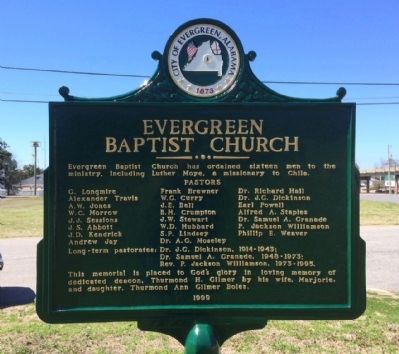
Evergreen Baptist Church Marker (Side 2)
GEOGRAPHIC SORT WITH USA FIRST Geographic Sort Title Sort Marker Number Sort Marker Number Sort N Marker Number Sort T Publication Order Sort Publication Order Sort A Erected Year Sort Most Viewed Sort Most Recent-Interest Sort Most Recently Changed Sort SEE FAQ #33 FOR DESCRIPTIONS
On Park Street, 0.1 miles north of Cemetery Avenue, on the right when traveling north.
On South Main Street (County Road 42) at Cemetery Avenue, on the left when traveling south on South Main Street.
On Brown Hawkins Road at Fall Lane, on the left when traveling north on Brown Hawkins Road.
On Alabama Route 22 west of Alabama Route 9, on the right when traveling west.
On Glenwood Road (County Road 6) 1 mile east of North Glenwood Road (County Road 57), on the left when traveling east.
On Lee Street (State Road 10) 1 mile west of Montgomery Highway (U.S. 331), on the right when traveling west.
On 4th Street Southwest at 5th Avenue Southwest, on the right when traveling east on 4th Street Southwest.
On 2nd Avenue Southeast north of 6th Street Southeast, on the right when traveling north.
On Saint Bernard Drive SE.
On U.S. 278 west of Wesley Avenue (County Road 1669), on the right when traveling west.
On County Road 846 north of County Road 844, on the right when traveling north.
On Kirby Richardson Road (County Road 13) 0.2 miles south of County Road 15, on the right when traveling south.
On Alabama Route 92, on the right when traveling east.
On County Road 67 at County Road 16, on the left when traveling north on County Road 67.
On Oates Drive east of College Street (Alabama Route 123/134), on the right when traveling east.
Paid Advertisement
On Andrews Avenue (Alabama Route 249) west of Meadowlake Drive, on the right when traveling west.
On Andrews Avenue (Alabama Route 249) west of Meadowlake Drive, on the right when traveling west.
On Marley Mill Road (County Route 36) east of County Road 233, on the right when traveling east.
On South Union Avenue (Alabama Route 123) at West College Street, on the right when traveling south on South Union Avenue.
On North Young Avenue at East Broad Street (Alabama Route 105), on the left when traveling south on North Young Avenue.
On County Road 33, on the right when traveling north.
On Morgan Church Road (County Road 333) 0.1 miles east of County Road 60, on the left when traveling east.
On County Route 41 at County Route 68, on the left when traveling south on County Route 41.
On County Road 23, on the left when traveling south.
On Alabama Route 22, on the left when traveling east.
On Vine Street, 0.1 miles south of Capitol Street, on the left when traveling south.
On Mulberry Street south of First South Street, on the left when traveling south.
On Vine Street, on the left when traveling south. Reported permanently removed.
On Mill Street South, on the right when traveling south.
On County Road 12, 0.1 miles east of County Road 7, on the right when traveling east.
Paid Advertisement
On Martin Luther King Street, 0.1 miles south of Clark Avenue, on the right when traveling south.
On Lauderdale Street at Alabama Avenue, on the right when traveling north on Lauderdale Street.
On Martin Luther King Jr. Street at JL Chestnut Jr Boulevard, on the left when traveling north on Martin Luther King Jr. Street.
Near Martin Luther King Street at Water Avenue.
On Business U.S. 80 north of Old Montgomery Highway, on the right when traveling north.
On Martin Luther King Jr. Street, 0.1 miles north of St. Johns Street, on the left when traveling north.
On Lauderdale Street at Selma Avenue, on the right when traveling north on Lauderdale Street.
On Broad Street (Business U.S. 80) at Minter Avenue, on the right when traveling south on Broad Street.
On Broad Street (Business U.S. 80) at Minter Avenue, on the right when traveling south on Broad Street.
On Martin Luther King Jr. Street at J L Chestnut Boulevard, on the left when traveling north on Martin Luther King Jr. Street.
On State Highway 22 at County Road 65, on the right when traveling south on State Highway 22.
On County Road 37 north of County Road 65, on the right when traveling north.
On Main Street north of County Road 16, on the right when traveling north.
On Gault Avenue North (U.S. 11) east of 4th Street, on the right when traveling east.
Paid Advertisement
On County Road 165 at County Road 617, on the right when traveling east on County Road 165.
Near Interstate 59, 1 mile north of County Road 140, on the right when traveling south.
On Main Street, 0.1 miles south of Alabama Route 14, on the right when traveling north.
On Jordan Avenue near Barnett Boulevard (Alabama Route 14), on the right when traveling north.
On West Bridge Street (Alabama Route 212) at Dozier Street, on the right when traveling east on West Bridge Street.
On West Bridge Street (Alabama Route 212) at North Bridge Street (Alabama Route 111), on the right when traveling west on West Bridge Street. Reported missing.
On Mathis Road west of Marshell Road, on the left when traveling west.
On West Tuskeena Street at North Broad Street, on the right when traveling west on West Tuskeena Street.
On Alco Drive, 0.2 miles south of Blacksher Lane, on the right when traveling south.
On East Street at Northeast Street, on the left when traveling east on East Street.
On Dr. Van Avenue (Houston Street) just south of College Street, on the right when traveling north.
On Lamosa Street at Misella Street, on the right when traveling east on Lamosa Street.
On Bradley Road (County Road 4) at Hickory Head Road, on the left when traveling east on Bradley Road.
On 6th Avenue at 4th Street NW, on the right when traveling north on 6th Avenue.
On Chestnut Street at South 8th Street, on the right when traveling west on Chestnut Street.
On South 1st Street at South 3rd Street, on the right when traveling north on South 1st Street.
Paid Advertisement
On Chestnut Street when traveling west.
On Rainbow Drive (U.S. 411) at Cemetery Road, on the right when traveling east on Rainbow Drive.
On Rainbow Drive (U.S. 411) east of Peteet Street, on the right when traveling east.
On Church Street north of Mission Street, on the right when traveling south.
On Main Street (Alabama Route 18) just north of Fenton Street, on the right when traveling north.
On County Road 50, 0.1 miles east of Berea Road, on the left when traveling east.
On North Jackson Avenue at Lauderdale Street NW, on the right when traveling south on North Jackson Avenue.
On North Shiloh Road, on the right when traveling south.
On County Line Drive east of Kelly Street, on the left when traveling south.
Near County Line Drive east of Kelly Street when traveling south.
On School Street (County Road 76) at Boligee Street (U.S. 11), on the right when traveling south on School Street.
On Alabama Route 39, 0.1 miles west of Alabama Route 14, on the right when traveling west.
On Main Street (State Highway 14) at Wilson Avenue, on the right when traveling west on Main Street.
On Demopolis Highway (U.S. 43) at A. L. Isaac Road, on the right when traveling south on Demopolis Highway.
On Pleasant Ridge Road, 0.2 miles south of Alabama Route 14, on the right when traveling south.
On County Route 213, 0.4 miles south of County Route 220, on the left when traveling south.
Paid Advertisement
On Main Street at Demopolis Street, on the right when traveling east on Main Street.
On State Street (Alabama Route 69) at Amory Street on State Street.
On Church Street at South Street, on the right when traveling south on Church Street.
On Alabama Route 61 at State Street (Alabama Route 14), on the right when traveling north on State Route 61.
On Alabama Route 61 south of Beech Street, on the right when traveling south.
On Alabama Route 61 at Beech Street, on the right when traveling south on State Route 61.
On Alabama Route 61 at Cemetery Street, on the right when traveling north on State Route 61.
On County Road 12 west of State Highway 69, on the right when traveling west.
Near County Road 92, 0.2 miles north of State Route 95.
On Doswell Street, on the right when traveling south.
On County Road 75 at County Road 54, on the right when traveling south on County Road 75.
On Stovall Drive, 0.5 miles south of Hayden Street, on the left when traveling south.
On Church Street (Alabama Route 134) at Mitchell Street, on the left when traveling east on Church Street.
On Broad Street (Alabama Route 173) 0.8 miles south of County Road 17, on the right when traveling south.
On County Road 119 at County Road 37, on the right when traveling south on County Road 119.
Paid Advertisement
On West Columbia Road, 0.2 miles east of County Road 7, on the right when traveling east.
On County Road 89 at County Road 109, on the right when traveling south on County Road 89.
On County Road 73, 0.3 miles north of County Road 138, on the left when traveling north.
On County Road 92, 0.3 miles north of State Route 95, on the left when traveling north.
On North 5th Avenue, on the right when traveling north.
19355 entries matched your criteria. Entries 101 through 200 are listed above.
⊲ Previous 100 —
Next 100 ⊳