By Tim Fillmon, January 3, 2024
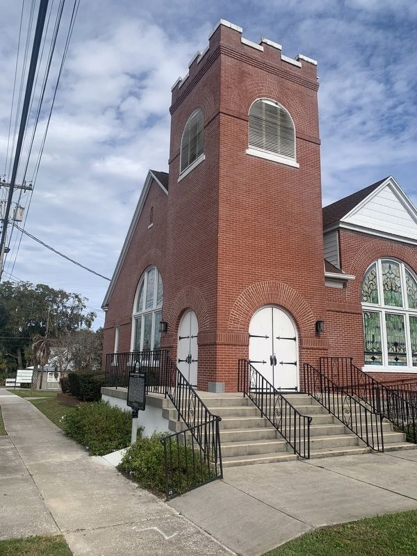
Alachua Methodist Church
GEOGRAPHIC SORT Title Sort Marker Number Sort Marker Number Sort N Marker Number Sort T Publication Order Sort Publication Order Sort A Erected Year Sort Most Viewed Sort Most Recent-Interest Sort Most Recently Changed Sort SEE FAQ #33 FOR DESCRIPTIONS
On Northwest 140th Street just south of Northwest 148th Place, on the right when traveling north.
On Main Street at NW 150th Avenue, on the right when traveling south on Main Street.
Near State Road 235, on the right when traveling west.
On Southwest 175th Terrace at Southwest 174th Street, on the right when traveling east on Southwest 175th Terrace.
On Southwest 137th Avenue (West Church Street) at Southwest 170th Street (Gibson Avenue) (Florida Route 241), on the right when traveling west on Southwest 137th Avenue (West Church Street).
On Southwest 170th Street (County Route 241) at Southwest 83rd Avenue, on the right when traveling north on Southwest 170th Street.
On Southwest 75th Terrace, 0.1 miles south of Archer Road (State Road 24), on the left when traveling south.
On NW 2nd Street near NW 7th Avenue, on the left when traveling north.
On Northwest 5th Avenue at Northwest 4th Street, on the right when traveling east on Northwest 5th Avenue.
On SW 5th Street at SW 8th Avenue, on the right when traveling south on SW 5th Street.
On Pearl Street at Hampton Street, on the right when traveling east on Pearl Street.
On Northwest 166th Street at Northwest 20th Avenue, on the left when traveling north on Northwest 166th Street.
On Old Bellamy Road, 0.2 miles west of Northwest 173rd Road Street,, on the left when traveling west.
On Old Bellamy Road, 0.2 miles west of Northwest 173rd Road Street, on the left when traveling west.
On Beulah Avenue, 0.1 miles south of Minneola Street, on the right when traveling south.
Paid Advertisement
On Grace Avenue at West 10th Street, on the left when traveling north on Grace Avenue.
On Chesnut Avenue at West 11th Street, on the left when traveling south on Chesnut Avenue.
On Beck Avenue (Florida Route 30) at West 14th Street, on the right when traveling south on Beck Avenue.
On Elm Avenue at East 7th Street, on the right when traveling north on Elm Avenue.
On West 14th Street at Beck Avenue, on the right when traveling east on West 14th Street.
On Indian River Drive (County Road 515) 0.1 miles south of Briarwood Lane, on the left when traveling north.
On Derby Street at Brevard Avenue, on the left when traveling west on Derby Street.
On Church Street at Riverside Drive, on the left when traveling east on Church Street.
On Old Dixie Highway at Briarwood Lane, on the left when traveling south on Old Dixie Highway.
On Old Dixie Highway at Briarwood Lane, on the left when traveling south on Old Dixie Highway.
On Highland Avenue, on the left when traveling south.
On Lipscomb Street just south of Brothers Avenue, on the right when traveling south.
On Peachtree Street at West Strawbridge Avenue, on the left when traveling north on Peachtree Street.
On West Strawbridge Avenue at Greenway Drive, on the right when traveling west on West Strawbridge Avenue. Reported missing.
Paid Advertisement
On Strawbridge Avenue (U.S. 192) at U.S. 1, on the right when traveling west on Strawbridge Avenue.
On Highland Avenue, 0.1 miles State Road 518.
On Ocean Avenue, on the right when traveling west.
On North Tropical Trail at Northgrove Drive, on the left when traveling north on North Tropical Trail.
On Bevis Road, 0.3 miles south of Lucas Road, on the right when traveling north.
On South Tropical Trail (County Road 3) at Crooked Mile Road, on the right when traveling south on South Tropical Trail.
On South Tropical Trail (County Road 3) at Old Settlement Road, on the right when traveling south on South Tropical Trail.
On North Tropical Trail at Church Road, on the left when traveling north on North Tropical Trail.
On North Tropical Trail, 0.1 miles south of Sawyer Avenue, on the right when traveling north.
Near South Sykes Creek Parkway at Fortenberry Road.
On Harry T. Moore Avenue at Ricard Street, on the right when traveling south on Harry T. Moore Avenue.
On Old Dixie Highway just south of Diamond Road, on the left when traveling south.
On Old Dixie Highway at Diamond Road, on the left when traveling south on Old Dixie Highway.
On Northeast Miller Street at Pollack Avenue Northeast, on the right when traveling south on Northeast Miller Street.
Near Cassia Blvd. just east of South Patrick Drive (Local Road 513), on the right when traveling east.
Paid Advertisement
On South Palm Avenue at Pine Street, on the right when traveling south on South Palm Avenue.
On South Federal Highway (U.S. 1) south of Southeast 1st Street, on the right when traveling north.
On Northwest 5th Avenue at Northwest 2nd Street, on the right when traveling south on Northwest 5th Avenue.
On Northwest 1st Avenue at Northwest 9th Street, on the left when traveling south on Northwest 1st Avenue .
On Northwest 6th Avenue at Northwest 9th Street, on the right when traveling south on Northwest 6th Avenue .
On Northwest 1st Avenue at Northwest 7th Street, on the left when traveling north on Northwest 1st Avenue .
On North Main Street (Florida Route 71) just south of Chipola Street (County Route 274), on the right when traveling north.
On Chipola Street (County Route 274) 1.3 miles west of North Main Street (Florida Route 71), on the right when traveling west. Reported missing.
On Seneca Avenue at Parmely Street, on the right when traveling north on Seneca Avenue.
On North Florida Avenue (U.S. 41) at East Parsons Point Road, on the right when traveling north on North Florida Avenue.
On Dr. Martin Luther King Jr. Avenue at East Dampier Street, on the right when traveling north on Dr. Martin Luther King Jr. Avenue.
On Old Church Road, 0.2 miles north of Augusta Drive, on the left when traveling north.
On Idlewild Avenue (Florida Route 16) 0.2 miles west of Sunset Avenue, on the right when traveling west.
On Sharron Road at Sweet Moody Road, on the left when traveling east on Sharron Road.
On Main Street at Wharf Street, on the right when traveling east on Main Street.
Paid Advertisement
On Main Street at Butler Avenue, on the right when traveling east on Main Street.
On Copeland Avenue South at Broadway Street East, on the right when traveling north on Copeland Avenue South.
On U.S. 41/441 near SE Racetrack Way (County Road 133B), on the right when traveling north.
On U.S. 41 at Southwest County Road 349, on the right when traveling north on U.S. 41.
On Northwest Falling Creek Road (County Road 131) 0.9 miles north of US Highway 41 (State Road 100), on the right when traveling north.
Near Northwest Falling Creek Road (County Road 131) 1.2 miles north of US Highway 41 (State Road 100), on the left when traveling north.
On North Arcadia Avenue at West Winifred Street, on the left when traveling north on North Arcadia Avenue.
On Southwest Highway 17 (U.S. 17) south of Cowart Street, on the right when traveling north.
On Northeast 106th Street at Northeast 216th Avenue, on the right when traveling north on Northeast 106th Street.
On Ocean Street (State Road A1A) just east of Broad Street, on the left when traveling east.
On Ft. George Road, on the left when traveling north.
On Fort George Road, on the left when traveling north.
Near Weller Avenue at Weller Place, on the right when traveling east.
On Fort Caroline Road, 0.2 miles north of Heathfield Road, on the right when traveling north.
On Mandarin Road at County Dock Road, on the left when traveling north on Mandarin Road.
On Kings Road (U.S. 23) at Pearce Street, on the right when traveling west on Kings Road.
Paid Advertisement
On 8th Street West at Francis Street, on the right when traveling west on 8th Street West.
On St Augustine Road at Kingswood Road, on the right when traveling north on St Augustine Road.
On POW-MIA Memorial Pkwy at Lake Newman Street, on the left when traveling north on POW-MIA Memorial Pkwy.
Near Ft. Caroline Road, on the left when traveling east.
On Van Buren Street, on the left when traveling north.
On Bethel Baptist Street at Rudolph McKissick Sr Boulevard, on the left when traveling east on Bethel Baptist Street.
On East Duval Street at Ocean Street, on the right when traveling west on East Duval Street.
On Kings Road (U.S. 23) at North Davis Street, on the right when traveling east on Kings Road.
On Broad Street, 0.1 miles south of West 1st Street, on the right when traveling north.
Near Beach Boulevard (U.S. 90).
On Mandarin Road near Thornapple Drive, on the right when traveling west.
On East Wright Street at North Palafox Street, on the right when traveling west on East Wright Street.
On South Adams Street at East Zarragossa Street, on the right when traveling south on South Adams Street.
On South Adams Street at Church Street, on the left when traveling north on South Adams Street.
On West Wright Street at North Palafox Street, on the right when traveling west on West Wright Street.
On North 9th Avenue (State Road 289) at East Jackson Street, on the left when traveling south on North 9th Avenue.
Paid Advertisement
On East Chase Street, 0.1 miles east of North Jefferson Street, on the right when traveling east.
On East Wright Street, 0.1 miles west of North Guillemard Street, on the right when traveling west.
On North 10th Avenue at East Salamanca Street, on the right when traveling south on North 10th Avenue.
On Zaragoza Street west of South Adams Street, on the left when traveling east.
On East Government Street, 0.1 miles west of South Alcaniz Street, on the right when traveling west.
458 entries matched your criteria. The first 100 are listed above.
Next 100 ⊳