After filtering for Ohio, 626 entries match your criteria. The first 100 are listed. ⊳
Churches & Religion Topic
By J. J. Prats, April 16, 2019
Covenanter Church Marker
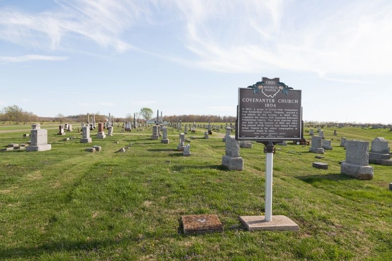
| 1 ► Ohio, Adams County, Cherry Fork, Wayne Township — 3-1 — Covenanter Church — 1804 — |
| On Ohio Route 138 south of 2nd Street (U.S. 137), on the right when traveling south. | |||
| 2 ► Ohio, Adams County, Manchester — Joseph Moore — 1754—1824 — |
| Near East 8th Street, 0.2 miles east of Cemetery Street, on the right when traveling east. | |||
| 3 ► Ohio, Adams County, Peebles — The Serpent In American Indian Traditions — |
| Near Horner Chapel Road (Ohio Route 73) 0.9 miles west of Horner Chapel Road (County Road T-116), on the right when traveling west. | |||
| 4 ► Ohio, Adams County, Peebles — The Shawnee And The King Of The Serpents — |
| Near Horner Chapel Road (Ohio Route 73) 0.9 miles west of Horner Chapel Road (Route T-116), on the right when traveling west. | |||
| 5 ► Ohio, Adams County, West Union — 12-1 — First Presbyterian Church — Thomas Kirker — American Presbyterian and Reformed Historical Site — |
| On Second Street (Ohio Route 247) at East Walnut, on the left when traveling south on Second Street. | |||
| 6 ► Ohio, Adams County, West Union — 16-1 — West Union Associate Reformed Presbyterian Church / Reverend John Graham — |
| On North Cherry Street west of North Cross Street (Ohio Route 247), on the right when traveling west. | |||
| 7 ► Ohio, Allen County, Beaverdam, Richland Township — Upon This Hallowed Ground — |
| On North Pevee Road, on the right when traveling north. | |||
| 8 ► Ohio, Allen County, Bluffton — Celebrating Our Heritage Mural — |
| On East Elm Street east of North Main Street, on the left when traveling east. | |||
| 9 ► Ohio, Allen County, Delphos — St. John the Evangelist Catholic Church — |
| On North Main Street (Ohio Route 66) just north of East 2nd Street, on the right when traveling north. | |||
| 10 ► Ohio, Allen County, Elida — Abraham Doner — |
| Near West Main Street west of South Greenlawn Avenue, on the left when traveling west. | |||
| 11 ► Ohio, Allen County, Elida — Walter M. Lawson, Jr. — |
| On East Main Street at Roger Street, on the right when traveling east on East Main Street. | |||
| 12 ► Ohio, Allen County, Gomer — This Lintel Stone — |
| On Gomer Road, 0.1 miles south of Lincoln Highway, on the left when traveling south. | |||
| 13 ► Ohio, Allen County, Lima — Adam Welty Park — |
| On North Central Avenue at East Wayne Street, on the right when traveling north on North Central Avenue. | |||
| 14 ► Ohio, Allen County, Lima, Shawnee Township — St. Matthews Memorial — |
| On Saint Matthews Drive, on the left when traveling north. | |||
| 15 ► Ohio, Allen County, Rockport — Old Church Site Rockport Cemetery — State of Ohio, Allen County — Monroe Township — |
| On Rockport Road, on the left when traveling west. | |||
| 16 ► Ohio, Ashland County, Ashland — 5-3 — Founding of Ashland College / Ashland Eagles Tradition — |
| Near Jefferson Street. | |||
| 17 ► Ohio, Ashland County, Loudonville — The Workman Cabin — |
| On South Market Street (Ohio Route 3) just south of West Main Street (Ohio Route 39), on the right when traveling south. | |||
| 18 ► Ohio, Ashland County, Mifflin — 8-3 — Historic Mifflin — |
| On Lincoln Highway (County Route 30A) at Iowa Street, on the right when traveling west on Lincoln Highway. | |||
| 19 ► Ohio, Ashtabula County, Ashtabula — 1147 — Historic Ashtabula Harbor — |
| On Bridge Street (Ohio Route 531) west of Hulbert Avenue, on the right when traveling west. | |||
| 20 ► Ohio, Ashtabula County, Ashtabula — Mother of Sorrows Church — 1500 West 6th Street — |
| On Coyne Avenue at West 6th Street, on the left when traveling north on Coyne Avenue. | |||
| 21 ► Ohio, Ashtabula County, Windsor Mills — Christ Church Episcopal — Windsor Mills, Ohio — |
| Near U.S. 322 at North Wiswell Road. | |||
| 22 ► Ohio, Athens County, Athens — First Presbyterian Church — |
| On North Court Street just north of East Washington Street, on the right when traveling north. | |||
| 23 ► Ohio, Athens County, Athens — Ohio University's Distinguished Visitors — |
| 24 ► Ohio, Auglaize County, Fryburg, Pusheta Township — Site of first Sts. Peter & Paul Church & Graveyard — |
| On Cemetery Road (County Road 161) north of Santa Fe-New Knoxville Road (County Road 100), on the right when traveling north. | |||
| 25 ► Ohio, Auglaize County, Fryburg, Pusheta Township — 527 — St. John Catholic Church and Parish Hall — 11257 Van Buren Street — Land of the Cross-Tipped Churches — |
| On Van Buren Street south of Schemel Street, on the left when traveling north. | |||
| 26 ► Ohio, Auglaize County, Glynwood, Moulton Township — 533 — St. Patrick Catholic Church — |
| On Glynwood-New Knoxville Road at Glynwood Road, on the left when traveling north on Glynwood-New Knoxville Road. | |||
| 27 ► Ohio, Auglaize County, Minster — Faith — |
| On West 4th Street west of North Frankfurt Street, on the right when traveling east. | |||
| 28 ► Ohio, Auglaize County, Minster — The Log Church — |
| On North Lincoln Drive, on the right when traveling north. | |||
| 29 ► Ohio, Auglaize County, New Bremen, German Township — History Of The Bell — |
| On North Main Street, on the right when traveling north. | |||
| 30 ► Ohio, Auglaize County, Wapakoneta — 8-6 — Sts. Peter and Paul Church — Mother Church of the Petersburg Parishes — |
| On Santa Fe-New Knoxville Road (County Route 100) at Cemetery Rd (County Route 161), on the left when traveling east on Santa Fe-New Knoxville Road. | |||
| 31 ► Ohio, Belmont County, Barnesville — 8-7 — Captina African Methodist Episcopal Cemetery — |
| On Oakes Place, 0.2 miles Flat Rock Road, on the right when traveling south. | |||
| 32 ► Ohio, Belmont County, Bellaire — 18-7 — Cornelius D. Battelle, Methodist Circuit Rider / The First United Methodist Church, Bellaire — |
| On Guernsey Street, 0.1 miles north of 34th Street, on the right when traveling south. | |||
| 33 ► Ohio, Belmont County, Colerain — Concord Hicksite Friends Meeting House — |
| On Negus Road (County Route 456), on the right when traveling west. | |||
| 34 ► Ohio, Belmont County, St. Clairsville — To the Glory of God — |
| Near Maple Avenue (Ohio Route 9) north of Bett-Mar Lane, on the right when traveling north. | |||
| 35 ► Ohio, Brown County, Georgetown — The Georgetown United Methodist Church — |
| On S. Main Street, on the right when traveling north. | |||
| 36 ► Ohio, Brown County, Ripley — The Residence of General Granville Moody — “The Fighting Parson” — |
| On North Front Street at Locust Street, on the right when traveling north on North Front Street. | |||
| 37 ► Ohio, Butler County, Bethany — 19-9 — First Jain Temple in Ohio / History of Jainism in Ohio — |
| 38 ► Ohio, Butler County, Fairfield — 42-9 — Miami Chapel Cemetery / Fair Play — |
| On River Road at Lakeside Drive, on the right when traveling north on River Road. | |||
| 39 ► Ohio, Butler County, Hamilton — 49-9 — Pilgrim Baptist Church / A Beacon of Light for Over a Hundred Years — |
| On Chestnut Street west of South 4th Street, on the left when traveling west. | |||
| 40 ► Ohio, Butler County, Hamilton — Trinity Episcopal Church — |
| On Butler Street at Center Street, on the right when traveling west on Butler Street. | |||
| 41 ► Ohio, Butler County, Millville — 2-9 — Bethel Chapel — 1815 - 1873 — |
| On Reily Millville Road, 0.1 miles east of Salman Road, on the left when traveling east. | |||
| 42 ► Ohio, Butler County, Miltonville — 5-9 — Village of Miltonville — |
| On Elk Creek Road at Howe Road, on the right when traveling north on Elk Creek Road. | |||
| 43 ► Ohio, Butler County, Oxford — 33-9 — Bunker Hill Universalist Church/Bunker Hill Cemetery — |
| On Reily-Millville Road (County Route 29) 0.2 miles west of Bunker Hill Woods Road, on the right when traveling east. | |||
| 44 ► Ohio, Butler County, Oxford — 34-9 — Indian Creek Baptist Church — The Indian Creek Pioneer Burial Ground — |
| On Indian Creek Road (County Route 37), on the left when traveling east. | |||
| 45 ► Ohio, Butler County, Oxford — Indian Creek Regular Baptist Church — 1810 - 1879 — |
| Near Indian Creek Road, 0.7 miles north of Imhoff Road, on the right when traveling north. | |||
| 46 ► Ohio, Butler County, Oxford — 23-9 — The Restoration Movement / Doty Settlement Cemetery — |
| On Brown Road, 0.2 miles south of Doty Road, on the right when traveling south. | |||
| 47 ► Ohio, Butler County, Shandon — 17-9 — Paddy's Run — |
| On Cincinnati-Brookville Road (Ohio Route 126), on the right when traveling east. | |||
| 48 ► Ohio, Butler County, Trenton — 18-9 — The Village of Trenton / The Elk Creek Baptist Church and Cemetery — |
| On State Street (Ohio Route 73) at Miami Street / Hamilton Road, on the left when traveling west on State Street. | |||
| 49 ► Ohio, Butler County, Woodsdale — The Amish Mennonite Settlement — |
| Near Woodsdale Road (County Route 150). | |||
| 50 ► Ohio, Carroll County, Morges — Morges — |
| On Bachelor Road (County Road 23) at Barks Road Northwest (County Road 26), on the right when traveling east on Bachelor Road. | |||
| 51 ► Ohio, Carroll County, Perrysville — The Perrysville Methodist Episcopal Church — |
| On Amsterdam Road Southwest (Ohio Route 164), on the right when traveling east. | |||
| 52 ► Ohio, Champaign County, Cable — 10-11 — Mt. Tabor Church / Mt. Tabor Cemetery — |
| On Ohio Route 245, 0.2 miles south of Mt. Tabor Road (Ohio Route 507), on the right when traveling north. | |||
| 53 ► Ohio, Champaign County, Mechanicsburg — 25-11 — Mechanicsburg United Methodist Church — |
| On Main Street (Ohio Route 29) at Race Street, on the right when traveling north on Main Street. | |||
| 54 ► Ohio, Champaign County, Mechanicsburg — 19-11 — Second Baptist Church — |
| On Sandusky Street (Ohio Route 4), on the right when traveling east. | |||
| 55 ► Ohio, Champaign County, North Lewisburg — 20-11 — Friends Church / Friends Cemetery — |
| On W, Elm Street (County Route 111) near Winder St, on the right when traveling east. | |||
| 56 ► Ohio, Champaign County, North Lewisburg — North Lewisburg — |
| On Winder Street (Ohio Route 559) 0.1 miles north of North Street (Ohio Route 559), on the right when traveling south. | |||
| 57 ► Ohio, Champaign County, Urbana — 5-11 — Bailey and Barclay Halls / Johnny Appleseed — |
| On College Way, on the right when traveling south. | |||
| 58 ► Ohio, Champaign County, Urbana — 12-11 — Kings Creek Baptist Church — |
| On Kennard- Kings Creek Road (County Route 130) at East Kings Creek Road (County Route 125), on the left when traveling north on Kennard- Kings Creek Road. | |||
| 59 ► Ohio, Champaign County, Woodstock — 31-11 — Universalist Church — Classic Architecture and Art in Rural Ohio — |
| On Urbana- Woodstock Pike (County Route 2) at Burnwell Street, on the right when traveling west on Urbana- Woodstock Pike. | |||
| 60 ► Ohio, Clark County, New Carlisle — Honey Creek Presbyterian Church — Original Site — |
| On Dayton-Lakeview Rd (Ohio Route 235), on the left when traveling south. | |||
| 61 ► Ohio, Clark County, New Carlisle — 183 — Honey Creek Presbyterian Historical Marker — Registered Site #183 — Current Location of Historical Congregation — |
| On West Jefferson Street (Ohio Route 571), on the left when traveling west. | |||
| 62 ► Ohio, Clark County, Springfield — 9-12 — Daniel Rudd — Journalist of Faith and Action / Layman of Faith and Action — |
| On East High Street east of South Spring Street (Ohio Road 72), on the right when traveling east. | |||
| 63 ► Ohio, Clark County, Springfield — Site of Springfield's First Church — 1805 - 1955 — |
| On Fountain Avenue at Main Street, on the left when traveling south on Fountain Avenue. | |||
| 64 ► Ohio, Clark County, Springfield — Theological Education at Wittenberg — |
| On East Campus Drive, on the left when traveling north. | |||
| 65 ► Ohio, Clark County, Springfield, Asbury Estates — Asbury Methodist Church — Memories in rural Clark County, Ohio — |
| On North Hampton Road, 0.3 miles north of Troy Road (Ohio Route 41), on the left when traveling north. | |||
| 66 ► Ohio, Clermont County, Bantam, Monroe Township — 08 — John Collins, Methodist Preacher and Circuit Rider / Bethel Methodist Church and Cemetery — |
| On Elklick Road, on the left when traveling east. | |||
| 67 ► Ohio, Clermont County, Batavia — St. Philomena Church — Clermont County Bicentennial Marker — |
| On Balzhiser Road just east of Stonelick Williams Corner Road when traveling east. | |||
| 68 ► Ohio, Clermont County, Cincinnati — Chapel — Mt. Moriah — Clermont County Bicentennial Marker — |
| On Mount Moriah Drive, on the left when traveling east. | |||
| 69 ► Ohio, Clermont County, East Fork State Park — Bethel Methodist Church — Clermont County Bicentennial Marker — |
| On Elklick Road, 0.8 miles north of Old State Route 125. | |||
| 70 ► Ohio, Clermont County, East Fork State Park — Old Bethel M.E. Church |
| On Elklick Road, 0.8 miles Old State Route 125, on the right when traveling east. Reported permanently removed. | |||
| 71 ► Ohio, Clermont County, Milford — 1-13 — First Methodist Church — United Methodist Church Registered Historic Site No. 266 — |
| On Main Street (U.S. 50) at Maple Street, on the right when traveling west on Main Street. | |||
| 72 ► Ohio, Clermont County, Milford — Milford — |
| On Glendale Milford Road north of U.S. 50, on the left when traveling north. | |||
| 73 ► Ohio, Clermont County, New Richmond — 1st Regular Baptist Church — Underground Railroad Site — Clermont Freedom Trail — |
| On Western Avenue just east of Washington Street, on the left when traveling east. | |||
| 74 ► Ohio, Clermont County, New Richmond — Franklin Chapel — Clermont County Bicentennial Marker — |
| On Franklin Laurel Road (County Route 49), on the right when traveling west. | |||
| 75 ► Ohio, Clermont County, New Richmond — 8-13 — Mt. Zion Chapel / Mt. Zion Cemetery - Lafayette School — |
| On Clermontville Laurel Road (County Route 31), on the left when traveling north. | |||
| 76 ► Ohio, Clermont County, Owensville — Owensville Village Hall — Clermont County Bicentennial Marker — |
| On West Main Street (U.S. 50) at South Broadway Street (Ohio Route 132/276), on the right when traveling east on West Main Street. | |||
| 77 ► Ohio, Clinton County, Wilmington — "Who Sends Thee?" — |
| 78 ► Ohio, Clinton County, Wilmington — Historic Downtown Wilmington Walking Tour — |
| On West Locust Street (U.S. 22) west of North South Street (Ohio Route 134), on the left when traveling west. | |||
| 79 ► Ohio, Clinton County, Wilmington — 5-14 — Wilmington College — |
| 80 ► Ohio, Clinton County, Wilmington, Chester Township — 12-14 — Jonah’s Run Baptist Church / Underwood Farms Rural Historic District — |
| On Ohio Route 73 just west of Collett Road (County Route 232), on the right when traveling east. | |||
| 81 ► Ohio, Columbiana County, Columbiana — Grace Church — |
| On South Main Street, on the right when traveling north. | |||
| 82 ► Ohio, Columbiana County, East Liverpool — Bradshaw's Hall — |
| On Broadway Street, 0 miles south of East 5th Street, on the right when traveling south. | |||
| 83 ► Ohio, Columbiana County, East Liverpool — Diamond Theater — |
| On Market Street at 5th Street, on the right when traveling south on Market Street. | |||
| 84 ► Ohio, Columbiana County, Hanoverton — 5-15 — Birthplace of Catholicism in Northern Ohio — |
| On Gavers Road at Railroad Street, on the left when traveling east on Gavers Road. | |||
| 85 ► Ohio, Columbiana County, Hanoverton — Hanoverton Christian Church — |
| On Plymouth Street just north of Market Street, on the left when traveling north. | |||
| 86 ► Ohio, Columbiana County, Hanoverton — Presbyterian Church — |
| On Plymouth Street at Church Street, on the right when traveling north on Plymouth Street. | |||
| 87 ► Ohio, Columbiana County, Hanoverton — St. Philip Neri — since 1817 — “The Birthplace of Catholicism in Northern Ohio” — |
| Near Gavers Rd (County Route 407). | |||
| 88 ► Ohio, Columbiana County, Wellsville — Ascension Church — 4 11th Street — |
| On 11th Street at Main Street, on the left when traveling west on 11th Street. | |||
| 89 ► Ohio, Columbiana County, Wellsville — Wellsville's Oldest Bell — |
| On Main Street just north of Pine Valley, on the left when traveling north. | |||
| 90 ► Ohio, Coshocton County, Roscoe — Daniel Boyd House - c.1825 |
| On Whitewoman Street, on the left when traveling north. Reported missing. | |||
| 91 ► Ohio, Cuyahoga County, Bay Village — 135-18 — Dover Lake Shore Methodist Episcopal Church — |
| On Lake Road (U.S. 6) east of Bayview Road, on the right when traveling east. | |||
| 92 ► Ohio, Cuyahoga County, Berea — 18-82 — First Congregational United Church of Christ of Berea — |
| On Seminary Street at Church Street on Seminary Street. | |||
| 93 ► Ohio, Cuyahoga County, Berea — 122-18 — Ogilvy Chapel of St. Thomas Episcopal Church — |
| On East Bagley Road at Seminary Street, on the right when traveling east on East Bagley Road. | |||
| 94 ► Ohio, Cuyahoga County, Cleveland, Buckeye - Shaker — Shaker Gate Post — Period 1830 — |
| On South Moreland Boulevard at Shaker Square, in the median on South Moreland Boulevard. | |||
| 95 ► Ohio, Cuyahoga County, Cleveland, Buckeye - Shaker — Shaker Gristmill Site — |
| On Fairhill Road near East 127th Street, on the right when traveling west. | |||
| 96 ► Ohio, Cuyahoga County, Cleveland, Buckeye - Shaker — Shaker Mill Stone — Period 1837 — |
| On North Moreland Boulevard near Shaker Boulevard (Ohio Route 87), in the median. | |||
| 97 ► Ohio, Cuyahoga County, Cleveland, Central — Trinity Cathedral — |
| On Euclid Avenue (U.S. 20) just east of East 22nd Street, on the right when traveling east. | |||
| 98 ► Ohio, Cuyahoga County, Cleveland, Central — 89-18 — Woodland Cemetery — |
| On Woodland Avenue (Ohio Route 87), on the right when traveling east. | |||
| 99 ► Ohio, Cuyahoga County, Cleveland, Downtown — 55-18 — 'Abdu'l-Bahá and the Bahá'í Faith — |
| On East 14th Street at Euclid Avenue (U.S. 20), on the left when traveling north on East 14th Street. | |||
| 100 ► Ohio, Cuyahoga County, Cleveland, Downtown — Erie Street Cemetery Chapel Flooring Stones — |
| Near East 9th Street north of Sumner Avenue, on the right when traveling north. | |||
626 entries matched your criteria. The first 100 are listed above. Next 100 ⊳