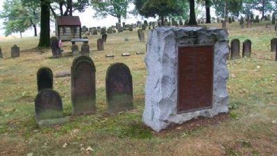
Erected to the memory of
Wilhelm Fischer
Born in the Palatinate April 11, 1706
Arrived at Philadelphia Aug. 17, 1733
Died October 23, 1771
and his wife
Elizabeth Gertrude
The daughter of
George and Veronica Hain
Born . . . — — Map (db m39298) HM
Erected 1749; once owned by Baron Stiegel. Operated by ironmaster George Ege, 1774-1824. Hessians were employed in Revolutionary days to cut a rock channel for water supply. Site is to the north of Womelsdorf. — — Map (db m84522) HM
Pioneer, Indian interpreter, treaty maker, 1732-1760. The Indians called him the "Holder of the Heavens." He lived, died, and is buried on this property, now a State Park devoted to his memory. — — Map (db m38777) HM
We can't be sure. We know that Conrad Weiser owned this land and lived on the property from 1729 to about 1750. And there is a strong oral tradition indicating that Weiser's house stood on this spot. But archaeology conducted in 2000 found few . . . — — Map (db m39287) HM
An Indian path from Shamokin (Sunbury) came over the mts. by way of Klingerstown and Pine Grove to Weiser's place in the Tulpehocken Valley. Chiefs of the Six Nations, carrying "words of wampum" to Brother Onas (Penn) at Philadelphia, traveled this . . . — — Map (db m38797) HM
The Livingood family came from Switzerland to the Palatinate. Jacob and his father, John Wendell Leibengut embarked for America with the first party of Palatines, May 6, 1709 from London, England. In 1728 Jacob Sr. arrived in the Tulpehocken Valley . . . — — Map (db m39285) HM
Near this spring for many years resided
Thachnectorus "The Spreading Oak"
alias
Captain John Logan (1718-1820)
Eldest son of Shikellemus, Vice-Gerent
of the Iroquois Federation in Pennsylvania
and a staunch and tried friend . . . — — Map (db m134807) HM
A settlement of French Royalists, who fled the French Revolution in 1793, was established in this valley directly opposite this marker. It was laid out and settled under the direction of Viscount de Noailles and Marquis Antoine Omer Talon.
It . . . — — Map (db m78907) HM
Named for an early town of the Munsee Delawares, which occupied the flats south of the present town. In 1760 Munsees under Papoonhank welcomed Post here, on his way toward a great Indian council beyond Allegheny River. — — Map (db m90559) HM
Site of the famed French refugee colony is a few miles south. Here exiles laid out a town and built La Grande Maison for the Queen and her son, the heir to the throne of France. — — Map (db m90331) HM
Points of Interest
118.8: Bristol Marsh Preserve contains an important freshwater tidal marsh, one of the few remaining along Pennsylvania's coastal region. Visitors may use the viewing platforms, a walking trail, and interpretive . . . — — Map (db m160092) HM
Early river port laid out as Buckingham, 1697. The third oldest borough in Pennsylvania, chartered Nov. 14, 1720. County seat of Bucks, 1705-26. Travel and trade center for over two hundred years. — — Map (db m28383) HM
has been designated a
National Historic Landmark
This site possesses national significance
in commemorating the history of the
United States of America
Constructed in 1768, this building became the
prototype for American Quaker . . . — — Map (db m221127) HM
One of Pennsylvania's three original counties. Formed 1682 by William Penn and site of his home, Pennsbury Manor. Name is derived from abbreviation for Buckinghamshire in England. Doylestown, chosen as county seat in 1812, was incorporated 1838. — — Map (db m21461) HM
Here stood an ancient crossroads, the meeting place of two major Lenape trade routes dating back before 1000 AD. The route extended from Shackamaxon (Philadelphia) to Lechauwekink (Easton) and connected the Delaware and Schuylkill Rivers to the . . . — — Map (db m114612) HM
The first Falls Meeting House
built here in 1690
on 6 acres given by
Samuel Burges
The second House, 1728
The third, present, house, to left, 1789
The fourth, present, house, to right, 1841
Here
William Penn
attended and . . . — — Map (db m30601) HM
One of the first places settled in Pennsylvania, this village has retained a great many of the fine houses of its provincial period. The Friends Meeting organized in 1683 was attended by William Penn in 1701. The original building of 1692 stood near . . . — — Map (db m160197) HM
Measured 1737, according to a supposed Indian deed of 1686, granting lands extending a day-and-a-half walk. Using picked men to force this measure to its limit, Thomas Penn reversed his father's Indian policy losing Indian friendship. — — Map (db m86294) HM
Here, Edward Marshall and his associates of the famous Indian Walk of a day and a half, September 19-20, 1737, left the Old Durham Road on the first day and followed the well-beaten Indian path which led Northwesterly through present Hellertown, . . . — — Map (db m193428) HM
was located
to the south in the vale
by the run and springs.
The Chief
Tammany
of the Unami Group
• their totem • the tortoise •
of the Lenni Lenape or Delawares
sold to
William Penn
the land between
Neshaminy and . . . — — Map (db m31193) HM
Bearing the inscription "1 M to N" (one mile to Newtown) this milestone is believed to have been placed before 1741. It is one of two such markers still located on the historical 43-mile road from Bristol to Durham Furnace. Newtown, an important . . . — — Map (db m31158) HM
Near this spot stood the white oak tree that marked the starting point of the survey of the first tract of land purchased of the Indians by William Penn July 15, 1682 on land in the tenure of John Wood and by him called Gray Stones over against the . . . — — Map (db m113529) HM
Known as the "Financier of the American Revolution," Robert Morris was regarded by many as second in importance to General George Washington in winning the War for Independence. He gave Washington the decisive support needed to win battles from . . . — — Map (db m82122) HM
Water craft were the major means of communications within the colony and it is probable that Governor [William] Penn traveled the 20 miles or so which separated him from his capital city largely with the tides. The Port of Philadelphia was the . . . — — Map (db m82169) HM
Shipbuilder's tools in the 16th and 17th Century were primitive but generally efficient. Shipbuilding was big business with an estimated 300 sailing ships built at the Port of Philadelphia between 1670 and 1710. — — Map (db m82171) HM
The Delaware Indians were Algonquins. Their name, Lenni-Lenape meant "real men" or "native men". They loved the rich land along the river and the men hunted the forests, the women tilled the fertile soil and the children played along the banks of . . . — — Map (db m82173) HM
Accompanying William Penn on his arrival in America aboard "The Welcome" at New Castle, Delaware in October of 1682 was William Best, a shipbuilder. Best built his first ship for the Governor at "Penny-Pot Free Landing", at the foot of Vine Street . . . — — Map (db m82168) HM
To celebrate the 300th birthday of Pennsylvania
Founded by William Penn
Presented to the Citizens of the Commonwealth
through the generosity of the Grundy Foundation
October 1982 — — Map (db m82175) HM
William Penn was a shipbuilder in partnership with a Bartholemew Penrose...in Philadelphia. Here we show the Governor, his wife, Hannah, and his small son, John who was born in Philadelphia, returning to Pennsbury in the graceful barge which has . . . — — Map (db m82170) HM
The barge was typical of luxurious 17th century rivercraft. It would have been equally at home in the Seine, the Thames or the Delaware Rivers.
Length Overall: 27.6
Length Waterline: 25.3
Beam: 5.0 ¾
Draft Loaded: 1.3 ½
Displacement: . . . — — Map (db m82174) HM
In 1718 King George I granted to John Wells a license to operate a ferry on this site, which provided an essential link in the establishment of the principal Stage Coach Route between Philadelphia and New York. The Landing became known as . . . — — Map (db m77999) HM
In 1790 Benjamin Parry, who owned mills on both the New Jersey and Pennsylvania sides of the Delaware River, lost his mills in Pennsylvania to fire. He rebuilt them and named them "New Hope Mills", commencing operation with new and fresh hope for . . . — — Map (db m20102) HM
This is the oldest stone house in New Hope. It was built in 1743 by Ichabod Wilkinson, an iron master from Providence, Rhode Island. The structure is an excellent example of colonial "kitchen-parlor" style. Mary Wilkinson, Ichabod's daughter, . . . — — Map (db m147861) HM
On this spot on a tract of land of 505 acres called by the Indians Win-Na-Haw-Caw-Chunk John Pidcock the first white settler built mills and established a trading post with the Indians in 1684 — — Map (db m13771) HM
Wells is the founder of Wells' Ferry, now known as New Hope. When York Road was established between Philadelphia and New York, travelers needed a dependable way to cross the Delaware River. In 1722 the Pennsylvania Provincial Assembly gave Wells the . . . — — Map (db m28131) HM
The Bird in Hand (formerly the "Red Lion Inn" and "Old Frame House") has played a rich and diverse role in the history of Newtown. There is record of a tavern on this site dating back to 1686, and it is considered the oldest frame structure still . . . — — Map (db m32278) HM
Prior to 1750, there existed a dwelling on this site, 1 East Washington Avenue, which had been built by Shadrach Walley, Newtown's first settler. Amos Strickland, a farmer and entrepreneur from Philadelphia, bought the property in 1760. In 1763, he . . . — — Map (db m32510) HM
This colonial inn, built 1768
by Anthony Siddons,
became headquarters of
the American General
William Alexander,
"Lord Stirling,"
after the battle of Trenton
December 26, 1776 — — Map (db m32386) HM
The buildings at 35 South State Street are situated on the tract of land on which the three main public buildings in Newtown were erected in 1726 when Newtown became the County Seat (Jail Keeper's House & Records Office, Jail, Court House). . . . — — Map (db m32428) HM
In 1684, William Penn planned his new town, which was later called Newtown. About 30 acres, on both sides of Newtown Creek, were reserved for common use. The town was designed to resemble an open fan of lots surrounding a narrow, rectangular town . . . — — Map (db m32609) HM
The third home of the Newtown Library Company is located at 114 East Centre Avenue at the corner of Centre Avenue and Congress Street. The Newtown Library Company was founded in 1760 and it is the third oldest private library in Pennsylvania. . . . — — Map (db m32354) HM
Although some historians believe there may have been a tavern at this location fifty years earlier, Andrew and Nancy McMinn built the first part of the Temperance House, located at 5 South State Street, circa 1772. Part of the building was used as . . . — — Map (db m32432) HM
The original structure on this property was likely built in about 1725 as the early settlers cabin of William Buckman. In 1918, John Goodnoe purchased the 78 acre farm located at 298 North Sycamore Street and started delivering produce grown from . . . — — Map (db m28133) HM
On March 4, 1681, Charles II granted William Penn a vast tract of land in the New World as payment for the debt the King owed Penn's father. The tract awarded to Penn included all of the land west of New Jersey, north of Maryland and south of New . . . — — Map (db m29833) HM
Measured 1737, according to a supposed Indian deed of 1686, granting lands extending a day-and-a-half walk. Using picked men to force this measure to its limit, Thomas Penn reversed his father's Indian policy losing Indian friendship. — — Map (db m86295) HM
Built in 1727. Original site at Durham. In blast until 1789, it made cannon and shot in the colonial wars and Revolution. Onetime owners included James Logan and George Taylor. — — Map (db m21786) HM
William Penn's country home in Pennsylvania, built 1683-1700. Here he often resided while in America. Re-created by the State as a historic shrine. Follow this road for 3.5 miles. — — Map (db m31169) HM
Main Marker:
Built by Rev. William Tennent c. 1735, it was the first academy in America for the training of Presbyterian ministers and the first college in Pa. A number of notable revivalist preachers and educators graduated from this . . . — — Map (db m21486) HM
The large flat bottom boats housed in this barn are reproductions of a mid-18th century vessel known as the Durham boat. Robert Durham, an engineer at the Durham Iron Works in nearby Reiglesville, Pennsylvania, reputedly designed a prototype for . . . — — Map (db m86026) HM
This site, Towissinck or Jericho Creek, was the northern boundary of Penn’s 1st purchase of Native American land on July 15, 1682. The land purchase was measured by the distance a man could walk in a day and a half, starting from the mouth of the . . . — — Map (db m13398) HM
Starting here at sunrise, Sept. 19, 1737, Marshall, Yeates, and Jennings set out on the "Indian Walk." In one and a half days, Edward Marshall reached a point beyond present Mauch Chunk, some 65 miles to the north and west. — — Map (db m202782) HM
A major Indian path between the Forks of the Ohio (now Pittsburgh) and the Seneca town of Venango (now Franklin) passed through here. On December 27, 1753, George Washington came this way with frontier scout Christopher Gist as they returned from . . . — — Map (db m160922) HM
[Top left painting caption reads] George Washington in his Virginia Regiment uniform. Painting by Charles Willson Peale
On November 30, 1753, 21-year-old George Washington, a major in the Virginia Regiment, camped . . . — — Map (db m244472) HM
Gnadenhuetten. The Moravian mission of this name was built in 1746 to accommodate the growing number of Mohican and Delaware Indian converts. It was the first white settlement in present-day Carbon County. It was burned on November 24, 1755, during . . . — — Map (db m133878) HM
Erected by Col. Benjamin Franklin in the winter of 1758 at the order of the Province of Pennsylvania. The fort consisting of the two block houses and a well, surrounded by a stockade, was situated 201 feet southwest of this spot. It was used as a . . . — — Map (db m86885) HM
The American Light Infantry near this place vigorously resisted the advance of the British at the battle of Brandywine September 11, 1777 — — Map (db m228034) HM
In the early 1700s, blacksmith William Barns foresaw the need for a tavern on "ye Great Road to
Nottingham,” a major highway between Philadelphia and Maryland. In 1714, he built a structure with
distinctive Flenish bond brickwork and a . . . — — Map (db m193930) HM
Welcome to the Barns-Brinton House, built in 1714 by William Barns for use as a tavern and private home. The Chadds Ford Historical Society purchased this handsome brick building in 1969, and has authentically restored it and furnished it as a . . . — — Map (db m193846) HM
Built c.1747 by Samuel Lightfoot, this mill provided feed and grain to the local community and exemplifies a turning point in American industrial technology. A rare surviving example of a colonial-era custom water-powered grist mill, its horizontal . . . — — Map (db m51310) HM
Famed Indian trader and interpreter bought a tract of 500 acres in this area in 1736. This site is a part of the tract. He died in 1742. Bezellon and his wife, Martha, lie buried in St. John's churchyard at Compass, Penna. — — Map (db m8259) HM
Site of
Mason & Dixon’s
“Stargazing” Observatory
1764
In the roadbed near this stone, a square iron spike marks the original location of the astronomical observatory used by surveyor-astronomers Charles Mason and Jeremiah Dixon in the . . . — — Map (db m193204) HM
The Star-Gazers’ Stone Erected in 1764 by Mason and Dixon in locating the Pennsylvania-Maryland Boundary Line Being 15 miles North thereof and 31 miles due West of Philadelphia. Here they also measured a degree of Latitude on the Earth’s surface . . . — — Map (db m159604) HM
In 1763, nearly 240 years before the widespread
use of GPS, surveyors and astronomers Charles
Mason and Jeremiah Dixon came to the New
World to end a bloody, 80-year boundary dispute
between Pennsylvania and Maryland. Their survey,
which . . . — — Map (db m192485) HM
Patriot and Revolutionary War Hero * Commanded the Chester County “Flying Camp” Militia Regiment in American efforts to repel the British occupation of New York city * Captured upon surrender of Fort Washington and sent to infamous . . . — — Map (db m78172) HM
Built 1737 by Anna Nutt and Co. Made first Franklin stoves, 1742. Supplied shot and cannon for American revolutionists. Furnace a mile and a half away on side road; iron mines a mile west on the highway. — — Map (db m158387) HM
The largest reserved estate of the Penns in Chester County. It was first authorized by William Penn as a 10,000 acre tract in 1701. After resurvey in 1730, it contained 8,313 acres, including most of present Wallace Township. The southern boundary . . . — — Map (db m84961) HM
Indian Hannah The last of the Indians in Chester County was born in the vale about 300 yards to the East on the land of the protector of her people the Quaker assemblyman William Webb Her mother was Indian Sarah and her grandmother . . . — — Map (db m240065) HM
Meeting for Worship
Our meeting was officially established in 1714 and our membership roster still
includes family members of that original gathering. Meeting for Worship is
open to all who wish to attend. It begins at 9.30am each First Day . . . — — Map (db m236787) HM
Quercus Alba -- White Oak
Girth Breast 22 ft. 2 ins.
Height 82,5 ft.
Spread 117 ft.
[2nd plaque]
1682 --------- 1982
This tree was living when
William Penn
came to Pennsylvania
1682
White Oak Quercus Alba . . . — — Map (db m236366) HM
The Manor of Steyning
of 15,500 acres patented by
William Penn
for "Fatherly Love"
and one beaver skin yearly to his daughter
Laetitia Penn
at Philadelphia, October 23, 1701
is here marked on its western line adjoining . . . — — Map (db m52068) HM
Minguannan Indian Town
Was Located Here
The Chief
Machaloha or Owhala
and his people
of the Unami Group
* Their Totem * The Tortoise *
of the Lenni-Lenape or Delawares
Sold To
William Penn
The Lands between Delaware . . . — — Map (db m168374) HM
The Conestoga Wagon
The Main Transportation Method Of The 1700's
During the 1700's, the trusty Conestoga wagon supported the westward expansion of the colonies. It was able to transport 8 tons of material about 15 miles per day, using 4-8 . . . — — Map (db m160474) HM
One of Pennsylvania's three original counties, formed 1682 by William Penn. Name derived from Cheshire in England. West Chester, the county seat since 1788, was incorporated in 1799. County was the scene of important military activities in 1777-1778. — — Map (db m50505) HM
This Structure Has Been
recorded by the
HISTORIC AMERICAN
BUILDINGS SURVEY
of the United States Department
of the Interior for its Archives
at the Library of Congress — — Map (db m92811) HM
circa
1796
Part of the Ashbridge Sawmill, built on 771 acre
land grant April 7, 1685 to Francis Fincher
of Worcester England. In later years it became a
home to workers employed at Westtown School.
The Springhouse fell into . . . — — Map (db m192733) HM
(Turk's Head), built of logs, 1760. Used as a hospital for American wounded after the Battle of Brandywine, Sept, 1777. Some soldiers died and were buried here in the schoolyard. — — Map (db m8154) HM
Site of First Schoolhouse in West Chester (Turk's Head), built of logs, 1760. Used as a hospital for American wounded after the Battle of Brandywine, Sept, 1777. Some soldiers died and were buried here in the schoolyard. — — Map (db m92184) HM
This Bank occupies the site on which John Hoopes erected the Turk’s Head Tavern in 1769. Much of West Chester’s early history is associated with The Turk’s Head. For nearly 200 years, as tavern and hotel, it was an important center for military, . . . — — Map (db m49389) HM
On this native stone rested one corner of the first Meeting House at Birmingham built cedar logs with a flintstone in center of it upon which they burnt charcoal to heat the meeting, erected 1721. — — Map (db m73829) HM
Was established at this place about 1753. It was for many years under the care of John Forsythe, the First Head Master of Westtown Boarding School opened in 1799. Dr. William Darlington was a pupil at Birmingham. — — Map (db m8245) HM
This location marks the approximate eastern boundary of the Worth / Jefferis Rural Historic District. The landscape that extends westward beyond the bridge before you exemplifies the formative character of Chester County's early 18th century era of . . . — — Map (db m242779) HM
Farmer, Patriot, Public Servant. Cheyney was born and lived at this homestead his entire life. During the Battle of the Brandywine, he warned Gen. Washington of a British flanking movement. As a delegate to Pennsylvania’s 1787 convention, he voted . . . — — Map (db m188674) HM
"Chester's Mother"
During the 1780s squabble over removing the county seat
to West Chester, both sides ranted in the newspapers. This
excerpt from the ditty, "Chester's Mother," satirises Chester
citizens who feared losing their public . . . — — Map (db m188213) HM
The Petition of Joseph Martin of the Township of West Bradford in the County of Chester Humbly Showeth
“That there is a Necessity for a Publick house for the Entertainment of Travellers in said Township, there being many Large roads Much . . . — — Map (db m194170)
1096 entries matched your criteria. Entries 101 through 200 are listed above. ⊲ Previous 100 — Next 100 ⊳