1629 entries match your criteria. The first 100 are listed. ⊳
Abolition & Underground RR Topic
By Mark Hilton, March 11, 2017
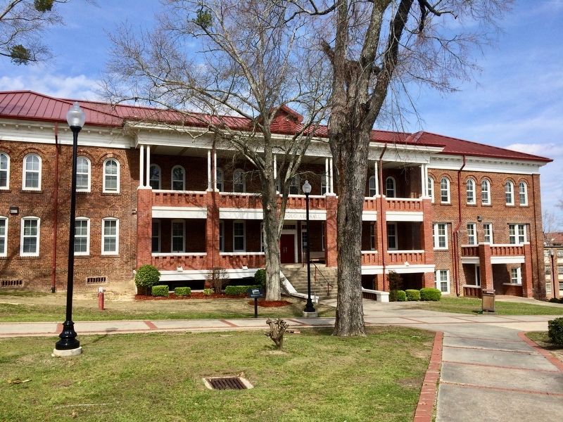
Frederick Douglass Hall
| 1 ► Alabama, Macon County, Tuskegee Institute — Frederick Douglass Hall — 1904 — |
| Near University Avenue, 0.2 miles east of Booker T. Washington Boulevard. | |||
| 2 ► Alaska, Juneau Borough, Juneau, Downtown Juneau — William Henry Seward — |
| Near Main Street at 4th Street. | |||
| 3 ► California, Riverside County, Riverside, Downtown Riverside — Booker Taliaferro Washington — |
| Near Mission Inn Avenue. | |||
| 4 ► California, San Francisco City and County, San Francisco, Japantown — Mary Ellen Pleasant Memorial Park — 1814 - 1904 — |
| On Octavia Street at Bush Street, on the right when traveling south on Octavia Street. | |||
| 5 ► Colorado, Denver County, Denver, Central — Barney Ford Building — 1863 — Lower Downtown Walking Tour — |
| On Blake Street. | |||
| 6 ► Connecticut, Hartford County, Farmington — Farmington and the Freedom Trail — |
| On Main Street (Connecticut Route 10) at School Street, on the right when traveling south on Main Street. | |||
| 7 ► Connecticut, Hartford County, Hartford, Downtown — Frederick Douglass — |
| On Main Street at Gold Street, on the left when traveling north on Main Street. | |||
| 8 ► Connecticut, Litchfield County, New Milford — "A Rough Road to Freedom" — Underground Railroad in New Milford Installed 2012 — New Milford Historical Society & Museum — |
| On Main Street at Main Street, on the right when traveling west on Main Street. | |||
| 9 ► Connecticut, Litchfield County, New Milford — History of the Underground Railroad — "A Rough Road to Freedom" — Ray Crawford — |
| On Elm Street at Main Street, on the right when traveling west on Elm Street. | |||
| 10 ► Connecticut, Litchfield County, Torrington — John Brown Birthplace — |
| On John Brown Road, 1 mile west of Town Farm Road, on the right when traveling west. | |||
| 11 ► Connecticut, Middlesex County, Deep River, Deep River Center — The Underground Railroad — |
| On Main Street (Connecticut Route 154) at Winter Avenue, on the right when traveling north on Main Street. | |||
| 12 ► Connecticut, Middlesex County, Middletown — The Abolitionist Movement — |
| On Broad Street at William Street, on the left when traveling south on Broad Street. | |||
| 13 ► Connecticut, New Haven County, New Haven, Downtown — “Make Us Free” — Amistad Memorial — |
| On Church Street at Court Street, on the right when traveling north on Church Street. | |||
| 14 ► Connecticut, New London County, New London — "Do you want to be slave or free?" — |
| On Bank Street just east of Pearl Street. | |||
| 15 ► Connecticut, New London County, New London — First Step to Freedom — |
| On Bank Street just east of Pearl Street. | |||
| 16 ► Connecticut, New London County, New London — 6 — Haley Houses & Racial Diversity — Hempstead Historic Neighborhood — |
| On Hempstead Street just south of Manwaring Street, on the left when traveling north. | |||
| 17 ► Connecticut, New London County, New London — Hempstead Historic District — |
| On Broad Street at Hempstead Street, on the left when traveling west on Broad Street. | |||
| 18 ► Connecticut, New London County, New London — Middle Passage to New London — |
| Near S Water Street east of Bank Street Connector, on the right when traveling east. | |||
| 19 ► Connecticut, New London County, New London — The Amistad Incident — Galvanizing Abolitionists — |
| On State Street, on the right when traveling west on State Street. | |||
| 20 ► Connecticut, New London County, New London — The Amistad — Black Heritage Trail City of New London — |
| Near S Water Street east of Bank Street Connector, on the right when traveling east. | |||
| 21 ► Connecticut, New London County, Stonington, Mystic — Captain Paul Cuffe, 1759 - 1817 — The Sea Connects Us — Mystic Seaport Museum — |
| On Greenmanville Avenue (Connecticut Route 27) north of Bruggeman Place, on the left when traveling north. | |||
| 22 ► Connecticut, New London County, Stonington, Mystic — George Greenman House — Mystic Seaport Museum — |
| On Greenmanville Avenue (Connecticut Route 27) at Rossie Street, on the right when traveling south on Greenmanville Avenue. | |||
| 23 ► Connecticut, New London County, Stonington, Mystic — Mystic Has a Complex and Engaging History. — The Sea Connects Us — Mystic Seaport Museum — |
| Near Greenmanville Avenue (Connecticut Route 27) north of Hinckley Street, on the left when traveling north. | |||
| 24 ► Connecticut, New London County, Stonington, Mystic — Thomas Downing, Oyster King — The Sea Connects Us — Mystic Seaport Museum — |
| Near Greenmanville Avenue (Route 27) at Bruggeman Place, on the left when traveling north. | |||
| 25 ► Connecticut, New London County, Stonington, Mystic — Waterways to Freedom - Maria Weems and Leah Green — The Sea Connects Us — Mystic Seaport Museum — |
| Near Greenmanville Avenue north of Rossie Street, on the left when traveling north. | |||
| 26 ► Delaware, Kent County, Camden — KC-41 — Camden — |
| On U.S. 13 at E. Camden-Wyoming Ave. (Delaware Route 10) on U.S. 13. | |||
| 27 ► Delaware, Kent County, Camden — KC-110 — Zion African Methodist Episcopal Church — |
| On Center Street. | |||
| 28 ► Delaware, Kent County, Camden, Camden Wyoming — KC-73 — Camden Friends Meeting — Burial Place of John Hunn — |
| On East Camden-Wyoming Ave.. | |||
| 29 ► Delaware, Kent County, Camden, Camden Wyoming — John Hunn — 1814 - 1894 — Quaker Abolitionist — |
| On East Camden-Wyoming Ave.. | |||
| 30 ► Delaware, Kent County, Dover — Continuity & Progress — Historically Happening — Dover, Delaware — |
| On West North Street just east of South Governors Avenue (Alternate U.S. 13), on the left when traveling east. | |||
| 31 ► Delaware, Kent County, Magnolia — KC-91 — Warner Mifflin — 1745 - 1798 — |
| On South State Street close to Quaker Hill Road. | |||
| 32 ► Delaware, Kent County, Willow Grove, Camden Wyoming — KC-118 — Samuel D. Burris — |
| On Willow Grove Road (Delaware Route 10) at Henry Cowgill Road (Delaware Route 10), on the left when traveling north on Willow Grove Road. | |||
| 33 ► Delaware, New Castle County, Middletown — NC-210 — Former Site of the Alston and Hunn Farms — |
| On East Main Street (County Route 299) near Dove Run Blvd, on the left when traveling west. | |||
| 34 ► Delaware, New Castle County, Newark, Iron Hill Park — The Civil War 1861 - 1865 — Iron Hill Museum & Science Center — Delaware Academy of Science — |
| Near South Old Baltimore Pike east of Whittaker Road, on the right when traveling west. | |||
| 35 ► Delaware, New Castle County, Odessa — NC-90 — Appoquinimink Friends Meeting House — |
| On Main Street, 0.1 miles west of US 13 South, on the right when traveling east. | |||
| 36 ► Delaware, New Castle County, Smyrna — NC-89 — Clearfield Farm — |
| On Smyrna Landing Road, 0.2 miles south of Paddock Road, on the right when traveling north. | |||
| 37 ► Delaware, New Castle County, Wilmington — "The Rocks" and the Underground Railroad — The Delaware Underground Railroad — |
| On East 7th Street. | |||
| 38 ► Delaware, New Castle County, Wilmington — NCC-248 — Abraham Shadd Family — |
| On North King Street (Business U.S. 13), on the left when traveling south. | |||
| 39 ► Delaware, New Castle County, Wilmington, Quaker Hill — NC-76 — Meeting House 1816 — Religious Society of Friends — |
| On 4th Street at West Street, on the right when traveling west on 4th Street. | |||
| 40 ► Delaware, New Castle County, Wilmington, Quaker Hill — NC-88 — Thomas Garrett — Stationmaster on the Underground Railroad — |
| On West 4th Street (Route 9) at Shipley Street, on the right when traveling east on West 4th Street. | |||
| 41 ► Delaware, New Castle County, Wilmington, Quaker Hill — NC-125 — Wilmington Friends Meeting — Burial Place of Thomas Garrett — |
| On 5th Street at Washington Street, on the left when traveling west on 5th Street. | |||
| 42 ► Delaware, New Castle County, Wilmington, Riverfront — NC-128 — Freedom Lost |
| On South Market Street (Business U.S. 13) at South Shipley Street, on the right when traveling south on South Market Street. Reported permanently removed. | |||
| 43 ► Delaware, New Castle County, Wilmington, Riverfront — NCC-128 — Freedom Lost — |
| On South Market Street (Business U.S. 13) at South Shipley Street, on the right when traveling south on South Market Street. | |||
| 44 ► Delaware, New Castle County, Wilmington, Riverfront — Harriet Tubman — (born Araminta Harriet Ross; 1820 - March 10, 1913) — |
| On Rosa Parks Drive east of South Market Street (Business U.S. 13), on the right when traveling east. | |||
| 45 ► Delaware, New Castle County, Wilmington, Riverfront — The Big Quarterly — Riverfront Wilmington — |
| On Rosa Parks Drive east of South Market Street (Business U.S. 13), on the right when traveling east. | |||
| 46 ► Delaware, New Castle County, Wilmington, Riverfront — The Tubman-Garrett Riverfront Park — |
| On Rosa Parks Drive just east of French Street, on the left when traveling west. | |||
| 47 ► Delaware, New Castle County, Wilmington, Riverfront — The Underground Railroad — Riverfront Wilmington — |
| On South Market Street (Business U.S. 13) south of South Shipley Street, on the right. | |||
| 48 ► Delaware, New Castle County, Wilmington, Riverfront — The Underground Railroad — |
| On Rosa Parks Drive just west of French Street, on the left when traveling west. | |||
| 49 ► Delaware, New Castle County, Wilmington, Riverfront — Thomas Garrett — (b. August 21, 1789 - d. January 24, 1871) — |
| On Rosa Parks Drive at South King Street, on the right when traveling east on Rosa Parks Drive. | |||
| 50 ► Delaware, Sussex County, Georgetown — Delaware Citizens Who Fought for the South — |
| Near South Bedford Street (Business U.S. 9) north of Zoar Road, on the right when traveling south. | |||
| 51 ► Delaware, Sussex County, Seaford — SC-233 — Gateway to Freedom: The Tilly Escape — |
| On Market Street just south of High Street, on the right when traveling south. | |||
| 52 ► District of Columbia, Washington, Northeast Washington, Capitol Hill — Frederick Douglass — (1817 - 1895) — |
| Near A Street Northeast east of Frederick Douglas Court Northeast, on the left when traveling east. | |||
| 53 ► District of Columbia, Washington, Northeast Washington, Capitol Hill — Freedmen’s Memorial Monument to Abraham Lincoln — or Freedom’s Memorial — |
| On East Capitol Street Northeast at 12th Street Northeast, in the median on East Capitol Street Northeast. | |||
| 54 ► District of Columbia, Washington, Northwest Washington, Adams Morgan — Resilience and Resistance — Hallowed Ground — Rock Creek Park, National Park Service, U.S. Department of the Interior — |
| On Calvert Street Northwest at 20th Street Northwest, on the right when traveling west on Calvert Street Northwest. | |||
| 55 ► District of Columbia, Washington, Northwest Washington, Adams Morgan — Seeking Freedom — Hallowed Ground — Rock Creek Park, National Park Service, U.S. Department of the Interior — |
| On Calvert Street Northwest at 20th Street Northwest, on the right when traveling west on Calvert Street Northwest. | |||
| 56 ► District of Columbia, Washington, Northwest Washington, Adams Morgan — Soldiers, Sailors, and Refugees of War — Hallowed Ground — Rock Creek Park, National Park Service, U.S. Department of the Interior — |
| On Calvert Street Northwest at 20th Street Northwest, on the right when traveling west on Calvert Street Northwest. | |||
| 57 ► District of Columbia, Washington, Northwest Washington, Bloomingdale — Metropolitan Wesley A.M.E. Zion Church — The Gate Way to Freedom — |
| On North Capitol Street Northwest at R Street Northwest on North Capitol Street Northwest. | |||
| 58 ► District of Columbia, Washington, Northwest Washington, Downtown — W.3 — Asbury United Methodist Church — Civil War to Civil Rights — Downtown Heritage Trail |
| On K Street Northwest (U.S. 29) at 11th Street Northwest (U.S. 29), on the right when traveling east on K Street Northwest. Reported permanently removed. | |||
| 59 ► District of Columbia, Washington, Northwest Washington, Downtown — W.3 — Asbury United Methodist Church — Civil War to Civil Rights — Downtown Heritage Trail — |
| On K Street Northwest (U.S. 29) at 11th Street Northwest, on the left when traveling west on K Street Northwest. | |||
| 60 ► District of Columbia, Washington, Northwest Washington, Downtown — W.4 — New York Avenue Presbyterian Church at Herald Square — Civil War to Civil Rights — Downtown Heritage Trail |
| On New York Avenue Northwest (U.S. 50) west of H Street Northwest. Reported permanently removed. | |||
| 61 ► District of Columbia, Washington, Northwest Washington, Downtown — W.4 — New York Avenue Presbyterian Church at Herald Square — Civil War to Civil Rights — Downtown Heritage Trail — |
| On New York Avenue Northwest at H Street Northwest, on the right when traveling west on New York Avenue Northwest. | |||
| 62 ► District of Columbia, Washington, Northwest Washington, Downtown — W.5 — The United States Treasury — Civil War to Civil Rights — Downtown Heritage Trail — |
| On 15th Street Northwest north of Pennsylvania Avenue Northwest, on the right when traveling south. | |||
| 63 ► District of Columbia, Washington, Northwest Washington, Downtown — Written with Water — The Story of Franklin Park — National Mall and Memorial Parks, Franklin Park — |
| On I Street Northwest just east of 14th Street Northwest, on the right when traveling west. | |||
| 64 ► District of Columbia, Washington, Northwest Washington, Dupont Circle — After the Civil War — Dupont Circle — Diverse Visions | One Neighborhood |
| On P Street Northwest at 17th Street Northwest, on the left when traveling west on P Street Northwest. Reported unreadable. | |||
| 65 ► District of Columbia, Washington, Northwest Washington, Dupont Circle — Dupont Circle Mural Key |
| On Connecticut Avenue Northwest south of Dupont Circle Northwest, on the right when traveling south. Reported permanently removed. | |||
| 66 ► District of Columbia, Washington, Northwest Washington, Dupont Circle — 336 — From 1890 to 1910 — Dupont Circle — Diverse Visions | One Neighborhood — |
| On R Street Northwest at 21st Street Northwest, on the right when traveling west on R Street Northwest. | |||
| 67 ► District of Columbia, Washington, Northwest Washington, Foggy Bottom — Leonard A. Grimes — (1815 - 1873) — |
| On H Street Northwest at 22nd Street Northwest, on the right when traveling west on H Street Northwest. | |||
| 68 ► District of Columbia, Washington, Northwest Washington, Georgetown — "The bramble and trees…had made them invisible" — |
| Near Q Street Northwest just west of 27th Street Northwest, on the right when traveling west. | |||
| 69 ► District of Columbia, Washington, Northwest Washington, Georgetown — Herring Hill — |
| On P Street Northwest at 27th Street Northwest on P Street Northwest. | |||
| 70 ► District of Columbia, Washington, Northwest Washington, Georgetown — Mt. Zion Cemetery / Female Union Band Society Cemetery — 2527 Q Street Northwest — |
| On 27th Street Northwest, 0.1 miles north of Q Street Northwest, on the left when traveling north. | |||
| 71 ► District of Columbia, Washington, Northwest Washington, Judiciary Square — e.1 — Senator Daniel Webster — Civil War to Civil Rights — Downtown Heritage Trail |
| On D Street Northwest west of 5th Street Northwest, on the right. Reported permanently removed. | |||
| 72 ► District of Columbia, Washington, Northwest Washington, Judiciary Square — e.3 — Senator Daniel Webster — |
| On D Street Northwest just west of 5th Street Northwest, on the right when traveling west. | |||
| 73 ► District of Columbia, Washington, Northwest Washington, Logan Circle — John Logan House — A Memorial to General and Senator John A. Logan — Champion in the Struggle to Preserve the Union and Establish Racial Justice in America — |
| On P Street Northwest at Logan Circle Northwest, on the left when traveling east on P Street Northwest. | |||
| 74 ► District of Columbia, Washington, Northwest Washington, Logan Circle — John Logan House — A Memorial to General and Senator John A. Logan — Champion in the Struggle to Preserve the Union and Establish Racial Justice in America — |
| On Logan Circle Northwest just north of P Street Northwest, on the right when traveling south. | |||
| 75 ► District of Columbia, Washington, Northwest Washington, Mount Vernon Square — 15 — On the Path — Midcity at the Crossroads — Shaw Heritage Trail — |
| On 4th Street Northwest at New York Avenue Northwest (U.S. 50), on the right when traveling south on 4th Street Northwest. | |||
| 76 ► District of Columbia, Washington, Northwest Washington, Mount Vernon Square — Second Baptist Church — 816 Third Street, NW — African American Heritage Trail, Washington DC — |
| On 3rd Street Northwest just north of H Street Northwest, on the left when traveling north. | |||
| 77 ► District of Columbia, Washington, Northwest Washington, North Cleveland Park — The Rest — Tenleytown, DC — Country Village to City Neighborhood — |
| On Yuma Street Northwest at 39th Street Northwest, on the right when traveling west on Yuma Street Northwest. | |||
| 78 ► District of Columbia, Washington, Northwest Washington, Old Soldiers Home — President Lincoln’s Cottage at the Soldiers’ Home — A National Trust Historic Site — |
| Near Lincoln Drive Northwest north of Upshur Street Northwest, on the right when traveling north. | |||
| 79 ► District of Columbia, Washington, Northwest Washington, Penn Quarter — e.2 — Ending Slavery in Washington — Civil War to Civil Rights — Downtown Heritage Trail — |
| On 6th Street Northwest at Indiana Avenue Northwest, on the right when traveling south on 6th Street Northwest. | |||
| 80 ► District of Columbia, Washington, Northwest Washington, Penn Quarter — Frederick Douglass 1817 - 1895 — The Extra Mile — Points of Light Volunteer Pathway — |
| On 15th Street Northwest north of Pennsylvania Avenue Northwest, on the right when traveling north. | |||
| 81 ► District of Columbia, Washington, Northwest Washington, Penn Quarter — Harriet Tubman circa 1820 - 1913 — The Extra Mile — Points of Light Volunteer Pathway — |
| On G Street Northwest east of 14th Street Northwest, on the right when traveling east. | |||
| 82 ► District of Columbia, Washington, Northwest Washington, Penn Quarter — 5850-2019 — Julia Ward Howe — 1819 - 1910 — |
| On 14th Street Northwest at F Street Northwest, on the left when traveling north on 14th Street Northwest. | |||
| 83 ► District of Columbia, Washington, Northwest Washington, Penn Quarter — .4 — The Roots of Freedom and Equality — Civil War to Civil Rights — Downtown Heritage Trail |
| On 7th Street Northwest south of F Street Northwest, on the right when traveling north. Reported permanently removed. | |||
| 84 ► District of Columbia, Washington, Northwest Washington, Penn Quarter — .4 — The Roots of Freedom and Equality — Civil War to Civil Rights — Downtown Heritage Trail — |
| On 7th Street Northwest at F Street Northwest, on the right when traveling north on 7th Street Northwest. | |||
| 85 ► District of Columbia, Washington, Northwest Washington, The National Mall — Live Oaks: A Gathering Place — |
| On 15th Street Northwest just south of Constitution Avenue Northwest (U.S. 50), on the left when traveling north. | |||
| 86 ► District of Columbia, Washington, Northwest Washington, The National Mall — Live Oaks: A Symbol of Strength — |
| On 15th Street Northwest just south of Constitution Avenue Northwest (U.S. 50), on the left when traveling south. | |||
| 87 ► District of Columbia, Washington, Northwest Washington, U Street Corridor — Mary Ann Shadd Cary House — |
| On W Street Northwest west of 14th Street Northwest, on the left when traveling east. | |||
| 88 ► District of Columbia, Washington, Northwest Washington, U Street Corridor — Mary Ann Shadd Cary Residence — 1421 W Street, NW — African American Heritage Trail, Washington DC — |
| On W Street Northwest west of 14th Street Northwest, on the left when traveling east. | |||
| 89 ► District of Columbia, Washington, Northwest Washington, U Street Corridor — 8 — Strivers' Section — Dupont Circle — Diverse Visions | One Neighborhood — |
| On U Street Northwest at 17th Street Northwest, on the right when traveling west on U Street Northwest. | |||
| 90 ► District of Columbia, Washington, Southeast Washington, Anacostia — Frederick Douglass National Historic Site — |
| Near W Street Southeast at 14th Street Southeast, on the left when traveling west. | |||
| 91 ► District of Columbia, Washington, Southeast Washington, Anacostia — 18 — The Sage of Anacostia — An East-of-the River View — Anacostia Heritage Trail — |
| On W Street Southeast at 14th Street Southeast, on the right when traveling east on W Street Southeast. | |||
| 92 ► District of Columbia, Washington, Southeast Washington, Anacostia Park — Hillsdale & Frederick Douglass — |
| On Anacostia Drive, 0.3 miles east of Good Hope Road Southeast, on the left when traveling east. | |||
| 93 ► District of Columbia, Washington, Southeast Washington, Barney Circle — Ann G. Sprigg — |
| Near E Street Southeast at Potomac Avenue Southeast, on the right when traveling south. | |||
| 94 ► District of Columbia, Washington, Southeast Washington, Barney Circle — Anna Murray-Douglass — |
| On E Street Southeast at Potomac Avenue Southeast, on the right when traveling east on E Street Southeast. | |||
| 95 ► District of Columbia, Washington, Southeast Washington, Barney Circle — John Smilie — Congressional Cemetery — |
| Near E Street Southeast, 0.1 miles east of Potomac Avenue Southeast, on the right when traveling east. | |||
| 96 ► District of Columbia, Washington, Southeast Washington, Barney Circle — National Underground Railroad Network to Freedom — |
| Near E Street Southeast just east of Potomac Avenue Southeast, on the right when traveling east. | |||
| 97 ► District of Columbia, Washington, Southeast Washington, Douglass — Activist Grove (1833-1845) — Douglass Community Center |
| Near Frederick Douglass Court Southeast north of Bruce Place Southeast. Reported unreadable. | |||
| 98 ► District of Columbia, Washington, Southeast Washington, Douglass — Escape Allée (1838) — Douglass Community Center — |
| On Frederick Douglass Court Southeast north of Bruce Place Southeast, on the right when traveling north. | |||
| 99 ► District of Columbia, Washington, Southeast Washington, Douglass — Freedom Grove (1838) — Douglass Community Center — |
| Near Frederick Douglass Court Southeast north of Bruce Place Southeast. | |||
| 100 ► District of Columbia, Washington, Southeast Washington, Douglass — Memorial Grove (1841-1895) — Douglass Community Center — |
| Near Frederick Douglass Court Southeast north of Bruce Place Southeast. | |||
1629 entries matched your criteria. The first 100 are listed above. Next 100 ⊳