Higher than any other dam from 1915 until 1934, Arrowrock Dam still is an essential part of Boise Valley's irrigation system.
Located six miles upstream from here, Arrowrock is 350 feet high and 1,150 feet wide. Built at a cost of $4,725,000 . . . — — Map (db m22597) HM
In the late 1800s, Idaho Territory needed to attract homesteaders to farm the Boise Valley. At the time, the area was dry sagebrush desert. A young engineer, Arthur Foote, designed a great canal system that was to allow the Boise River to . . . — — Map (db m119027) HM
The Warm Springs Avenue neighborhood began to emerge in the 1890’s, soon after Kelly Hot Springs, for which the street was named, was tapped to provide water for Boise’s fire hydrants.
The prominent owners of the water line built their mansions on . . . — — Map (db m109839) HM
You are standing in the outlet of ancient Lake Bonneville, a vast prehistoric inland sea, of which Salt Lake is modern remnant
Covering over 20,000 square miles when it overflowed here about 14,500 years ago, its winding shoreline would have . . . — — Map (db m105831) HM
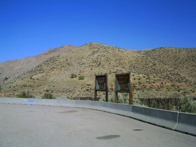
McCammon's mogul
(two photos at bottom left)
In 1865 William H. Murphy operated a toll bridge on the Portneuf River mainly used by miners traveling from Utah to the Montana goldfields. Murphy and his wife Catherine Scott Murphy . . . — — Map (db m108261) HM
Chief Pocatello's memory was honored by giving his name to two fighting vessels in World War II.
USS Pocatello
Tacoma-Class Frigate
Launched October 17, 1943. It was sponsored by Miss Thelma Dixey, Chief Pocatello's . . . — — Map (db m108326) HM
Loggers used the splash dam system in the Marble Creek basin between 1915 and 1931.
In 1923, Rutledge Lumber Company spent $16,352.25 building the dam depicted in this mural.
Splash dams stored enough water to “flush” logs down . . . — — Map (db m109997) HM
St. Maries, named by Jesuit Father Pierre DeSmet during the 1840s, sits at the confluence of the "Shadowy" St. Joe and St. Maries rivers. It was recognized as a settlement in the 1880s. Incorporated as a village in 1902, and as a city in 1913, it . . . — — Map (db m122624) HM
Water from deep snow that falls on high mountain ridges north of here is stored each Spring in this reservoir to irrigate farm land near Shoshone and Richfield.
Big Wood River flows past some hills that separate this valley from a broad plain . . . — — Map (db m110116) HM
(This marker consists of three panels:)
The Payette River is a major tributary of the Snake River and drains about 3,200 square miles, an area about the size of Delaware and Rhode Island. Annual rainfall within the drainage ranges . . . — — Map (db m119311) HM
Glaciers advanced and retreated a dozen times or more
Damming Glacial Lake Missoula
Bursting with gargantuan force
Flooding areas 400 miles away
Shaping today's landscape in Idaho, Washington and Oregon
Glacial ice above . . . — — Map (db m73493) HM
Force of energy unleashed was hundreds of times the explosive energy of Mt. Saint Helens
Flood events occurred more than a dozen times before the last torrential cataclysm of 12-15,000 years ago
Glacial Lake Missoula and the Channeled . . . — — Map (db m73495) HM
When the last of the continental ice sheets blocked this valley, a great lake extended over 200 miles into Montana. Ice about as high as the mountain ridges held back water as deep as 800 to 1000 feet at Missoula, ten to twenty thousand years . . . — — Map (db m73490) HM
...the falls
As you look down at the Pend Oreille (Pond O'Ray) River and Albeni Falls Dam (Albany) you may be looking for the falls. In 1887 a 26 year-old French Canadian farmer living in Blanchard, Idaho, also wondered where the falls . . . — — Map (db m109902) HM
Harnessing the Flow
During the year, the Corps of Engineers regulates the flow of water through the dam.
Water is released from Lake Pend Oreille to maintain seasonal lake elevations and to adjust for rain and snowmelt.
Water at . . . — — Map (db m109906) HM
The fertile soil and abundance of water in this
valley lured pioneer settlers. With small slip
scrapers, hand plows, picks and shovels, they
cleared sagebrush, built log homes, made canals,
ditches and dams to put water on the land. One of . . . — — Map (db m239843) HM
Gold miners rushing to Wild Horse in British Columbia in 1863 were paddled across this river by Indians; in 1864 E.L. Bonner established a proper ferry here.
This ferry and its trading store served the Wild Horse packtrains for many years. . . . — — Map (db m122203) HM
Bonners Ferry riverfront today is quiet compared to the bustling center of activity it was during the 1860s gold rush. Picture prospectors and pack trains, traders and supples, all gathered here waiting to be ferried across the river to continue . . . — — Map (db m122656) HM
Harnessing water for power
Electricity and fast-flowing rivers are inseparable in the Pacific Northwest. In the early 1900s, harnessing the power of water to supply Bonners Ferry's ever-increasing demand for electricity was challenging. . . . — — Map (db m122658) HM
[front side] Constructed in 1964, the 1223 ft. long steel truss bridge spans the Moyie River Canyon at a height of 464 ft. It replaces the old bridge built in 1923 and 1¼ miles of narrow, winding highway. It is the second highest bridge in . . . — — Map (db m73505) HM
This Pelton Wheel provided the power to generate the first electricity from the foot of Myrtle Creek 6 miles west of town, for the Village of Bonners Ferry from 1906 – 1921. — — Map (db m109851) HM
During the 1920s, the Bonners Ferry Water and Light Department made multiple improvements to the Moyie River and Myrtle Creek power plants, but relying on hydroelectric power alone has its drawbacks. Generating electricity depended on river . . . — — Map (db m122661) HM
Statistics
Length: 20.5 feet
Diameter: 21 inches
Weight: 3300 pounds
Range: 5500 to 9000 yards
Propulsion: Steam Turbine
History
The Mark 14 torpedo was introduced into the navy in 1929. The warhead contained . . . — — Map (db m103596) WM
USS Hawkbill (SSN-666)
Class: (Sturgeon Variant) Sturgeon
Built At: Mare Island Naval Shipyard
Keel Laid: 12 September 1966
Launched: 2 April 1969
Christening: Mrs. Bernard F. Roeder
Commissioned: 4 February 1971
First Commanding . . . — — Map (db m103649) WM
The historic Guffey Bridge is an elegant Parker-through truss railroad bridge, the State’s largest artifact, and the site of the most spectacular train wreck in Idaho.
The Boise, Nampa and Owyhee Railroad (BNO), was organized by owner Col. Wm. . . . — — Map (db m73344) HM
Blocked by lava eruptions at least 140,000 years ago, the Bear River was diverted from draining into the Snake River system.
It was forced to drain southward into what were then lakes Thatcher and Bonneville and is now the Great Salt Lake.
. . . — — Map (db m109914) HM
Two miles east is located the dam and headworks of the canal system. Incorporation was effected Feb. 4, 1899 for the purpose of irrigating this valley. First filing on Bear River to supply the canal was Mar. 4, 1897. To perfect the right it was . . . — — Map (db m140280) HM
Many Oregon & California bound emigrants mention seeing ten to twelve foot hight white mounds and cones in their diaries and journals while passing through the Soda Springs area in the mid-1800s. Often, one of the first natural curiosities that . . . — — Map (db m106251) HM
When completed in 1904, Milner Dam raised Snake River 38 feet to divert water into major north and south side canals.
A gravity system unmatched in size in national reclamation development, this project irrigates 360,000 acres of land. Twin . . . — — Map (db m31636) HM
In 1880, George Starrh, a Snake River placer miner, started a ferry across Snake River one mile north of here. From 1880-2, freighters hauling supplies for a mining rush to Wood River used Starrh's ferry (powered by river current when stiff winds . . . — — Map (db m31635) HM
In the summer of 1880 George Starrh, a placer miner, established a ferry 4 miles west of the present city of Burley. Rich mineral mines had been discovered in the Wood River country and freight was hauled between the mines and Kelton, Utah, (the . . . — — Map (db m125404) HM
This 717 foot high concrete structure is the highest straight axis gravity dam in North America. The dam backs up water from the North Fork of the Clearwater River forming a 54-mile lake at full pool. Flood control, power production, and recreation . . . — — Map (db m159495) HM
Founded by Seth S. Slater, May 6, 1861, Slaterville (permanent population, 50) had 5 edifices – built mainly of colored blankets – 2 stores, 2 houses, and a saloon.
When the Colonel Wright “snapped her tow-line on the Grand Rapids . . . — — Map (db m110703) HM
Guided by Twisted Hair and several other Nez Perce, Capt. William Clark selected this as a camp site because of the many large ponderosa pines that grew here then. The canoe makers chopped out small portions of the pine logs, then used fire or . . . — — Map (db m109875) HM
Welcome to
Canoe Camp
One of 38 sites of Nez Perce National Historical Park
These grounds have been inhabited for thousands of years by the Nez Perce people, but are best known as the place where the Lewis and Clark . . . — — Map (db m109872) HM
Ever since the first cross-cut saws were heard in the remote forests of Clearwater County in the late 1800s, the Clearwater River played a major role in the timber industry of this area. The river served as a means of transportation and by the early . . . — — Map (db m159486) HM
After more than a month’s search, they finally had reached a westward river where they could use canoes.
From here they continued another 16 miles with their pack horses before they found a campsite with trees suitable for making canoes.
But at . . . — — Map (db m109757) HM
When the Lewis and Clark Corps of Discovery entered this area in September 1805, they were not only hungry, but still anxious to locate a water route to the Pacific Ocean.
Under the direction of a Nez Perce headman, Twisted Hair, the explorers . . . — — Map (db m159484) HM
...then crossed the River at a shole place the water to the horses bellies." - Sgt. John Ordway, Sept. 26, 1805
Clearwater Crossings
Long before we had highways and bridges, people crossed the river at this location. What . . . — — Map (db m159488) HM
Routes Through History
Travel through the rugged Clearwater River region has not always been on smooth, paved highways. Routes on land began as game trails, then foot paths which grew into horse paths. Many of these historic routes paid . . . — — Map (db m159490) HM
Canoe Camp is part of the Nez Perce National Historical Park and a key site along the Northwest Passage Scenic Byway
An Interesting Drive
The 202-mile Northwest Passage Scenic Byway stretches from Lewiston to Lolo Pass on US Highway . . . — — Map (db m109886) HM
Prospectors panned for gold in the Yankee Fork-Salmon River area from the late 1860's to 1879.
Then in 1880 the Yankee Fork Consolidated Gravel Mining Company built a ditch to bring water here for their new hydraulic gold mining operations. . . . — — Map (db m110013) HM
River rafters and kayakers now find whitewater excitement on this stretch of the Salmon River. Early photographs help us discover that these rapids were once replaced by a lake.
Whitewater was missing after the completion of Sunbeam Dam. . . . — — Map (db m110011) HM
The Sunbeam Dam was constructed by the Sunbeam Consolidated Gold Mines Company to provide power for their mill located 13 miles up Yankee Fork on Jordan Creek.
Construction of the dam and power plant began in June, 1909, and was completed . . . — — Map (db m110010) HM
After the golden spike was driven at Promontory Utah in 1869 the nearest railroad station to Boise was Kelton on the north shore of the Great Salt Lake. A ferry was built 1/2 mile up on the river as a joint effort by Gustavus Glenn, a local rancher . . . — — Map (db m31678) HM
1890, Joseph Rosevear and Sam McAnulty pulled the waterlogged Glenn Ferry out of the Snake River, and some of its material was used to build the Rosevear Ferry, which operated until 1908, when a bridge was built. The Rosevear Ferry was owned and . . . — — Map (db m125675) HM
The Town site of Mountain Home was chosen by the Union Pacific Railroad as a stop because of a readily available supply of water. The railroad utilized steam operated pumps in trench wells to fill storage tanks with this water in order to supply the . . . — — Map (db m110156) HM
Diverted into this valley by lava flows, the Bear River deposited a huge, mostly red clay delta here where it entered a vast inland sea that covered much of Utah.
About 14,500 years ago , its shoreline suddenly went down about 80 feet . . . — — Map (db m105834) HM
Concrete shaft located one-half mile west on Bear River marks the site of the Nathan Williams Packer Toll Ferry and Bridge, one of the first on the river. The ferry operated with rope and carried equivalent of one team and wagon. In 1869 a bridge . . . — — Map (db m48977) HM
Constructed in 1924, this $1,500,000 concrete gravity dam has a 1,039 foot crest and a 183 foot structural height.
A 29 mile canal, along with lesser ditches, serves 58,250 acres of Boise and Payette valley farms. A power plant at Black Canyon . . . — — Map (db m23237) HM
Visible directly across the river is a pit left by large scale hydraulic mining for gold deposited in ancient gravel beds.
Big nozzles, called “hydraulic giants,” shot powerful streams of water against a pre-historic river . . . — — Map (db m109642) HM
The Riggins irrigation ditch was built in 1891 by early pioneers, Charlie Clay and brothers Isaac and Johnny Irwin, to supply water to their gold mining operation. By 1894, gold mining waned and the ditch was used for irrigation water. It wasn’t . . . — — Map (db m119354) HM
In the 1890s, Captain “Cap” Guleke began making regular float trips down the Salmon River from the town of Salmon to Riggins. He would build a large wooden sweep boat, called a scow, and deliver supplies to river ranches. At the . . . — — Map (db m119413) HM
A vast mountain wilderness, cut by the mile deep Salmon River Canyon stretches across Idaho south and east of here.
Travel through the Salmon River Mountains always was hard in the early days.
An 1872 railroad survey showed the Salmon . . . — — Map (db m109667) HM
Then this part of the earth’s surface gradually rose.
As the mountains were rising, the river cut down into the older rock below.
Many other northwestern rivers cut similar gorges.
The Snake flows through Hell’s Canyon – deepest of them . . . — — Map (db m109662) HM
Prior to the Holt Ferry, mail and supplies could be sent across the South Fork of the Snake River in a heavy wire basket on a cable. In 1894, Richard C. Heise, who had read of the healing properties of the mineral springs, came from Pocatello and . . . — — Map (db m140543) HM
The Snake River shifted to the north bypassing the South Channel or Dry Bed and left canals along this route without water during most of the summer of 1894. The Great Feeder Headgate and Canal were built in the years 1894 and 1895 to supply . . . — — Map (db m140541) HM
This type of canoe was not used by the Coeur d'Alene until the arrival (of the) pioneer settlers. Combined with iron tooling and burning, it took two men up to eight weeks to build. The Indians preferred their traditional bark-skinned canoe . . . — — Map (db m122768) HM
The Coeur d'Alene River is moderately visible from this vista point. The river aided in popularizing the Sacred Heart Mission by creating a steamboat access for outlying communities.
For one dollar, passengers could enjoy the 27 mile river . . . — — Map (db m122763) HM
The Coeur d'Alene River once flowed through here. Dams raised the level of Lake Coeur d'Alene causing the river to develop new channels. Annual flooding now furnishes water and silt to this former river bed. — — Map (db m122767) HM
Look to the north: blocking the northward passage of the rivers which form this lake, a great dam of glacial ice once towered above the horizon as far as the eye can see. When the glacier melted, about 600,000 years ago, it left a moraine - a . . . — — Map (db m122872) HM
Built by the army in 1880 to carry hay and supplies for Fort Coeur d'Alene, the "Amelia Wheaton" was the first of a long list of steamers on this lake. Commercial steamboating began in 1884 with the mining rush. In later years, fleets of . . . — — Map (db m122877) HM
Living for more than 60 years in hand-built "dugouts" across the Salmon River from this site, Richard "Dugout Dick" Zimmerman (1916-2010) came to symbolize the Idaho hermit.
With colorful names like Buckskin Bill and Hank the Hermit, . . . — — Map (db m109678) HM
Two days before reaching the Continental Divide, Meriwether Lewis speculated that the Columbia River would not have the same moderate character as the Missouri.
“I do not beleive (sic) that the world can furnish an example of a . . . — — Map (db m109542) HM
An old ferry near here took thousands of eager fortune hunters to a trail that climbed out of this canyon to rich gold fields discovered at Pierce in 1860.
You can still follow their spectacular route to Weippe Prairie, where in 1805 Lewis and . . . — — Map (db m109756) HM
Completed in 1910 at a cost of $3,000,000 Magic Dam stores water for 89,000 acres of irrigated farms near Shoshone and Richfield.
Rising 129 feet high, it is 700 feet wide.
An adjacent 1600-foot embankment with a concrete spillway helps . . . — — Map (db m109633) HM
No. 70
August 21, 1937
In honor of
The Mormon Pioneers of Idaho
Builders of
North Fork Ferry
The first ferry on Henry’s Fork
of Snake River, was first operated
near this spot March 26, 1883. It
was constructed by Rexburg . . . — — Map (db m103903) HM
An important pioneer federal reclamation dam and power plant provides water and electricity for farms and cities nearby.
Constructed 5 miles east of here between 1904 and 1906 at a cost of $675,000, Minidoka Dam diverts water into . . . — — Map (db m124027) HM
Near this spot, a ferry was established in 1886 by George Montgomery and Andrew Smith. Charges were fifty cents for man and horse; seventy five cents for team and wagon. Only means of crossing Snake River between Starrh's Ferry and American Falls, a . . . — — Map (db m138487) HM
For thousands of years the river scene at this village site hardly changed. The stream was full of fish, served as a trade route for neighboring tribes, and attracted wildlife to this green corridor.
While the river fostered a life of bounty and . . . — — Map (db m121715) HM
Father had a small grist mill near the house -- a great improvement over their (the Nez Perce) mortars and pestles. --- Eliza Spalding Warren
To power the gristmill that stood at this site, Henry Spalding directed some Nez Perce to dig . . . — — Map (db m121719) HM
Lewiston's first bridge across the Clearwater River
was constructed in 1913 and replaced in 1951.
Early efforts for a bridge were opposed by ferryboat owners, but other business leaders recognized the need for a link to northern . . . — — Map (db m109711) HM
Piloted by Ephraim W. Baughman, the Colonel Wright was the first sternwheeler to ascend the Snake River to its junction with the Clearwater.
After the strong current snapped the boat’s tow line at Big Eddy (present-day Lenore), the Oregon . . . — — Map (db m110588) HM
The Corps of Discovery reached the confluence of the Snake and Clearwater Rivers on October 10, 1805.
In his map of the site, William Clark included a small island he observed “at the point of union” of the channels.
The island . . . — — Map (db m110632) HM
Pioneer businessman and politician,
he owned and operated ferries in the Lewiston and Spokane areas.
Early in the 1860’s, John Silcott ran a ferryboat across the Snake River at Lewiston.
He soon put in a ferry across the Clearwater River . . . — — Map (db m109713) HM
This scenic route commemorates the Lewis and Clark expedition’s quest for a watercourse through the Rocky Mountains connecting the Missouri and Columbia rivers.
The byway parallels the explorers' journey through the ancestral Nez Perce homeland in . . . — — Map (db m109726) HM
Started May 13, 1861, as a steamboat landing, Lewiston immediately became a primary commercial center for Idaho miners during their hectic gold rush to Pierce that spring. Steamboats continued to dock there until 1940, mainly after Columbia . . . — — Map (db m121918) HM
“…one canoe in which Sergt. Gass was Stearing
And was nearle turning over, she Sprung
A leak or Split open on one side and
Bottom filled with water & Sunk on the rapid…”
~Captain Wm. Clark,
October 8, . . . — — Map (db m110634) HM
When the Nez Perce named this site, they viewed a desolate yet beautiful landscape.
Near a large island at the confluence, crystal waters from the Clearwater joined the murky flow of the Snake. Scattered willows grew along the broad river . . . — — Map (db m121810) HM
Petroglyphs
The earliest ‘writings’ along the Snake River were petroglyphs carved into the rocks.
At the Buffalo Eddy and Captain John sites, located 20 miles upriver from here, some of the petroglyphs are four to six thousand years . . . — — Map (db m110688) HM
In 1888 George Froman built a ferry about a mile downstream from here. It operated until a bridge was built here in 1921.
The ferry barge was connected by ropes to a pulley which slid along a cable spanning the river. By angling the barge into . . . — — Map (db m26192) HM
The boat was built in 1866 to provide easy river travel for a part of the route from the Columbia to Boise and Silver City. It was intended to ply 105 miles between here and Old's Ferry. Once it even explored the river for 60 miles above here, . . . — — Map (db m32175) HM
The valley of the Snake, historic passage from the Midwest to the Northwest, has been a primary route for travel since the days of Indians and fur traders.
The Oregon Trail forded the river at Old Fort Boise, the Hudson's Bay Company 12 miles . . . — — Map (db m23195) HM
More than two decades before American Falls Dam was built, water power was generated in a series of plants at America Falls.
Starting with an island plant to serve Pocatello in 1902, this superlative site was utilized soon after long . . . — — Map (db m124073) HM
The town of Buhl, second largest in Twin Falls County, was founded in 1906 and named in honor of Frank H. Buhl, a financier of the South Side Irrigation Project. Buhl was a wealthy capitalist who owned steel mills in Sharon, Pennsylvania, and . . . — — Map (db m125626) HM
A scow powered by oarsmen let Oregon Trail wagons cross Snake River here from 1852 to 1870. Then Overland Stage service from Boise to a rail terminal in Kelton, Utah was moved to this crossing, and M.E. Payne installed a large (14 by 60 foot) new . . . — — Map (db m31653) HM
The lush willow bottoms of Rock Creek provided Native Americans with a natural campsite. During the early and mid-1800s, Rock Creek was an oasis for the trappers, explorers and Oregon-bound emigrants attempting to traverse the arid Snake River . . . — — Map (db m31522) HM
(This marker is composed of photographs and the captions associated with them.)(top left)
Carved by a Flood
Lake Bonneville, the bigger ancestor of Salt Lake, flooded this area about 15,000 years ago. Twin . . . — — Map (db m125565) HM
Constructed in 1910 about 8 miles west of here, Salmon Dam was a spectacular early irrigation structure.
220 feet high, it blocks a narrow lava gorge of Salmon Falls Creek. Intended to create a large reservoir to irrigate desert lands . . . — — Map (db m125620) HM
Shoshone Falls Hydroelectric Project.
In 1900 Ira B. Perrine began seeking investors for a hydroelectric plant at Shoshone Falls, ultimately forming the Shoshone Falls Power Company on March 9, 1904. In 1907, the site was sold to William S. . . . — — Map (db m62971) HM
(Two panels are found at the Shoshone kiosk:)
Native Americans and life in the Snake River Canyon
Coyote Creates the Snake River
A Traditional Shoshone-Bannock Story
Once in that . . . — — Map (db m125560) HM
Owrned and operated by Idaho Power, the Shoshone Falls Hydroelectric Project located on the Snake River, is licensed by the Federal Energy Regulatory Commission as Project No. 2778.
The reservoir provides recreation opportunities for . . . — — Map (db m26478) HM
Prior to the arrival of the railroad in 1912, the North Fork of the Payette River provided an avenue for logs destined to downstream mills in Horseshoe Bend and Emmett.
In 1903, $100,000 was spent to dynamite open a clear channel in the . . . — — Map (db m23233) HM