After filtering for South Dakota, 63 entries match your criteria.
Environment Topic
By Ruth VanSteenwyk, April 16, 2017
Waterfowl Marker
| 1 ► South Dakota, Brown County, Columbia — Waterfowl — |
| On Sand Lake Dr., 0.2 miles east of County Highway 16, on the right when traveling east. | |||
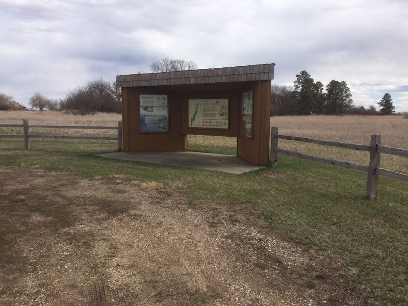
| 2 ► South Dakota, Brown County, Columbia — Sand Lake National Wildlife Refuge — Welcome to — |
| On Sand Lake Dr., 0.2 miles County Highway 16. | |||
| 3 ► South Dakota, Brown County, Columbia — Sand Lake's Observation Tower — …A Bird's Eye View — |
| On Sand Lake Dr, 0.2 miles County Highway 16. | |||
| 4 ► South Dakota, Brown County, Columbia — Songbirds — Neotropical Migrants — |
| On Sand Lake Dr., 0.2 miles County Highway 16, on the right when traveling east. | |||
| 5 ► South Dakota, Brown County, Columbia — The View from the Top — |
| On Sand Lake Dr, 0.2 miles County Highway 16. | |||
| 6 ► South Dakota, Brown County, Houghton — Sand Lake National Wildlife Refuge — |
| On County Route 7, 1.3 miles 400th Ave.., on the right when traveling east. | |||
| 7 ► South Dakota, Brule County, Chamberlain, Chamberlain Township — The Plant Life — Chamberlain and the Lewis & Clark Expedition — |
| Near State Highway 50 south of Thunder Road, on the right when traveling south. | |||
| 8 ► South Dakota, Charles Mix County, Pickstown, White Swan Township — A Gathering Place for Eagles — |
| 9 ► South Dakota, Charles Mix County, Pickstown, White Swan Township — Missouri River — |
| 10 ► South Dakota, Clay County, Vermillion — From Lewis and Clark to the Future — |
| On State Highway 19, 0.1 miles north of 312th Street, on the left when traveling north. | |||
| 11 ► South Dakota, Clay County, Vermillion — Vermillion — June 24, 1984 — |
| On South Dakota Street, 1.5 miles south of State Highway 50, on the right when traveling south. | |||
| 12 ► South Dakota, Clay County, Vermillion — Welcome to Cotton Park — Missouri National Recreational River Water Trail — |
| On South Dakota Street, 0.1 miles south of East Broadway Street, on the right when traveling south. | |||
| 13 ► South Dakota, Clay County, Vermillion, Spirit Mound Township — Hill of Chalk — Missouri National Recreational River — |
| Near State Highway 19 north of 312th Street, on the left when traveling north. | |||
| 14 ► South Dakota, Custer County, Custer — Fire Tower Lookouts — |
| Near Mount Coolidge Lookout Road near State Highway 87. | |||
| 15 ► South Dakota, Custer County, Custer — Jasper Fire — |
| On Mt. Rushmore Road (U.S. 16) 0.2 miles west of Road 282, on the left when traveling west. | |||
| 16 ► South Dakota, Custer County, Custer — Jasper vs. Jewel — Seeking Answers to Questions About Caves and Wildfires — |
| On U.S. 16 at Jewel Cave National Monument Entrance Road, on the left when traveling west on U.S. 16. | |||
| 17 ► South Dakota, Custer County, Custer — Prescribed Fire — An Important Tool to Tame Wildfire — |
| On U.S. 16 at Jewel Cave National Monument Entrance Road, on the left when traveling west on U.S. 16. | |||
| 18 ► South Dakota, Custer County, Hot Springs — Stephen Tyng Mather — July 4, 1867 — Jan. 22, 1930 — |
| Near Wind Cave Road, 1 mile south of U.S. 385. | |||
| 19 ► South Dakota, Custer County, Hot Springs — Vanishing Prairie — Wind Cave National Park — |
| On U.S. 385, 3.9 miles north of 7-11 Road (County Road 101), on the right when traveling north. | |||
| 20 ► South Dakota, Custer County, Pringle — Discover the Black Hills National Forest — |
| On State Highway 89, 0.7 miles north of Prairie Schooner Road (County Road 318), on the right when traveling north. | |||
| 21 ► South Dakota, Day County, Waubay — Changes on the Land — |
| On Waubay Refuge Entrance Road. | |||
| 22 ► South Dakota, Day County, Waubay — Potholes and Prairie — |
| On Waubay Refuge Entrance Road. | |||
| 23 ► South Dakota, Day County, Waubay — Waubay National Wildlife Refuge — Welcome to — |
| On Waubay Refuge Entrance Road. | |||
| 24 ► South Dakota, Day County, Waubay — Waubay Wetland Management District — |
| On Waubay Refuge Entrance Road. | |||
| 25 ► South Dakota, Dewey County, Gettysburg — Nača Inyanska Unwayu Onihan Owakpamni Tanni Oasnikiye — Naca' Monument and Old Agency Park — CRST Flora Stewardship Project — |
| On U.S. 212, 1.2 miles north of Old U.S. Highway 212, on the right when traveling east. | |||
| 26 ► South Dakota, Fall River County, Edgemont — Battle the Blaze — White Draw Fire — |
| On U.S. 18, 0.9 miles south of County Road 18S, on the right when traveling south. | |||
| 27 ► South Dakota, Fall River County, Edgemont — MAFFS 7 — Modular Airborne Fire Fighting System — |
| On U.S. 18, 0.9 miles south of County Road 18S, on the right when traveling south. | |||
| 28 ► South Dakota, Fall River County, Hot Springs — Fire on the Edge — Where the Prairie Meets the Forest — Black Hills National Forest — |
| On State Highway 71, 0.1 miles south of Cascade Trail. | |||
| 29 ► South Dakota, Harding County, Reva — The Castles — |
| Near Forest Road 31261, 0.2 miles south of Forest Road 3126. | |||
| 30 ► South Dakota, Hughes County, Pierre — Welcome to Steamboat Park! — |
| On South Poplar Street, 0.2 miles south of West Missouri Avenue, on the left when traveling south. | |||
| 31 ► South Dakota, Jackson County, Interior — A 75-Million-Year Walk — |
| On State Highway 240. | |||
| 32 ► South Dakota, Jackson County, Interior — Bands of Time — |
| On State Highway 240. | |||
| 33 ► South Dakota, Jackson County, Interior — Dying to Become a Fossil — |
| On State Highway 240. | |||
| 34 ► South Dakota, Jackson County, Interior — Reading the Rocks — |
| On State Highway 240. | |||
| 35 ► South Dakota, Jackson County, Interior — See Ya Later, Alligator — |
| On State Highway 240. | |||
| 36 ► South Dakota, Jackson County, Interior — Titanic Discovery — |
| On State Highway 240. | |||
| 37 ► South Dakota, Jackson County, Interior — Under the Sea — |
| On State Highway 234. | |||
| 38 ► South Dakota, Jackson County, Interior — What a Find! — |
| On State Highway 240. | |||
| 39 ► South Dakota, Jackson County, Wall — Fight for Survival — |
| On State Highway 240. | |||
| 40 ► South Dakota, Jackson County, Wall — Off to the Races — |
| On State Highway 240. | |||
| 41 ► South Dakota, Lawrence County, Deadwood — Mining & Logging — Homestake: Timber supply closely related to gold production — |
| Near Mount Roosevelt Road east of Stage Run Road. | |||
| 42 ► South Dakota, Lawrence County, Spearfish — Spearfish Canyon Flora and Fauna — A View from the Wild Side — |
| On Spearfish Canyon Highway (U.S. 14A) 6 miles Business 90, on the left when traveling south. | |||
| 43 ► South Dakota, Lincoln County, Sioux Falls — 1300s — Bison Roamed the Prairies — |
| Near 480th Avenue (County Highway 135) 0.2 miles south of 269th Street. | |||
| 44 ► South Dakota, Lincoln County, Sioux Falls — The Missing Bison — |
| Near 480th Avenue (County Highway 135) 0.2 miles south of 269th Street (County Highway 102). | |||
| 45 ► South Dakota, Lincoln County, Sioux Falls, Springdale Township — A Landscape Shaped by Glaciers — |
| Near 480th Avenue (County Highway 135) 0.2 miles south of 269th Street (County Highway 102). | |||
| 46 ► South Dakota, McPherson County, Leola — Dan Ashe Waterfowl Production Area — Honoring a Commitment to Conservation of the Prairie Pothole Region — |
| On State Highway 10, 1 mile east of 350 Ave, on the right when traveling west. | |||
| 47 ► South Dakota, McPherson County, Leola — Prairie Potholes — A haven for Waterfowl — |
| On State Highway 10, 1 mile east of 350 Ave, on the right when traveling west. | |||
| 48 ► South Dakota, McPherson County, Leola — Samuel H. Ordway, Jr. Memorial Prairie — |
| On State Highway 10 at 355 Ave on State Highway 10. | |||
| 49 ► South Dakota, Minnehaha County, Crooks — Peter Byg, Prairie Fire Victim — |
| On 257th Street, 0.2 miles west of 468th Avenue (County Road 141), on the right when traveling west. | |||
| 50 ► South Dakota, Minnehaha County, Montrose — Doug Horsted — |
| On 249th Street, 1.4 miles east of 453rd Avenue, on the right when traveling east. | |||
| 51 ► South Dakota, Minnehaha County, Sioux Falls — 1870s' Grasshopper Invasions — |
| On West 22nd Street, 0.1 miles west of South Western Avenue, on the right when traveling east. | |||
| 52 ► South Dakota, Minnehaha County, Sioux Falls — Foster Children Tragedy — |
| On Benson Road at LaMesa Drive, on the right when traveling east on Benson Road. | |||
| 53 ► South Dakota, Minnehaha County, Sioux Falls — Inland Seas — |
| Near North Weber Avenue, 0.2 miles south of East Falls Park Drive. | |||
| 54 ► South Dakota, Minnehaha County, Sioux Falls — Sioux Falls — 1950-2019 — |
| Near East 26th Street, 0.2 miles west of South Southeastern Avenue, on the right when traveling west. | |||
| 55 ► South Dakota, Minnehaha County, Sioux Falls — The Great Bend — |
| On West 57th Street north of Old Yankton Circle, on the right when traveling west. | |||
| 56 ► South Dakota, Minnehaha County, Sioux Falls, North End East — Legacy of Ice and Rock — |
| On East Falls Park Drive. | |||
| 57 ► South Dakota, Minnehaha County, Sioux Falls, North End East — Monarch of the Plains — |
| 58 ► South Dakota, Moody County, Flandreau — Flandreau — April 20, 1969 — |
| On Water Street north of East Pipestone Avenue, on the left when traveling north. | |||
| 59 ► South Dakota, Pennington County, Hill City — Multiple Purpose Management in Action — |
| On U.S. 385 at Custer Crossing Road, on the right when traveling south on U.S. 385. | |||
| 60 ► South Dakota, Pennington County, Keystone — Peter Norbeck — |
| On Iron Mountain Road (U.S. 16A). | |||
| 61 ► South Dakota, Perkins County, Shadehill — Great Plains Weather: Land of Extremes — |
| Near Forest Road 5740, 1 mile north of Forest Road 5626. | |||
| 62 ► South Dakota, Union County, Elk Point — 404 — Grasshopper Cross — |
| On County Road 1B at 479th Avenue, on the right when traveling north on County Road 1B. | |||
| 63 ► South Dakota, Yankton County, Yankton — Sculpting the Landscape — Missouri National Recreational River — |
| Near Levee Street, 0.1 miles south of Pearl Street, on the right when traveling east. | |||