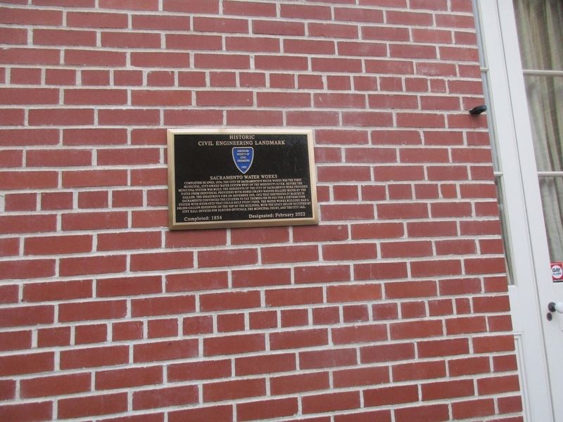
On I street at Front Street, on the right when traveling west on I street.
Historic Civil Engineering Landmark
Sacramento Water Works
Completed in April 1854, the City of Sacramento’s water works was the first municipal, city-owned water system west of the Mississippi River. Before the municipal system was built, the . . . — — Map (db m224046) HM
On Seventh Street, on the left when traveling south.
This is the site of the first church building associated with an African American religious congregation on the Pacific Coast. The church was the Methodist Church of Colored People of Sacramento City, formally organized in 1850. In 1851 the . . . — — Map (db m4327) HM
On N Street west of 9th Street, on the left when traveling west.
This landmark home upholds a tradition of service to the state Leland Stanford Mansion State Historic Park, a National Historic Landmark, served as the headquarters of three governors during the turbulent 1860s. Today it welcomes leaders from . . . — — Map (db m137650) HM
[Front of Monument:]
Erected
To A
Friend of Labor
By His
Coworkers
Nov. 28, 1889
[Inscription on West Side of Monument:]
Think
Look Up
And
Lift Up
[Inscription on Back of Monument:]
Well . . . — — Map (db m160828) HM
On N Street at 15th Street, on the right when traveling east on N Street.
From the upland we descended into broad groves on the river, consisting of the evergreen,
and a new species of white oak.. Among these was no brushwood; and the grassy surface
gave to it the appearance of parks in an old settled country We made . . . — — Map (db m143965) HM
On 11th Street north of Kayak Alley, on the right when traveling north.
The Most Reverend Alfonso Gallegos, O.A.R., D.D. Titular Bishop of Sasabe, Auxiliary Bishop of the Diocese of Sacramento Feb. 20, 1931 – Oct. 6, 1991 “Love one another” May 24, 1958 – Ordained priest for the . . . — — Map (db m137648) HM
On 10th Street at Capital Mall, on the right when traveling south on 10th Street.
In memory of the American Servicemen of Hispanic descent and all others who sacrificed their lives to protect the freedoms we enjoy. — — Map (db m15474) HM
HISTORY
When Spanish governors ruled the California territory, its capitol was moved from town to town between San Diego and Monterey.
San Jose had already been designated the capitol by the time California was granted statehood in 1850. . . . — — Map (db m15017) HM
Near L Street south of 12th Street, on the left when traveling west.
History When Spanish governors ruled the California territory, its capital was moved from town to town between San Diego and Monterey. San Jose had already been designated the capital by the time California was granted statehood in 1850. In . . . — — Map (db m137646) HM
On 15th Street south of L Street, on the right when traveling south.
Dedication The people of the State of California dedicate this Monument to the memory of those Californians who died, or remain
missing, in the Vietnam War 1959-1975 and in doing so, Honor all the men and women who served during that war. . . . — — Map (db m137482) WM
On 10th Street at Capitol Mall, on the right when traveling north on 10th Street.
The historic Capitol was designed by architects M.F. Butler and Reuben Clark. Its style is an adaption of Roman Corinthian architecture. Work began in 1860 and by late 1869 the Capitol was partly occupied. In 1874, construction ended at a cost of . . . — — Map (db m154357) HM
When the task of building the C.P.R.R. line over the Sierra provided too much for the Irish, Chinese laborers from Kwantung took over. Called Tze Yap or Four Districts Men, their hard work and perseverance earned them the nickname of “Cholly . . . — — Map (db m16941) HM
Near 10th Street north of N Street, on the right when traveling north.
In grateful memory
of the brave men
from California
who served
gallantly in War,
1861 - 1865. This
memorial plaque
is dedicated one
hundred years
later in tribute
to their sacrifices. — — Map (db m113193) WM
A STUMP IS ALL THAT REMAINS of a Silver Maple transplanted from the Battlefield of Chattanooga. In 1897 the sapling was planted here as part of a Memorial Grove dedicated to Union soldiers who fought in the Civil War. The first war memorial to . . . — — Map (db m14984) HM
This commemorative bell celebrates a combined century of service by the California Federation of Women’s Clubs and California State Automobile Association including the establishment of bell markers along the historical El Camino Real. — — Map (db m14819) HM
Dedicated to the Memory of
Father Junipero Serra
1713 - 1784
the first Franciscan missionary
to whom California owes an
everlasting tribute – he brought
civilization to our land and in deed
and character he deserves a foremost
place in . . . — — Map (db m14817) HM
On Ninth Street at Capitol Mall, on the right when traveling north on Ninth Street.
First Sacramento high school
building was erected on this
site - occupied January 1, 1877
Founding of Sacramento high
school - September 1, 1856
one block west of this site — — Map (db m161689) HM
On 7th Street south of L Street, on the left when traveling south.
This was the site of the first synagogue on the Pacific Coast, dedicated on September 3, 1852. The building, prefabricated in Baltimore and shipped around Cape Horn in 1849, originally housed the Methodist Episcopal Church, whose trustees sold the . . . — — Map (db m149189) HM
On N Street at 15th Street, on the right when traveling east on N Street.
On this site generations of dedicated legislative
and State employees parked their cars.
1952 through 2000
- Dedicated by -
Senator Patrick Johnston — — Map (db m145028) HM
On O Street at 7th Street, on the left when traveling west on O Street.
Built in 1881 for August and Louisa Heilbron and
occupied by them and their descendants until
1953. Purchased and restored by San Diego Federal
Savings and Loan in 1974, this historic mansion
symbolizes the emergence of Sacramento from
Gold . . . — — Map (db m135526) HM
[A tree was planted in the memory of Jean Bell Kellogg. At the foot of the tree lies this marker] Charter member of Sumner Woman’s Relief Corps No.11, Auxiliary to the Grand Army of the Republic, Founded 1885. — — Map (db m15012) HM
Designated on the 19th day of August 1987
By the
Honorable George Deukmejian
Governor of California
In honor of
Jesse Marvin Unruh
September 30, 1922 – August 4, 1987
Member of the Assembly, 1955 – 1970 . . . — — Map (db m14852) HM
Dedicated to the Memory of
KENNETH L. MADDY
1934 – 2000
served in the California State Legislature from 1970 to 1998,
and as the Senate Minority Leader from 1987 to 1995.
”As someone who spent nearly three decades in the . . . — — Map (db m15028) HM
The house originally designed in 1857 by Seth Babson and was purchased by Leland Stanford in 1861. It served as the State Executive Office from 1861 to 1867, before the completion of the State Capital. It was later extensively remodeled and . . . — — Map (db m11842) HM
Dedicated To You, A Free Citizen In A Free Land
This reproduction of the Liberty Bell was presented to the people of
California
by direction of
The Honorable John W. Snyder
Secretary of Treasury
As the . . . — — Map (db m14837) HM
Dedicated in 1849 to the use of future generations by
Captain John A. Sutter
Later used as a hay market, miners gathering place, civic celebrations and since 1873 as a public park. — — Map (db m17346) HM
Near L Street at 10th Street, on the right when traveling east.
Dedicated on April 14, 1983 by Governor George Deukmejian celebration of the 50th anniversary of the Civilian Conservation Corps — — Map (db m90265) HM
Established as a living memorial to the early builders of California in recognition of their courage, determination & contribution toward progress in the community & our golden state. — — Map (db m14822) HM
On 7th Street near J Street, on the left when traveling south.
Constructed in 1868. Headquarters of Sacramento Society of California Pioneers Founded 1854 Sacramento Pioneer Foundation Incorporated 1966
Plaque dedicated April 19, 1967 by Sacramento Historic Landmarks Commission Rededicated June 30, . . . — — Map (db m68630) HM
Sa’ Cumn’e means “Big House” in the Miwok Language
And was an early name for the Sacramento area
This plaza is dedicated to the Native Americans
who walked this land before us and inspire current
generations to carry . . . — — Map (db m60041) HM
On 7th Street south of J Street, on the left when traveling south.
The Pioneer Hall was built in 1868 as headquarters of the Sacramento Society of California Pioneers, which was organized February 6, 1853. It has been owned and cared for since its construction by the California Pioneer Association, descendants of . . . — — Map (db m68629) HM
Near N Street north of 14th Street, on the left when traveling east.
Purple Heart Memorial front:
My Stone Is Red For The Blood They Shed
The Medal I Bear Is My Country's Way
To Show They Care If I Could Be Seen
By All Mankind Maybe Peace Will Come In My Lifetime
Purple Heart Memorial top: . . . — — Map (db m114107) HM WM
During the Gold Rush Days of 1857, the Sisters of Mercy came to Sacramento to care for the children of the miners and to serve the sick and the homeless.
In those early days, the Sisters purchased land in the heart of the city to build a . . . — — Map (db m14839) HM
This sculpture commemorates the 150th anniversary of the Sisters of Mercy caring for those in need to the greater Sacramento region. Mary Baptist Russell, California Foundress of the Sisters of Mercy, is depicted here as a woman of vision, courage . . . — — Map (db m14840) HM
On "I" Street at 7th Street, on the right when traveling west on "I" Street.
Sacramento’s first county courthouse, formerly located on this site, served as California’s State Capitol from January 16, 1852 to May 4, 1852 for the third session of the legislature and from March 1, 1854 to May 15, 1854 for the fifth session. . . . — — Map (db m14803) HM
On J Street at 4th Street, on the right when traveling east on J Street.
[Front of Marker]
ST.GEORGE HOTEL
Dedicated March 19, 2005
SACRAMENTO
By
James Streetsky
First Northern Bank
The Firehouse Restaurant
Rotary Club of Sacramento
Burnett & Sons Planing Mill
and Lumber Co. – Since . . . — — Map (db m14810) HM
This grove of trees as saplings, transplanted from southern battlefields was dedicated to the memory of Union Veterans of the Civil War and presented to the State of California — — Map (db m14827) WM
In the street, at the corner of Fourth and J,
on Aug. 14, 1850, settlers were confronted
by the Mayor and the Sheriff. The fatalities
that day and the next ended
THE SQUATTERS RIOTS
[Column 1]
Hardin Bigelow, Mayor
J. W. . . . — — Map (db m14806) HM
Near L Street at 10th Street, on the right when traveling east.
Courageous and inspirational San Francisco minister, stalwart defender of the Union during the Civil War, advocate of racial justice, admired educator and pioneering nature writer.
Starr King was a Unitarian preacher credited with keeping . . . — — Map (db m90267) HM
On 10th Street near K Street, on the left when traveling north.
Anthony J. "Tony" Monti sold newspapers on this corner for 35 years. He lost a leg in an accident early in life and sold newspapers here day and night to support his mother and sister. All of the Governors of the State of California from 1915 to . . . — — Map (db m27236) HM
On I Street just east of 8th Street, on the right when traveling west.
This property has been placed on the National Register of Historic Places by the United States Department of the Interior United States Post Office, Courthouse, & Federal Building c. 1933 — — Map (db m146396) HM
(Left Side of Base Holding Bell)
Only battleship
built on the
Pacific Coast
Launched at
Mare Island
Navy Yard
Nov. 20, 1919
Ship’s bell
dedicated and
rung for the
last time by
Governor
Earl Warren
Oct. 27, 1949
. . . — — Map (db m70035) HM WM
This place was built in 1884 as a home for L. Williams, a flour merchant. The structure is primarily Stick style, with some Baroque and Second Empire influences which lingered into the 1880 Victorian Era.
It was moved about 40 feet west in 1907, . . . — — Map (db m145240) HM
On H Street at 6th Street, on the left when traveling east on H Street.
The first distribution point of electricity for a major city, Station A was constructed in 1894. Built by the Sacramento Electric Power and Light Company to receive power generated from Folsom Powerhouse. The first transmission of electricity was on . . . — — Map (db m11185) HM
This mansard-styled Victorian house was built for Albert Gallatin in 1877. Acquired by the State, it served as the first official Governor's residence. Governor George C. Pardee and his family moved in during November, 1903. It ultimately served as . . . — — Map (db m13882) HM
On 16th Sreet at Capitol Avenue, on the right when traveling north on 16th Sreet.
The Camellia Coffee Shop was located on
this site from 1962 to 1999 and operated by
Parise "Bill” Voudouris and his wife Rosalie.
"He was a friend to man, and lived by
the side of the road” -Homer — — Map (db m152858) HM
When Sacramento bought steam pumpers the volunteers could not keep their steam? up, so they hired professional firemen. Since March 30, 1872, Sacramento paid firemen have always been the first to respond to any crisis.
New Helvetia Chapter No. 5, . . . — — Map (db m38318) HM
Sailing ships since the “Gold Rush” laden with supplies and sitting deep in the water just above the river bottom have inched their way slowly up the Sacramento River to Sacramento. After unloading, the ships would risk rolling over . . . — — Map (db m16474) HM
The original building was completed in the spring of 1854 at a cost of $120,000. It housed the City Waterworks, its Superintendent and Tapper, and the City offices for Mayor, Council, Secretary, Marshall, Police, Collector, Assessor, Surveyor, and . . . — — Map (db m16948) HM
On I Street at Front Street, on the right when traveling west on I Street.
The original flagpole was constructed from a single Oregon pine tree reaching a height of 113 feet. When first erected in the 1860's during a patriotic “Flag War” with the Central Pacific Railroad, it was considered to be the tallest . . . — — Map (db m136275) HM
Near K Street at Interstate 5, on the right when traveling east.
For Sacramento, the prize of statehood was being named California’s capital in 1854. The logistics of finding a suitable location for the Capitol building itself proved to be a frustrating challenge to the City. One early site was destroyed by fire, . . . — — Map (db m229827) HM
Near K Street at Interstate 5, on the right when traveling east.
Religious organizations were among the earliest forces in the community to shape not only moral and ethical issues, but to frame many social and economic concerns as well. One way religion shaped Sacramento was through architecture. The impressive . . . — — Map (db m229833) HM
News of the 1848 gold discoveries in California traveled around the globe, stirring up thousands of dreams of instant wealth. A slow trickle at first, by 1849 gold seekers rushed in from China, Australia, Mexico, Colombia, Argentina, Chili, Brazil, . . . — — Map (db m229813) HM
Near K Street at Interstate 5, on the right when traveling east.
The reformer who emerged to challenge the leadership and direction of government was Hiram Johnson. Johnson served as governor for two terms from 1911 to 1917, and then as a U.S. Senator from 1917 until 1945. When he was elected governor, California . . . — — Map (db m229907) HM
Near K Street at Interstate 5, on the right when traveling east.
A stock market panic in 1893 threw many out of work and created hard times. Labor strikes became increasingly aggressive until a strike of the Pullman Factory near Chicago in 1894 resulted in a nation-wide railroad boycott. Railroad workers in . . . — — Map (db m229897) HM
Near K Street at Interstate 5, on the right when traveling east.
While a few people question Sacramento’s role in the transcontinental railroad, the larger story of Sacramento’s place in transportation history revolves around numerous transportation events such as national stagecoach lines, steamship companies, . . . — — Map (db m229917) HM
Near K Street at Interstate 5, on the right when traveling east.
With the overnight entry of the United States into World War II, it was apparent that despite America’s strength, much work needed to be done to allow the country to be successful in two different portions of the world. The country developed a new . . . — — Map (db m229970) HM
On 2nd Street south of I Street, on the left when traveling south.
This structure, erected in 1852-53, was occupied during the 1850’s by the B.F. Hastings Bank, Wells Fargo and Co., various state officials, Sacramento Valley Railroad, and the Alta Telegraph Co. during April 1860 - May 1861. The Alta Telegraph Co. . . . — — Map (db m11388) HM
Near K Street at Interstate 5, on the right when traveling east.
Floods, fires, and disease tested Sacramento’s resolve to survive. Floods were nearly an annual event and sometimes occurred several times in a winter season. City residents responded by building increasingly larger levees. Meanwhile, two fires in . . . — — Map (db m229814) HM
On Front Street north of K Street, on the right when traveling north.
This building was the home of the Booth Company, a wholesale grocery business and its founder Newton Booth, lawyer, writer, lecturer, and politician. Booth served as State Senator 1862-1863, and lived here while Governor of California 1871-1875 and . . . — — Map (db m154356) HM
Near K Street at Interstate 5, on the right when traveling east.
As the City grew, the land area between the Sacramento River and Third Street was not sufficient for the business needs of the community. Mercantile establishments flowed east along J and K Streets to accommodate their customers. Large successful . . . — — Map (db m229826) HM
Near K Street at Interstate 5, on the right when traveling east.
Four of the most successful merchants in Sacramento specialized in hardware, dry goods, and groceries. Later known as the “Big Four,” Charles Crocker, Mark Hopkins, Collis P. Huntington, and Leland Stanford banded together to convince the United . . . — — Map (db m229817) HM
The City’s Wharf and Warehouse probably was constructed in the late 1880’s. A south extension likely was added around 1900. The small waterfront facility provided river-craft dockage for a number of small independent operators. As indicated by the . . . — — Map (db m16500) HM
Near K Street at Interstate 5, on the right when traveling east.
Redevelopment in the 1950s evolved out of the programs of Franklin D. Roosevelt’s New Deal. In 1958, it appeared that Sacramento’s central district was dying as it expanded into the suburbs. Sacramento’s West End, a 65-block portion of the City, . . . — — Map (db m229973) HM
On Front Street north of J Street, on the right when traveling north.
This replica is on the site of the original Eagle Theatre. Built in 1849, it was the first structure in California constructed specifically as a theatre. The Theatre was a canvas covered timber structure with a false front, a large door and a . . . — — Map (db m143478) HM
Near K Street at Interstate 5, on the right when traveling east.
Even though California and the Sacramento Valley were remote to the rest of the world, the area was a focus of exploration in the first half of the 19th century by the Spanish, Americans, British, French, Germans, Russians, and many others. Gabriel . . . — — Map (db m229800) HM
Near K Street at Interstate 5, on the right when traveling east.
California’s Central Valley had one of the most concentrated assemblies of Native Americans in North America. Approximately 150,000 natives were grouped by language rather than political boundaries. In Sacramento, the local natives were called . . . — — Map (db m229798) HM
Near K Street at Interstate 5, on the right when traveling east.
A line of strong, diverse, and dedicated teachers from a wide range of social and economic backgrounds have shaped the lives of Sacramento’s children. Ernesto Galarza was such a teacher, with an influence reaching far beyond Sacramento. He was born . . . — — Map (db m229914) HM
On Front Street at K Street, on the left when traveling north on Front Street. Reported permanently removed.
At this location on January 8, 1863, Governor Stanford surrounded by politicians and locals, announced the start of the United States’ first transcontinental railroad. You are standing at Mile Marker 0, the origin of the Central Pacific Railroad . . . — — Map (db m149177) HM
On Front Street at K Street, on the left when traveling north on Front Street. Reported permanently removed.
You are standing where the First Transcontinental Railroad in America had its western origin, at Front and K Streets in Sacramento.
On January 8, 1863, prominent citizens and railroad founders gathered here for a groundbreaking ceremony to . . . — — Map (db m201267) HM
Since the days of Sutter’s Fort, Sacramento was the trading center for much of the Central Valley, the Sierra Nevada and points beyond. As the railroad network around the capital city expanded, Sacramento merchants were able to market a greater . . . — — Map (db m201266) HM
Near K Street at Interstate 5, on the right when traveling east.
Many early Sacramento merchants amassed significant wealth. Some moved to nearby San Francisco, others to New York and other eastern states. A number of wealthy merchant families turned to philanthropy later in their lives: Margaret Crocker built . . . — — Map (db m229832) HM
Near K Street at Interstate 5, on the right when traveling east.
During the early years of statehood, Sacramento became not only the State Capital, but also the seat of the State Supreme Court. The B.F. Hastings Building at 2nd and J Streets first served as the State’s highest court. The Gold Rush attracted a . . . — — Map (db m229812) HM
Historic Street Lights
Restored by
SACRAMENTO
MUNICPAL
UTILITY
DISTRICT
Personnel and
Traffic Signals &
Street Lighting Employees
of the
City of Sacramento
Department of Public Works
Installed by
Allen L. Bender, . . . — — Map (db m16521) HM
To 1840
First Settlers lived and worked in the Sacramento Valley for thousands of years before Europeans arrived.
Nisenan
1840 to 1850 - Population 6,820
War with Mexico • Treaty of Guadalupe Hidalgo • The Gold Rush • California . . . — — Map (db m229385) HM
The Sacramento Wood Company’s steamer wood freight shed, between N and O streets in the Front Street right-of-way, remained at this location for approximately 30 years. The Sacramento Wood Company could trace his roots from an earlier enterprise . . . — — Map (db m16508) HM
Built in 1852 by the Lady Adams Mercantile Co.; named after the brig which brought the partners around the horn. She has survived fires, flood, and being lifted one story. She has served merchants, bankers, and as a “rooming house”. . . . — — Map (db m58582) HM
Dedicated to all Merchant Marine Seaman
Members of the U.S. Merchant Marines serving world wide aboard
U.S. Flag cargo ships during World War II suffered a greater
percentage of war-related deaths than did all of the
nation’s regular armed . . . — — Map (db m16493) HM
On "J" Street at Commonwealth Avenue when traveling west on "J" Street.
On this site stood the store of James L. L. F. Warren, an influential center of agriculture during the Gold Rush. Here at the New England Seed Store, the camellia was first introduced into California in February, 1852.
Camellia
Official . . . — — Map (db m11193) HM
Founded in December 1848 by John A. Sutter, Jr., Sacramento was an outgrowth of Sutter’s Fort established by his father, Captain John A. Sutter, in 1839. State Capital since 1854, it was a major distribution point during the Gold Rush. A . . . — — Map (db m11486) HM
On J St at Firehouse Alley, on the right when traveling east on J St. Reported missing.
Display 1
Sacramento property owners often adorned their buildings with cast-iron columns like these to embellish their structures and refine the city's overall appearance. If you look closely, a decorative column may feature information . . . — — Map (db m113063) HM
Dedicated April 13, 2000
Sacramento
by
James Stretesky
George E. Kuchler Family
Rotary Club of Sacramento
Burnett & Sons Planing Mill and Lumber Co – Since 1869
Sacramento Traditional Jazz Society
Sacramento Metro Chamber of . . . — — Map (db m15702) HM
Among the many sailing ships bound for California in 1849 was the LaGrange, a three-masted bark from Salem, Massachusetts. The ship arrived at Sacramento on October 3, 1849, and the following June was purchased by the city for a prison. In . . . — — Map (db m16989) HM
On Second Street at I Street, on the right when traveling south on Second Street.
Where do you go after you find gold? Professor L.A. Lauriet’s Assay Office, once located here in a two story brick building, was often a miner’s first stop in Sacramento. Originally from the West Indies, Lauriet weighed and analyzed miner’s gold. If . . . — — Map (db m201773) HM
On Front Street south of O Street, on the right when traveling north.
R Street formed the boundary of a levee system that surrounded Sacramento. It also served as the base of operations for the State's first rail line, the Sacramento Valley Railroad. The line was designed by Theodore Judah, who also became the . . . — — Map (db m90220) HM
Near K Street at Interstate 5, on the right when traveling east.
Floods, like fires, required extraordinary solutions. The City of Sacramento had been building levees with limited success since 1849. After a devastating flood in 1862, the community mobilized a massive effort to raise the central City as much as . . . — — Map (db m229815) HM
This original building built in 1853, housed Sacramento Engine Company No. 3. In 1921 the building was abandoned as a firehouse. It was restored to its present state in 1960, as an historical landmark. — — Map (db m17004) HM
On Front Street north of Capitol Mall, on the right when traveling south. Reported permanently removed.
Display 1 Before 1848, the Sacramento River waterfront, behind you, was quiet and occupied by few people. New arrivals during the Gold Rush transformed the waterfront rapidly, turning it into a chaotic transportation hub crowded with goods . . . — — Map (db m201276) HM
The second world war found river transportation companies continuing service on the Sacramento River while under the restrictions of wartime conditions. In the 1950’s, river commerce consisted of the transportation of barges of bulk grain, . . . — — Map (db m16467) HM
Near K Street at Interstate 5, on the right when traveling east.
As the rush for gold continued, it became apparent that Sutter’s landing on the Sacramento River was the natural head of navigation for the sailing ships and river boats arriving from San Francisco and around the world. On the shore of the . . . — — Map (db m229804) HM
138 entries matched your criteria. The first 100 are listed above. The final 38 ⊳