There have been four court houses in Rockville since it was established as the County seat in 1776. Court was originally held at Hungerford Tavern. A frame court house existed in the late 18th century but was sufficiently outgrown by 1810 to . . . — — Map (db m101964) HM
Across Beach Drive, three hundred yards from this recreation building is a stone abutment, all that remains of a Bollman truss bridge, originally 450 feet long and 70 feet high, used by America's first railroad, the Baltimore and Ohio. Chartered . . . — — Map (db m184470) HM
The original ferry was probably a flat-bottomed-wooden craft guided across the river using poles and ropes. Its design was much like the ferry boat shown below: a long, low structure with a ramp at both ends for loading and unloading cargo. . . . — — Map (db m182685) HM
In the early 1800s, Nathan Loughborough moved from Philadelphia to Washington and purchased the 250 acre estate, Milton c.1820. Believed to be the oldest standing house in the area, the original wing was built in the eighteenth century of granite, a . . . — — Map (db m185529) HM
In the nineteenth century, boats along the Chesapeake and Ohio Canal transported coal from Cumberland, Maryland to Georgetown in the District of Columbia. By the early twentieth century, trains had replaced boats as a means of transportation and . . . — — Map (db m295622) HM
In 1946 Mr. George A. (Jay) Chadwick, Jr. bought the Gold Mine Farm which now makes up a large part of Black Hill Regional Park. He cleared the property of brush and Fieldstone for a dairy farm which was operated for many years. This beautiful stone . . . — — Map (db m90477) HM
Known locally as "The Linden Oak," this white oak tree (Quercus alba) is the fourth largest of its species in the state of Maryland and the largest in Montgomery County. How it came to be called "The Linden Oak" is unknown.
Recognized in the . . . — — Map (db m22317) HM
During the Civil War between 1861 and 1865, the Army of the Potomac had a two-fold mission: to defeat the Confederate Army and to defend the City of Washington against enemy attack. To prepare for the possibility of enemy attack, military . . . — — Map (db m295580) HM
Lee Jordan was one of the most influential citizens in Takoma Park history. By the time of his death in 1988 he achieved legendary status for his inspirational role in the lives of hundreds of children through the Takoma Park Boys & Girls Club and . . . — — Map (db m75220) HM
When Takoma Park was founded in 1883 the parcel of land that today is Lee Jordan Field was part of a large farm belonging to the Brashears family. A stream known as Brashears Run flowed here across a lush, soggy pasture. A son-in-law, Roger . . . — — Map (db m75214) HM
Mr. John Diggs-Dorsey, a Black man in his early twenties, lived and worked in Darnestown as a servant to James and Linnie Tschiffely, On July 25, 1880, Linnie Tschiffely accused Diggs-Dorsey of rape and physical assault, a charge he denied, After . . . — — Map (db m269623) HM
Sadie Matthews Budd and Family
Kate Matthews of Sandy Spring was the mother of Sadie Matthews, who was married to Norman Budd. In 1888, Norman Edward Budd was born in Montgomery County, Maryland, to Samuel Waters and Emma Budd. . . . — — Map (db m188346) HM
The Community of Silver Spring, Maryland, derives its name from this spring, discovered in 1840 by Francis Preston Blair and his daughter, Elizabeth. While riding on horseback in the woods beyond Washington, rays of sun on mica sand particles in . . . — — Map (db m74684) HM
Lynching of George W. Peck
January 10, 1880.
George W. Peck, a 22-year-old Black man who lived and worked in Beallsville, Maryland, was lynched near this site by a white mob in an act of racial terror. On the morning of . . . — — Map (db m265285) HM
Forts Alexander, Ripley and Franklin, built to protect the Washington water system in 1861, were connected by earthworks in 1863 and renamed Ft. Sumner to honor Maj. Gen. Edwin V. Sumner, a hero of Antietam. The fort’s 28 cannon provided a a . . . — — Map (db m295619) HM
Battery - a fortification formed by moving earth or other materials into hill-like formations to protect artillery, having the following components:
Parapet - an elevation of earth that protects soldiers from attack.
Terreplain . . . — — Map (db m174636) HM
In this village President Madison and members of his official family found refuge in the home of Caleb Bentley, first Postmaster of Brookeville, following the burning of the Capitol and the White House by the British army. Many other refugees from . . . — — Map (db m293857) HM
On June 30, 1960 African Americans Gwendolyn Greene (Britt), William Griffin, Michael Proctor, Marvous Saunders and Cecil Washington Jr. were arrested when they attempted to ride Glen Echo Park's Dentzel Carousel and were charged with trespassing on . . . — — Map (db m30484) HM
Early headquarters of the American Red Cross and home of Clara Barton, founder and First President, who lived here until her death in 1912. Located just south of this marker, the house had an unusual interior of Steamboat Gothic design with railed . . . — — Map (db m303) HM
John Garrett laid out a town called Newport here in 1797 and gave away lots as prizes in a lottery, but a town did not actually appear until after 1830, when the C&O Canal was completed from Georgetown to Seneca Creek. The town was called Seneca. A . . . — — Map (db m764) HM
In 1900, Frederick Allnutt purchased the 1855 Darby House and 1½ acres of land from Wilson Tschiffely, who had recently acquired the property along with the nearby mill. Allnutt, who had been running a store next to the canal for several years, . . . — — Map (db m765) HM
Near this spot was the home of Daniel Carroll, member of the Second Continental Congress and of the Federal Constitutional Convention. He was a Representative from Maryland in the first United States Congress and served as one of the three . . . — — Map (db m168741) HM
Olive Branch Community Church
On the evening of Sept 13, 2006, a small group met at Reverend Kelly's home. They decided to build a new church. Pastor Kelly and the seven Founding Elders continued to meet at various homes and . . . — — Map (db m188150) HM
Senator from Nevada
His statesmanship held true regard for the interests of all men
Founder of Chevy Chase
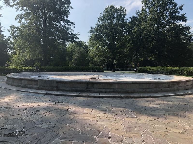
This fountain erected in 1933 authorized by Act of Congress — — Map (db m154285) HM
Lavinia Margaret Engle was a lifelong advocate for women's rights and social services.
Born here in 1892, before women had the right to vote, she joined the women's suffrage movement, led the state's League of Women Voters, and became . . . — — Map (db m240327) HM
The earliest inhabitants of the Monocacy River Valley lived here about 12,000 years ago. These Native Americans lived in territorial, semi-nomadic groups dependent upon hunting, fishing, and food gathering. When European settlers first came to . . . — — Map (db m3287) HM
The 1843 Howard County Courthouse, Located on Court Avenue in the Historic District of Ellicott City, Maryland, was the location for judicial proceedings related to legal cases involving those charged with encouraging enslaved persons to run away. . . . — — Map (db m111703) HM
The house that would one day become City Hall was built for Henry Miller, an active businessman in early Gaithersburg, and his wife Rosa. In 1913, the house was bought by Edward P. Schwartz, a Washington, DC real estate broker. Here he established a . . . — — Map (db m3312) HM
Built in 1927, the Smithfield Colored School was one of sixteen schools for African Americans constructed in the county with financial assistance from the Julian Rosenwald Fund. The Smithville school was built near Colesville, Maryland to provide . . . — — Map (db m109226) HM
One of the most significant reasons for Silver Spring's growth was its location along the Metropolitan Branch of the B&O Railroad. The railroad line stimulated the development of outlying commuter suburbs. It also allowed the County's agriculture . . . — — Map (db m75802) HM
Meshach Browning (1781, Damascus, Montgomery County,
Maryland - 19 November 1859, Garrett County, Maryland) was an early backwoodsman, hunter and explorer of the watersheds of the North Branch Potomac and Youghiogheny Rivers. His memoir is . . . — — Map (db m275619) HM
The Brookville Schoolhouse sits upon land purchased for $300 in 1865, four years after the Maryland General Assembly established the Montgomery County public school system. At some subsequent point, the school began operation as a traditional . . . — — Map (db m114395) HM
Of the four presidential candidates in 1860, Abraham Lincoln received only 50 of Montgomery County's 2429 votes. Some of Rockville's 365 residents surrendered government jobs in Washington, refusing to sign the Oath of Loyalty, rather than face . . . — — Map (db m102181) HM
"Buy 'em by the Bag," the motto urged. For more than half a century, hamburger-hungry customers came to Maryland's first Little Tavern to do just that.
Harry F. Duncan founded Little Tavern Shops, Inc., which specialized in 5¢ little . . . — — Map (db m75468) HM
Neal Potter
Neal Potter was a model public citizen, an economist, and a lifelong advocate for world peace, human rights, and responsible government. As a Montgomery County citizen and Councilmember and Montgomery County Executive, he . . . — — Map (db m182165) HM
On June 25-27, 1863, the Federal Army of the Potomac used two temporary pontoon bridges to cross the Potomac River from Virginia back into Maryland at Edwards Ferry. On the evening and morning of June 27-28, Confederate Gen. J.E.B. Stuart led . . . — — Map (db m293881) HM
Slavery in Maryland lasted for 230 years, beginning with the earliest colonists and persisting through most of the Civil War. During the war, Maryland remained in the Union. Like other border state residents, Marylanders were sympathetic to — . . . — — Map (db m174693) HM
Historic Sites Allegedly Connected to the Underground Railroad
Caleb Bentley and his son Richard Bentley owned and occupied Historic Bloomfield from the early 1800s until 1914. The Bentleys were Quaker farmers, entrepreneurs, and active . . . — — Map (db m188243) HM
With a burst of new development in 1927, downtown Silver Spring's commercial center -- originally located around the Baltimore and Ohio Railroad station (8100 Georgia Avenue at Sligo Avenue) -- firmly re-established itself three blocks to the north. . . . — — Map (db m62161) HM
The Silver Spring Armory, completed in 1927, was significant for its association with the Maryland National Guard 29th Division's service during World Wars I and II. It was one of the major civic buildings constructed in Silver Spring during the . . . — — Map (db m75275) HM
Take a moment to think about your home and family life. Thomas Harper and his wife Elizabeth raised six children in this home. Later, their son Richard and his wife Rachel raised fifteen children there. They kept chickens and pigs, had vegetable . . . — — Map (db m109224) HM
The Civil War profoundly affected county residents because of their proximity to Washington, D.C. —the Union Capital— and Virginia, the northern reach of the Confederate States of America. No community in Montgomery County was immune to the . . . — — Map (db m104229) HM
Russell Cemetery AKA Pines Cemetery. Pvt. E. Thompson served in Revolutionary War 1776-1778. Fought at Germantown & White Plains. — — Map (db m285502) HM
Climb high
Climb far
Your goal the sky
Your aim the stars
On January 31, 1991, Captain Thomas Clifford Bland, Jr., U.S.A.F. of Darnestown, gave his life in the Persian Gulf, in tribute to his outstanding courage and valor while serving . . . — — Map (db m141320) WM
Born into slavery in 1789, Josiah Henson was purchased as a child by Adam Robb and transferred here to the Riley plantation in 1795. The Rileys enslaved him for over 30 years until he escaped with his wife and children from Kentucky to . . . — — Map (db m189537) HM
When Edgar was born on May 3, 1871, his father Thomas was a partner with Winfield Offutt in a mercantile operation at the intersection of River and Falls Road, then known as “Offutt's Crossroads.“ By the year 1880, when “Potomac . . . — — Map (db m106484) HM
To
Our Heroes
of
Montgomery Co.
Maryland
That We Through Life
May Not Forget to Love
The Thin Gray Line
Erected A.D. 1913
1861 CSA 1865 — — Map (db m106402) WM
Geology
This section of the Metropolitan Branch Trail is on the border of two physiographic provinces, the Coastal Plain and the Piedmont Region, displaying traces of two very different times on Earth.
The Coastal Plain stretches south . . . — — Map (db m174049) HM
Poolesville is a town of unique charm, a special place strategically located at a crossroads in western Montgomery County, not only one of geography but also where the past intersects the present, agriculture connects with commerce, and rural . . . — — Map (db m305915) HM
Poolesville is a town of unique charm, a special place strategically located at a crossroads in western Montgomery County, not only one of geography but also where the past intersects the present, agriculture connects with commerce, and rural . . . — — Map (db m305969) HM
Harridays and Carrolls
Joseph Harriday was born on November 29, 1953 to the late Archie "Jerry" Bell and the late Sadie Harriday, died on Friday, August 30, 2019 in his home in Germantown, MD. Joe loved watching the "Andy . . . — — Map (db m188347) HM
Tribute to Robert H. "Bob" Hill: Entrepreneur, Master Builder, and Community Leader
Robert H. Hill was born on a farm in Sandy Spring in 1904. His parent, Samuel T. and Mary Hill, were prosperous and raised not only 16 children, but hogs, . . . — — Map (db m188361) HM
Sitting near the junction of the Potomac River and the Great Seneca Creek, the Seneca Mill had a long tradition at this pivotal location.
By 1725, a grist mill functioned here as a commercial staple for the small village. Early proprietors . . . — — Map (db m96104) HM
In 1890, the Tennallytown and Rockville Railroad ran along Old Georgetown Road to Bethesda Park, a favorite amusement spot in the area. The park entrance was located on the corner of what is now Old Georgetown Road and Sonoma Road. — — Map (db m73284) HM
The thriving crossroads community of Darnestown during the 1880s looked much different than it does today. Photographs from that time, however, help us understand what someone traveling through Darnestown might have experienced.
Darnestown grew . . . — — Map (db m69722) HM
Officer, 4th Battalion, Continental Army during the Revolutionary War;
Brigadier General of Maryland Militia, 1794; member of 4th United States Congress, 1795–96. — — Map (db m20931) HM
Importance of Horses
Horses were brought to this continent by Spanish explorers in the 16th century. Their speed and endurance were invaluable in the New World. In early America. specific breeds were relatively unknown. Horses were . . . — — Map (db m86431) HM
When the Magruders operated this farm in the 18th century, the crops were alternated yearly between tobacco and corn. This was called the "Maryland plan." Planters relied on enslaved laborers to do the back-breaking work that began in . . . — — Map (db m229731) HM
A former slave, Minister, Author, Abolitionist and Entrepreneur
Born a slave, a son of Charles County, Maryland; a historical figure trudging through the toils and injustices in life as a slave in Montgomery County, Maryland and Kentucky . . . — — Map (db m205932) HM
She was born in Poolesville on November 13, 1917, grew up in Dickerson, graduated from Rockville Colored High School in 1934, and received her first degree in elementary education from Hampton Institute in 1942. Her thirst for higher education . . . — — Map (db m205944) HM
The Establishment of Silver Spring's first bank and Newspaper, traditional institutions required for a community to grow and prosper, occurred on this corner with the opening of the Silver Spring National Bank in 1910 and publication of The . . . — — Map (db m62165) HM
6 August 1863: “Our weather continues intensely hot, so far Blair endures it well — cheerful as a bird — out under the trees all day about the Spring where it is cool from the dense shade & the cool waters, he makes mill dams, mud cakes & runs . . . — — Map (db m82236) HM
"For many years Marian served as the unofficial 'mayor' of Wheaton, a title justly deserved by her passion over decades to making Wheaton and all of Montgomery County a better place to live, work and raise a family. Truly she was . . . — — Map (db m176341) HM
The Seven Branches Of Learning
Quadrivium
The higher division of the seven liberal arts in the Middle Ages, composed of geometry, astronomy, arithmetic, and music
Trivium
The lower division of the seven liberal arts . . . — — Map (db m7253) HM
The Military Road School opened in 1864 here along what then was Military Road, an artery linking Civil War forts. The School was one of the first to open after Congress authorized public education for Washington's African Americans in 1862. . . . — — Map (db m115232) HM
Frederick County. Named for Frederick 5th and last Lord Baltimore. Erected out of Prince George’s County in 1748. It then included Montgomery County and all of Maryland west to the West Virginia boundary.
Washington County. The first . . . — — Map (db m41770) HM
Ad Gloriam Dei St. Peter's ChurchFounded as Monocacy Chapel, a Chapel of Ease. Upon a site two and one half miles North of this point about 1737. The First Church West of the Great Seneca Creek in the Province of Maryland. This Structure was . . . — — Map (db m33825) HM
Carver was the first accredited two-year junior college conducted under County Board of Education for post-secondary education of Negro students in Montgomery County. At the time, Lincoln High School, located in a historic black community in . . . — — Map (db m106396) HM
The Montgomery County Courthouse that stood here from 1840 to 1891 witnessed the turbulent antebellum and Civil War years in Rockville. It was the setting for legal transactions involving both the selling and emancipation of enslaved individuals. . . . — — Map (db m202643) HM
Built by the Thomas Family in the early 1800s,this property, formerly known as Woodlawn, has national significance. In 1816, Samuel and Anna Thomas established a Friends Boarding School here. Francis Scott Key frequently visited his daughters who . . . — — Map (db m67596) HM
A 1794 map of Maryland indicates a mill at this site owned by Quaker minister and political activist Evan Thomas. Thomas' Mill, leased to Thomas Brown in 1803, was sold to Aaron Dyer in 1816. Francis Valdenar purchased the frame saw and grist mill . . . — — Map (db m332) HM
The Capital Crescent Trail follows the route of an old railroad line called the Georgetown Branch of the Baltimore and Ohio (B&O). It's all that remains of an unrealized attempt by the B&O to construct a major rail link between the . . . — — Map (db m83) HM
The Capital Crescent Trail follows the route of an old railroad line called the Georgetown Branch of the Baltimore and Ohio (B&O). It's all that remains of an unrealized attempt by the B&O to construct a major rail link between the . . . — — Map (db m295745) HM
Today Piscataway peoples remain in their homelands, continuing their culture and exercising their sovereign rights.
Indigenous Peoples in Maryland
Montgomery County is within the ancestral homelands of the Piscataway. They . . . — — Map (db m296008) HM
Martha Howard and John H. Murphy Alliance Founded the Baltimore Afro-American Newspaper
Martha E. Howard (1846-1915) was the third child of Enoch George and Harriet Howard. She was born a slave and was released to her mother . . . — — Map (db m188350) HM
The School Building Just Ahead of You Opened In 1912 as the Military Road School, the area's third public elementary for African Americans. For decades it was the only public school serving black children in Upper Northwest and nearby . . . — — Map (db m110235) HM
James “Jim” Wims, who acquired this land in 1919 operated a farm with an orchard on this land. In an effort to provide a local place for his children to play ball, Jim took acrage out of crop production and converted it into the . . . — — Map (db m95723) HM
A small grouping of houses and outbuildings near this spot became a kinship-based community known as Newmantown. There were numerous post Civil-War African American communities in Montgomery County similar to Newmantown. There were also several . . . — — Map (db m295953) HM
This park occupies seven parcels of land in Montgomery county used by the U. S. Army for the air defense of Washington D.C. from the mid-1950's to the mid-1970's
In the early days of the Cold War, the Soviet Union produced high-speed . . . — — Map (db m61671) HM
Historical Background of the Canning Industry:
In 1812, Thomas Kensett introduced the canning process to America with a small plant in New York, which canned oysters, meats, fruits, and vegetables. However, historians generally agree that . . . — — Map (db m245543) HM
1921 to 2004
Carlton R. Sickles served the people of
Montgomery County and Maryland
for 49 years as a member of the
United States House of Representatives,
Maryland House of Delegates, and both the
Washington Metropolitan Area . . . — — Map (db m277700) HM
Lineage of Leatha Howard Holland Webster and the Canadian Connection
The Howard-Holland traces its roots to the Montgomery County plantations of the Gaithers, Howse and Griffith families. From census records and manumission . . . — — Map (db m188339) HM
Constructed in 1901, Frederick A. Allnutt built this gable-front, general store on Old River Road beside his newly acquired place of residence, the c. 1855 Darby House. This two-and-a-half story wood and frame store originally had counters on both . . . — — Map (db m96105) HM
The 1866 Seneca Schoolhouse—the oldest surviving one-room school building in Montgomery County—today offers a unique “living history” experienced for Washington area children.
Leaving their cell phones and computer tablets at home, visiting . . . — — Map (db m96084) HM
PRESIDENT HARRY S. TRUMAN
wrote in his diary on January 3, 1952: “The Baltimore & Ohio [B&O] Station was new, on a double track. Great business houses were on both sides of the track, thick as they could be. When I came to Washington on . . . — — Map (db m304917) HM
Geology
This section of the trail is on the border of two physiographic provinces, the Coastal Plain and the Piedmont Region, display traces of two different times on Earth.
The Coastal Plain stretches south and east from where you are . . . — — Map (db m58425) HM
This commemorative site known as "Five Points," has been used as a commercial crossroads for almost 300 years. Its name was derived from the old Indian trails which are now merged and identified as Edgemoor Lane, Wisconsin Avenue, East West Highway . . . — — Map (db m84) HM
Several pits for the mining of gold formerly existed in Black Hill Regional Park. A result of gold mining fever in Montgomery County between 1850 and 1950. In this open pit extraction site, miners used simple picks and shovels. Ore containing . . . — — Map (db m268899) HM
Built about 1930 as the first metering station for the Washington area gas supply, this building was saved from imminent destruction by concerned citizens dedicated to both the preservation of the visible past and revitalization of the railroad. . . . — — Map (db m139683) HM
What was enslavement like for a young child of African descent? Only the men and women who endured slavery and lived to share their experiences either in published autobiographies or in recorded oral histories could answer that painful question. . . . — — Map (db m197907) HM
With the shackles of slavery removed following the end of the Civil War, freed blacks in Montgomery County made strides to achieve successful lives for their families. During Reconstruction (1865 - 1877), African Americans established churches, . . . — — Map (db m305918) HM
The Bell Tower Building, formerly the Rockville Christian Church, is listed in the National Register of Historic Places by the United States Department of the Interior, under provisions of the National Historic Preservation Act of 1966.
In . . . — — Map (db m306007) HM
179 entries matched your criteria. The first 100 are listed above. The final 79 ⊳
Thin black lines indicate changes in relevance. Between each pair of lines entries are ordered geographically but all have the same relevance.
* Inflectional forms of words are their plurals, singulars, and possessives as well as gramatical tenses and similar variations.