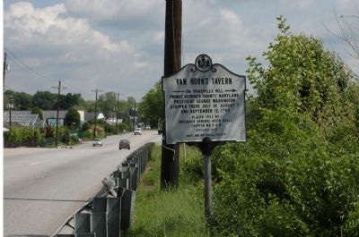
On Rhode Island Avenue (U.S. 1) at Perry Street, on the right when traveling west on Rhode Island Avenue.
Welcome to Mount Rainier's Memorial Park — created in 1926 to honor citizens who distinguished themselves in service to the community.
For many decades, the park served as the location for civic celebrations in the heart of Mount . . . — — Map (db m289731) HM
On Perry Street at Rhode Island Avenue (U.S. 1), on the right when traveling east on Perry Street.
For many decades prior to the founding of Mount Rainier, Bunker Hill Road — one block north of this location — and Bladensburg Road to the south provided the local farms with access into the District of Columbia and to the port of . . . — — Map (db m289732) HM
On Archer Avenue (Illinois Route 171) west of Willow Springs Road, on the right when traveling east.
This statue commemorates the dedication and spirit of the young men who served in the Civilian Conservation Corps from April, 1933 to July, 1942.
Camp Chicago-Lemont, Company 612
Willow Springs, Illinois
Established June 4, 1933
. . . — — Map (db m267606) HM
On The Walk of History north of Main Street (Maryland Route 725).
The Walk of History
“We walk in the footsteps of those who went before us.”
The 300th anniversary of the founding of Prince George’s County Maryland, was celebrated on April 23rd, 1996. Three hundred years before, in . . . — — Map (db m32566) HM
On Nottingham Road at Tanyard Road on Nottingham Road.
A port town with a population of 1500. During the Revolution the British camped here on August 21, 1814 on their march to Washington, D.C. — — Map (db m189220) HM
On Livingston Road 0 miles north of Fort Washington Road, on the left when traveling north.
The Broad Creek Historic District was established by the Prince George's County Council on July 30, 1985. The area surrounding Broad Creek, an estuary of the Potomac River, is considered a special place because of its historical significance, its . . . — — Map (db m4617) HM
Oldest historically black institution of higher education in Maryland. Established in 1865 in Baltimore as a school for freed slaves. In 1867 became Baltimore Normal School for the education of colored teachers. Relocated in 1911 to Prince George’s . . . — — Map (db m96371) HM
Near National Harbor Boulevard south of Capital Beltway (Interstate 95), on the right when traveling south.
Durante Vita
From the day the colony was founded in 1634, enslaved Africans played an important role in the history and development of Maryland and Prince George's County. As skilled laborers, artisans, and farmhands, the . . . — — Map (db m202335) HM
Brought to Maryland in 1634 by the first colonists on the ships Ark and Dove, this demiculverin was presented to Charles Benedict Calvert of Riversdale in 1845. — Preservation and restoration was funded by the Maryland Heritage Committee of Prince . . . — — Map (db m187) HM
John Rogers, a prominent lawyer and patriot, resided in Upper Marlboro during the 1760s and 1770s. He represented Prince George’s County at the Maryland Conventions of 1774 and 1775, and on July 25, 1775, signed the “Association of the Freemen of . . . — — Map (db m33011) HM
On St. Thomas Church Road at Croom Road (Route 382), on the left when traveling east on St. Thomas Church Road.
Successor to the 17th century Anglican Church at Mount Calvert, this cruciform, brick church was authorized in 1732 and completed in 1745 during the rectorate of John Eversfield, 1728-1780. Built by Daniel Page it served as chapel of ease for the . . . — — Map (db m3620) HM
Near Livingston Road south of Old St. Johns Way, on the right when traveling south.
Here is the final resting place of 40 members of the Col. John Addison family, some of Maryland's earliest colonial settlers. Their story began when Col. John Addison, the Emigrant (1634 – 1706) arrived on Maryland shores from England (1667). He . . . — — Map (db m272119) HM
On Annapolis Road (Maryland Route 450) at Baltimore Lane when traveling south on Annapolis Road.
A suburb established by progressive African Americans who worked in the District of Columbia. Platted in 1908 along a stop of the WB&A Electric Railway. Developed by Lawyer Educator, Civil Servant and activist Thomas Junius Calloway. Vice President . . . — — Map (db m72043) HM
During the War of 1812, the bombardment of Baltimore, Maryland took place September 13-14, 1814. Dr. William Beanes was held prisoner aboard the British flagship of Vice Admiral Edward Cochrane. Francis Scott key and John Skinner were charged with . . . — — Map (db m69428) HM
Near North Glebe Road (Virginia Route 120) just north of Fairfax Drive ( Route 237), on the left when traveling north.
Arlington County in 1921
This 1921 aerial photograph shows the immediate surroundings and transportation networks of both the streetcar line and roads from Clarendon from Ballston. The Washington-Virginia Railway, successor to the Washington, . . . — — Map (db m145151) HM
On Main Street at 9th Street, on the right when traveling west on Main Street.
The pool opened here in 1958 was originally private and whites only. Dr. John Warren of the Lions Club led the effort to open a pool in Laurel after seeing so many children swimming in the polluted Patuxent River.
Warren formed . . . — — Map (db m229027) HM
On West Street at 8th Street, on the left when traveling west on West Street.
Throughout its history, St. Mark's has been a focal point of the Grove where residents would gather for community meetings, prayer, and activities such as the Emancipation Proclamation Celebration established in 1902, Laurel's longest running . . . — — Map (db m229025) HM
On 41st Avenue at Wallace Road, on the left when traveling north on 41st Avenue.
Sis's Tavern was built in 1912 and originally operated as a grocery by Thomas F. Randolph, a member of the prominent Randall family who were the first residents of North Brentwood.
In 1919, the building was sold to Jeremiah Hawkins who, . . . — — Map (db m228992) HM
On Pratt Street just east of Main Street (Maryland Route 725), on the right when traveling east.
You are standing across from one of the filming locations for Black Like Me.
The film, released on May 20, 1964, was based on John Howard Griffin's book about his experience in 1959 of medically darkening his skin to pass himself . . . — — Map (db m229033) HM
On Main Street (Maryland Route 725) west of East Court Drive, on the right when traveling west.
The Upper Marlboro Courthouse was the site of an important Civil Rights era protest against racism on the part of the judiciary.
Presiding over a manslaughter trial on October 10, 1967, Judge William B. Bowie said, "If they [blacks] want . . . — — Map (db m229034) HM
Near Thrift Road 0.3 miles west of West Boniwood Turn, on the right when traveling west.
Miocene Period (20-10 Million Years Ago)
You are standing on an ancient seabed. During the Miocene period. 20 to 10 million years ago, all of Southern Maryland was a warm shallow ocean called the Miocene Sea that reached as far north as . . . — — Map (db m199450) HM
On Mid Atlantic Boulevard 0.4 miles south of Contee Road when traveling west.
Astrodon was a member of the group of long necked, plant-eating dinosaurs called sauropods. When fully grown, it may have exceeded 60 feet in length and weighed 20 tons.
Astrodon was discovered in 1858, right here in Prince . . . — — Map (db m188071) HM
On MGM National Avenue just west of Oxon Hill Road, on the right when traveling east.
Bird's Eye View of Alexandria, 1863
Ships that docked at Alexandria's bustling wharves carried tobacco all over the world and brought fine goods from Europe for wealthy Maryland planters.
Addison Family at National Harbor . . . — — Map (db m144024) HM
Burial place of George & Rosalie Calvert, four infant children and Charles Benedict Calvert and his infant son. The Calvert family, descendants of the Lords Baltimore, lived at "Riversdale" from 1803 to 1887. Charles Benedict Calvert was a major . . . — — Map (db m123) HM
Near Old Muirkirk Road. Reported permanently removed.
Abraham Hall was built in 1889 as a lodge for the Benevolent Sons and Daughters of Abraham. Chartered in 1877, this fraternal organization provided emergency financial assistance and death benefits to its members: a form of insurance not . . . — — Map (db m66418) HM
Near National Harbor Boulevard south of Capital Beltway (Interstate 95), on the right when traveling south. Reported missing.
A Plantation Society
Settlers to the New World came in search of gold, but what they found was a rugged landscape whose humbler natural resources would prove to be the greatest source of wealth. Timber, furs, and metal ores that had . . . — — Map (db m229194) HM
On National Harbor Boulevard at Capital Beltway (Interstate 95), on the right when traveling south on National Harbor Boulevard.
1. Oxon Cove Farm & Oxon Hill Farm
Explore farm life and how it's changed over time by visiting the outbuildings and animal pens of a working farm, taking a wagon ride, and by participating in hands-on activities and living history . . . — — Map (db m202578) HM
Near Oxon Hill Road (Maryland Route 414) south of Harborview Avenue, on the right when traveling north. Reported missing.
Resistance to slavery took many forms – some more extreme and more cruel than others. In November 1834, house slave Judah, a 14 year-old, girl confessed to fatally poisoning three of Dr. Bayne’s children and attempting to set fire to Salubria, his . . . — — Map (db m117030) HM
On Van Buren Street at Baltimore Avenue (Route 1) on Van Buren Street.
Much of the area around you — some 1500 acres — was part of Riversdale, a plantation founded in 1801 by an aristocratic Belgian family — the Stiers — who had escaped the terror of the French Revolution and subsequent . . . — — Map (db m117967) HM
Near Old Muirkirk Road. Reported permanently removed.
Iron Production: Maryland’s Industrial Past
Maryland’s early economy and identity were based on slave-based agriculture. However, slaves were also employed in manufacturing iron, one of the first non-agricultural industries. Seeing how other . . . — — Map (db m104641) HM
Near Capital Beltway (Interstate 95) west of National Harbor Boulevard, on the right when traveling east.
At the time of the first European contact, the indigenous people of Southern Maryland were united in a loose group of villages known to the English as the Piscataway Confederation. Their paramount chief, or Tayac, lived in a village called Moyaone, . . . — — Map (db m127706) HM
In 1673, Charles Calvert, the Third Lord Baltimore, granted 1000-acres of land to Thomas Sprigg. Sprigg named the property Northampton, located in what later became Prince George's County, and was home to the Sprigg family and their slaves and . . . — — Map (db m69274) HM
On 9th Street near Riverfront Park Trail, on the right when traveling north.
This point marking the site of the 9th Street Bridge that connected Laurel and Howard County over the Patuxent River is dedicated to the memory of Frank P. Casula (1920-2001).
Frank P. Casula served the Citizens of Laurel and Prince George's . . . — — Map (db m72071) HM
Near Oxon Hill Road (Maryland Route 414) south of Harborview Avenue, on the right when traveling north.
Experience Salubria is a curated collective of historic facts that establishes Southern Prince George’s County as the front door to Maryland’s epic heritage. The collective within the Tanger Outlets National Harbor consists of four . . . — — Map (db m74970) HM
In 1774, the Maryland General Assembly passed legislation for the establishment of a school near “Ye Coole Springs” for the education of boys from St. Mary’s, Charles, Calvert, and Prince George’s counties. As a result of the . . . — — Map (db m81186) HM
On Thames Street west of Point Street, on the right when traveling west.
The Maritime Park and Museum, one of many Living Classrooms Foundation facilities, opened in 2006 and uses our motto "Learning by Doing" to engage visitors through interactive displays, hands-on activities and special programs. The . . . — — Map (db m219599) HM
Near Sheriff Road west of Harvey Drive, on the left when traveling west.
Former Prince George's County Council member Marvin F. Wilson, representing District 5, gained a reputation early on as a staunch supporter of the Washington Redskins' relocation to Prince George's County. Mr. Wilson had a vision that this . . . — — Map (db m199005) HM
Revolutionary Soldier, 1775-1783
Pierre Charles L’Enfant
Engineer, Artist, Soldier
under the direction of George Washington, designed the plan for the Federal City
Major US Engineer Corps 1782
Charter member of the Society of the . . . — — Map (db m224006) HM
On Addison Road at 60th Place, on the right when traveling south on Addison Road.
The Fairmount Heights No. 92 F.A.A.M Maryland Jurisdiction received their charter in 1928 with Andrew Knox, W.M. George Henderson, Jr. W. Edward Patterson, Sr. W. James A. Campbell, Secretary and George W. Patterson, Treasurer. The Lodge building . . . — — Map (db m120313) HM
The Robert M. Watkins Regional Park is 864 acres in size. It was named in honor of Robert Watkins, who served as the Chairman of The Maryland-National Capital Park and Planning Commission (M-NCPPC) from 1951 until 1954 and played a significant role . . . — — Map (db m192205) HM
Near Oxon Hill Road (Maryland Route 414) south of Harborview Avenue.
Only Black Slavery Was Legal in Maryland Maryland institutionalized the enslavement of Africans at the same time they were being shipped to this section of the Potomac Valley from St. Mary’s City, Port Tobacco, and Virginia. Indians and Whites . . . — — Map (db m75283) HM
Near West Marlton Avenue west of Crain Highway (U.S. 301), on the right when traveling south.
This area of Rosaryville State Park is dedicated in honor and memory of
Frederick Lee Eskew
(April 22, 1938 - April 29, 1986)
A graduate of the University of Maryland, School of Recreation and Parks, Fred Eskew dedicated 25 years to . . . — — Map (db m299825) HM
On Kirkwood Lane, on the right when traveling east.
At Hobkirk’s Hill the American army numbered between 1,200 and 1,500 men. Col. Otho Holland Williams’s brigade held the left of the line. It consisted of two Maryland Continental regiments commanded by Col. John Gunby and Lt. Col. Benjamin Ford, . . . — — Map (db m48268) HM
On Pines Church Road just north of Pines Road, on the right when traveling north.
Russell Cemetery AKA Pines Cemetery. Pvt. E. Thompson served in Revolutionary War 1776-1778. Fought at Germantown & White Plains. — — Map (db m285502) HM
On Lower Marlboro Road (Maryland Route 262) 0.2 miles Southern Maryland Boulevard ( Route 4), on the right when traveling east.
Authorized in 1692 by the Maryland Assembly the first All Saints (log) Church was built near this site "at the cross-roads of the Severn Ridge Path and the road leading to Coxtown" on land donated by early French Huguenot settler Thomas Hilleary . . . — — Map (db m3471) HM
On Edmonston Road north of Pontiac Street, on the right when traveling south.
Archibald Edmonston (c. 1668-1734), born in Scotland, immigrated to Maryland in 1683, and afterward married Jane Beall. He would later become Colonel of the Prince George's County militia.
In Maryland, the Edmonstons accumulated great wealth. . . . — — Map (db m133938) HM
Near Pontiac Street west of 63rd Avenue, on the right when traveling west.
Pine Grove Academy was the first public school to serve the area. It opened in 1889, about a year after the first homes were built in the new development of Charlton Heights, later incorporated as the Town of Berwyn Heights. The one-room school . . . — — Map (db m216726) HM
On His Lordship's Kindness 0.1 miles west of Woodyard Road, on the left when traveling west.
Name derives from 7000-acre grant by Lord Baltimore in 1703. Although present house, known as Poplar Hill for many years, may date from latter part of 18th century, it was believed built c. 1728 for Anne Talbot, niece of 14th Earl of Shrewsbury upon . . . — — Map (db m72052) HM
On Thrift Road 0.2 miles east of Tippet Road, on the left when traveling east.
One of the oldest surviving one-room schoolhouses in Prince George’s County, Thrift School was built in 1884. It replaced an earlier school from 1869 located on the same site. The School Commissioners, having acquired the one-acre tract from the . . . — — Map (db m6084) HM
On Mount Calvert Road 2.4 miles east of Croom Road ( Route 382), on the right when traveling east.
Near this place the first courthouse in Prince George's County was erected in 1698, which served as the center of county government until 1721, when the county seat was moved to Upper Marlborough. The village of Charles Town was built on a tract of . . . — — Map (db m68085) HM
On 61st Avenue at Addison Road, on the right when traveling north on 61st Avenue.
Education for the children was an important concern for the community. In 1910, there were 100 children living in the community, but no school. The first school opened in 1909 in a frame house on 59th Avenue with Carrie Griffin as the first . . . — — Map (db m302888) HM
Near Oxon Hill Road (Maryland Route 414) south of Tanger Boulevard.
A Need For Change
After acquiring the Salubria land and building his manor house here in 1830, Dr. John H. Bayne quickly realized that devoting the entire property to the cultivation of tobacco was not going to produce the income he needed. . . . — — Map (db m75404) HM
Near Spellman Overpass north of Baltimore-Washington Parkway ( Route 295), on the right when traveling south.
This trail and overpass are dedicated to Gladys Noon Spellman in recognition of 18 years of public service to the citizens of Greenbelt as Member of Congress for the Fifth Congressional District of Maryland and as Chairman and Member of the Prince . . . — — Map (db m129985) HM
Here at the National Colonial Farm, you will see a realistic portrait of everyday life in Prince George’s County 250 years ago.
Welcome to the National Colonial Farm, one of the Accokeek Foundation’s first educational programs. Created in . . . — — Map (db m70620) HM
On Tulip Grove Drive, on the right when traveling east.
When the Civil War began, Prince George's County was full of Southern sympathizers. To keep Maryland in the Union, President Abraham Lincoln imposed martial law, and as the Prince George's Planters' Advocate on May 8, 1861, noted, "Maryland is . . . — — Map (db m66432) HM
On Oxon Hill Farm Trail west of Bald Eagle Road, on the right when traveling west.
“It was indeed a day and night of horrors, the fleet … lay directly before our house.”
Mary DeButts, writing to her sister Millicent on March 18, 1815.
From this farm, Mary DeButts saw a small fleet on the Potomac . . . — — Map (db m48959) HM
Near Capital Beltway (Interstate 95) west of National Harbor Boulevard, on the right when traveling east.
"From this we went to Piscataway, where all flew to arms. About five hundred men, equipped with bows, stood on the shore with their chieftain. Signs of peace given them, the chief, laying aside his apprehensions, came on board the . . . — — Map (db m202692) HM
Near Rock Creek Park Road 0.3 miles north of Muncaster Road, on the right when traveling north.
When the Magruders operated this farm in the 18th century, the crops were alternated yearly between tobacco and corn. This was called the "Maryland plan." Planters relied on enslaved laborers to do the back-breaking work that began in . . . — — Map (db m229731) HM
On Brooke Road 0.1 miles west of Chandlee Mill Road, on the right when traveling west.
Historic Sites Allegedly Connected to the Underground Railroad
Caleb Bentley and his son Richard Bentley owned and occupied Historic Bloomfield from the early 1800s until 1914. The Bentleys were Quaker farmers, entrepreneurs, and active . . . — — Map (db m188243) HM
Welcome to the City of College Park
The city is perhaps best known as home to the flagship campus of the University of Maryland. More surprising is that a significant chapter in early aviation history began here in 1909 at the world's . . . — — Map (db m5740) HM
On Mount Calvert Road 0.3 miles east of McClure Road, on the right.
Colonial Settlement
It is hard to imagine, but Mount Calvert was once a busy port town of a frontier community. After the Colony of Maryland was created in 1634, colonists began seeking land grants along the Upper Patuxent River. In 1658 . . . — — Map (db m187418) HM
The Trammell-Taylor House was one of the most substantial houses in the early development of Fairmount Heights. The house is a two-and-one-half story, side gabled, wood frame dwelling with Classical Revival decorative details. Above the entry porch . . . — — Map (db m119837) HM
Near National Harbor Boulevard south of Capital Beltway (Interstate 95), on the right when traveling south.
The Berry Years
Prosperous planter Zachariah Berry owned thousands of acres in Prince George's County before purchasing Oxon Hill Manor from the Addison Family in 1810. Little is known about his activity on the estate–indeed, it . . . — — Map (db m127693) HM
Near Oxon Hill Road (Maryland Route 414) 0.3 miles south of Harborview Avenue, on the left when traveling south.
In addition to his very successful horticulture activities, Dr. Bayne provided leadership in other areas.
A Politician Who Evolved
In 1841, Dr. Bayne entered Maryland politics and was elected to the House of Delegates as a member of . . . — — Map (db m75411) HM
Near Point Lookout Road (Maryland Route 5) 0.4 miles west of Rosecroft Road, on the left when traveling west.
When Maryland's governor ordered the chapel door locked in 1704 and the legislature passed the Act to Prevent the Growth of Popery, a new chapter in religion began in the colony. Catholics were barred from holding office and voting, were . . . — — Map (db m190032) HM
Frederick County. Named for Frederick 5th and last Lord Baltimore. Erected out of Prince George’s County in 1748. It then included Montgomery County and all of Maryland west to the West Virginia boundary.
Washington County. The first . . . — — Map (db m41770) HM
Near Annapolis Road (Maryland Route 450) at 46th Street.
In 1742, the town of Bladensburg was created on the banks of the Anacostia River (also known as the Eastern Branch of the Potomac river) through an act of the Maryland General Assembly for the purpose of promoting trade and commerce. The act stated . . . — — Map (db m8220) HM
The Luther Goldman Birding Trail is dedicated to the memory of Luther Chase Goldman (1909 - 2005), a noted Prince Georges County Resident, field biologist, pioneer national wildlife refuge manager, renowned wildlife photographer, and nature tour . . . — — Map (db m7870) HM
Near Fenno Road 0.8 miles north of Nottingham Road.
The Merkle Wildlife Sanctuary was established in 1970 here along the Patuxent River in Prince George's County. It is named for Edgar Merkle who owned a large part of the land and who originated a breeding plan to re-introduce gees to this part of . . . — — Map (db m189221) HM
On Nottingham Road 0.1 miles north of Tanyard Road, on the right when traveling north.
One-room schoolhouses were common in small towns and rural areas during the late 19th and early 20th Centuries. Children from all grad levels were taught in a single room. Eventually one-room schoolhouses disappeared leaving only a few examples like . . . — — Map (db m68074) HM
Near Capital Beltway (Interstate 95) west of National Harbor Boulevard, on the right when traveling east.
By the mid-1700s, Prince George's County had the largest population of slaves in the state — nearly half of its residents were enslaved Africans, most working on local tobacco plantations. The Civil War drastically changed this equation. During . . . — — Map (db m202697) HM
Built in 1928, Highland Park was the second high school for African Americans in Prince George's County, Maryland. It was one of 23 "Rosenwald Schools" constructed in Prince George’s County with financial assistance from the Julius Rosenwald Fund, . . . — — Map (db m40025) HM
On Governor Oden Bowie Drive at Elm Street, on the right when traveling east on Governor Oden Bowie Drive.
Within these walls rest the remains of William Beanes, 1749 - 1828, Prince George's County physician, planter, patriot. Served on the Committee of Prince Georgians to carry into effect the resolutions adopted by the First Continental Congress. . . . — — Map (db m70125) HM
On Sperryville Pike (U.S. 522), on the right when traveling south.
Just to the south stood Catalpa, where John Strode Barbour was born on 29 Dec. 1820. In 1849, he was appointed the state’s representative on the board of directors of the Orange and Alexandria Railroad. The board elected him president in 1851 and he . . . — — Map (db m288424) HM
On Orange Avenue 0.1 miles east of City Island Parkway, on the right when traveling east.
On June 18, 1812, the United States declared war against the United Kingdom for the British impressment of American sailors into the Royal Navy, the interception of neutral ships and blockades of the United States. The conflict resolved political . . . — — Map (db m154660) WM
First Lady Jane Contee Hanson, 1728-1812
In the unmarked mass grave behind this memorial rests Jane Hanson, the original first lady of the United States.
She is buried here with 285 others reinterred in 1913 from Frederick's . . . — — Map (db m103170) HM
Welcome to the City of Greenbelt
Unlike most towns that develop gradually over a long period of time, Greenbelt was the first "green town" built in 1936 from scratch as part of President Franklin Roosevelt's New Deal. The entire community was . . . — — Map (db m5038) HM
On Queensbury Road at Rhode Island Avenue on Queensbury Road.
A key factor in the initial development
of Riverdale Park in 1887 was its proximity
to Washington, D.C. By the end of the
19th century, transportation between
Riverdale Park and Washington was
extremely convenient by either the
Baltimore . . . — — Map (db m984) HM
On Riverdale Road at 49th Avenue, on the right when traveling east on Riverdale Road.
Welcome to the Town of Riverdale Park
Formally incorporated in 1920, the Town of Riverdale Park derives its name from historic Riversdale Plantation. Riversdale Mansion still stands today, surrounded by the community that grew up around it. . . . — — Map (db m13628) HM
On Main Street (Maryland Route 725) at East Court Drive, on the left when traveling east on Main Street.
This monument perpetuates the memory of the sons and daughters of Prince George’s County who, true to the traditions of their county and the teachings of their forefathers, served their country in the Great War of 1917-1918. To the spirit of that . . . — — Map (db m32622) HM
Near Annapolis Road (Maryland Route 450) at 46th Street.
Floods were practically a way of life in Bladensburg until the late 1950s, when an intensive flood control project was completed. Noted attorney and author William Wirt, who was born in Bladensburg in 1772, makes mention of the floods at Bladensburg . . . — — Map (db m8218) HM
Near Capital Beltway (Interstate 95) west of National Harbor Boulevard, on the right when traveling east.
At first, Maryland's early settlers had little to trade with England in return for tools, clothing, coffee, tea, sugar, rum, and other necessities and luxuries of life. Tobacco, which was in great demand in Europe, proved to be the key to . . . — — Map (db m202693) HM
Near Baltimore Avenue (U.S. 1) at Gallatin Street.
Welcome to the City of Hyattsville
Christopher Clark Hyatt purchased a land parcel in 1845 and soon after the surrounding farmland was subdivided into housing lots. By 1859, the tract officially began to be recognized as Hyattsville.
. . . — — Map (db m13753) HM
Near Old Marlboro Pike at Starting Gate Drive, on the right when traveling east.
Clerk of the County Court 1767-1777
Colonel of the Lower Battalion of Militia in Prince George's County 1777
Member of Council of State 1777-1779
Governor of the State of Maryland 1779-1782, 1792-1794, who by his patriotic zeal . . . — — Map (db m175324) HM
On Mid Atlantic Boulevard 0.4 miles south of Contee Road, in the median.
The History of Dinosaur Park
In the 1800s and early 1900s, the Arundel clays of Prince George's County were mined for siderite, or iron ore. Iron furnaces located throughout the region melted down the siderite to produce iron used in . . . — — Map (db m188077) HM
Thomas Henry Ball was born in Northumberland County, Virginia, in 1819, the son of The Rev. David Thomas and Hannah Henry (Gaskins) Ball. Following in his father's footsteps, Ball became a Methodist minister. While serving his first congregation in . . . — — Map (db m129692) HM
A family farm, a Civil War encampment site, and a country home, Historic Blenheim now welcomes visitors to explore its landscape and many stories. Over 200 years ago, family patriarch Rezin Willcoxon moved here from Prince Georges County, . . . — — Map (db m24662) HM
Near Mount Vernon Highway (Virginia Route 235) at George Washington Memorial Parkway.
While its location on the Potomac was usually a blessing—both for its beautiful views and commercial opportunities—Mount Vernon's safety was threatened by activities on the river during times of war.
American Revolution (1775-1783)
In . . . — — Map (db m147908) HM
On Harry Thomas Way Northeast south of Quincy Lane Northeast, on the right when traveling north.
Alethia Tanner, or "Lethe" as she was known, was born into slavery in 1781 on a plantation in Prince George's County, Maryland, where she lived and worked with her sisters, Laurana and Sophia, before coming to Washington in the early 1800s. . . . — — Map (db m234910) HM
On Old Muirkirk Road 0.2 miles north of Muirkirk Road, on the right when traveling north.
Abraham Hall was built in 1899 as a lodge for the Benevolent Sons and Daughters of Abraham. Chartered in 1877, this fraternal organization provided emergency financial assistance and death benefits to its members — a form of insurance not . . . — — Map (db m188090) HM
Near Campus Drive 0.1 miles south of Union Drive, on the left when traveling south.
The garden's three masonry benches and fountain pedestal were originally part of a Remembrance Garden located near St. Mary's Hall. Formerly named Margaret Brent Hall, St. Mary's Hall was the first campus residence hall planned and constructed . . . — — Map (db m151099) HM
The Hargrove House was built in the North Fairmount Heights subdivision, platted in 1910. It was built by brick mason Samuel Hargrove. It is an unusual dwelling form, with molded brick detail and is probably unique in Prince George's County. It is . . . — — Map (db m119876) HM
Near Sheriff Road at Harvey Drive, on the right when traveling east.
On this site stood the Wilson family homestead, which was built in the early 1900s after an earlier family home was destroyed by fire. It was the home of Georgianna Cornelia Wallis and Joseph Percy Wilson, the grandparents of the last generation of . . . — — Map (db m202764) HM
On Van Buren Street at Baltimore Avenue (U.S. 1), on the right when traveling east on Van Buren Street.
You are standing near the remains of a 19th century icehouse.
What is an icehouse? An icehouse is an underground facility designed to store ice during times of year when it is not easily available. Icehouses use the natural insulating qualities of . . . — — Map (db m117925) HM
Welcome to Government Island. This 17-acre historic site is an early American quarry originally named Brent’s Island or Wiggington’s Island. As early as 1694, stone was quarried from this site for use as architectural trim in Colonial America. . . . — — Map (db m39550) HM
123 entries matched your criteria. The first 100 are listed above. The final 23 ⊳
Thin black lines indicate changes in relevance. Between each pair of lines entries are ordered geographically but all have the same relevance.
* Inflectional forms of words are their plurals, singulars, and possessives as well as gramatical tenses and similar variations.