3554 entries match your criteria. Entries 101 through 200 are listed.⊲ Previous 100 — Next 100 ⊳
Man-Made Features Topic
By J. Makali Bruton, February 17, 2025
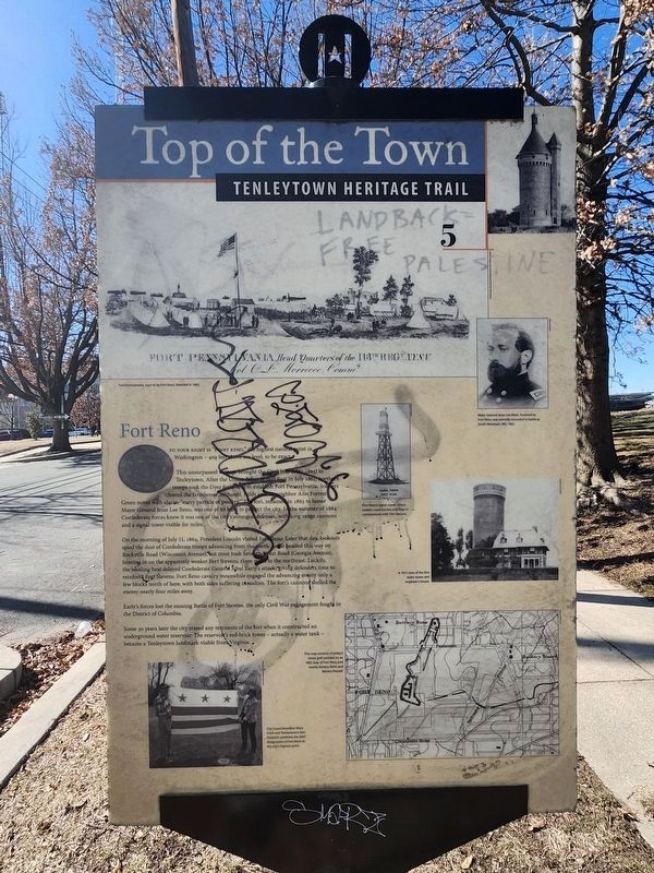
Fort Reno Marker
101 ► District of Columbia, Washington, Northwest Washington, Tenleytown — 5 — Fort Reno — Top of the Town — Tenleytown Heritage Trail —  |
| On Chesapeake Street Northwest east of 40th Street Northwest, on the left when traveling east. | |||
| 102 ► District of Columbia, Washington, Northwest Washington, The Ellipse — The National Christmas Tree — President's Park — National Park Service, U.S. Department of the Interior |
| On E Street Northwest west of 15th Street Northwest, on the left when traveling west. Reported permanently removed. | |||
| 103 ► District of Columbia, Washington, Northwest Washington, The National Mall — Jefferson Pier — [Washington Monument] — |
| Near 15th Street Northwest south of Constitution Avenue Northwest (U.S. 50), on the right when traveling north. | |||
| 104 ► District of Columbia, Washington, Northwest Washington, The National Mall — The Fountain — Smithsonian National Museum of American History — Kenneth E. Behring Center — |
| On Constitution Avenue Northwest (U.S. 50) 0.1 miles east of 14th Street Northwest, on the right when traveling east. | |||
| 105 ► District of Columbia, Washington, Northwest Washington, Wakefield — 3 — Suburban Style — Top of the Town — Tenleytown Heritage Trail — |
| On Brandywine Street Northwest at 38th Street Northwest, on the left when traveling east on Brandywine Street Northwest. | |||
| 106 ► District of Columbia, Washington, Southeast Washington, Anacostia — The World’s Largest Chair — |
| On V Street Southeast at Martin Luther King Jr. Avenue Southeast, on the left when traveling west on V Street Southeast. | |||
| 107 ► District of Columbia, Washington, Southwest Washington, East Potomac Park — Engineering a Landmark — Hains Point, National Mall & Memorial Parks, Washington, D.C. — National Park Service, U.S. Department of the Interior |
| Near Ohio Drive Southwest, on the right when traveling south. Reported permanently removed. | |||
| 108 ► Florida, Citrus County, Crystal River — A View from the Top — Crystal River Archaeological State Park — |
| On North Museum Point 0.1 miles south of West State Park Street, on the right when traveling north. | |||
| 109 ► Florida, Collier County, Immokalee, Corkscrew — Well — Immokalee Pioneer Museum — |
| On Roberts Avenue West 1 mile west of North 15th Street, on the right when traveling west. | |||
| 110 ► Florida, Escambia County, Pensacola — 19th Century Well — |
| Near Radford Boulevard at San Carlos Road, on the left when traveling west. | |||
| 111 ► Florida, Escambia County, Pensacola — The Privy — |
| Near Radford Boulevard at San Carlos Road, on the left when traveling west. | |||
| 112 ► Florida, Lee County, Fort Myers — #3 — Swimming Pool — Fun in the Sun — Edison and Ford Winter Estates — |
| On McGregor Road 0.1 miles north of Llewellyn Drive, on the right when traveling north. | |||
| 113 ► Florida, Lee County, Fort Myers — Water Systems — Modern Plumbing Comes To Fort Myers — Edison and Ford Winter Estates — |
| Near McGregor Boulevard (Florida Route 867) south of West First Street, on the right when traveling south. | |||
| 114 ► Florida, Lee County, Sanibel — E-223 — Sanibel Lighthouse — |
| Near Periwinkle Way 1.7 miles east of Causeway Boulevard. | |||
| 115 ► Florida, Manatee County, Anna Maria — Historic Anna Maria City Pier — |
| Near South Bay Boulevard at Pine Avenue, on the left when traveling south. | |||
| 116 ► Florida, Okeechobee County, Okeechobee — History of the Ranch Entry Gate — Cattleman’s Square — |
| Near SW Park Street at SW 6th Avenue, on the right when traveling east. | |||
| 117 ► Florida, Osceola County, Kissimmee — Tree Firemark — |
| On County Road 532 (County Route CR552) at East Monument Avenue, on the right when traveling south on County Road 532. | |||
| 118 ► Florida, Sarasota County, Sarasota — The Meadows — |
| On Longmeadow at Glebe Farm Road, on the left when traveling north on Longmeadow. | |||
| 119 ► Florida, St. Johns County, St. Augustine, Historic District — Invincible? / ¿Invencible? — Castillo de San Marcos National Monument — |
| Near South Castillo Drive (Business State Highway A1A) east of Orange Street, on the right when traveling north. | |||
| 120 ► Florida, St. Johns County, St. Augustine, Lincolnville — The Fountain — |
| On King Street at Grenada Street on King Street. | |||
| 121 ► Georgia, Glynn County, Jekyll Island — Preserving the Legacy — |
| On Old Plantation Road north of Schoolhouse Lane, on the right when traveling north. | |||
| 122 ► Georgia, Glynn County, Jekyll Island — Taking Care of Family |
| On Riverview Drive 0.2 miles south of Stable Road, on the left when traveling south. Reported permanently removed. | |||
| 123 ► Georgia, Glynn County, Jekyll Island — The Clubhouse — Evolution of Elegance — |
| On Pier Road at Riverview Drive, on the right when traveling west on Pier Road. | |||
| 124 ► Georgia, Putnam County, Eatonton — Rock Eagle Mound — |
| On Madison Highway (U.S. 129) at Rock Eagle Road, on the left when traveling north on Madison Highway. | |||
| 125 ► Georgia, Union County, Blairsville — Original Clock & Bell Mechanism — From the Historic 1899 Courthouse — |
| On Town Square at Candler Drive, on the left when traveling north on Town Square. | |||
| 126 ► Idaho, Ada County, Boise, East End — Sally Port — |
| On Old Penitentiary Road, on the right when traveling east. | |||
| 127 ► Idaho, Boise County, Robie Creek — Arrowrock Dam — National Historic Civil Engineering Landmark — |
| On Arrowrock Road. | |||
| 128 ► Illinois, Cook County, Elk Grove Village — Centex Corporation and the Village of Elk Grove — |
| Near Wellingon Avenue 0.1 miles south of Biesterfield Road, on the right when traveling north. | |||
| 129 ► Illinois, Hancock County, Warsaw — This Antique Fire Hydrant — |
| On North 5th Street east of Main Street, on the right when traveling south. | |||
| 130 ► Illinois, Jefferson County, Mount Vernon, Shiloh Township — The WPA Outhouse — Jefferson County Historical Village Museum — |
| On North 27th Street north of Caroline Street, on the left when traveling north. | |||
| 131 ► Illinois, Kane County, Aurora — Millennium Tower — Dedicated January 1, 2000 — |
| On Stolp Avenue north of Downer Place. | |||
| 132 ► Illinois, Knox County, Galesburg — Spanish-American War Cannon — |
| On South Cherry Street near East Tompkins Street. | |||
| 133 ► Illinois, Logan County, Atlanta — Snerd Giant — |
| On Southeast Vine Street at Southwest Arch Street (Old U.S. 66), on the right when traveling west on Southeast Vine Street. | |||
| 134 ► Illinois, Madison County, Collinsville — Cahokia — City of the Sun — |
| Near Collins Lane 0.1 miles north of Collinsville Road. | |||
| 135 ► Illinois, Marion County, Kinmundy — Cypress Water Tower — |
| On Illinois 37 0.5 miles south of West 4th Street, on the left when traveling south. | |||
| 136 ► Illinois, Marshall County, Toluca — Devlin/Toluca Coal Mine Fan Housing — |
| Near East Bennington Street 0.3 miles west of East Railroad Avenue, on the left when traveling west. | |||
| 137 ► Illinois, Massac County, Metropolis — Superman Statue Facts — |
| On Market Street north of West 5th Street, on the left when traveling west. | |||
| 138 ► Illinois, Montgomery County, Litchfield — Hitching Posts — |
| On West Kirkham Street near Old U.S. 66. | |||
| 139 ► Illinois, Peoria County, Peoria — The Easton Fountain — |
| On West High Street south of Main Street, on the left when traveling south. | |||
| 140 ► Illinois, Sangamon County, Springfield — Selvaggio Historic Arches — |
| Near South 2nd Street. | |||
| 141 ► Illinois, St. Clair County, Collinsville — Grand Plaza — Heart of the City — |
| Near Ramey Street 0.2 miles south of Collinsville Road. | |||
| 142 ► Illinois, Tazewell County, Morton — William E. Aupperle Rotary Marker — |
| On West Birchwood Street, on the right when traveling west. | |||
| 143 ► Indiana, Cass County, Logansport — Little Turtle Waterway Plaza — |
| On 4th Street, on the right when traveling south. | |||
| 144 ► Indiana, Franklin County, Metamora, Metamora Township — Building the Whitewater Canal — an 1840s Engineering Feat — |
| On 75 Main Street, on the right when traveling east. | |||
| 145 ► Indiana, Franklin County, Metamora, Metamora Township — Locking Thru Lock No. 24 — Welcome to Whitewater Canal State Historic Site — Metamora — |
| On U.S. 52, on the right when traveling east. | |||
| 146 ► Indiana, Harrison County, Corydon — Flags Over Corydon — |
| On South Capitol Avenue west of West Poplar Street, on the right when traveling south. | |||
| 147 ► Indiana, Ripley County, Versailles — Hitching Post — |
| On South Main Street at Water Street, on the right when traveling south on South Main Street. | |||
| 148 ► Indiana, White County, Monticello — Courthouse Cast Iron Drinking Fountain — |
| On North Bluff Street at East Broadway Street, on the left when traveling north on North Bluff Street. | |||
| 149 ► Indiana, White County, Monticello — The Black Light Poles — |
| On North Bluff Street at East Broadway Street, on the left when traveling north on North Bluff Street. | |||
| 150 ► Iowa, Appanoose County, Moravia — Emergency Siren — Wabash Depot/Moravia Historical Complex — 1903 — |
| Near West North Street east of Myra Lane. | |||
| 151 ► Iowa, Linn County, Cedar Rapids, Czech Village — Kosek Bandstand — |
| On 16th Avenue Southwest south of Inspiration Place Southwest, on the right when traveling south. | |||
| 152 ► Kansas, Trego County, WaKeeney, WaKeeney Township — The Christmas City of the High Plains — |
| On North Main Street, on the right when traveling north. | |||
| 153 ► Kentucky, Livingston County, Grand Rivers — Kentucky Dam — National Historic Civil Engineering Landmark — Tennessee Valley Authority — |
| On Kentucky Dam Road. | |||
| 154 ► Kentucky, Marshall County, Calvert City — The TVA System of Multi-Purpose Dams — Kentucky Dam — |
| On Kentucky Dam Road 0.5 miles east of U.S. 62/641. | |||
| 155 ► Kentucky, Mercer County, Harrodsburg, Shakertown — Inspiring Innovation — The 1833 Water House — Shaker Village of Pleasant Hill — |
| Near Lexington Road (U.S. 68) at Shakertown Road (Kentucky Route 33), on the left when traveling east. | |||
| 156 ► Kentucky, Nelson County, Bardstown — The Jacob Rizer House — Circa 1802 — |
| On West Flaget Street west of West Fourth Street, on the right when traveling west. | |||
| 157 ► Kentucky, Shelby County, Shelbyville — Shelbyville Fountain — |
| On Main Street (U.S. 60) at 5th Street, on the right when traveling east on Main Street. | |||
| 158 ► Louisiana, Orleans Parish, New Orleans, French Quarter — Port of New Orleans — |
| Near Decatur Street east of St Peter. | |||
| 159 ► Louisiana, St. Charles Parish, Norco — Bonnet Carré Spillway — National Historic Civil Engineering Landmark — |
| Near River Road 0.3 miles north of Eighth Street, on the left when traveling north. | |||
| 160 ► Maine, Lincoln County, Wiscasset — 20 — Downtown Stores c. 1892 — Wiscasset, Maine — The Museum in the Streets — |
| On Main Street (U.S. 1) east of Middle Street, on the right when traveling east. | |||
| 161 ► Maryland, Cecil County, North East — Why Build a Lighthouse? — |
| On Turkey Point Road (Maryland Route 272). | |||
| 162 ► Maryland, Garrett County, Oakland — The Creation of Deep Creek Lake — Deep Creek Lake 100 Years — 1925 • 2025 — |
| On Garrett Highway (U.S. 219) at Mountainview Drive, on the right when traveling north on Garrett Highway. | |||
| 163 ► Maryland, Montgomery County, Chevy Chase — Original Federal Boundary Stone, District of Columbia, Northwest 7 — |
| Near Western Avenue at Cedar Parkway. | |||
| 164 ► Maryland, Montgomery County, Clarksburg — Our Daily Bread — The Hyattstown Mill — |
| Near Hyattstown Mill Road 0.2 miles east of Frederick Road ( Route 355), on the right when traveling east. | |||
| 165 ► Maryland, Montgomery County, Dickerson — Linden Farm — A living, thriving slice of Maryland history — |
| Near Martinsburg Road 0.2 miles north of Wasche Road, on the left when traveling north. | |||
| 166 ► Maryland, Montgomery County, Silver Spring, Wheaton — Azalea Garden — 1970 — Brookside Gardens: 40 years (1969-2009) — |
| Near Glenallan Avenue east of Heurich Road, on the right when traveling east. | |||
| 167 ► Maryland, Montgomery County, Silver Spring, Wheaton — Conservatory — 1969 — Brookside Gardens: 40 years (1969-2009) — |
| Near Glenallan Avenue east of Heurich Road, on the right when traveling east. | |||
| 168 ► Maryland, Montgomery County, Silver Spring, Wheaton — Formal Gardens — 1969 — Brookside Gardens: 40 years (1969-2009) — |
| Near Glenallan Avenue east of Heurich Road, on the right when traveling east. | |||
| 169 ► Maryland, Montgomery County, Silver Spring, Wheaton — Trial Garden — 1974 — Brookside Gardens: 40 years (1969-2009) — |
| Near Glenallan Avenue east of Heurich Road, on the right when traveling east. | |||
| 170 ► Massachusetts, Norfolk County, Weymouth — Osprey Overlook Park — Back River Trail — |
| On Wharf Street 0.1 miles north of East Street, on the right when traveling east. | |||
| 171 ► Massachusetts, Suffolk County, Boston, East Boston — Islands - Volkan Alkanoglu, 2019 — |
| On Father Jacobbe Road at Lisbon Street, on the right when traveling east on Father Jacobbe Road. | |||
| 172 ► Massachusetts, Suffolk County, Boston, East Boston — View of Boston in 1848. — East Boston — Harborwalk Boston — |
| On Lewis Street at East Pier Drive, on the right when traveling south on Lewis Street. | |||
| 173 ► Michigan, Antrim County, Elk Rapids — 548 — The Island House — |
| On River Street at Pine Street, on the right when traveling west on River Street. | |||
| 174 ► Michigan, Branch County, Sherwood — 28 — Riley Dam & Trail End — Union City Heritage Water Trail — |
| Near Riley Road. | |||
| 175 ► Michigan, Cheboygan County, Mackinaw City — The Dixie Highway — Mackinaw City Historical Pathway |
| On East Central Avenue at Langlade Street, on the right when traveling west on East Central Avenue. Reported permanently removed. | |||
| 176 ► Michigan, Chippewa County, Sault Ste. Marie — Construction of the Power Canal — |
| On Ashmun Street (Business Interstate 75) at Dawson Street, on the right when traveling south on Ashmun Street. | |||
| 177 ► Michigan, Presque Isle County, Presque Isle — L39 — Old Presque Isle Lighthouse — Registered Michigan Historic Site — |
| On East Grand Lake Road 0.9 miles north of County Road 638, on the right when traveling north. | |||
| 178 ► Michigan, St. Clair County, Fort Gratiot — What Lies Beneath — |
| On the park road, in the median. | |||
| 179 ► Michigan, Wayne County, Dearborn — The Path of the Setting Sun — |
| Near Fair Lane Drive 0.3 miles west of Evergreen Road. | |||
| 180 ► Minnesota, Chisago County, Almelund, Wild River State Park — Nevers Dam — 1889–1954 — |
| Near St. Croix Scenic Byway. | |||
| 181 ► Minnesota, Chisago County, Lindström — Lindström's Iconic Water Tower — Welcome to Kaffe Kanna Park — |
| On 1st Avenue N. (U.S. 8) west of N. Lakes Trail, on the left when traveling west. | |||
| 182 ► Minnesota, Crow Wing County, Crow Wing, Crow Wing State Park — Town Well — Old Crow Wing Historic Site — |
| Near Crow Wing State Park Road. | |||
| 183 ► Minnesota, Crow Wing County, Crow Wing, Crow Wing State Park — Town Well — |
| Near Crow Wing State Park Road. | |||
| 184 ► Minnesota, Freeborn County, Albert Lea — Burglar Alarm — |
| Near Bridge Avenue north of Amelia Place. | |||
| 185 ► Minnesota, Hennepin County, Minneapolis, Hiawatha — A River Highway — |
| Near W. River Parkway, on the left when traveling south. | |||
| 186 ► Minnesota, Hennepin County, Minneapolis, Hiawatha — Big Water / Stairway of Water — |
| Near Godfrey Road 0.2 miles east of 46th Avenue South. | |||
| 187 ► Minnesota, Hennepin County, Minneapolis, Hiawatha — Miter Gate Operating Mechanism — |
| Near W. River Parkway, on the left when traveling south. | |||
| 188 ► Minnesota, Hennepin County, Minneapolis, Hiawatha — Stoney Valve Operating Mechanism — |
| Near W. River Parkway, on the left when traveling south. | |||
| 189 ► Minnesota, Hennepin County, Minneapolis, Loring Park — 501 — Wesley United Methodist Church — Established in 1852 — United Methodist Church Registered Historic Site No. 501 — |
| On Grant Street at Marquette Avenue / 1st Avenue, on the right when traveling east on Grant Street. | |||
| 190 ► Minnesota, Meeker County, Darwin, Darwin Township — Francis Johnson Corner — Honoring Francis, A Valued Friend and Neighbor — |
| On 1st Street at East Williams Street, on the right when traveling north on 1st Street. | |||
| 191 ► Minnesota, Ramsey County, North St. Paul — Our Famous Snowman — |
| On Margaret Street N. at Centennial Drive, on the right when traveling north on Margaret Street N.. | |||
| 192 ► Mississippi, Grenada County, Grenada — Grenada Dam — |
| On Scenic Mississippi Route 333 0.1 miles north of Grenada Lake Visitor's Center, on the right when traveling north. | |||
| 193 ► Mississippi, Panola County, Sardis — Sardis Dam — |
| On Scenic Mississippi Route 315 north of Route 35. | |||
| 194 ► Mississippi, Tishomingo County, Tishomingo — Bear Creek Mound — |
| Near Natchez Trace Parkway (at milepost 308.8), 1.2 miles north of Highway 30, on the left when traveling north. | |||
| 195 ► Missouri, Cape Girardeau County, Cape Girardeau — World's Largest Fountain Drink Cup — 4,730 Gallons of Lemonade - Record Set August 20, 2017 — |
| On South Mount Auburn Road south of Bloomfield Road. | |||
| 196 ► Missouri, Crawford County, Dillard — Turning Water into Power — |
| Near Dillard Mill Road (County Road 811) 1.6 miles south of State Highway 49, on the left when traveling south. | |||
| 197 ► Missouri, Greene County, Springfield, Government Plaza — Pillars on Public Square — |
| On North Boonville Avenue at East Central Street, on the left when traveling south on North Boonville Avenue. | |||
| 198 ► Missouri, Marion County, Hannibal — Gaba's Girls — |
| On Center Street east of Main Street, on the left when traveling east. | |||
| 199 ► Missouri, Pulaski County, Fort Leonard Wood — The Berlin Wall — |
| On South Dakota Avenue, on the right when traveling west. | |||
| 200 ► Missouri, Saline County, Arrow Rock — Capt. John Burruss' Bell — |
| On Main Street east of 4th Street, on the right when traveling east. | |||
3554 entries matched your criteria. Entries 101 through 200 are listed above. ⊲ Previous 100 — Next 100 ⊳