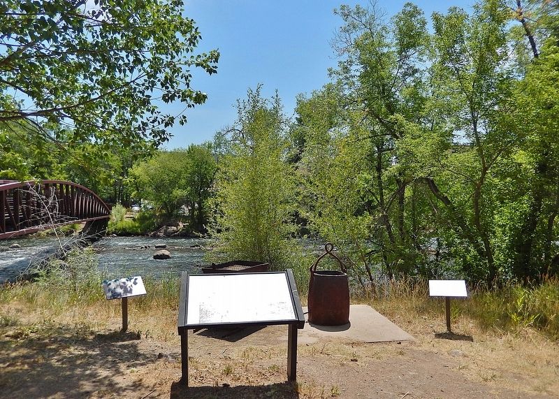
On West Main Street (Business Interstate 25) just west of North Commercial Street, on the left when traveling east.
Established in 1973, this National Historic District encompasses about 40 irregularly shaped city blocks in the Heart of Trinidad. The first log cabins and adobe houses were built here in 1861. Most of the existing buildings were constructed . . . — — Map (db m282383) HM
On East Main Street (Business Interstate 25) just west of North Commercial Street, on the right when traveling west.
Trinidad is uniquely blessed to have over 100 years of its history preserved in photographs taken by a father-son team of camera artists, Oliver and Glenn Aultman, ably assisted by their wife and mother, Jennie. Through the years, their camera . . . — — Map (db m282473) HM
On Greene Street (County Road 2) just south of East 16th Street, on the right when traveling south.
Immigrants played a vital role in the development of mining in the San Juan Mountains. Until 1941, the San Juan County Courthouse housed the Naturalization Office, where immigrants began the legal process of becoming U.S. citizens. Immigration . . . — — Map (db m282892) HM
Discovery of gold in the Rocky Mountains in 1859 lured thousands of prospectors to the area eventually known as the Colorado Territory. This first wave of fortune seekers triggered the development of farms, ranches, businesses, and railroads . . . — — Map (db m222040) HM
On Main Street north of Mather Street, on the left when traveling north.
Between 1863 and 1865, nearly 1,700 men of color enlisted in the 29th Volunteer Infantry Regiment, Connecticut's first non-white military unit. The recruits came from a variety of racial and ethnic origins and professional backgrounds. A . . . — — Map (db m230467) HM
On Main Street north of St. Monica's Avenue, on the right when traveling south.
Born in St. Andrew, Jamaica, he immigrated to Connecticut in 1951, where he opened a real estate and insurance company.
Elected to Hartford's city council in 1965, he battled to assist low-income families in purchasing homes for eight years. . . . — — Map (db m230481) HM
On North Main Street at Linnard Road, on the left when traveling north on North Main Street.
Laurent Clerc
the apostle
to the deaf mutes of the
New World
Laurent Clerc A.M.
Born in La Balme, France
December 26, 1785
landed at New York
August 9, 1816
Died at Hartford
July 18, 1869
— — Map (db m97551) HM
Near Connecticut Route 140 north of Canal Bank Road, on the right when traveling west.
More than 400 Irish immigrants came
to this area between 1827 and 1829 to
build the canal next to where this
park now stands. These brave people
lived in makeshift camps and worked
dawn until dusk in hard and dangerous
conditions to build a . . . — — Map (db m208597) HM
Near Ferry Road (Connecticut Route 148) west of Geer Hill Road ( Route 431), on the right when traveling west.
William Gillette's Secretary and Confidante
A Japanese expatriate who exemplified the Connecticut state motto, "He who transplants sustains," Yukitaka Osaki came to the United States with his elder brother, Yukio, in 1888. The Ozaki family . . . — — Map (db m266480) HM
On Hillhouse Avenue north of Grove Street, on the left when traveling south.
"The Lord will recognize us if, in our turn, we recognize him in the poor, in the hungry, in the indigent and the outcast, in those who suffer and are alone.
Pope Francis, Aug. 6, 2014
"In the annals of the priesthood of New England, no . . . — — Map (db m299409) HM
On Hillhouse Avenue north of Grove Street, on the left when traveling south.
Blessed are they who hunger and thirst for righteousness, for they will be satisfied.
There was an irony for Father McGivney to begin his priestly path at Saint Mary's located on the aristocratic Hillhouse Avenue, "the most beautiful street . . . — — Map (db m299417) HM
On Chapel Street at College Street, on the left when traveling east on Chapel Street.
In July of 1865 Pierre L'allement left his native France for America with the makings of a primitive iron bicycle in tow. That fall the 22-year-old mechanic settled in Ansonia about 12 miles west of here. The following April he rode his . . . — — Map (db m227297) HM
On Hillhouse Avenue north of Grove Street, on the left when traveling south.
Blessed are you when people insult you, persecute you and falsely say all kinds of evil against you because of me.
Having escaped starvation and death, the Irish immigrants tried to pursue happiness in their adopted land but often were faced . . . — — Map (db m299415) HM
On Hillhouse Avenue north of Grove Street, on the left when traveling south.
Blessed are the poor in spirit, for theirs is the kingdom of heaven.
Michael had two homes: one where he was born on Aug. 12, 1852, and another one where he was baptized one week later.
His parents, Patrick and Mary (Lynch) McGivney, had . . . — — Map (db m299410) HM
On Chapel Street at York Street, on the right when traveling west on Chapel Street.
First in 1840 Directory
but among those streets
officially named by the
new city government in
1784. This formed the
western boundary of the
original nine
squares.
Named for the people
from Yorkshire, England,
who first settled . . . — — Map (db m278242) HM
On Howe Street at George Street, on the right when traveling north on Howe Street.
Alfred Gerald Caplin, better known as
Al Capp, was a cartoonist and humorist.
He was born in 1909 in New Haven to
Latvian parents who had come to live
in America where "it was no crime
to be a Jew". He was best known for
his satirical comic . . . — — Map (db m269663) HM
On Bank Street at Shaw Street, on the right when traveling east on Bank Street.
Given by the Italian American Community
and its Friends to the City of New London
in Memory of Those who came to America
to Fulfill Their Hopes and Dreams
May 3, 1987 — — Map (db m217034) HM
On Deer Hill Avenue at West Street, on the right on Deer Hill Avenue.
The potato famine of 1846-1851 brought large numbers of Irish immigrants to town. Many purchased homes in the Town Hill neighborhood and St. Peter Church became a focal point for the community.
Germans immigrants were the first major group . . . — — Map (db m71353) HM
On Deer Hill Avenue at West Street, on the right when traveling north on Deer Hill Avenue.
The start of the 20th century saw a continual influx of newcomers to Danbury. A religious census taken in 1916 showed that 27 nationalities and 20 creeds were represented among the 22,533 residents of the town.
The 1910 census shows that a . . . — — Map (db m71473) HM
Near Myrtle Avenue 0.1 miles north of Avery Place, on the right when traveling north.
Indigenous people frequented this area for thousands of years before the arrival of Europeans in the 17th century. In 1637, native Paugussets were driven away after the Great Swamp Fight between the larger Pequot tribe and European colonizers. In . . . — — Map (db m226768) HM
On Young Street, on the right when traveling south.
History (circa 1657) reflects that two hundred Italians from the Piedmont region may have immigrated to New Amstel (New Castle) via Holland and New Amsterdam (New York) little is known of his group, Not until the late nineteenth century did . . . — — Map (db m246130) HM
On Young Street, on the right when traveling south.
This monument is dedicated to the immigrants who came to New Castle from Italy starting in the late 1890s. They came primarily from the Abruzzo Region which is located on the Adriatic east from Rome. Residing for the most part on the west side of . . . — — Map (db m246127) HM
Near South Old Baltimore Pike east of Whittaker Road, on the right when traveling west.
Could it be …
1. a natural hill that formed millions of years ago?
2. a Native American burial mound?
3. a spoils pile from iron mining?
4. an abandoned charcoal furnace or collier's hut used by Abbington Iron Works? . . . — — Map (db m238414) HM
Near Stadium Drive south of West 18th Street, on the right when traveling south.
In the human experience, nothing has the power to transcend political and cultural boundaries quite like sport. On September 10, 1962, Armando "Tantor" Hidalgo '63, one of the 21 Cuban emigres that attended Salesianum from 1960-64, took the field . . . — — Map (db m217914) HM
On Hagley Creek Road at Stone Block Row, on the left when traveling north on Hagley Creek Road.
Located at this site on land purchased by French immigrant Elueuthere Irenee du Pont in 1802, the du Pont Powder Mills manufactured black powder at three sites along the Brandywine Creek north of Wilmington. E.I. du Pont de Nemours & Company . . . — — Map (db m240854) HM
On Blacksmith Hill Road, on the right when traveling west.
The foremen of the Hagley Yard and their families lived in this house for more than 50 years, following its construction by the company in 1846. John Stewart and his family were photographed in front of the house in 1885, the year he succeeded . . . — — Map (db m231912) HM
Near Hagley Creek Road north of Blacksmith Hill Road, on the right when traveling north.
Leaving France
Politics in France prompted the du Ponts to look for a future elsewhere. Economic opportunities in the United States enticed the du Ponts to the new nation. Politicians and business leaders who knew Pierre Samuel and Victor . . . — — Map (db m271612) HM
Near Hagley Creek Road north of Blacksmith Hill Road, on the right when traveling north.
The du Ponts arrived in the United States with a list of eight possibilities for businesses and other ventures. These included real estate, shipping, dry goods, printing, and other ideas. Eventually, the family settled on the business that would . . . — — Map (db m271610) HM
On South Harrison Street south of Linden Street, on the left when traveling south.
As the first century of our parish and the second millenium of our Catholic faith draw to a close we dedicate this bell which called the faithful to prayer for eight decades to our immigrant fathers and mothers who founded St. Hedwig . . . — — Map (db m217935) HM
On South Harrison Street south of Linden Street, on the left when traveling south.
St. Hedwig's R.C. Church
has been placed on the
National Register
of
Historic Places
November 12, 1982
Very Rev. Thomas F. Gardocki, Pastor
— — Map (db m196475) HM
On H Street Northeast at 13th Street Northeast, on the right when traveling east on H Street Northeast.
The small scale and low rents of H Street's oldest buildings have lured waves of immigrant entrepreneurs since the buildings were new in the 1880s. By 1930, alongside Greek, Italian, Irish, and other immigrant-owned shops, at least 75 . . . — — Map (db m71690) HM
On Maryland Avenue Northeast at G Street Northeast, on the right when traveling west on Maryland Avenue Northeast.
Maryland Avenue in the 1930s was home to immigrants from around the Mediterranean. Evelyn Kogok Hier grew up at 1328 Maryland Avenue. She remembered her next-door neighbor, the Right Reverend Ayoub (Job) Salloom, hosting after-church gatherings . . . — — Map (db m152471) HM
On F Street Northeast at 2nd Street Northeast, on the right when traveling east on F Street Northeast.
This is the western edge of what once was the rough, working-class Swampoodle neighborhood.
In the early days the marshy Tiber Creek ran between what are now North Capitol and First Streets, NE. Legend has it that lingering rain puddles . . . — — Map (db m130581) HM
On Adams Mill Road Northwest west of Columbia Road Northwest, on the right when traveling west.
Painted in 1977, A People Without Murals Is A Demuralized People is the oldest and only mural remaining in Adams Morgan created by a group of Latino immigrant artists. It was brought back to life in 2005 by Sol & Soul, a D.C. . . . — — Map (db m112851) HM
On G Street Northwest 0.1 miles east of 23rd Street NW.
Given in gratitude by George Washington University Trustee and Alumnus Emilio Fernandez (M.E.A., School of Engineering and Applied Science, Class of 1976) and dedicated to the Dynamic Cultural Diversity of the United States of America. . . . — — Map (db m282005) HM
On H Street Northwest west of 18th Street Northwest, on the left when traveling east.
"I am interested in how interactivity and play help us understand how we relate to one another. I create disarmingly fun experiences allowing people to let down their boundaries and connect. By expressing my ideas through . . . — — Map (db m223817) HM
On Pierce Mill Road Northwest at Park Road Northwest, on the right when traveling north on Pierce Mill Road Northwest. Reported permanently removed.
Like the Latino immigrants of recent times, Europeans left the political and economic hardships of home for a better life in the United States. Following the 1948 communist coup of Czechoslovakia a "Czech Row" or "Prague Road" enclave . . . — — Map (db m152976) HM
On Klingle Road Northwest at Park Road Northwest, on the left when traveling north on Klingle Road Northwest.
Like so many emigrants before and after them, Europeans left the political and economic hardships of home for a better life in the United States. Following the 1948 communist coup in Czechoslovakia, a "Czech Row" or "Prague Road" enclave . . . — — Map (db m299162) HM
On Mount Pleasant Street Northwest at Kenyon Street Northwest, on the right when traveling south on Mount Pleasant Street Northwest.
Harry Townsend, who passed away at the age of 102 in 2004, had lived in the 1700 block of Kenyon Street since 1956. He was a well-known local figure who worked in construction. Townsend was still helping neighbors with repairs at age 90. . . . — — Map (db m179596) HM
On 18th Street Northwest at Newton Street Northwest on 18th Street Northwest.
Just like Mount Pleasant, Bancroft School is known for its ethnic and racial diversity. "at one of the spring fairs in the early 1970s, we asked people to bring native dishes, and I bought 27 little flags to mark the food," parent Gloria . . . — — Map (db m130872) HM
On 7th Street Northwest near L Street Northwest, on the left when traveling north.
Roots of Saint Sophia Greek Orthodox Cathedral
In 1904 members of Washington, DC's "Greek Colony" — mostly recently arrived immigrant men — held the city's first Greek Orthodox church service above a warehouse on Indiana . . . — — Map (db m130901) HM
On Georgia Avenue Northwest (U.S. 29) at Kenyon Street Northwest, on the right when traveling south on Georgia Avenue Northwest. Reported missing.
"Innumerable colored Chinese lanterns ... shedding that dim uncertain light which is the delight of lovers and the poetry of beer drinking"
— Washington Post, June 1879
Back when this area was open . . . — — Map (db m99221) HM
On Georgia Avenue Northwest (U.S. 29) at Morton Street Northwest, on the right when traveling south on Georgia Avenue Northwest.
Caribbean immigrants discovered this stretch of Georgia Avenue in the 1940s, bringing island culture along with jerk chicken, curry, and coco bread. Many, like Eric Williams, who later led Trinidad and Tobago to independence in 1962, came to . . . — — Map (db m130769) HM
On Kennedy Street Northwest just west of 4th Street Northwest, on the right when traveling east.
This mural created by Shirien Damra and United We Dream commemorates the very first Immigrant Day of Resilience on April 15, 2021.
On this day, we honor Edder, Joella, Satsuki, and the millions of resilient immigrants in the United States . . . — — Map (db m201675) HM
On 7th Street Northwest at O Street Northwest, on the right when traveling north on 7th Street Northwest.
Across the intersection stands the tower of the O Street Market. When the market opened in 1881 and refrigerators had not been invented, people shopped here daily for everything from live chickens to fresh tomatoes. At first the vendors were . . . — — Map (db m274722) HM
On Sheridan Circle Northwest south of Massachusetts Avenue Northwest, on the left when traveling north.
서재필 선생
Philip Jaisohn
1864 - 1951
The First Korean American
Pioneer for the Korean Independence and Democracy
Philip Jaisohn loved his native land, Korea
Shook it from its . . . — — Map (db m223330) HM
On 12th Street Northwest just south of Constitution Avenue Northwest (U.S. 1/50), on the right when traveling south.
Deer's Tongue lettuce was brought to North America by English settlers in the mid-1700s. Because the leaves are delicate, they are not distributed commercially. It is best to grow this lettuce variety in a backyard garden or small farm. — — Map (db m211416) HM
On Constitution Avenue Northwest (U.S. 50) west of 15th Street Northwest, on the right when traveling east.
The German-American Friendship Garden
1683-1983
commemorates 300 years of German immigration and contributions to America and symbolizes the friendship between the German and American people — — Map (db m114162) HM
On Constitution Avenue Northwest (U.S. 50) at 16th Street Northwest on Constitution Avenue Northwest.
The German-American Friendship Garden
1683 - 1983
commemorates 300 years of German immigration and contributions to America and symbolizes the friendship between the German and American people — — Map (db m234006) HM
On Chicago Street Southeast north of Martin Luther King Jr Avenue Southeast, on the right when traveling north.
Muralist Info: Maser is an artist originally from Ireland, now living in the USA. As early as 1995 under the moniker 'Maser', he began painting graffiti on the streets of Dublin, where he soon earned the respect of other graffiti artists in . . . — — Map (db m297843) HM
Near E Street Southeast at Potomac Avenue Southeast, on the right when traveling east.
Established in 1836 by hotelier John Gadsby, this structure was built to house many members of his family. An immigrant from England, Gadsby started his career in Alexandria in 1795. His reputation for fine hospitality was sealed at the City . . . — — Map (db m211921) HM
On 6th Street Southwest at Maine Avenue Southwest, on the right when traveling south on 6th Street Southwest.
Emerging from master planner Pierre L'Enfant's District Plan completed in 1791, Southwest D.C. began largely as an industrial shipyard, with fishermen selling directly off their boats until the Municipal Fish Market was established. In the years . . . — — Map (db m213299) HM
Near North G Street at West Belmont Street, on the left when traveling north.
In the early 20th century, several Greek families immigrated to Pensacola. Most are buried in this cemetery, which has no restrictions as to cemetery markers. Commonly, they will utilize orthodox crosses or symbology associated with their Greek . . . — — Map (db m298751) HM
On Broad Street (U.S. 41) at Wilson Boulevard, on the right when traveling north on Broad Street.
In 1924-26, a group of Slovak and Czech immigrants moved down from New York and Pennsylvania to establish a farming community in Florida, and bought about 10,000 acres in Hernando County. They founded a town here, which they named after Thomas G. . . . — — Map (db m281941) HM
On Florida Avenue (Business U.S. 41) north of East Emily Street, on the right when traveling north.
The advent of the cigar industry in the late 1890’s ushered in an era of significant growth for Tampa which included many Catholic immigrants from Spain, Cuba, and Sicily as well as Catholic families who relocated from other parts of the U.S. This . . . — — Map (db m238387) HM
On North Donnelly Street at East 7th Avenue, on the right when traveling north on North Donnelly Street.
The First Congregational Church of Mount Dora was established in 1883, and Ross Tremain was its first deacon. The land on which the church was built was donated by John and Annie Donnelly, and the building was occupied in 1886. At that time it . . . — — Map (db m311995) HM
Near Northeast 3rd Street just west of Northeast Sanchez Avenue, on the right when traveling west.
Marti City, the center of Ocala’s tobacco industry, was a Cuban community of cigar makers, located 2 miles S.S.W. of this park. The Cubans worked with tobacco leaves that came from Cuba to Ocala through Jacksonville. Twenty cigar factories were . . . — — Map (db m212100) HM
On Charles Avenue 0.1 miles west of Main Highway, on the left when traveling west.
Mariah Brown was born in the Upper Bogue, Eleuthera, Bahamas in 1851 and immigrated to the United States in 1880. Brown lived in Key West with her three daughters and worked as a laundress. By 1889, Brown had moved to Coconut Grove to work in the . . . — — Map (db m150796) HM
On Main Highway just south of Fuller Street, on the right when traveling south.
Coconut Grove began as a small settlement on the cliffs of Biscayne Bay, surrounded by a vast tropical wilderness. In the mid-1800s, the first known permanent residents, Edmund “Ned” and Ann Beasley, settled near what became Barnacle Historic State . . . — — Map (db m273452) HM
On Southwest 13th Avenue north of Southwest 10th Street, on the left when traveling south.
[English:]
This public space is dedicated to the exiled Cuban community in Miami and is named after Cuba’s national hero, José Martí. It serves as an open space for reflection and meditation, honoring the past and the lives left . . . — — Map (db m295346) HM
On Southwest 13th Avenue at Tamiami Trail, in the median on Southwest 13th Avenue.
During 1960 and early 1961, Cuban exiles from Miami flew from Opa-Locka airport to Guatemala to become part of the almost 1,300 men of Brigade 2506 who were recruited, trained, and equipped by the CIA during the Eisenhower . . . — — Map (db m269010) HM
On Liberty Avenue at 22nd Street, on the right when traveling east on Liberty Avenue.
Desiderio Alberto Arnaz y de Acha was born into wealth and privilege in Santiago, Cuba. After the Cuban Revolution of 1933, his family was forced to flee to Miami. The teenage refugee lived in a pest-ridden warehouse and earned spare change . . . — — Map (db m263369) HM
Cuban Missile Crisis
Following the discovery of Russian nuclear missile installations in Cuba on October 15, 1962, large numbers of military troops and aircraft began arriving in Key West while destroyers and submarines in the harbor . . . — — Map (db m224166) HM WM
Near Wall Street at Tift’s Alley, on the left when traveling north.
In 1904, the beneficencia Cubana was organized for work among the Key West Cuban poor. In December, 1910, Maria Gutsens, Mrs Blanca Ferriol de Perez, Mrs. Carlotta Cenarro de Alayeto, Mrs. Maria Manas de Betancourt, Mrs. Esperanza La Fe, Mrs. . . . — — Map (db m223607) HM
On Whitehead Street at Greene Street, on the left when traveling north on Whitehead Street.
Arrived, Key West, August 3, 2015
21 feet × 7 feet. Steel and Wood
The Mariana landed in Key West with 23 men and one woman on board. It had taken just over 24 hours to make the 111 mile voyage from Cárdenas, Cuba. Empty 55-gallon . . . — — Map (db m245831) HM
Near Quay Road at Butler Boulevard, on the right when traveling south.
This 327 foot long, 6,200 hp cutter with a crew of 300 served in World War II, Vietnam, and the Korean war. The Ingham received a record 35 awards and was the most decorated vessel of its time. During it's service December 15, 1942, the Ingham . . . — — Map (db m222494) HM WM
On Pointe Village Drive 0.1 miles west of North Pointe Parkway, on the right when traveling east.
The namesake of Pasco County, Samuel Pasco was born in London, England and immigrated to the United States with his family in 1846. He graduated from Harvard University in 1858 and moved to Monticello, Fl the following year. While serving in the . . . — — Map (db m267940) HM
On St. Joe Road (County Road 578) east of Lake Lola Road/Scharbar Road, on the left when traveling east.
The St. Joseph community was founded by German Catholic immigrants who migrated to Florida from Minnesota. In March 1883, Andrew Barthle visited the area and in June 1883 his older brother, Bernard A. Barthle, established the first permanent . . . — — Map (db m37719) HM
On Gulf Way at 8th Avenue, on the right when traveling north on Gulf Way.
Bruno Reitano was born in Italy in 1884. He emigrated to the United States in the early twentieth century and began a successful business career in Pittsburg and Baltimore. His doctor encouraged him to go to Florida and soak in the Gulf of Mexico to . . . — — Map (db m313646) HM
On East Tarpon Avenue east of Hibiscus Street, on the left when traveling east.
This one-part masonry vernacular commercial building is the home of one of Tarpon Springs’ oldest businesses, Faklis Department Store & Show Repair, which began in 1912 as a shoe repair shop. Vasile Faklis, who started the business, came to Tarpon . . . — — Map (db m216602) HM
On Cross Street at Athens Street, on the right when traveling north on Cross Street.
In 2014, Tarpon Springs' Greektown was listed as a Historic District and Traditional Cultural Property on the National Register of Historic Places for its unique ethnic heritage and maritime character. Greektown is bounded by the Anclote River on . . . — — Map (db m215070) HM
Near West Main Street (Georgia Route 113) west of South Public Square, on the right when traveling west.
Thoroughbred Horse Racing Hall of Fame Trainer. Two Kentucky Derby Winners. Born February 27, 1901, Argentina, died December 16, 1991, buried Oak Hill Cemetery. Inducted into Hall of Fame, November 9, 1980, by Thoroughbred Club of America at . . . — — Map (db m190670) HM
Near East Morgan Street east of Jeffferson Street, on the right when traveling north.
A Presbyterian Clergyman, Chaplain, and Professor near Columbia, S.C.
Born in Ireland, Parish Garvaghy, county Down and accidently drowned when bathing at the Falls of Tallulah near this place, July 11th, 1837, aged 30 years and five months. . . . — — Map (db m292579) HM
On U.S. 78 at Budapest Road, on the left when traveling west on U.S. 78.
In 1888, three wine-making communities were founded here on some 2000 acres. A local land developer, Ralph L. Spencer, invited some 200 Hungarian wine-making families to settle this region. They named their largest community BUDAPEST, in honor of . . . — — Map (db m11137) HM
On Walker Street east of 6th Street, on the right when traveling east.
The second half of the nineteenth century saw increased Chinese immigration to
the United States to meet the needs of large-scale labor projects. In 1873, Chinese
laborers were contracted to expand the Augusta Canal. The Chinese Exclusion . . . — — Map (db m235779) HM
On Telfair Street west of 5th Street, on the right when traveling west.
In 1846, Augusta-area Jews founded the city's first congregation, B'nai Israel, later Congregation Children of Israel (CCI), building its first synagogue here in 1869. Membership reflected Jewish migration to the United States, including Central and . . . — — Map (db m291965) HM
On James Brown Boulevard south of D'Antignac Street, on the right when traveling north.
Successive populations of rural, Irish, Chinese, and African-American residents lived adjacent to the second and third levels of the canal, developing a local culture and supporting institutions.
Many workers on the Georgia Railroad, . . . — — Map (db m291966) HM
On West Robert Toombs Ave (U.S. 72), on the right when traveling west.
1895
This area known as the
Benson Block
named for the wealthy Irishman
James A. Benson
a cotton broker.
Was erected after the Great
Fire of 1895 — — Map (db m93836) HM
Near Hansen Road east of Hawaii Route 311, on the left when traveling east.
On February 18, 1881, the Norwegian barque Beta captained by C. Rist-Christensen, dropped anchor in the sheltered cove of McGregor Point. Days later, after being tagged with numbers and divided by lot, 228 adults and their children were assigned . . . — — Map (db m297512) HM
Holy Ghost Catholic Church has been placed on the National Register of Historic Places by the United States Department of the Interior — — Map (db m71770) HM
Near Honoapiilani Highway (Hawaii Route 30) north of Leialii Parkway, on the left when traveling north.
Hanaka'ö'ö Cemetery, across the road behind you, is the final resting place of some of the immigrants who came to work in Hawai'i's sugar and pineapple plantations. Like the women shown in this photo, these immigrants labored in hot, dusty fields so . . . — — Map (db m293020) HM
Near Honoapiilani Highwary (Route 30), on the left when traveling west.
This monument commemorates the arrival of the Norwegian barque Beta which dropped anchor near this spot on February 18, 1881, and of her sister ship Musca, which arrived in Honolulu May 13, 1881. They brought more than six hundred . . . — — Map (db m73188) HM
Near Iao Valley Road west of Aulii Drive, on the left when traveling west.
Dedicated on December 16, 2000 in celebration of the centennial of the arrival of the Puerto Ricans in Hawaii on December 23, 1900
Back Of Marker - English
The Puerto Ricans
In December 1900, the Puerto . . . — — Map (db m292751) HM
Near Iao Valley Road west of Aulii Drive, on the left when traveling west.
The early Chinese were drawn to Hawaii by the economic opportunities that these
dramatically beautiful and blessed islands offered. They settled on Maui in the last
half of the 1800s and early 1900s. The early Chinese pioneers played a vital . . . — — Map (db m292746) HM
On Maalaea Road 0.6 miles north of Honoapiilani Highway ( Highway 30), on the left when traveling north.
Asian migration to Maui began in the 1880's with the arrival of the first Japanese laborers. Many found work in the sugar cane fields, while others became fishermen and settled in coastal villages such as Ma'alaea. Perpetuating homeland . . . — — Map (db m290129) HM
Near Iao Valley Road west of Aulii Drive, on the left when traveling west.
The earliest settlers of African ancestry arrived in Hawai'i well before the missionaries' 1820 arrival. Until Hawai'i became a territory in 1898, many of these black immigrants were active in the community as advisors, entrepreneurs . . . — — Map (db m292723) HM
Near Iao Valley Road west of Aulii Drive, on the left when traveling west.
This Kwai Mi Lychee tree was planted on February 11, 1989 by Hannibal Taveres, Mayor of the county of Maui in commemoration of the 200 years since the first arrival of the Chinese in Hawaii. Assisting in the bicentennial tree planting ceremonies . . . — — Map (db m292750) HM
Near Iao Valley Road west of Aulii Drive, on the left when traveling west.
In commemoration of the arrival of the first Japanese Immigrants to Hawai'i February 8th, 1885
Erected by the Japanese of Maui on the Fiftieth Anniversary - 1935
Re-erected by the Japanese of Maui on the Seventy Second Anniversary . . . — — Map (db m292727) HM
Near Iao Valley Road west of Aulii Drive, on the left when traveling west.
One hundred years ago the first government contract immigrants from Japan set foot on these shores and entered the banks of the sugar industry labor force. By 1924, when Japanese immigration was effectively ended by a new American immigration . . . — — Map (db m292743) HM
Near Iao Valley Road 0.1 miles west of Aulii Drive, on the left when traveling west.
In commemoration of the 100th Anniversary of the XinHai Revolution,
which marks the birth of Modern China. The Sun Yat-sen Foundation
for Peace & Education proudly dedicates this bronze statue in memory
of Dr. Sun Yat-sen, who was once a . . . — — Map (db m292745) HM
Near Iao Valley Road west of Aulii Drive, on the left when traveling west.
A century has elapsed since the first Korean emigrants who left jemulpo Port, arrived in the port of Honolulu, Hawaii on January 13, 1903. The emigration was a historic moment for the Korean people, who had never experienced a world outside of . . . — — Map (db m292726) HM
Near Iao Valley Road west of Aulii Drive, on the left when traveling west.
The people who lived in this kind of house in the early 1800's were mostly from New England. They came to Hawai'i either as traders and merchants or as missionaries sent by the American Board of Commissioners for Foreign Missions (ABCFM) of . . . — — Map (db m292725) HM
Near Iao Valley Road just west of Aulii Drive, on the left when traveling west.
From islands in the Atlantic to islands in the Pacific, Portuguese came. This miniature house, representing the architecture of Portugal, commemorates Hawai'i's Portuguese immigrants. Settlers from the Portuguese islands of Madeira and Azores . . . — — Map (db m292722) HM
1636 entries matched your criteria. Entries 101 through 200 are listed above. ⊲ Previous 100 — Next 100 ⊳