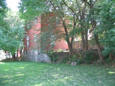
By Craig Swain, September 3, 2007
The Site Today
| Near South Court Street, on the right when traveling north. |
| On Church Street, on the left when traveling east. |
| On Old National Road (Alternate U.S. 40), on the left when traveling west. |
| On West Patrick Street (U.S. 40), on the right when traveling west. |
| On Fry Road, 1.3 miles east of Point of Rocks Road (Maryland Route 464), on the right when traveling north. |
| On National Road (Alternate U.S. 40) at Finzel Road, on the right when traveling west on National Road. Reported missing. |
| On National Pike (U.S. 40) 0.8 miles east of the Pennsylvania state line, on the right when traveling west. |
| On National Pike (Alternate U.S. 40) west of Springs Road (Maryland Route 669), on the right when traveling west. |
| On National Pike (Alternate U.S. 40) east of Chestnut Ridge Road (U.S. 219), on the right when traveling east. |
| Near Westlake Terrace, 0.1 miles west of Westlake Drive, on the left when traveling west. |
| On Wisconsin Avenue (Maryland Route 355) at Montgomery Lane, on the right when traveling south on Wisconsin Avenue. |
| On Western Avenue at Chevy Chase Circle, on the right when traveling west on Western Avenue. |
| On North Frederick Road (Maryland Route 355) just south of Stringtown Road. |
| On North Frederick Road (Maryland Route 355) south of Stringtown Road, on the right when traveling south. |
| On South Frederick Avenue (Maryland Route 355) at South Summit Avenue on South Frederick Avenue. |
| On Courthouse Square near East Jefferson Street (Maryland Route 28), on the right when traveling south. |
| On East Jefferson Street west of Maryland Avenue, on the right when traveling west. |
| Near Fort Frederick Road south of Big Pool Road (Maryland Route 56), on the right when traveling south. |
| On National Pike (U.S. 40) at Big Pool Road (Maryland Route 56), on the left when traveling west on National Pike. |
| On Fort Frederick Road south of Big Pool Road (Maryland Route 56), on the right when traveling south. |
| On Fort Frederick Road, on the left when traveling south. |
| Near Fort Frederick Road south of Big Pool Road (Maryland Route 56). |
| On Appalachian Trail, on the right when traveling north. |
| On Cumberland Street (U.S. 40) at Martin Street, on the right when traveling west on Cumberland Street. |
| On South Potomac Street (Maryland Route 65) just north of West Memorial Boulevard, on the right when traveling south. |
| On Key Street at Highland Avenue, on the right when traveling south on Key Street. |
| On Virginia Avenue at High Street, on the left when traveling north on Virginia Avenue. |
| On Western Pike (Maryland Route 144) at Locher Road, on the left when traveling west on Western Pike. |
| On West Main Street (State Highway 34) at South Mechanic Street, on the right on West Main Street. |
| On E. Potomac Street (U.S. 11) 0.1 miles east of Williamsport Pike (Maryland Route 63), on the right when traveling east. |
| On Main Street (U.S. 7) west of North Street, on the right when traveling west. |
| On Main Street (U.S. 7) west of North Street, on the right when traveling west. |
| On Main Street (Massachusetts Route 2) east of Park Street, on the right when traveling east. |
| On Bay Road close to Turkey Farm Road, on the right when traveling north. |
| On High Street (Massachusetts Route 1A) at Green Street, on the right when traveling south on High Street. |
| On Beach Street, on the right when traveling south. |
| On Turkey Hill Street at Arrowhead Way, on the right when traveling north on Turkey Hill Street. |
| On Bernardston Road (U.S. 5), on the right when traveling north. |
| On Brattleboro Road (U.S. 5), on the left when traveling north. |
| On Huckle Hill Road close to West Road, on the right when traveling north. |
| On Northfield Road (U.S. 10), on the right when traveling west. |
| On Greenfield Road (U.S. 5) north of Main Street, on the right when traveling north. |
| On Albany Road at Old Main Street, on the left when traveling north on Albany Road. |
| On Eunice Williams Drive, 0.5 miles Leyden Road, on the left when traveling west. |
| On East Hawley Road, on the right when traveling north. |
| On Millers Falls Road (Massachusetts Route 63) close to S. Mountain Road, on the right when traveling north. |
| On Millers Falls Road (Massachusetts Route 63) close to Homer Road, on the right when traveling north. |
| Near U.S. 10. Reported missing. |
| On Main Street (U.S. 10) close to Maple Street, on the left when traveling north. |
| On South Maple St., on the right when traveling north. |
| On U.S. 20 close to Warren Road (Massachusetts Route 19), on the left when traveling east. |
| On U.S. 20 at Warren Road (Massachusetts Route 19) on U.S. 20. |
| On North Lane (Massachusetts Route 9) south of Cemetery Road, on the right when traveling south. |
| On Russell Street (Massachusetts Route 9), on the right when traveling east. |
| On Boston Road close to River Street. |
| On Billerica Avenue just north of Hickory Lane, on the right when traveling north. |
| On Dudley Road at Mt. Wayte Avenue, on the right when traveling north on Dudley Road. |
| On Pawtucket Blvd at Island Road on Pawtucket Blvd. |
| On North Main Street (Massachusetts Route 27) just south of Coolidge Street, on the right when traveling south. |
| On Water Row at Old Sudbury Road (State Route 27), on the left when traveling north on Water Row. |
| On Pleasant Street near Winn Street. |
| On Washington Street (Massachusetts Route 138). |
| On Main Street, in the median. |
| On Barre Road at Hardwick Road, in the median on Barre Road. |
| On Massachusetts Route 12 at Huguenot Road, on the left when traveling south on State Route 12. |
| On Harwood Street close to Old Webster Road, on the right when traveling east. |
| On Massachusetts Route 12, 0.1 miles Johnson Lane, on the right when traveling south. |
| On Main Street (Massachusetts Route 122A) at Pleasantdale Road, on the left when traveling east on Main Street. |
| On W Main Street (Massachusetts Route 9) at Massachusetts Route 49, on the left when traveling east on W Main Street. |
| On W Main Street (Massachusetts Route 9) at Massachusetts Route 49, on the left when traveling east on W Main Street. |
| On Thompson Road at Lake Street, on the right when traveling south on Thompson Road. |
| On Massachusetts Route 67 at Winter Street, on the right when traveling north on State Route 67. |
| On North Huron Avenue at East Jamet Street, on the right when traveling north on North Huron Avenue. |
| Near Headlands Road north of McGulpin Point Road, on the right when traveling north. |
| Near Headlands Road north of McGulpin Point Road, on the right when traveling north. |
| On Elmwood Street just north of Forest Avenue, on the right when traveling east. |
| On Washington Blvd. at Jefferson Ave., on the right when traveling east on Washington Blvd.. |
| Near Atwater Street south of St. Aubin Street. |
| Near River Drive near Stewart Avenue. |
| Near Orleans Street near South Canal Street (Business U.S. 84). |
| On Pierce Street at President Avenue, on the right when traveling east on Pierce Street. |
| Near Natchez Trace Parkway (at milepost 107.9), 4.4 miles north of Old Canton Road, on the right when traveling north. |
| On Wornall Road, on the right when traveling south. |
| On State Highway 94 north of Lucille Avenue, on the right when traveling north. |
| On Lucille Avenue east of Alice Avenue, on the left when traveling east. |
| On Pine Lake Road near South 30th Street. |
| On New Hampshire Route 119 at Templeton Turnpike, on the left when traveling south on State Route 119. |
| On New Hampshire Route 119 west of Templeton Turnpike, on the left when traveling west. |
| On New Hampshire Route 12, 0.9 miles north of Upper Walpole Road, on the right when traveling north. |
| On Prospect Street (U.S. 3) at Portland Street (U.S. 2), in the median on Prospect Street. |
| On Darthmouth College Highway at Horse Meadow Road on Darthmouth College Highway. |
| On Dartmouth College Highway, 0.2 miles south of S. Court Street. |
| On North Main Street, 0.2 miles north of U.S. 202, on the right when traveling north. |
| On Main Street (New Hampshire Route 12) north of Olcott Lane, on the left when traveling north. |
| On Main Street (New Hampshire Route 12) north of Olcott Lane, on the left when traveling north. |
| On Pascack Road at Wierimus Lane, on the left when traveling north on Pascack Road. |
971 entries matched your criteria. Entries 101 through 200 are listed above.
⊲ Previous 100 —
Next 100 ⊳