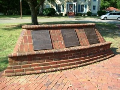
On Maxwell Boulevard at Magnolia Drive, on the right when traveling west on Maxwell Boulevard.
During the late 1950’s three courses at Air Command and Staff College: the Weapons course, the Squadron Officer course, and the Academic Instructor course, became separate schools under the AU umbrella.
”…It is regrettable that what . . . — — Map (db m64373) HM
On Maxwell Boulevard at Magnolia Drive, on the right when traveling west on Maxwell Boulevard.
HQ USAF realigned AU under Air Training Command (ATC) in 1978. For five years AU remained a part of ATC. On 1 July 1983, AU regained its major command status. ROTC was reassigned to ATC. The College of Aerospace Doctrine, Research and Education, . . . — — Map (db m64376) HM
On Maxwell Boulevard at Magnolia Drive, on the right when traveling west on Maxwell Boulevard.
In 1931 Maxwell Field began its mission to educate Army Air Corps officers in strategy, tactics, and techniques of air power. Many early Air Force leaders attended Air Corps Tactical School here including Generals Vandenberg, Twining, White, and . . . — — Map (db m64369) HM
On Maxwell Boulevard at Magnolia Drive, on the right when traveling west on Maxwell Boulevard.
The tradition of excellence established by Air University pioneers will continue throughout the next fifty years… AU’s ability to educate people and develop critical thinkers is a mission that continues today. Now, more than ever, the United . . . — — Map (db m64427) HM
All discipline for the moment seems not to be joyful, but sorrowful, yet, for those who are trained by it, afterwards, it yields the peaceful fruit of righteousness.
Hebrews 4:11
Maj. Norman L. Lowry III
Capt. Willie T. Mays
Capt. . . . — — Map (db m64484) WM
On Maxwell Boulevard at Magnolia Drive, on the right when traveling west on Maxwell Boulevard.
Deja vu, once again, 1993, AU was aligned with ATC but this time to form Air Education and Training Command. Enlisted professional military education was consolidated, Officers Training School moved to Maxwell, and ROTC and CCAF were again part . . . — — Map (db m86055) HM
On Hall Street at Tatum Street, on the right when traveling south on Hall Street. Reported missing.
Alabama State University. The Early Years. Founded in 1867, the Lincoln School in Marion, Alabama became the first state-assisted normal school for African Americans in 1874. The school prospered in that location for 13 years, . . . — — Map (db m254913) HM
Alabama State University. Founded 1866 as the Abraham Lincoln Normal School in Marion, Alabama by nine former slaves. Operated from 1868 until 1874 by the American Missionary Association. The school began to receive state funding in 1874, . . . — — Map (db m86061) HM
On Rosa L. Parks Avenue at National Street, on the right when traveling north on Rosa L. Parks Avenue.
Beulah Baptist Church was organized in the home of Monday and Dora Duvall, on the corner of Hull and Winnie Streets. Rev. William (Billy) Jenkins served as the pastor when the first church building was erected on Norton Street. Beulah served as the . . . — — Map (db m71377) HM
On Tullibody Drive at University Drive North, on the right when traveling north on Tullibody Drive.
Side 1
On Dec. 1, 1955, at Alabama State College (now Alabama State University) in a basement room in Councill Hall, the Montgomery Bus Boycott was planned and publicized after the arrest that day of Rosa Parks, who refused to give up . . . — — Map (db m91279) HM
On South Court Street at Mildred Street, on the right when traveling south on South Court Street.
Civil War-Barnes School
In April 1865, the Union Army command made this house its headquarters. Mrs. Pickett hid her silver on an inside ledge of the cupola. Later, former Confederate Generals Hood, Bragg, and Walker visited here. In 1906, . . . — — Map (db m86072) HM
On North Perry Street at Madison Avenue, on the right when traveling north on North Perry Street.
Elijah Cook
Educator, Businessman, Lawmaker
Born a slave in Wetumpka in 1833, Elijah Cook became a leader in Montgomery’s African American community. Credited with helping to establish the city’s first school for blacks in the basement . . . — — Map (db m69222) HM
Near Dexter Avenue west of North Bainbridge Street.
Emancipation
The end of the Civil War in April 1865 and ratification of the
13th Amendment to the U.S. Constitution meant the end of
enslavement for approximately four hundred thousand black
Alabamians. Freedmen embraced emancipation by . . . — — Map (db m182603) HM
On Adams Avenue at South Hull Street, on the left when traveling east on Adams Avenue.
Thomas Goode Jones, governor of Alabama from 1890-1894, occupied this house during his long political career which took him from the Montgomery City Council to a federal judgeship. During his two terms as governor, his home was the Executive Mansion . . . — — Map (db m36585) HM
On Macedonia Drive 0.3 miles east of Woodley Road (County Road 39), on the left when traveling east.
The Harrison L. Price Educational Wing is dedicated
in loving memory of Reverend Harrison L. Price, Sr.,
who served faithfully as Pastor of Macedonia
Missionary Baptist Church from March 1972 until his
death on February 6, 2008. Under his . . . — — Map (db m260226) HM
Near Dexter Avenue at North Decatur Street, on the right when traveling west.
A native of Tuscumbia, he was the son of Reverend Marvin R. Heflin and Louise D. Strudwick Heflin. He was a graduate of Colbert County High School, Birmingham Southern College, and the University of Alabama School of Law. He was a past President of . . . — — Map (db m69336) HM
Near Dexter Avenue at North Decatur Street, on the right when traveling east.
A native of Notasulga in Macon County, Alabama, he was the son of Mrs. Stella Elizabeth (Burks) Livingston and Mr. James Cooper Livingston of Macon County.
Chief Justice Livingston attended the public school of Macon County and Alabama . . . — — Map (db m86123) HM
On Hall Street at Grove Street, on the right when traveling south on Hall Street.
This home was originally owned in 1901 by Emily V. Semple. It changed hands several times until purchased by Flora K. Daniels and Arlam and Johnnie R. Carr, Sr. The Carrs moved into this residence in 1943. They resided here during the 1955 . . . — — Map (db m282856) HM
On West Jeff Davis Avenue at Bragg Street, on the right when traveling east on West Jeff Davis Avenue.
Loveless School
Montgomery's first junior and senior high schools for African American students began in Loveless School. Built in 1923 and enlarged in 1930, this building first housed seven grades; the opening of Carver Elementary School and . . . — — Map (db m71082) HM
On Old Wetumpka Highway (County Road 74) at Brooks Road, on the left when traveling north on Old Wetumpka Highway.
In 1890, Elijah Madison Jr., Charles Branson, Charles Braswell and others donated funds to construct a private school in the Madison Park Community, which was founded by 14 former Slaves in 1880. A storm soon destroyed the first school building. . . . — — Map (db m142146) HM
On South Jackson Street at Tuscaloosa St. on South Jackson Street.
In 1900, Marshall Moore and his wife, Agnes V. McClain commissioned Joseph G. Nesbitt, Sr., an African-American contractor/builder, to construct this Victorian period cottage. The Moores, among the first graduates and early faculty members of . . . — — Map (db m310804) HM
Near Maxwell Boulevard just east of North Holt Street, on the right when traveling west.
The Air Force presence in Montgomery, Alabama began in April 1918 with the
establishment of the U.S. Army Air Service's Aircraft and Engine Repair Depot #3 at
the same site as the earlier Wright Brothers' flying school. On November 8, 1922,
the . . . — — Map (db m146981) HM
On Maxwell Boulevard east of North Holt Street, on the right when traveling west.
In 1910, Wilbur and Orville Wright opened a flying school on the
Kohn plantation west of Montgomery where for three months they
trained aviators and made history with the first night flight. Today,
Maxwell AFB, home of the Air University, the Air . . . — — Map (db m146978) HM
On Washington Avenue at South Perry Street, on the left when traveling west on Washington Avenue.
Montgomery County Circuit Court
Site of Major Civil Rights Cases 1956-1960
In 1956, 89 persons were indicted for violating an anti-boycott law; Rosa Parks' conviction was appealed; the Montgomery Improvement Association car . . . — — Map (db m94925) HM
On Holcombe Street at Mildred Street, on the right when traveling north on Holcombe Street.
This congregation was organized by the Court Street Methodist Church in the early 1850s. The latter group offered their 1835 wood frame building to the black members if they would relocate it. In 1852 the church was moved to this site under the . . . — — Map (db m168917) HM
On South Holt Street at Bullock Street, on the right when traveling south on South Holt Street.
Born April 11, 1899, on the corner of Jefferson Davis Avenue and Holt
Street, Percy Lavon Julian was the eldest child of James S. Julian and
Elizabeth (Adams) Julian. He attended segregated public schools in
Montgomery and spent two years at . . . — — Map (db m270094) HM
Near Dexter Avenue east of South Decatur Street, on the right when traveling east.
Professor John Metcalfe Starke "Fessor Starke" 1860-1941A native of Virginia, John Metcalfe Starke received his early education in Petersburg and graduated from the University of Virginia in 1882, earning diplomas in Latin and mathematics. He . . . — — Map (db m86421) HM
Near South Court Street south of Felder Avenue, on the right when traveling south.
Established in 1910 on South McDonough Street, this school was named for the well-known southern poet, Sidney Lanier, who resided in Montgomery 1866-67.
This late Gothic Revival building was constructed 1928-29 to consolidate the original . . . — — Map (db m86424) HM
On Winona Avenue at North Florida Street, on the right when traveling west on Winona Avenue.
While Capitol Heights was a new town, city leaders, including founder and first mayor J. S. Pinckard, donated land for an elementary school. The community partnered with the Montgomery County Board of Education to build the Capitol Heights . . . — — Map (db m81810) HM
On South Union Street at High Street, on the left when traveling north on South Union Street.
This neighborhood evolved around historic First Congregational Church established through the American Missionary Association (AMA) October 6, 1872, by Pastor George Whitfield Andrews. In 1867 the AMA and the Freedmen's Bureau, headed by General . . . — — Map (db m86067) HM
On South Union Street, on the left when traveling north.
Swayne CollegeNamed for Union General and Freemen’s Bureau Agent Wager Swayne, Swayne College was dedicated 21 April 1869. The Bureau appropriated $10,000 for the building and the local black community purchased 3.5 acres for the site. Future . . . — — Map (db m28171) HM
On High Street at South Riley Street, on the right when traveling east on High Street.
Victor H. Tulane Humanitarian (1874-1931)
Victor H. Tulane was born on a Wetumpka farm on April 20, 1874, into a biracial family. At the age of fifteen and with only $13.60 to his name, he walked to Montgomery, determined to establish himself . . . — — Map (db m259415) HM
On East Fairview Avenue at College Street, on the right when traveling east on East Fairview Avenue.
Coeducational liberal arts college of the United Methodist Church
1854: Founded as Tuskegee Female College
1872: Acquired by the Methodist Church, renamed Alabama Conference Female College
1909: Moved to this site as Woman's College . . . — — Map (db m86122) HM
On Georgia Washington Road at Antioch Lane, on the right when traveling south on Georgia Washington Road.
Miss Georgia Washington founded the Peoples Village School for black students on this site in 1893. Georgia Washington was born a slave November 23, 1851 in Virginia. As a student at Hampton Institute, Virginia, she met Dr. Booker T. . . . — — Map (db m72010) HM
On Pike Road (County Route 85) at Flinn Road, on the right when traveling south on Pike Road.
Montgomery County's first school to consolidate rural, one-room school houses into grades one through twelve opened November 11, 1918. The school was built by the Montgomery County Board of Education on 30 acres of land at a cost of $40,000 with . . . — — Map (db m72017) HM
On Federal Road (County Route 24) 0.1 miles west of Mobile Highway (U.S. 31), on the left when traveling west.
(Side 1)
Pintlala Grange Hall
The National Grange of the Patrons of Husbandry was organized in 1867 to provide economic, social and cultural improvements for farmers and their families. Pintlala's Grange Hall was erected circa . . . — — Map (db m71433) HM
On Federal Road (County Route 24) 0.3 miles Mobile Highway (U.S. 31), on the left when traveling west.
Opened in 1923 to consolidate a number of one-, two-, and three-teacher institutions in southwestern Montgomery County including Hope Hull, LeGrand, Mt. Carmel, Grange Hall, Snowdoun, Bethlehem, Fleta, Sankey, and Tabernacle. W.F. Feagin served . . . — — Map (db m71432) HM
On Mobile Highway (U.S. 31) at Big Zion Road, on the right when traveling north on Mobile Highway.
The Big Zion A.M.E. Zion Church and Cemetery were organized in 1867. In 1902, the church building was rebuilt, and the Big Zion School was erected beside the church and cemetery. Although the school moved across the street, the church and . . . — — Map (db m304265) HM
On Mobile Highway (U.S. 31) at Big Zion Road, on the left when traveling north on Mobile Highway.
In 1902, Big Zion School was erected where Big Zion A.M.E. Zion Church sits
today and remained in that location until 1925, when it moved across the
street to its present site. Moses Primus, Jr., served as the principal and only
teacher in 1908, . . . — — Map (db m304263) HM
On State Road 36 0.1 miles east of Johnson Chapel Road, on the left when traveling east. Reported permanently removed.
1936 Olympic Silver Medalist
Morgan County native David Donald Albritton competed at the XI Olympics in Berlin, Germany and became the first Alabama native to win an Olympic track and field medal. During Olympic Trials on July 11, 1936 at . . . — — Map (db m160716) HM
On Alabama 36 (Alabama Route 36) 0.1 miles east of N Johnson Chapel Road, on the left when traveling east.
Morgan County native David Donald Albritton competed at the XI
Olympics in Berlin, Germany and became the first Alabama native
to win an Olympic track and field medal. During Olympic Trials
on July 11, 1936 at Randall's Island in New York City. . . . — — Map (db m299715) HM
On Clara Avenue Southwest north of Clearview St SW, on the right when traveling north.
The pride of its community, Austinville High School opened at this
site in 1937, on land donated by A. J. Roper. It continued as a high
school for students in the surrounding countryside for more than two
decades. In 1959, after the Austinville . . . — — Map (db m299719) HM
On Church Street south of 8th Avenue NE, on the right when traveling south.
When classes began on this site in the late 1800s, the teaching staff
of the East End Public School (also known as the Gibb Street School)
consisted of Professor T. A. Frierson and his wife, Anna B. Frierson.
At the time, it was the only school . . . — — Map (db m158179) HM
On Sycamore Street Northwest north of Wilson Street Northeast (U.S. 72), on the right when traveling north.
During the 1870s, Samuel Schaudies and Abbie Robinson Schaudies moved to this site from Huntsville and purchased this five-room cottage in 1881 for $800.00. The deed lists this site as part of Lot 84, “Old Town” Decatur. In 1875, their . . . — — Map (db m27763) HM
Oral tradition—stories passed from one generation to the next—long told the history of the Cherokee people. Sequoyah was the first to write it down. In 1921, about 90 miles east of Decatur, he created the Cherokee syllabary, a set of 85 . . . — — Map (db m140861) HM
On Terry Lane 0.1 miles east of Bluff City Road, on the left when traveling east.
St. John Elementary School served approximately 40 African American
children in grades pre-primer through sixth, located in Bluff City, an
African American settlement rich in cultural heritage and community
resilience. The school began in St. . . . — — Map (db m309156) HM
On Bibb Street at Early Street, on the right when traveling north on Bibb Street.
Founded 1838
Milo P. Jewett, President
Deeded in 1843 to
The Alabama Baptist Convention
One of the nation's first colleges to offer higher education for women, it has served, since its founding, as a liberal and fine arts . . . — — Map (db m70071) HM
On Lincoln Street at Lee Street, on the left when traveling west on Lincoln Street.
On July 17, 1867, nine ex-slaves (James Childs, Alexander H. Curtis, Nicholas Dale, John Freeman, David Harris, Thomas Lee, Nathan Levert, Ivey Pharish and Thomas Speed) formed and incorporated the “Lincoln School of Marion.” They soon . . . — — Map (db m70096) HM
On Lee Street south of Lincoln Street, on the right when traveling south.
Lincoln Normal School was established in Marion,
Alabama, on July 18, 1867, for the education of African
American children. Nine formerly enslaved men incorporated the school: James Childs, Alexander Curtis,
Nicholas Dale, John Freeman, David . . . — — Map (db m307361) HM
On Jefferson Street at Pickens Street, on the right when traveling east on Jefferson Street.
County Seat of Perry County
Population 4457
Founded by Anderson West in 1822
Home of Judson College
and
Marion Military Institute
Friendly People Welcome You. — — Map (db m116895) HM
On Washington Street 0.1 miles north of Grove Street, on the left when traveling north.
Founded in 1842 as Howard English & Classical School by the Alabama Baptist Convention, with Dr. S. S. Sherman as President, it later became Howard College. Lovelace Hall (Old South Barracks), built 1854, and the Chapel, built 1857, served the . . . — — Map (db m70091) HM
On West Monroe Street at Spring Street, on the left when traveling east on West Monroe Street.
One of the earliest colleges for women in America. Founded in 1835, was the first of four colleges established in Marion,“The Athens of Alabama.”
This building, erected in 1850, contained the art studio of Nicola Marschall, who . . . — — Map (db m70068) HM
Near Columbus Road (Alabama Route 14) at 10th Avenue Northwest, on the right when traveling north.
Summerville Industrial High School, the first high school for African Americans in the southern part of Pickens County, was moved to this site in 1958, becoming Robert Jackson Kirksey High School. The new name honored a long-term member of the . . . — — Map (db m92647) HM
On Jim Locke Road at Copper Road, on the left when traveling east on Jim Locke Road.
This school was erected in c. 1925 and sits on 3 acres donated by two community citizens, Nunnie and Jennie Stinson, parents of Yeuma Stinson-Gillis.
Some educators were: A.B. Bonner, Nora Spencer, Dotha Will Moss, Annie Sherrod, Zora . . . — — Map (db m178783) HM
On County Road 2203 south of County Road 2204, on the left when traveling south.
Built ca. 1860 on land owned by Daniel Carlisle, this school educated Pike County youths until consolidation closed its doors in 1935. In 1895 it was conveyed to trustees for the school by Robert Henry Lee Rodgers for a school. Between 1923 and . . . — — Map (db m92684) HM
On Lockheed Martin Drive (County Route 37) at Old U.S. Highway 231 (County Route 105), on the left when traveling east on Lockheed Martin Drive.
Founded 1848 by legislative act and donations of citizens. Excellent instruction made it only school of kind for youth in area. Later used as public school until 1929 school consolidation.
Orion settled about 1815, by 1830 saw arrival of . . . — — Map (db m71791) HM
On University Avenue west of Luther Drive, on the right when traveling east.
Donated to Troy University by Huo Bao Zhu During the visit of Chancellor Jack Hawkins, Jr. to Xian, China in April 2002.
The gift was made in celebration of the Sino-American 1-2-1 Joint Degree Program and as a lasting symbol of friendship between . . . — — Map (db m38930) HM
On East Academy Street at Farrior Street, on the left when traveling east on East Academy Street.
Side 1
On May 9, 1921, S.B. Innis, C.L. Jenkins, James Henderson, Pres Thomas and C.B. Brooks, the “colored school committee,” entered into a school mortgage for the construction of a building for “colored school . . . — — Map (db m76755) HM
Built in 1929, Bibb Graves Hall opened in September, 1930. It was named for Alabama Governor Bibb Graves (1927-31, 1935-39) who was known as the “education governor.” Bibb Graves Hall served as the original administration building for . . . — — Map (db m38940) HM
On McKinley Drive north of University Avenue, on the left when traveling north.
Built in 1961 and renovated in 1989, the Chancellor's residence is the "front door" to the University. It has served as the entertainment site for international, national, state and local leaders, including ambassadors, U.S. Senators, governors, . . . — — Map (db m111582) HM
Named for Fletcher Thomas Cowart, a Troy University professor of natural science from 1890 to 1919. Cowart Hall was constructed in 1950. Originally a men’s dormitory, it was later used to house junior and senior women students. The structure was . . . — — Map (db m38933) HM
Born in Henderson, Alabama in 1850, Fletcher Jackson Cowart began his working career as a public school teacher. He later served superintendencies for both the Pike County and the Troy City schools. He was editor of the Troy Messenger and a . . . — — Map (db m38934) HM
On University Avenue west of South George Wallace Drive, on the left when traveling west.
“Tailgating" on the Troy campus was initiated during the 1990’s through the example and leadership of Green Davis. In 1993 the area outside of Memorial Stadium was named in honor of Green Davis for his enduring efforts to boost Trojan . . . — — Map (db m38929) HM
Near Luther Drive 0.1 miles north of University Avenue, on the left when traveling north.
Janice Hawkins Park was named in honor of the First Lady of Troy University, a devoted wife and loving mother, whose work benefited Troy in the fine arts, service to students, internationalization of the University, and support of military veterans. . . . — — Map (db m111581) HM
Near University Avenue, on the right when traveling west.
Built in 1929 and originally named for Gov. Bibb Graves,
this building was renamed in 2020 in memory of U.S. Rep.
Lewis, a central figure in the U.S. civil rights movement.
Nicknamed "the boy from Troy" by Dr. Martin Luther King,
Jr., he was the . . . — — Map (db m168100) HM
The original structure was named for Charles Roderick McCall, Professor of Languages at Troy Normal School from 1890 to 1898. It was constructed in 1960-1961 to house the various sciences. In 1999, the structure was renovated and enlarged to house . . . — — Map (db m38938) HM
Built in 1946 as a men’s dorm. Named for Matthew Downer Pace, who served Troy University from 1891 to 1941 as Professor of Mathematics, Dean and President. The building was made necessary by the heavy influx of male students enrolling immediately . . . — — Map (db m38931) HM
On Luther Drive north of University Avenue, on the right when traveling north.
Originally constructed as the home field for the university’s football and baseball teams. Pace Field, home of the Troy Trojans and the Troy baseball team in the late 1930s and 1940s, stood at the location of the current Riddle - Pace Field. It is . . . — — Map (db m38935) HM
On University Avenue at Luther Drive, on the right when traveling west on University Avenue.
Rushing Hall was named in honor of distinguished Class of 1965 Troy Alumni, Sue and Lewis Rushing, of Birmingham, Alabama by the Troy University Board of Trustees on February 22, 2018. It was named in recognition of the Rushings' loyalty to Troy . . . — — Map (db m205227) HM
Built during 1929, Shackelford Hall opened to students in September 1930. It was named for the institution’s president Edward Madison Shackelford, who served from 1899 to 1936. Adjoining this building was the original dining facility for the campus. . . . — — Map (db m38932) HM
On University Avenue west of Luther Drive, on the left when traveling west.
Troy State Normal School was established by the Alabama General Assembly in 1887. Land and the first building for the original downtown campus and land for the present site were provided by the City of Troy. The College was moved to the present site . . . — — Map (db m38937) HM
On Lafayette Highway 0.1 miles north of West Point Street, on the right when traveling north.
Randolph County Training School (RCTS) was chartered on
September 15, 1919 as a public school for African Americans. It
opened in the fall of 1920 with 73 students. The original two-story
wood structure was built with contributions from black . . . — — Map (db m235575) HM
On Lafayette Highway (Local Route 252) 0.2 miles south of Main Street ( Route 22), on the right when traveling south.
Clark Funeral Home was established on this site in 1969 by Wilkie Clark and his wife and business partner, Hattie Peters Clark, representing the life-long dream of the well-known civil rights activist and entrepreneur. The funeral home was . . . — — Map (db m282042) HM
In September 1821 Rev. William Capers was sent to Fort Mitchell, by the South Carolina Conference of the Methodist Episcopal Church, to negotiate with the chiefs of the Creek Indian Nations for a mission which would teach their children reading, . . . — — Map (db m26121) HM
On Alabama Route 165 south of Mt. Olive Drive, on the right when traveling south.
1916. In 1916, Mt. Olive School was built on Ft. Mitchell Highway across the highway from the current location of the school. Philanthropist Julius Rosenwald, in partnership with Booker T. Washington, created matching grants to fund rural . . . — — Map (db m302424) HM
On Old Seale Highway (County Road 137) 0.3 miles north of Penny Well Road, on the left when traveling north.
One of the earliest white settlements in the Old Creek Indian Nation. James Elizabeth Glenn, who named the town, and his brother Thompson Glenn, arrived here in 1835 only to have to evacuate during the Indian uprisings of 1836, at which time all . . . — — Map (db m284357) HM
On 5th Avenue at 15th Street, on the left when traveling north on 5th Avenue.
(side 1)
Born at New Site, Alabama, he grew up working on his parents’ farm. In 1916 he worked in the oil fields in Texas and joined the Texas National Guard. He married Agnes Benson of Alabama in 1917. In 1918 he was commissioned an . . . — — Map (db m69114) HM
On Seale Road at 4th Street, on the right when traveling north on Seale Road.
On October 11, 1939, Father Harold Purcell established Mother Mary Mission for the education of African Americans in Phenix City. In 1940, the Vincentian Sisters of Charity of Pittsburgh arrived to operate the mission. The Salvatorian Fathers of . . . — — Map (db m253882) HM
On Fontaine Road north of 6th Street South, on the right when traveling north.
South Girard High School was the first public high school for black students in Phenix City. The school was originally located on 11th Street South. Enrollment began with five students in 1945 and gradually increased to over 400 students in 1963. . . . — — Map (db m253870) HM
On 11th Avenue just north of 15th Street, on the right when traveling north.
In 1953 the Phenix City Elementary School for Negroes was constructed during the tenure of L.P. Stough, Phenix City School Superintendent. It was built to accommodate 488 students with 13 classrooms, a multi-purpose room, clinic, library, cafeteria . . . — — Map (db m173475) HM
Near Old Seale Highway (U.S. 431) 0.6 miles south of Villula Road (County Road 58), on the left when traveling south.
Originally known as Vilula, this community was formed about 1848 as a stage coach stop. For many years the only post office in the central part of the county was located here. William A. Lester served as the first postmaster. The Villula . . . — — Map (db m188837) HM
On Oswichee Road (County Road 18) 1.9 miles east of Greenburt/Nuckols Roads (County Road 39), on the right when traveling east.
Macedonia Missionary Baptist Church
Macedonia Baptist Church was organized in 1870 by Pastor Robert Fegins with the assistance of twelve members from Providence Baptist Church. The first person baptized in the church was Mr. Charles Smith . . . — — Map (db m78113) HM
The history of Alabaster is proudly rooted in industrial development.
During the mid-to-late 19th century, cotton mills were built along
rivers for their hydropower, usually in rural areas and near
railroads, both of which made the Siluria . . . — — Map (db m295139) HM
On Alabama Route 25 at County Road 23, on the right when traveling east on Alabama Route 25.
James Hardy and his twin brother, Julian, were born and reared in Newala, Alabama, 3 miles east of Montevallo. He attended the consolidated grammar school nearby which had 3 rooms for the 6 grades, then attended high school in Montevallo. James . . . — — Map (db m76244) HM
On Gilmore Nick Circle at Vassar Circle, on the left when traveling north on Gilmore Nick Circle.
In the 1930s, the Shelby County educational system consolidated many of its
one-, two-, and three-teacher schools. During the 1938-39 school year,
the citizens of Almont donated a five-acre plot to establish a school for
African American . . . — — Map (db m307411) HM
Known as the Alabama College Laboratory School, Montevallo High School was housed in Reynolds’ Hall on the University of Montevallo campus from 1922 until January 1930 when the central portion of this building was completed. The original structure . . . — — Map (db m37428) HM
On Samford Street near Selma Road, on the right when traveling west.
On this site stood Prentice High School, established in 1950 to meet the need for an African American high school in Montevallo. Before the school was built, Black students had to travel eighteen miles to Columbiana for secondary
education. The . . . — — Map (db m307405) HM
On Salem Road (County Road 15) 0.1 miles north of Polk Drive, on the left when traveling north.
From the late nineteenth century until 1927 a one-room public school operated on the site of the
Memory Chapel. The children of many of the area's
leading families attended the school, including those
with surnames Bearden, Burgin, Harrison, . . . — — Map (db m295138) HM
On Selma Road north of Quarles Street, on the right when traveling south.
During the Jim Crow era, Selma Road served as the business, social, and
cultural center for African Americans in Montevallo. Most of the commercial
buildings in the district were owned by Hampton D. and Exie P. Lee an
affluent Black couple from . . . — — Map (db m295137) HM
On Island Street west of Bloch Street, on the right when traveling west.
Operating from as early as 1924 to 1939, the first public school for Black children in Montevallo stood on this corner. Known affectionately as the "Little School," the two-room school was built with funds raised by the African American community . . . — — Map (db m295102) HM
On Highland Street south of Bloch Street, on the left when traveling north.
Originally named Alabama Girls' Industrial School and later Alabama College, this institution was founded Oct. 12, 1896, by the Alabama Legislature. It was the state college for women until 1956, when it became coeducational. In 1969 the name was . . . — — Map (db m37289) HM
On County Road 85 at County Road 62, on the right when traveling west on County Road 85.
Founded July 19, 1911 in the Arkwright community near the Atlantic
Coast Line railroad crossing at what is now Highway 62 East. The
first pastor was Brother T.M. Nelson. Services were held in Pop Ray's
store until a storm destroyed the building. . . . — — Map (db m295030) HM
On 8th Street 0.1 miles south of 8th Avenue, on the right when traveling north.
This park was dedicated on May 15, 1990 to D. O. Langston for his service to the town of Ashville, his support for senior citizens, and his enduring impact on our community.
A native of Oakvale, Mississippi, Mr. Langston was born in 1904 and died . . . — — Map (db m156372) HM
On 5th Street (U.S. 411) at 7th Avenue, on the right when traveling south on 5th Street.
Greek revival antebellum home built by Moses Dean in 1852, acquired by John W. Inzer in 1866. Home occupied by Inzer family from 1866 to 1987. In July 1987 home and its contents, including extensive law library, deeded by family heirs to St. Clair . . . — — Map (db m28092) HM
On Liberty Road at U.S. 411, on the right when traveling west on Liberty Road.
Liberty Cumberland Presbyterian Church was organized on this site in March, 1835. However, the congregation probably met here as early as 1821, when Rev. Peter Harden and other Presbyterians first settled in the valley. The present church building . . . — — Map (db m217728) HM
On North Washington Street (U.S. 11) just north of North Street, on the left when traveling north.
Former site of the Houston-Bailey House, built ca. 1835 as a residence by Matthew C. Houston, a founding citizen and early merchant of Livingston. The home was visited by his cousin, Sam Houston, in 1845. Later residents included Adolph Brown, who . . . — — Map (db m228699) HM
On North Washington Street (State Highway 11), on the left when traveling north.
Chartered in 1840 as Livingston Collegiate Institute (1835: Female Presbyterian Academy planned). In 1883, by work of Julia Tutwiler, Alabama legislature made its first grant of funds to a girls school. In 1907: State Normal school. In 1929: became . . . — — Map (db m109526) HM
On South Street East (State Highway 77) at East Street South, on the right when traveling east on South Street East.
By action of the Alabama Conference of The Methodist Episcopal Church, South in session at Talladega, December 13-18, 1854, Auburn University and Birmingham - Southern College were born. The delegation resolved to “have a college within the . . . — — Map (db m28202) HM
On Ashland Highway (State Highway 77) east of Chaffee Street, on the right when traveling east.
Originally conceived 1864 as a home for children of Confederate dead by Synod in session at Selma.
Opened at Tuskegee 1868 - relocated in Talladega 1891. A haven for dependent youth of Alabama providing training, education, and worship in a . . . — — Map (db m28206) HM
19416 entries matched your criteria. Entries 401 through 500 are listed above. ⊲ Previous 100 — Next 100 ⊳