Early Years of Statehood
In the early years of statehood, silver strikes at Leadville and Aspen brought settlers and money into Colorado. Rail lines, smelters, and refineries were built, and large coalfields were opened up.
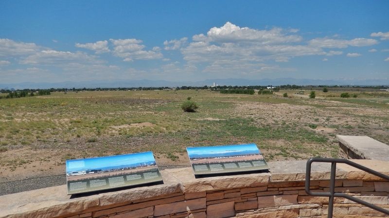
The High . . . — — Map (db m119387) HM
This Headquarters area is dedicated in honor of all the Rocky Mountain Arsenal employees who accomplished the production, demilitarization, and environmental restoration at the Arsenal from 1942 until 2012 — — Map (db m162066) HM WM
As the focus changed to environmental cleanup, Building 111 became the headquarters of this new mission-and of a public-private partnership among the U.S. Army, Shell Oil Co. and U.S. Fish and Wildlife Service. Years of
Partnership Called . . . — — Map (db m163885) HM
Arsenal Beginnings
Building 111, also known as the “White House, "was located north of the flagpole area. The building was the U.S. Army's headquarters
from the time the Arsenal was established in 1942 until the building was . . . — — Map (db m163883) HM
Above this sign, a mile away, 230 buildings once stood. The U.S. Army constructed South Plants in 1942 to produce chemical weapons for World War II — — Map (db m156147) HM
Ma Barker's infamous son, Lloyd "Red" Barker traded in a life of crime for a life in Westminster in the 1940s. Lloyd grew up as part of the Barker Gang, described by FBI Director J. Edgar Hoover as "the toughest gang of hoodlums the FBI has ever . . . — — Map (db m69547) HM
This monument is placed here to preserve the important history of the start of the whole San Luis Valley, by the Denver and Rio Grande Railroad's entrance to Alamosa.
The work train arrived in Alamosa in late 1877, and the first passenger train . . . — — Map (db m160877) HM
Colorado's first home railroad was begun in 1871. William J. Palmer, Civil War veteran and founder of the Denver and Rio Grande, felt that transportation was the key to success in this new, undeveloped land.
"Narrow gauge" railroad was a new . . . — — Map (db m160929) HM
Emblematic of the courage, fortitude, and vision of those stalwart pioneers and valiant railroad builders who foresaw a great future in the Southwest, this monument is installed to guide the way for posterity in this mighty empire.
29th January. Thursday. Finding the distance too great to attempt crossing immediately to the river, in a direct line, we marched obliquely to a copse of woods, which made down a considerable distance from the mountains. Distance 17 miles. Saw . . . — — Map (db m145393) HM
As you travel through these sandy grasslands, notice the bright white surface deposits visible along the highway to the west. The sabkha forms where sand is seasonally saturated by rising ground water. When the water evaporates away in late . . . — — Map (db m160687) HM
The first railroad to reach present-day Littleton was the Denver & Rio Grande on October 28, 1871. The line was being built by William Jackson Palmer to connect Denver to the resort community he had just founded, Colorado Springs. Richard Little's . . . — — Map (db m177545) HM
One of the earliest buildings in Littleton was the J. D. Hill General Store. Julius D. Hill, known as J.D., was born in Massachusetts in 1843 and served in the Union Army during the Civil War. Hill came to Littleton in 1870 and was employed by the . . . — — Map (db m177629) HM
At various points in its history, the Rough and Ready Mill churned out flour, lumber, and livestock feed. But the end product was always the same: growth for Littleton. Built in 1867 by pioneers Richard Little, Joseph Bowles, and John Lilley, among . . . — — Map (db m177558) HM
Pagosa Springs has a rich history, beginning with the Anasazi Indians. Later the Utes, Navajos and Apaches inhabited this beautiful corner of the Southwest. They also visited the great “Pagosah” hot springs which they believed had . . . — — Map (db m27527) HM
This sign marks the site of The Holiday Drive-In, which operated from 1953 until 1988. Drive-In theaters were popular in the 1950s and 1960s, especially among young families and amorous couples, where films could be viewed from the relative . . . — — Map (db m18299) HM
This building was the site of a continuously operated dry goods store from 1874 until the closing of Brooks-Fauber in 1986. It is one of the oldest commercial structures in the downtown historic district. — — Map (db m87716) HM
If you were here in 1908, you'd be singing, dancing or playing poker at the luxurious Crags Hotel. The Hotel's success was short lived. A fire destroyed the building in 1912.
Archaeologists who studied this site discovered significant . . . — — Map (db m185412) HM
This mural is a composite of two historical photographs. One is the 1862 image of our town's founder, Mary Miller with her husband, Lafayette, (D. 1878), for whom she named the town. Mary platted 150 acres and sank the first coal mine shaft in 1887. . . . — — Map (db m87606) HM
Front
Colorado's Northern Coal Field: Lest We Forget
Colorado's immense northern coal field, centered beneath these rolling hills, contributed to the early development and growth of Colorado and to the birth of nearby towns. . . . — — Map (db m119521) HM
Native peoples traveled through the Upper Arkansas Valley for centuries before European and American explorers.
Ute, Comanche and other tribes traveled on foot until the arrival of the Spanish and the introduction of the horse in the 1600’s. . . . — — Map (db m107827) HM
With the discovery of gold in California Gulch in 1860, getting to Oro City (now Leadville) meant an opportunity for fame and fortune.
It would, however, be twenty years before railroad service traversed the Upper Arkansas . . . — — Map (db m107833) HM
In the late 1800’s, transportation of goods and people could be an arduous undertaking.
Gold and silver fever led many to endure travel up the Arkansas River from Canon City to Leadville.
Although arguably the largest and most notorious, . . . — — Map (db m107835) HM
Electricity was introduced in Salida in 1887 when a group of local townsfolk created The Electric Illuminating Company. In 1892 the then-named Salida Light and Power Company built a 1000-kilowatt steam generating plant at this location on the banks . . . — — Map (db m52403) HM
The Texas-Montana, Bacon and Potter, and J.S. Chisum trails converged in this vicinity. Over these routes great herds of Texas Longhorns, scions of hardy stock from Spain, moved northward. Big Springs, 2.4 miles west, was an important cattle . . . — — Map (db m87888) HM
The Griffith Lode (2,500 ft. N.E.), later a silver producer, was discovered June 17, 1859, by George W. Griffith, for whom Georgetown was named. Town site claimed June 29, 1860. The Belmont Lode (5.7 miles S.W.), first important silver discovery in . . . — — Map (db m173244) HM
Thomas Cornish built this elaborate home that combines a French Mansard roof with
Italianate and Gothic Revival detailing. It is one of the last homes in Georgetown to display such exuberance in Victorian architectural styles.
Cornish came to . . . — — Map (db m152842) HM
In the fall of 1872, William Cushman was busily erecting two fine brick buildings, one on either side of his bank building. This one, on the west, had its roof completed as workers laid the foundation for the other one. Undoubtedly Cushman leased . . . — — Map (db m173241) HM
William H. Cushman built this imposing brick Italianate commercial building in two phases. He completed the western part as a two-story structure in 1872. Three years later, Cushman built an adjoining three-story edifice on the corner lot; he . . . — — Map (db m173242) HM
Charles R. Fish, a local banker, built this fine structure for his Bank of Clear Creek County. Today the Fish Block is one of the more prominent and substantial brick commercial buildings in town. It is similar in design, though less elaborate in . . . — — Map (db m173243) HM
The construction history of this building is uncertain. A.R. Forbes was an early owner
and used the space for his drug store until around 1880, at which time he moved his
business to the northwest corner of Alpine (now 6th) and Taos streets. He . . . — — Map (db m152848) HM
Georgetown-Silver Plume
National Historic Landmark District
Hamill House
1867/1879
The Hamill House represents the height of prosperity achieved during Georgetown's mining era. The centerpiece of Historic Georgetown's properties, this . . . — — Map (db m69625) HM
Henry Kneisel built the western unit of this three-bay structure in 1892, and he moved his grocery business into it the following year. Kneisel had all the shelves and bins, which are still in use, built to his personal specifications. From his old . . . — — Map (db m173422) HM
Attorney John McMurdy built this fine structure for offices; it is one of Georgetown's
earliest commercial buildings. Typical of the times, a false front extends above the gable roof, topped by a well-proportioned Italianate cornice.
Jacob . . . — — Map (db m152895) HM
The firm of Teal, Foster, and Co. built this fine brick office building. Brothers George and James Teal and their partner, Ernest Le Neve Foster, were "general mining agents and consulting engineers.” Their ads indicate that they managed . . . — — Map (db m152849) HM
Brothers James F. and Alfred C. Tucker conducted their grocery and provisions business out of this building during the 1870s. They advertised “Wines, Liquors, Tobacco, Queens-ware, Clothing, Boots and Shoes.” Here a customer in 1879 . . . — — Map (db m173240) HM
Arrastras like this one were used by the earliest hard-rock miners in this area to grind gold ore. People skilled in stone cutting made them for the miners from local rock.
This arrastra was chiseled by hand from blocks of hard granite. . . . — — Map (db m144184) HM
Mrs. Coddington owned a two-story brick double on the corner lot. It was occupied by W.K. Townsend (grocer) and Paul Lanius (hardware). Townsend imported glassware and crockery and was said to have the best selection of cigars in town. "Lets all . . . — — Map (db m76856) HM
J.J. Elliott had his assay office in the building which was built in 1879. Often during the boom days of the 1880's dozens of ore wagons were parked on Miner Street in front of the "Exchange". Elliott promoted himself in the city directories of the . . . — — Map (db m76854) HM
Charlie Tayler used this waterwheel to power a stamp mill at his gold mining operations on Ute Creek. Tayler, who attributed his good health to the fact that he never kissed woman or took baths, built the waterwheel in 1893. It was moved to its . . . — — Map (db m74371) HM
Built in 1881, this building housed M. C. Livingstone’s jewelry and sewing machine store during the early ‘80’s. Since Livingstone had some of the first commercial sewing machines in the district, he made a brisk living repairing the canvas awnings . . . — — Map (db m144187) HM
Crowley Communities
If the dry summers of the late 1920s spelled trouble for Crowley County, the Dust Bowl of the 1930s spelled disaster. Many farmers simply packed up and left, and their acreage reverted to grasslands and became cattle . . . — — Map (db m120745) HM
Alexander Barclay
Like so many early Colorado settlers, Alexander Barclay came here in search of fortune but found something else entirely. The British-born corset-maker arrived in 1836 and spent the next nineteen years chasing his dream. He . . . — — Map (db m154830) HM
Western Slope Agriculture
According to an 1888 U.S. Department of Agriculture report, western Colorado's thin soils, high altitude, and lack of rainfall rendered the region totally unfit for cultivation. The document’s author apparently . . . — — Map (db m120123) HM
North Fork Harvests Early pioneers recognized that the mild climate of the Hotchkiss/Paonia area, also known as the North Fork Valley, could support quality fruit production, and in 1882 the first orchards were planted. In 1902 the Denver & Rio . . . — — Map (db m186965) HM
This tablet is the property of the State of Colorado ——— Immediately north-east of this point and covering much of Block 18 East Denver stood the famous Elephant Corral camp ground, immigrant headquarters and stock . . . — — Map (db m203481) HM
18th St. Atrium
1919
One of the last buildings constructed in "Warehouse Row," which stretched from Cherry Creek to the 1900 blocks of Wynkoop Street, 1621 18th Street originated as the warehouse and offices for Bourk, . . . — — Map (db m97346) HM
Blake Street was named after Charles Blake, who came to Denver in 1858, and established supply depots throughout Lower Downtown.
Originally, the area was Denver's warehouse, brothel, and sporting house district. Some of the most infamous . . . — — Map (db m97357) HM
"Visitors to Denver will certainly find a great improvement because they will… step aboard any one of the different lines right at the door of Union Station."
The Denver Post, May 26, 1918
(opening day of the Denver Tramway . . . — — Map (db m118591) HM
”Union Station belongs to all of us.”
Union Station neighbor, 2002
Rich or poor, famous or anonymous, everybody passed through Union Station from the time it opened in 1881. A trip to the station meant something new was . . . — — Map (db m118585) HM
Denver's emergence as the metropolis of the Rockies is directly related to its role as the regional rail hub. When the transcontinental railroad chose Cheyenne and not Denver as its gateway to the west, Denverites rallied. Civic leaders such as . . . — — Map (db m237361) HM
Windsor Farm Dairy Building
1918
A building with a milky past, the Windsor Farm Dairy was built in 1918 for $30.000. A leading Denver architectural firm, Fisher & Fisher, designed this red brick structure with terra cotta . . . — — Map (db m97358) HM
At the very heart of Denver’s rough beginnings, Fifteenth Street actually followed the old military trails from Santa Fe, Fort Union and trading posts north and south of Denver. It was here that General Larimer expropriated the one . . . — — Map (db m118601) HM
The significance of 1514 Blake St. lies in its connection to the remarkable life of black pioneer Barney Ford. Ford was born a slave on January 22, 1822 in Stafford, Virginia, but escaped to Chicago, where he worked with the underground railroad . . . — — Map (db m118597) HM
For more than a century, Denver's warehouse district has centered on Wynkoop. Stimulated by the arrival of the railroads in 1870 and the subsequent need for distribution services, an impressive array of three-to-five story warehouses, flat roofed . . . — — Map (db m97395) HM
Constructed in 1896 for $75,000, the Morey Mercantile Building was the first notable warehouse to be built after the 1893 silver crash. Designed by Gove & Walsh, the structure included a spice grinding mill, roasting plant, extract laboratory and . . . — — Map (db m97396) HM
In the 1860’s, when gold from Colorado’s grubstakes began flowing into Denver at a mad pace, the costly and risky problem of shipping it to banks back East was neatly solved by Clark, Gruber and Co. In a building near this site, the banking firm . . . — — Map (db m51712) HM
The area known today as Lower Downtown, is the Location of the original town of Denver. Gold seekers from Lawrence, Kansas staked the first claim in September of 1858, under the name St. Charles Town Association, but they left only one man to . . . — — Map (db m27493) HM
Originally built as the stables for the Denver City Railway Company in 1883, this building was the birthplace of Denver's Public Transportation system. Horse drawn trolleys, soon replaced by one of America's most extensive cable car networks, . . . — — Map (db m97394) HM
This building is named for Edward W. Wynkoop (1836-1891) to honor his peacemaking efforts, though unsuccessful, to resolve the Indian-white conflict which resulted tragically in the Sand Creek Massacre in 1864.
Exaggerated reports of . . . — — Map (db m97294) HM
The pattern of ownership of 1545 Wazee Street symbolizes the development of Denver's rail age boom as an industrial and supply city requiring large scale warehousing. Its first owner and occupant, Henry Lee, was an agriculturist, pioneer gardener . . . — — Map (db m27242) HM
General William H. Larimer, Jr., founder of Denver City which was established on November 22, 1858, named the city after the Governor of the Kansas Territory and the principal street after himself. Some of Denver’s first cabins were located at the . . . — — Map (db m51710) HM
In the 1880s and 1890s Denver was the nation's headquarters for "con" men, a dubious honor that it maintained into the early years of the 20th century.
The most famous con man was "Soapy" Smith who sold $5.00 bars of soap from 17th Street, . . . — — Map (db m52186) HM
The first man to rob the Denver Mint was “Small Bad Jim” – James Clark. The gold bars were so heavy that he began dropping them only one mile away in what is now Cheesman Park. Six days later, the desperado was captured 25 miles south of Colorado . . . — — Map (db m100808) HM
On the original site of the Washington Hotel and Studebaker Buggy and Carriage House, this building was constructed in 1906 as a four-story warehouse for the Spratlen-Anderson Mercantile Co. Frank Edbrooke designed the original structure, as well as . . . — — Map (db m97415) HM
The sweet smell of success pervaded the Sugar Building from 1906, when it was constructed by the Great Western Sugar Company. During the 1920's, GW became the largest producer of sugar beets in the country. The original building was four stories . . . — — Map (db m22304) HM
Denver's municipal facts book of 1909 states "Denver is known in every civilized country as the 'City of Lights.'" Electric light bulbs were considered a miraculous new invention and Denver took full advantage of the ease and elegance these . . . — — Map (db m118598) HM
This site has been home to:
1880 • The Washington Hotel
1896 • Studebaker Buggy & Carriage Works
1902 • The Spratlen-Anderson Wholesale Grocery Company
1923 • Davis Brothers Drug Company
1957 • Lande Manufacturing
1990 • Edbrooke . . . — — Map (db m97417) HM
An ancestor to the beginnings of the National Western Stock Show, the Elephant Corral was home to prairie oxen and mountain mules, horses, and cows, but not a single elephant. In fact, the name is said to relate to a metaphor for the Gold Rush days . . . — — Map (db m199427) HM
Denver grew from its humble beginnings along the banks of Cherry Creek in the 1860’s, to a well-organized and prosperous city by the turn of the century. The “rail-age” of Denver’s history brought tremendous growth and turned thoughts from mining . . . — — Map (db m237351) HM
In 1915, this was the Colorado National Banks slogan.
Designed by W.E. and A.A. Fischer, the buildings bronze vault and door weighs 73,000 lbs with supports walls three-and-a-half inches thick. Inside the vaults, the doors alone weigh 62,000 . . . — — Map (db m135451) HM
The downtown skyline was transformed in the late 1970s and early 1980s as the Denver economy boomed based on the price of oil. As oil prices fell below $10/barrel in 1986, Denver’s economy contracted.
In 1986, the Denver economy entered its . . . — — Map (db m135486) HM
Charles Henry Dow, the first editor of the Wall Street Journal, created the stock market index with Edward D. Jones in 1897.
Dow, who had worked as a bookkeeper for a Leadville mining operation, was the first Vice-President of the . . . — — Map (db m135528) HM
Constructed in 1890-92, the Equitable Building is on the National Register of Historic Places. It has long been home to many of Denver’s most prestigious law firms and financial institutions, and is generally regarded as the last great building . . . — — Map (db m135472) HM
The four corners of 17th and Champa Streets are occupied by the Boston Building (1890), the Colorado National Bank (1915), the Railway Exchange (Title) Building (1937), and the Ideal Cement (Colorado Federal) Building (1907). All were built of . . . — — Map (db m4659) HM
Unlike San Francisco, which the Spanish founded as a mission, and Salt Lake City, which the Mormons started as a communal religious utopia, Denver originated as a place to make money.
From the beginning, the town aspired to be the supply hub: . . . — — Map (db m135357) HM
The Oscar Wallpaper investigates not only the collision of the natural world with the domestic but also the weight of time and history in addition the intersection of the local and global. The installation reframes and reconsiders . . . — — Map (db m233740) HM
This tablet is the
Property of the State of Colorado
——
Here was the end of the famous Smoky Hill Trail
Immigrant and stage road extending
from the Missouri River to Denver.
Traversed by pioneers in 1858. . . . — — Map (db m4678) HM
Charles Boettcher (1852-1948) was a German immigrant who played several key roles in the state’s economic development. He introduced the sugar beet industry to Colorado and established the Great Western Sugar Company.
While building sugar . . . — — Map (db m135478) HM
Mr. Barney Ford (1822-1902) was a former slave who dared to venture forth in the new frontier of Colorado. He eventually settled in Denver becoming a political activist, prominent businessman and sometimes millionaire. — — Map (db m135510) HM
Overnight, paper empires collapsed. Prominent businessman Claude Boettcher borrowed $2 million in life insurance and plunged into the market to recoup his losses. Fifty-six of Colorado’s 174 state and national banks closed their doors. — — Map (db m135490) HM
Orphaned at age seven, Henry C. Brown worked on a farm in Ohio where he learned carpentry. In 1860, Brown moved to Denver and set up shop. He went on to become one of Denver’s most important early developers. He donated land for the State Capitol, . . . — — Map (db m135541) HM
17th Street earned this title long ago based on its status as the business and financial center of the Rocky Mountain Region. Many consider 17th Street the “right address” for business success.
Denver’s major banking institutions, brokerage . . . — — Map (db m135513) HM
This memorial is the property of the State of Colorado ——— Commemorating the route of the Platte River Trail principal route of Colorado pioneers trail of Major S.H. Long in 1820 trappers’ trail of 1830s and 1840s the . . . — — Map (db m203494) HM
In November 1893, Henry H. “Shorty Scout” Zietz opened a saloon in this building, which was built about 1886 by Neef Brothers Brewery. Known as the Rio Grande Exchange, the saloon catered to the railroaders working across Osage Street at . . . — — Map (db m51709) HM
A geologic phenomenon known as a “glowing avalanche” formed Castle Rock and the other buttes of Douglas County 36.7 million years ago. A volcanic eruption near Mount Princeton, about 95 miles southwest of here, spewed a frothy, gleaming . . . — — Map (db m46142) HM
The Historic Railroad Depot was the first passenger loading area and mail station in the central valley. The Depot was a source of pride and the center of the town. By 1919 the railroad departed Basalt.
From 1930 the building has been repurposed . . . — — Map (db m152905) HM
A Privately-Owned Balanced Rock In the 1890s, photographer Paul Goerke shrewdly purchased the land around Balanced Rock. Goerke and his son, Curt, snapped photos of tourists for .25 cents each. The Goerkes then developed the plates in their . . . — — Map (db m45981) HM
Jerome Wheeler donated this clock in 1889 for the opening of the Manitou Mineral Water Bottling Company. The clock, cast by the J. L. Mott Iron Works of Trenton, New Jersey, was also a fountain. Water flowed from stylized dolphin heads into . . . — — Map (db m55812) HM
Built before 1880, this building originally faced east towards the railroad tracks. It became the Elizabeth Hotel in 1882 and catered to tourists and railroad crew members. It changed to the Arlington hotel in the early 1900's to include a . . . — — Map (db m203888) HM
In the 1890s, it was the envy of every hotel owner in Colorado. It offered steam heat,
electric lights, running water, an elevator, and a first class dining room with linen
tablecloths and napkins and snappy waiters. It had thirty guest rooms with . . . — — Map (db m239851) HM
330-332 Main Street
National Register: #5FN 573
Date of Construction: 1882-1883
Builder: Frederick A. Raynolds
Architecture: Gothic Revival
Housed: Raynolds Bank
The Handy & McGee Mercantile Store
Known as the "Ornament of Canon . . . — — Map (db m153088) HM
This region is called the "Banana Belt of Colorado” for a reason. The climate is milder here year round than most counties in the state. Good weather creates the best environment for farming and raising livestock to feed the local economy. . . . — — Map (db m153091) HM
Henry Andrews, a real estate investor,
erected the building with space for two
businesses on the first story and rooms
for renters on the upper story. Although
the first story has been altered by chang-
ing from two storefronts to one, the . . . — — Map (db m232459) HM
323 entries matched your criteria. The first 100 are listed above. Next 100 ⊳