After filtering for New Mexico, 191 entries match your criteria. Entries 101 through 191 are listed.⊲ Previous 100
Industry & Commerce Topic
circa February 22, 2020
St. Vrain Marker
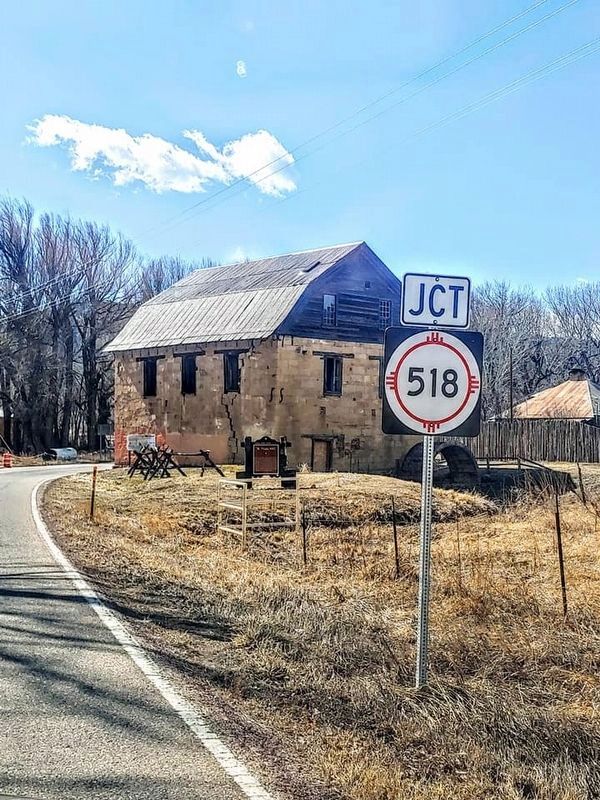
| 101 ► New Mexico, Mora County, Mora — St. Vrain Mill — |
| On New Mexico Route 434 at 518, on the left when traveling north on State Route 434. | |||
| 102 ► New Mexico, Mora County, Wagon Mound — Sentinel on the Trail — Santa Fe Trail National Scenic Byway — |
| On State Road 120 just east of Interstate 25, on the right when traveling east. | |||
| 103 ► New Mexico, Mora County, Watrous — A New Community Sprouts Roots — Santa Fe National Historic Trail — Fort Union National Monument — |
| On New Mexico Route 161, 2.3 miles north of Interstate 25, on the right when traveling north. | |||
| 104 ► New Mexico, Mora County, Watrous — Big Business for New Mexico — Fort Union National Monument — |
| Near New Mexico Route 161, 7.5 miles north of CanAm Highway (Interstate 25). | |||
| 105 ► New Mexico, Mora County, Watrous — Buttons, Bowling, Billiards and Beer — Sutler's Store — Fort Union National Monument — |
| Near New Mexico Route 161, 7.5 miles north of CanAm Highway (Interstate 25). | |||
| 106 ► New Mexico, Mora County, Watrous — Commissary Storehouse — Fort Union National Monument — |
| Near New Mexico Route 161, 7.5 miles north of CanAm Highway (Interstate 25). | |||
| 107 ► New Mexico, Mora County, Watrous — Enough to Feed an Army — Quartermaster Depot Storehouses — Fort Union National Monument — |
| Near New Mexico Route 161, 7.5 miles north of CanAm Highway (Interstate 25). | |||
| 108 ► New Mexico, Mora County, Watrous — Fort Union and the Santa Fe Trail — Santa Fe National Historic Trail — Fort Union National Monument — |
| Near New Mexico Route 161, 7.5 miles north of CanAm Highway (Interstate 25). | |||
| 109 ► New Mexico, Mora County, Watrous — Fort Union: 1866 — Fort Union National Monument — |
| Near New Mexico Route 161, 7.5 miles north of CanAm Highway (Interstate 25). | |||
| 110 ► New Mexico, Mora County, Watrous — From Indigenous Trail to International Highway — Santa Fe National Historic Trail — Fort Union National Monument — |
| On New Mexico Route 161, 2.3 miles north of Interstate 25, on the right when traveling north. | |||
| 111 ► New Mexico, Mora County, Watrous — Intersection of History — The Santa Fe Trail and Fort Union — Fort Union National Monument — |
| On New Mexico Route 161, 2.3 miles north of Interstate 25, on the right when traveling north. | |||
| 112 ► New Mexico, Mora County, Watrous — Keep the Wagons Rolling — The Mechanics' Corral — Fort Union National Monument — |
| Near New Mexico Route 161, 7.5 miles north of CanAm Highway (Interstate 25). | |||
| 113 ► New Mexico, Mora County, Watrous — La Junta — Santa Fe Trail National Scenic Byway — |
| On New Mexico Route 161, 0.6 miles south of CanAm Highway (Interstate 25), on the left when traveling south. | |||
| 114 ► New Mexico, Mora County, Watrous — Separate Worlds — Fort Union National Monument — |
| Near New Mexico Route 161, 7.5 miles north of CanAm Highway (Interstate 25). | |||
| 115 ► New Mexico, Mora County, Watrous — The End of the Road — Depot Transportation Corral — Fort Union National Monument — |
| Near New Mexico Route 161, 7.5 miles north of CanAm Highway (Interstate 25). | |||
| 116 ► New Mexico, Mora County, Watrous — The Six Mule Army Wagon — Fort Union National Monument — |
| Near New Mexico Route 161, 7.5 miles north of CanAm Highway (Interstate 25). | |||
| 117 ► New Mexico, Mora County, Watrous — Trail Sites to the North and East — Santa Fe National Historic Trail — Fort Union National Monument — |
| On New Mexico Route 161, 7.6 miles north of Interstate 25. | |||
| 118 ► New Mexico, Mora County, Watrous — Trail Sites to the West — Santa Fe National Historic Trail — Fort Union National Monument — |
| On New Mexico Route 161, 7.6 miles north of Interstate 25. | |||
| 119 ► New Mexico, Mora County, Watrous — Transportation Corral — Fort Union National Monument — |
| Near New Mexico Route 161, 7.5 miles north of CanAm Highway (Interstate 25). | |||
| 120 ► New Mexico, Mora County, Watrous — Watrous - Western Junction of the Santa Fe Trail — National Historic Landmark — |
| Near 2nd Street (Briges Street) just north of Concord Street, on the left when traveling north. | |||
| 121 ► New Mexico, Quay County, Tucumcari — A Route 66 Classic — |
| On East Route 66 Boulevard (Business Interstate 40) at South Dawson Street, on the right when traveling east on East Route 66 Boulevard. | |||
| 122 ► New Mexico, Quay County, Tucumcari — Blue Swallow Motel — |
| On East Tucumcari Boulevard (Business Interstate 40) west of South Choctaw Street, on the right when traveling west. | |||
| 123 ► New Mexico, Quay County, Tucumcari — Yetta Kohn (1843 – 1917) — Matriarch, Cattle Rancher and Business Woman — |
| On West Tucumcari Boulevard west of West Hines Avenue, on the right when traveling east. | |||
| 124 ► New Mexico, Rio Arriba County, Chama — Old Spanish Trail — |
| On State Highway 17 at U.S. 64, on the right when traveling south on State Highway 17. | |||
| 125 ► New Mexico, Rio Arriba County, Española — 1543 — Chimayo Trading Post / Trujillo House — |
| On Sandia Drive (U.S. 285) at State Road 68, on the left when traveling east on Sandia Drive. | |||
| 126 ► New Mexico, Rio Arriba County, Velarde — Velarde — On the Camino Real — |
| On State Road 68 at County Road 60, on the left when traveling north on State Road 68. | |||
| 127 ► New Mexico, San Juan County, Farmington — Harriet Belle Amsden Sammons (1876-1954) — Bank President — |
| On Browning Parkway at Burnham Road, on the right when traveling south on Browning Parkway. | |||
| 128 ► New Mexico, San Miguel County, Las Vegas — Baca Building — 1884 — |
| On Bridge Street west of Valencia Street, on the right when traveling west. | |||
| 129 ► New Mexico, San Miguel County, Las Vegas — Chapman Hall/Winternitz Block — 1860s and 1894 — |
| On Bridge Street east of South Gonzales Street, on the right when traveling east. | |||
| 130 ► New Mexico, San Miguel County, Las Vegas — Dold Block — 1881 — |
| On Hot Springs Boulevard at Plaza Street, on the right when traveling south on Hot Springs Boulevard. | |||
| 131 ► New Mexico, San Miguel County, Las Vegas — First National Bank of Las Vegas — 1880 — |
| On Bridge Street at South Gonzales Street, on the left when traveling west on Bridge Street. | |||
| 132 ► New Mexico, San Miguel County, Las Vegas — La Plaza Vieja Partnership, Ltd. — (1985-2008) — |
| On Bridge Street east of North Gonzales Street, on the left when traveling east. | |||
| 133 ► New Mexico, San Miguel County, Las Vegas — Ludwig W. Ilfeld Hardware Store — 1913 — |
| On Bridge Street west of Valencia Street, on the right when traveling west. | |||
| 134 ► New Mexico, San Miguel County, Las Vegas — Maloof Hall — 1921 — |
| On Bridge Street east of South Gonzales Street, on the right when traveling east. | |||
| 135 ► New Mexico, San Miguel County, Las Vegas — Marcellino's Music Store — 1883 — |
| On Bridge Street east of South Gonzales Street, on the right when traveling east. | |||
| 136 ► New Mexico, San Miguel County, Las Vegas — Puertocito de la Piedra Lumbre — |
| On New Mexico 283, 0.8 miles west of Romeoville Frontage Road, on the right when traveling west. | |||
| 137 ► New Mexico, San Miguel County, Las Vegas — Romero Block — 1919 — |
| On North Gonzales Street at Bridge Street, on the right when traveling north on North Gonzales Street. | |||
| 138 ► New Mexico, San Miguel County, Las Vegas — Veeder Block — 1895 — |
| On Hot Springs Boulevard at Plaza Street, on the right when traveling south on Hot Springs Boulevard. | |||
| 139 ► New Mexico, San Miguel County, Las Vegas — Winters Drug Company — 1884 — |
| On Bridge Street west of Valencia Street, on the right when traveling west. | |||
| 140 ► New Mexico, San Miguel County, Las Vegas, East Las Vegas — Browne & Manzanares Commission House — 1889 & 1895 — |
| On Railroad Avenue at Douglas Avenue, on the right when traveling north on Railroad Avenue. | |||
| 141 ► New Mexico, San Miguel County, Las Vegas, East Las Vegas — Clara Waring Bookstore — 1901 — |
| On 6th Street south of Douglas Avenue, on the right when traveling south. | |||
| 142 ► New Mexico, San Miguel County, Las Vegas, East Las Vegas — Gross, Blackwell & Company Commission House — 1899 — |
| Near Railroad Avenue south of East Lincoln Street, on the left when traveling south. | |||
| 143 ► New Mexico, San Miguel County, Las Vegas, East Las Vegas — Meadows Hotel — 1923 — |
| Near CanAm Highway (U.S. 85) at Douglas Avenue, on the right when traveling south. | |||
| 144 ► New Mexico, San Miguel County, Las Vegas, East Las Vegas — Monte Carlo Hall/J.A. Taichert & Company Store — 1900 — |
| On University Avenue. | |||
| 145 ► New Mexico, San Miguel County, Las Vegas, East Las Vegas — Rosenthal Brothers General Merchandise Store — 1903 — |
| On 6th Street at Grand Avenue (U.S. 85), on the right when traveling south on 6th Street. | |||
| 146 ► New Mexico, San Miguel County, Las Vegas, East Las Vegas — Wells Fargo Express Office — 1881 — |
| On East Lincoln Street east of CanAm Highway (U.S. 85), on the right when traveling east. | |||
| 147 ► New Mexico, San Miguel County, Pecos — Kosloski's Historic Stagecoach Stop and Trading Post — |
| On State Road 63, 2.7 miles south of State Road 50, on the left when traveling south. | |||
| 148 ► New Mexico, Sandoval County, San Ysidro — Trinidad Gachupin Medina (ca. 1883-1964) — Zia Pueblo — |
| On N.M. State Route 44 (U.S. 550) 0.3 miles east of Zia Boulevard (Business Road 785), on the right when traveling east. | |||
| 149 ► New Mexico, Santa Fe County, Cerrillos — Welcome to the Cerrillos Hills State Park — |
| On County Road 59, on the right when traveling south. | |||
| 150 ► New Mexico, Santa Fe County, Los Cerrillos — Briggs Building — Built before 1893 — |
| On 1st Street just north of Main Street, on the right when traveling north. | |||
| 151 ► New Mexico, Santa Fe County, Los Cerrillos — C. Rael's Market — Built in mid 1880s — |
| On 1st Street at Waldo Street, on the left when traveling north on 1st Street. | |||
| 152 ► New Mexico, Santa Fe County, Los Cerrillos — Cerrillos through the Years — |
| On Main Street west of 1st Street, on the right when traveling west. | |||
| 153 ► New Mexico, Santa Fe County, Los Cerrillos — DeLallo-Simoni-Torres Building — Built before 1893 — |
| On 1st Street at Main Street, on the right when traveling north on 1st Street. | |||
| 154 ► New Mexico, Santa Fe County, Los Cerrillos — R. Granito's General Store — Built before 1893 — |
| On 1st Street north of Waldo Street, on the right when traveling north. | |||
| 155 ► New Mexico, Santa Fe County, Los Cerrillos — The Cerrillos Bar — Built 1918 — |
| On 1st Street at Main Street, on the right when traveling north on 1st Street. | |||
| 156 ► New Mexico, Santa Fe County, Los Cerrillos — The Joe M. Granito Block — |
| On 1st Street north of Waldo Street, on the right when traveling north. | |||
| 157 ► New Mexico, Santa Fe County, Los Cerrillos — The Simoni Store — Built 1892 — |
| On 1st Street south of Main Street, on the right when traveling north. | |||
| 158 ► New Mexico, Santa Fe County, Los Cerrillos — Welcome to Cerrillos — |
| On 1st Street north of Main Street, on the left when traveling north. | |||
| 159 ► New Mexico, Santa Fe County, Madrid — Welcome to Madrid on the Turquoise Trail — |
| On New Mexico Route 14 at Ice House Road, on the left when traveling east on State Route 14. | |||
| 160 ► New Mexico, Santa Fe County, Santa Fe — 1583 — |
| Near East Palace Avenue east of Cathedral Place, on the right when traveling east. | |||
| 161 ► New Mexico, Santa Fe County, Santa Fe — 1598-1890 — |
| 162 ► New Mexico, Santa Fe County, Santa Fe — 17 — 1976 — Commemorative Walkway Park — |
| On Paseo de Peralta near Otero Street. | |||
| 163 ► New Mexico, Santa Fe County, Santa Fe — A Long Haul — Santa Fe Trail National Historic Byway — |
| Near Old Santa Fe Trail south of East De Vargas Street. | |||
| 164 ► New Mexico, Santa Fe County, Santa Fe — El Camino Real de Tierra Adentro — Welcome to El Camino Real Park — |
| On Constellation Way north of Riverside Loop, on the right when traveling north. | |||
| 165 ► New Mexico, Santa Fe County, Santa Fe — Gold and Turquoise — |
| Near Interstate 25 at milepost 269,, 1.5 miles east of Waldo Canyon Road (County Road 57). | |||
| 166 ► New Mexico, Santa Fe County, Santa Fe — Santa Fe Trail - Road to Opportunity — |
| On Camino Lejo at Old Santa Fe Trail, on the right when traveling south on Camino Lejo. | |||
| 167 ► New Mexico, Santa Fe County, Santa Fe — The Old Spanish Trail — |
| On West Marcy Street near Lincoln Avenue, on the right when traveling east. | |||
| 168 ► New Mexico, Santa Fe County, Santa Fe — The Spiegelberg Brothers — 1846-1892 — |
| Near Paseo De Peralta west of South Guadalupe Street. | |||
| 169 ► New Mexico, Santa Fe County, Santa Fe — Three Wise Women — Eva Scott Fenyes, 1849-1930 Leonora Scott Muse Curtin, 1879-1972 — |
| Near Interstate 25 at milepost 269,, 1.5 miles west of Waldo Canyon Road (County Road 57). | |||
| 170 ► New Mexico, Santa Fe County, Santa Fe — Trade Transforms Art — Art of Santa Fe Trail — |
| Near Camino Lejo south of Old Santa Fe Trail. | |||
| 171 ► New Mexico, Santa Fe County, Santa Fe — Welcome to the Pink Adobe — |
| On Old Santa Fe Trail south of East De Vargas Street, on the right when traveling south. | |||
| 172 ► New Mexico, Santa Fe County, Santa Fe — Witnessed from Fort Marcy Hill — Prince Park — |
| Near Kearney Avenue south of Prince Avenue. | |||
| 173 ► New Mexico, Santa Fe County, Tesuque — Tesuque Rain Gods — Tesuque Pueblo — |
| Near West Frontage Road (U.S. 285 Frontage Road at milepost 175), 0.2 miles north of Camel Rock Road (Business U.S. 285). | |||
| 174 ► New Mexico, Sierra County, Hillsboro — Hillsboro — Historic District — |
| On State Road 152 at milepost 49 at State Road 27, on the right when traveling west on State Road 152. | |||
| 175 ► New Mexico, Sierra County, Hillsboro — Sadie Orchard — (1860 - 1943) — |
| On Road 152, on the left when traveling east. | |||
| 176 ► New Mexico, Socorro County, Belen — Abó Pass Trail — |
| On U.S. 60 at milepost 189.6,, 1.4 miles west of Forest Road 422, on the right when traveling west. | |||
| 177 ► New Mexico, Socorro County, Magdalena — Kelly — |
| On U.S. 60, on the right when traveling east. | |||
| 178 ► New Mexico, Socorro County, Magdalena — Kelly — |
| On 1st Street (Route 60) at Kelly Road, on the right when traveling east on 1st Street. | |||
| 179 ► New Mexico, Socorro County, Magdalena — Magdalena Livestock Driveway — |
| On U.S. 60, 24 miles west of Interstate 25, on the right when traveling west. | |||
| 180 ► New Mexico, Socorro County, Socorro — 506 — Abeyta Block — |
| On Plaza Street at Manzanares Avenue, on the right when traveling north on Plaza Street. | |||
| 181 ► New Mexico, Socorro County, Socorro — 153 — Juan Jose Baca House — |
| On Abeyta Avenue at Bernard, on the right when traveling west on Abeyta Avenue. | |||
| 182 ► New Mexico, Taos County, Dixon — Rio Grande Gaging Station — U.S. Geological Survey — Established 1889 — |
| On State Road 68, on the left when traveling south. | |||
| 183 ► New Mexico, Taos County, Taos — 860 — El Rincon Trading Post — |
| On Kit Carson Road east of Paseo del Pueblo Sur, on the right when traveling east. | |||
| 184 ► New Mexico, Taos County, Taos — 860 — Hotel La Fonda de Taos — |
| On South Plaza west of Camino de Santa Fe, on the right when traveling east. | |||
| 185 ► New Mexico, Taos County, Taos — Taos Plaza — Historic District — |
| On Camino de la Placita at Ranchitos Road, on the right when traveling north on Camino de la Placita. | |||
| 186 ► New Mexico, Taos County, Taos — The Alley Cantina — |
| On Scheurich Lane at Teresina Lane, on the right when traveling west on Scheurich Lane. | |||
| 187 ► New Mexico, Torrance County, Abó — Village of Abó/Pueblo de Abó — Salinas Pueblo Missions National Monument — |
| Near Abó Ruins Road (State Road 513) 0.6 miles north of U.S. 60, on the left when traveling north. | |||
| 188 ► New Mexico, Torrance County, Mountainair — Willard Mercantile Company — |
| On Broadway (U.S. 60) at North Summit Avenue (New Mexico Road 55), on the right when traveling west on Broadway. | |||
| 189 ► New Mexico, Valencia County, Belen — Camino del Llano — |
| On Camino Del Llano just east of CanAm Highway (US Highway 85) (Interstate 25), on the right when traveling east. | |||
| 190 ► New Mexico, Valencia County, Los Lunas — Atchison, Topeka, and Santa Fe Railroad Depot — Los Lunas, New Mexico — |
| On New Mexico 314, 0.2 miles south of Park Lane SW, on the right when traveling south. | |||
| 191 ► New Mexico, Valencia County, Los Lunas — The Luna Mansion — |
| On Main Street Northwest (State Road 6), on the right when traveling east. | |||
191 entries matched your criteria. Entries 101 through 191 are listed above. ⊲ Previous 100