By Beverly Pfingsten, April 20, 2008
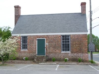
Debtors Prison Building
GEOGRAPHIC SORT Title Sort Marker Number Sort Marker Number Sort N Marker Number Sort T Publication Order Sort Publication Order Sort A Erected Year Sort Most Viewed Sort Most Recent-Interest Sort Most Recently Changed Sort SEE FAQ #33 FOR DESCRIPTIONS
On Courthouse Ave. (County Route 764) 0.1 miles north of Front Street (Alternate U.S. 13), on the right when traveling west.
On Belle Haven Road (Virginia Route 178) at Merry Cat Lane (County Road T-601), on the right when traveling north on Belle Haven Road.
Near Main Street at Post Office Street, on the right when traveling west.
On Main Street at Mumford Street, on the right when traveling west on Main Street.
On Main Street just west of Post Office Street, on the right when traveling west.
On Main Street just west of Post Office Street, on the right when traveling west.
On Main Street just west of Mumford Street, on the right when traveling west.
On National Seashore Lane at Stephen Decatur Hwy (Virginia Route 611), on the right when traveling west on National Seashore Lane.
Near Beach Access Road north of Boat Ramp Access Road, on the right when traveling south.
On Market Street near South Street, on the left when traveling west.
On Market Street near Mt. Prospect Ave., on the left.
Near Market Street at College Avenue, on the right when traveling west.
On Cassatt Avenue (Virginia Route 316) just south of Mary Street, on the left when traveling south.
On Dunne Avenue just north of County Road T-1804, on the left when traveling north.
On Bobtown Road Rt 178, 0.2 miles north of St. George Circle, on the right when traveling north.
Paid Advertisement
On Bannys Road at Factory Road, on the right when traveling south on Bannys Road.
On Main Ridge Road just north of Hilda Crockett Lane.
On Main Ridge Road at Chambers Road, on the left when traveling south on Main Ridge Road.
On Main Ridge Road at Wallace Road on Main Ridge Road.
On West Ridge Road at Wallace Road, on the right when traveling north on West Ridge Road.
On Canton Road just south of Canton Road, on the right when traveling south.
On Factory Road east of West Ridge Road, on the right when traveling east.
Near Parks Marina Lane west of Main Ridger Road, on the right when traveling west.
On Main Ridge Road at Garman Road, on the right when traveling south on Main Ridge Road.
On Main Ridge Road at John Al Lane, on the right when traveling south on Main Ridge Road.
On Main Ridge Road at Pondarosa Road, on the left when traveling south on Main Ridge Road.
On Main Ridge Road at Williard's Lane, on the right when traveling south on Main Ridge Road.
On Main Ridge Road at John Al Lane, on the left when traveling south on Main Ridge Road.
On West Ridge Road south of School Lane, on the left when traveling north.
On Main Ridge Road at Twin John Lane, on the right when traveling south on Main Ridge Road.
On West Ridge Road north of Factory Road, on the left when traveling north.
Paid Advertisement
On Main Ridge Road just south of Wallace Road.
On West Ridge Road north of Wallace Road, on the left when traveling north.
Near Saxis Road at VA 699.
On Rockfish Gap Turnpike (U.S. 250) close to Critzer Shop Road (Virginia Route 151), on the right when traveling west.
Near Thomas Jefferson Parkway.
Near Monticello Loop north of Thomas Jefferson Parkway (Virginia Route 53), on the left when traveling north.
Near Monticello Loop, 0.4 miles north of Thomas Jefferson Parkway (Virginia Route 53), on the left when traveling north.
Near Thomas Jefferson Parkway (Virginia Route 53) at Jefferson Lake Drive, on the right when traveling east.
Near Thomas Jefferson Parkway (Virginia Route 53) west of James Monroe Parkway (County Route 795), on the right when traveling east.
Near Monticello Loop, 0.4 miles north of Thomas Jefferson Parkway (Virginia Route 53), on the left when traveling north.
On Thomas Jefferson Parkway (Virginia Route 53) at Michie Tavern Lane (Virginia Route 1102), on the right when traveling east on Thomas Jefferson Parkway.
On Thomas Jefferson Parkway (Route 53) 0.1 miles east of Michie Tavern Lane (Virginia Route 1102), on the right when traveling east.
Near Thomas Jefferson Parkway.
Near Monticello Loop north of Thomas Jefferson Parkway (Virginia Route 53), on the left when traveling north.
Near Thomas Jefferson Parkway (Virginia Route 53) at Mitchie Tavern Lane (County Road 1102), on the right when traveling east. Reported permanently removed.
Near Monticello Loop, 0.4 miles north of Thomas Jefferson Parkway (Virginia Route 53), on the left when traveling north.
Paid Advertisement
Near Thomas Jefferson Parkway.
On Thomas Jefferson Parkway (Virginia Route 53) at Michie Tavern Lane (County Road 1102), on the right when traveling east on Thomas Jefferson Parkway. Reported permanently removed.
On East Market Street (County Road 1105) 0.3 miles south of Riverside Drive, on the right when traveling east.
On East Market Street (County Road 1105) 0.2 miles south of Broadway Street, on the right when traveling east.
Near Monticello Loop at Thomas Jefferson Parkway (Virginia Route 53), on the left when traveling north.
On Advance Mills Road (County Route 743) at Frays Mill Road (County Route 641), on the left when traveling west on Advance Mills Road.
On East Main Street west of 6th Street, in the median.
On East Main Street west of 6th Street, on the right when traveling east.
On Earlysville Road, 0.2 miles south of Woodlands Road, on the right when traveling south.
Near Earlysville Road (County Road 743) 0.3 miles south of Woodlands Road, on the right when traveling south.
On Rotunda Drive west of Hospital Drive, on the right when traveling west.
On East Market Street (County Road 1105) 0.2 miles south of Riverside Avenue, on the right when traveling east.
On Monacan Trail Road (U.S. 29) at Lackey Lane (County Route 838), on the right when traveling south on Monacan Trail Road.
On East Main Street (Virginia Route 6) east of Valley Street (Virginia Route 20), on the left when traveling east.
On Hatton Ferry Road, 0.5 miles south of Hatton Ferry Lane.
On Thomas Jefferson Parkway (Virginia Route 53) just south of Colle Lane, on the right when traveling south.
Paid Advertisement
On Hoffman Street just south of Mandeville Lane, on the right when traveling south.
On Eisenhower Avenue, on the right when traveling west.
Near Duke Street (Virginia Route 236) at Daingerfield Road, on the right when traveling east.
On Eisenhower Avenue, 0.8 miles east of Metro Road, on the right when traveling east.
On North Paxton Street at Cloude's Mill Drive, on the right on North Paxton Street.
Near Brenman Park Drive south of Duke Street (Virginia Route 236), on the left when traveling west.
On King Street (Virginia Route 7) 0.1 miles east of Marlee Way, on the right when traveling east.
On South Royal Street south of Prince Street, on the right when traveling north.
Near Thompsons Alley east of North Union Street, on the right when traveling east.
On Cameron Street west of North Royal Street, on the right when traveling east.
Near Wilkes Street at South Royal Street, in the median.
On Pioneer Mill Way just east of The Strand, in the median.
On North Fairfax Street at Cameron Street, on the right when traveling north on North Fairfax Street.
Near Wharf Street east of Ford's Landing Way, on the right when traveling west. Reported unreadable.
On Prince Street east of South Alfred Street, on the left when traveling east.
Paid Advertisement
Near North Fairfax Street south of Cameron Street, on the right when traveling north.
On Prince Street just east of South Fairfax Street, on the right when traveling east.
On Cameron Street just west of North Fairfax Street, on the right when traveling west.
Near Wharf Street east of Ford's Landing Way, on the right when traveling west. Reported unreadable.
On King Street at North Pitt Street, on the left when traveling east on King Street.
On North Union Street at Princess Street, on the right when traveling north on North Union Street.
On King Street east of Strand Street.
On King Street (Virginia Route 7) at North West Street, on the right when traveling west on King Street.
On North Royal Street at Cameron Street, on the left when traveling north on North Royal Street.
On Cameron Street at North Royal Street, on the right when traveling west on Cameron Street.
On King Street at North Royal Street, on the right when traveling west on King Street.
On The Strand north of Prince Street, on the right when traveling north.
On South Fairfax Street at Prince Street, on the right when traveling north on South Fairfax Street.
On Cameron Street just west of North Fairfax Street, on the left when traveling west.
On Cameron Street west of North Fairfax Street, on the right when traveling west.
Near Strand Street just south of Prince Street, on the right when traveling south.
Paid Advertisement
On King Street at North Washington Street (Virginia Route 400), on the right when traveling west on King Street.
On King Street at North Royal Street, on the right when traveling west on King Street.
Near Jones Point Drive, 0.3 miles east of South Royal Street, on the right when traveling east.
Near Strand Street south of King Street, on the right when traveling north.
Near King Street at Strand Street, on the right when traveling west.
1538 entries matched your criteria. The first 100 are listed above.
Next 100 ⊳