One of the most visible and longstanding programs of the THC is the Historical Markers Program. This program, which began in the late 1940s, has erected nearly 2,000 markers commemorating sites, persons, and events significant in Tennessee history. ... The markers program is an effective means of introducing highway travelers to Tennessee history.
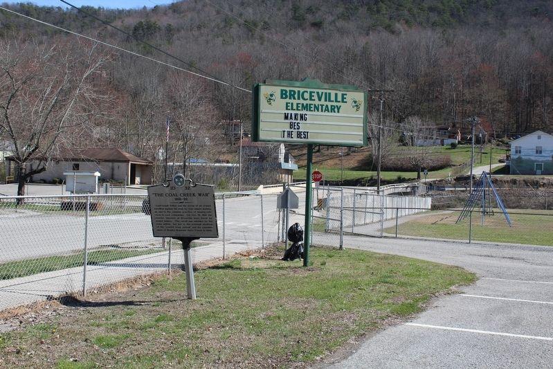
Coal Creek valley was the scene of an armed rebellion against the state by free miners seeking an end to the common practice of leasing convicts to coal companies. On Oct. 31, 1891 the convict laborers at Briceville were freed by armed miners. The . . . — — Map (db m102292) HM
Following a court order by Federal District Judge Robert L. Taylor, on August 27, 1956, 12 black students, now known as "The Clinton 12", enrolled in Clinton High School without incident, making it one of the first desegregated public high schools . . . — — Map (db m121331) HM
David Hall, a revolutionary War veteran, purchased a plantation near here in 1803. Seven years later he opened a tavern and inn on the property. Granville Arnold purchased the site in 1854, operating the inn for the remainder of the 19th century. . . . — — Map (db m165936) HM
From about 1895 to 1936 Tennessee was one of the nation's six leading states in marketing pearls. Clinton was listed as one of three Tennessee towns known as centers of the pearling industry. New York dealers came regularly to Clinton during the . . . — — Map (db m112098) HM
Upset by segregationists who intimidated 12 African American pupils at Clinton High School who refused to return to classes, the Reverend Paul Turner, pastor of Clinton's First Baptist Church, met with the pupils on December 4. 1956, when he and two . . . — — Map (db m220585) HM
Established March 7, 1895, on a 390-acre farm purchased from Bradley Farm descendent, Sallie Kincaid, the farm provided housing, clothing, food, and healthcare to the county's poor for almost 7 decades. As a working farm, it generated revenue . . . — — Map (db m227436) HM
The Administration Building for the Clinton Engineering Works opened March 15, 1943. Dubbed "The Castle", it became headquarters for the Manhattan Engineering District, U.S. Army Corps of Engineers, from which all Manhattan Project construction was . . . — — Map (db m112099) HM
From April 1, 1943, until March 19, 1949, this was the site of Elza Gate. Elza Gate was the primary entrance to the secret community of Oak Ridge and along with six other entry points, it was manned by armed guards. Elza Gate took its name from a . . . — — Map (db m88625) HM
One of the oldest continuously operating community theatres in the Southeastern United States. Oak Ridge Playhouse began in 1943 as the Little Theatre of Oak Ridge when the city was being built for the World War II top-secret Manhattan Project. The . . . — — Map (db m176893) HM
In 1943, Oak Ridge was created as the residential center for the Clinton Engineering Works. Located on the northeast corner of a 59,000-acre reservation acquired by the government in 1942, the community was designed by Skidmore, Owings, and Merrill, . . . — — Map (db m81358) HM
Built in 1943 near the main business district (Jackson Square), this standard Army chapel was soon known with the Manhattan Project as "The Chapel-on-the-Hill". On 30 September 1943 it was dedicated for Jewish, Catholic, and Protestant worship. The . . . — — Map (db m112102) HM
On a route that was first authorized to be "cut and cleared" in 1787, the Rock Pillar Bridge 60 yards to the north-northeast was built in the early 1900's. This road became known as the Emery Road and was one of the earliest routes used in the . . . — — Map (db m89677) HM
The Guest House provided accommodations for visitors to the Clinton Engineering Works (Oak Ridge) during the time of the Manhattan Project, which led to the development of the atomic bomb. The Guest House hosted such dignitaries as physicists J. . . . — — Map (db m114613) HM
The Robertsville Community was settled in 1804 by Collins Roberts, who had received a 4,000-acre land grant in this region. Robertsville was one of four communities in the area that predated Oak Ridge. The community was dispersed in 1942 when the . . . — — Map (db m176887) HM
The Scarboro Community was founded by three brothers in the early 1790s. Jonathan, David and James Scarborough traveled from Virginia and settled here. Scarboro was one of four area communities that predated Oak Ridge. The community remained largely . . . — — Map (db m32575) HM
Founded 1870, at Culleoka, by William R. ("Sawney") Webb, whose brother John M. ("Old Jack") Webb joined him in 1874. It moved here in 1886. Its curriculum, embracing chiefly Latin, Greek and Mathematics, was designed to give a sound preparatory . . . — — Map (db m24169) HM
On this knoll, members of the Federal party which attempted to destroy the Western & Atlantic R.R. in 1862, assembled before starting their foray. It started with seizure of the engine "General" and ended with recapture of the engine at the Georgia . . . — — Map (db m80317) HM
The Reserve Corps (Granger) moved south along this road, screened by the Army's Cavalry (D.S. Stanley). Taking Guy's Gap, against minor resistance, they pushed rapidly into Shelbyville, evacuated the same morning by the Corps of Maj. Gen. Leonidas . . . — — Map (db m26075) HM
This was Lot 44 of the original town plan. A log church was built here in 1815. The Presbyterians used it, and built the present church in 1817. In 1856, a Catholic congregation bought the building, selling to the Northern Methodists in 1894. These . . . — — Map (db m25049) HM
Born in NC, 1783; veteran of the War of 1812; early Bedford County manufacturer; Whig political leader. In 1810 Cannon provided 100 acres of land for the site of the "Town of Shelbyville" and in 1817 donated 5 acres to Dickson Academy and a lot to a . . . — — Map (db m26807) HM
In the cemetery north of the road are buried Confederate soldiers of the Army of Tennessee, who fell while opposing the advance of Rosecrans' Army of the Cumberland through Liberty Gap and Guy's Gap, in late June, 1863. Also buried here are soldiers . . . — — Map (db m25864) HM
Born in a house which stood here. Enlisted in the 1st Tenn. Volunteers for the Mexican War; on graduation from US Military Academy in 1853, commissioned in Dragoons. Resigning for the Confederacy and rapidly promoted to colonel, he was captured at . . . — — Map (db m207913) HM
Governor of Tennessee for three successive terms 1939-1945. A native of Bedford County and graduate of Webb School, Princeton and Harvard Law School, he was Attorney General of the 8th Judicial Circuit, a member of the 63rd and 70th General . . . — — Map (db m25868) HM
This 90-acre tract is home of the Tennessee Walking Horse National Celebration - "The World's Largest Walking Horse Show". On July 17, 1939, a non-profit association was chartered to conduct a national celebration to honor and exhibit the Tennessee . . . — — Map (db m25869) HM
Moore County Established 1871; named in honor of
Major Gen. William Moore
He settled in Tennessee in 1808, coming from Kentucky. Commanded a company in the Creek War; finished the War of 1812 as a Major General. Member of the State House . . . — — Map (db m61915) HM
Wartrace is located on a 5000-acre North Carolina grant acquired by General Andrew
Jackson at an 1802 marshal's sale in Nashville. In 1805, Jackson came to the area to establish his boundaries for the opening of the lands for settlement by the . . . — — Map (db m152096) HM
Hardee's Corps retired to the Wartrace-Fairfield defensive line, January, 1863. Here they remained until late June, when Rosecrans, moving the bulk of the Federal Army of the Cumberland around the right flank to Manchester, made Bragg withdraw from . . . — — Map (db m152093) HM
The Beechwood Plantation house, which formerly stood at this site, was an important Confederate headquarters during the Tullahoma Campaign. It was built for Col. Andrew Erwin, Jr. and family in 1826. The Erwins, who were southern sympathizers, . . . — — Map (db m25862) HM
Strolling Jim, the first World's Champion Tennessee Walking Horse, is buried in a pasture directly behind the Walking Horse Hotel. Foaled in 1936, this former work horse was ridden to the championship by Floyd Carothers at the first Walking Horse . . . — — Map (db m24165) HM
In 1850, Rice Coffey gave eight acres to the Nashville and Chattanooga Railroad on which the main line would run with a depot and freight house at the junction of the branch line to Shelbyville. In 1851, town lots were laid off. The following year, . . . — — Map (db m88407) HM
An early post office of this name was opened Sept. 28, 1835, in the home of William H.H. Burton, which stood at this site. It remained here until Aug. 27, 1837, when it was moved to the public square of Camden and the name changed to "Camden." . . . — — Map (db m109047) HM
8½ miles east, at Johnsonville Landing, Forrest's Cavalry Corps, after blocking river approaches from both directions with captured Federal vessels and gunfire, destroyed the Federal base at Johnsonville. Losses were 4 gunboats, 14 steamboats, 17 . . . — — Map (db m237476) HM
Mary Cordelia Beasley-Hudson, a life-long resident of Benton County, was an advocate for women's suffrage. The Tennessee General Assembly approved an amendment to the state constitution to allow women's suffrage on April 15, 1919. Seven days later . . . — — Map (db m81359) HM
Mildred Jolly Lashlee was the first woman elected to the Tennessee Senate for a full “regular” term. Elected in November 1944, she represented the 26th Senatorial District. Before her election she was appointed to complete the term of . . . — — Map (db m109048) HM
Born June 2, 1863, in a log cabin, about ½ mile N., he studied law at Charlotte, later began practice at Camden. Attorney General of the 13th Judicial District, 1908-12, he was the last Tennessee governor to be elected by a convention. . . . — — Map (db m74481) HM
On Aug. 29, 1862, the Army of Mississippi was enroute to Kentucky: Army Headquarters was near Dunlap; Col. Joseph Wheeler's Cavalry Brigade was moving against Maj. Gen. A McD. McCook's Federal Division at Altamont. Advance elements of Maj. Gen . . . — — Map (db m81360) HM
Born in a house 160 ft. west, Oct. 18 1856. Elected Governor of Tennessee in 1902, he was reelected in 1904. He resigned in 1905, having been elected to the Senate, vice William B. Bate, deceased, and served there until 1911. Defeated for . . . — — Map (db m109180) HM
Born in a house 160 ft. west, Oct. 18 1856. Elected Governor of Tennessee in 1902, he was reelected in 1904. He resigned in 1905, having been elected to the Senate, vice William B. Bate, deceased, and served there until 1911. Defeated for . . . — — Map (db m109179) HM
(obverse)
Rhea County
Established 1807; named in honor of
John Rhea
Revolutionary veteran, who fought at King's Mountain. Delegate to the North Carolina Convention which ratified the U.S. Constitution; member of the Tennessee . . . — — Map (db m63645) HM
About 500 yds. NW. This school was the outgrowth of a community meeting at Bryant Camp Ground in 1858. War conditions delayed opening until 1865, with Prof. Gerry Rodgers first president. The first student body included both Confederate and Federal . . . — — Map (db m57953) HM
Hunt Field was the home of the Maryville-Alcoa
Twins baseball team that won the 1953 Class-D
Mountain States League Pennant. This 1,750-seat
ballpark, built in the 1940s, averaged an
attendance of about 1,550 for 62 home games.
Major league . . . — — Map (db m195413) HM
This village, 8 mi. W., was founded by a colony of Quakers from New Garden,
N. C., in the 1790's. The Newberry Meeting officially recognized it in 1808. The first Friends' organization in the county, it is the only one surviving. Friendsville . . . — — Map (db m150763) HM
In 1807, Sam Houston arrived at this 419-acre site with his widowed mother and eight brothers and sisters. The homesite was located just above the spring on the hill. Sam Houston served as general, President of Texas, Governor of Tennessee and . . . — — Map (db m150793) HM
About 2 miles northeast. Attacked Oct. 13, 1788, by 300 Indians under John Watts, the half breed. Defenders held out until ammunition was exhausted. 28 were taken prisoner; 17 slaughtered and bodies burned. Thereafter the locality was called the . . . — — Map (db m90458) HM
Yellow Sulphur Springs was developed on a modest scale by Jesse Kerr in 1859. In 1885, Nathan McCoy, of Indiana, built an elaborate hotel here. John Hanlon took it over in 1900, and operated it until the outbreak of World War I. It burned in 1933. — — Map (db m107919) HM
This Presbyterian church was
established in 1786. Its first pastor
was the Rev. Gideon Blackburn
who served an extensive circuit
in the area. Elizabeth Paxton
Houston, mother of Sam Houston,
is buried here. — — Map (db m150789) HM
On Abram’s Creek, near the site of the early Cherokee village, Chilhowee, William and Robert James established a water-powered cotton and woolen spinning and weaving factory. A charter for the business was issued in 1846 and the mill was evidently . . . — — Map (db m58501) HM
A three-story brick building was erected 1872-74 on this site to train blacks as teachers. Institute was begun in 1867, in a log house ½ mile north, and later moved into a new building, financed mainly by friends. By 1879, it had trained 80 . . . — — Map (db m81362) HM
Established by James Houston in 1785, it stood about 300 yards east on Little Nine Mile Creek. From here, in 1786, John Sevier led 160 horsemen against the Cherokee towns. In 1788, the Kirk family was massacred about three miles south; shortly . . . — — Map (db m58500) HM
Site of the original settlement of Maryville. Here Captain John Craig in 1785 erected a fort on Pistol Creek to protect settlers from Indian raids. In 1793 as many as 280 men, women, and children lived within its walls for several months, surviving . . . — — Map (db m58839) HM
Louis Philippe, Duke of Orleans
and later king of France, lived in
exile in the United States in 1797.
Following a route designed by
President George Washington he
toured the South in that year. On
April 29 he spent the night here
at Woods . . . — — Map (db m150836) HM
Founded in 1819 by the Synod of Tennessee, Presbyterian Church in the USA, as The Southern and Western Theological Seminary, its first president was Rev. Isaac Anderson, D.D. Its original buildings were on Broadway at College Street. Receiving its . . . — — Map (db m36993) HM
7 ½ mi. S, this resort was termed the Saratoga of the South in stagecoach days. First advertised in 1832; Daniel Foute built a log hotel there in 1837. In 1853, Asa Watson, of Mississippi, built the Seven Gable Hotel. Sidney Lanier spent much . . . — — Map (db m81363) HM
This Presbyterian church was founded in 1786 by Rev. Archibald Scott, of Virginia. In 1792, Rev. Gideon Blackburn built a log church here; the stones in the present wall are from a church which replaced it in 1829; the brick church replaced it in . . . — — Map (db m28733) HM
Chartered in 1806. Opened in 1808. Occupied two Maryville sites from 1808 to the Civil War. Reopened at Wildwood in 1872 on a five acre tract donated by Thomas J. Pritchett and wife Mary. Academy land and buildings were deeded to Blount County in . . . — — Map (db m150839) HM
Dr. Samuel Pride, first Worthy Master of the New Providence Masonic Lodge, built his house here. Maj. Gen. W. T. Sherman, enroute to the relief of Burnside at Knoxville, billeted himself here. From 1878 to 1900 it was the Friends’ Normal Institute. . . . — — Map (db m58509) HM
Maj. Gen. W. T. Sherman, U.S.A., arrived in Blount County with 25,000 men, Dec. 5, 1863, to relieve Gen. Ambrose Burnside besieged at Knoxville by Gen. James Longstreet. The 15th Corps camped around Maryville, the 11th around Louisville and the 4th . . . — — Map (db m58836) HM
Three miles south is the school-house built in 1796 by Andrew Kennedy and Henry McCulloch for their children. Sam Houston taught here in 1811 or 1812. He later became Governor of Tennessee, Commander-in-Chief of the Texas Army, President of the . . . — — Map (db m109629) HM
On the hill to the south, beside the Great War and Trading Path, later the Federal Road, Samuel Henry, Sr., built a fort by 1792. The half-breed John Watts and 200 followers attacked it in August, 1793. Henry’s first mill was authorized in 1795. He . . . — — Map (db m58508) HM
For more than 200 years the Black Sulfur Spring has been a landmark location in Blount County. The spring and 215 acres was bought from David Delzell in 1834 to become one of three primary mineral springs for Daniel Foute's 6,500 acre Montvale . . . — — Map (db m164837) HM
Here, where Blount County's first courthouse stood, Sam Houston "took a dollar from the drum", thus marking his first enlistment in the United States Army, March 24, 1813. This culminated in his command of the Army of Texas, which decisively . . . — — Map (db m28579) HM
William B. Scott, Sr., a free Black, migrated to East Tennessee in 1847 after increased racial tension in North Carolina. He made harnesses and saddles in Blount County’s Quaker community of Friendsville until the Civil War. In Knoxville, during . . . — — Map (db m107600) HM
Nicholas Bartlett built a mill 300 ft. downstream about 1785. When Blount County was created in 1795, its mill-pond was a turning point from the Stock Creek boundary to run toward Bay's Mountain. The mill was used as a fort in the Indian troubles . . . — — Map (db m109333) HM
Knox County
Established 1792; named in honor of
Maj. Gen. Henry Knox
Washington's Chief of Artillery in the Revolutionary War. Secretary of War in Washington's Cabinet. One of the founders and first secretary of the Society of the . . . — — Map (db m109332) HM
Early settlers coming down the Great War & Trading Path in 1784-85 camped here; it was the scene of their first death and burial. In 1786 the Rev. Archibald Scott of Virginia organized a Presbyterian congregation in the area; the church was built . . . — — Map (db m81365) HM
One mile south, near a large spring, Robert McTeer built a fort and mill in 1784. A branch of the Great War and Trading Path passed nearby. Reportedly, the first school in what later became Blount County was held here; it was also the first polling . . . — — Map (db m108216) HM
This Irish patriot, exiled from his homeland for revolutionary newspaper activities, settled in the cove about two miles from here in 1855. After a short stay he moved to Knoxville. The rest of his life was taken up with lecture tours and newspaper . . . — — Map (db m56818) HM
This is the former site of the Little River Lumber Company mill complex. Founded in 1901 by Col. W.B. Townsend for whom this community is named, the company was one of the largest commercial lumber operations in the Smokies. From 1901 to 1939, the . . . — — Map (db m36995) HM
Near here was one of these three Cherokee villages, unoccupied when settlers arrived about 1791. A branch of the Great War and Trading Path forked here, one to North Carolina, the other to villages on the Little Tennessee. The Virginia trader, . . . — — Map (db m46477) HM
A mile north, on Little River, Josias Gamble built a fort in 1740. Gov. William Blount came here in 1790, to pacify and disperse a gathering of settlers about to attack the Indians to recover stolen horses. The fort was never attacked, but was a . . . — — Map (db m46479) HM
John McPherson entered Cherokee territory as a miller and was an early settler in the Eureka Valley. In 1834 he was one of five founding members of Candies Creek Baptist Church. An active Unionist during the Civil War, he was imprisoned by the . . . — — Map (db m177951) HM
Here stood the home of John Walker, Junior, known as “Chief Jack”. A grandson of Nancy Ward, he was prominent in the affairs of the Cherokee nation, belonging to the party advocating a voluntary treaty of removal of the Cherokees to the . . . — — Map (db m81366) HM
On this site in 1916, Bradley Central High School began meeting the educational needs of
this community. Adopting its name from the county, which in turn was named in honor of Col. Edward Bradley, a veteran of both the Revolutionary War and the War . . . — — Map (db m153667) HM
After battles at Chattanooga in November 1863, and before the Atlanta Campaign the following May, southern Bradley County lay between Union and Confederate lines at Cleveland, Tennessee, and Dalton, Georgia. Both armies scouted the area. Soldiers . . . — — Map (db m115884) HM
On this site in 1883, the first local school building for African-Americans was erected. In 1890, the school awarded four diplomas at its first commencement. The wooden building was razed in 1924, and a new brick structure was built to house grades . . . — — Map (db m153738) HM
In 1873, Bennet Cooper (1797-1886) gave one-quarter of an acre of land for a family burying ground. His first wife, Lydia, was buried there along with several other family members. The cemetery is located on a ridge behind the Cooper Homeplace . . . — — Map (db m81367) HM
Chartered Dec. 16, 1837, this was the first such institution in the Ocoee Purchase; here was its home during its entire existence. An early teacher (1843) was Henry von Aldehoff, a native of Prussia and graduate of Bonn University. This building was . . . — — Map (db m49559) HM
One mile west was this Cherokee council ground. Here was held the last council between the United States and the Cherokee nation, preceding the removal of the Indians to Indian Territory, now Oklahoma. John Howard Payne, author of “Home, . . . — — Map (db m49722) HM
From Canasoga, near Wetmore, to Chiaha, near South Pittsburg. De Soto's expedition of 1540 followed the Great War and Trading Path, which ran from northeast to southwest, passing near this spot. — — Map (db m178048) HM
1.5 miles to the southeast on Cove Creek. Joel E. Stone built a dam, grist mill and a saw mill, which he and his family operated until 1934 when Norris Lake was raised. The mill served the surrounding area as a community center and whistle-stop for . . . — — Map (db m74243) HM
Heth's Division, with the army's artillery and subsistence trains, passed into Kentucky through Walker's and Big Creek Gaps, while other combat elements of the Army of East Tennessee moved through Roger's Gap. The two columns reunited at . . . — — Map (db m121322) HM
Campbell County
Established 1806: reportedly named in honor of Col. Arthur Campbell. Member of the Virginia House of Burgesses; Commanded 70th Regiment Virginia Militia, in the Revolution; Commissioner for negotiation of Indian Treaties in . . . — — Map (db m119950) HM
Born in Cannon County in 1890, James Harvey Cummings, known as "Mr. Jim," was a farmer, attorney, politician, and statesman. Having served in the Tennessee General Assembly from 1928 to 1972, except for 1949 – 1953 when he was Secretary of . . . — — Map (db m60422) HM
Cannon County
Established 1836; named in honor of Newton Cannon Governor of Tennessee, 1835–39; Member of Congress, 1814–17 and 1821–27; Served in Creek War and War of 1812.
Warren County
Established . . . — — Map (db m60421) HM
On Short Mountain, 7.1 mi., Henry Hoover & John Beeson established a millstone and grindstone factory in 1806. An inscription on a bluff of the mountain, and discarded fragments of stone mark the spot. — — Map (db m60423) HM
The East Fork Stone's River originates approximately 7 miles to the east, at a spring on
Short Mountain. Stone's River is named after
Uriah Stone, a member of a party of longhunters
who explored a section of the river in 1767.
Beginning in the . . . — — Map (db m150447) HM
Here Forrest, with his newly organized brigade of about 1400 cavalrymen, halted for a short rest before making his successful raid on Federal forces at Murfreesboro under Gen. T.L. Crittenden. He freed a number of hostages from this locality and . . . — — Map (db m76173) HM
In the valley to the south, that part of the Cherokee nation which took part in the enforced overland migration to Indian Territory rested for about three weeks in 1839. About 15,000 persons of various ages took part in the march. Several who died . . . — — Map (db m76174) HM
Carroll County
Established 1822: Named in honor of
William Carroll
An officer in the War of 1812;
governor of Tennessee, 1821-27
and 1829-35; Served as governor
longer than any other man.
Gibson County
Established . . . — — Map (db m52132) HM
Established 1823; Named in honor of
Colonel John Gibson
who served with distinction under
General Andrew Jackson in the
Natchez Expedition, 1812 - 13,
and in the Creek Wars. — — Map (db m52134) HM
Governor Browning was born in Carroll County. After graduating from Cumberland Law School in 1915, he began practicing in Huntingdon. He commanded Battery D, 114th Field Artillery in France in World War I. In 1922 he was elected to Congress and . . . — — Map (db m51404) HM
In July 1825, William and Mary Billingsley Holmes and daughter, Polly Holmes, Christopher and Elizabeth Wood Gist, and Levi McWhirter and wife met in the grove of large oaks directly to the west and organized a Bible school. This was the beginning . . . — — Map (db m156580) HM
Alexis de Tocqueville (1805-1859), author of the classic Democracy in America, and Gustave de Beaumont (1802-1866) spent four frigid days and nights, December 12-16, 1831 at Sandy Bridge, now Hollow Rock. The postmaster, Zephaniah Harris, and . . . — — Map (db m52647) HM
Founded in 1822, this Primitive Baptist Church has been in constant use. It holds an annual foot-washing ceremony the first Sunday in May, which is attended by communicants and witnesses from many parts of this and neighboring states. — — Map (db m52585) HM
Born in Maury Co., he was an officer of volunteers in the Mexican War. A lifelong staunch Unionist, he was a delegate to the Constitutional Union Party convention of 1860, later an officer in the Federal Army. A delegate to the Republican convention . . . — — Map (db m52608) HM
Lived and is buried about 3½ miles southeast. On December 9, 1822, he made a trail through the woods to the new county seat, carrying a crosscut saw. Arrived at Huntingdon, he sawed a door in the new log courthouse and thus, as Chairman of the . . . — — Map (db m52609) HM
Established in 1822, this cemetery contains the remains of soldiers from every major American war since the establishment of the state. Among those buried here are two from the War of 1812, three from the Mexican War, and thirty-eight from the Civil . . . — — Map (db m51407) HM
Built about 1818 in the area to the east. Here also were held barbecues, barn dances, prize fights and cockfights. Here, according to court records, David Crockett “participated in an affray,” while attending the races. He was fined six . . . — — Map (db m52584) HM
Founded as Bethel Seminary at McLemoresville in 1842 by the West Tennessee Synod, Cumberland Presbyterian Church, with Rev. Ruben Burrow principal. Incorporated in 1847, it became Bethel College in 1850 and moved here in 1872. It was presented to . . . — — Map (db m52842) HM
About 3 miles SE, the lake was discovered in 1785 by Henry Rutherford, who surveyed the majority of west Tennessee. It was orginally named Boyd's Lake, for the Rev. Adam Boyd, chaplin [sic] of the North Carolina Regiment in the Revolution, who later . . . — — Map (db m81368) HM
1458 entries matched your criteria. The first 100 are listed above. Next 100 ⊳