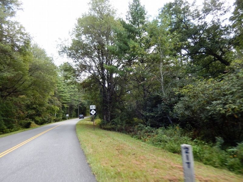
On Blue Ridge Parkway at the High Piney Spur Overlook (at milepost 218.6), 1.8 miles the Virginia state line, on the left when traveling south.
The knoll low on the ridge to the right boasts this celestial name. It is well known locally that hunters often sat about a night fire there while they followed the chase in the lowlands. They knew which hound held the lead by the . . . — — Map (db m104662) HM
On Blue Ridge Parkway 7 miles east of State Highway 18, on the right when traveling east.
You are looking into Basin Creek Cove. The log cabin 1500 feet below was the home of Martin and Janie Caudill and their 14 children. Martin's father, Harrison, who fathered 22 children, lived about a mile down the creek in the community of Basin . . . — — Map (db m306198) HM
Robert Lee Doughton, for whom Doughton Park is named, was born in Alleghany County, North Carolina, November 7, 1863. An original and leading advocate of the establishment and development of the Blue Ridge Parkway, he was a member of the United . . . — — Map (db m91786) HM
On North Main Street (U.S. 21) just north of East Whitehead Street (State Highway 18), on the right when traveling north.
[southwest side]Coast Guard • Army • Air Force • Navy • Marine Corps ☆ Dedicated to the honor and sacrifice of our Men and Women who served our Country in War and Peace ☆[northeast . . . — — Map (db m227326) WM
Near Cherry Street just east of Grayson Street, on the right when traveling east.
Crouse Park Sparta and Alleghany County have a rich heritage of music, crafts and agriculture. Crouse Park, including the Crouse House before you, was donated to the town in 1969. The Park hosts the Crouse House Pickers Monday night jam . . . — — Map (db m182942) HM
On Blue Ridge Parkway (at milepost 232.5), 3 miles west of U.S. 21, on the left when traveling south.
The massive gray rock before you is Stone Mountain, formed about 350 million years ago from intense heat and pressure deep within the earth. Centuries of erosion uncovered the rock and sculptured it into the curious shape it is today.
At one . . . — — Map (db m140553) HM
On Blue Ridge Parkway (at milepost 236.9), on the right when traveling south.
For thousands of years Native Americans cultivated the fertile valleys of the Blue Ridge region including North Carolina. Employing techniques such as “slash and burn” to clear small areas of forested land and fertilize the soil, the Cherokee raised . . . — — Map (db m123230) HM
On Healing Springs Road East 0.3 miles east of Old Highway 16, on the right when traveling east.
1883 The Spring is Discovered The Healing Spring was discovered by Willie Barker, son of Mr. and Mrs. Eli Barker, according to well-accepted tradition. As the story goes, Willie was helping his father plow corn when his father sent him to the . . . — — Map (db m228778) HM
On State Highway 16 0.1 miles north of Charles Spencer Road (County Route 1534), on the right when traveling north.
Grayson County, Virginia. Area 425 square miles. Formed in 1792 from Wythe. Named for William Grayson, one of the first two United States Senators from Virginia. Headwaters of New River are in this county.
North . . . — — Map (db m228775) HM
On Rugby Road (State Highway 194) at Joe Thomas Road, on the left when traveling north on Rugby Road.
North Carolina. Colonized, 1585-87, by first English settlers in America; permanently settled c. 1650; first to vote readiness for independence, Apr. 12, 1776
Virginia. First permanent English colony in America, 1607, one of thirteen . . . — — Map (db m95737) HM
On East Main Street (State Highway 88) at Cherry Street, on the right when traveling west on East Main Street.
American botanist and Harvard professor. In July 1841, investigated the region's flora. Headquarters was in house that stood 50 yds. N. — — Map (db m95736) HM
Near Court Street at Ashe Street, on the right when traveling east.
With European farmlands devastated and farmers called into military service
during WWI, America's European allies turned to us for food. Months before
entering WWI in 1917, the National War Garden Commission was established
to encourage Americans . . . — — Map (db m228823) HM
On Government Circle 0.1 miles south of U.S. 221, on the right when traveling south.
United States of America
Ashe County, North Carolina
“Our country called, our county answered”
American Revolution
1775-1783
Approximately 40 Ashe County pioneers fought in the Revolutionary War with General
George Washington's . . . — — Map (db m228813) HM WM
On East Main Street (Business U.S. 221) at Academy Street, on the right when traveling west on East Main Street.
A History of Jefferson
"Jefferson was a very special place at the turn of the century. The main street must have been one of the best conceived and most beautiful of its kind in the state. The pace of life was more leisurely and, in some . . . — — Map (db m269690) HM
On East Main Street (Business U.S. 221) at Academy Street, on the left when traveling east on East Main Street.
Honor Roll
In memory of those who made the supreme sacrifice while serving in wars in which the United States participated prior to World War One
Honor Roll
Ashe County World War One
Ashley, Charlie C. • Bare, Cecil • Barker, John . . . — — Map (db m228821) WM
On Government Circle south of East Main Street (U.S. 221), on the right when traveling south.
The original Charters of Freedom are on
display in The Rotunda at the National
Archives in Washington, D.C.
The Declaration of Independence was adopted July 4, 1776.
The United States Constitution was adopted . . . — — Map (db m269968) HM
On State Highway 18 S 1 mile south of Blue Ridge Parkway, on the right when traveling south.
This plaque is erected and dedicated in honor and appreciation of the forty-six years Dr. Luke has been a minister of the gospel, along with his devoted wife Mary at his side he gave so much and asked so little. In 1927 he was called to preach at . . . — — Map (db m237797) HM
On Tobaccoville Road, on the left when traveling east.
This barn was built on Old Richmond Creek in 1885 by W.W. (Billy) Doub. It was donated to the Village by Mr. W. G. (Jack) Doub on July 14, 1992 in honor of Tobaccoville's first Mayor, Henry Beck. — — Map (db m162114) HM
On Railroad Grade Road (State Road 1100) at South Fork Church Road, on the right when traveling south on Railroad Grade Road.
The early history of Todd is much like that of numerous crossroads communities
throughout northwestern North Carolina. Located where Elk Creek flows into the
South Fork of the New River, it was a logical site for trade, starting with . . . — — Map (db m228892) HM
On Blue Ridge Parkway (at milepost 266.8), on the right when traveling south.
Mount Jefferson looms high over the town of Jefferson for which it is named. It was formerly called Negro Mountain because run-away slaves supposedly hid out there while fleeing north. The summit and slopes of the mountain now make up Mount . . . — — Map (db m140555) HM
On BackStreet at State Street, on the left when traveling north on BackStreet.
Horse Creek
After crossing the border into North Carolina, the Virginia Creeper wound
along the banks of Big and Little Horse Creeks, crossing
the creeks a total of 17 times.
Tuckerdale
One of the largest for timber extraction . . . — — Map (db m269953) HM
On BackStreet at State Street, on the left when traveling north on BackStreet.
The Norfolk and Western Railroad first came to Ashe County in 1914. As the train line was established, numerous small communities began to emerge along the rails. A lone depot, placed between Paddy Mountain and Mount Jefferson, would soon blossom . . . — — Map (db m269957) HM
On Hickory Nut Gap Road (County Route 1342) west of Highway 184, on the left when traveling west.
In 1860 Banner Elk was a small community in the mountains of Watauga County (present-day Avery County). Then called Banner’s Elk, it was named for the local Banner family and the Elk River. During the last years of the Civil War, an organized system . . . — — Map (db m77533) HM
On Main Street West (State Highway 184/194) at Maple Court, on the right when traveling west on Main Street West.
Presbyterian. Founded in 1900 by Edgar Tufts. Named for teacher Elizabeth McRae & benefactor Mrs. S. P. Lees. Senior college since 1988. — — Map (db m98511) HM
On Linville Falls Highway (U.S. 221) at Sloop Mill Dam Road, on the left when traveling west on Linville Falls Highway.
Founded by Mary Martin Sloop, physician, 1913, to serve region's youth. Weaving Room, est. 1920, boosted revival of handicrafts. Campus ½ mi. W. — — Map (db m77493) HM
On Linville Falls Highway (U.S. 221) west of Sloop Mill Dam Road, on the left when traveling west.
Nowhere is The Crossnore School's mission to provide hope and healing in a
homelike residential education setting for children from families in crisis more
lovingly portrayed than through Ben Long's rendering of Mark 10:14, “Suffer the . . . — — Map (db m262974) HM
Near Elk Park Highway (North Carolina Route 194) at U.S. 19E, on the right when traveling south.
In honor of all CHS men and women who served our country in war and peace
Cranberry High School purchased March 17, 1986
Dedication 17 July 2010 to original note signees
Lila Beck C.A. & Edith Bowlick • Mary Daniels
Elbert & Georgia . . . — — Map (db m268048) WM
Near Elk Park Highway (State Highway 194) at U.S. 19E, on the right when traveling east.
During the Civil War, natural resources such as salt, lead, and iron were highly prized commodities in the Confederacy. The government relied especially on small rural ironworks to manufacture cannons, swords, and firearms. Ruben White first mined . . . — — Map (db m77479) HM
On Hospital Drive 0.5 miles south of Newland Highway ( Highway 181), on the left when traveling south.
Sarah Malinda Blalock and her husband, William McKesson “Keith” Blalock, lived in Coffey’s Gap on the Watauga and Caldwell County line in 1860. Keith Blalock was an avowed Unionist, but with the passage of the first Confederate . . . — — Map (db m77492) HM
Near Blue Ridge Parkway (at milepost 304.4), 1 mile north of Blowing Rock Highway (U.S. 221).
The first bridge of its type in the United States, the Linn Cove Viaduct is a product of design and construction techniques developed in Europe. The S-shaped structure contains 153 concrete segments, only one of which is straight. Weighing 50 tons . . . — — Map (db m134201) HM
Near Blue Ridge Parkway (at milepost 304.4), 1 mile north of Blowing Rock Highway (U.S. 221), on the right when traveling north.
He laid the foundation of the National Park Service, defining and establishing the policies under which its areas shall be developed and conserved unimpaired for future generations. There will never come an end to the good that he has done. — — Map (db m134202) HM
On Library Place at Elk Street ( Road 1342), on the right when traveling east on Library Place.
Honoring those who served
remembering those who died
Revolutionary War
Barjonah William Braswell • Martin Davenport • William Davis • William Gragg • Joseph Pyatte • Robert Sevier • John Vance • Thomas Wiseman • William Wiseman . . . — — Map (db m229167) WM
On Montezuma Street at Elk Street ( Road 1342), on the right when traveling west on Montezuma Street.
[Front]
Dedicated to
the honor and
sacrifice of
our men and
women who
served our
country in
war and peace
[Back]
Erected by Veterans
of Foreign Wars
Pat Ray Post #4286
Avery County
1775 Revolutionary War . . . — — Map (db m229247) WM
Appalachian Trail, Yellow Mountain Gap. Yellow Mountain Gap is the junction of the Appalachian Trail and Historic Bright’s Trace, route used by the “Overmountain Men” to cross the mountain enroute to the Revolutionary War battle at . . . — — Map (db m3269) HM
On College Place east of Town Mountain Road (State Highway 694), on the right when traveling east.
Founded October 31, 1887 by Mr. and Mrs. Lewis M. Pease and later donated to the Women's Home Missionary Society of the Methodist Episcopal Church, Allen Home for Girls, named in honor of English Quaker benefactor, Mrs. Marriage Allen, . . . — — Map (db m298447) HM
Welcome to the Blue Ridge, an area steeped in tradition and recognized world-wide as a crossroads of natural and cultural richness. The Parkway serves to tie together a diverse landscape and lifestyle-connecting the past with the present and . . . — — Map (db m299616) HM
The original Biltmore Dairy Bar began as an extension of the estate's dairy operations, established in 1897 as part of George Vanderbilt's vision of Biltmore as a self-sustaining farm.
Thanks to the prized herd of Jersey cows, the dairy . . . — — Map (db m179297) HM
On Approach Road, on the right when traveling south.
The success of the final design of Biltmore House and its home grounds was the result of
the strong collaborative effort between George Vanderbilt, his architect Richard Morris Hunt,
and Frederick Law Olmited, who designed and executed a plan for . . . — — Map (db m209739) HM
George W. Vanderbilt, following the recommendation of landscape architect Frederick Law Olmsted, was the first American landowner to implement scientific forestry, the management and conservation of forest lands, on a large scale. He hired Gifford . . . — — Map (db m58507) HM
On South Market Street south of Sycamore Street, on the right when traveling south.
Asheville's first official school building for black children, built in 1892. Destroyed by fire in the great tragedy of 1917, seven students died. In 1922 the famous Stephen's Lee High School was erected in it's place, becoming a beacon for black . . . — — Map (db m209939) HM
On Approach Road, on the left when traveling south.
"...in the year 1891 there was not, I repeat, a single acre of forest under forestry anywhere in the United States...My work in Biltmore Forest began February 3, 1892...Thus Biltmore Forest became the beginning of practical Forestry in America."
. . . — — Map (db m209738) HM
On Swannanoa River Road (State Highway 81) at Biltmore Avenue, on the right when traveling east on Swannanoa River Road.
Devastated western N.C. and western Piedmont; destroyed homes, crops, mills, bridges. Four lives lost, July 16, near main gate of Biltmore Estate. — — Map (db m97531) HM
As work progressed on Biltmore Estate, his last and largest private project, Frederick Law Olmsted observed, "It is a great work of peace we are engaged in and one of these days we shall all be proud of our parts in it." It was Olmsted who . . . — — Map (db m175856) HM
On Approach Road north of Glen Road, on the right when traveling north.
As you traveled up Biltmore's Approach Road, what did you notice about the landscape? You may be surprised to learn that the winding road, lush vegetation, and trickling streams were all designed as an experience which would affect your . . . — — Map (db m209737) HM
On Overlook Road south of Springside Road (County Route 3506), on the left when traveling south.
Early in 1861, Buncombe County farmer William Riley Powers joined the Rough and Ready Guards (Co. F, 14th North Carolina Infantry). The regiment was assigned to southeastern Virginia. There, Confederate Gen. Benjamin Huger discharged Pvts. Powers . . . — — Map (db m75532) HM
On South Market Street at Sycamore Street, on the right when traveling south on South Market Street.
Lynching in America
Between 1865 and 1950, thousands of African Americans were victims of mob violence and racial terror lynching across the United States. Following the Civil War, white Southerners fiercely resisted equal rights for African . . . — — Map (db m246650) HM
On Riverside Drive (State Highway 251) south of Pearson Bridge Road, on the right when traveling south.
Congressman, 1895-1901; U.S. Minister to Persia, 1902-07, and to Greece and Montenegro, 1907-09. His home, “Richmond Hill,” was ½ mile N.W. — — Map (db m209952) HM
On Hendersonville Road, on the right when traveling south.
The expedition led by Gen. Griffith Rutherford against the Cherokee, September, 1776, passed nearby on the banks of the Swannanoa River. — — Map (db m2279) HM
On Running Cedar Road 0.2 miles east of Frederick Law Olmsted Way, on the left when traveling east.
Celebrate Sassafras! Native Americans have used this lovely, slender native tree for millennia. The brittle bark, which glistens with small crystals, makes an excellent tea and flavors sarsparilla (root beer). The very young spring leaves are . . . — — Map (db m291257) HM
Near Approach Road 0.2 miles north of The Glen Road, on the right when traveling south.
Before considering designs for his future home, George Vanderbilt brought landscape architect Frederick Law Olmsted to assess the potential of the land Vanderbilt had purchased. Olmsted agreed with Vanderbilt that distant views of the Blue Ridge . . . — — Map (db m209740) HM
Near Victoria Road 0.1 miles south of Oakland Road, on the right when traveling south.
After John Brown’s raid on Harpers Ferry, Virginia, in 1859, new militia companies were formed in the South. Businessman William W. McDowell, whose wife acquired this house from her father’s and brother’s estates, raised a company called the . . . — — Map (db m75524) HM
On Victoria Road south of McDowell Street (U.S. 25), on the right when traveling south.
The Religious of Christian Education, an
order of nuns originally from France,
established Hillside Convent School on
January 6, 1908. In 1910, the school was
moved to this site and renamed St.
Genevieve~of~the~Pines. For eight decades,
the . . . — — Map (db m57479) HM
Near Frederick Law Olmsted Way 1.2 miles west of Brevard Road (State Highway 191).
This central garden pays homage to North Carolina's long history of quilting. The flowers and plants represent some of the most popular traditional block patterns used in Appalachian quilts. The garden uses a technique called tessellation . . . — — Map (db m169047) HM
On Haywood Road (Business U.S. 19/23) near Balsam Avenue, on the right when traveling west.
Writer of fiction and poetry. "Fielding Burke," her pen name. Author of Call Home the Heart and Highland Annals. Home, 1925-68, was 1/4 mile N. — — Map (db m57222) HM
On Biltmore Plaza at Kitchen Pl on Biltmore Plaza.
Near and West of this spot at Gum Spring The County of Buncombe
was organized on April 16, 1792
under act of the
General Assembly of North Carolina
Erected by The National Society of the Colonial Dames Of America
In the State of . . . — — Map (db m12831) HM
On Charlotte Street just south of East Chestnut Street, on the right when traveling north.
Helen Morris Lewis suffrage leader who founded NC Equal Rights Association here at Mayor Thomas Patton's home in November 1894. — — Map (db m209102) HM
Near South Market Street north of Eagle Street, on the right when traveling south.
Eagle Street traditionally has been the commercial, cultural, and professional center of the African-American community. The YMI Cultural Center, commissioned by George W. Vanderbilt in 1892 as the Young Men's Institute, was renovated in the 1980s. . . . — — Map (db m98367) HM
On College Street near Oak Street and Valley Street, on the right when traveling east.
Established in 1887 to
teach African Americans
in western N.C. Emerged
as residential preparatory
school for Black women.
Was ⅓ mi. NE until 1974. — — Map (db m274253) HM
On College Street (U.S. 74) near Coxe Avenue, on the right when traveling west.
Since 1902, when the first city auditorium
was built here, this area has been a center
for entertainment and the preservation of
Southern Appalachian culture. Acclaim has
gone to composer Boscom Lamar Lunsford
and playwright Hubert Hayes for . . . — — Map (db m36176) HM
Dedicated to the memory of
Samuel Ashe
1725 - 1813
Distinguished North Carolinian
Governor, Statesman and Jurist
in whose honor
the City of Asheville was named
— — Map (db m30120) HM
On Biltmore Avenue (U.S. 25) at Eagle Street, on the right when traveling north on Biltmore Avenue. Reported permanently removed.
Building the Block
Gateway to Community
As you turn down Eagle Street, you'll find yourself in The Block. This revitalizing district was crucial to the culture, economy and history of Asheville's African American community for more . . . — — Map (db m283144) HM
Near Eagle Street at Davidson Drive, on the right when traveling east.
When the war began, more than 15 percent of Buncombe County’s residents were enslaved people. James Patton housed slaves behind his Eagle Hotel (straight ahead), where they worked as waiter, maids, grooms, cooks, and trail guides. Three blocks to . . . — — Map (db m75507) HM
On O Henry Avenue at Battle Square, on the right when traveling north on O Henry Avenue. Reported missing.
Near the end of the Civil War in 1865, Confederate Battery Porter was positioned uphill to your right on Stony Hill, at that time the highest point in Asheville. The battery included four 12-pounder field pieces known as Napoleons, a model 1857 . . . — — Map (db m75505) HM
Near South Market Street north of Eagle Street, on the right when traveling south.
James Vester Miller was chief brickmason for the 1925 Municipal Building. The cornucopias over the side doorway mark the entrance to the City Market, located there from 1926 to 1932. Of slave parentage, Miller achieved renown as a craftsman, . . . — — Map (db m98368) HM
1200 entries matched your criteria. The first 100 are listed above. Next 100 ⊳