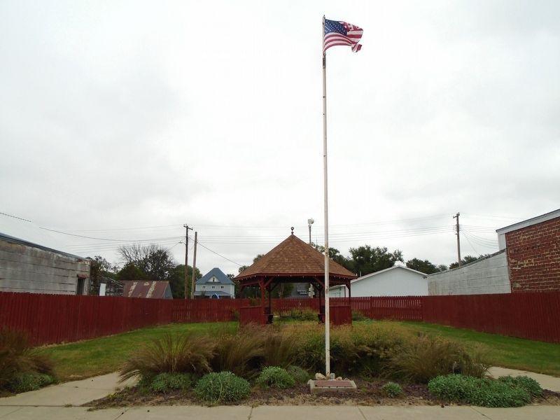
On Thayer Street north of Gale Street, on the right when traveling north.
Following his U.S. Navy service during WWII, Marvin was a member of The American Legion for over 70 years and Alice was active in The American Legion Auxiliary. As patriotic, inspirational educators, they encouraged citizenship as students . . . — — Map (db m312336) HM
On Thayer Street north of Butte Street, on the right when traveling north.
In commemoration of the men of Boyd County
who made the supreme sacrifice in the World War
Robert L. Wills • Finn L. Nelson • Frank H. Bergstrom
Frank Joseph Carroll • Lynn Stockwell • Floyd Earl Clute
Karl Schumann • William L. Whidden . . . — — Map (db m312315) WM
On Sampson Street just north of Outlaw Trail Scenic Byway (State Highway 12), on the right when traveling north.
On this day the Lewis and Clark Expedition to the Pacific Ocean camped on the bank of the Missouri River at the base of a river landmark near here, now called The Tower. Clark wrote, “Capt Lewis & my Self walked up to the top which forms a Cone and . . . — — Map (db m181800) HM
On State Highway 12, on the right when traveling west.
FLIGHT CREW
Capt. Stanley J. Meadows, C-47 Pilot
Capt. Robert K. "Bud" Bohle, C-47 Co-Pilot
Sgt. Orson H. Hutslar, C-47 Crew Chief
PASSENGERS
Capt. Leslie B. Roberts, Flight Surgeon
F/O John F. Albert
2nd Lt. William F. . . . — — Map (db m312356) WM
On State Highway 12, on the right when traveling west.
On August 3, 1944, a C-47 transport carrying twenty-eight men of the U.S. Army Air Forces crashed in a ravine six miles southwest of Naper during a severe storm. There were no survivors. It was the largest single military air disaster in Nebraska . . . — — Map (db m70623) HM
On Thayer Street (U.S. 281) at Main Street, on the right when traveling north on Thayer Street.
[Armed Services Emblems]
★ Killed/Missing During Service
[Honor Roll of Veterans]
Adams Bill D • Adams Jack H • Adams John B • Adams L Dean • Adams Louis C • Ahlers Walter E • Alford Douglas C • Alford William R • Alford William T . . . — — Map (db m312314) WM
On U.S. 20 at milepost 235, on the right when traveling west.
Ainsworth Army Air Field, completed on November 30, 1942, was a satellite of Rapid City Army Air Field and under command of the Second Air Force. The field was one of eleven Army Air Force training bases built in Nebraska during World War II. The . . . — — Map (db m77760) HM
On US 20 (U.S. 20), on the left when traveling east.
Lakeland High School was constructed 20 miles south of this site by ranchers from several rural school districts during the summer of 1934. School began that September with 11 students. Constructed of prairie sod, with a sod roof supported by pole . . . — — Map (db m9623) HM
On North Main Street 0.1 miles south of East 3rd Street, on the left when traveling south.
Like many Nebraska communities, Long Pine's history is tied to railroad development. When the Fremont, Elkhorn, and Missouri Valley line arrived in 1881, Long Pine became a bustling railroad town. The Chicago & North Western Railroad (CNW) built a . . . — — Map (db m182061) HM
The first ranch in this area was set up on the Niobrara River about five miles south of here in 1877. E. S. Newman established his ranch to sell cattle to the government for delivery to the Indians at the Pine Ridge Agency to the north.
The . . . — — Map (db m9622) HM
On State Highway 61 0.2 miles north of Survey Valley Road, on the left when traveling north.
This natural valley extending east and west across the Sandhills became known as Survey Valley after the Burlington and Missouri River Railroad surveyed a prospective line from O’Neill to Alliance in 1887. No rails were ever laid. On January 19, . . . — — Map (db m178711) HM
On U.S. 20 3 miles west of U.S. 83, on the left when traveling west.
This arched cantilever truss bridge, connected in the center with a single pin, is the only one of its kind in the United States. It was built in 1932 by the Department of Public Works and named by the local citizenry in honor of Governor Charles . . . — — Map (db m70625) HM
On Macomb Street at 3rd Street, on the right when traveling north on Macomb Street.
Oldest High School Bldg. in Nebraska
———————————————
A living memorial
in memory of
Maxine Allard
for her dedication to the
education of our children — — Map (db m312421) HM
On Macomb Street at 3rd Street, on the right when traveling north on Macomb Street.
This land was donated to the
CITY OF VALENTINE in 1986
by Frank & Harriet Colburn and is
hereby named
COLBURN PARK
and it[s] purpose being for the use
of the elderly citizens &
various civic organizations of
Valentine & the . . . — — Map (db m312403) HM
Spread out along the North Loup River west of here, DeWitty, later known as Audacious, was the largest and longest-lasting African American settlement in rural Nebraska. The settlers, including former slaves who had fled to Canada before the . . . — — Map (db m312383) HM
On U.S. 20 at milepost 198, on the right when traveling west.
When a Sioux Indian reservation was established north of here in Dakota Territory in 1878, early settlers in the region grew fearful of attack. They requested military protection, and in 1880 Fort Niobrara was built a few miles east of present-day . . . — — Map (db m77753) HM
On Main Street north of 3rd Street, on the left when traveling north.
For Those That Served
In The
Korean War
January 1, 1947
January 27, 1961
[Armed Services Emblems]
[★ - Killed in Action or Died in Service]
Adams, Donald E. • Adams, Jack B. • Adams, Merle D. • Ahrens, . . . — — Map (db m312570) HM
On Main Street north of 3rd Street, on the left when traveling north.
For Those That Served
In The
Vietnam War
January 28, 1961
May 7, 1975
[Armed Service Emblems]
[★ - Killed in Action or Died in Service]
Aeschliman, Darwin W. •
Aeschliman, Richard L. •
Ahrens, Dennis . . . — — Map (db m312609) WM
On Main Street north of 3rd Street, on the left when traveling north.
Dedicated to the memory of All Area Veterans.
Inscribed here are the names of those veterans
from this area who made the supreme sacrifice
in defense of the freedoms we all cherish
[Dedicated] November 11, 1984
World War I . . . — — Map (db m312531) HM
On Main Street north of 3rd Street, on the left when traveling north.
Honoring those from Cherry Co[unty]
who served in the Second World War
Dedicated June 28, 2003
Carl G. Abercrombie •
Donald L. Abraham •
Ruth Ahlf •
Leonard H. Alder •
Donald J. Allard •
Walter W. Allard •
Albert Allen • . . . — — Map (db m312633) HM
On Main Street (U.S. 83) north of 3rd Street, on the left when traveling north.
In honor and memory of those
who served in the World War
World War Veterans
[★ Killed or Died in Service]
[Column 1]
Adams, Harvey •
Adams, John Phillip •
Adair, Carl Geoffrey •
Albrechtsen, Kai •
Allard, Carl Allen . . . — — Map (db m312448) WM
On U.S. 20 at milepost 221 east of Main Street, on the right when traveling west.
At 10:45 a.m. on February 5, 1944, 1st Lt. John B. Beatty of Sandusky, OH, and 2d Lt. Earnest W. Fanslau of Mantua, NJ took to the air from the Ainsworth Army Air Field in two P-47 "Thunderbolt" fighter planes for an instrument training flight. Lt. . . . — — Map (db m77754) HM
Near Railroad Street just east of North Main Street, on the left when traveling east.
The Early Years 1875-1881 Welcome to Atkinson — a city of 1,462 as of 2019 census and thank you for visiting Railroad Park. The Railroad played an important role in establishing our city. This picnic pavilion is on the west end of . . . — — Map (db m191594) HM
Near Railroad Street just east of North Main Street, on the left when traveling east.
Atkinson celebrated its Diamond Anniversary in August 1940 and The Atkinson Graphic newspaper published numerous articles describing meetings of various local clubs which were organizing activities leading up to the late summer event. In the June . . . — — Map (db m191595) HM
On U.S. 275 at South Spruce Street, on the right when traveling south on U.S. 275.
Near here was the scene of some of Nebraska’s earliest experiments with flight in a heavier-than-air vehicle. Sometime before late 1907, Martin P. Savidge’s sons set out to construct a flying machine.
They began by studying hawks, then went . . . — — Map (db m101688) HM
On U.S. 20 2.5 miles east of O’Neill, on the right when traveling east.
One of the most colorful leaders in the early development of Nebraska was General John O'Neill, founder of O'Neill. After leading several ill-fated raids against British military posts in Canada 1866-1871, O'Neill lost his leading position in the . . . — — Map (db m9632) HM
On North 4th Street at East Clay Street, on the right when traveling north on North 4th Street.
The Irish were a major immigrant group contributing to the settlement of Nebraska. Speaking the English language, they blended into the population and were found in many communities. However, due to ancient animosities with Britain, some of them . . . — — Map (db m179200) HM
On American Legion Memorial Highway (U.S. 281) 8.6 miles south of U.S. 20, on the right when traveling south.
Originally the entire responsibility for highways in Nebraska rested with the counties. In 1917 the Legislature accepted the provisions of a federal law and appropriated money to match federal funds for highway construction. This act marked the . . . — — Map (db m182016) HM
On 5th Street (State Highway 45A Spur) at Main Street, on the left when traveling south on 5th Street.
In the late nineteenth century the U. S. Coast & Geodetic Survey undertook measurements to determine the nation’s physical shape with absolute accuracy. This survey initially involved two triangulation networks. One survey stretched from coast to . . . — — Map (db m181892) HM
On 5th Street (State Highway 45A Spur) at Main Street, on the left when traveling south on 5th Street.
The first Page School was a small sod building located ½ mile south of Page and was erected in 1883. It was open for seven years. In 1891, a large 2-story wooden schoolhouse was erected on the block west of the Page Park. In 1892, the students put . . . — — Map (db m181975) HM
On U.S. 183 2.1 miles south of Nebraska Route 12, on the left when traveling south.
Before you is a settlement success story resulting from the Homestead Act of 1862 and the Timber Culture Act of 1873.
David A. and Kate E. (Blakely) Clopton came to Keya Paha county from Jefferson, Iowa in 1884. They homesteaded just south of . . . — — Map (db m237138) HM
On Nash Street at L Street, on the right when traveling north on Nash Street.
Keya Paha County, organized at a special election January 20, 1885, was created from that part of Brown County lying north of the Niobrara River. Its name comes from “Ke’-ya Pa-ha’ Wakpi” or “Turtle Hill River,” the Lakota Indian designation for . . . — — Map (db m237246) HM
On L Street (East Turbine Avenue) just east of North Ash Street, on the left when traveling east.
Dedicated to the memory of our men from Keya Paha County who served their country in the Civil War, the Spanish War, and Great World War that Liberty shall not perish from the Earth. World War Antrim, Benj. R. • Austin, Warren . . . — — Map (db m237257) WM
On L Street (East Turbine Avenue) east of North Ash Street, on the left when traveling east.
Dedicated to the memory of the Men and Women from Keya Paha County who served their county, that Liberty shall not perish from the Earth World War II Adams Everett V. • Adkinson Charles L. • ☆Alexander Charles H. • . . . — — Map (db m237274) WM
On Norden Road 0.3 miles south of State Highway 12.
The first Keya Paha County Fair was held in September 1898. Ever since, the center of the fair’s activities has been the Barn Dance. The current fairground was purchased in 1921. A new dance hall was approved in 1929 and built by Fred Taylor. The . . . — — Map (db m179183) HM
On Main Street just east of West 3rd Street, on the right when traveling east.
While lost and searching for missing horses, George Shannon had missed many adventures and some wonderful food — as soon as the men found Shannon, they were eager to share their stories. During those sixteen days, the men were feasting on fish and . . . — — Map (db m313300) HM
On Main Street just east of West 3rd Street, on the right when traveling east.
In the 125 years since Crofton was founded, the United States and its communities have changed dramatically. Even with industrialization and advancements in education and technology, there remain certain constants in our lives. Crofton is a . . . — — Map (db m312995) HM
On Main Street 0.1 miles west of 539 Avenue, on the right when traveling west.
On its journey to the Pacific Ocean the Lewis and Clark Expedition camped near here on September 2, 1804. At this camp the explorers’ imagination and knowledge of military fortifications misled them into concluding that sand ridges and mounds left . . . — — Map (db m181799) HM
On Main Street 0.1 miles west of 539 Avenue, on the right when traveling west.
George Shannon was reunited with the Lewis and Clark Expedition and the group traveled onward to present-day North Dakota. Private John Newman was caught speaking in mutinous tones — an attempt to subvert the discipline and loyalty of other members . . . — — Map (db m181894) HM
..came to the mouth of the Qui courre (rapid) this river Comes roleing its Sands whuch (is corse) into Missouris from the SW by W... it does not rise high when it Does it Spreds over a large Surface, and is not navagable....
Captain William . . . — — Map (db m311993) HM
"4th of September Tuesday 1804 a verry cold wind from SouthE. by S. we set out early proceeded on"
[Map showing entire Corps of Discovery route and location of Niobrara State Park along that route]
[Bas reliefs of] . . . — — Map (db m312279) HM
In 1846, some 65 Mormon families with 150 wagons were
headed West along the north shore of the Platte River.
Somewhere between present-day Columbus and Genoa, a
government agent contacted them to harvest some grain
planted by white laborers . . . — — Map (db m312189) HM
Near 521st Avenue at 890th Road, on the left when traveling north.
Seen through Ponca eyes, the original prairie environment was a cherished sea of grasses and plants. Together, with the buffalo, we kept the prairie healthy. Buffalo herds would graze the vast landscape, and our people would collect different types . . . — — Map (db m192598) HM
Fur traders had already traveled the region some years before
the Lewis and Clark Expedition of 1804-06. Trader Juan Munier
claimed to have discovered the Ponca living on the Niobrara in
1789, but Pierre and Paul Mallet probably visited the . . . — — Map (db m312296) HM
Near 521st Avenue at 890th Road, on the left when traveling north.
In contrast to the village earthlodge, the tipi was a light and portable shelter. It was a kind of seasonal, second home. Constructed of slender wooden poles and buffalo hide, tipis were pitched in a circular arrangement during the bison hunt and . . . — — Map (db m192656) HM
Excerpt from William Clark's Field Notes for September 4, 1804.
"A verry cold wind from South E. by S. We set out early-proceeded on to the mouth of a Small Creek in the bend of the
L.S. Called (Sand) white line [lime] at 1½ miles furthr . . . — — Map (db m312183) HM
Near Walnut Street (Outlaw Trail Scenic Byway) (State Highway 12) at Spruce Avenue, on the right when traveling east.
George Shannon was in St. Louis in 1810 when he was authorized to travel to Pennsylvania to assist historian Nicholas Biddle in editing the Lewis and Clark journals. While working on the journals, Shannon decided he would like to study law. Shannon . . . — — Map (db m181895) HM
LAND MANAGEMENT
As a Natural Legacy
Demonstration Site,
Niobrara State Park
showcases land
management techniques
landowners can use to
provide good wildlife
habitat on their land. These
techniques include eastern
red cedar tree . . . — — Map (db m311982) HM
Near 522 Avenue 0.4 miles south of State Highway 12, on the left when traveling south.
[east side]Newell Knight Born Sept. 13, 1800 Died Jan. 11, 1847 A member of the Church of Jesus Christ of Latter Day Saints. Erected in loving appreciation of our father who died during the hardships of the Mormon exodus . . . — — Map (db m312700) HM
Established in 1856 at the confluence of the Niobrara and
Missouri rivers, the town of Niobrara has actually had three
homes." The first settlement, about 2 miles east of here
grew up around a building known as "Old Cabin." When the
Indians . . . — — Map (db m312294) HM
Near 521st Avenue at 890th Road, on the left when traveling north.
This building was constructed in 1936 by the Indian Emergency Conservation Work (IECW) force. Like the Civilian Conservation Corps, the IECW was part of the country's New Deal program aimed at providing economic relief during the Great Depression. . . . — — Map (db m192597) HM
Near 521st Avenue at 890th Road, on the left when traveling north.
Back in the day, our people lived in villages comprised of earthlodges. We called the lodges maithi, and they were set beside our gardens and crops. These dwellings were constructed by women, though men sometimes helped to cut and carry in the . . . — — Map (db m192655) HM
Near 521st Avenue at 890th Road, on the left when traveling north.
After a tragic history of forced relocation and land loss many tribes began coming together in the mid-20th century for intertribal gatherings. It was here that each tribe's long history of seasonal dances and sacred ceremonies culminated in a new . . . — — Map (db m192596) HM
Things did not improve for the Ponca. Disease and homesickness
still plagued them. During the winter of 1878-79, Chief Standing
Bear's son died. He wanted to be buried in Nebraska. With a small
band, the chief slipped away and headed North to . . . — — Map (db m312299) HM
Near 521st Avenue at 890th Road, on the left when traveling north.
For thousands of years our people depended upon the buffalo. We ate its meat, used its hides for our homes and clothing, its horns to make spoons, and our children even used the buffalo's ribs to make winter sleds. Every part of the animal was . . . — — Map (db m192600) HM
Conditions became so bad for the Poncas that by 1876
Washington had to act. Congress authorized $25,000 to move
the tribe to Indian Territory, "if they consented to go." Eight
chiefs went to select a new reservation site. They refused . . . — — Map (db m312195) HM
Near 521st Avenue at 890th Road, on the left when traveling north.
maN zhaN (the land) is xube' (sacred) to the Ponca People as is Ni' (water). Following forced removal of the Ponca Tribe to Oklahoma, the tribe split into two groups. The members that stayed in Oklahoma are now referred to . . . — — Map (db m192657) HM
Termed one of the most developed North American Indian
civilizations, the Poncas derive from the Middle Mississippi
Culture and are related to the Osage, Kansas, Quapaw and
Omaha. Their main villages occupied what is now Knox County.
Never . . . — — Map (db m312191) HM
On State Highway 12 at 522 Avenue, on the right when traveling west on State Highway 12.
This has been the homeland of the Ponca Indians since earliest recorded history. In 1868 the federal government signed the Treaty of Fort Laramie, which transferred the land to the Sioux without the permission of the Ponca. Treaties made with the . . . — — Map (db m179194) HM
Near Walnut Street (Outlaw Trail Scenic Byway) (State Highway 12) at Spruce Avenue, on the right when traveling east.
On the night of June 2, 1969, while on maneuvers in the South China Sea off the coast of Vietnam, the Australian aircraft carrier Melbourne was in collision with the destroyer USS Frank E. Evans. The impact cut the Evans in . . . — — Map (db m181893) HM WM
In 1803, President Thomas Jefferson commissioned
Meriwether Lewis and William Clark to explore the vast
wilderness of the Louisiana Purchase via the great Missouri
River and its tributaries all the way to the Pacific Ocean. As
they sailed, . . . — — Map (db m312185) HM
Near 521st Avenue at 890th Road, on the left when traveling north.
Seen through Native eyes, the land and water are alive. Rocks, trees, meadows, and rivers: all of these natural elements possess their own life spirit. In our culture, Mother Earth is a powerful force in everyday life. We believe that our people, . . . — — Map (db m192653) HM
Near 521st Avenue at 890th Road, on the left when traveling north.
Our villages and old trails were always located near rivers or streams. Waterways were the highways of days gone by, and we used them for travel and trade. Sometimes they would also function as natural yet strategic barriers between one tribe and . . . — — Map (db m192599) HM
On Main Street (State Highway 12) at 516th/Glick Avenue, on the right when traveling west on Main Street.
A successful lawyer, Shannon was easily recognized by his peg leg but never wanted or sought sympathy. He served in the Kentucky House of Representatives from 1820 to 1824 and was a circuit judge for three years. Then Shannon moved his family to . . . — — Map (db m312300) HM
On U.S. 20 0.1 miles east of 457th Avenue, on the right when traveling east.
Welcome to Spring Valley Park. Pioneers of this
region, eastern Rock County, recognized it as a great
natural haying region extending over twenty miles
south down this valley. The nearby village of Newport.
established in 1883, became one of . . . — — Map (db m223476) HM