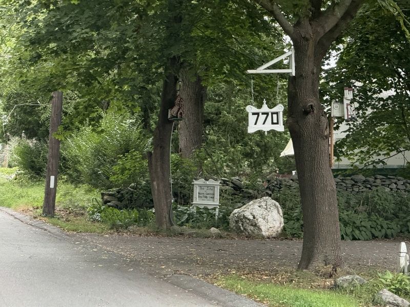
On Child Street (Rhode Island Route 103) at Hugh Cole Road, on the right when traveling east on Child Street.
The town of Warren was first settled by people from the Pokanoket Tribe, later known as the Wampanoag. The Pokanoket controlled the land from Plymouth to the eastern shores of Narragansett Bay. In 1620, “Osamequin”, which translates as “Yellow . . . — — Map (db m301430) HM
Near West Main Road (Rhode Island Route 77) just south of Fairfields Drive, on the left when traveling south.
Distrust for the Newcomers
The Sakonnets and the English were not friends.
As many as 3,000 Sakonnets lived here in the 1600s.
They saw European ships sail by beginning in the 1500s.
European newcomers brought diseases but the
Sakonnets were . . . — — Map (db m307016) HM WM
On Main Street (Massachusetts Route 70) north of Bigelow Gardens, on the left when traveling north.
In the field nearby was situated the garrison house of the Rev. Joseph Rowlandson first ordained minister of Lancaster. During his absence on February 10, 1675-76 this garrison house was attacked and destroyed by the Indians. The inhabitants were . . . — — Map (db m299114) HM
This Tablet erected by the Rhode Island Society of Colonial Wars in recognition of the exceptional services rendered by Col. Benjamin Church. His fearless leadership and effective command during King Philip's War 1675-1676 — — Map (db m307061) WM
On Main Street at Town Square, on the left when traveling north on Main Street.
After the Pilgrims’ arrival, Native Americans in New England grew increasingly frustrated with the English settlers’ abuse and treachery. Metacomet (King Philip), a son of the Wampanoag sachem known as the Massasoit (Ousamequin), called upon all . . . — — Map (db m299590) HM
On Boston Post Road (U.S. 20) at Concord Road, on the right when traveling west on Boston Post Road.
One-quarter mile north took place the Sudbury Fight with King Philip's Indians on April 21, 1676. Captain Samuel Wadsworth fell with twenty-eight of his men; their monument stands in the burying ground. — — Map (db m302189) HM WM
On U.S. 44 2 miles east of U.S. 118, on the right when traveling east.
Site of capture of the Wamponoag Indian Chief Anawan by Captain Benjamin Church on August 28th 1676, thus ending King Philip's war — — Map (db m44921) HM
On North Main Street, on the right when traveling north.
Erected August
1838
—
On this Ground Capt. Thomas Lathrop and eighty four men under his command, including eighteen
teamsters from Deer field, conveying stores from that town to Hadley, were ambuscaded by about
700 . . . — — Map (db m37542) HM
On North Main Street (Massachusetts Route 105) at Barrows Street, on the right when traveling north on North Main Street.
Fifty rods east is the site of the Old Fort built about 1670 as a place of defense and refuge in time of need. During King Philip’s War an Indian making insulting gestures on Indian Rock across the Nemasket River was shot from the fort. — — Map (db m301634) HM
On Barney Avenue at Providence Road, on the right when traveling south on Barney Avenue.
Block House No. 2. From 1675 - as seen in 1782. On the rise behind this sign was a fortified house surrounded by a palisade during the King Philip's War. This enclosure was a place of safety against Indian attack for the settlers in the Palmer's . . . — — Map (db m299476) HM WM
On Washington Street (Massachusetts Route 53) at Winter Court, on the right when traveling east on Washington Street.
Near this site took place on April 19, 1676 the Last Indian Attack on Weymouth. This attack was the high water mark of King Philip's War being the nearest point to Boston ever reached by King Philip's forces.
Erected by the Society . . . — — Map (db m297528) HM WM
On Plympton Street (Massachusetts Route 105) near U.S. 44, on the left when traveling south.
In Memory of John Miller
Died May 11, 1720 in the 97th year of his age
He was one of the householders who returned to Middleborough from Plymouth after King Philip's War, and at their first meeting in June 1677 resolved to repossess their . . . — — Map (db m302508) HM WM
On Old Providence Road at Barneyville Road, on the left when traveling east on Old Providence Road.
Near this spot stood the John Myles Garrison House. The place of meeting of the troops of Massachusetts Bay and Plymouth colonies.
Commanded by
Majors Thomas Savage and James Cudworth, who marched to the relief of Swansea at the opening of . . . — — Map (db m299489) HM WM
On Water Row just north of Old Sudbury Road (State Route 27), on the left when traveling north.
Site of the Haynes Garrison House
The home of Deacon John Haynes
Here the settlers by their brave defense helped save the town when the Indians tried to destroy Sudbury. 18 through 21 April 1676. — — Map (db m302069) HM
On Main Street (Massachusetts Route 109) at Pound Street, on the right when traveling west on Main Street.
The original house, built in 1651, was burned when King Philip's Indians burnt the town of Medfield in 1676. Seth Clark, the owner, received indemnity from the colonial government and in 1680 rebuilt the present Peak house, so called because of its . . . — — Map (db m48797) HM
Near Metacom Avenue (Rhode Island Route 136) 0.1 miles south of Mount Hope Avenue, on the right when traveling north.
Mount Hope (originally Montaup in the Pokanoket language) is a wooded promontory on the eastern shore of Bristol, Rhode Island overlooking the part of Narragansett Bay known as Mount Hope Bay. Before the European settlers arrived in New England, . . . — — Map (db m301431) HM
On High Street near Blackstone Street, on the left when traveling north.
Near this spot Captain Michael Pierce and his company of
Plymovth Colonists ambvshed and outnvmbered were
almost annihilated by the Indians
March 26, 1676 — — Map (db m303649) HM WM
On Main Street (U.S. 44) at Howland Street, on the left when traveling north on Main Street.
The Spring of clear cold water located thirty feet west of this point led Roger Williams to found Providence here in the year 1636 from which center has developed in four directions — — Map (db m122490) HM
On Main Street (Massachusetts Route 119), on the left when traveling south.
Near by stood a garrison house, residence of Captain James Parker, Commander of the town forces in King Philip's War. Here Captain Parker parleyed with the Indian Chief John Monoco regarding his threat to burn Groton and Boston, March 13, 1676. — — Map (db m48821) HM
On High Street north of Blackstone Street, on the right when traveling north.
Due to land disputes and broken peace treaties between local natives and early English settlers, King Philip's War took place for 14 months during 1675 and 1676. Captain Michael Pierce's fight with the natives occured on this spot in March of . . . — — Map (db m313313) HM
On Main Street near Hastings Street ( Route 16), on the right when traveling south.
In memory of the honored founders of Mendon 'the old mother town.' Settled 1663. Incorporated 1667. Eight towns are now located on her original territory. Near this spot Mendon's first three meeting houses were built."
Founders 1668: . . . — — Map (db m91558) HM
On Water Street south of Haile Street, on the left when traveling south.
The Sowams Heritage Area includes Barrington, Bristol, East Providence, Providence, and Warren RI, and Rehoboth, Seekonk and Swansea, MA. Sowams means "Southern Area” and was the historic home of the Pokanokets (later described as Wampanoags) . . . — — Map (db m296118) HM
Near Broad Street just north of Summit Street, on the left when traveling north.
Donated by Alvin Jenks in 1890, the park was built around Dexter's Ledge. In 1676 during King Philip's War, Indian scouts saw the approach of a colonist band from that height. Indians and colonists engaged in Pierce's Fight at a site along the . . . — — Map (db m303634) HM WM
Near Temple Street 0.1 miles south of Elm Street, on the right when traveling south.
In Memory of the Regicide
Col William Goffe
A member of the High Court of Justice which in 1649 tried and condemned King Charles 1st of England and a signer of the kings death warrant. He served with distinction in the Parliamentary Army and in . . . — — Map (db m34817) HM
On Water Row at Old Sudbury Road (State Route 27), on the left when traveling north on Water Row.
One-eighth of a mile north is the site of the Haynes Garrison House the home of Deacon John Haynes. Here the settlers by their brave defense saved the town when King Philip and his Indian warriors attacked Sudbury in April, 1676. — — Map (db m300804) HM
On Boston Post Road (U.S. 20) just west of Goodmans Hill Road, on the left when traveling west.
Portion of the Goodenow Garrison
House in which the settlers took
refuge from King Philip's Indians
during the battle of April 18-21,
1676. — — Map (db m301962) HM
Near Asylum Road 0.3 miles west of Cole School Road, on the left when traveling north.
In memory of Hugh Cole. Born London, England, 1627. Died Swansea, Mass, 1699. An honorable and useful citizen of Plymouth Colony. Many years a representative of Swansea, Mass.
A sergeant in King Philip's War, 1675. An esteemed friend of . . . — — Map (db m304527) HM
On Newman Avenue (Rhode Island Route 152) at Pawtucket Avenue ( Route 1A), on the right when traveling east on Newman Avenue.
The area of today’s City of East Providence was inhabited by the Pokanoket Tribe, later known as the Wampanoag, for over 10,000 years. In 1621, the Massasoit Ousamequin entered into a mutual protection agreement with the English settlers in . . . — — Map (db m299261) HM
On Highland Avenue at Sunnyside Avenue, on the right when traveling north on Highland Avenue.
The first settlement of Waterbury was made on land in this region about 1675. The settlement was abandoned during King Philip’s War and was resumed around the present Waterbury green after 1677. — — Map (db m23600) HM
Site of first house in Acton, built by Captain Thomas Wheeler in 1668. He was commissioned to keep fifty cattle for the inhabitants and at night protect them in a yard from wild beasts. He was wounded by the Indians in King Philip's War. — — Map (db m48823) HM
On Country Way just north of the Greenbush Rotary, on the left when traveling north.
The Stockbridge mansion, built before 1660, stood on this site. It was a garrison house in King Philip’s War for protection of the mills, and was successfully defended. The pond and mill were made famous by Woodworth’s poem "The Old Oaken Bucket." — — Map (db m48800) HM
On Barker Road 0.1 miles north of Brookline Road, on the right when traveling north.
A portion of the house built by John Williams in 1634 is incorporated in the present house. It was a "garrison" or place of refuge and defense during King Philip's War. — — Map (db m48804) HM
On Belmont Street (Massachusetts Route 9) at Shrewsbury Street, on the left when traveling west on Belmont Street.
The first settlement of this lonely region called Quinsigamond was attempted in 1673, but abandoned during King Philip's War. A second settlement, attempted in 1684, soon named Worcester, was also temporarily abandoned because of Indian hostility. . . . — — Map (db m48046) HM
On Main Street (Massachusetts Route 9) at Stafford Street, on the left when traveling west on Main Street.
The first settlement of this lonely region called Quinsigamond was attempted in 1673, but abandoned during King Philip's War. A second settlement, attempted in 1684, soon named Worcester, was also temporarily abandoned because of Indian hostility. . . . — — Map (db m48047) HM
On Belmont Street (Massachusetts Route 9) at Grove Street, on the left when traveling west on Belmont Street.
The first settlement of this lonely region called Quinsigamond was attempted in 1673, but abandoned during King Philip's War. A second settlement, attempted in 1684, soon named Worcester, was also temporarily abandoned because of Indian hostility. . . . — — Map (db m48048) HM
Near Midstate Trail south of Redemption Rock Trail North ( Route 140), on the left when traveling south.
Upon this rock May 2nd 1676 was made the agreement for the ransom of Mrs. Mary Rowlandson of Lancaster between the Indians and John Hoar of Concord. King Philip was with the Indians but refused his consent. — — Map (db m297893) HM
On Boston Post Road (U.S. 20) at Concord Road, on the right when traveling west on Boston Post Road.
To the left is the site of Hop Brook Mill, erected in 1659 by virtue of a town grant to Thomas and Peter Noyes, "to build and maintain a mill to grind the corn of the settlers." It is now the property of Henry Ford. — — Map (db m48812) HM
Near Asylum Road 0.3 miles west of Cole School Road, on the left when traveling north.
June, 1628: Born in Devonshire England
1633: Hugh and his family arrive in Plymouth as indentured servants
1634: Hugh was hired by neighbors to tend to their cows. Every day from April to November he milked the cows, brought them . . . — — Map (db m303832) HM
Near Concord road south of Codjer Lane, on the left when traveling south.
This monument is erected by the Commonwealth of Massachusetts and the town of Sudbury in grateful remembrance of the services and sufferings of the founders of the state; and especially in honor of
Capt. S. Wadsworth of Milton.
Capt. . . . — — Map (db m301973) WM
Near West Main Road (Rhode Island Route 77) south of Fairfields Drive, on the right when traveling north.
The Sakonnet Diaspora
The descendants of the Sakonnets are a diaspora.
The Sakonnets began leaving their homelands in the Late 1600s, driven away by war, European diseases English encroachment, and fear. English neighbors burned a Native . . . — — Map (db m307144) HM
Near South County Trail (Rhode Island Route 2) 1.4 miles south of Kingstown Road ( Route 132), on the left when traveling west.
Attacked
within their fort upon this island
the Narragansett Indians
made their last stand
in King Philip's War and
were crushed by the united forces
of the Massachusetts Connecticut
and Plymouth Colonies
in the
“Great Swamp Fight” . . . — — Map (db m300554) HM
On Westford Street at Academy Street, on the left when traveling west on Westford Street.
The Chelmsford Forefathers Burying Ground is one of the oldest cemeteries in the Merrimack River Valley. Established in 1655, the Burying Ground is an important part of Chelmsford's local history and an integral link to our past.
Read about . . . — — Map (db m311815) HM
On Centre Street, on the right when traveling west.
Defense was a prime necessity to the early settlers of Salem Village, and as early as 1671 the male inhabitants began meeting here for military drill. This preparation was heightened in 1675 during the King Philip War in which many villagers took . . . — — Map (db m17991) HM
On Washington Street (Massachusetts Route 53) at Middle Street, on the right when traveling east on Washington Street.
Site of first “Town House” Here in 1852 at the geographical
center of Weymouth was built the first “Town House” or Town Hall, later used as a high school. During King Philip’s War in 1675, this was the location nearest to Boston at which settlers . . . — — Map (db m296638) HM
On North Main Street, on the left when traveling north. Reported permanently removed.
This intersection was the earliest center of colonial Providence. A grist mill stood just north, at the falls of Moshassuck River, and a tannery and taverns were nearby across the street. In 1676 the natives of many tribes united against the New . . . — — Map (db m56152) HM
Near West Main Road (Rhode Island Route 77) south of Fairfields Drive, on the right when traveling north.
Buying & Selling Acoaxet
After the war many Native people owned
land in Acoaxet with English-style deeds.
Mamanuah preserved his homelands by remaining
loyal to the English during King Philip's War and by selling
Awashonks' land instead . . . — — Map (db m307138) HM WM
On Ingersoll St just north of Centre Street, on the right when traveling north.
In grateful memory of the following men of the town of Danvers, as well as those others whose memory is known but to God, who gave their lives and, through their sacrifice, begat us a nation.
Patrick Carroll d. Sept. 10, 1779
Samuel Cook Jr. . . . — — Map (db m309596) WM
Near Western Avenue (Massachusetts Route 127) at Essex Avenue ( Route 133), on the right when traveling north.
Oldest Defenses in the Mass. Bay Colony. Thrown up in 1625 by Capt. John Hewest. Occupied in King Philips War 1675 and in King Georges War 1743. Companies under Capt. John McCaw and Capt. John Lane stationed here during War for Independence . . . — — Map (db m36355) HM
On Conway Street at Silver Street, on the right when traveling south on Conway Street.
A military commander during King Phillip's War. Capt. Turner was killed near here in a retreat after leading a massacre of Indians fishing at the Great Falls of the Conn. River in Gill on May 19, 1676. — — Map (db m299224) HM
On Summer Street at Favor Street, on the right when traveling west on Summer Street.
Site of chapel erected in 1653 for John Eliot, the Apostle to the Indians. Here he preached to the Wamesit and Pennacook Indians, converting many and establishing a village of Christian Indians called Wamesit. — — Map (db m298183) HM
On Eliot Street (Massachusetts Route 16) at Union Street, on the left when traveling north on Eliot Street.
On this site John Eliot helped his Indian converts to build their first meetinghouse in 1651, with a "prophet's chamber" where he lodged on his fortnightly visits to preach to them in their language. His disciple Daniel Takawambait succeeded to . . . — — Map (db m295847) HM
Near Old Sudbury Road (Route 27), on the right when traveling north.
Panel 1
Old Town Bridge ----- -----
Foot-bridge and ferry until a cart-bridge in 1643
First frame bridge in Middlesex Co.
First Four-arch stone bridge in Massachusetts.
Over this the Indians were were forced in King Philips . . . — — Map (db m302016) HM WM
On Washington Street (Massachusetts Route 138) south of Homans Lane, on the right when traveling south.
The north line of Ponkapoag Plantation second of the Apostle Eliot's Praying Indian towns, set apart by the Dorchester Proprietors in 1657. — — Map (db m308384) HM
Near Mansfield Road east of East Foxboro Road, on the left when traveling east.
Here is a place where Native Americans may have met to strategize during King Philip's War (1675-76). This major conflict between colonists and a number of native tribes started in Rhode Island and southern Massachusetts and ended with the death . . . — — Map (db m298163) HM WM
On Winslow Cemetery Road west of Presidential Circle, on the left when traveling north.
Erected about 1641, a small building with a thatched roof stood a little north of this enclosure. It was sold in 1657 for 50 shillings when a new church was built near the site of the present First Congregational Church. Here are to be found the . . . — — Map (db m304464) HM
On River Street east of Forest Street, on the right when traveling west.
Home of Rev. James Keith
First Minister to Bridgewater
Built in 1662
The generous gift of
Mr. and Mrs. Howard Anderson
to the old Bridgewater
Historical Society
For tours and information,
Visit . . . — — Map (db m297629) HM
Near Head Island Causeway south of Harborwalk, on the right when traveling south.
Quonehassit, now known as Boston Harbor, is part of the ancestral lands of the Massachusett, one of many Algonkian peoples in eastern North America. For generations, thousands of Massachusett lived on the harbor islands in warmer months, fishing, . . . — — Map (db m297803) HM WM
On Roxbury Street east of John Eliot Square, on the right when traveling west.
People have lived in the Roxbury area since the last glaciers melted 14,000 years ago. As the climate warmed, glacial melt flooded rivers and coasts, creating a diverse ecosystem. Forests and waters supported abundant game, fish, and shellfish, as . . . — — Map (db m295836) HM
On West Road 0.3 miles north of Unitas Road, on the right when traveling north.
Somewhere within 1/2 mile
along the base of this hill
Capt. Edward Hutchinson and
his company were attacked
by Indians lying in ambush
Aug. 2 1675, and he and more
than one half of his men slain
or wounded. — — Map (db m311496) HM WM
On this site stood the stone residence of Peter Disbrow, designated by the Rye colonists as the "Rye Fort" when it was offered for protection from the Indian attack during "King Philip's War" of 1675.
Around 1728 the present frame (North) . . . — — Map (db m34485) HM
On S Canterbury Road (Connecticut Route 169) at Westminster Road ( Route 14), on the right when traveling north on S Canterbury Road.
Originally part of Plainfield the town was incorporated in October, 1703. The town area includes the original Quinebaug Plantation of Major James Fitch, son of the Reverend James Fitch of Saybrook Fort, a first settler of Norwich in 1659. Major . . . — — Map (db m301999) HM
The Native American Sachem, Metacomet of Pokonoket, called King Philip by the English, Sachem or chief of the Wampanoag people is reported to have used this area as a stopping place. It provided a natural fortress for his many visits to the . . . — — Map (db m56217) HM
One of the thirteen original colonies
Capital-Boston
A group of zealous Puritans known as the Separatists or “Pilgrims” left England and established a colony at Plymouth in New England in 1620. In 1626, a Puritan settlement was . . . — — Map (db m97856) HM
On Enfield Street (U.S. 5) at S. Road, on the left when traveling north on Enfield Street.
Established as the township of Enfield, 1683, this area was part of the Springfield Plantation granted to William Pynchon and others by the Massachusetts General Court. Springfield was settled in 1636, but no effectual grants were made here until . . . — — Map (db m301997) HM
On West Main Street at Church Street, on the right when traveling east on West Main Street.
The present settlement of Waterbury
was made on land in this region.
The original settlement known
as Town Plot was abandoned
during King Philip’s War and the
town site was moved to this location
in 1677.
The Mattatuck Historical . . . — — Map (db m116385) HM
On Town Street (Connecticut Route 642) at New London Turnpike, on the right when traveling east on Town Street.
The early life of John Mason in England (born circa 1600-01) is obscure. A Puritan, he served as an officer, under Sir Thomas Fairfax, in the Netherlands against Spain. He made the 63 day passage to the Massachusetts Bay Colony with Reverend . . . — — Map (db m306428) HM
Winneccunnett Pond is the only sizable, natural body of water in Norton, Massachusetts. Winneccunnett is a Native American word meaning "the place of the black geese." A Native American village was established on the north end of the pond long . . . — — Map (db m56459) HM
Near Fort Street north of Lucy Street, on the left when traveling north.
The Russell Garrison
A place of refuge for the
Early settlers of Dartmouth during
King Philip’s War
1675-1676
Foundations restored by the Old Dartmouth Historical Society
1951 — — Map (db m303336) HM
On Wampanoag Trail (Rhode Island Route 114) at Kyle Circle, on the right when traveling north on Wampanoag Trail.
Osamequin Nature Preserve and Bird Sanctuary is named in honor of the Massasoit (Great Leader) Osamequin (or Ousamequin) of the Pokanoket Tribe. Osamequin, which means Yellow Feather, led his people in helping the settlers of the Plymouth Colony . . . — — Map (db m282075) HM
On Ferry Lane 0.7 miles west of Main Street, on the right when traveling west.
Bissell Ferry
1641 - 1917
This quiet spot with its big old house was once the scene of great activity. In 1614 Adrian Block, a Dutch explorer, found Indians living between the Scantic and the Podunk rivers.
At the request of Sachem . . . — — Map (db m114057) HM
Near Center Street (Connecticut Route 150) at South Colony Road, on the right when traveling east.
In Memory Of
Hon. Abraham Doolittle
Died Aug. 11, 1690 Ae. 70.
Born in England, was progenitor of the family in America, father of thirteen children, survived by seven sons and three daughters.
Widow, Abigail Moss died Nov. 5, 1710 Ae. . . . — — Map (db m27571) HM
On Norwich-New London Turnpike (Connecticut Route 32) south of Maple Avenue, on the right when traveling south.
This area was long the home of the Mohegan Indians, by settlement before the Colonial period, and by reservation until more recent years. Prominent Indian sachems were Owaneco and his father Uncas, who defeated the chief Miantonomoh, a . . . — — Map (db m114904) HM
Near Skinner Mill Road north of Laudholm Farm Road, on the right when traveling north.
After glaciers retreated from our region 6,000 years ago, Native Americans settling along the coast flourished on its rich resources. When Europeans arrived about 400 years ago and began establishing settlements, they also favored coastal . . . — — Map (db m186467) HM
On High Street just north of Congregational Street, on the right when traveling north.
In January 1680, following King Philip’s War, Plymouth Colony sold the area “known by the name of Mount Hope Neck and Poppasquash Neck”, which was part of Sowams, the ancestral home of the Pokanoket Tribe. Following the sale, four wealthy Boston . . . — — Map (db m186127) HM
Near Thames Street north of John Street, on the left when traveling north.
In 1675, after King Philip's War, the lands known as Mount Hope were ceded to Plymouth Colony. Plymouth sold the area that became the Town of Bristol and its deep water harbor to four proprietors, who laid out streets relative to the waterfront. . . . — — Map (db m222772) HM
Near East Road (Rhode Island Route 179) near Rod Way, on the right when traveling east.
Native people thrived in Narragansett Bay for thousands of years. Giovanni da Verrazzano explored the bay in 1524 and described them as "the most beautiful and the most civilized... we have found," with land that was a "patchwork of cultivated . . . — — Map (db m306718) HM
Near Canal Street south of Smith Street, on the left when traveling south.
For thousands of years before European settlement, people came from across the region to the Great Salt Cove to hunt, fish, and farm. The Narragansett, Wampanoag, Massachusett, and Nipmuc all used the trails that intersected here on the upper . . . — — Map (db m115212) HM