137 entries match your criteria. The first 100 are listed. ⊳
Historical Markers and War Memorials
in Oregon Wine Country
By Barry Swackhamer, September 26, 2017
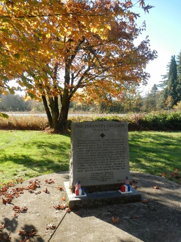
96th Infantry Division Marker
1 ► Oregon, Benton County, Corvallis — 96th Infantry Division — "Deadeyes" —  |
| Near Camp Adair Road near Pacific Highway West (Oregon Route 99W), on the left when traveling east. | |||
| 2 ► Oregon, Benton County, Corvallis — Alice E. Biddle — First Woman Graduate of Oregon State University — |
| Near SE Jefferson Way. | |||
| 3 ► Oregon, Benton County, Corvallis — Avery Park Applegate Trail Kiosk — Southern Route to Oregon — |
| On SW Avery Park Drive, on the left when traveling east. | |||
| 4 ► Oregon, Benton County, Corvallis — Benton County Courthouse — |
| On 4th Street, on the right when traveling south. | |||
| 5 ► Oregon, Benton County, Corvallis — Benton County State Bank — |
| On SW Madison Avenue, on the right when traveling west. | |||
| 6 ► Oregon, Benton County, Corvallis — Camp Adair — |
| Near Camp Adair Road near Pacific Highway West (Oregon Route 99W), on the left when traveling east. | |||
| 7 ► Oregon, Benton County, Corvallis — Capitol of Territorial Oregon — 1855 — |
| On SW 2nd Street at SW Adams Avenue on SW 2nd Street. | |||
| 8 ► Oregon, Benton County, Corvallis — City Hall — |
| On Southwest Madison Avenue at Pacific Hwy W (U.S. 20), on the right when traveling east on Southwest Madison Avenue. | |||
| 9 ► Oregon, Benton County, Corvallis — Early Town Development — The Corvallis Riverfront — |
| On SW 1st Street north of SW Jefferson Avenue, on the right when traveling north. | |||
| 10 ► Oregon, Benton County, Corvallis — Ecology of the Agricultural Reach — |
| On SW Campus Way 0.5 miles west of SW 35th Street, on the left when traveling west. | |||
| 11 ► Oregon, Benton County, Corvallis — Elementary Schools — Central Park — |
| Near NW Monroe Street. | |||
| 12 ► Oregon, Benton County, Corvallis — First Congregational Church — 1918-1932 — |
| On SW 8th St at SW Madison Ave, on the right when traveling north on SW 8th St. | |||
| 13 ► Oregon, Benton County, Corvallis — Home of Fred J. Porter — Corvallis City Engineer From 1909 to 1949 — |
| On SW Madison Ave at SW 8th St, on the right when traveling west on SW Madison Ave. | |||
| 14 ► Oregon, Benton County, Corvallis — Kearney Hall — |
| On Southwest Monroe Avenue, on the left when traveling west. | |||
| 15 ► Oregon, Benton County, Corvallis — Kings Valley Millstone — |
| On SW Avery Park Drive. | |||
| 16 ► Oregon, Benton County, Corvallis — L.G. Kline Building — |
| On Southwest Madison Avenue at SW 2nd St, on the left when traveling east on Southwest Madison Avenue. | |||
| 17 ► Oregon, Benton County, Corvallis — Madison Avenue — A Place For People — |
| On SW Madison Ave, on the left when traveling north. | |||
| 18 ► Oregon, Benton County, Corvallis — Oak Creek’s Watershed — |
| On SW Campus Way 0.5 miles west of SW 35th Street, on the left when traveling west. | |||
| 19 ► Oregon, Benton County, Corvallis — Oregon State University — National Historic District — |
| On SW Jefferson Way at SW 15th Street, on the right when traveling west on SW Jefferson Way. | |||
| 20 ► Oregon, Benton County, Corvallis — Peavy Hall War Memorial — |
| Near SW Jefferson Way at SW 30th St. | |||
| 21 ► Oregon, Benton County, Corvallis — River Transport — |
| On SW 1st Street north of SW Jefferson Avenue, on the right when traveling north. | |||
| 22 ► Oregon, Benton County, Corvallis — Site of Corvallis Public Schools — 1889-1946 — |
| Near NW Monroe Avenue. | |||
| 23 ► Oregon, Benton County, Corvallis — Site of the Earliest Boat Landing — Lower Town, Marysville, 1851 — |
| On Northwest Van Buren Avenue. | |||
| 24 ► Oregon, Benton County, Corvallis — Sustainable Farm Management — |
| On SW Campus Way 0.5 miles west of SW 35th Street, on the left when traveling west. | |||
| 25 ► Oregon, Benton County, Corvallis — The Corvallis Arts Center — |
| On SW Madison Ave, on the left when traveling north. | |||
| 26 ► Oregon, Benton County, Corvallis — The Corvallis Ferry — |
| Near NW 1st Street when traveling south. | |||
| 27 ► Oregon, Benton County, Corvallis — The Incubator House & Poultry Building — |
| On SW Washington Avenue at SW 8th Street, on the right when traveling east on SW Washington Avenue. | |||
| 28 ► Oregon, Benton County, Corvallis — The Opera House — |
| On Pacific Highway West at Pacific Hwy W (U.S. 20) on Pacific Highway West. | |||
| 29 ► Oregon, Benton County, Corvallis — The Timberwolves — |
| On Camp Adair Road near Pacific Highway West (Oregon Route 99W). | |||
| 30 ► Oregon, Benton County, Corvallis — The Trailblazers — |
| Near Camp Adair Road near Pacific Highway West (Oregon Route 99W), on the left when traveling east. | |||
| 31 ► Oregon, Benton County, Corvallis — The Van Buren Street Bridge — |
| Near NE 1st Street south of NW Harrison Boulevard. | |||
| 32 ► Oregon, Benton County, Corvallis — The Whiteside Theatre — |
| On Pacific Hwy W (U.S. 99) at SW Madison Ave, on the right when traveling north on Pacific Hwy W. | |||
| 33 ► Oregon, Benton County, Corvallis — The Wild West Division — Powder River! Let'er Buck! — |
| Near Camp Adair Road near Pacific Highway West (Oregon Route 99W), on the left when traveling east. | |||
| 34 ► Oregon, Benton County, Monroe — Applegate Trail — |
| On Dawson Rd, on the right when traveling east. | |||
| 35 ► Oregon, Benton County, Monroe — Ebenezer Schoolhouse — United Methodist Historic Site — |
| On Bellfountain Rd, on the left when traveling south. | |||
| 36 ► Oregon, Benton County, Monroe — The Applegate Trail — Southern Route to Oregon — |
| On Pacific Hwy (U.S. 99) at Main Street, on the right when traveling south on Pacific Hwy. | |||
| 37 ► Oregon, Benton County, Monroe — 323 — The Belknap Settlement — United Methodist Church Registered Historic Site No. 323 — |
| Near Orchard St. | |||
| 38 ► Oregon, Benton County, Monroe — Wilhelm Mill Water Wheel — Historical Site — |
| On Pacific Hwy W (Oregon Route 99), on the right when traveling west. | |||
| 39 ► Oregon, Benton County, Philomath — 385 — Historic Philomath College Building — |
| On Corvallis-Newport Highway (aka Main Street) (U.S. 20) at South 11th Street, on the right when traveling west on Corvallis-Newport Highway (aka Main Street). | |||
| 40 ► Oregon, Benton County, Philomath — Mt. Union Cemetery — |
| On Mt. Union Avenue, on the right when traveling north. | |||
| 41 ► Oregon, Benton County, Philomath — Reuben and Mary Jane Shipley — Benefactors of Mount Union Cemetery — |
| Near Mount Union Avenue north of Benton View Drive, on the right when traveling north. | |||
| 42 ► Oregon, Benton County, Philomath — Shipley Family Homestead — |
| On James Street 0 miles east of Newton St, on the left when traveling east. | |||
| 43 ► Oregon, Marion County, Aurora — Aurora — |
| On Main Street North East near Pacific Highway East ( Route 99E), on the left when traveling south. | |||
| 44 ► Oregon, Marion County, Aurora — Aurora Colony Black Walnut — Juglans nigra — Oregon Heritage Tree — |
| On Liberty Street Northeast at 3rd Street Northeast, on the right when traveling north on Liberty Street Northeast. | |||
| 45 ► Oregon, Marion County, Aurora — Boone's Ferry — |
| Near Interstate 5 at milepost 281, 1 mile south of Miley Road, on the right when traveling north. | |||
| 46 ► Oregon, Marion County, Aurora — 16 — The Octagonal Building — Built in 1867 — |
| Near Main Street North East near 2nd Street Northeast, on the right when traveling south. | |||
| 47 ► Oregon, Marion County, Aurora — 18 — Will-Snyder Store — Built in 1912 — |
| On Main Street NorthEast at 2nd Street NorthEast, on the left when traveling south on Main Street NorthEast. | |||
| 48 ► Oregon, Marion County, Aurora — 19 — Wm. Keil and Company — Built in 1874 — |
| On Main Street NorthEast at 2nd Street NorthEast, on the right when traveling south on Main Street NorthEast. | |||
| 49 ► Oregon, Marion County, Saint Paul — St. Paul Roman Catholic Church — |
| Near Christie Street, on the right when traveling south. | |||
| 50 ► Oregon, Marion County, Salem — Column Segments — |
| Near Court Street NE west of Waverly Street NE, on the left when traveling west. | |||
| 51 ► Oregon, Marion County, Salem — Dedicated to You, A Free Citizen in a Free Land — Oregon's Liberty Bell Replica — |
| Near Waverly Street Northeast, on the left when traveling west. | |||
| 52 ► Oregon, Marion County, Salem — Dr. John McLoughlin — 1784-1857 — |
| Near Court Street Northeast at East Summer Street Northeast. | |||
| 53 ► Oregon, Marion County, Salem — Giant Sequoia — Sequoia Giganteum — |
| Near Court Street Northeast at East Summer Street Northeast. | |||
| 54 ► Oregon, Marion County, Salem — Herbert Hoover Boyhood Home — Historical Landmark — |
| Near Hazel Avenue North at Highland Avenue Northeast. | |||
| 55 ► Oregon, Marion County, Salem — Marking an Old Trail — |
| Near Court Street Northeast at West Summer Street Northeast. | |||
| 56 ► Oregon, Marion County, Salem — Rev. Jason Lee — 1803-1845 — |
| Near Court Street Northeast at East Summer Street Northeast. | |||
| 57 ► Oregon, Marion County, Salem — Salem — |
| On High Street Northeast at Chemeketa Street Northeast, on the right when traveling south on High Street Northeast. | |||
| 58 ► Oregon, Marion County, Salem — T.G. Bligh Building — 1923 — |
| On Court Street Northeast at High Street Northeast, on the right when traveling west on Court Street Northeast. | |||
| 59 ► Oregon, Marion County, Salem — The Circuit Rider / Robert Booth Memorial — |
| Near Waverly Street Northeast south of Court Street Northeast, on the right when traveling south. | |||
| 60 ► Oregon, Marion County, Salem — Willamette University College of Medicine — |
| On State Street east of Winter Street SE, on the right when traveling east. | |||
| 61 ► Oregon, Marion County, Salem, Central Area — 9/11 — We Will Never Forget — |
| On Trade Street Southeast, on the right when traveling east. | |||
| 62 ► Oregon, Marion County, Salem, Central Area — A Grand Tradition — |
| On Liberty Street Southeast at State Street, on the left when traveling west on Liberty Street Southeast. | |||
| 63 ► Oregon, Marion County, Salem, Central Area — Adolph Block — 1880 — Salem Downtown Historic District — |
| On State Street, on the left when traveling west. | |||
| 64 ► Oregon, Marion County, Salem, Central Area — All Aboard! — Streetcars in Salem — |
| On Liberty Street Northeast at State Street on Liberty Street Northeast. | |||
| 65 ► Oregon, Marion County, Salem, Central Area — Anderson Building — c.1900 — Salem Downtown Historic District — |
| On Commercial Street Northeast at Court Street, on the left when traveling north on Commercial Street Northeast. | |||
| 66 ► Oregon, Marion County, Salem, Central Area — Arthur Moore Building — c.1924 — Salem Downtown Historic District — |
| On High Street Northeast, on the left when traveling north. | |||
| 67 ► Oregon, Marion County, Salem, Central Area — Benjamin Forstner Store Building/South National Bank Block — 1887/c.1923 — Salem Downtown Historic District — |
| On Commercial Street Northeast, on the left when traveling north. | |||
| 68 ► Oregon, Marion County, Salem, Central Area — Bligh Building — 1926 — Salem Downtown Historic District — |
| On High Street Southeast south of State Street, on the left when traveling south. | |||
| 69 ► Oregon, Marion County, Salem, Central Area — Breyman Brothers Block — c.1904/1940s — Salem Downtown Historic District — |
| On Commercial Street Northeast, on the left when traveling south. | |||
| 70 ► Oregon, Marion County, Salem, Central Area — Bush-Breyman Block — c.1889 — Salem Downtown Historic District — |
| On Commercial Street Northeast, on the right when traveling south. | |||
| 71 ► Oregon, Marion County, Salem, Central Area — Catlin & Linn Building — c.1909 — Salem Downtown Historic District — |
| On State Street, on the left when traveling west. | |||
| 72 ► Oregon, Marion County, Salem, Central Area — Claire Maybelle Phillips — |
| On Cottage Street Northeast, on the right when traveling south. | |||
| 73 ► Oregon, Marion County, Salem, Central Area — Durbin Building — c.1860s/1920s — Salem Downtown Historic District — |
| On State Street at Commercial Street NE, on the right when traveling west on State Street. | |||
| 74 ► Oregon, Marion County, Salem, Central Area — Ekerlen (Bishop) Building — 1894 — Salem Downtown Historic District — |
| On Liberty Street Northeast, on the left when traveling north. | |||
| 75 ► Oregon, Marion County, Salem, Central Area — Elsinore Theatre — 1926 — Salem Downtown Historic District — |
| On High Street Southeast south of State Street, on the left when traveling south. | |||
| 76 ► Oregon, Marion County, Salem, Central Area — First National Bank, Old/Capitol Tower Building — 1927 — Salem Downtown Historic District — |
| On State Street. | |||
| 77 ► Oregon, Marion County, Salem, Central Area — First Trustees of Oregon Institute — Feb 1, 1842 — Founding of Willamette University — |
| Near State Street. | |||
| 78 ► Oregon, Marion County, Salem, Central Area — Grand Theater & Odd Fellows Lodge — 1900 — |
| On High Street Northeast at Court Street, on the right when traveling east on High Street Northeast. | |||
| 79 ► Oregon, Marion County, Salem, Central Area — Gray Belle Restaurant — 1890 — Salem Downtown State-Street-Commercial Street Historic District — |
| On State Street, on the left when traveling west. | |||
| 80 ► Oregon, Marion County, Salem, Central Area — Gray Building — 1891 — Salem Downtown Historic District — |
| On State Street at Liberty St NE, on the right when traveling west on State Street. | |||
| 81 ► Oregon, Marion County, Salem, Central Area — Hughes-Durbin Building — (Metropolitan Building) — 1916 — |
| On Liberty Street Northeast, on the right when traveling north. | |||
| 82 ► Oregon, Marion County, Salem, Central Area — John Hughes Company/New Salem Hotel Building — c.1924 — Salem Downtown Historic District — |
| On High Street Southeast, on the right when traveling south. | |||
| 83 ► Oregon, Marion County, Salem, Central Area — McGilchrist Building — 1916 — Salem Downtown Historic District — |
| On State Street, on the right when traveling west. | |||
| 84 ► Oregon, Marion County, Salem, Central Area — Meredith Building — c.1923 — Salem Downtown Historic District — |
| On State Street, on the right when traveling east. | |||
| 85 ► Oregon, Marion County, Salem, Central Area — Meyers Building — 1906 — Salem Downtown State Street Commercial Historic District — |
| On High Street Northeast, on the left when traveling east. | |||
| 86 ► Oregon, Marion County, Salem, Central Area — Moon Tree — Pseudotsuga menziesii — Oregon Heritage Tree — |
| On Court Street Northeast, on the left when traveling west. | |||
| 87 ► Oregon, Marion County, Salem, Central Area — New Breyman Block — 1874 — Salem Downtown Historic District — |
| On Court Street Northeast, on the left when traveling west. | |||
| 88 ► Oregon, Marion County, Salem, Central Area — Oregon Spirit of ‘45 — Europe - Pacific — Remember and Be Inspired — |
| Near Cottage Street Northeast. | |||
| 89 ► Oregon, Marion County, Salem, Central Area — Paulus Building — 1907 — |
| On Court Street Northeast, on the right when traveling west. | |||
| 90 ► Oregon, Marion County, Salem, Central Area — Pearce Building — c.1940 — Salem Downtown Historic District — |
| On Court Street Northeast, on the right when traveling west. | |||
| 91 ► Oregon, Marion County, Salem, Central Area — PGE Building — 1920 — |
| On Liberty Street Northeast, on the left when traveling north. | |||
| 92 ► Oregon, Marion County, Salem, Central Area — Pomeroy Building — c.1860/1925 — Salem Downtown Historic District — |
| On State Street, on the right when traveling west. | |||
| 93 ► Oregon, Marion County, Salem, Central Area — Public Amusement in Salem — |
| On Liberty Street Northeast at Liberty Street NE, on the right when traveling east on Liberty Street Northeast. | |||
| 94 ► Oregon, Marion County, Salem, Central Area — R.P. Boise Building — |
| On State Street at Front Street NE, on the right when traveling west on State Street. | |||
| 95 ► Oregon, Marion County, Salem, Central Area — Reed Opera House — 1870 — Salem Downtown Historic District — |
| On Liberty Street Northeast, on the left when traveling north. | |||
| 96 ► Oregon, Marion County, Salem, Central Area — Roth Company Building — 1916 — |
| On Liberty Street Northeast, on the right when traveling north. | |||
| 97 ► Oregon, Marion County, Salem, Central Area — S.A. Manning Company Building — c.1908 — |
| On State Street at Front Street SE, on the left when traveling west on State Street. | |||
| 98 ► Oregon, Marion County, Salem, Central Area — Salem First United Methodist Church — |
| On State Street at Church Street, on the right when traveling east on State Street. | |||
| 99 ► Oregon, Marion County, Salem, Central Area — Salem’s Chinatown — |
| On State Street at High Street, on the right when traveling east on State Street. | |||
| 100 ► Oregon, Marion County, Salem, Central Area — Salem’s Fire Bell — |
| On Trade Street Southeast, on the right when traveling east. | |||
137 entries matched your criteria. The first 100 are listed above. The final 37 ⊳