By James L.Whitman, November 6, 2021
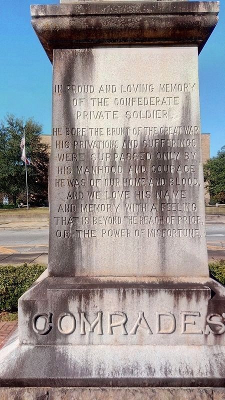
Comrades Marker
| On Eufaula Avenue at Court Square, in the median on Eufaula Avenue. |
| On Eufaula Avenue (Alabama Route 198) at South Armory Street, on the right when traveling east on Eufaula Avenue. |
| On South Midway Street, on the right when traveling south. |
| On Court Street, on the left when traveling south. |
| On West Louisville Avenue at South Midway Street, in the median on West Louisville Avenue. |
| On North Midway Street, on the right when traveling south. |
| On West Louisville Avenue, on the right when traveling east. |
| On North Midway Street, on the right when traveling north. |
| On Bowden Road, on the right when traveling west. |
| On Hunt Street, 0.1 miles south of Brundidge Street (Alabama Route 10), on the left when traveling south. |
| On Alabama Route 51 north of Clio Short Road, on the right when traveling north. |
| On Elamville Street (Alabama Route 10), on the right when traveling west. |
| On Blue Springs Street, on the right when traveling west. |
| Near Alabama Route 51 north of Clio Short Road, on the right when traveling north. |
| On Alabama 51 (Alabama Route 51) 0.1 miles north of Clio Short Road, on the right when traveling north. |
| On U.S. 82 just west of Silo Road, on the right when traveling east. |
| On Danny Road, on the left when traveling west. |
| On East Broad Street east of North Livingston Avenue, in the median. |
| On West Broad Street east of Sanford Avenue, on the right when traveling east. |
| On West Broad Street east of Colby Avenue, on the right when traveling east. |
| On East Broad Street east of North Livingston Avenue. |
| On Riverside Drive at Front Street, on the right when traveling north on Riverside Drive. |
| Near East Broad Street east of North Livingston Avenue. |
| On South Eufaula Avenue (U.S. 431) near West Barbour Street, on the right when traveling south. |
| On Lake Drive, 0.4 miles east of Lakeside Drive, on the right when traveling east. |
| On East Broad Street, 0.1 miles north of North Livingston Ave, in the median. |
| On East Barbour Street (U.S. 82) at South Eufaula Avenue (U.S. 431), on the right when traveling east on East Barbour Street. |
| On Springhill Road north of U.S. 82, on the right when traveling north. |
| On West Barbour Street, on the left when traveling west. |
| On East Broad Street at North Randolph Avenue, on the right when traveling west on East Broad Street. |
| On East Barbour Street (U.S. 82) at South Randolph Street, on the right when traveling west on East Barbour Street. |
| On North Randolph Avenue. |
| On West Broad Street, in the median. |
| On East Barbour Street (U.S. 82), on the right when traveling east. |
| On North Eufaula Avenue (U.S. 431) 0.1 miles north of Broad Street, in the median. |
| On East Broad Street east of North Randolph Avenue, on the left when traveling east. |
| On North Randolph Avenue just south of East Browder Street, on the left when traveling south. |
| Near North Randolph Avenue at East Browder Street. |
| On School Street east of Engram Street, on the right when traveling east. |
| On East Broad Street east of North Livingston Avenue, on the right when traveling west. |
| On East Broad Street east of North Livingston Avenue, on the right when traveling west. |
| On East Broad Street east of North Livingston Avenue, on the right when traveling west. |
| On East Broad Street, on the right when traveling west. |
| On East Broad Street east of North Livingston Avenue. |
| On Cotton Avenue at Highland Avenue on Cotton Avenue. |
| On South Eufaula Avenue (U.S. 431), on the right when traveling south. Reported missing. |
| On West Broad Street, on the right when traveling west. |
| On East Broad Street east of North Livingston Avenue, in the median. |
| On East Broad Street at Orange Avenue, in the median on East Broad Street. |
| On Main Street (Alabama Route 51), on the right when traveling south. |
| On Alabama Route 51, on the right when traveling south. |
| On North Main Street (Alabama Route 51) 0.6 miles south of West Street, on the right when traveling south. |
| On Main Street (Alabama Route 51) at Alabama Route 130, on the left when traveling north on Main Street. |
| On North Main Street (Alabama Route 51) 0.6 miles south of West Street, on the right when traveling south. |
| On Alabama Route 51, on the right when traveling north. |
| On North Main Street (Alabama Route 51) 0.6 miles south of West Street, on the right when traveling south. |
| On Woody Johnson Road east of County Road 79, on the left when traveling east. |
| On Springhill Road, on the left when traveling west. |
| On Woody Johnson Road, 0.1 miles east of County Route 79, on the left when traveling east. |
| On U.S. 82 close to County Road 79, on the left when traveling west. |
| On Springhill Road (County Road 89), on the right when traveling west. |
| On County Road 89 west of County Road 49, on the left when traveling west. |
| On Main Street (Alabama Route 25) at 1st Street, on the right when traveling south on Main Street. |
| On Montevallo Road (State Highway 25) at County Road 62, on the left when traveling west on Montevallo Road. |
| On Furnace Road (County Road 62) south of Montevallo Road (State Route 25). |
| On Montevallo Road (State Highway 25) at County Road 62, on the left when traveling west on Montevallo Road. |
| Near State Park Road south of Furnace Road (County Route 62), on the right when traveling south. |
| On State Park Road south of Furnace Road (County Road 62), on the left when traveling south. |
| Near Mill Street, 0.2 miles south of Walnut Street (State Route 25), on the right when traveling south. |
| On Sixmile School Road south of Montevallo Road (State Highway 25), on the right when traveling south. |
| On Montevallo Road (State Highway 25) at Six Mile School Road, on the left when traveling west on Montevallo Road. |
| On Cahaba River Drive (County Road 24), on the right when traveling north. |
| On Blocton Bypass (County Road 24) 0.1 miles east of Primitive Ridge Road, on the left when traveling east. |
| On Cahaba River Drive (County Road 24) at Piper Road, on the right when traveling south on Cahaba River Drive. |
| Near Blocton Bypass (County Road 24) west of Griffin Town Road, on the right when traveling west. |
| Near Blocton Bypass (County Road 24) west of Griffin Town Road, on the right when traveling west. |
| On Main Street at Walter Owens Drive, on the left when traveling east on Main Street. |
| Near Blocton Bypass (County Road 24) west of Griffin Town Road, on the right when traveling west. |
| On Alabama Route 5, on the right. |
| On U.S. 31 at County Road 7, on the right when traveling north on U.S. 31. |
| On Local Road 26 at Dunn Lane, on the right when traveling east on Local Road 26. |
| On Main Street (U.S. 231) at Lee Street West, on the left when traveling north on Main Street. |
| On Lee Street (County Road 26), on the right when traveling west. |
| On College Street at Church Street, on the right when traveling north on College Street. |
| On Local Road 26 at Dunn Lane, on the right when traveling east on Local Road 26. |
| On Main Street (U.S. 231), on the right when traveling south. |
| Near Main Street South (U.S. 231) at Lee Street, on the right when traveling south. |
| On County Route 27 at Fred Young Road, on the right when traveling south on County Route 27. |
| On State Highway 79 at Hornet Drive, on the right when traveling south on State Highway 79. |
| On Town Hall Road, on the left when traveling east. |
| On Alabama Route 160 at Nectar Bridge Road, on the right when traveling north on State Route 160. |
| On County Route 20, on the left when traveling north. |
| On County Road 36, 0.1 miles north of New Home Church Road, on the right when traveling north. |
| On Second Avenue East (US Highway 231) at 4th Street North, on the right when traveling west on Second Avenue East (US Highway 231). |
| On 6th Street South (U.S. 231) at Champion Road, on the right on 6th Street South. |
| On 2nd Street South, 0.2 miles south of Alabama Highway 75, on the right when traveling south. |
| On Ingram Avenue East at 2nd Street South, on the right when traveling east on Ingram Avenue East. |
| On Alabama Route 75, on the left when traveling north. |
4009 entries matched your criteria. Entries 201 through 300 are listed above.
⊲ Previous 100 —
Next 100 ⊳