By J. J. Prats, May 30, 2015
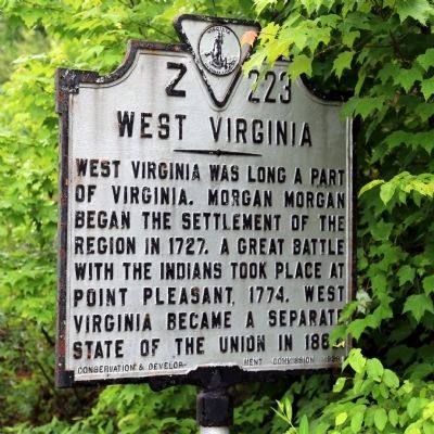
West Virginia Face of Marker
GEOGRAPHIC SORT Title Sort Marker Number Sort Marker Number Sort for Trails Publication Order Sort Publication Order Sort A Erected Year Sort Most Viewed Sort Most Recent-Interest Sort Most Recently Changed Sort SEE FAQ #33 FOR DESCRIPTIONS
On Kanawha Trail (Virginia Route 311) 0.3 miles south of West Virginia Exit 183 (Interstate 64), on the left when traveling south.
On Main Street at River Street, on the right when traveling west on Main Street.
On West Ridgeway Street (Business U.S. 60) at 5th Street, on the right when traveling east on West Ridgeway Street.
On East Ridgeway Street (Business U.S. 60) at Race Street when traveling west on East Ridgeway Street.
On Main Street at River Street, on the right when traveling west on Main Street.
On Longdale Furnace Road (Virginia Route 269) at Tri County Rd (Local Road F271), on the right when traveling north on Longdale Furnace Road.
On Main Street (Business U.S. 60) at East Ridgeway Street (Business U.S. 60), on the right when traveling west on Main Street.
On Main Street (Business U.S. 60) at Jefferson Avenue, on the right when traveling east on Main Street.
On Main Street (Business U.S. 60) at Jefferson Avenue, on the right when traveling east on Main Street.
On Main Street at River Street, on the right when traveling west on Main Street.
On Main Street at River Street (Business U.S. 60), on the right when traveling west on Main Street.
On Main Street at River Street, on the right when traveling west on Main Street.
On Main Street at River Street, on the right when traveling west on Main Street.
On Grafton Street (Business U.S. 60) at Longdale Furnace Road (County Route 637), on the left when traveling west on Grafton Street.
On Kanawha Trail (Route 311) south of Sweet Springs Lane, on the right when traveling south.
Paid Advertisement
On Mall Road 0.2 miles east of Horse Mountain View ( Route 648), on the left when traveling east.
On Kanawha Trail (Virginia Route 311) south of Sweet Springs Lane, on the right when traveling south.
On Kanawha Trail (Virginia Route 311) 0.3 miles south of Sweet Springs Lane, on the right when traveling south.
Near Rumsey Road (Virginia Route 600) 0.1 miles south of Midland Trail (U.S. 60), on the left when traveling south.
On Interstate 64 0.6 miles east of Jerry's Run Road ( Route 198), on the right when traveling east.
On Hot Springs Road (U.S. 220) just south of Falls Road (County Route 640).
On U.S. 220 2.7 miles south of County Route 606, on the right when traveling north.
On Hot Springs Road (U.S. 220) south of Falls Road (County Route 640), on the left when traveling north.
On Hot Springs Road (U.S. 220) 0.2 miles south of Falls Road ( Route 640), on the right when traveling north.
On Hot Springs Road (Route 220) west of Falls Road ( Route 640), on the right when traveling west.
On Botetourt Road (U.S. 220) at 10th Street (County Route 753), on the left when traveling north on Botetourt Road.
On Longdale Furnace Road (Virginia Route 269) at Collierstown Road ( Route 770), on the right when traveling west on Longdale Furnace Road.
On Longdale Furnace Road (Virginia Route 269) at Collierstown Road ( Route 770), on the right when traveling west on Longdale Furnace Road.
On Longdale Furnace Road (Virginia Route 269) at Iron Ore Lane, on the right when traveling west on Longdale Furnace Road.
On Selma Low Moor Road (Virginia Route 696) 0.2 miles west of Oakland Drive, on the right when traveling west.
On Winterbury Avenue NE (Road F-205) north of Exit 21 (Interstate 64), on the right when traveling east.
Paid Advertisement
On Selma Low Moor Road (Virginia Route 696) 0.2 miles west of Oakland Drive ( Route 1002), on the right when traveling west.
Near Selma Low Moor Road (Virginia Route 696) 0.2 miles west of Oakland Drive ( Route 1002), on the right when traveling west. Reported permanently removed.
Near Selma Low Moor Road (Virginia Route 696) 0.2 miles west of Oakland Drive ( Route 1002), on the right when traveling west. Reported permanently removed.
Near Selma Low Moor Road (Virginia Route 696) 0.2 miles west of Oakland Drive ( Route 1002), on the right when traveling west.
On County Route 687 at Post Office Drive, on the right when traveling west on County Route 687.
On Virginia Route 39 at Dinwiddie Trail, on the right when traveling west on Virginia Route 39. Reported missing.
On Cowpasture River Highway (Virginia Route 42) 5.3 miles north of Interstate 64, on the right when traveling north.
Near Sam Snead Highway (U.S. 220) north of Frenchs Hill Drive, on the right when traveling north.
Near Sam Snead Highway (U.S. 220) at Main Street, on the left when traveling south.
On Delafield Road 0.2 miles east of Mountain Laurel Drive, on the right when traveling east.
Near Delafield Road east of Shady Lane, on the right when traveling east.
On Sam Snead Highway (U.S. 220) at Garth Newel Lane, on the right when traveling north on Sam Snead Highway.
Near Sam Snead Highway (U.S. 220) at Main Street, on the left when traveling south.
Near Sam Snead Highway (U.S. 220) at Main Street, on the left when traveling south.
Paid Advertisement
On Sam Snead Highway (U.S. 220) south of Main Street (County Route 615), on the left when traveling north.
Near 7696 Sam Snead Highway.
On Homestead Drive, on the right when traveling west.
Near 7696 Sam Snead Highway.
Near Sam Snead Highway (U.S. 220) at Main Street, on the left when traveling south.
On Homestead Drive, on the left when traveling west.
Near Ski Slope Way north of Delafield Road, on the right when traveling north.
On Sam Snead Highway (U.S. 220) at Dunns Gap Road (County Route 618), on the left when traveling north on Sam Snead Highway.
On Little Gibralter Road at Alkulana Camp Road, on the right when traveling east on Little Gibralter Road.
On Indian Draft (County Route 625) at Fort Lewis Road, on the left when traveling south on Indian Draft.
On Main Street (County Route 644) at Church Street on Main Street.
On Virginia Route 39 at T. C. Walker Road (County Route 635), on the left when traveling west on Virginia Route 39.
Paid Advertisement
On Maury River Road (State Highway 39), on the right when traveling east.
On Cowpasture River Highway (Virginia Route 42) at Mont Shenandoah Lane, on the right when traveling south on Cowpasture River Highway.
On Cowpasture River Highway (Virginia Route 42) south of Mountain Valley Road ( Route 39), on the right when traveling south.
On Virginia Route 39 west of County Route 678, on the right when traveling east.
On Virginia Route 39 at County Route 600, on the left when traveling west on Virginia Route 39.
On Main Street (County Route 615) just east of Pinehurst Heights Road (County Road 616), on the right when traveling west.
On Jackson River Road (U.S. 220) 0.5 miles south of Bolar Lane, on the right when traveling south.
On Courthouse Hill Road (Virginia Route 619) 0.2 miles west of Sam Snead Highway (U.S. 220), on the right when traveling west.
On Courthouse Hill Road (Virginia Route 619) 0.1 miles east of Old Mill Road (Route 645), on the left when traveling east.
On Courthouse Hill Road (Virginia Route 619) just east of Old Mill Road ( Route 645), on the right when traveling west.
On Sam Snead Highway (U.S. 220) north of Mountain Valley Road ( Route 39), on the right when traveling north.
On Courthouse Hill Road (Virginia Route 619) 0.1 miles east of Old Mill Road (Route 645), on the right when traveling west.
On Sam Snead Highway (U.S. 220) at Three Hills Lane, on the left when traveling south on Sam Snead Highway.
On Old Mill Road (Virginia Route 645) south of Old Germantown Road ( Route 692), on the left when traveling south.
On Mountain Valley Road (Virginia Route 39) at Old Germantown Road, on the left when traveling west on Mountain Valley Road.
On County Route 619 west of U.S. 220, on the right when traveling west.
Paid Advertisement
Near Old Mill Road (Virginia Route 645) just south of Old Germantown Road ( Route 692), on the right when traveling north.
On Church Drive west of Mountain Valley Road ( Route 39), on the left when traveling north.
On Courthouse Hill Road (Virginia Route 619) 0.1 miles east of Old Mill Road ( Route 645), on the right when traveling west.
On Sam Snead Highway (U.S. 220) at Courthouse Hill Road (County Route 614), on the right when traveling south on Sam Snead Highway.
On Sam Snead Highway (U.S. 220) just south of Mountain Valley Road eastbound ( Route 39), on the right when traveling south.
On Old Mill Road (Virginia Route 645) just south of Old Germantown Road ( Route 692), on the left when traveling south.
On Sam Snead Highway (U.S. 220) north of Mountain Valley Road ( Route 39), on the left.
On Mountain Valley Road (Virginia Route 39) just west of Edgewood Lane, on the left when traveling west.
On Mountain Valley Road (Virginia Route 39) just west of Edgewood Lane (County Route 622), on the left when traveling west.
On State Highway 39 at Homestead Mountain Drive, on the right when traveling west on State Highway 39.
On State Highway 39 at Homestead Mountain Drive, on the right when traveling west on State Highway 39.
On Ingalls Overlook Trail at Mountain Valley Road ( Route 39), on the right when traveling north on Ingalls Overlook Trail.
On State Highway 39 at Homestead Mountain Drive, on the right when traveling west on State Highway 39.
On State Highway 39 at Homestead Mountain Drive, on the right when traveling west on State Highway 39.
On Ingalls Overlook Trail north of Mountain Valley Road ( Route 39), on the right when traveling west.
On West Main Street at North Court Avenue, on the right when traveling west on West Main Street.
Paid Advertisement
On West Main Street west of North Monroe Avenue (U.S. 60), on the right when traveling west.
On West Main Street west of North Monroe Avenue (U.S. 60), on the right when traveling west.
On West Main Street west of North Monroe Avenue (U.S. 60), on the right when traveling west.
On South Lexington Avenue south of West Oak Street, on the right when traveling south.
︽
160 entries matched your criteria. The first 100 are listed above.
The final 60 ⊳