173 entries match your criteria. The first 100 are listed. ⊳
Entries Containing the Phrase «oregon california trail»
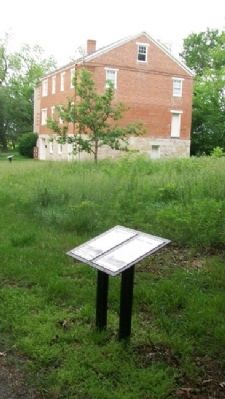
By William Fischer, Jr., May 29, 2011
Oregon-California Trail Marker
RANKED BY RELEVANCE
1 ► Kansas, Doniphan County, Highland — The Oregon-California Trail —  |
| Near Elgin Road. | |||
| 2 ► Wyoming, Natrona County, Casper — Oregon-California Trail — C.H. King and Company — |
| On South Center Street at East 1st Steet, on the right when traveling north on South Center Street. | |||
| 3 ► Kansas, Johnson County, Shawnee — Westport - Santa Fe Trail - Oregon/California Trail — |
| On Shawnee Mission Parkway near Melrose Lane, on the right when traveling east. | |||
| 4 ► Wyoming, Lincoln County, Kemmerer — Nancy Jane Hill — |
| On Farm Field Road 1 mile east of Dempsey Road, on the right when traveling east. | |||
| 5 ► California, Siskiyou County, Tennant — Y-10 — Yreka Trail-Splendid Pine Timber / Yreka Trail-To a Swamp — |
| On Forest Road 44N18Y 0.8 miles east of Forest Road 44N23, on the right when traveling east. | |||
| 6 ► Nebraska, Garden County, Lewellen — The Oregon Trail — |
| Near U.S. 26, on the right when traveling south. | |||
| 7 ► Nebraska, Garden County, Lewellen — Wagon Ruts — |
| Near U.S. 26, on the right when traveling south. | |||
| 8 ► Wyoming, Fremont County, Lander — Old Oregon Trail — |
| On Emigrant Trail near Oregon Bluffs Road, on the right when traveling west. | |||
| 9 ► Wyoming, Fremont County, Lander — Oregon Buttes — |
| On Oregon Buttes Road at Emigrant Trail, on the left when traveling south on Oregon Buttes Road. | |||
| 10 ► Wyoming, Fremont County, Lander — South Pass — |
| On Emigrant Trail near Oregon Buttes Road. | |||
| 11 ► California, Amador County, Kit Carson — Mormon-Carson Pass Emigrant Trail — |
| On Carson Pass Highway (State Highway 88), on the right when traveling east. | |||
| 12 ► Nebraska, Keith County, Brule — 313 — California Hill — |
| On U.S. 30 at M, on the right when traveling west on U.S. 30. | |||
| 13 ► Nebraska, Morrill County, Bridgeport — In Memory of Paul C. Henderson of Bridgeport, Nebraska — 1895 — 1979 — |
| Near US Highway 26 (State Highway 92) 2.4 miles west of Main Street (Gold Rush Highway) (U.S. 385), on the left when traveling west. | |||
| 14 ► Idaho, Bear Lake County, Montpelier — Hot, Cold, Dry, Wet, Dusty, 2,000-Mile Trail — |
| On U.S. 30 at milepost 441.7 near Hunters Lane, on the right when traveling west. | |||
| 15 ► Idaho, Bear Lake County, Montpelier — Big Hill — |
| On U.S. 30 at milepost 441.7 near Hunters Lane, on the right when traveling west. | |||
| 16 ► Kansas, Johnson County, Olathe — Elm Grove Campground — |
| On Old U.S. 56 0.1 miles east of West 151st Street, on the right when traveling west. | |||
| 17 ► Kansas, Johnson County, Olathe — The Travelers — |
| Near West 167th Street. | |||
| 18 ► Kansas, Johnson County, Olathe — Roads To The West — |
| Near West 167th Street. | |||
| 19 ► Idaho, Bear Lake County, Montpelier — One Continual Stream — |
| On U.S. 30 at milepost 441.7 near Hunters Lane, on the right when traveling west. | |||
| 20 ► Wyoming, Natrona County, Bessemer Bend — Willow Springs — Willow Springs Pony Express Station — |
| On Oregon Trail Road (County Route 319), on the right when traveling south. | |||
| 21 ► California, Santa Cruz County, Santa Cruz — Grave of Grove C. Cook — |
| Near Evergreen Street, on the right when traveling south. | |||
| 22 ► Idaho, Bear Lake County, Montpelier — Big Hill... — |
| On U.S. 30 at milepost 441.7 near Hunters Lane, on the right when traveling west. | |||
| 23 ► Kansas, Doniphan County, Highland — Cooperation and Conflict on the Trail — |
| Near Elgin Road. | |||
| 24 ► Kansas, Marshall County, Blue Rapids — Oregon Trail Memorial Garden — |
| Near East River Road. | |||
| 25 ► Kansas, Johnson County, Shawnee — California Road — |
| On Shawnee Mission Parkway near Melrose Lane, on the right when traveling east. | |||
| 26 ► Nebraska, Scotts Bluff County, Gering — Robidoux Trading Post — |
| On Robidooux Road, on the left when traveling west. | |||
| 27 ► Oregon, Clackamas County, Oregon City — Abernethy Green — |
| Near Washington Street. | |||
| 28 ► Oregon, Morrow County, Ione — Willow Creek Campground — |
| On Oregon Route 74 near Cecil Lane, on the left when traveling south. | |||
| 29 ► California, Lassen County, Norvell — Nancy Ann Allen Grave — Nobles' Emigrant Trail — |
| Near Bridge Creek Springs Road 1 mile Merrill Flat Road, on the left when traveling north. | |||
| 30 ► Nebraska, Adams County, Kenesaw — Susan C. Haile — |
| On West 70th Street 0.4 miles west of Shiloh Avenue, on the right when traveling west. | |||
| 31 ► Idaho, Bear Lake County, Montpelier — The McAuley Cutoff — |
| On U.S. 30 at milepost 441.7 near Hunters Lane, on the right when traveling west. | |||
| 32 ► Kansas, Marshall County, Blue Rapids — Alcove Spring Park — |
| Near East River Road. | |||
| 33 ► Missouri, Jackson County, Independence — Trails to the East & West — Santa Fe, Oregon and California National Historic Trails — |
| On West College Street at North McCoy Street, on the right when traveling west on West College Street. | |||
| 34 ► Nebraska, Scotts Bluff County, Gering — Pierre Papin Grave — |
| On County Road 20 at Peaceful Valley Road & County road 20, on the left when traveling south on County Road 20. | |||
| 35 ► California, Modoc County, Davis Creek — A-39 — South Road - Blazed Pine Tree — California Trail — |
| On Mowitz Rd (Forest Road 46N10), on the right when traveling south. | |||
| 36 ► California, Alpine County, Hope Valley — Over the Sierra Nevada — |
| On Blue Lakes Road, on the right when traveling south. | |||
| 37 ► California, Alpine County, Kirkwood — First Summit — |
| On "Additional Parking" Road near Carson Pass Scenic Byway (California Highway 88). | |||
| 38 ► California, Alpine County, Kirkwood — Naming of Carson Pass — |
| On The "Additional Parking" Road at Carson Pass Scenic Byway (California Highway 88) on The "Additional Parking" Road. | |||
| 39 ► California, Kern County, Bakersfield — Captain Elisha Stephens — and the — Stephens-Townsend-Murphy Party of 1844 — |
| On Potomac Avenue, on the right when traveling west. | |||
| 40 ► California, Lassen County, Norvell — Nancy Ann Allen — |
| Near Bridge Creek Springs Road (County Road 112) 1 mile north of Merrill Flat Road. | |||
| 41 ► California, Santa Clara County, San Jose, South San Jose — Dr. John Townsend — |
| On Curtner Avenue, on the right when traveling south. | |||
| 42 ► California, Santa Cruz County, Santa Cruz — California Pioneers — James Williams - Mary Patterson Williams — |
| Near Evergreen Street, on the right when traveling south. | |||
| 43 ► California, Tuolumne County, Sonora — Emigrant Trail Terminus — |
| On Mono Way (Old State Highway 108) at Greenley Road, on the right when traveling east on Mono Way (Old State Highway 108). | |||
| 44 ► Idaho, Ada County, Boise — 10 — Site 10 ★ Blacks Creek Road Crossing — |
| On Black Creek Road near Songbird Lane, on the left when traveling west. | |||
| 45 ► Idaho, Elmore County, Glenns Ferry — 2 — Site 2 ★ Old Oregon Trail Road Crossing — Main Oregon Trail Back County Byway — |
| On Old Oregon Trail Road near Bennett Road, on the right when traveling west. | |||
| 46 ► Idaho, Elmore County, Glenns Ferry — 3 — Site 3 ★ Hot Springs Creek — Main Oregon Trail Back County Byway — |
| On Hot Springs Road at Teapot Road/Ross Road, on the right when traveling west on Hot Springs Road. | |||
| 47 ► Idaho, Elmore County, Mountain Home — 4 — Site 4 ★ Hot Springs — Main Oregon Trail Back County Byway — |
| On Northeast Teapot Road near Worth Lee Road, on the right when traveling west. | |||
| 48 ► Idaho, Elmore County, Mountain Home — 5 — Site 5 ★ Rattlesnake Creek — Main Oregon Trail Back County Byway — |
| On U.S. 20 near Industrial Way. | |||
| 49 ► Idaho, Elmore County, Mountain Home — 6 — Site 6 ★ Kelton Road — Main Oregon Trail Back County Byway — |
| On Immigrant Road at Canyon Creek Road, on the right when traveling west on Immigrant Road. | |||
| 50 ► Idaho, Elmore County, Mountain Home — 7 — Site 7 ★ Canyon Creek — Main Oregon Trail Back County Byway — |
| On Canyon Creek/Mayfield Road near Memory Lane, on the right when traveling west. | |||
| 51 ► Idaho, Elmore County, Mountain Home — Site 8 ★ Ditto Creek — |
| On Mayfield Road near East Rumsley Lane, on the right when traveling west. | |||
| 52 ► Idaho, Elmore County, Mountain Home — Site 9 ★ Bowns Creek — |
| On Mayfield Road near Bowns Creek Road, on the right when traveling west. | |||
| 53 ► Idaho, Franklin County, Preston — BB ID-4 — Bidwell/Bartleson Trail - Small Brook — |
| On U.S. 91 near West 5000 North, on the right when traveling north. | |||
| 54 ► Idaho, Owyhee County, Murphy — Utter Wagon Train Disaster — |
| On Wees Road near Nettleton Road, on the left when traveling north. | |||
| 55 ► Idaho, Twin Falls County, Hansen — Stricker Store — |
| On Stricker Cabin Road at East 3200 North (Pumpland Road), on the right when traveling east on Stricker Cabin Road. | |||
| 56 ► Kansas, Douglas County, Lawrence — California and Oregon Trails Memorial — |
| On Crescent Road at West Campus Road, on the right when traveling east on Crescent Road. | |||
| 57 ► Kansas, Johnson County, Olathe — A Most Desirable Spot For Camping — |
| Near West 167th Street. | |||
| 58 ► Kansas, Johnson County, Olathe — Lone Elm Campground — |
| On Lone Elm Park Drive, on the right when traveling south. | |||
| 59 ► Kansas, Johnson County, Olathe — Trail Campground..To Farm..To Park — |
| Near West 167th Street. | |||
| 60 ► Kansas, Johnson County, Olathe — Trails West — by Eldon Tefft — |
| On Lone Elm Park Drive, on the left when traveling south. | |||
| 61 ► Kansas, Johnson County, Olathe — Workin' For a Living — |
| Near East Kansas City Road. | |||
| 62 ► Kansas, Marshall County, Blue Rapids — A Respite In The Wilderness — Alcove Spring — |
| Near East River Road. | |||
| 63 ► Kansas, Pottawatomie County, Westmoreland — One Step at a Time — |
| On The Road to Oz Highway (State Highway 99), on the left when traveling south. | |||
| 64 ► Kansas, Pottawatomie County, Westmoreland — Route of the Oregon Trail — |
| On The Road to Oz Highway (State Highway 99), on the left when traveling south. | |||
| 65 ► Kansas, Pottawatomie County, Westmoreland — Scott Spring — |
| On The Road to Oz Highway (State Highway 99), on the left when traveling south. | |||
| 66 ► Kansas, Pottawatomie County, Westmoreland — 20 — The California - Oregon Trail — |
| On The Road to Oz Highway (State Highway 99), on the right when traveling south. | |||
| 67 ► Kansas, Pottawatomie County, Westmoreland — The Long Journey — |
| On The Road to Oz Highway (State Highway 99), on the left when traveling south. | |||
| 68 ► Kansas, Pottawatomie County, Westmoreland — The Wagon & Team • Supplies Needed — |
| On The Road to Oz Highway (State Highway 99), on the left when traveling south. | |||
| 69 ► Kansas, Pottawatomie County, Westmoreland — Wagons Fording Rock Creek — |
| On The Road to Oz Highway (State Highway 99), on the left when traveling south. | |||
| 70 ► Kansas, Shawnee County, Topeka — Trails across Kansas — |
| Near Southwest 6th Avenue. | |||
| 71 ► Missouri, Buchanan County, St. Joseph — No Turning Back — |
| On Frederick Avenue (Business Interstate 29) at Faraon Street, on the right when traveling north on Frederick Avenue. | |||
| 72 ► Missouri, Buchanan County, St. Joseph, Washington Township — The California - Oregon Trail — 1840s & 1850s — |
| Near Felix Street. | |||
| 73 ► Missouri, Jackson County, Independence — A Man of Means — Santa Fe, Oregon and California National Historic Trails — |
| On West College Street at North McCoy Street, on the right when traveling west on West College Street. | |||
| 74 ► Missouri, Jackson County, Independence — An Epicenter of International Commerce — Santa Fe, Oregon and California National Historic Trails — |
| On West College Street at North McCoy Street, on the right when traveling west on West College Street. | |||
| 75 ► Missouri, Jackson County, Independence — The Railroad Comes to Town! — Santa Fe, Oregon, and California National Historic Trails — |
| On West College Street at North McCoy Street, on the left when traveling east on West College Street. | |||
| 76 ► Missouri, Jackson County, Independence — Three Trails From Independence — Santa Fe, Oregon and California National Historic Trails — |
| On West College Street at North McCoy Street, on the left when traveling east on West College Street. | |||
| 77 ► Nebraska, Garden County, Oshkosh — 235 — John Hollman Grave — |
| On State Highway 27 at Road 54, on the right when traveling south on State Highway 27. | |||
| 78 ► Nebraska, Morrill County, Lisco — 295 — Narcissa Whitman — |
| On U.S. 26 7 miles west of Lisco. | |||
| 79 ► Nebraska, Phelps County, Bertrand — Sarepta Gore Fly — |
| On B Road north of Local Road 748, on the left when traveling north. | |||
| 80 ► Nebraska, Platte County, Columbus — North Branch, Oregon Trail — |
| On 33rd Avenue (U.S. 30/81) near 7th Street, on the right when traveling south. | |||
| 81 ► Nebraska, Scotts Bluff County, Gering — Robidoux Pass — |
| On Robidoux Road, on the right when traveling west. | |||
| 82 ► Nebraska, York County, York — Nebraska City Cut-Off of the Oregon Trail — |
| On Lincoln Avenue south of 1st Street, on the right when traveling south. | |||
| 83 ► Nevada, Pershing County, Lassens Meadows — Susan Coon Grave — |
| Near Antelope Road 0.1 miles north of Big Antelope Spring. | |||
| 84 ► Oregon, Baker County, Huntington — Van Ornum Wagon Train Massacre — |
| On Oregon Trail Boulevard (Business U.S. 30) when traveling north. | |||
| 85 ► Oregon, Baker County, Huntington — Van Ornum Wagon Train Massacre — |
| On Washinton Street East (Business U.S. 30) near 1st Street East. | |||
| 86 ► Oregon, Douglas County, Oakland — Applegate Trail - Oakland — Southern Route to Oregon — |
| On NE 1st Street at SE Maple Street, on the left when traveling north on NE 1st Street. | |||
| 87 ► Oregon, Douglas County, Reedsport, East Gardiner — Smith, Jackson & Sublette Umpqua Memorial — |
| On Lower Smith River Road (County Road 48 at milepost 1), at Stables Road (County Road 498), on the left when traveling north on Lower Smith River Road. | |||
| 88 ► Oregon, Jackson County, Ashland — The Applegate Trail — |
| Near 7th Street. | |||
| 89 ► Oregon, Klamath County, Malin — Applegate Trail — |
| Near 4th Street. | |||
| 90 ► Oregon, Malheur County, Nyse — Starvation Camp — |
| On Succor Creek Highway (Oregon Route 201) near Adams Road, on the left when traveling north. | |||
| 91 ► Oregon, Malheur County, Vale — John D. Henderson — |
| Near Sand Hollow Road near Lytle Boulevard, on the right when traveling north. | |||
| 92 ► Oregon, Umatilla County, Adams — Whitman Route Oregon Trail 1843-1847 — |
| On North Main Street at West Center Street, on the left when traveling south on North Main Street. | |||
| 93 ► Oregon, Umatilla County, Echo — David R. Koontz — |
| On Rieth Road near Jane Street, on the left when traveling west. | |||
| 94 ► Utah, Box Elder County, Collingston — HSLC UT-8 — Hensley/Salt Lake Cutoff - Hampton Ford — |
| On Bigger Road near West 15200 North. | |||
| 95 ► Utah, Box Elder County, Corinne — BBU-7 — Bidwell/Bartleson Trail - Monument Point — First Overland Emigrant Party — |
| On Transcontinental Railroad Back Country Byway, on the right when traveling west. | |||
| 96 ► Utah, Juab County, Dugway — COTNU-8A — Central Overland Trail - Black Rock Hills Southern Route — |
| On Pony Express Road, on the left when traveling west. | |||
| 97 ► Utah, Juab County, Dugway — COTNU-8 — Central Overland Trail - Dugway Pass — |
| On Pony Express Road, on the right when traveling west. | |||
| 98 ► Utah, Juab County, Dugway — OTN-10 — Central Overland Trail - Fish Springs — |
| On Watchable Wildlife Area Access, on the left when traveling south. | |||
| 99 ► Utah, Juab County, Greenhaven — COTNU-12 — Central Overland Trail - Boyd Station — |
| On East Pony Express Road, on the right when traveling west. | |||
| 100 ► Utah, Juab County, Greenhaven — COTNU-10A — Central Overland Trail - Fish Springs Mountain — |
| On Wilson Cutoff Road, on the right when traveling west. | |||
173 entries matched your criteria. The first 100 are listed above. The final 73 ⊳
Thin black lines indicate changes in relevance. Between each pair of lines entries are ordered geographically but all have the same relevance.
* Inflectional forms of words are their plurals, singulars, and possessives as well as gramatical tenses and similar variations.
Nov. 10, 2026