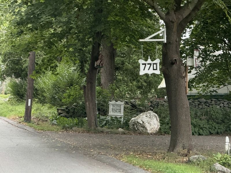
By G.W.Bartlett, August 6, 2025
Bourne Garrison King Philip's War Marker
RANKED BY RELEVANCE
| On Gardners Neck Road at Milne Avenue, on the left when traveling south on Gardners Neck Road. |
| On Child Street (Rhode Island Route 103) at Hugh Cole Road, on the right when traveling east on Child Street. |
| Near West Main Road (Rhode Island Route 77) just south of Fairfields Drive, on the left when traveling south. |
| On Main Street (Massachusetts Route 70) north of Bigelow Gardens, on the left when traveling north. |
| On Millers Falls Road (Massachusetts Route 63) south of South Mountain Road, on the right when traveling north. |
| On Main Street at Town Square, on the left when traveling north on Main Street. |
| On Boston Post Road (U.S. 20) at Concord Road, on the right when traveling west on Boston Post Road. |
| On U.S. 44 2 miles east of U.S. 118, on the right when traveling east. |
| On North Main Street, on the right when traveling north. |
| On Sandwich Street, on the left when traveling east. |
| On North Main Street (Massachusetts Route 105) at Barrows Street, on the right when traveling north on North Main Street. |
| Near Tower Street (at milepost 0.7), 0.2 miles south of Tower Street. |
| On Barney Avenue at Providence Road, on the right when traveling south on Barney Avenue. |
| On Washington Street (Massachusetts Route 53) at Winter Court, on the right when traveling east on Washington Street. |
| On Monponsett Street (Massachusetts Route 58) at White Island Road, on the left when traveling south on Monponsett Street. |
| On Plympton Street (Massachusetts Route 105) near U.S. 44, on the left when traveling south. |
| On Foster Hill Road just west of George Allen Road, on the left when traveling west. |
| On Old Providence Road at Barneyville Road, on the left when traveling east on Old Providence Road. |
| On North Main Street, on the right when traveling north. |
| On Water Row just north of Old Sudbury Road (State Route 27), on the left when traveling north. |
| On Main Street (Massachusetts Route 109) at Pound Street, on the right when traveling west on Main Street. |
| On Plympton Street (Massachusetts Route 105) south of U.S. 44, on the left when traveling south. |
| Near Metacom Avenue (Rhode Island Route 136) 0.1 miles south of Mount Hope Avenue, on the right when traveling north. |
| On High Street near Blackstone Street, on the left when traveling north. |
| Near Diamond Hill Road (Rhode Island Route 114) 1 mile south of Angell Road ( Route 116), on the right when traveling south. |
| On Main Street (U.S. 44) at Howland Street, on the left when traveling north on Main Street. |
| On Stockbridge Road at Meeting House Lane, on the right when traveling south on Stockbridge Road. |
| On Main Street (Massachusetts Route 119), on the left when traveling south. |
| On Elm Court near Interstate 91, on the right when traveling east. |
| On High Street north of Blackstone Street, on the right when traveling north. |
| On Main Street near Hastings Street ( Route 16), on the right when traveling south. |
| On Water Street south of Haile Street, on the left when traveling south. |
| Near Broad Street just north of Summit Street, on the left when traveling north. |
| Near Temple Street 0.1 miles south of Elm Street, on the right when traveling south. |
| On Water Row at Old Sudbury Road (State Route 27), on the left when traveling north on Water Row. |
| On Boston Post Road (U.S. 20) just west of Goodmans Hill Road, on the left when traveling west. |
| Near Asylum Road 0.3 miles west of Cole School Road, on the left when traveling north. |
| On Newman Avenue (Rhode Island Route 152) at Pawtucket Avenue ( Route 1A), on the right when traveling east on Newman Avenue. |
| On Highland Avenue at Sunnyside Avenue, on the right when traveling north on Highland Avenue. |
| On Alcott Street 0.2 miles south of Concord Road. |
| On Country Way just north of the Greenbush Rotary, on the left when traveling north. |
| On Barker Road 0.1 miles north of Brookline Road, on the right when traveling north. |
| On Belmont Street (Massachusetts Route 9) at Shrewsbury Street, on the left when traveling west on Belmont Street. |
| On Main Street (Massachusetts Route 9) at Stafford Street, on the left when traveling west on Main Street. |
| On Belmont Street (Massachusetts Route 9) at Grove Street, on the left when traveling west on Belmont Street. |
| Near Midstate Trail south of Redemption Rock Trail North ( Route 140), on the left when traveling south. |
| On Boston Post Road (U.S. 20) at Concord Road, on the right when traveling west on Boston Post Road. |
| Near Asylum Road 0.3 miles west of Cole School Road, on the left when traveling north. |
| Near Concord road south of Codjer Lane, on the left when traveling south. |
| Near West Main Road (Rhode Island Route 77) south of Fairfields Drive, on the right when traveling north. |
| Near South County Trail (Rhode Island Route 2) 1.4 miles south of Kingstown Road ( Route 132), on the left when traveling west. |
| On Westford Street at Academy Street, on the left when traveling west on Westford Street. |
| On Centre Street, on the right when traveling west. |
| On Washington Street (Massachusetts Route 53) at Middle Street, on the right when traveling east on Washington Street. |
| On North Main Street, on the left when traveling north. Reported permanently removed. |
| Near West Main Road (Rhode Island Route 77) south of Fairfields Drive, on the right when traveling north. |
| On North Washington Street at Park Street, on the right when traveling south on North Washington Street. |
| On Ingersoll St just north of Centre Street, on the right when traveling north. |
| Near Western Avenue (Massachusetts Route 127) at Essex Avenue ( Route 133), on the right when traveling north. |
| On Mohawk Trail (Route 2/2A) at Riverview Drive, on the right when traveling east on Mohawk Trail. |
| On Conway Street at Silver Street, on the right when traveling south on Conway Street. |
| On Summer Street at Favor Street, on the right when traveling west on Summer Street. |
| On Eliot Street (Massachusetts Route 16) at Union Street, on the left when traveling north on Eliot Street. |
| Near Old Sudbury Road (Route 27), on the right when traveling north. |
| On Washington Street (Massachusetts Route 138) south of Homans Lane, on the right when traveling south. |
| Near Mansfield Road east of East Foxboro Road, on the left when traveling east. |
| On Winslow Cemetery Road west of Presidential Circle, on the left when traveling north. |
| On River Street east of Forest Street, on the right when traveling west. |
| Near Head Island Causeway south of Harborwalk, on the right when traveling south. |
| On Roxbury Street east of John Eliot Square, on the right when traveling west. |
| On West Road 0.3 miles north of Unitas Road, on the right when traveling north. |
| On Foster Hill Road west of George Allen Road, on the right when traveling west. |
| On Boston Post Road (U.S. 1 at milepost 25). |
| On Main Street (U.S. 44) at Howland Street, on the right when traveling north on Main Street. |
| On Bay Street south of Sunset Avenue, on the right when traveling south. |
| On Chatauqua Avenue when traveling north. |
| On S Canterbury Road (Connecticut Route 169) at Westminster Road ( Route 14), on the right when traveling north on S Canterbury Road. |
| On Stone Run Drive, in the median. |
| On Berkley Street 0.4 miles north of Elm Street, on the right when traveling north. |
| On George Street 0.2 miles south of Warren Avenue, on the right when traveling east. |
| On Enfield Street (U.S. 5) at S. Road, on the left when traveling north on Enfield Street. |
| On West Main Street at Church Street, on the right when traveling east on West Main Street. |
| On Town Street (Connecticut Route 642) at New London Turnpike, on the right when traveling east on Town Street. |
| On Bay Road, on the right when traveling north. |
| Near Fort Street north of Lucy Street, on the left when traveling north. |
| On Wampanoag Trail (Rhode Island Route 114) at Kyle Circle, on the right when traveling north on Wampanoag Trail. |
| On Ferry Lane 0.7 miles west of Main Street, on the right when traveling west. |
| Near Center Street (Connecticut Route 150) at South Colony Road, on the right when traveling east. |
| On Norwich-New London Turnpike (Connecticut Route 32) south of Maple Avenue, on the right when traveling south. |
| Near Skinner Mill Road north of Laudholm Farm Road, on the right when traveling north. |
| On Main Street (Massachusetts Route 6A) east of Ryder Lane, on the left when traveling east. |
| On Longhill Street (Massachusetts Route 83), on the right when traveling south. |
| On Providence Street at Hartford Avenue E., on the right when traveling south on Providence Street. |
| On High Street just north of Congregational Street, on the right when traveling north. |
| Near Thames Street north of John Street, on the left when traveling north. |
| Near East Road (Rhode Island Route 179) near Rod Way, on the right when traveling east. |
| Near Canal Street south of Smith Street, on the left when traveling south. |
| On Montieth Drive at Farmington Avenue (Connecticut Route 4), on the right when traveling east on Montieth Drive. |
126 entries matched your criteria. The first 100 are listed above.
The final 26 ⊳
Thin black lines indicate changes in relevance. Between each pair of lines entries are ordered geographically but all have the same relevance.* Inflectional forms of words are their plurals, singulars, and possessives as well as gramatical tenses and similar variations.
Nov. 10, 2026
